Appendix
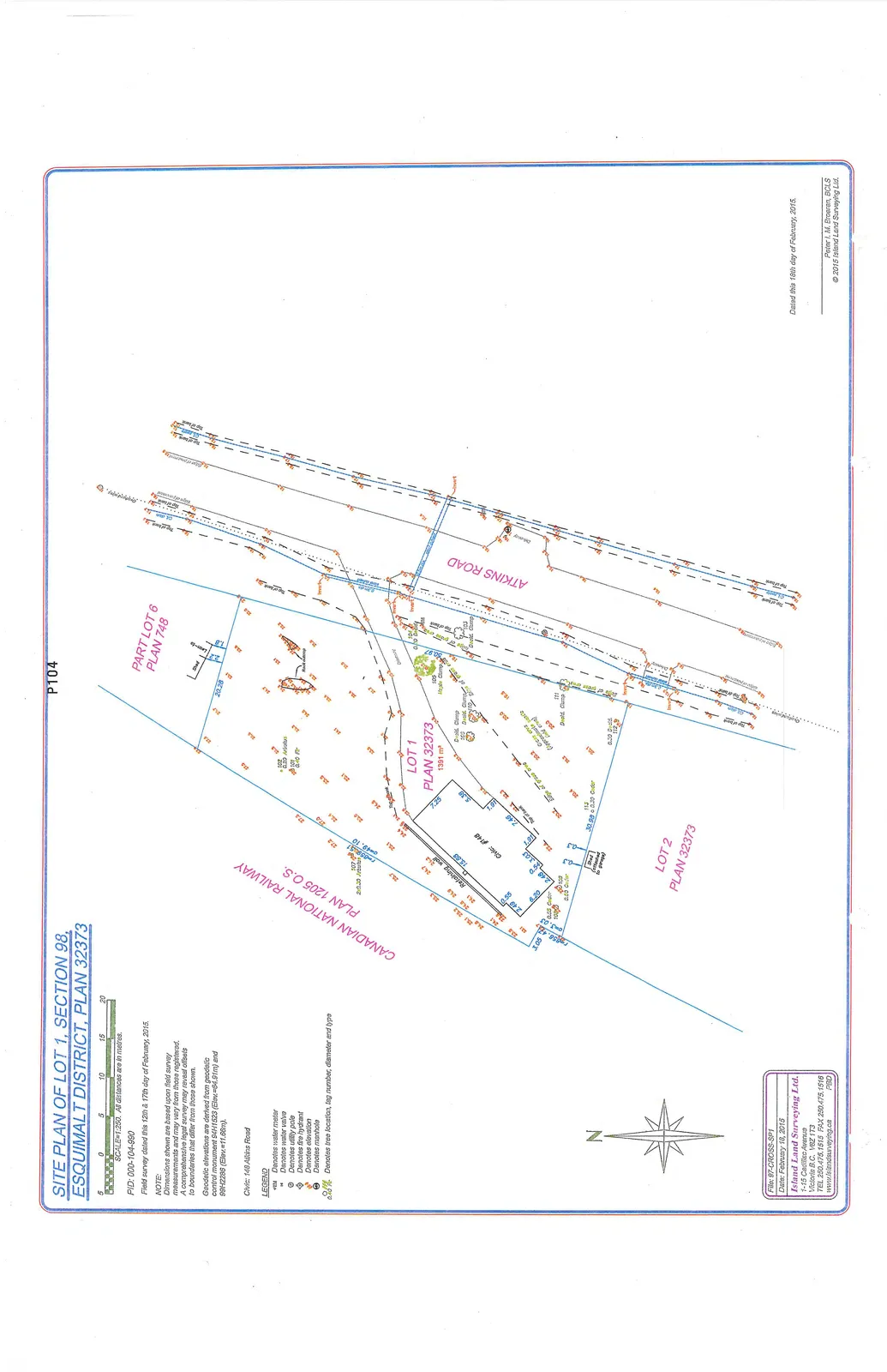
Appendix: Site Plan Survey - 148 Atkins Road
June 9, 2015Page 1091 section
Detailed legal survey of the property showing tree locations and existing structures.
Firm: Island Land Surveying Ltd.Date: February 18, 2015PID: 000-104-990
SITE PLAN OF LOT 1, SECTION 98, ESQUIMALT DISTRICT, PLAN 32373
PID: 000-104-990
SCALE: 1:250. All distances are in metres.
NOTE
Dimensions shown are based upon field survey measurements and may vary from those registered. A comprehensive legal survey may reveal offsets to boundaries that differ from those shown.
Geodetic elevations are derived from geodetic control monument 84H1523 (Elev.=54.91m) and 99H2286 (Elev.=11.66m).
Civic: 148 Atkins Road
LEGEND
- wm Denotes water meter
- v Denotes water valve
- (Symbol) Denotes utility pole
- (Symbol) Denotes fire hydrant
- .12.3 Denotes elevation
- (Symbol) Denotes manhole
- 101 0.50 Fir Denotes tree location, tag number, diameter and type
File Information
- File: 97-CROSS-SP1
- Date: February 18, 2015
- Surveying Firm: Island Land Surveying Ltd.
- Address: 1-15 Cadillac Avenue, Victoria B.C. V8Z 1T3
- Contact: TEL 250.475.1515, FAX 250.475.1518, www.islandsurveying.ca
Dated this 18th day of February, 2015. Peter I. M. Broeren, BCLS © 2015 Island Land Surveying Ltd.
Page 109
Extracted from: 2015 06 09 Committee of the Whole Agenda