Dukrill Shoreline Access Report
Assessment and recommendations for the Dukrill shoreline access point.
Dukrill Shoreline Access
General
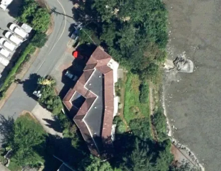
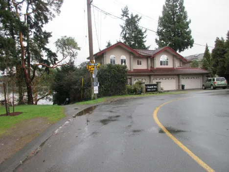
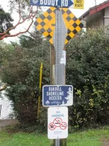
Dukrill Shoreline Access is a signed water access at the corner of Buddy Rd. and Dukrill Rd. It comprises a short decomposed aggregate access trail that slopes gently down from Dukrill Rd. to a 38-riser concrete staircase that leads to the water’s edge. The bottom of the staircase connects to a decomposed aggregate trail that follows the shoreline to Water’s Edge, a holiday apartment complex at 485 Island Highway. The trail is supported by a seawall and an SOR agreement for public access. TOVR currently maintains the path by weed eating and leaf blowing 6-8 times per year on the south (Strata) side to keep vegetation under control, and fixing holes and erosion caused by periodic heavy rain. Maintenance may exceed 8x per year if conditions require it. The Town also empties the two garbage cans on a regular basis and maintains the painted green drop loop chain fence along the seawall and adjacent properties. The Strata is responsible for tree pruning and removal, and maintenance of the Gazebo which they own. A small break in the guard rail at the bottom of the stair (0.9-1.2m) provides water access. The stair itself has a substantial wood railing in good shape.
The stair is in a Tsunami danger area and a warning sign is posted.


Challenges
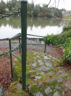
There are 38 concrete risers and several landings between Dukrill Rd. and the bottom of the staircase, where there is a narrow (+/-1m), beachless, water access. The treads and risers have moss growing on them; pedestrian wear and tear has removed most of the moss from the centre of the treads. There is no room on the landings or near the water’s edge for seating.
The stair is in a Tsunami danger area.
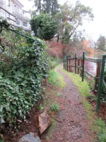
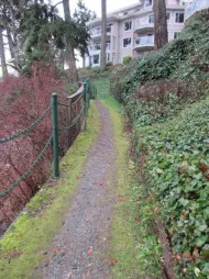
The aggregate path leading to and from the stair is of irregular width and moss and grass are encroaching along the edges.
The banks flanking the staircase are steep and the south bank is a solid field of English ivy. The north bank shows evidence of erosion.
There is high potential for archaeological sites near the shoreline in this location.
Dukrill Shore Access Opportunities & Recommendations
Highlighting entry to shoreline access at Dukrill is recommended. Install short length (at least 5 sections) of cedar split rail fence at road entrance. Field place to best suit.
Improve stair safety by removing moss through pressure washing. It is recommended this be undertaken as needed and at least once every two years.
Confirm if TOVR or neighbour is responsible for vegetation management in SRW (south side). Responsible party cut back encroaching vegetation on the south side of the path, and expand vegetation management to include invasive species removal, potentially with TOVR support if neighbour is managing SRW. All invasive species are to be fully removed, the most prevalent of which is English ivy. It is recommended that removal include a prepared strategy and monitoring. Prepare bed where invasive species have been removed and plant with low growing native species in the fall at the start of the rainy season; there is no irrigation on this site. (select from list page 4)
Remove grass lawn from north side of path access from road and replace with low growing drought tolerant native species planted in the fall at the start of the rainy season; there is no irrigation on this site. (select from list page 4)
Repair path between Dukrill Rd. and top of stair using CRD ‘path mix’. Begin by replacing geotextile, and grass and weeds in path footprint. Path mix to be placed over non-woven polyester geotextile material (aka soil separation blanket) that allows free movement of water. Set geotextile into shallow (100-150mm) excavation, anchor in place, and cover with surface material. Path to be 1.2m wide, edged, gently crowned, and flush with grade at edges. If space on upper site allows, construct seating area for bench placement and wheelchair seating using same specifications. Seating area to be accessed from path and to allow for wheelchair and ambulatory circulation. Bench to face ocean. Field fit.
Confirm if TOVR or neighbour is responsible for vegetation management on north side of staircase. If TOVR, plant with native species to reduce erosion and invasive species/weed growth. Plant in fall at start of rainy season – there is no irrigation on this site. Remove invasive species first. Invasives removal should follow a strategy and be monitored.
Note – if neighbour is responsible for this land, encourage them to do the same, potentially with support from TOVR.
Remove English ivy from TOVR land and replace with native species vegetation planted in fall at the start of the rainy season . After planting mulch immediately with 100mm depth organic mulch, such as composted leaf mulch, to help retain moisture and mitigate invasive species spread. There is no irrigation on this site. Newly planted areas to be maintained for minimum 2-year establishment period. This will only be successful if adjacent private landowners are encouraged, possibly incentivized, to remove English ivy from their property, too. Education outreach is important.
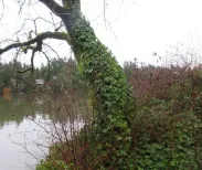
Remove English ivy from tree on shoreline (see photo page 6)
Refurbish portion of path at bottom of stair that is within the Water Access site (use CRD pathway mix; specifications are provided above).
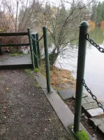
Improve foreshore access safety where access is over retaining wall and identified by break in chain rail along path(one high step down). Provide concrete stair with two or more risers (max. riser ht. 200mm) and fixed (not chain) handrail. Design to mitigate potential for slipping.
Put Tsunami sign on its own stand and relocate for higher visibility (or keep existing sign and add second sign on own stand).
Paint staircase handrail (aesthetic improvement; structure is good).
Determine where archaeological sites are, if any, on Dukrill shoreline access, and acknowledge them in accordance with the wishes of the local First Nations.
Recommended Plant List (all native species)
Shrubs Suitable for Replacing Grass Lawn & Invasive Species On This Site
| Common Name | Botanical Name | Notes |
|---|---|---|
| Saskatoon | Amelanchier alnifolia | To 1.5m tall, deciduous, not shade tolerant |
| Salal | Gaultheria shallon | Usually to 1m tall but can get taller, ever-green, not tolerant of full sun |
| Red-flowering Currant | Ribes sanguineum | 1-3m tall, deciduous, sun to light shade |
| Snowberry | Symphoricarpos albus | 0.5-2m tall, deciduous, light shade |
Groundcovers & Perennials Suitable for Replacing Grass Lawn & Invasive Species on this Site
| Common Name | Botanical Name | Notes |
|---|---|---|
| Kinnikinnick | Arctostaphylos uva ursi | Trailing evergreen groundcover, not tolerant of shade |
| Low Oregon Grape | Grape Mahonia nervosa | To 60cm tall, evergreen, sun or shade, leaves resemble holly (prickly) |
| Sword Fern | Polystichum munitum | To 1.5m tall, evergreen, sun or shade |
| Tall Fringecup | Tellima grandiflora | Perennial 40-cm tall, shade to semi-shade |
Site Photos
Document Images
(16)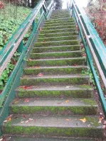
Concrete staircase showing moss growth on the treads and risers
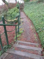
View of the path showing invasive species in the statutory right of way (SRW)
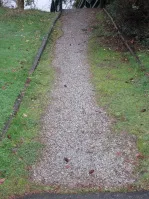
View of the aggregate path with grass and weeds encroaching into the footprint
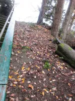
View of the north side of the staircase bank showing bare soil and debris
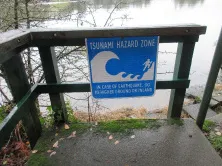
Photo of the existing foreshore access and chain railing
Existing tsunami hazard zone signage posted on a wooden railing
Street corner sign assembly showing "Buddy Rd", "Dukrill Shoreline Access", and "No Smoking" signs
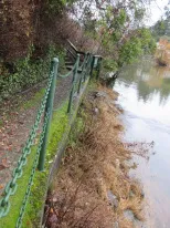
View of the shoreline path with a green post and chain fence
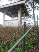
View of a wooden gazebo adjacent to the shoreline path
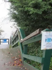
Top of the wooden staircase railing leading down to the shore
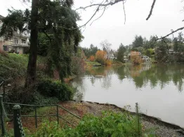
Wide view of the shoreline and the access path near the water
Stone-paved landing area and railing at the edge of the water
View looking down the shoreline path through trees
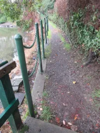
Path following the shoreline, bordered by a chain fence and ivy-covered banks
Close-up of a large tree trunk heavily infested with English ivy near the shore
View of the shoreline path with dense English ivy growth on the adjacent hillside