Rezoning Application for 339, 341, & 345 Island Highway (Presentation)
A comprehensive staff presentation outlining the rezoning application details, project statistics, and staff recommendations.
Rezoning Application for 339, 341, & 345 Island Highway
Committee of the Whole – September 12, 2023 REZONING 2023-01 331, 341, & 345 Island Highway
BACKGROUND
- Former site of Cambridge Motel
- Functions as below market rental housing in the community
- Located in the Harbour Neighbourhood
- Designated: Mixed Residential
- Zoned: C-5 Tourist Commercial
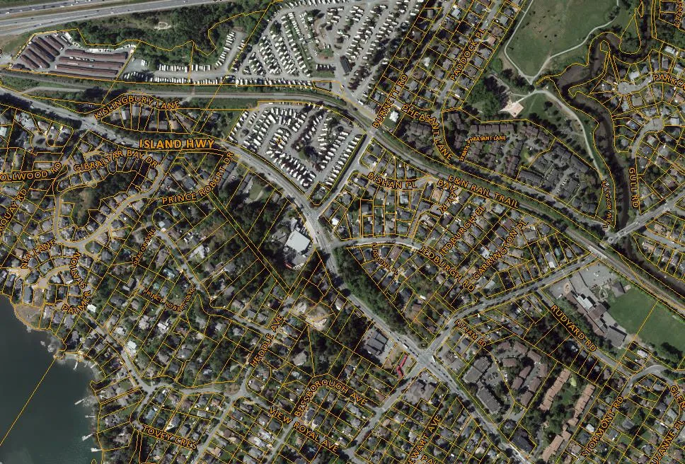
- 12,219 m²
- Rezoning requires a new Comprehensive Development (CD) Zone
- Does not require a OCP Amendment
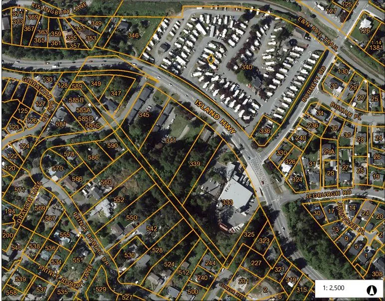
PROJECT INFORMATION: Zoning Review
| Regulation | Permitted C-5: Tourist Commercial Zone | Proposed Comprehensive Development Zone |
|---|---|---|
| Floor Space Ratio | 0.4:1 | 1.6:1 |
| Lot Coverage | 50% | 29% |
| Impermeable Coverage | 80% | TBD |
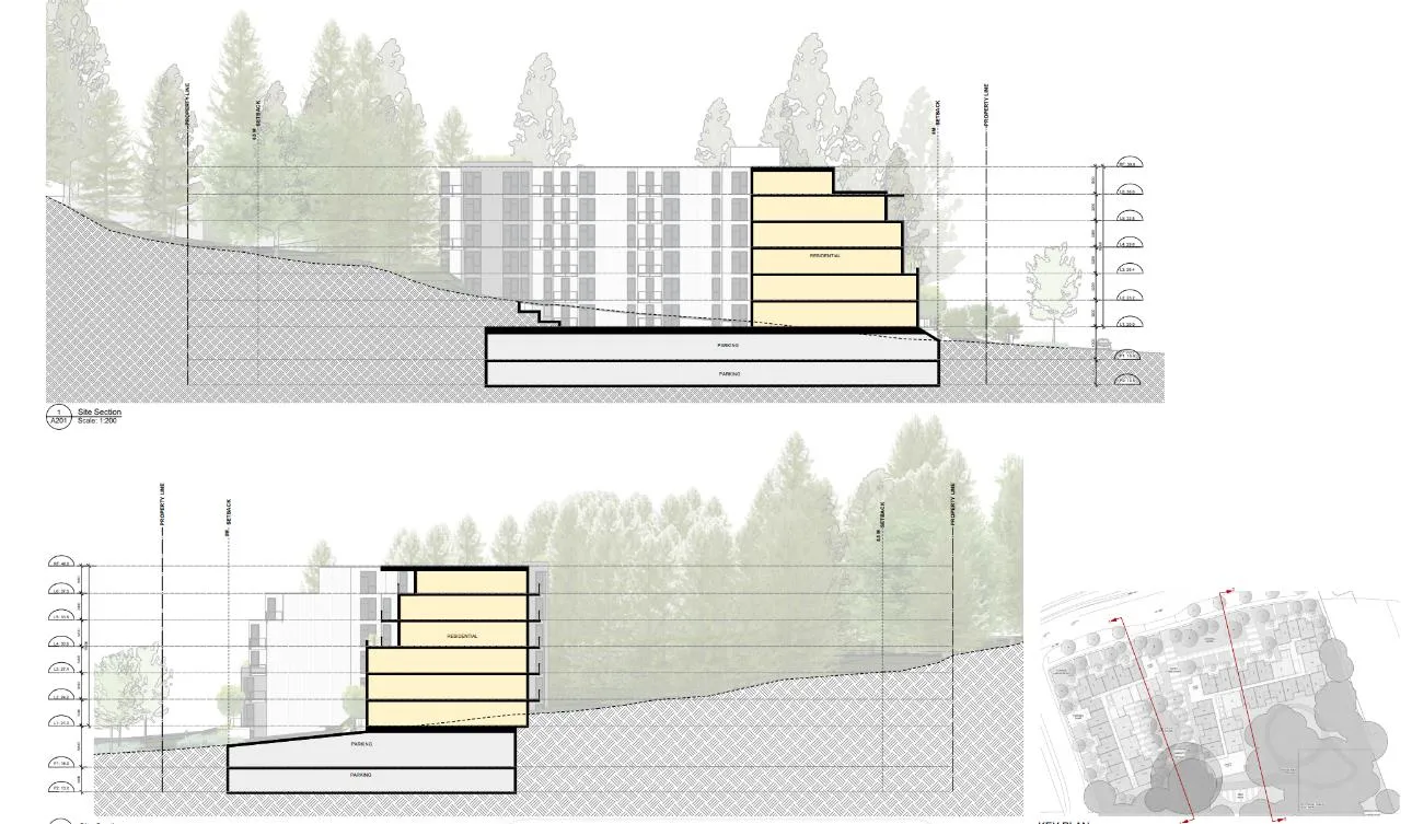
| Building Height (m) | 9 | 19.2 m |
| Front Yard Setback (m) – Prince Robert Drive | 7.5 m | 8.0 m |
| Side Yard Setback (m) – Heddle Park | 6.0 m | 8.5 m |
| Rear Yard Setback (m) – Fire Hall | 7.5 m | 6.0 m |
| Flanking Yard Setback (m) – Island Highway | 3.0 m | 8.0 m |
PROJECT INFORMATION: Parking Review
| Parking by Type | Units | Parking Requirement | Parking Proposed |
|---|---|---|---|
| Studio | 5 | 1 per dwelling unit | 5 |
| 1 Bedroom | 120 | 1 per dwelling unit | 120 |
| 2 Bedroom | 108 | 1.5 per dwelling unit | 162 |
| 3 Bedroom | 5 | 2 per dwelling unit | 10 |
| Total Small Car Parking (max 30%) | n/a | 90 (maximum) | None – TBD. |
| Electric Vehicle Parking Spaces (Level 3 – 240 V.) | Every required parking space to have electric charging capability. | 1 designated EV parking space on-site. | None – TBD. |
| Accessible Parking | 1 per every 100 | 3 | None |
| Bicycle Parking | 238 dwellings | 1 per dwelling unit + a rack at each building entrance | 238 |
NOTE: All required residential and bicycle parking (Class 1) must be electrified.
PROJECT INFORMATION: Unit Mix Overview
| Type | Number of Units | % Total | Size (sq. ft.) |
|---|---|---|---|
| Studio | 5 | 2% | 450 – 575 ft2 |
| 1 Bedroom | 120 | 50% | 600 – 710 ft2 |
| 2 Bedroom | 108 | 45% | 845 – 905 ft2 |
| 3 Bedroom | 5 | 2% | 1,105 ft2 |
| Amenity Space (Indoor) | 1 | N/A | 1,450 ft2 |
NOTE: The number of units provided and the size of the units are conceptual and are subject to change prior to building permit issuance.
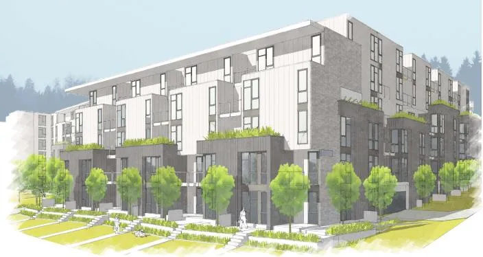
PROJECT INFORMATION: Conceptual Design
Conceptual Rendering Perspective at Island Highway
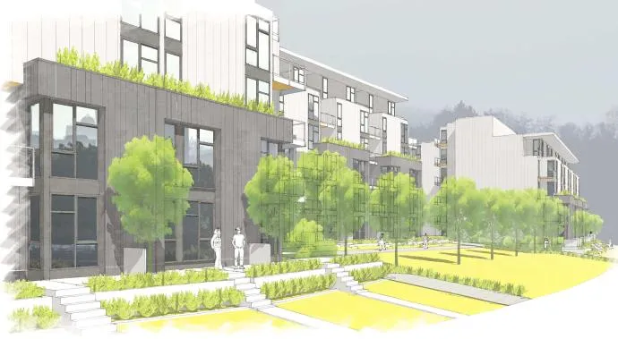
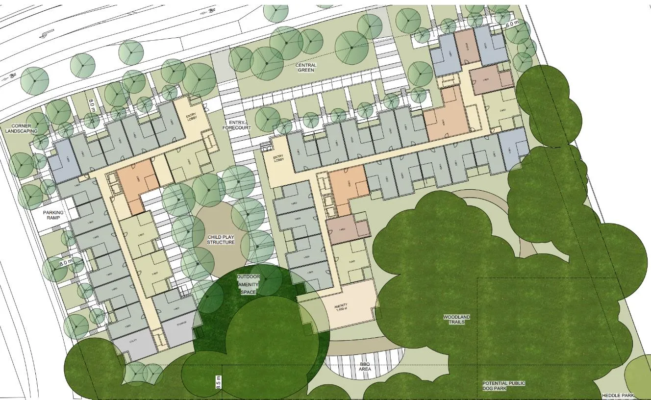
Conceptual Rendering of Site Plan
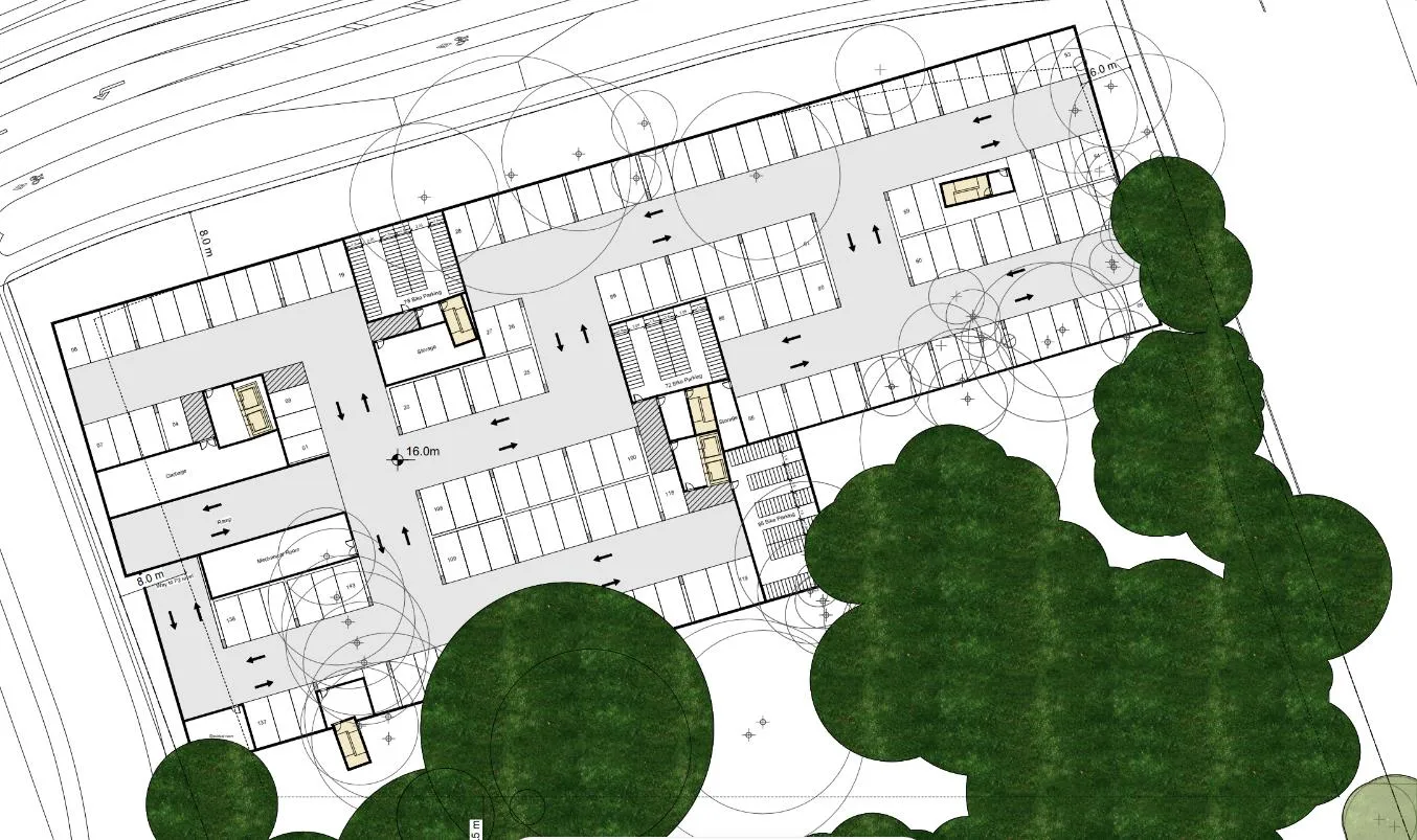
Conceptual Rendering of Underground Parking
Conceptual Rendering of Building Cross Sections
Conceptual Digital Elevation Models
- Flanking Yard (Island Highway)
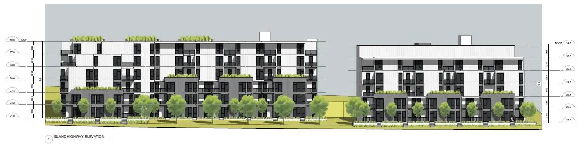
Digital elevation model rendering of the Island Highway elevation - Side Yard (Heddle Park)
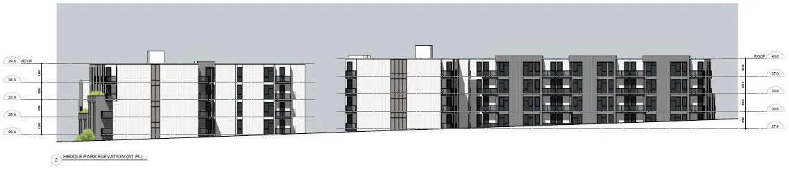
Digital elevation model rendering of the side elevation facing Heddle Park - Front Yard (Prince Robert Drive)
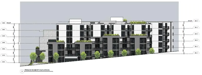
Digital elevation model rendering of the front elevation along Prince Robert Drive - Rear Yard (Fire Hall)
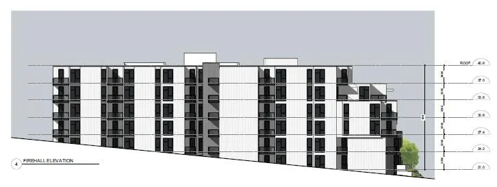
Digital elevation model rendering of the rear elevation facing the Fire Hall
DISCUSSION: Part 1 Official Community Plan Review
The development site is not located within an identified Neighbourhood Centre or Community Centre in the OCP Community Development Framework.
Land Use Designation (LUD): Mixed Residential
- Small lot detached houses, townhouses, and low-rise apartments up to 3 storeys and a maximum 1.25:1 floor space ratio (FSR); or
- Four storeys for apartment and a maximum FSR of 1.6:1
The proposal meets the intended density and land use.
- Policy LU1.4 Diversity of Forms and Uses
- Policy LU4.2 Support Walking, Cycling and Transit
- Policy LU4.5 Street-oriented buildings
- Policy HS1.1 Range of Housing Types
- Policy HS1.6 Loss of Rental Housing
- Policy NE1.6 Native Trees and Vegetation
- Policy NE1.7 Urban Forest
DISCUSSION: Part 2 Zoning Bylaw Review
- The proposed development requires a new Comprehensive Development Zone to regulate height, setbacks, and density.
- A variance to the height is required, the proposed height is greater than the OCP LUD permits.
- All future variances will be considered at the time of a future Development Permit.
DISCUSSION: Part 3 Potential Land Use Impacts
Transportation and Parking
Traffic Impact Assessment (TIA) recommendations:
- Island Highway and Prince Robert Drive intersection upgrade to signalized intersection
- Install a westbound turn land on Island Highway at Prince Robert Drive
- Install a sidewalk with landscape boulevards along Island Highway frontage
- Upgrade existing bus stops
- A two-way left turn lane between Prince Robert Drive and Burnett Road is also recommended; and is supported by Town’s documents, but would require road widening thus would be considered capital works.
On-site Parking
- On-site parking requirements will be confirmed in greater detail at the Development Permit stage.
Site and Fire Access
- Engineering and Planning are supportive of a singular vehicle access off Prince Robert Drive.
- The proposed plans do not meet fire truck access requirements; Fire Department must be able to access the buildings on-site via aerial ladder truck.
Environmental Impacts
- The site is not within a Environmental Development Permit Area: Sensitive Terrestrial Ecosystem.
- There is a large stand of trees that the applicant proposes to preserve via a green space & trails.
- Staff recommendation: Invasive species are present on-site and staff recommend that as a condition of rezoning, the species be removed.
Tree Impacts
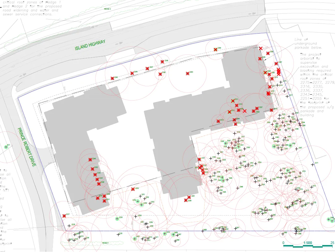
- 125 on-site trees total
- 43 on-site trees to be removed
- Tree replacement ratio 2:1 is required, to be determined at Development Permit Stage with detailed landscape plan.
- Tree permit required prior to issuance of a BP.
- Arborist to remain on-site during construction.
Servicing Requirements
- Stormwater and Sewer details to be determined via Servicing Agreement at time of Building Permit Review (prior to issuance); conceptual sewer plans indicate that the sewer main may need to be upgraded
- Road widening of Prince Robert Drive will be done via a cost share to ensure the road remains in Town right-of-way
On-site Outdoor Amenities
- On-site trail and greenspace area, children’s play area, and a barbeque area
- Staff recommendation: Staff do not support the proposed public dog park or possible trail connection to Heddle Park
Green Space and Natural Buffer
- Staff recommendation: Staff recommend that a covenant be registered on title to protect and establish a buffer adjacent to Heddle Park
- Staff recommendation: Staff also recommend that a covenant be registered to preserve the proposed green space on-site for trail use
- Further conversations will be required prior to consideration of First Reading
Foundation and Underpinning
- Where underpinning is proposed, the applicant must obtain permissions from the affected property owner and necessary agencies (e.g. CRD).
- Where underpinning is proposed in municipal lands the applicant must apply for a license to occupy in addition to approval
DISCUSSION: Part 4 Amenity Contributions
- A prior Landlift Analysis found there was no lift in land value
- Staff have requested that the applicant consider providing below-market and accessible housing units, but affordability remains a challenge
- Providing affordable rental dwellings and a mix of dwellings is consistent with the OCP
- The development site is in the proximity of community amenities, transportation infrastructure, and an identified growth area to support tenants
- An alternative is that the applicant pay cash with guidance from the Policy
Staff will continue to work with the applicant prior to consideration of First Reading should the application advance to Public Hearing.
DISCUSSION: Part 5 Tenant Assistance Plan
- The proposal is grandfathered and is not affected by the Tenant Assistance Policy
- Tenants will be assisted via monetary payment for relocation and moving based on tenure (years)
- The value provided is above the required compensation in the Town’s Tenant Assistance Policy
Document Images
(1)