Appendix A: Open House Display Boards
Information boards used during public open houses to visualize the OCP process, land use designations, and the three proposed growth scenarios for the Western Gateway.
Appendix A: Open House Display Boards
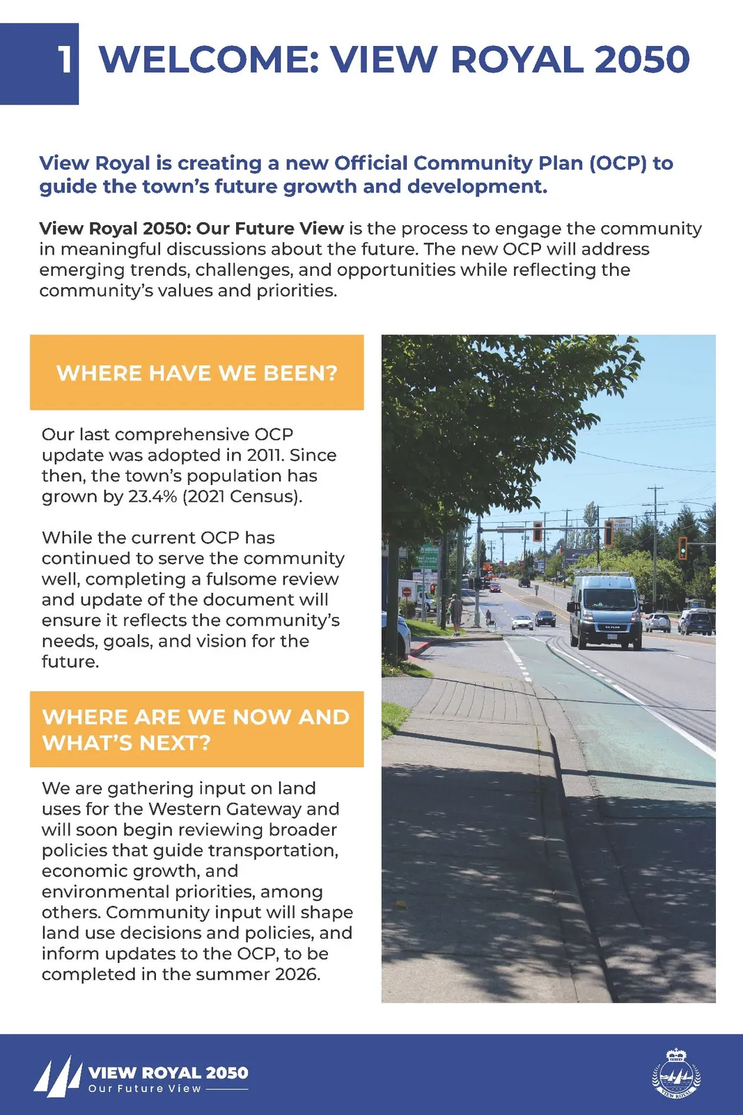
1 WELCOME: VIEW ROYAL 2050
View Royal is creating a new Official Community Plan (OCP) to guide the town’s future growth and development.
View Royal 2050: Our Future View is the process to engage the community in meaningful discussions about the future. The new OCP will address emerging trends, challenges, and opportunities while reflecting the community’s values and priorities.
WHERE HAVE WE BEEN?
Our last comprehensive OCP update was adopted in 2011. Since then, the town’s population has grown by 23.4% (2021 Census).
While the current OCP has continued to serve the community well, completing a fulsome review and update of the document will ensure it reflects the community’s needs, goals, and vision for the future.
WHERE ARE WE NOW AND WHAT'S NEXT?
We are gathering input on land uses for the Western Gateway and will soon begin reviewing broader policies that guide transportation, economic growth, and environmental priorities, among others. Community input will shape land use decisions and policies, and inform updates to the OCP, to be completed in the summer 2026.
2 VIEW ROYAL 2050 PROCESS
View Royal 2050 is a multi-year process with three phases, each focusing on key topics and public input through in-person events and online tools. This approach balances technical analysis with community feedback to shape a vision and policies that reflect residents’ needs.
We are now in Phase 2, focusing on updates to the Western Gateway Community Corridor, and general policies.
LET'S START A CONVERSATION
View Royal’s Official Community Plan is shaped by its residents. We want to hear your thoughts and ideas!
Visit www.engage.viewroyal.ca to learn more or scan the QR code below.
How to Use a QR Code:
- Open your smartphone’s camera
- Point it at the QR code
- Tap the link that appears on your screen
PROJECT TIMELINE
- Project Launch: January 2025
- Consultation: January - April 2025
- Check-in & Review: April 2025
- Council & Advisory Committee Review: May - July 2025
- Consultation: July - August 2025
- Check-in, Review & Consultation: September - October 2025
- Bylaw Adoption (SSMUH & TOA): October - November 2025
- Consultation: November 2025
- Draft Bylaw Review: January - March 2026
- Adoption: April - September 2026
3 COMMUNITY PLANNING 101
OCPs are a provincially legislated tool for British Columbian municipalities within the Local Government Act. It serves as a blueprint and will help define what we envision for View Royal over the next 20 years. As a key municipal document, it reflects community values and guides decisions on land use, housing, transportation, parks, environmental stewardship, economic development, and more.
The OCP is a living document, updated periodically to stay relevant as the community evolves and grows.
OCP VS. ZONING BYLAW: WHAT'S THE LINK
An OCP is a statement of objectives and policies that guides decisions on municipal planning and land use management. It is intended to be the document that informs bylaws and policies.
The Zoning Bylaw is a regulatory tool that translates policies from the OCP into land use, density, building height, and siting regulations on individual properties through general regulations and specific zones (e.g., R-1B Detached Residential Zone).
HOW AN OCP GUIDES LAND USE
Land use refers to the broad use of how a parcel of land may be used; these policies can be found within the OCP.
A land use designation (LUD) map in an OCP clearly shows how land is classified at a high level (e.g., residential, commercial, mixed-use, park). The LUD map works together with land use policies to broadly direct how development will occur.
HOW AN OCP ADDRESSES HOUSING?
OCPs include housing policies and land use designations to guide this growth. View Royal's Interim Housing Needs Report estimates the town will need 842 new homes in the next 5 years and 2,889 over 20 years. These projections will inform the updated OCP.
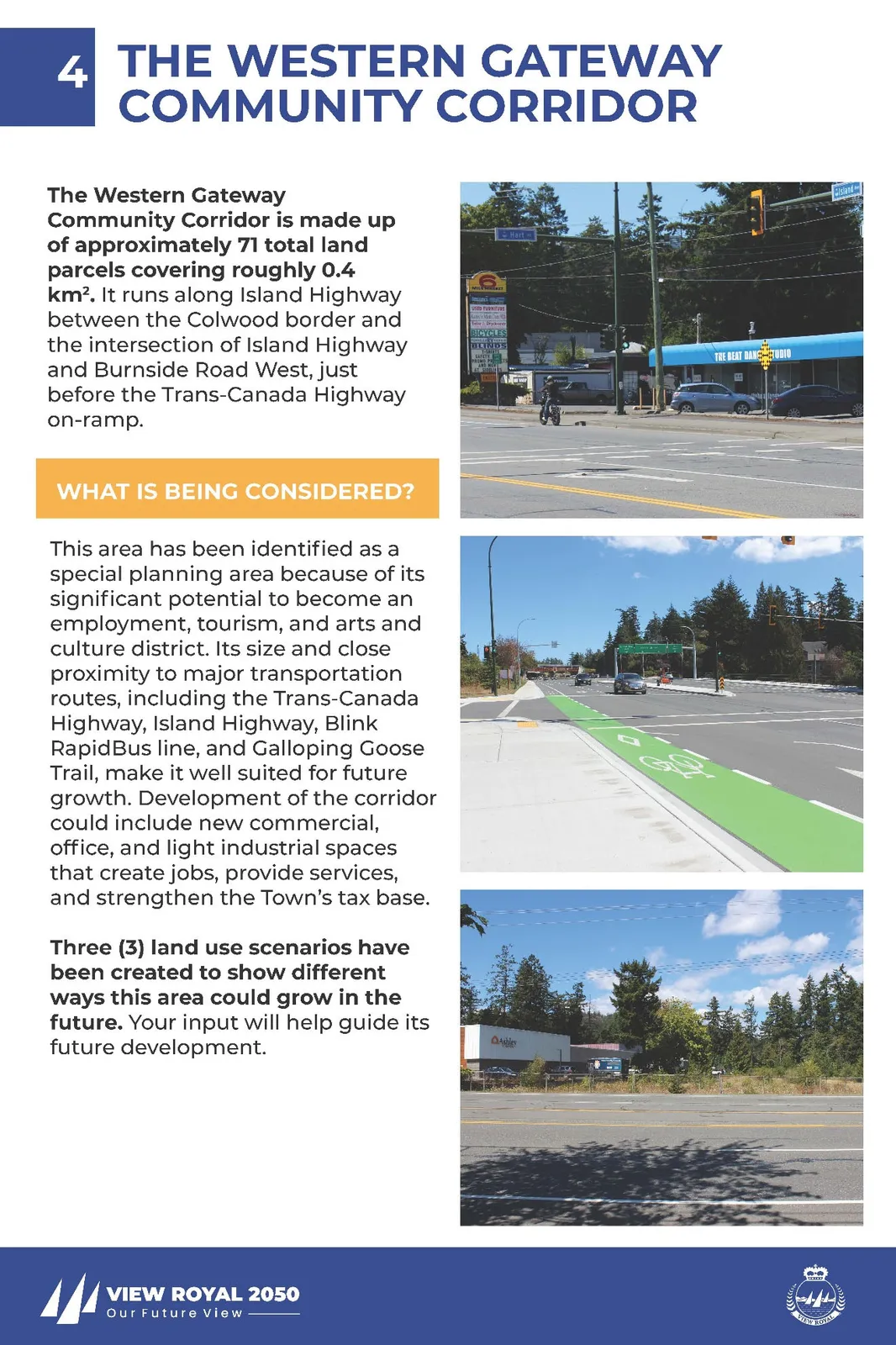
4 THE WESTERN GATEWAY COMMUNITY CORRIDOR
The Western Gateway Community Corridor is made up of approximately 71 total land parcels covering roughly 0.4 km². It runs along Island Highway between the Colwood border and the intersection of Island Highway and Burnside Road West, just before the Trans-Canada Highway on-ramp.
WHAT IS BEING CONSIDERED?
This area has been identified as a special planning area because of its significant potential to become an employment, tourism, and arts and culture district. Its size and close proximity to major transportation routes, including the Trans-Canada Highway, Island Highway, Blink RapidBus line, and Galloping Goose Trail, make it well suited for future growth. Development of the corridor could include new commercial, office, and light industrial spaces that create jobs, provide services, and strengthen the Town’s tax base.
Three (3) land use scenarios have been created to show different ways this area could grow in the future. Your input will help guide its future development.
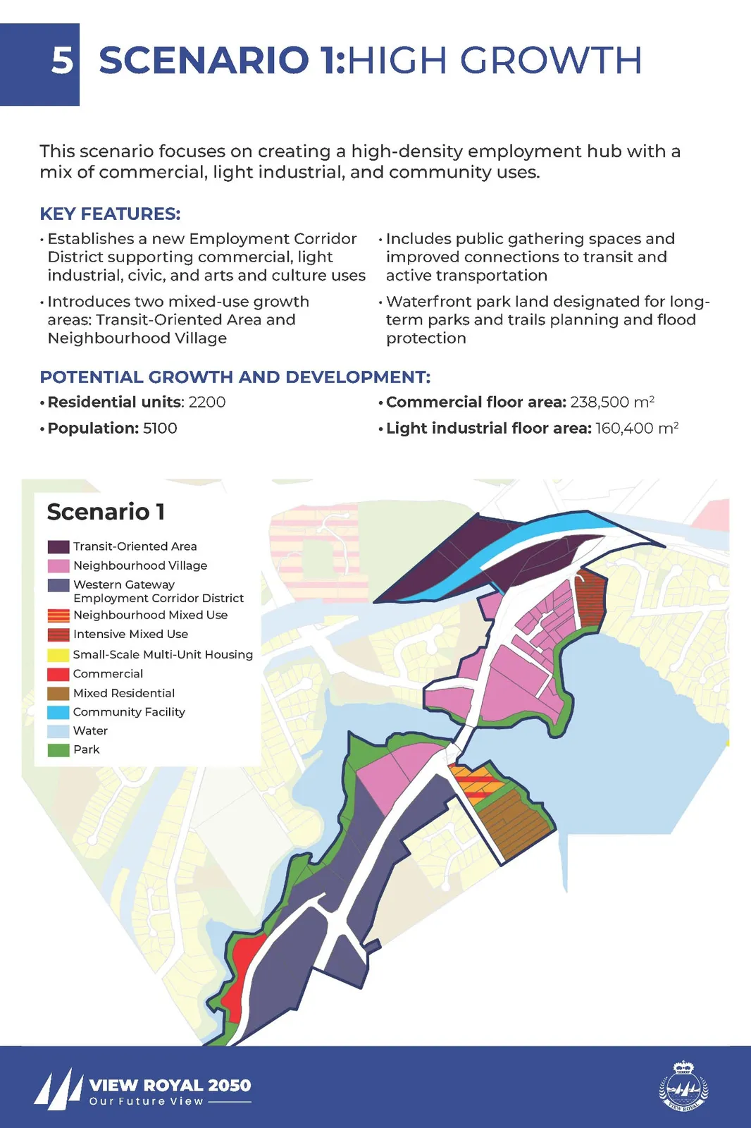
5 SCENARIO 1: HIGH GROWTH
This scenario focuses on creating a high-density employment hub with a mix of commercial, light industrial, and community uses.
KEY FEATURES:
- Establishes a new Employment Corridor District supporting commercial, light industrial, civic, and arts and culture uses
- Introduces two mixed-use growth areas: Transit-Oriented Area and Neighbourhood Village
- Includes public gathering spaces and improved connections to transit and active transportation
- Waterfront park land designated for long-term parks and trails planning and flood protection
POTENTIAL GROWTH AND DEVELOPMENT:
- Residential units: 2200
- Population: 5100
- Commercial floor area: 238,500 m²
- Light industrial floor area: 160,400 m²
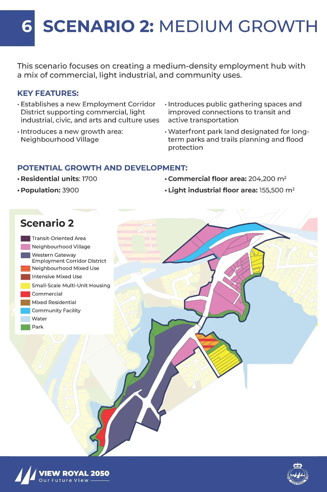
6 SCENARIO 2: MEDIUM GROWTH
This scenario focuses on creating a medium-density employment hub with a mix of commercial, light industrial, and community uses.
KEY FEATURES:
- Establishes a new Employment Corridor District supporting commercial, light industrial, civic, and arts and culture uses
- Introduces a new growth area: Neighbourhood Village
- Introduces public gathering spaces and improved connections to transit and active transportation
- Waterfront park land designated for long-term parks and trails planning and flood protection
POTENTIAL GROWTH AND DEVELOPMENT:
- Residential units: 1700
- Population: 3900
- Commercial floor area: 204,200 m²
- Light industrial floor area: 155,500 m²
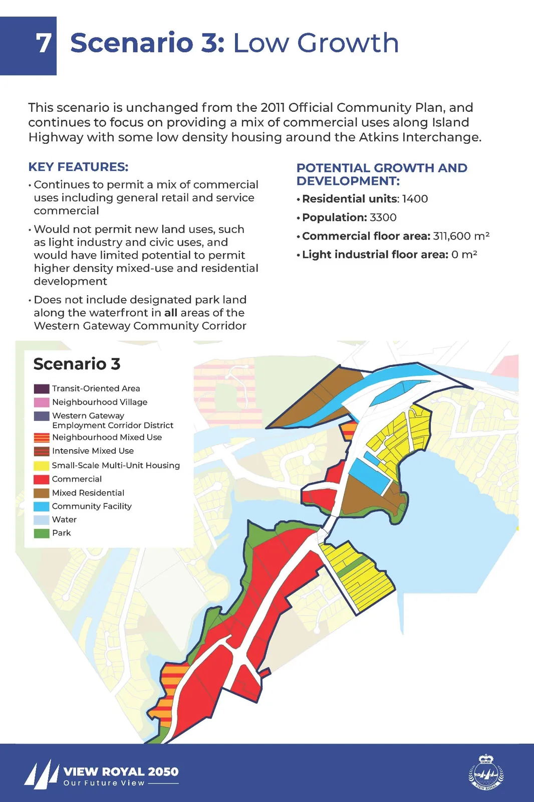
7 SCENARIO 3: LOW GROWTH
This scenario is unchanged from the 2011 Official Community Plan, and continues to focus on providing a mix of commercial uses along Island Highway with some low density housing around the Atkins Interchange.
KEY FEATURES:
- Continues to permit a mix of commercial uses including general retail and service commercial
- Would not permit new land uses, such as light industry and civic uses, and would have limited potential to permit higher density mixed-use and residential development
- Does not include designated park land along the waterfront in all areas of the Western Gateway Community Corridor
POTENTIAL GROWTH AND DEVELOPMENT:
- Residential units: 1400
- Population: 3300
- Commercial floor area: 311,600 m²
- Light industrial floor area: 0 m²
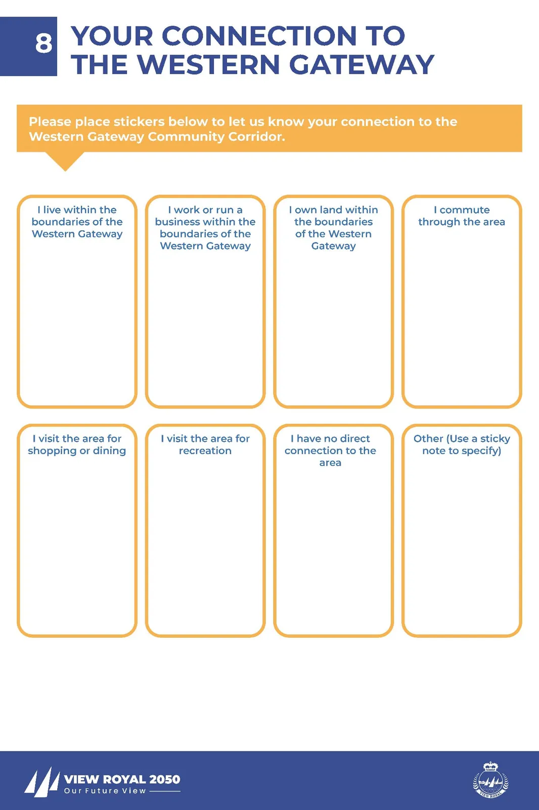
8 YOUR CONNECTION TO THE WESTERN GATEWAY
Please place stickers below to let us know your connection to the Western Gateway Community Corridor.
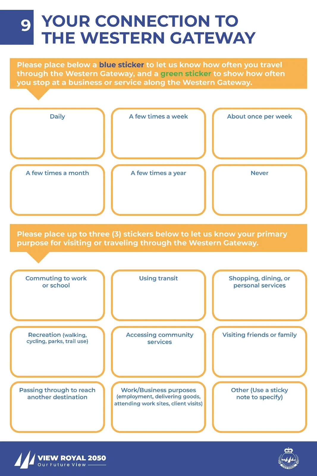
9 YOUR CONNECTION TO THE WESTERN GATEWAY
Please place below a blue sticker to let us know how often you travel through the Western Gateway, and a green sticker to show how often you stop at a business or service along the Western Gateway.

Frequency Categories:
- Daily
- A few times a week
- About once per week
- A few times a month
- A few times a year
- Never
Please place up to three (3) stickers below to let us know your primary purpose for visiting or traveling through the Western Gateway.
Purpose Categories:
- Commuting to work or school
- Using transit
- Shopping, dining, or personal services
- Recreation (walking, cycling, parks, trail use)
- Accessing community services
- Visiting friends or family
- Passing through to reach another destination
- Work/Business purposes (employment, delivering goods, attending work sites, client visits)
- Other (Use a sticky note to specify)
13 ADDITIONAL COMMENTS
Do you have any additional comments to share with the Town about the Western Gateway Community Corridor?
Please write your comment on a post-it note and place it below.

10 WHAT WORKS WELL TODAY?
What do you like about the Western Gateway Community Corridor as it is today?
Write your thoughts on a post-it note and place it below or write a location specific comment on the map.
11 WHAT'S NOT WORKING WELL TODAY?
What do you not like about the Western Gateway Community Corridor as it is today?
Write your thoughts on a post-it note and place it below or write a location specific comment on the map.
12 WHAT'S YOUR BIG IDEA FOR THE NEXT 20 YEARS?
What is your big idea for how the Western Gateway Community Corridor could develop and change over the next 20 years?
Please write your idea on a post-it note and place it below.