Appendix
Appendix B: Community Workshop Feedback (October 18)
January 13, 2026Pages 246–2532 sections
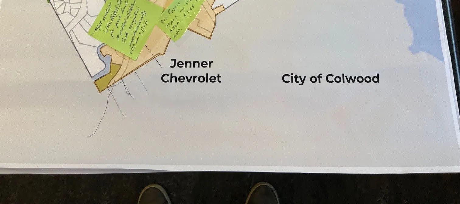
Photographic records of maps and sticky-note feedback collected during the community workshop held on October 18, 2025.
Workshop held at Juan de Fuca 55+ Activity CentreTotal of 11 participants attended the workshopScenario 2 received the highest vote in the marble exercise (14 votes/40%)
Appendix B: Community Workshop Feedback (October 18)
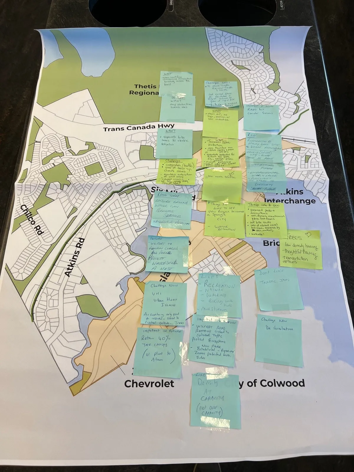
Participant Feedback from Map Sticky Notes:
- Wants:
- Some sort of commercial/retail building across the road.
- Clean air, no high vehicular, low industrial.
- Separate bike lanes for electric vehicles.
- Transit-oriented protection, view corridor, public access to pond etc., small park, low impact bike routes.
- Retain 40% tree canopy (or plant to Atam).
- Transit Hub to see Vic Royal become a "Sponge City" with water retention.
- Likes:
- Recreation, Nature, Walking, Biking with Kids, Mill Stream.
- Density at capacity (not over capacity).
- Challenges/Dislikes:
- Do not want any industrial zone used.
- Congestion (traffic), loss of trees - canopy loss.
- Maintain separation of bike & cars, sidewalk/stairs along.
- UHI (Urban Heat Island) - Air quality only good for workers, need to control outside - trees.
- Traffic jams.
- De formulation.
- Future/Trees:
- Maintain current access, protect watershed - a must.
- Low density housing, thoughtful density, transportation options.
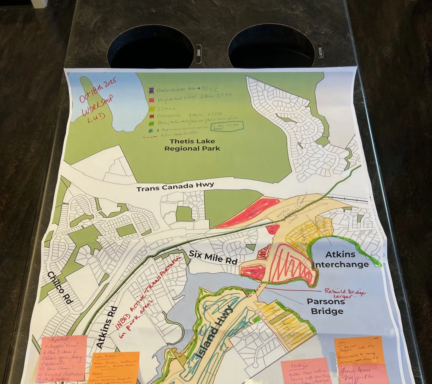
Handwritten Legend on Map:
- Transit-Oriented Area -> NONE
- Neighbourhood Village: 4-6 Storey, 2.5 FSR
- SSMUH (Small-Scale Multi-Unit Housing)
- Commercial: 4 Storey, 2.5 FSR
- Park/Bike land/Sidewalk/Active access point
- Employment district corridor: 6 Storey, 3.5 FSR
- Active Trans Protection
Additional Participant Comments:
- Important: 1) Traffic Flow, 2) Max 8 Storeys, 3) Retail, Office, Housing, 4) Restaurants, 5) Some Charm!, 6) Sidewalk/Multi-use, 7) Tree Protection.
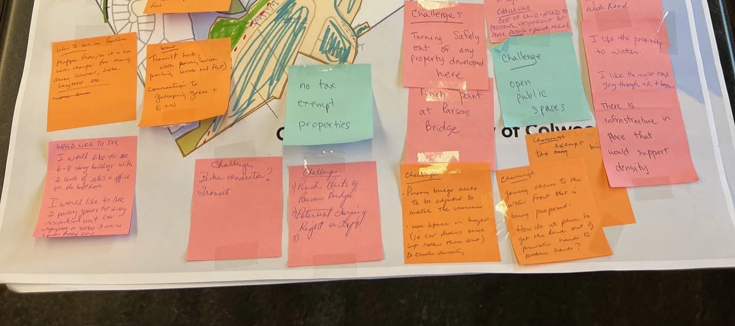
- I would like to see: 6-8 story buildings with 2 levels of retail + office on the bottom. I would like to see 2 parking spaces for every residential unit. (No unplanned in zones if we don't have enough parking).
- Challenges:
- Transit hub with peninsula parking levels (not flat). Connection to Galloping Goose + E-N.
- Bike connector? Transit.
- No tax exempt properties.
- Turning safely out of any property developed here. Pinch point at Parsons Bridge.
- Open public spaces.
- Gaining access to the water from this is being proposed. How do we plan to get the land out of private hands to public hands?
- General Likes:
- I like the proximity to water.
- I like the major road going through VR + bypass.
- There is infrastructure in place that would support density.
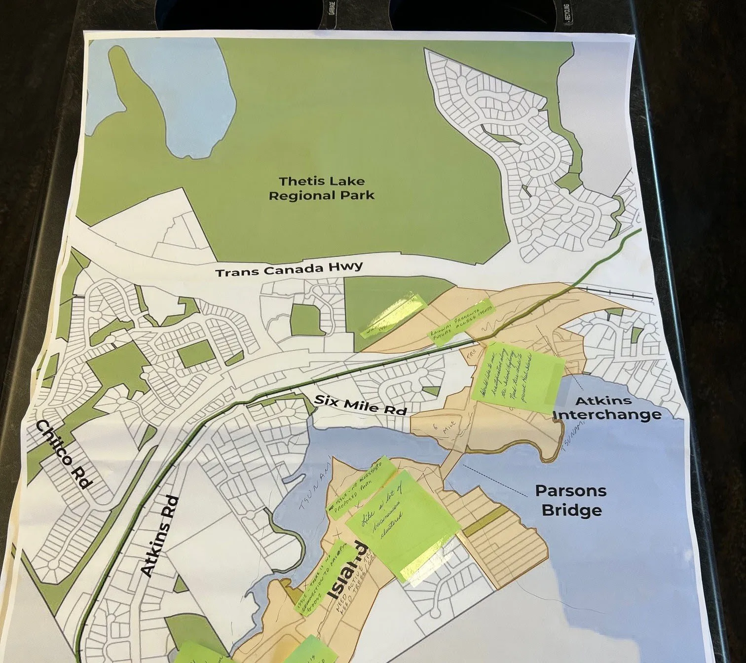
Annotations and Notes:
- Railway presents future access.
- Tsunami - No issue - as long as no connection to Parsons.
- No public space in this area. Need to add.
Scenario 1
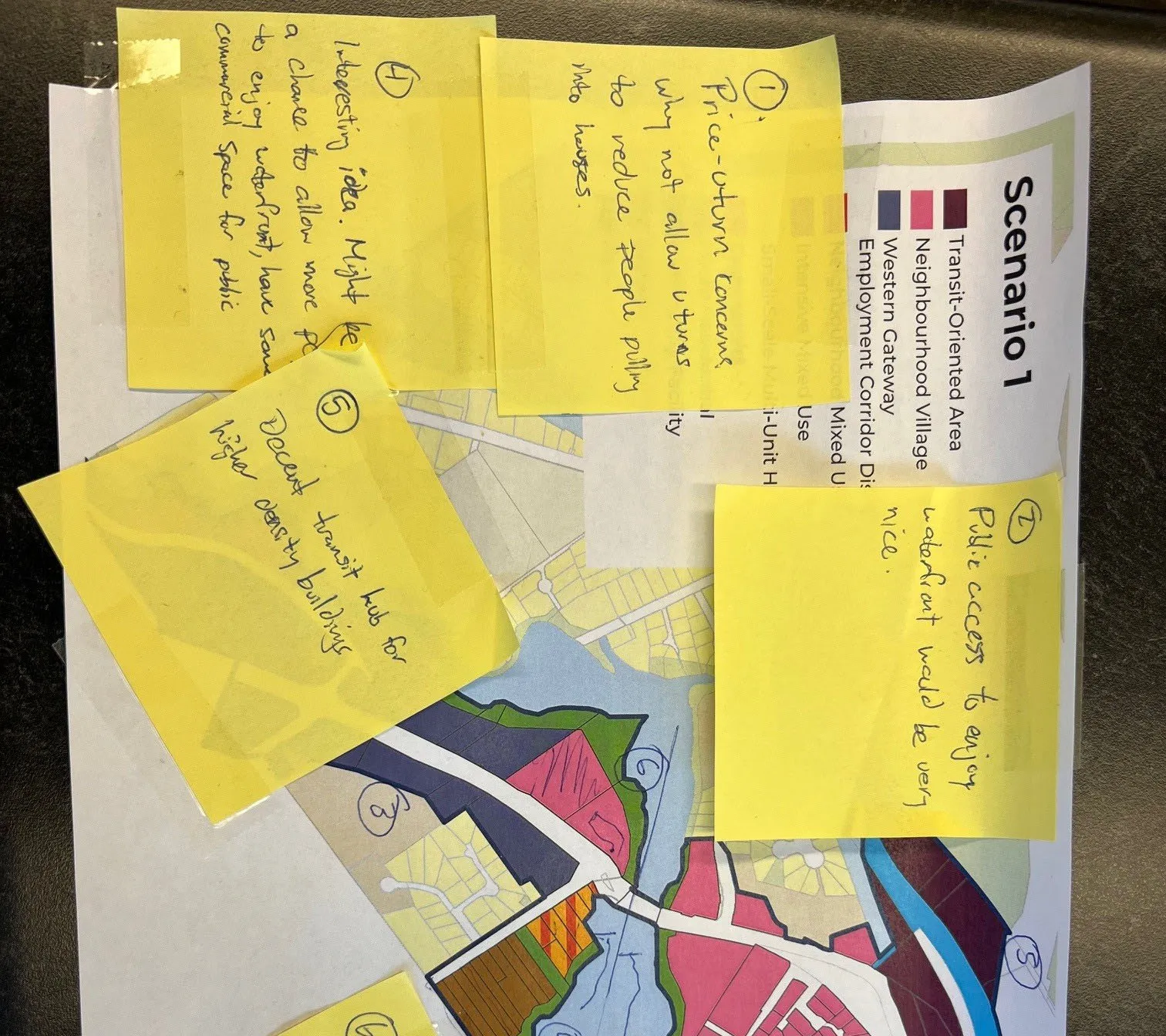
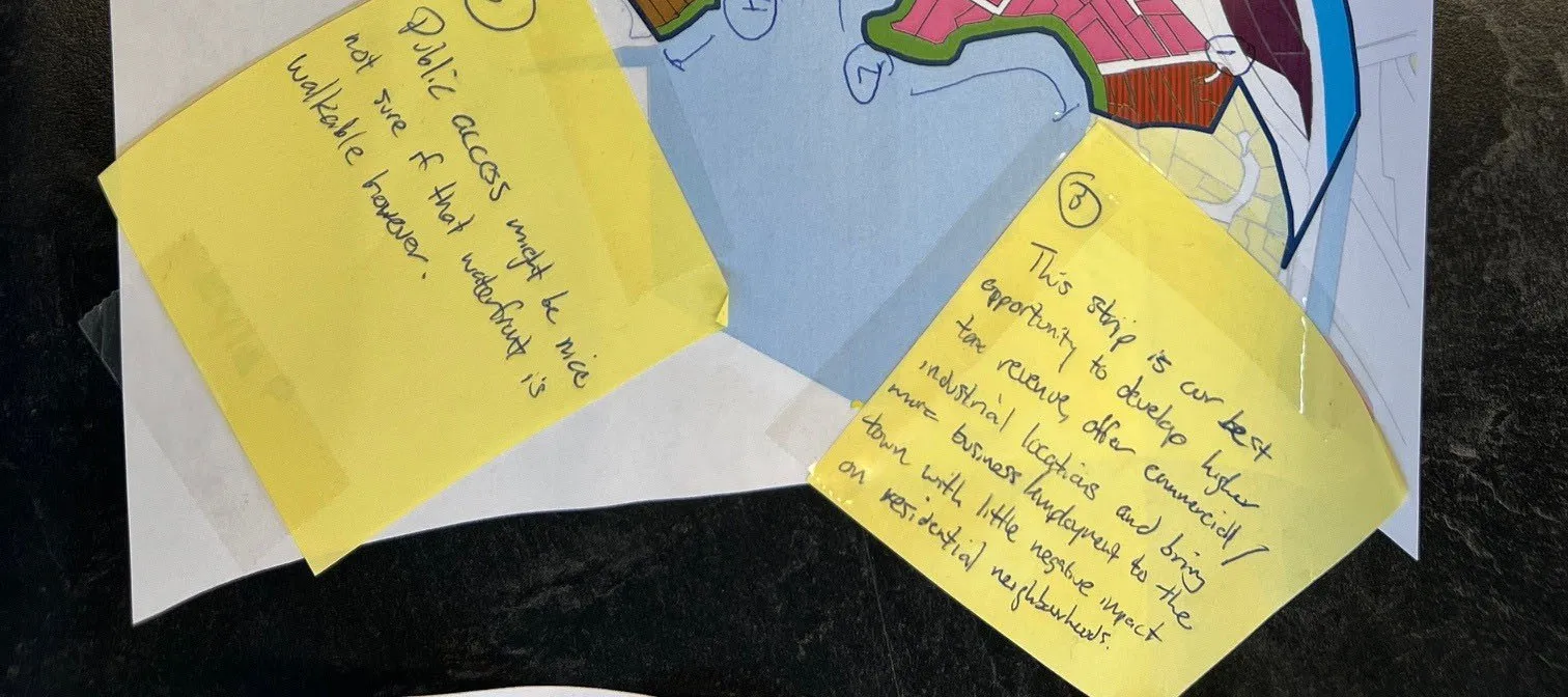
Numbered Participant Feedback:
- Price-return concerns, why not allow u-turns to reduce people pulling into houses.
- Public access to enjoy waterfront would be very nice.
- This strip is our best opportunity to develop higher tax revenue, offer commercial / industrial locations and bring more business development to the town with little negative impact on residential neighbourhoods.
- Interesting idea. Might be a chance to allow more people to enjoy waterfront, have some commercial space for public.
- Decent transit hub for higher density buildings.
- Public access might be nice, not sure if that waterfront is walkable however.
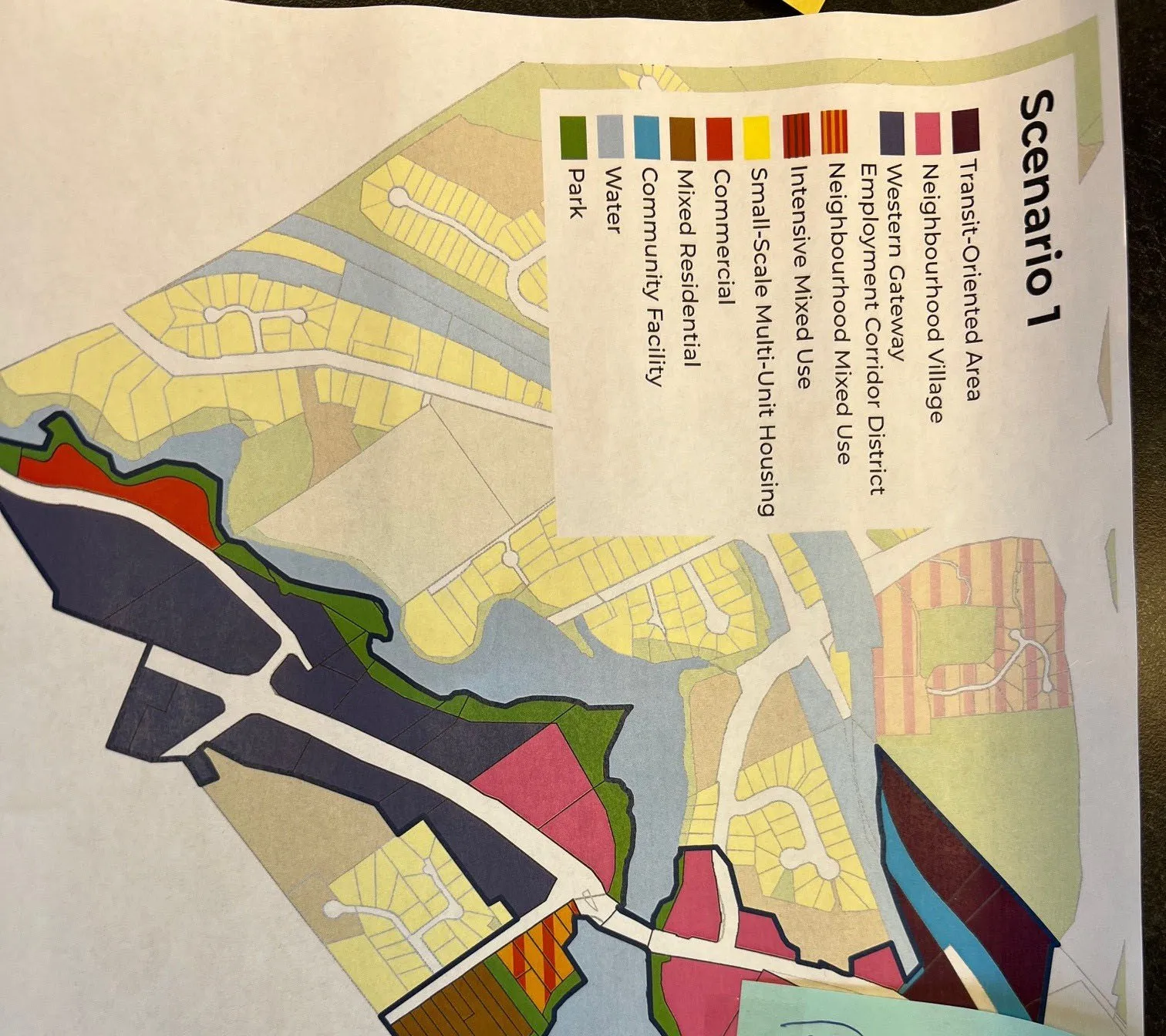
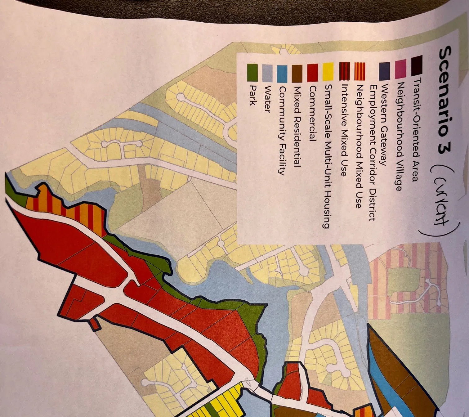
Scenario 1 Land Use Legend:
- Transit-Oriented Area
- Neighbourhood Village
- Western Gateway Employment Corridor District
- Neighbourhood Mixed Use
- Intensive Mixed Use
- Small-Scale Multi-Unit Housing
- Commercial
- Mixed Residential
- Community Facility
- Water
- Park
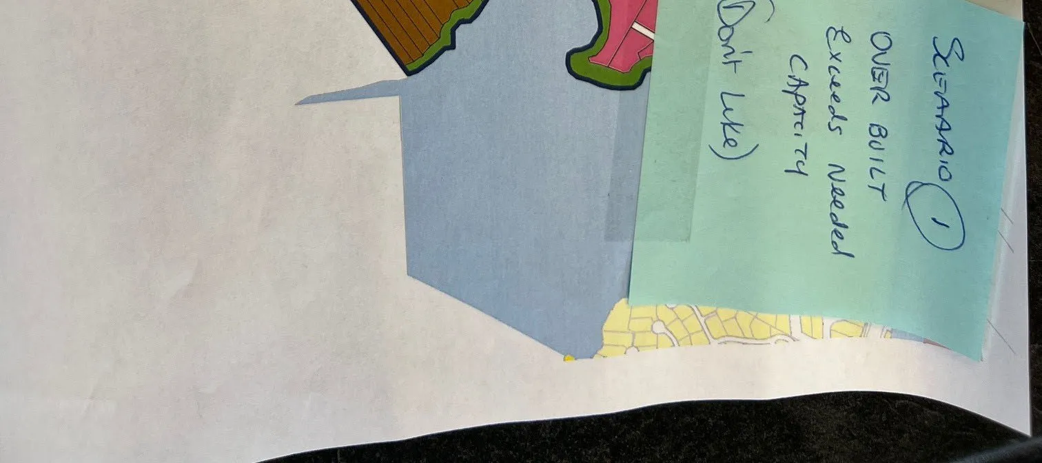
Sticky Note Comment:
- Scenario 1: OVER BUILT. Exceeds Needed CAPACITY (Don't Like).
Scenario 3 (current)
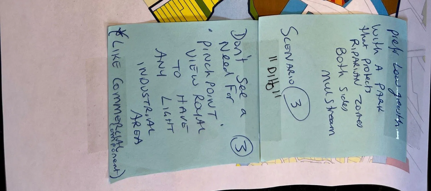
Participant Feedback:
- Scenario 3: "Like it"
- Prefers low growth with A PARK that protects Riparian Zones Both Sides Millstream.
- Don't see a need for "Pinch Point" View Royal to have any light industrial area (*LIKE Commercial component).
Page 246–253
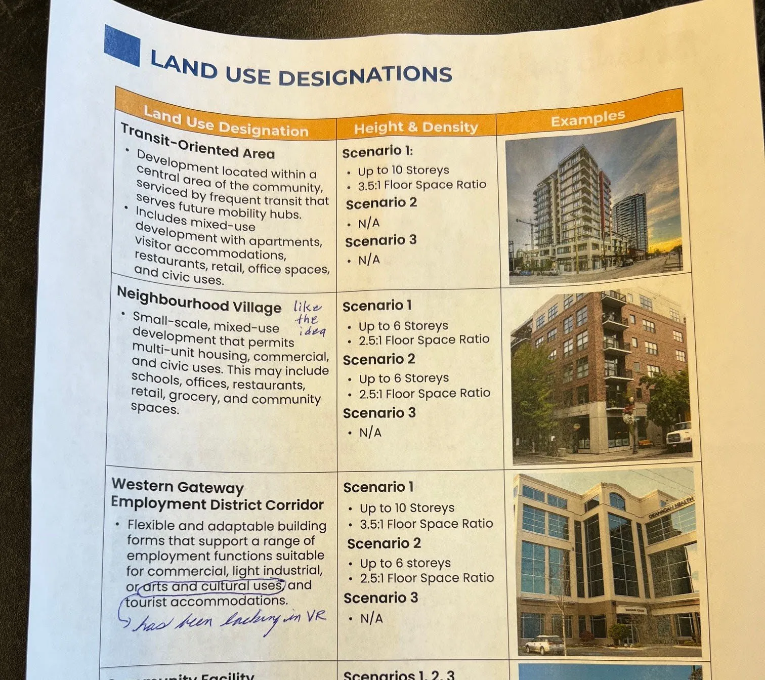
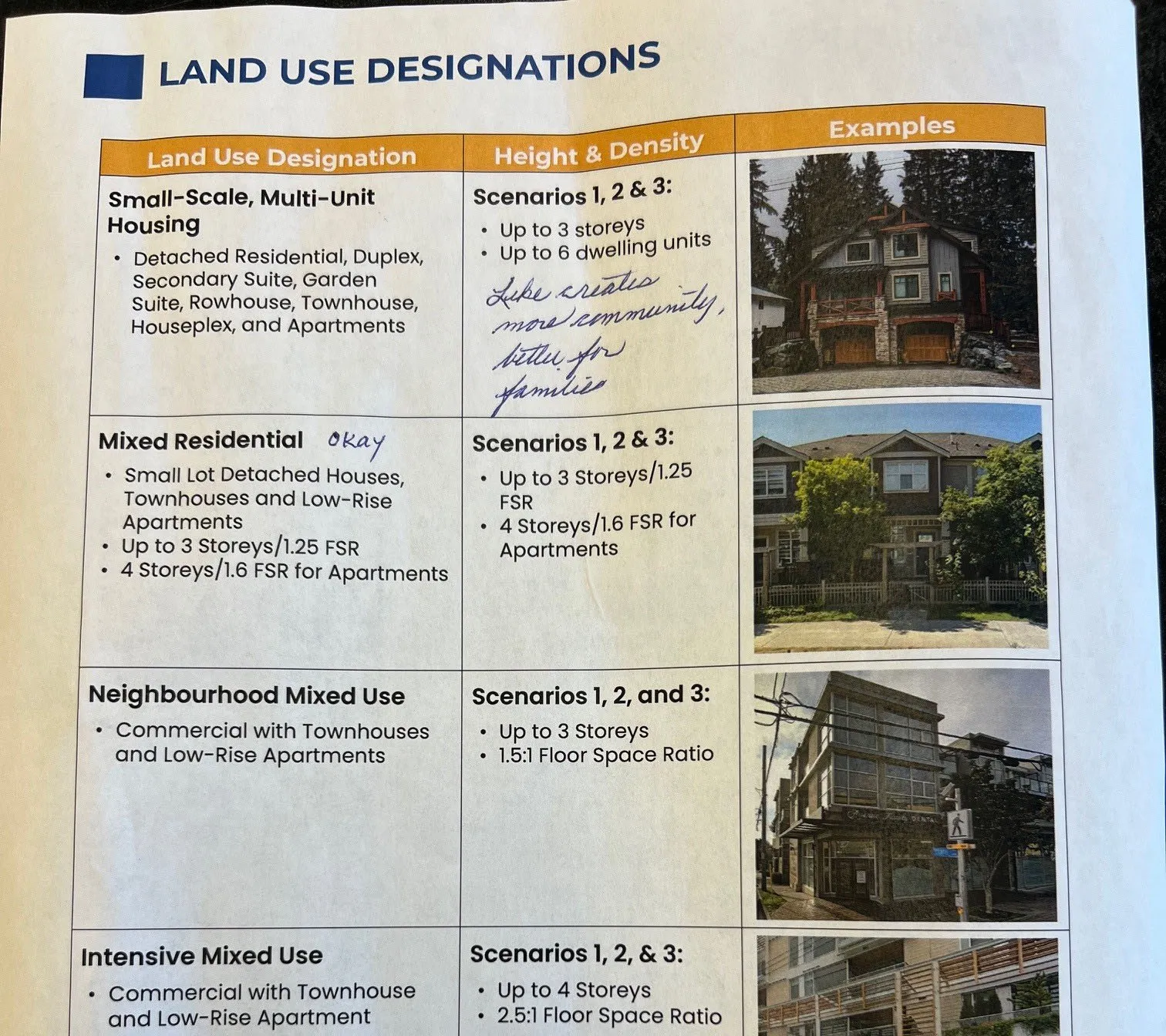
LAND USE DESIGNATIONS
| Land Use Designation | Height & Density | Examples |
|---|---|---|
| Transit-Oriented Area • Development located within a central area of the community, serviced by frequent transit that serves future mobility hubs. • Includes mixed-use development with apartments, visitor accommodations, restaurants, retail, office spaces, and civic uses. |
Scenario 1: • Up to 10 Storeys • 3.5:1 Floor Space Ratio Scenario 2: • N/A Scenario 3: • N/A |
[Example photo of high-rise apartment building] |
| Neighbourhood Village (Handwritten: "like the idea") • Small-scale, mixed-use development that permits multi-unit housing, commercial, and civic uses. This may include schools, offices, restaurants, retail, grocery, and community spaces. |
Scenario 1: • Up to 6 Storeys • 2.5:1 Floor Space Ratio Scenario 2: • Up to 6 Storeys • 2.5:1 Floor Space Ratio Scenario 3: • N/A |
[Example photo of mid-rise mixed-use building] |
| Western Gateway Employment District Corridor • Flexible and adaptable building forms that support a range of employment functions suitable for commercial, light industrial, or arts and cultural uses (Handwritten: "has been lacking in VR") and tourist accommodations. |
Scenario 1: • Up to 10 Storeys • 3.5:1 Floor Space Ratio Scenario 2: • Up to 6 Storeys • 2.5:1 Floor Space Ratio Scenario 3: • N/A |
[Example photo of modern office building] |
| Land Use Designation | Height & Density | Examples |
|---|---|---|
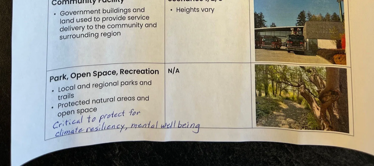
| Community Facility • Government buildings and land used to provide service delivery to the community and surrounding region |
Scenarios 1, 2, 3 • Heights vary |
[Example photo of community fire station] |
| Park, Open Space, Recreation • Local and regional parks and trails • Protected natural areas and open space (Handwritten: "Critical to protect for climate resiliency, mental well being") |
N/A | [Example photo of nature trail] |
| Land Use Designation | Height & Density | Examples |
|---|---|---|
| Small-Scale, Multi-Unit Housing • Detached Residential, Duplex, Secondary Suite, Garden Suite, Rowhouse, Townhouse, Houseplex, and Apartments |
Scenarios 1, 2 & 3: • Up to 3 storeys • Up to 6 dwelling units (Handwritten: "Like creates more community, better for families") |
[Example photo of multi-unit residential house] |
| Mixed Residential (Handwritten: "okay") • Small Lot Detached Houses, Townhouses and Low-Rise Apartments • Up to 3 Storeys/1.25 FSR • 4 Storeys/1.6 FSR for Apartments |
Scenarios 1, 2 & 3: • Up to 3 Storeys/1.25 FSR • 4 Storeys/1.6 FSR for Apartments |
[Example photo of rowhouses] |
| Neighbourhood Mixed Use • Commercial with Townhouses and Low-Rise Apartments |
Scenarios 1, 2, and 3: • Up to 3 Storeys • 1.5:1 Floor Space Ratio |
[Example photo of mixed-use building with retail at base] |
| Intensive Mixed Use • Commercial with Townhouse and Low-Rise Apartment |
Scenarios 1, 2, & 3: • Up to 4 Storeys • 2.5:1 Floor Space Ratio |
[Example photo of modern apartment building with terrace] |
| Land Use Designation | Height & Density | Examples |
|---|---|---|
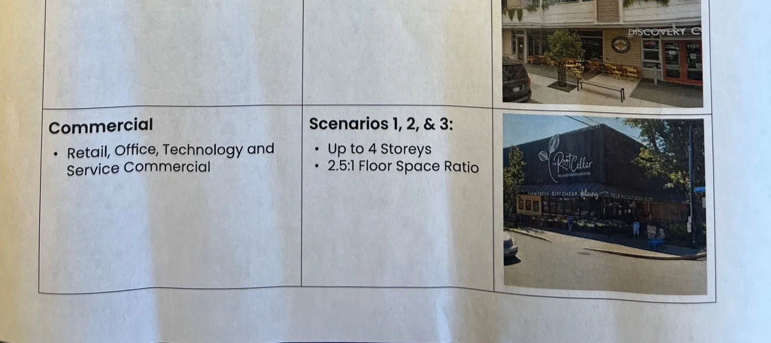
| Commercial • Retail, Office, Technology and Service Commercial |
Scenarios 1, 2, & 3: • Up to 4 Storeys • 2.5:1 Floor Space Ratio |
[Example photo of "The Root Cellar" retail building] |
Page 246–253
Extracted from: 2026 01 13 Committee of the Whole Meeting - Agenda - Pdf