Official Community Plan Update: What We Heard Report #4 – Western Gateway Community Corridor Engagement (Presentation)
A slide deck summarizing the key outcomes, participant demographics, and recommendations from the fourth OCP engagement touchpoint.
Official Community Plan Update: What We Heard Report #4 – Western Gateway Community Corridor Engagement
Committee of the Whole – January 13, 2026
Purpose & Background
- During June 17, 2025 Council Meeting, Council expressed interest in establishing the Western Gateway Community Corridor as an employment hub
- Council proposed that the existing Western Gateway area be expanded as part of this process
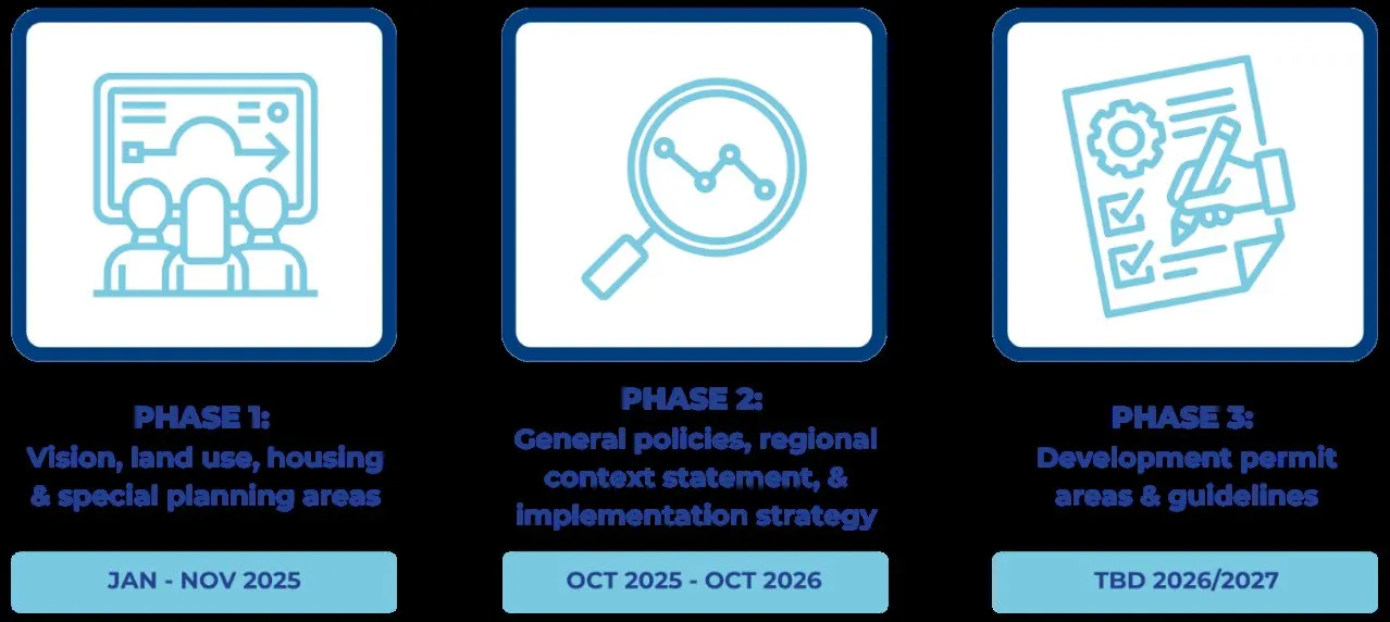
- Feedback would be used to inform a first draft of the OCP, expected in the spring of 2026
Engagement Overview
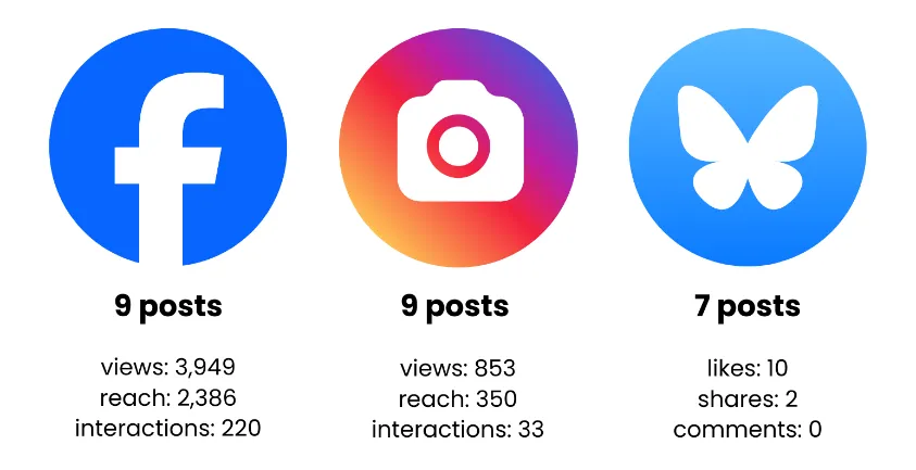
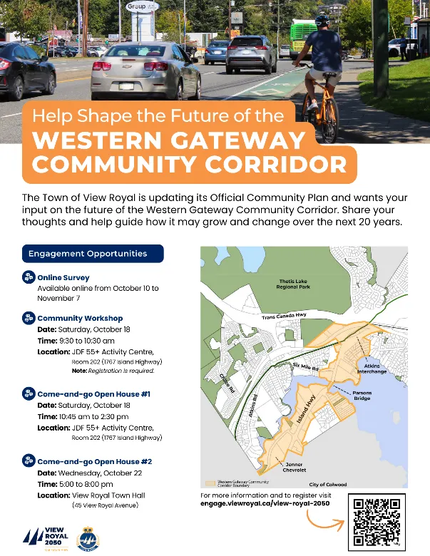
- The project team advertised ways to get involved through social media, the View Royal E-Newsletter, posters, resident and business letters, stakeholder emails, and news paper advertisements.
- The Westen Gateway Community Corridor survey, was open October 7 – November 12, 2025
General Feedback (Survey)
What is your primary purpose for visiting or travelling through the Western Gateway?
- Shopping, dining, or personal services (64%)
What do you Value about the Western Gateway?
- Its role as a gateway between communities (53%)
What are the issues or challenges of the Western Gateway?
- Heavy traffic and congestion (79%)
What challenges will the Western Gateway face in the future?
- Traffic and congestion (93%)
Existing Conditions & Future Priorities
How would you rate current conditions in the Western Gateway? 39% said current retail and services were poor.
Which of the following Mobility and Connectivity Improvements should be prioritized? 47% wanted upgrades to sidewalks and pedestrian crossings to improve safety and accessibility
Which of the following design features should be prioritized? 54% said landscaping and street trees should be incorporated; and 53% said that sidewalks should be widened, continuous, and accessible.

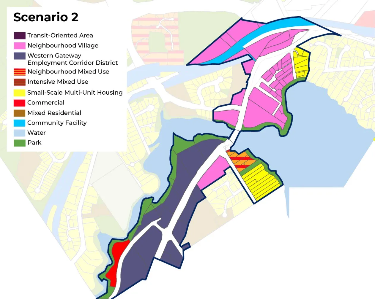
Preferred Land Use Scenario
| Survey | Focus Group Workshop | Open Houses | Total Vote % | |
|---|---|---|---|---|
| Sc. 1 | (20) 34% | (5) 83% | (2) 6% | 27% |
| Sc. 2 | (24) 41% | (1) 17% | (14) 40% | 39% |
| Sc. 3 | (10) 17% | (0) 0% | (4) 11% | 14% |
| Hybrid | (4) 3% | (0) 0% | (13) 37% | 17% |
| Don’t Like Any Scenario | (1) 2% | (0) 0% | (2) 6% | 3% |
Demographics
- 86% of respondents live in View Royal
- 30% of respondents said they live within the Wilfert neighbourhood
- 18% of respondents are between the ages of 35 and 39 years old
- 42% of respondents have moved to View Royal in the last 5 years
- 32% of respondents found out about the survey online or through the Town’s website
- 58% of respondents said that this was their first time participating in View Royal 2050
Recommendation
THAT the report titled “Official Community Plan Review and Update: What We Heard Report #4 – Western Gateway Community Corridor Engagement” by the Senior Planner, dated December 12, 2025 be received for information.