FORM 1 Riparian Areas Protection Regulation - Qualified Environmental Professional - Assessment Report
An environmental assessment report conducted by a Qualified Environmental Professional regarding the development proposal at 221 Atkins Road.
FORM 1
Riparian Areas Protection Regulation - Qualified Environmental Professional - Assessment Report
(boulevard and adjacent off-site trees) including any restoration planting. The ten general tree protection recommendations provided in the December 18, 2020 report are:
- Pre-construction meeting: Before demolition or site-servicing begins, the contractor shall meet with the arborist to review the placement of fencing and other tree protection measures within this plan. a) The Project Arborist shall clearly mark the boundaries of all areas to be fenced and protected. b) Access routes and areas for trade parking and materials storage will be identified with the contractor.
- Tree Fencing: a) Tree protection fencing shall be installed to the Township of View Royal standards at the locations indicated on this drawing prior to demolition or site servicing permits being issued (see fencing detail on plan). b) Tree protection fencing, and armouring shall be maintained in good condition throughout the duration of the project. c) Requests to temporarily remove or move tree fencing must be reviewed by the project arborist for approval.
- Tree Management Plan posting: a) A full-sized weather-proof copy of this tree plan shall be posted in plain sight in the site office. b) The general contractor shall ensure that all relevant sub-trades are familiar with the drawing and tree protection measures.
- Site servicing and excavations: The project arborist shall be present to oversee excavation, service trenching, stump removal, site grading or blasting within, or adjacent to, the tree protection areas (TPAs).
- Root & branch pruning and protection: a) Any tree roots or branches damaged during site work shall be pruned back to undamaged tissue by the arborist. b) The vertical face of excavated cuts adjacent to the TPAs shall be securely covered with non-permeable fabric by the project arborist to prevent soil desiccation and erosion.
- Mulch and Irrigation: Trees impacted by excavation for site servicing shall be top-dressed throughout their protected root zones with 100 mm of clean tree chip mulch and irrigated once every two weeks during the dry summer period (May to mid-October) to a minimum effective depth of 30cm.
- Temporary access: If temporary access is required within a tree protection area (TPA), the contractor shall notify the project arborist in advance and review the access requirements and any additional protective measures prescribed by the arborist.
- Soil armouring: If it is not possible to fence the entire PRZ, the unprotected portion of the PRZ shall be armoured with 3/4" plywood or a temporary cover of geo-textile and 200mm of road-base, moderately compacted with a plate compactor. (See drawing for recommended soil armouring locations.)
- Storage restrictions: No equipment, materials or excavated soil shall be placed or stored within the TPA.
- Procedure for rock removal near tree root zones: a. The general contractor will convene a meeting with the arborist and blasting contractor prior to drilling to develop a work plan that limits rock removal impacts to protected trees. b. Where considered necessary by the arborist, alternate rock removal techniques, such as hoe-ramming, shall be used in place of blasting. c. Blasting vibrations in the vicinity of the Tree Protection Areas are not to exceed a measured peak particle velocity of 25 mm/sec. i. Seismometer records will be kept of all blasting within a 30m radius of any tree protection areas for review by the project arborist. ii. Seismometers shall be placed at the outer boundary of the tree protection area closest to the blast zone. d. Use DYNAMITE as the explosive product. No fertilizer-based explosive is permitted, due to its toxicity to tree roots. e. The contractor shall prevent rock debris from the blast site from entering the TPA.
Further site-specific tree protection recommendations and guidance will be required from a certified arborist during site servicing and lot buildout. Minor updates of tree protection fencing layout are recommended in Figure 3.
I, Tim Adam, hereby certify that: a. I am a qualified environmental professional, as defined in the Riparian Areas Protection Regulation made under the Riparian Areas Protection Act; b. I am qualified to carry out this part of the assessment of the development proposal made by the developer David McAllister; c. I have carried out an assessment of the development proposal and my assessment is set out in this Assessment Report; and in carrying out my assessment of the development proposal, I have followed the assessment methods set out in the Minister’s technical manual to the Riparian Areas Protection Regulation.
5. Encroachment
A major cause of riparian loss and stream degradation is a result of encroachment by adjacent landowners. Human impacts to streams and riparian areas commonly consist of refuse dumping (including yard waste which can introduce invasive species), trampling of vegetation and bank erosion. These effects were noted within the survey area.
To avoid further or future encroachment into the SPEA and SPEA Protection Zone (SPZ) during construction, a high visibility fence will be erected along the SPEA and SPZ boundary prior to clearing, excavation or grading. The no-clearing fence is intended to prevent inadvertent damage or disturbance to the SPEA and SPZ by construction activities.
Once construction has been completed, the no-clearing boundary fence must be replaced with a permanent fence located along or outside SPEA. The permanent fence will, at a minimum, be a post and rail wood fence (1.5 m high) with wire mesh or an alternate design which is acceptable to the QEP.
To protect and maintain the SPEA over the long term (e.g. including all future owners), a “no-disturbance” restrictive covenant should be registered for the SPEA. Alternatively, park dedication of the SPEA area could explored.
I, Tim Adam, hereby certify that: a. I am a qualified environmental professional, as defined in the Riparian Areas Protection Regulation made under the Riparian Areas Protection Act; b. I am qualified to carry out this part of the assessment of the development proposal made by the developer David McAllister; c. I have carried out an assessment of the development proposal and my assessment is set out in this Assessment Report; and in carrying out my assessment of the development proposal, I have followed the assessment methods set out in the Minister’s technical manual to the Riparian Areas Protection Regulation.
6. Sediment and Erosion Control
Erosion and sediment control (ESC) measures should be implemented and monitored during land clearing, grading, and building construction phases of development, as well as during final landscaping, to meet the requirements of the water discharge criteria of the BC Water Quality Guidelines for Aquatic Life (BCWQG-AL) (e.g., prevent the discharge of “waste” into storm sewers or watercourses). Silt fence (keyed-in to the ground) with crushed rock berm as required is to be properly installed and maintained along the outer edge (development side) of the SPEA or SPZ. Sediment and turbid water must be collected and treated within the development area such that water not meeting the BCWQG-AL (e.g., for turbidity or other applicable parameters) is not discharged from the construction site into to Millstream, SPEA, SPZ or into ditches along Atkins Road or any storm sewers (e.g. catch basins).
An environmental monitor (a QEP) should work with the project engineer to prepare a site specific ESC plan in advance of construction. The environmental monitor should review the installation of all erosion and sediment control measures as directed in the ESC plan following clearing, prior to grading, and frequently during the duration of construction. The environmental monitor should monitor the implementation and effectiveness of the ESC plan. Following construction, the environmental monitor should confirm the removal of all temporary ESC measures and final installation of all permanent ESC measures (e.g., seeding).
I, Tim Adam, hereby certify that: a. I am a qualified environmental professional, as defined in the Riparian Areas Protection Regulation made under the Riparian Areas Protection Act; b. I am qualified to carry out this part of the assessment of the development proposal made by the developer David McAllister; c. I have carried out an assessment of the development proposal and my assessment is set out in this Assessment Report; and in carrying out my assessment of the development proposal, I have followed the assessment methods set out in the Minister’s technical manual to the Riparian Areas Protection Regulation.
7. Stormwater Management
Development tends to increase the proportion of impervious surfaces on a parcel of land by converting previously forested or grass covered areas into building structures with roofs and paved surfaces. The associated increase in impervious surfaces can impact the hydrology of a stream, by increasing peak storm flows and decreasing stream base flow. Peak storm flows are increased when rainwater hitting impervious surfaces is collected and directed to the stream as stormwater runoff (as opposed to infiltrating into the ground). Increasing peak storm flows within streams increases the erosion risk posed to stream bed and banks and can increase slope stability concerns. As infiltration of rainwater is reduced, groundwater recharge is reduced and consequently the baseflow of the stream is reduced. Reduced baseflow is particularly significant during the drier summer months when insufficient flow can pose an issue to aquatic life.
Recommendations are provided by Ryzuk Geotechnical Engineering and Material Testing dated March 5, 2019 regarding stormwater management for slope stability. Landscaping features should be constructed such that surface flows are not concentrated to discharge at the slope crest. Alternatively, collected water could be conveyed downslope via secured solid pipe network and discharged onto non-erodible soils. In discussion with the municipal staff, they indicated a preference to discharge stormwater runoff to the ravine and Millstream directly as described in the alternative plan.
Use of the existing ditch along Atkins Road would result in the eventual discharge of stormwater to Millstream with the potential for ground infiltration, nutrient absorption, and particulate filtration within the ditch. Additional enhancements through rock groin placement and in channel planting (bioswale) could improve these results.
The project civil engineer should consider the design and implementation of measures to reduce the total volume of stormwater discharging from the site by planning to maximize infiltration to groundwater if safe to do so geotechnically. Consideration should be given to utilizing additional topsoil on landscaped areas of the site for volume reduction purposes. Roof leaders and foundation drains should be directed to infiltration areas (rock pits) and biofiltration swales (Atkins Ditch).
The results of geotechnical investigations and qualified professional recommendations on slope stability should be taken into consideration when planning groundwater loading, storm water runoff, impervious surface and landscaping features. Surface runoff should be intercepted and directed away from the existing ravine to avoid slope erosion and instability.
I, Tim Adam, hereby certify that: a. I am a qualified environmental professional, as defined in the Riparian Areas Protection Regulation made under the Riparian Areas Protection Act; b. I am qualified to carry out this part of the assessment of the development proposal made by the developer David McAllister; c. I have carried out an assessment of the development proposal and my assessment is set out in this Assessment Report; and In carrying out my assessment of the development proposal, I have followed the assessment methods set out in the Minister’s technical manual to the Riparian Areas Protection Regulation.
8. Floodplain Concerns (highly mobile channel)
There are no floodplain concerns regarding the proposed development and Millstream. The channel shows indications of channel mobility within the ravine. However, Millstream is highly unlikely to impact the proposed development given the width of the calculated SPEA, the height of the ravine, and the proposed tree replanting on the ravine slope.
I, Tim Adam, hereby certify that: a. I am a qualified environmental professional, as defined in the Riparian Areas Protection Regulation made under the Riparian Areas Protection Act; b. I am qualified to carry out this part of the assessment of the development proposal made by the developer David McAllister; c. I have carried out an assessment of the development proposal and my assessment is set out in this Assessment Report; and In carrying out my assessment of the development proposal, I have followed the assessment methods set out in the Minister’s technical manual to the Riparian Areas Protection Regulation.
Section 5. Environmental Monitoring
Environmental monitoring of the Site during the future construction phase, once the development plan has been finalized, will be conducted to support the implementation of the recommendations outlined within this report. This RAPR Assessment Report has been completed early in the development planning for this Site, with the objective of determining the “development envelopes” for a subdivision of the existing lot. Once the streamside protection and enhancement area (SPEA) is set aside and protected, the measures to protect the SPEA must be maintained though the duration of all stages of redevelopment including construction and restoration works.
Prior to clearing and site preparation works, the SPEA and SPZ boundary is to be marked on the ground (e.g. staking) and a “no-clearing, no work, no access boundary” snow fence is to be erected along the SPZ boundary. The installation of the no-clearing boundary fence is to be inspected regularly by the environmental monitor to ensure that the SPEA and SPZ are protected, before and after clearing as well as during the excavation at the site. A silt fence should also be installed adjacent to the no-clearing boundary fence, inside the development zone. Once clearing and grading are completed, the completed installation of the permanent SPEA fence is to be inspected.
Post-Construction Report
A post-development report must be prepared by the environmental monitor, documenting the measures taken to establish the SPEA on the ground and the implementation of measures to protect the SPEA (e.g. SPEA encroachment avoidance, sediment and erosion control, and stormwater management) described above. The post-development report will also describe the effectiveness of the SPEA protection measures, detail steps taken to correct problems during development, and ensure compliance with the establishment and protection of the SPEA.
Section 6. Photos
Photo 1 Typical photo of Millstream taken at transect 6 upstream of a log and debris jam. View downstream. [Photo 1: Typical photo of Millstream taken at transect 6 upstream of a log and debris jam. View downstream.]
Photo 2 Typical photo of Millstream taken at transect 7. View upstream. [Photo 2: Typical photo of Millstream taken at transect 7. View upstream.]
Photo 3 View of the existing home and steep slope from the top of bank of Millstream.
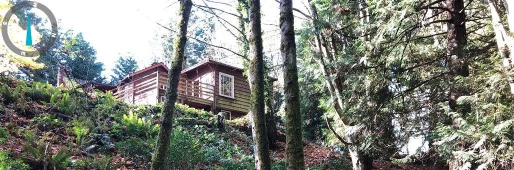
Photo 4 The existing modified ravine top of bank behind the existing home.
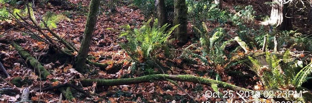
Photo 5 A typical view of a log and debris jam including fallen trees from along the high-water mark between transect 5 and 6 (Figure 1).
Photo 6 Localized bank failure and tree loss (east bank) due to erosion caused by a log and debris jam.
Photo 7 View of a run downstream of transect 1 (Figure 1). Spawning habitat for Coho Salmon.
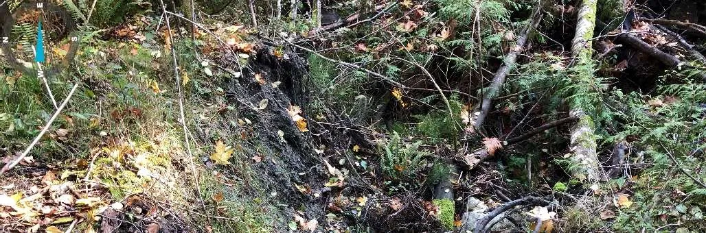
Photo 8 Three adult Coho salmon spawning downstream of transect 1 (Figure 1).
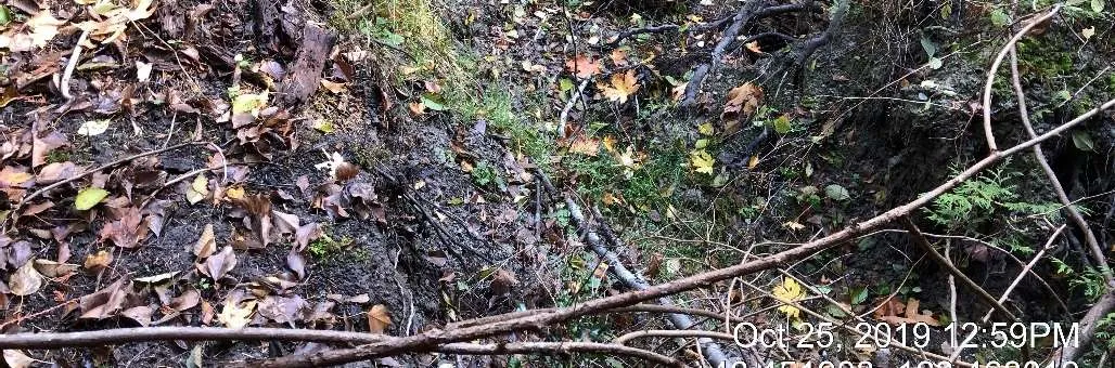
Photo 9 Mature trees located along the top of ravine bank at the north end of the property.
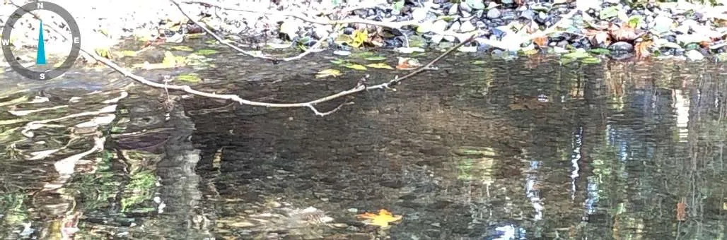
Photo 10 View looking up the ravine along the north property line.
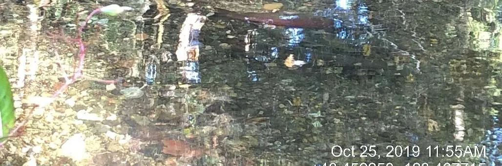
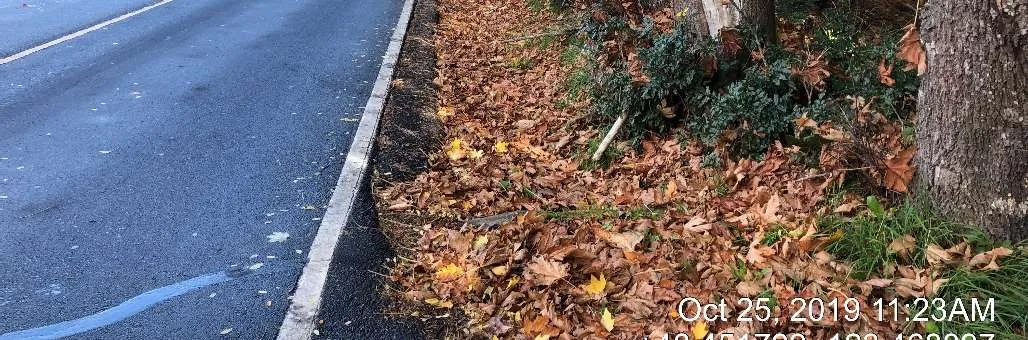
Photo 11 View of the upstream extent of the ditch along Atkins Road from the existing driveway access.
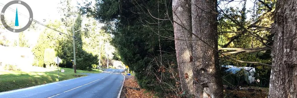
Photo 12 View looking downstream at the ditch along Atkins Road from the existing driveway access.
Section 7. Professional Opinion
Qualified Environmental Professional opinion on the development proposal’s riparian assessment.
Date December 23, 2020
- I Tim Adam, hereby certify that: a) I am/We are qualified environmental professional(s), as defined in the Riparian Areas Protection Regulation made under the Riparian Areas Protection Act; b) I am/We are qualified to carry out the assessment of the proposal made by the developer David McAllister, which proposal is described in section 3 of this Assessment Report (the “development proposal”), c) I have/We have carried out an assessment of the development proposal and my/our assessment is set out in this Assessment Report; and d) In carrying out my/our assessment of the development proposal, I have/We have followed the specifications of the Riparian Areas Protection Regulation and assessment methodology set out in the minister’s manual; AND
- As qualified environmental professional(s), I/we hereby provide my/our professional opinion that: a) N/A the site of the proposed development is subject to undue hardship, (if applicable, indicate N/A otherwise) and b) X the proposed development will meet the riparian protection standard if the development proceeds as proposed in the report and complies with the measures, if any, recommended in the report.
[NOTE: "Qualified Environmental Professional" means an individual as described in section 21 of the Riparian Areas Protection Regulation.]