Appendix
Site Plan Map (Attachment 6 Copy)
May 11, 2021Page 1911 section
A duplicate copy of the Atkins Road site plan, included as part of Attachment 6.
221 Atkins Road
Site Plan Of: Lot 1, Section 98, Esquimalt District, Plan 21115. P.I.D. 003-483-991
Scale = 1 : 250
Dated this 6th day of April, 2018.
Distances and elevations shown are in metres. Elevations are based on an assumed datum.
This site plan is for building and design purposes and is for the exclusive use of our client. This document shows the relative location of the surveyed structures and features with respect to the boundaries of the parcel described above. This document shall not be used to define property lines or property corners.
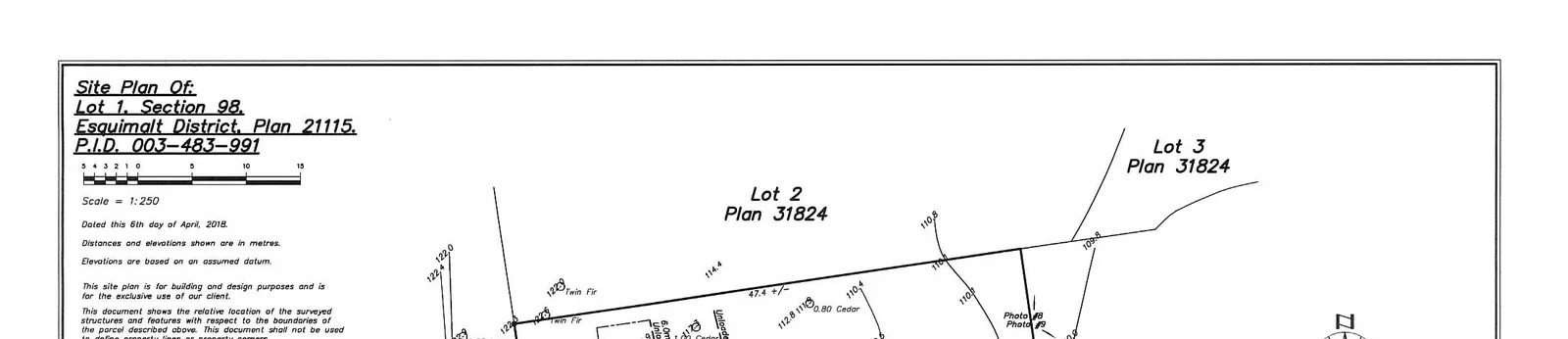
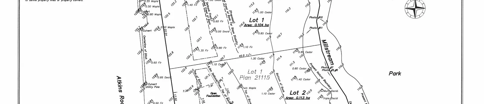
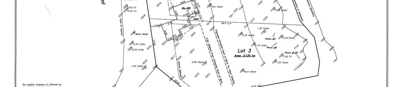
Plan Details
- Subject Properties:
- Lot 1, Plan 21115 (Area: 0.104 ha)
- Lot 2, Plan 21115 (Area: 0.113 ha)
- Lot 3, Plan 21115 (Area: 0.134 ha)
- Adjacent Features:
- Atkins Road (to the west)
- Millstream (running through the eastern portion)
- Park (to the east)
- Lot 2 and Lot 3, Plan 31824 (to the north)
- Lot D, Plan 21116 (to the south)
- Existing Structures:
- Building No. 221 with "Open Foundation" and "Deck"
- Topographical and Survey Markers:
- Proposed Unloaded Crest of Bank For Slope Stability
- 4.0m Setback From Unloaded Crest of Bank
- Top of Bank / Bottom of Bank
- Zoning Setback
- Centerline of Ditch, Culvert, Utility Pole, Water Meter, Edge of Asphalt
- Present Natural Boundary and Centreline of Millstream
- Numerous tree survey points (Maple, Cedar, Twin Fir, Deciduous) with sizes
- Contour lines with elevations
- Photo locations #1 through #11
The subject property is affected by the following registered documents: EV105849
Wey Mayenburg Land Surveying Inc.
www.weysurveys.com #4-2227 James White Boulevard Sidney, BC V8L 1Z5 Telephone (250) 656-5155 File: 18009S\Sit\LE
Page 191
Extracted from: 2021 05 11 Committee of the Whole Agenda - Agenda - Pdf