Presentation: DEVELOPMENT PERMIT 2021/03 - 221 Atkins Road
A slide deck presentation for the municipal meeting regarding a development permit application for 221 Atkins Road, highlighting environmental and zoning constraints.
DEVELOPMENT PERMIT 2021/03
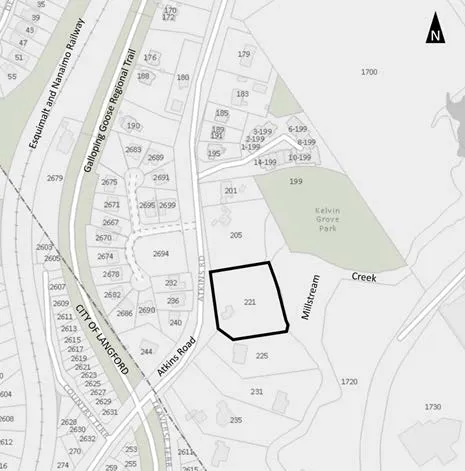
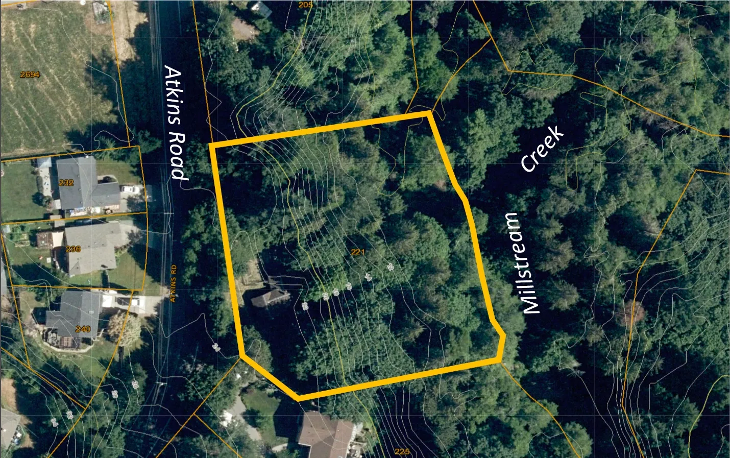
221 Atkins Road
Environmental Development Permit application with variances requested to facilitate subdivision of the parcel for two additional lots.
Discussion
- Development Permit Area Guidelines
- Zoning
- Next Steps
1. Development Permit Area Guidelines
- Natural Watercourse and Shoreline Areas (within 30m of the natural boundary of Millstream Creek)
- Sensitive Terrestrial Ecosystems development permit areas.
Riparian Areas Regulations (RAR) report establishes a Streamside Protection and Enhancement Area and provides recommendations for development permit for:
- Tree protection
- Slope stability
- Sediment and erosion control
- Storm water management - into municipal storm strain or downslope by pipe?
Geotechnical report
- Topics covered
- Requirements
- Safe geotechnical setback
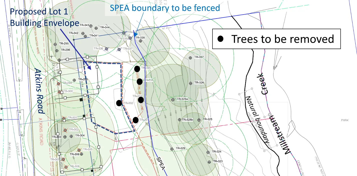
Arborist Report
Tree protection boundaries
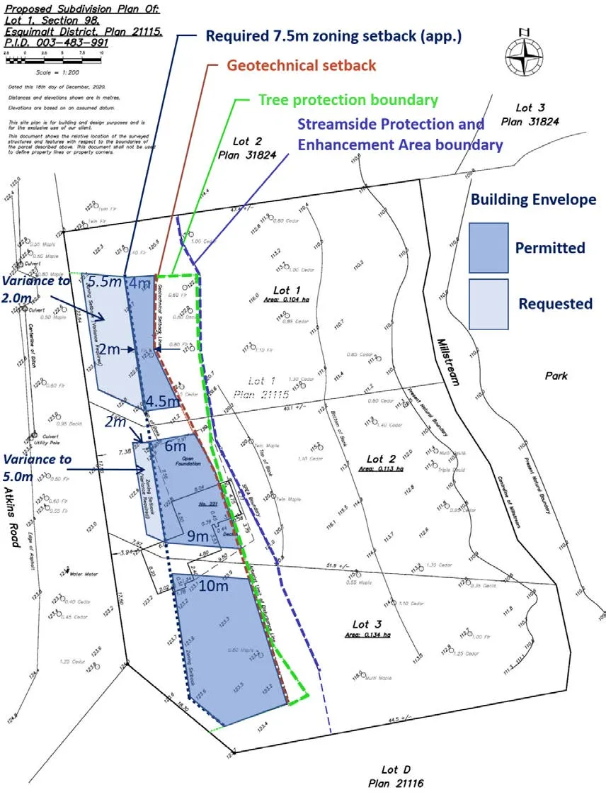
2. Zoning
- Proposed lot sizes and dimensions comply with requirements of the R-1 Detached Residential (Large Lot) zone
- Variances
| Lot | Required Front Lot Line Setback, minimum | Proposed | Difference |
|---|---|---|---|
| 1 | 7.5m | *2.0m | 5.5m |
| 2 | 7.5m | *5.0m | 2.0m |
| 3 | 7.5m | 7.5m |
- variance
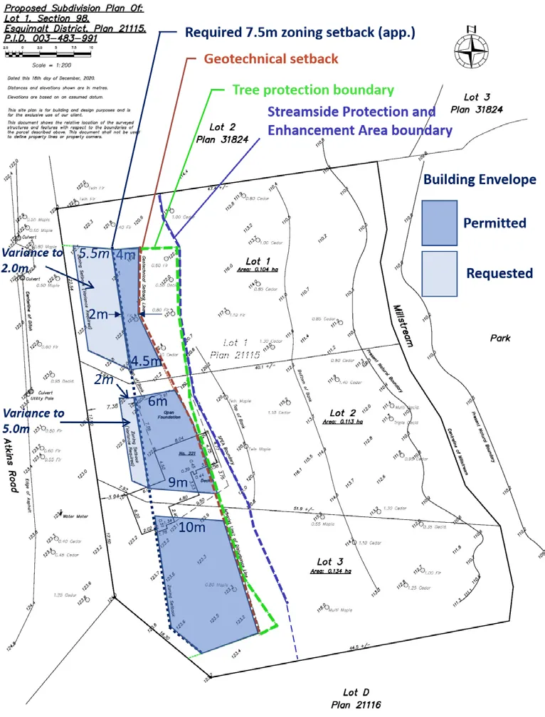
LOT 1
- Tree loss
- Extent of front lot line setback variance from 7.5m to 2.0m front lot line - no real front yard.
- Rear yard is within the geotechnical setback (no buildings or structures) and would be less than 5.0m deep as the SPEA boundary would be fenced.
- No room for onsite parking in front of the garage or house.
- Appears to be insufficient area onsite for vehicle egress without backing out into the road.
LOT 2
Rear yard Within geotechnical setback and tree protection boundary
3. Conclusion and Next Steps
Staff does not support of this application in its current form.
- Subdivision to create one additional lot rather than two may allow a better response to the site constraints.
- Comments are sought from the Committee of the Whole. Feedback would give the applicant an opportunity to amend or withdraw the application before it moves forward for consideration by Council.
- Additional information: storm water discharges into the municipal storm drain or through development permit area to Millstream Creek.
RECOMMENDATION:
THAT the report dated May 5, 2021 from the Senior Planner titled “Development Permit Application 2021/03 – 221 Atkins Road” be received for information.
Document Images
(1)