Water, Storm and Sanitary Servicing Review - 250 Helmcken Road
A professional engineering review of the infrastructure capacity to support the proposed development at 250 Helmcken Road.
November 20, 2020
File No. 33038
Wayne Pye Pye Holdings Via Email
Re: Proposed Development at 250 Helmcken Road – Fiddlers Green Water, Storm and Sanitary Servicing Review
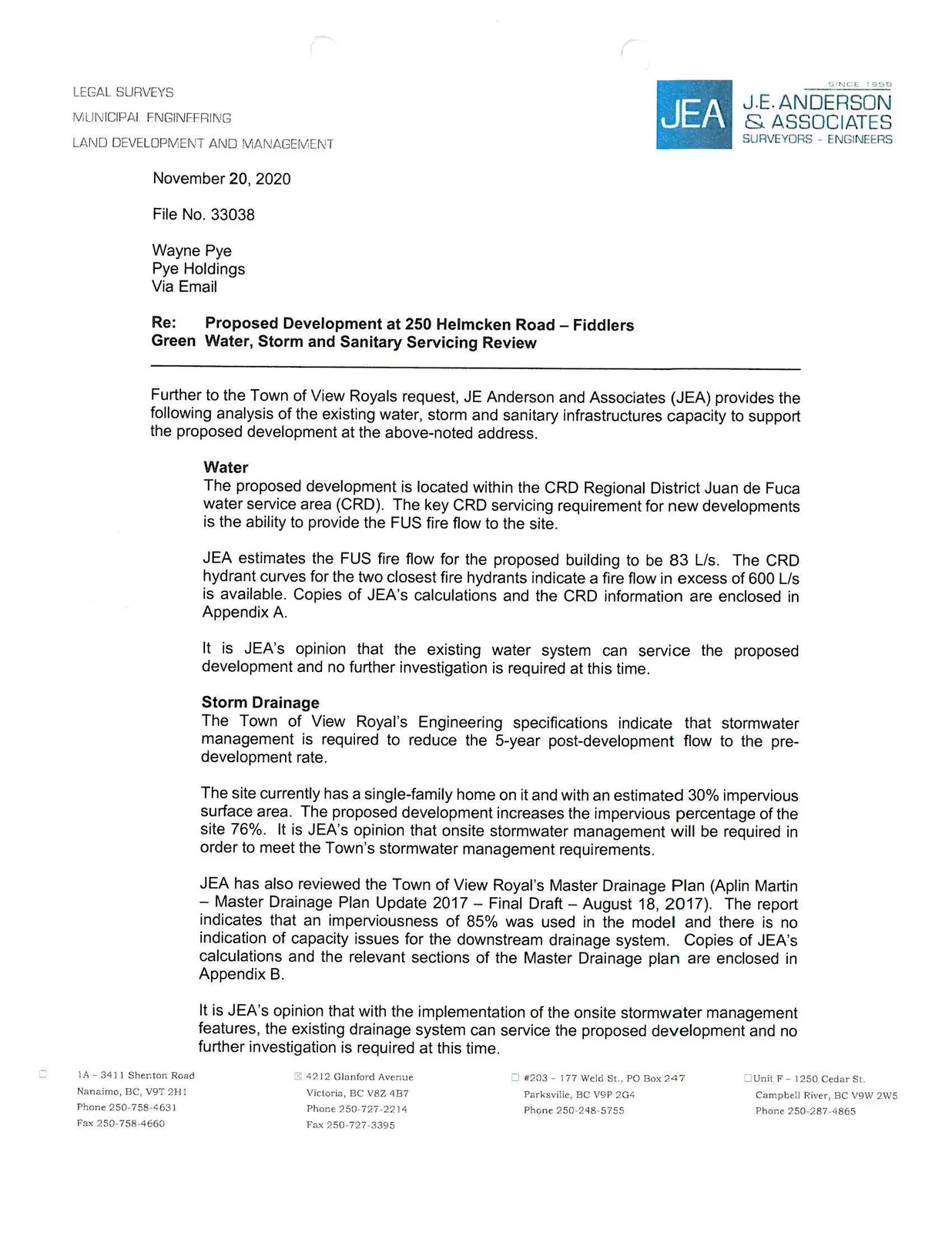
Further to the Town of View Royals request, JE Anderson and Associates (JEA) provides the following analysis of the existing water, storm and sanitary infrastructures capacity to support the proposed development at the above-noted address.
Water
The proposed development is located within the CRD Regional District Juan de Fuca water service area (CRD). The key CRD servicing requirement for new developments is the ability to provide the FUS fire flow to the site.
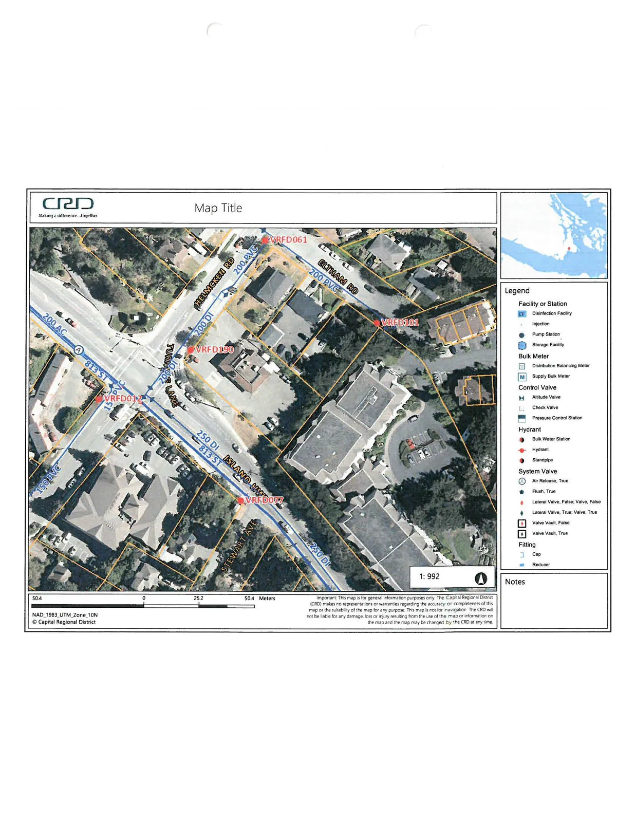
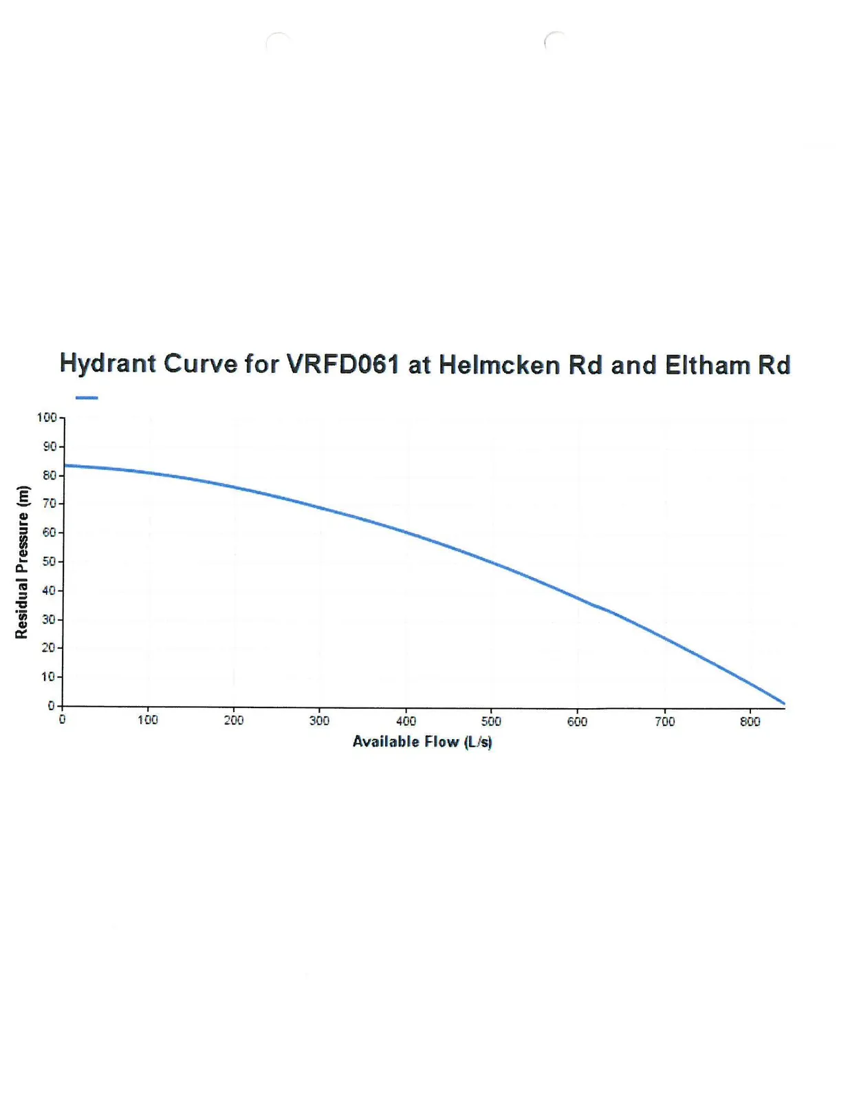
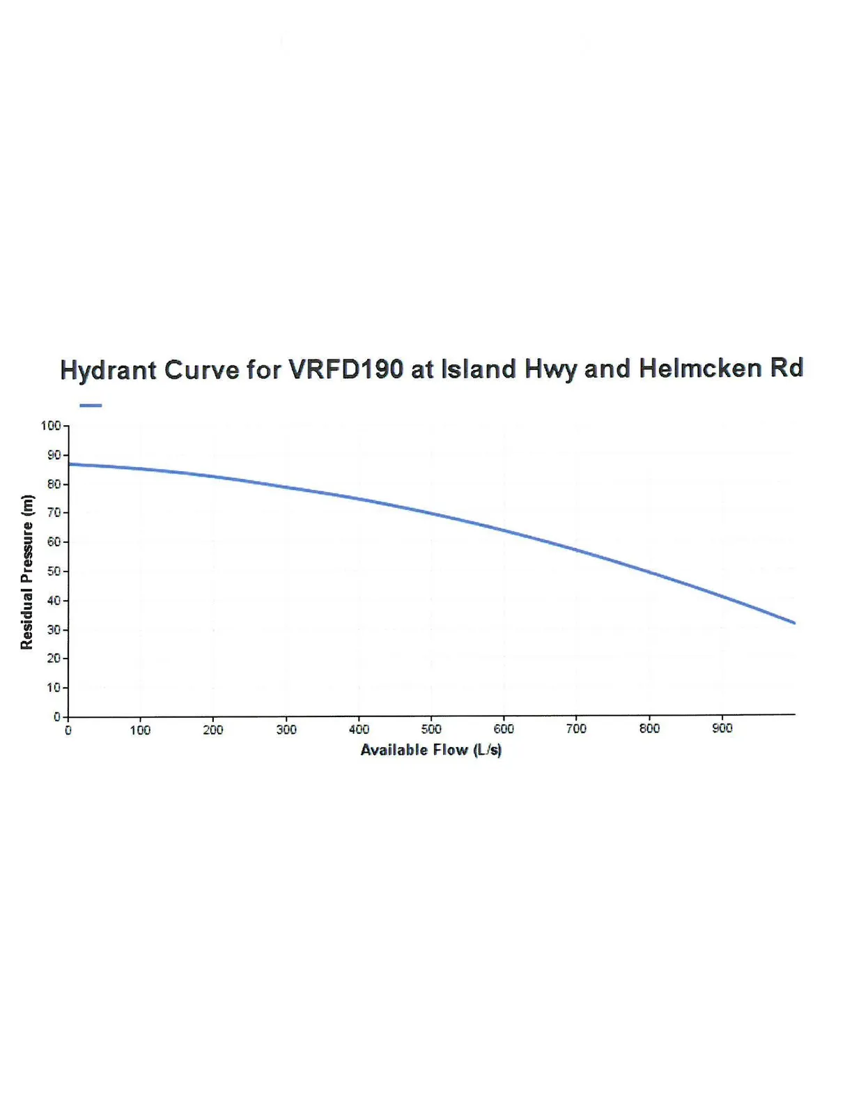
JEA estimates the FUS fire flow for the proposed building to be 83 L/s. The CRD hydrant curves for the two closest fire hydrants indicate a fire flow in excess of 600 L/s is available. Copies of JEA's calculations and the CRD information are enclosed in Appendix A.
It is JEA's opinion that the existing water system can service the proposed development and no further investigation is required at this time.
Storm Drainage
The Town of View Royal's Engineering specifications indicate that stormwater management is required to reduce the 5-year post-development flow to the predevelopment rate.
The site currently has a single-family home on it and with an estimated 30% impervious surface area. The proposed development increases the impervious percentage of the site 76%. It is JEA's opinion that onsite stormwater management will be required in order to meet the Town's stormwater management requirements.
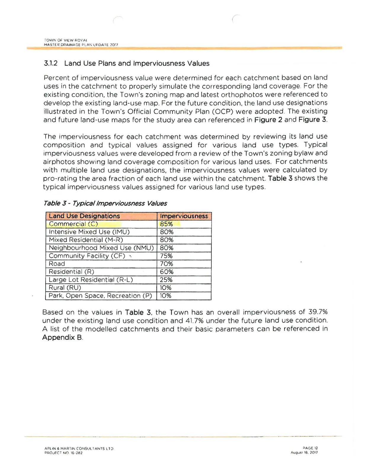
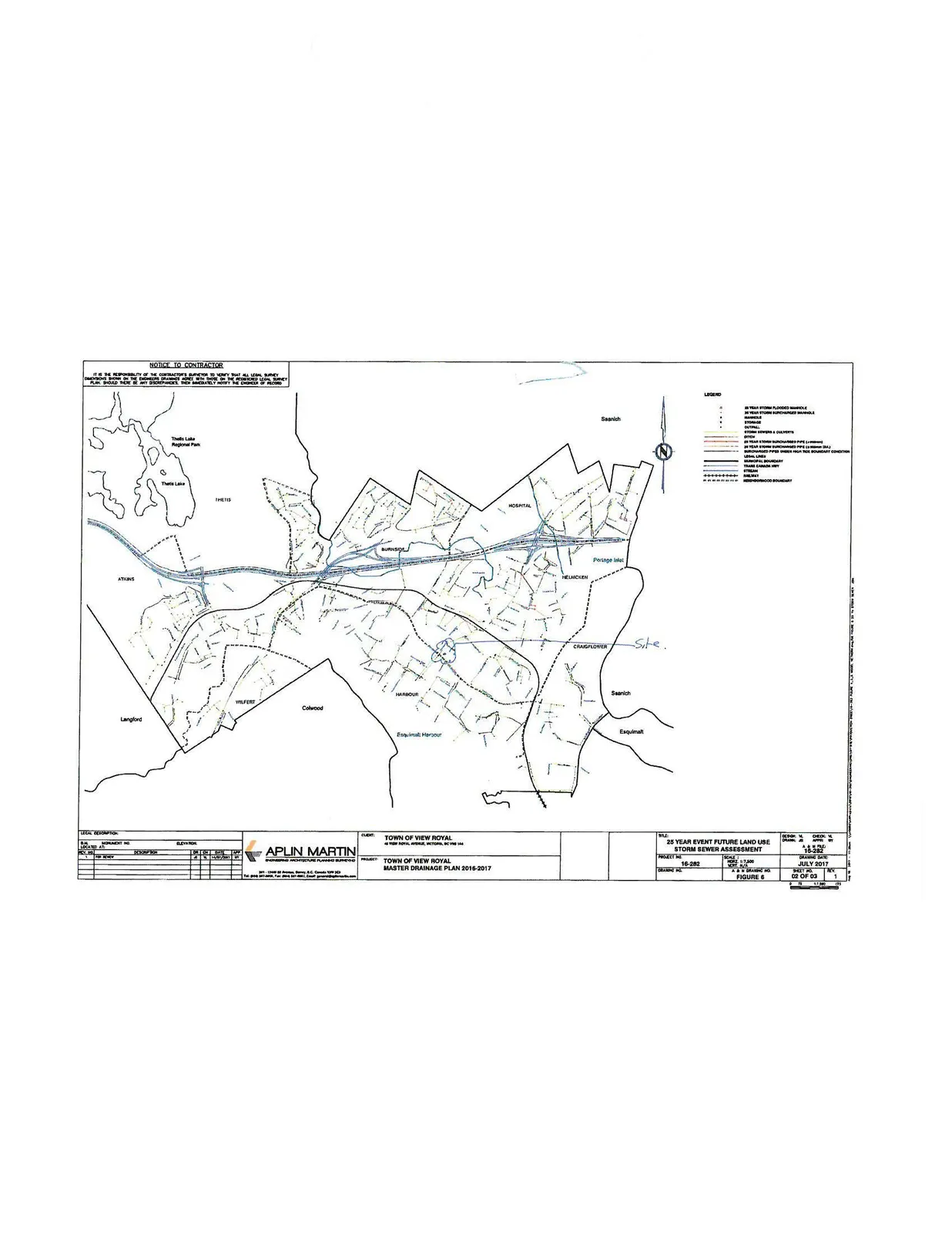
JEA has also reviewed the Town of View Royal's Master Drainage Plan (Aplin Martin - Master Drainage Plan Update 2017 – Final Draft – August 18, 2017). The report indicates that an imperviousness of 85% was used in the model and there is no indication of capacity issues for the downstream drainage system. Copies of JEA's calculations and the relevant sections of the Master Drainage plan are enclosed in Appendix B.
It is JEA's opinion that with the implementation of the onsite stormwater management features, the existing drainage system can service the proposed development and no further investigation is required at this time.
Sanitary
JEA calculations, attached in Appendix C, indicate that the proposed development Peak Wet Weather Flow (PWWF) will be 0.145 L/s, which would be a minor increase of 0.009 L/s over the Sewer Model.
JEA has reviewed the Town of View Royal's Sewer Master Plan (McElhanney – View Royal Sanitary Master Plan – Working Draft – December 16, 2017) and McElhanney's memo for the adjacent site (298 Island Highway). Based on JEA's review of these documents, it is JEA's opinion that the downstream gravity system and Helmcken Pumpstation have capacity to service the proposed development and no further investigation is required at this time.
If you have any questions regarding this report, please feel free to contact the undersigned at your convenience.
Yours truly,
J.E. Anderson and Associates
Appendix A
- FUS Calculations
- CRD Information
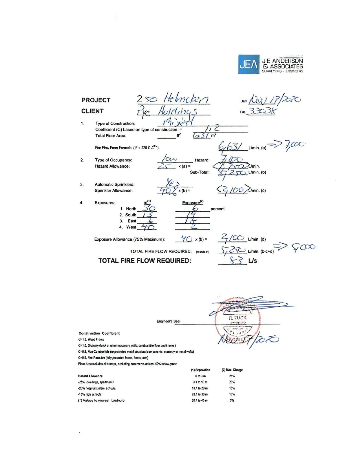
PROJECT: 250 Helmcken Road
CLIENT: Pye Holdings
Date: Nov 17/2020 File: 33038
Type of Construction: Mixed Coefficient (C) based on type of construction = 1.2 Total Floor Area: 631 m² Fire Flow From Formula (F = 220 C A^0.5): 6,631 L/min (a) $\rightarrow$ 7,000
Type of Occupancy: low Hazard Allowance: -25% x (a) = -1,750 L/min Sub-Total: 5,250 L/min (b)
Automatic Sprinklers: Yes Sprinkler Allowance: 40% x (b) = <2,100> L/min (c)
Exposures:
- North: 30 m; Exposure: 6 percent
- South: 15 m; Exposure: 14 percent
- East: 6 m; Exposure: 18 percent
- West: 40 m; Exposure: 2 percent
Exposure Allowance (75% Maximum): 40% x (b) = 2,100 L/min (d)
TOTAL FIRE FLOW REQUIRED: 5,250 L/min (b-c+d) $\rightarrow$ 5,000 TOTAL FIRE FLOW REQUIRED: 83 L/s
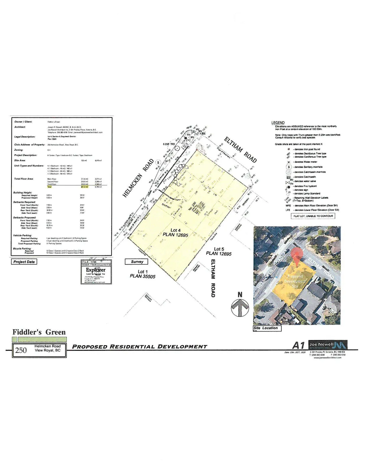
Project Data
| Owner / Client: | Fiddler’s Green |
|---|---|
| Architect: | Joseph P. Newell, MAIBC, B. Arch, B.E.S. |
| Legal Description: | Lot 4, Section 8, Esquimalt District, Plan 12695 |
| Civic Address of Property: | 250 Helmcken Road, View Royal, B.C. |
| Zoning: | C-1 |
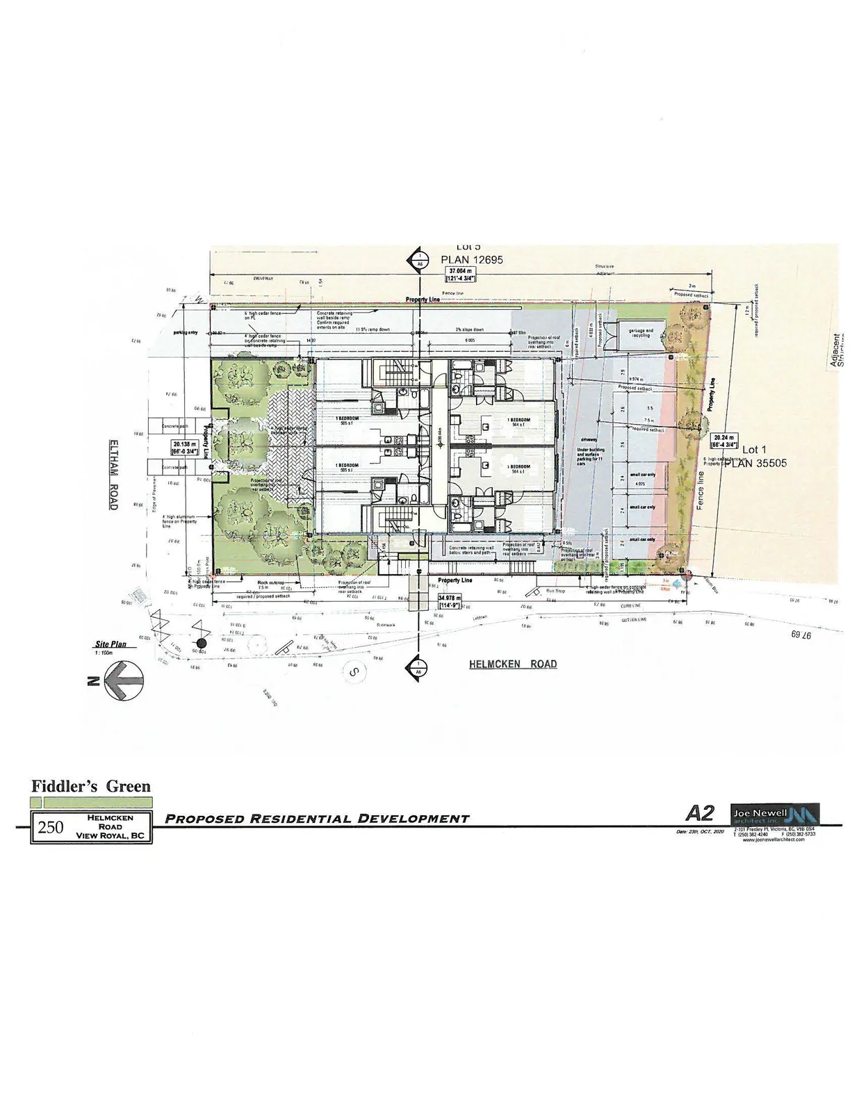
| Project Description: | 8 Suites / Type 1 Bedroom & 2 Suites / Type 2 Bedroom |
| Site Area: | 725 m² (6,875 sf) |
| Unit Types and Numbers: | 4 / 1 Bedroom - 42 m2 / 448 sf 4 / 1 Bedroom - 45 m2 / 481 sf 1 / 2 Bedroom - 84 m2 / 900 sf 1 / 2 Bedroom - 90 m2 / 970 sf |
| Total Floor Area: | Main Floor: 211.0 m2 (2,271 sf) Second Floor: 210.0 m2 (2,260 sf) Third Floor: 210.0 m2 (2,260 sf) Total: 631.0 m2 (6,792 sf) |
| Building Height: | Required Height: 9.00 m (29.53 ft) Proposed Height: 9.30 m (30.51 ft) |
| Setbacks Required: | Front Yard (North): 7.50 m (24.61 ft) Side Yard (West): 3.00 m (9.84 ft) Rear Yard (South): 10.00 m (32.81 ft) Side Yard (east): 3.60 m (11.81 ft) |
| Setbacks Proposed: | Front Yard (North): 7.50 m (24.61 ft) Side Yard (West): 3.23 m (10.60 ft) Rear Yard (South): 10.76 m (35.30 ft) Side Yard (east): 4.03 m (13.22 ft) |
| Vehicle Parking: | Required Parking: 1 per dwelling unit (1 bedroom) / 6 Parking Space Proposed Parking: 1.5 per dwelling unit (2 bedroom) / 3 Parking Space Total Proposed Parking: 11 Parking Spaces |
| Bicycle Parking: | Required: 12 Class 1 spaces and 12-space Class 2 Rack Proposed: 12 Class 1 spaces and 12-space Class 2 Rack |
Appendix B
- Relevant Master Storm Drain Information
3.1.2 Land Use Plans and Imperviousness Values
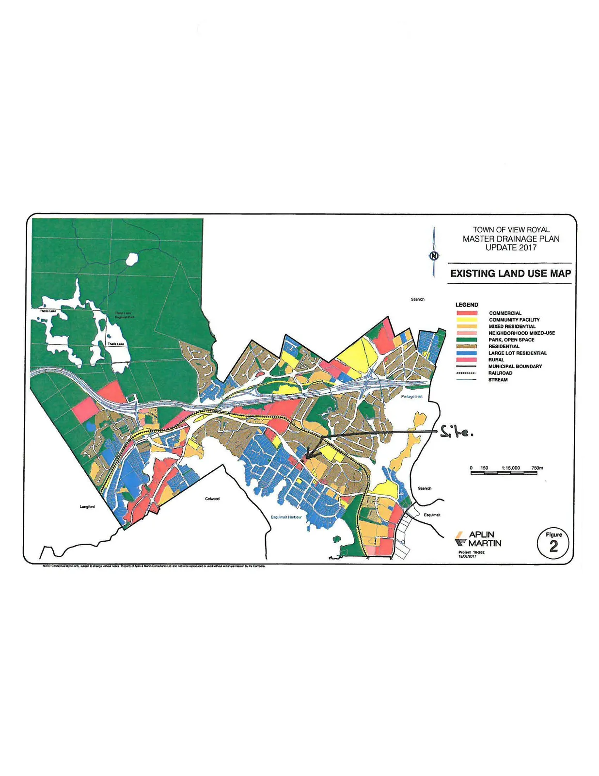
Percent of imperviousness value were determined for each catchment based on land uses in the catchment to properly simulate the corresponding land coverage. For the existing condition, the Town's zoning map and latest orthophotos were referenced to develop the existing land-use map. For the future condition, the land use designations illustrated in the Town's Official Community Plan (OCP) were adopted. The existing and future land-use maps for the study area can referenced in Figure 2 and Figure 3.
The imperviousness for each catchment was determined by reviewing its land use composition and typical values assigned for various land use types. Typical imperviousness values were developed from a review of the Town's zoning bylaw and airphotos showing land coverage composition for various land uses. For catchments with multiple land use designations, the imperviousness values were calculated by pro-rating the area fraction of each land use within the catchment. Table 3 shows the typical imperviousness values assigned for various land use types.
Table 3 - Typical Imperviousness Values
| Land Use Designations | Imperviousness |
|---|---|
| Commercial (C) | 85% |
| Intensive Mixed Use (IMU) | 80% |
| Mixed Residential (M-R) | 80% |
| Neighbourhood Mixed Use (NMU) | 80% |
| Community Facility (CF) | 75% |
| Road | 70% |
| Residential (R) | 60% |
| Large Lot Residential (R-L) | 25% |
| Rural (RU) | 10% |
| Park, Open Space, Recreation (P) | 10% |
Based on the values in Table 3, the Town has an overall imperviousness of 39.7% under the existing land use condition and 41.7% under the future land use condition. A list of the modelled catchments and their basic parameters can be referenced in Appendix B.
Appendix C
- Sanitary Calculations
- Relevant Sewer Master Plan Information
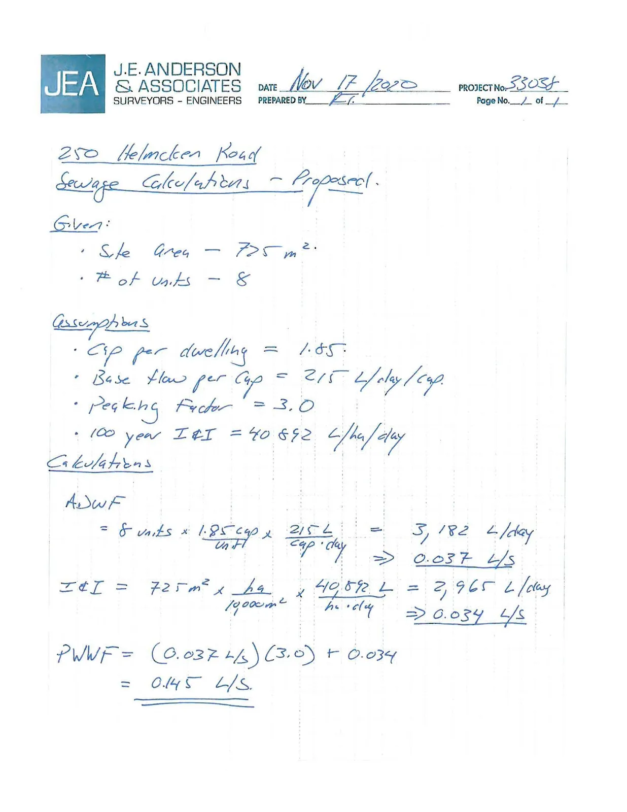
250 Helmcken Road Sewage Calculations - Proposed
Given:
- Site Area - 725 m²
of units - 8
Assumptions:
- Cap per dwelling = 1.85
- Base flow per cap = 215 L/day/cap
- Peaking Factor = 3.0
- 100 year I&I = 40,892 L/ha/day
Calculations: ADWF = 8 units x 1.85 cap/unit x 215 L/cap/day = 3,182 L/day $\Rightarrow$ 0.037 L/s
I&I = 725 m² x 1 ha / 10,000 m² x 40,892 L/ha/day = 2,965 L/day $\Rightarrow$ 0.034 L/s
PWWF = (0.037 L/s)(3.0) + 0.034 = 0.145 L/s
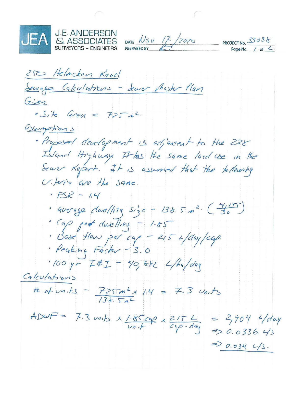
250 Helmcken Road Sewage Calculations - Sewer Master Plan
Given:
- Site Area = 725 m²
Assumptions:
- Proposal development is adjacent to the 298 Island Highway. It has the same land use in the Sewer Report. It is assumed that the following criteria are the same.
- FSR - 1.4
- Average dwelling size - 138.5 m² (4,155 / 30)
- Cap per dwelling - 1.85
- Base flow per cap - 215 L/day/cap
- Peaking Factor - 3.0
- 100 yr I&I - 40,892 L/ha/day
Calculations:
of units = 725 m² x 1.4 / 138.5 m² = 7.3 units
ADWF = 7.3 units x 1.85 cap/unit x 215 L/cap/day = 2,904 L/day $\Rightarrow$ 0.0336 L/s $\Rightarrow$ 0.034 L/s
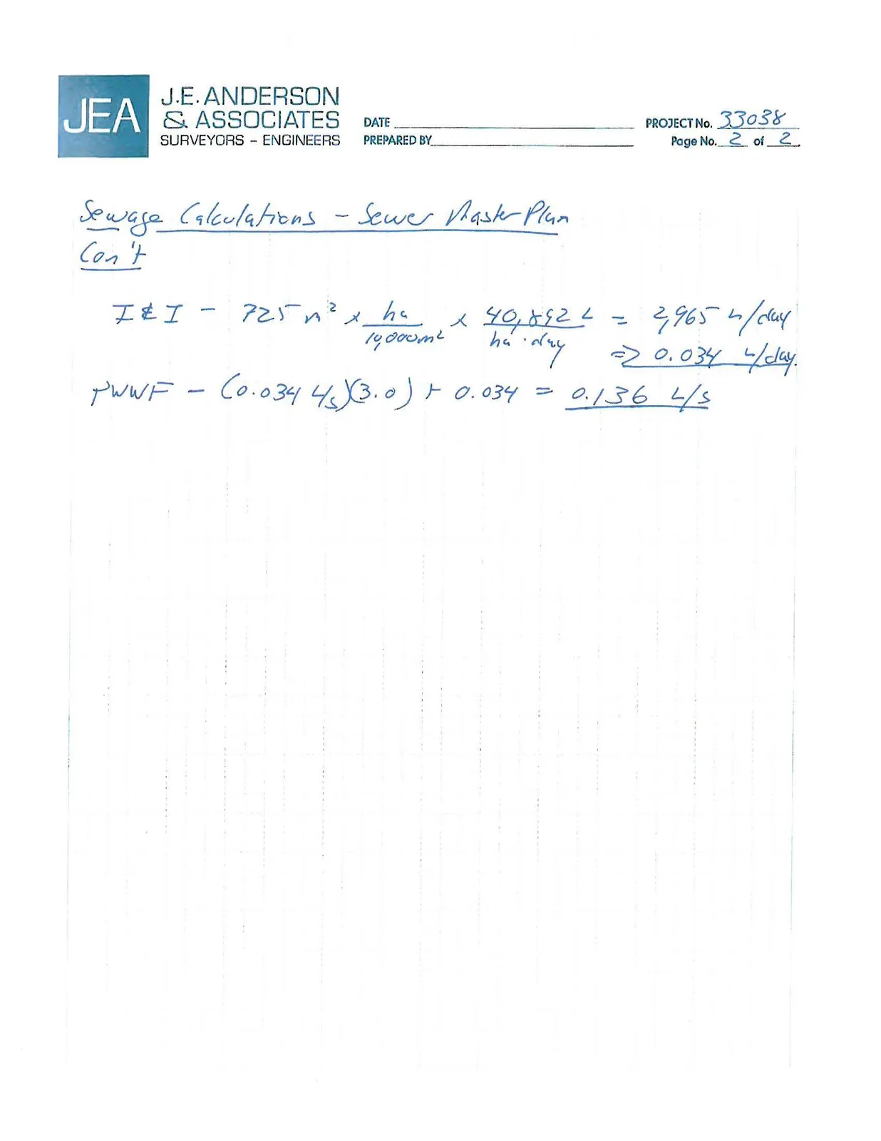
Sewage Calculations - Sewer Master Plan Con't
I&I = 725 m² x 1 ha / 10,000 m² x 40,892 L/ha/day = 2,965 L/day $\Rightarrow$ 0.034 L/day
PWWF = (0.034 L/s)(3.0) + 0.034 = 0.136 L/s
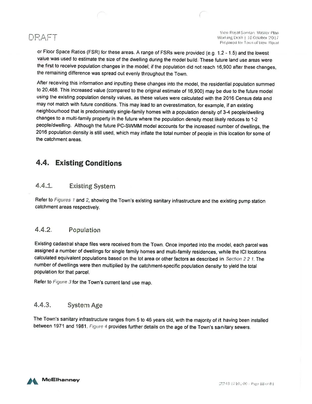
4.4. Existing Conditions
4.4.1. Existing System
Refer to Figures 1 and 2, showing the Town's existing sanitary infrastructure and the existing pump station catchment areas respectively.
4.4.2. Population
Existing cadastral shape files were received from the Town. Once imported into the model, each parcel was assigned a number of dwellings for single family homes and multi-family residences, while the ICI locations calculated equivalent populations based on the lot area or other factors as described in Section 2 2 1. The number of dwellings were then multiplied by the catchment-specific population density to yield the total population for that parcel.
Refer to Figure 3 for the Town's current land use map.
4.4.3. System Age
The Town's sanitary infrastructure ranges from 5 to 46 years old, with the majority of it having been installed between 1971 and 1981. Figure 4 provides further details on the age of the Town's sanitary sewers.
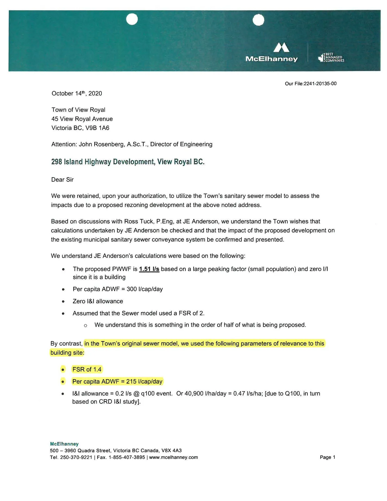
October 14th, 2020
Town of View Royal 45 View Royal Avenue Victoria BC, V9B 1A6
Attention: John Rosenberg, A.Sc.T., Director of Engineering
298 Island Highway Development, View Royal BC.
Dear Sir
We were retained, upon your authorization, to utilize the Town's sanitary sewer model to assess the impacts due to a proposed rezoning development at the above noted address.
Based on discussions with Ross Tuck, P.Eng, at JE Anderson, we understand the Town wishes that calculations undertaken by JE Anderson be checked and that the impact of the proposed development on the existing municipal sanitary sewer conveyance system be confirmed and presented.
We understand JE Anderson's calculations were based on the following:
- The proposed PWWF is 1.51 l/s based on a large peaking factor (small population) and zero I/I since it is a building
- Per capita ADWF = 300 l/cap/day
- Zero I&I allowance
- Assumed that the Sewer model used a FSR of 2.
- We understand this is something in the order of half of what is being proposed.
By contrast, in the Town's original sewer model, we used the following parameters of relevance to this building site:
- FSR of 1.4
- Per capita ADWF = 215 l/cap/day
- I&I allowance = 0.2 l/s @ q100 event. Or 40,900 l/ha/day = 0.47 l/s/ha; [due to Q100, in turn based on CRD I&I study].
- Per the two tables below, the proposed development results in an increase in flow of approximately 0.36 L/s [to 0.97 l/s]; over the assumed development flow under the 2017 Sanitary Master Plan.
- The proposed development discharges into a 150 mm gravity sewer line on Helmcken Rd.
- The gravity line flows southwest discharging into the Helmcken Bay Pump Station and is then pumped to the CRD trunk and Craigflower PS.
SMP Assumed Flow
| Attribute | Value | Units |
|---|---|---|
| Land Use | Multi-Family | |
| People Per Dwelling | 1.85 | |
| Parcel Area | 0.4155 | ha |
| Assumed number of dwellings | 30 | |
| Residential Population | 55.5 | |
| Base Sanitary Flow | 215 | L/cap/day |
| Base Sanitary Flow | 0.14 | L/s |
| Peaking Factor | 3 | |
| Peak Dry Weather Flow | 0.41 | L/s |
| 100 Year I&I | 40892 | L/ha/day |
| 100 Year I&I | 0.20 | L/s |
| Peak Wet Weather Flow | 0.61 | L/s |
Proposed Development Flow
| Attribute | Value | Units |
|---|---|---|
| Land Use | Multi-Family + Commercial | |
| People Per Dwelling | 1.85 | |
| Parcel Area | 0.4155 | ha |
| No. of Dwellings | 54 | |
| Residential Population | 99.9 | People |
| Base Sanitary Flow | 215 | L/cap/day |
| Res. Base Sanitary Flow | 0.25 | L/s |
| Commercial Area | 655 | m2 |
| ICI Eqivalent Pop. | 60 | People/ha |
| ICI Eqivalent Pop. | 3.93 | People |
| ICI Base Sanitary Flow | 0.01 | L/s |
| Base Sanitary Flow | 0.26 | L/s |
| Peaking Factor | 3 | |
| Peak Dry Weather Flow | 0.78 | L/s |
| 100 Year I&I | 40892 | L/ha/day |
| 100 Year I&I | 0.20 | L/s |
| Peak Wet Weather Flow | 0.97 | L/s |
Gravity Main (Development to Helmcken PS):
- The table below outlines the gravity sewer flow and capacity to the Helmcken PS. As shown, with the increase in flow, the sewer still has capacity up to MH VRMH0000000000000220. There is then a 7 m stretch of 200 mm diameter sewer that does not meet the conservative d/D < 0.5 design requirement. This section of 200 mm diameter pipe does not meet design requirements regardless of the proposed development. The increase in flow results in an essentially negligible increase in the d/D ratio (0.70 to 0.71).
| U/S MH | D/S MH | Pipe Size (mm) | Slope (%) | Qcap (L/s) | SMP PWWF (L/s) | PWWF w/ Proposed Development (L/s) | Velocity (m/s) | d/D | d/D Check | Velocity Check |
|---|---|---|---|---|---|---|---|---|---|---|
| VRMH0000000000000226 | VRMH0000000000000225 | 150 | 3.1 | 26.81 | 2.62 | 2.98 | 1 | 0.22 | OK | OK |
| VRMH0000000000000225 | VRMH0000000000000224 | 150 | 7.1 | 40.58 | 2.92 | 3.28 | 1.38 | 0.19 | OK | OK |
| VRMH0000000000000224 | VRMH0000000000000223 | 150 | 1.25 | 17.03 | 3.12 | 3.48 | 0.76 | 0.31 | OK | OK |
| VRMH0000000000000223 | VRMH0000000000000220 | 200 | 1.94 | 45.68 | 3.9 | 4.26 | 0.91 | 0.21 | OK | OK |
| VRMH0000000000000220 | Helmcken PS | 200 | 0.86 | 30.42 | 26.07 | 26.43 | 1.11 | 0.71 | Failed | OK |
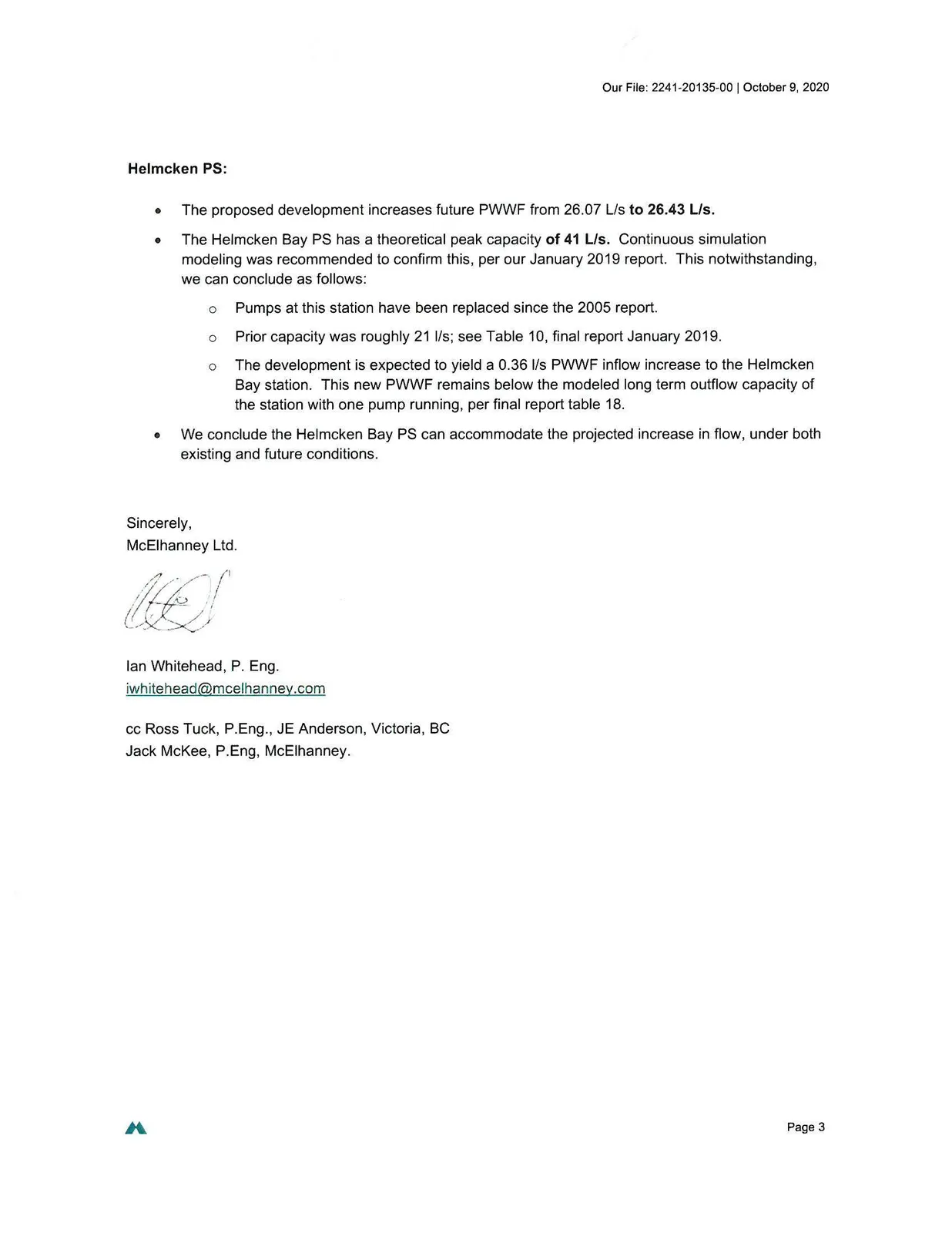
Helmcken PS:
- The proposed development increases future PWWF from 26.07 L/s to 26.43 L/s.
- The Helmcken Bay PS has a theoretical peak capacity of 41 L/s. Continuous simulation modeling was recommended to confirm this, per our January 2019 report. This notwithstanding, we can conclude as follows:
- Pumps at this station have been replaced since the 2005 report.
- Prior capacity was roughly 21 l/s; see Table 10, final report January 2019.
- The development is expected to yield a 0.36 l/s PWWF inflow increase to the Helmcken Bay station. This new PWWF remains below the modeled long term outflow capacity of the station with one pump running, per final report table 18.
- We conclude the Helmcken Bay PS can accommodate the projected increase in flow, under both existing and future conditions.
Sincerely, McElhanney Ltd.
Ian Whitehead, P. Eng. iwhitehead@mcelhanney.com
cc Ross Tuck, P.Eng., JE Anderson, Victoria, BC Jack McKee, P.Eng, McElhanney.
Document Images
(9)