Presentation: ENVIRONMENTAL DEVELOPMENT PERMIT 2021/11 - 315 Stewart Ave
A visual presentation summarizing the application for 315 Stewart Ave, including site photos, project proposal, and requested height and setback variances.
ENVIRONMENTAL DEVELOPMENT PERMIT 2021/11
Foreshore and Uplands – 315 Stewart Ave
The purpose of this report is to introduce a new application for an Environmental Development Permit with variances.
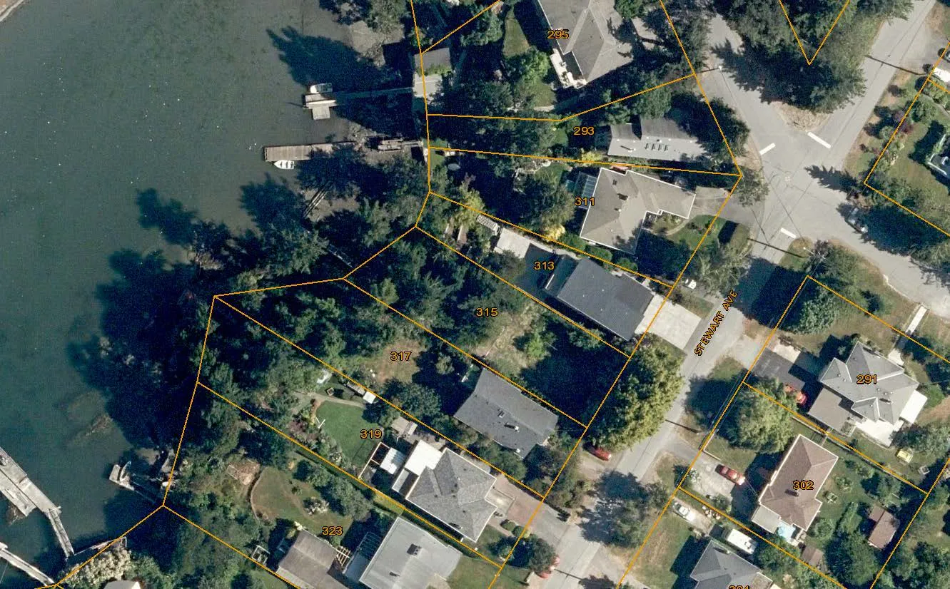
The property is 758m² and zoned R-1: Detached Residential (Large Lot). There is no dwelling on the property now, but one is planned. The property has a dock that was regularized as part of the 2012 process to document existing docks along the Esquimalt Harbour shorelines.
The owner wishes to address improvements in the Development Permit Area as it will be difficult to access after the house is built. The property is immediately adjacent to Esquimalt Harbour.
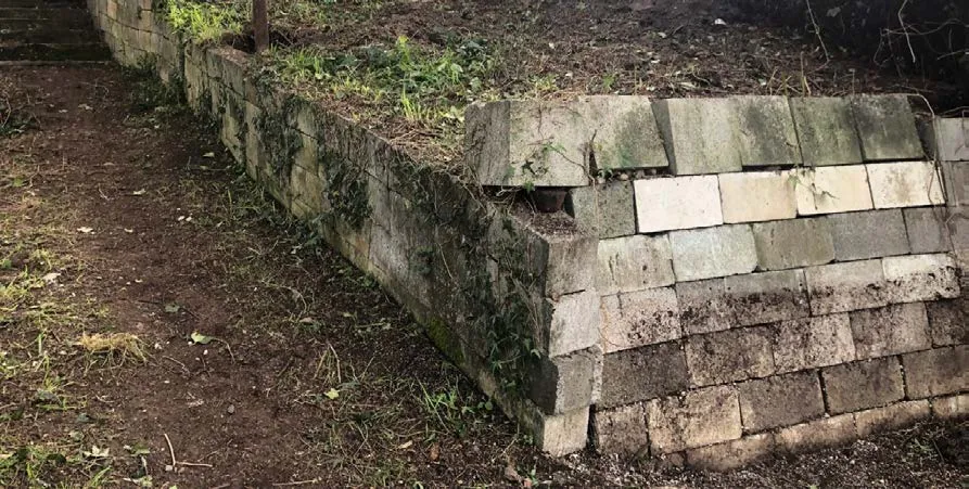
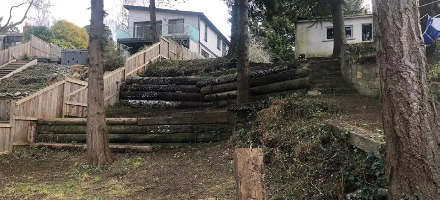
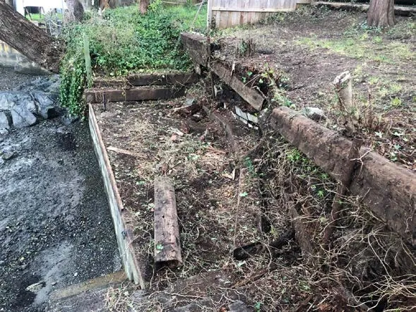
The property is in a poor state of maintenance and heavily disturbed.
Requested Variances
The application requires the following variances:
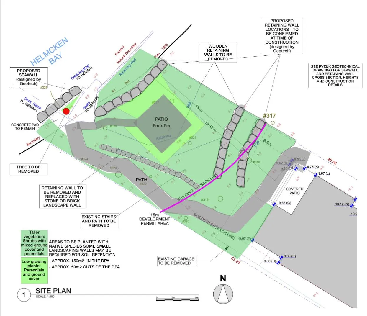
- A variance to Section 3.8.2 of Zoning Bylaw No. 900, 2014 for the construction of retaining walls within the 15m setback to the natural boundary to the sea.
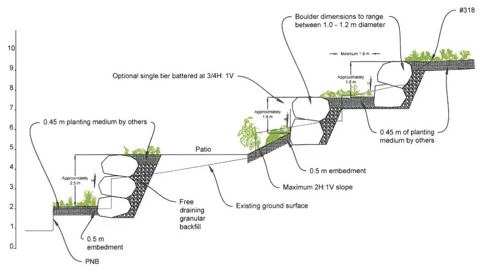
- A variance to Section 4.8.9 of Zoning Bylaw No. 900, 2014 for the height of a retaining wall in a residential zone from 1.2m to 2.5m.
Two replacement trees are required for the removal of the Douglas Fir.
There are two issues for Council to consider:
- The impact of the proposal on the environment.
- The impact of the variance on the use and enjoyment of adjacent properties.
Geotechnical
The geotechnical report recommends the proposed works.
Environment
The Environmental Assessment from Swell Environmental concludes that it is not expected to cause negative impacts to the Development Permit Area:
The works within the DPA have been designed to address the slope stability issues identified by Ryzuk Geotechnical on the site. Provided the Environmental Protection Measures described are followed, I expect the proposed construction activities to have minimal negative impacts to the current ecological condition of the ecosystems of the 15m DPA setback or the marine environment. The restoration activities (invasive species removal and native plantings) will provide improvement over the current ecological conditions for the backshore ecosystem.
Given the plant list provided in the Landscape Plan, the largely natural state of the proposal, the 2:1 replacement of the removed tree, the invasive species removal and the improvement of the condition of the site in general, this proposal is in keeping with other developments in the area and follows the lead of the OCP by restoring ecosystem function to the property and preventing erosion of the foreshore.
Staff will require a landscape deposit to cover damage to the environment and installation of the proposed landscape.
Impact on Use and Enjoyment of Neighbouring Properties
Given the size and location of these retaining walls, staff is of the opinion that the visual impacts on neighbouring properties will be low. That said, staff would prefer to see a lower retaining wall than 2.5m and will work with the applicant to see if that can be reduced in height or tiered in several walls in a more subtle way, and that, if possible, screening plants can be added to further break up the impact from the water side and the opposite side of Lime Kiln Cove.
Staff is supportive of the application.
NEXT STEPS
Staff will work with the applicant to do the following:
- Explore alternatives to the proposed retaining walls to reduce their height.
- Require that locations and pot sizes of plantings be provided on the Landscape Plan.
- Require that the patio pavers and pathway be of a permeable nature and be indicated on plans as such.
RECOMMENDATION
THAT the report from the Community Planner titled “Environmental Development Permit No. 2021/11 - Natural Watercourse and Shoreline – 315 Stewart Avenue” be received for information.
Document Images
(1)