BC Water Resource Atlas Map
Map showing locations of private and provincial groundwater wells within a specific radius of 9 Erskine Lane.
BC Water Resource Atlas
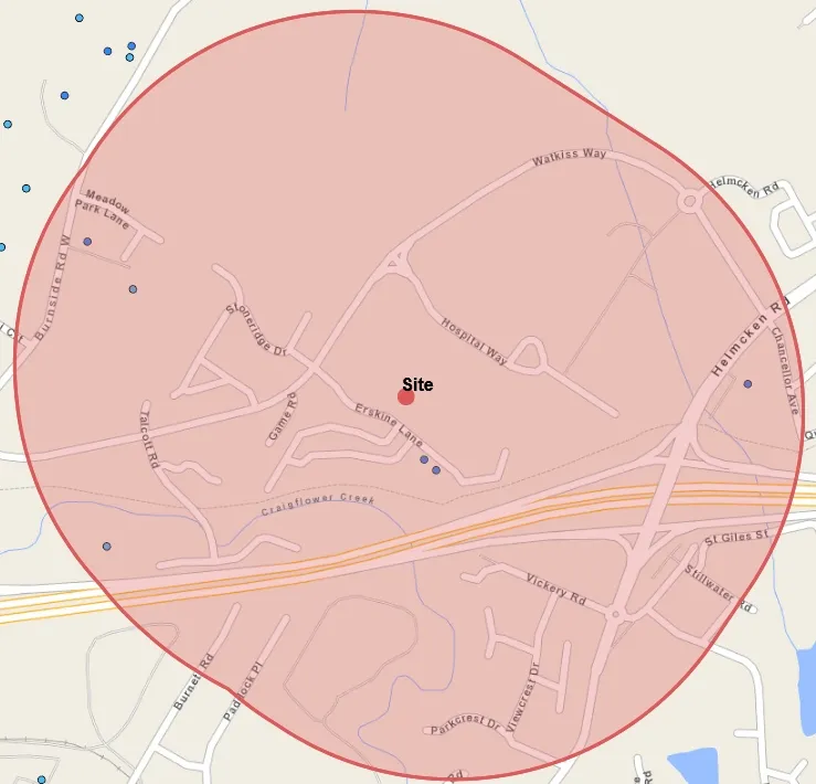
Legend
- Water Wells - Private Domestic
- Provincial Groundwater Observation Wells - Active
- Provincial Groundwater Observation Wells - Inactive
- Water Wells - Artesian
- Water Wells - All
Scale: 1: 10,000 Scale Bar: 0 to 0.41 km
Copyright/Disclaimer
The material contained in this web site is owned by the Government of British Columbia and protected by copyright law. It may not be reproduced or redistributed without the prior written permission of the Province of British Columbia. To request permission to reproduce all or part of the material on this web site please complete the Copyright Permission Request Form which can be accessed through the Copyright Information Page.
CAUTION: Maps obtained using this site are not designed to assist in navigation. These maps may be generalized and may not reflect current conditions. Uncharted hazards may exist. DO NOT USE THESE MAPS FOR NAVIGATIONAL PURPOSES.
Datum: NAD83 Projection: WGS_1984_Web_Mercator_Auxiliary_Sphere
Key Map of British Columbia
[Small inset map showing the geographical location of the main map area within the province of British Columbia.]
Document Images
(1)