Other
Location Plan (Drawing 8298-3-1)
September 15, 2020Page 4941 section
An aerial location map showing site boundaries and significant surrounding landmarks like Victoria General Hospital.
Drawing No: 8298-3-1Scale 1:2950Identifies bedrock and clay deposit areas
LOCATION PLAN
Client: Westurban Developments Ltd. Project: Proposed 5-6 Story Building Address: 9 Erskine Lane, View Royal, B.C. Engineering Firm: RYZUK GEOTECHNICAL Engineering & Materials Testing
| Item | Details |
|---|---|
| Drawn | SJB |
| Date | July, 2019 |
| Scale | 1:2950 |
| Drawing No. | 8298-3-1 |
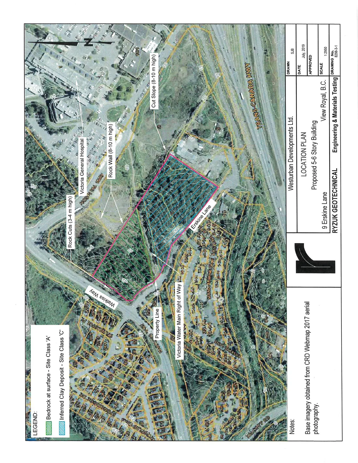
Legend
- Green Hatched Area: Bedrock at surface - Site Class 'A'
- Blue Hatched Area: Inferred Clay Deposit - Site Class 'C'
Map Labels and Features
- Rock Cuts (3-4 m high)
- Victoria General Hospital
- Hospital Way
- Rock Wall (8-10 m high)
- Cut Slope (8-10 m high)
- Property Line
- Watkiss Way
- Victoria Water Main Right of Way
- Erskine Lane
- Trans-Canada Hwy
- Chilcott Rd
Notes
Base imagery obtained from CRD Webmap 2017 aerial photography.
Page 494
Extracted from: 2020 09 15 Committee of the Whole Agenda - Agenda - Pdf