This site is in beta — data may be incomplete and features are still being added.
Committee of the Whole/Documents/Attachment 2. Orthophoto
Appendix

Attachment 2. Orthophoto

September 15, 2020Page 6601 section

An aerial orthophoto showing the subject property and surrounding neighborhood context.

298 Island Highway parcel identified in context of neighboring properties like Lion's Cove

Attachment 2. Orthophoto
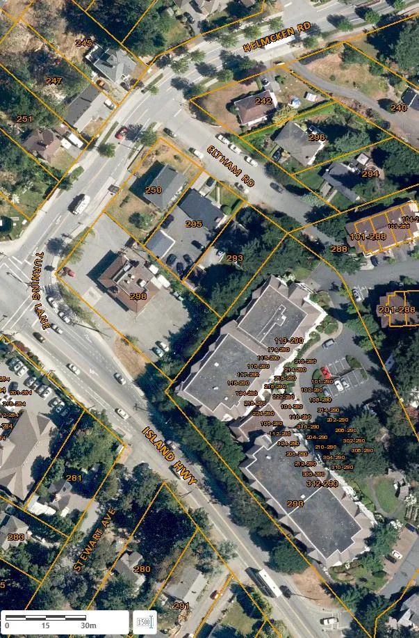
Orthophoto aerial map showing property parcels and buildings around the intersection of Island Hwy, Stewart Ave, Helmcken Rd, and Eltham Rd. Property addresses such as 242, 245, 247, 250, 251, 280, 281, 283, 288, 291, 293, 294, 295, 296, 298, and unit numbers for 290 Island Hwy are overlaid on the parcels. A scale bar showing 0 to 30m is at the bottom left.
Page 660
Extracted from: 2020 09 15 Committee of the Whole Agenda - Agenda - Pdf