Other
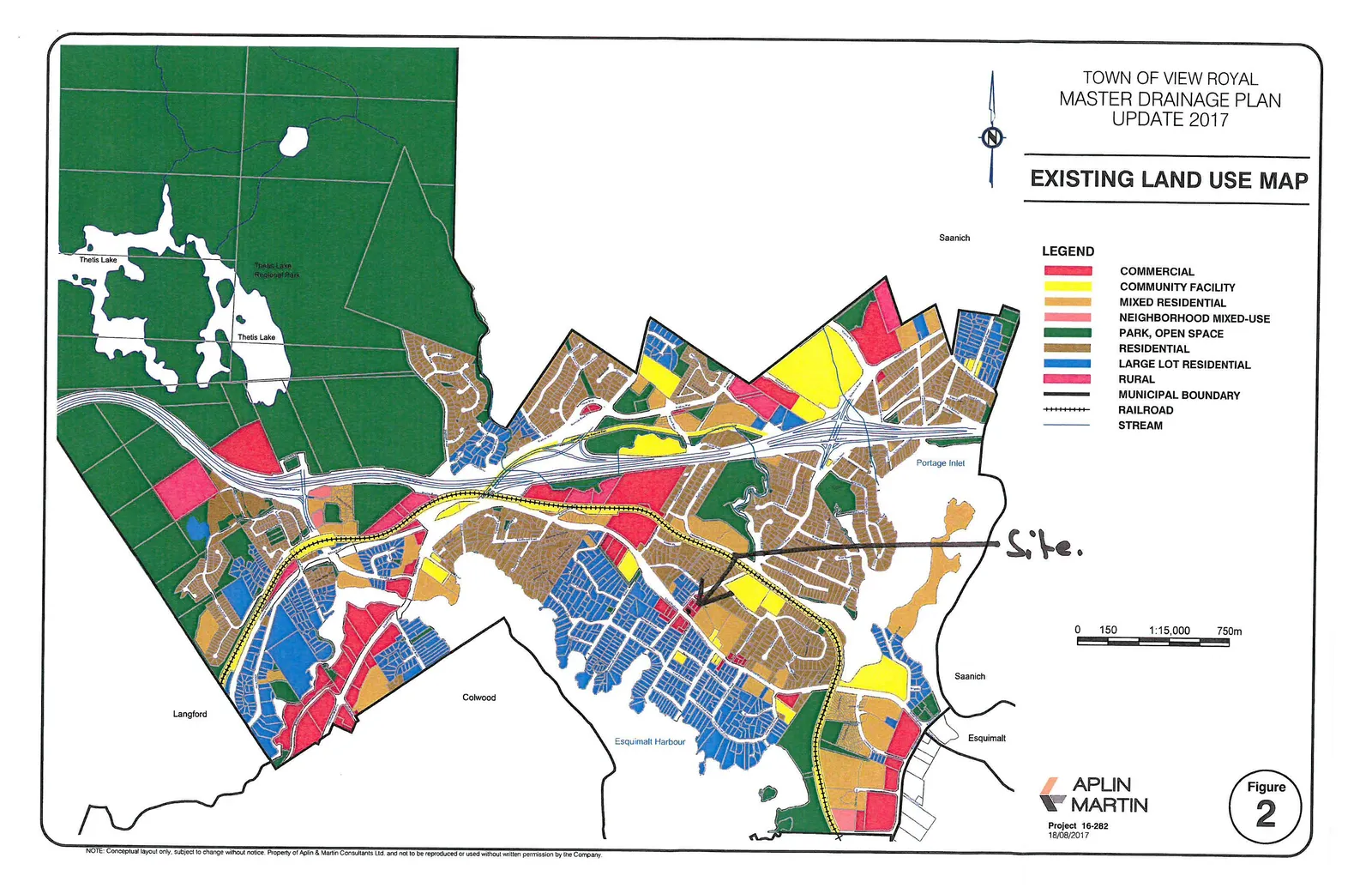
Existing Land Use Map - Figure 2
September 15, 2020Page 7841 section
Town map identifying current land use classifications throughout the municipality.
Scale 1:15,000August 18, 2017
TOWN OF VIEW ROYAL MASTER DRAINAGE PLAN UPDATE 2017
EXISTING LAND USE MAP
LEGEND
- COMMERCIAL
- COMMUNITY FACILITY
- MIXED RESIDENTIAL
- NEIGHBORHOOD MIXED-USE
- PARK, OPEN SPACE
- RESIDENTIAL
- LARGE LOT RESIDENTIAL
- RURAL
- MUNICIPAL BOUNDARY
- RAILROAD
- STREAM
Figure 2 Project 16-282 18/08/2017
NOTE: Conceptual layout only. subject to change without notice. Property of Aplin & Martin Consultants Ltd. and not to be reproduced or used without written permission by the Company.
Page 784
Extracted from: 2020 09 15 Committee of the Whole Agenda - Agenda - Pdf