Presentation
Presentation: OCP2020/01 and REZONING 2020/04 - 298 Island Highway
September 15, 2020Pages 792–8051 section
Municipal staff presentation regarding the proposed OCP amendment and rezoning for a 6-story mixed-use development at 298 Island Highway.
298 Island Highway6 storeys54 apartment units3.0:1 Floor Space Ratio$189,000 community amenity contribution
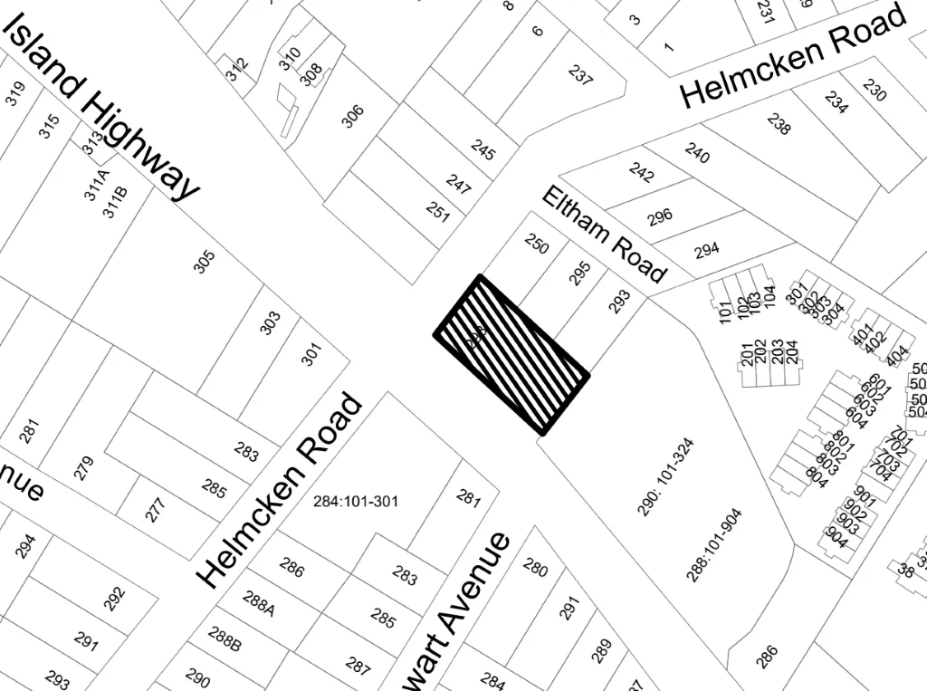
OCP2020/01 and REZONING 2020/04
298 Island Highway
OCP amendment and rezoning to redevelop the property for commercial and residential use.
| Application | From | To |
|---|---|---|
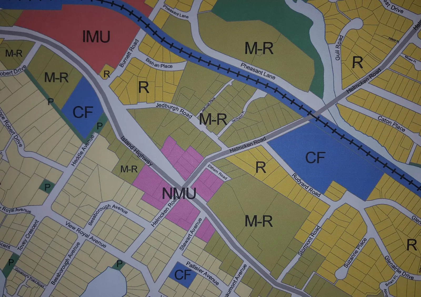
| OCP | Neighbourhood Mixed Use • Commercial/Residential • (1.5:1 Floor Space Ratio) |
Comprehensive Development Area • Commercial/Residential • (3.0:1 Floor Space Ratio) |
| Rezoning | C-1: Community Commercial | New commercial / residential zone |
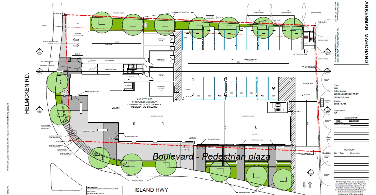
Development Concept (development permit stage)
- Six-storey building with the upper two storeys set back
- Ground floor: 560m² commercial use
- Upper floors: 54 apartment units
- Two levels of underground parking
- 16 one-bedroom units
- 37 two-bedroom units
- 1 three-bedroom unit
| Category | Specification |
|---|---|
| Lot Size | 1853m² |
| Floor Area | 5559 m² |
| Floor Space Ratio | 3.0:1 |
| Units/Hectare | 292 |
| Building Height | 20.3m |
| Storeys | 6 |
| Site Coverage | 75% |
| Units Proposed | 54 |
| Vehicle Parking | 104 (102 required) |
| Secure Bike Parking | 62 (56 required) |
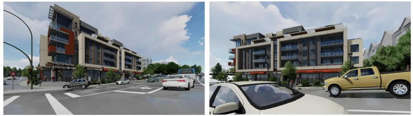
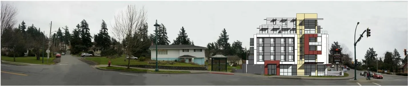
Perspectives from Island Highway
Plaza rendering
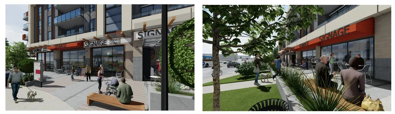
Figure 2. Island Highway frontage (proposed boulevard trees not shown)
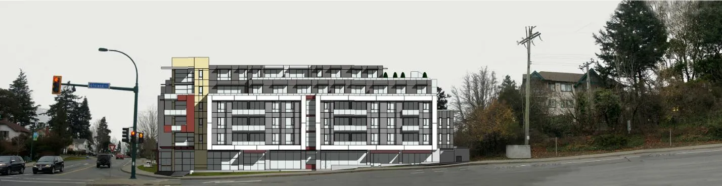
Figure 3. Helmcken Road frontage (proposed boulevard trees not shown)
Official Community Plan Context (3 of 5)
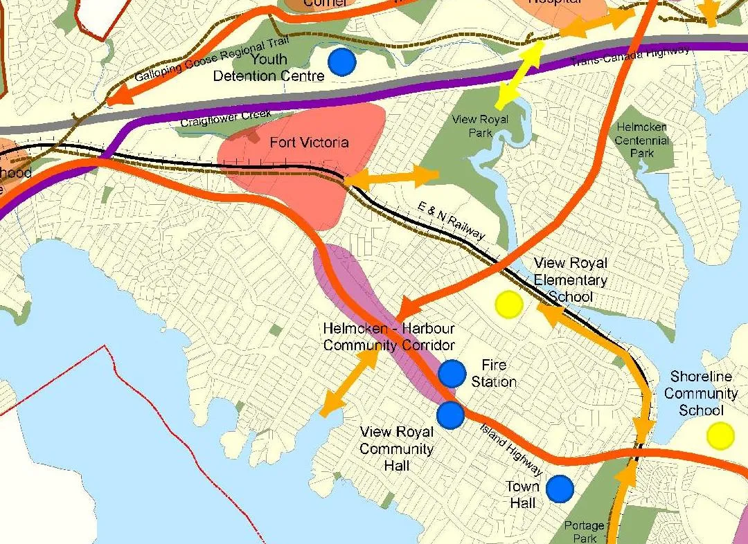
Within the Helmcken-Harbour Community Corridor:
- Mixed-use intensification and public space improvements concentrated at intersection
- Applicant’s concept for a neighbourhood grocery/deli is consistent with the policy that commercial uses should be neighbourhood-serving and limited to properties located near the Helmcken Intersection.
- Plaza supports pedestrian safety and connections across the two roads
- Provides a high-quality built environment and would become a landmark for this neighbourhood centre.
- Strong and safe connections would be provided to surrounding residential areas, the waterfront, Helmcken Road, View Royal Elementary School and the planned Town Centre.
- Higher residential densities fronting the Island Highway
- Would complement and not compete with the future Town Centre and would not inhibit eventual development of the Town Centre desired for the Fort Victoria site.
Official Community Plan Context (4 of 5)
- Consideration should be made on whether the mixed-use intensity would be appropriate for the corridor’s lots sizes and adjacent residential areas
| Development | Address | Units | Lot Area | Units per hectare |
|---|---|---|---|---|
| Current proposal | 298 Island Highway | 54 | 0.1853 ha | 291.4 |
| Lions Cove | 288/290 Island Highway | 66 | 0.8275 ha | 80.0 |
| Maia London | 280 Island Highway | 37 | 0.1677 ha | 220.6 |
| DP approved, not built | 242-244 Island Highway | 37 | 0.1860 Ha | 198.9 |
Official Community Plan Context (5 of 5)
OCP Consultation
- The Local Government Act has requirements for early and ongoing consultation of OCP amendments, but Council can waive.
- Council should give consideration to whether or not early and ongoing consultation is needed given that this is a site specific proposal.
- The application was referred to the relevant agencies as part of the application review process with no major concerns noted.
- It is recommended if the application moves forward to a public hearing, that the agencies be formally notified of the amendment bylaw in conjunction with the public hearing process.
New Zone
- Commercial (ground floor)
- Residential, Apartment
| Category | Specification |
|---|---|
| Lot Size | 1853m² |
| Floor Area | 5559 m² |
| Floor Space Ratio | 3.0:1 |
| Building Height | 20.3m |
| Site Coverage | 75% |
Community Amenity Contribution
- The Community Amenity Contribution Policy target is $3,500 per unit.
- $189,000 based on 54 units
- Community amenity contribution provision to be secured in a covenant.
Possible community amenities
- Housing amenity contribution (CRD Regional Housing Trust Fund)
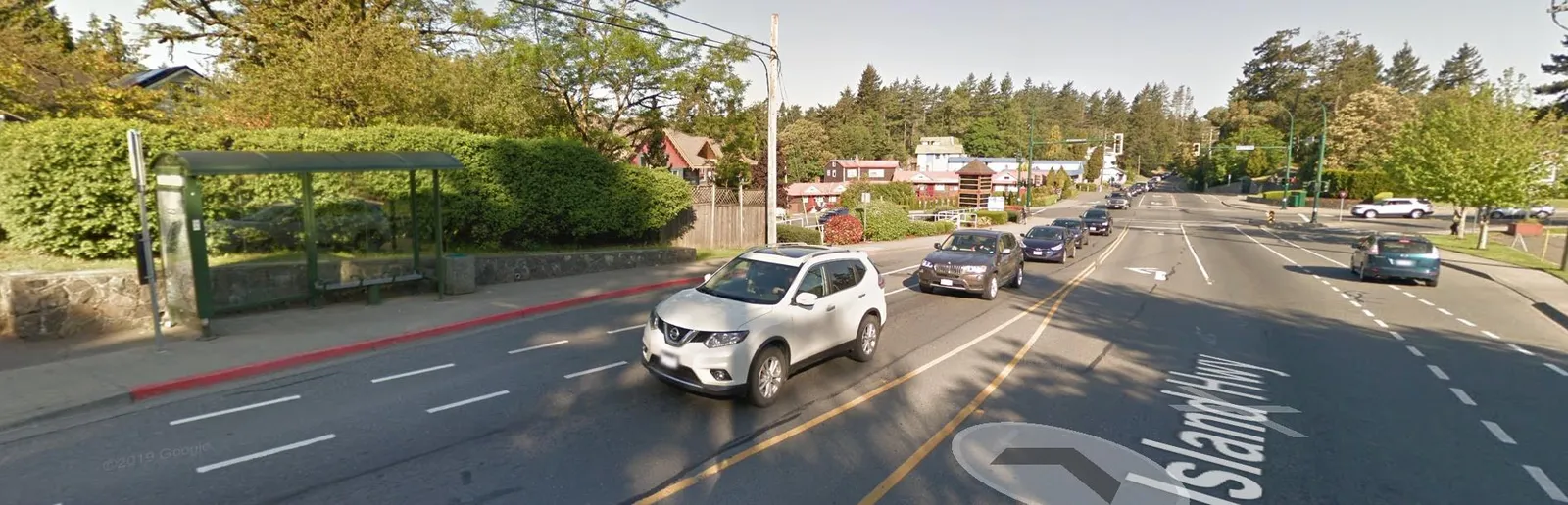
- Improve eastbound transit stop across the street on the high volume 14 UVic and 46 Dockyard routes.
- Current ridership weekday average of 116 boardings and 28 alightings
- A T-4 shelter (i.e. high volume) is required when boarding exceeds 400.
Transportation Impact
- Right-in/right-out vehicle access on each frontage. Analysis should be provided on restricting left turn movements and commercial truck access.
- 2017 and June 2020 traffic counts. More recent counts may have been influenced by summer, the COVID-19 pandemic, and the construction of the Trans Canada Highway / McKenzie interchange.
- Information on bicycle parking, or Transportation Demand Management initiatives should be provided.
- Reconfiguration of lanes on Island Highway through the Helmcken Road intersection to move more vehicles through.
- More detail is needed.
- Future plan to realign Island Highway from Helmcken to Beaumont
Page 792–805
Document Images
(1)
Extracted from: 2020 09 15 Committee of the Whole Agenda - Agenda - Pdf