This site is in beta — data may be incomplete and features are still being added.
Committee of the Whole/Documents/Appendix: Erskine Lane Aerial Property Map
Appendix

Appendix: Erskine Lane Aerial Property Map

September 15, 2020Page 8431 section

An aerial GIS map showing property lines and lot numbers for Erskine Lane and the proximity to the Galloping Goose Trail.

Shows lots 7, 9, 10, and 14 on Erskine LaneProximity to Galloping Goose Trail
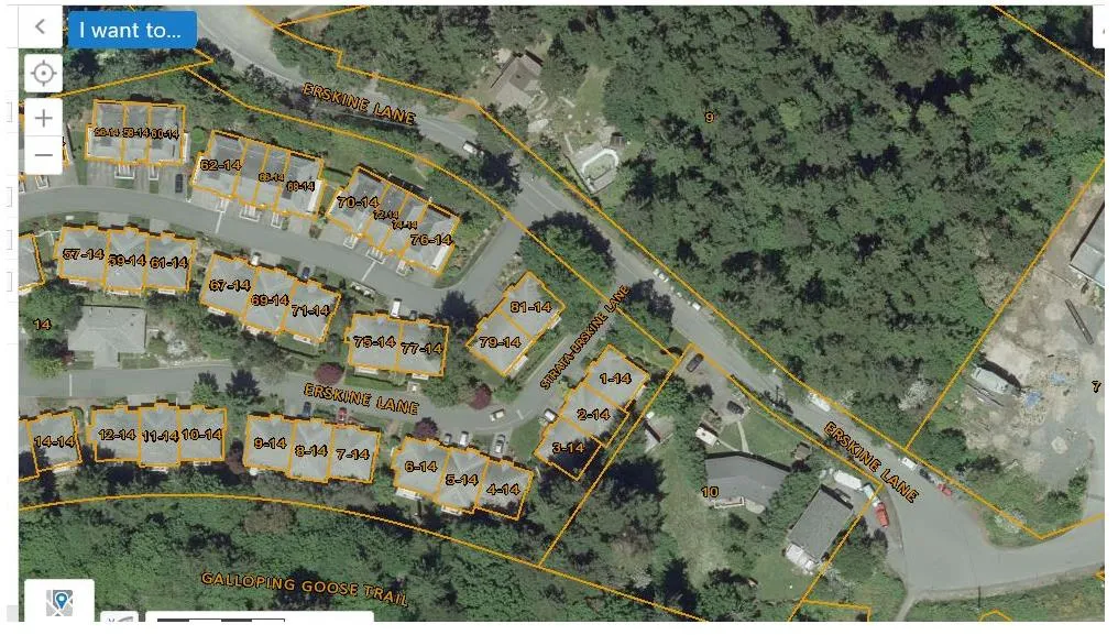
Aerial map view showing residential property parcels and unit numbers along Erskine Lane and Strata-Erskine Lane, with the Galloping Goose Trail located to the south. Individual housing units are labeled with numbers ranging from 1-14 to 81-14, and adjacent larger land parcels are identified with numbers 7, 9, 10, and 14.
Page 843
Extracted from: 2020 09 15 Committee of the Whole Agenda - Agenda - Pdf