Appendix
Attachment 6. New Site Concept
April 9, 2019Page 1361 section
Revised site plan showing building locations and covenant areas.
Covenant Area 11067 SQ M21.3% Covenant Percentage
Attachment 6: New Site Concept
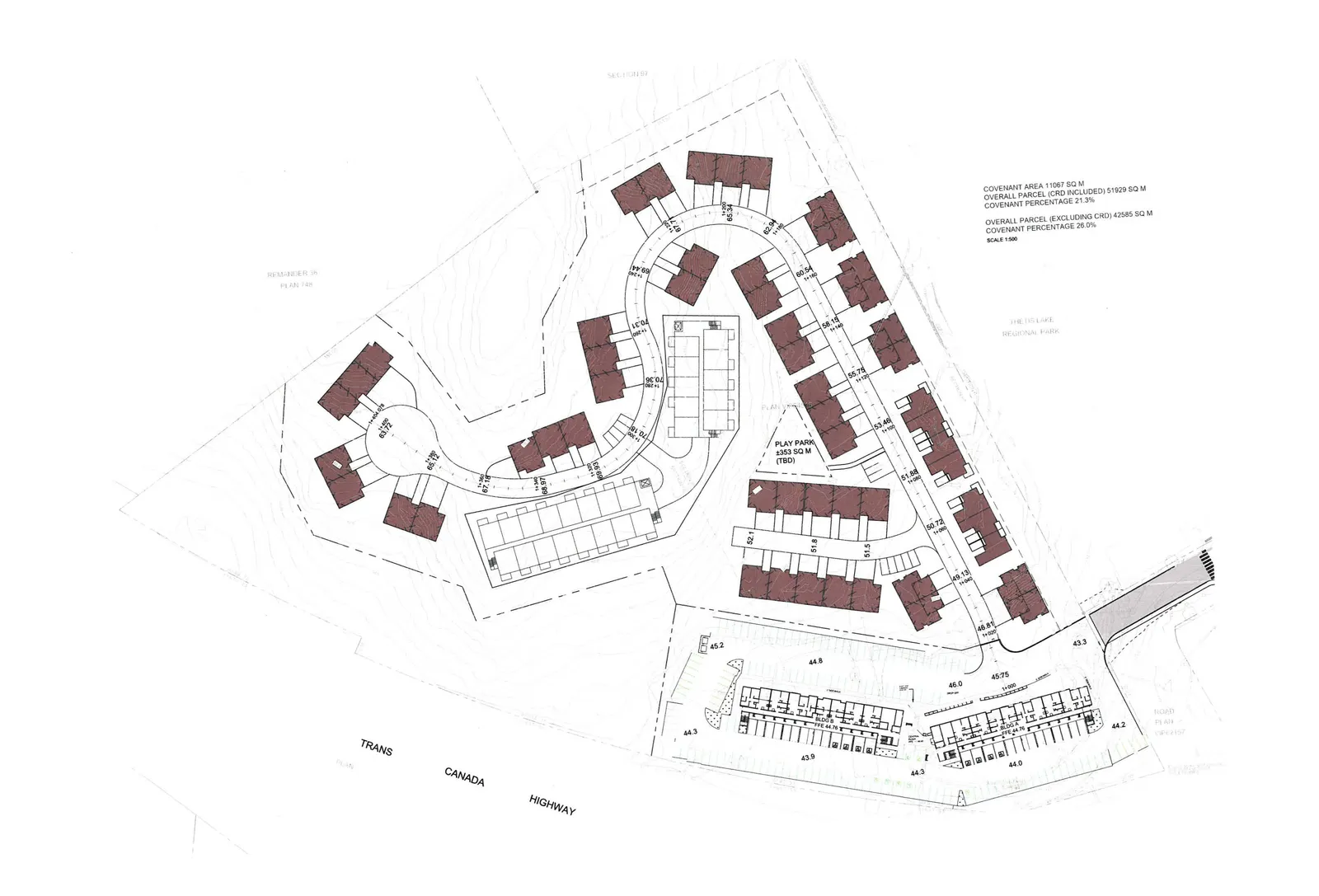
Site Data
- COVENANT AREA: 11067 SQ M
- OVERALL PARCEL (CRD INCLUDED): 51929 SQ M
- COVENANT PERCENTAGE: 21.3%
- OVERALL PARCEL (EXCLUDING CRD): 42585 SQ M
- COVENANT PERCENTAGE: 26.0%
- SCALE: 1:500
General Site Information
- Proposed Play Park: ±353 SQ M (TBD)
- Surrounding Context:
- TRANS CANADA HIGHWAY
- THETIS LAKE REGIONAL PARK
- REMAINDER 36 PLAN 748
- SECTION 97
- ROAD PLAN VIP62157
Site Elevations and Reference Points
The following numerical labels and elevation points are indicated across the site plan:
- 43.3
- 43.9
- 44.0
- 44.2
- 44.3
- 44.8
- 45.2
- 45.75
- 46.0
- 46.81
- 49.13
- 50.72
- 51.5
- 51.8
- 51.88
- 52.1
- 53.46
- 55.78
- 58.15
- 60.54
- 62.94
- 63.45
- 63.72
- 65.11
- 65.34
- 67.18
- 67.71
- 68.97
- 69.44
- 69.93
- 70.18
- 70.31
- 70.36
Page 136
Extracted from: 2019 04 09 Committee of the Whole Agenda - Agenda - Pdf