Appendix
Attachment 7. Civil Cut/Fill Matrix
April 9, 2019Page 1371 section
Engineering chart and map detailing the depth of excavation (cut) and deposit (fill) across the site.
Associated Engineering7-9.2m CUT
SEYMOUR PACIFIC DEVELOPMENTS LTD
THETIS LAKE SUBDIVISION
CIVIL CUT/FILL MATRIX
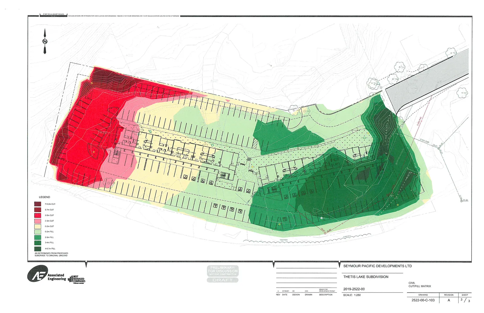
LEGEND
(AS DETERMINED FROM PROPOSED SUBGRADE TO ORIGINAL GROUND)
- 7-9.2m CUT
- 5-7m CUT
- 3-5m CUT
- 2-3m CUT
- 0-2m CUT
- 0-2m FILL
- 2-3m FILL
- 3-4m FILL
- 4-6.7m FILL
Revision History
| REV | DATE | DESIGN | DRAWN | DESCRIPTION |
|---|---|---|---|---|
| A | 2019/MAR/11 | DD | DAH | ISSUED FOR DEVELOPMENT PERMIT |
Drawing Information
| Project Number | 2019-2522-00 |
|---|---|
| Scale | 1:250 |
| Drawing No. | 2522-00-C-103 |
| Revision | A |
| Sheet | 3 / 3 |
Page 137
Extracted from: 2019 04 09 Committee of the Whole Agenda - Agenda - Pdf