Attachment 7. Letter from Applicant, May 29, 2019
A letter from M.H. Johnston & Associates Inc. addressing neighborhood concerns and clarifying the developer's amenity contributions.
Town of View Royal May 29th 2019
Attn. Jeff Chow – Planner
Re: Rezoning Application - #7 Erskine Lane
We have attempted to address Council’s concerns from the meeting of February 19th 2019 and provide the following additional information.
NEIGHBOURHOOD MEETING
We held a neighbourhood meeting on March 26th and approximately 20 people attended. Almost everyone attending lived in the townhouse development at #4 Erskine Lane. Concerns expressed focused on additional traffic and its impact on Erskine Lane as well as the loss of street parking.
TRAFFIC IMPACT STUDY – WATT CONSULLTING GROUP
The Watt Consulting Group is an independent traffic engineering company, and they have prepared a review of the impact of our development on the intersections of
- Watkiss Way and Erskine Lane
- Watkiss Way and Burnside Rd (recently signalized)
- Watkiss Way and Eagle Creek Village Access
- Watkiss Way and Helmcken Rd. intersection
The review studied the impact of our proposed development on the intersections as well as the impact over the next 10 years with expected growth in the area. The review indicates that the development would have no impact on the Watkiss Way – Erskine Lane intersection and no mitigation measures are required. The study also indicates that the development would have no significant impact on the other 3 intersections on Watkiss Way. The Towns Engineering staff have copies of the report and have reviewed the results.
STREET PARKING
Our proposal meets the Towns zoning by-law requirements for parking including visitor parking.
The permitted parking presently on Erskine Lane provides additional private street parking for the townhouses at #4 Erskine Lane. The building of a sidewalk will require the removal of this private parking. I have attached a plan which illustrates how the street parking could be replaced by developing parking in the cul de sac.
SIDEWALK
Our proposal was to develop a 260m temporary asphalt sidewalk from our property to the intersection of Watkiss Way. The cost of the sidewalk was estimated at $98,000. This sidewalk would provide pedestrian safety on Erskine Lane and would be replaced when #9 Erskine Lane was developed. With the asphalt sidewalk the roadway is still wide enough for two cars to pass and most of Erskine Lane has a painted center line (picture attached)
#9 Erskine Lane, with 260m of frontage, is now for sale and development of this property would require the development of its street frontage in accordance with the Towns by-laws including sidewalk, boulevard and street widening. This means the temporary asphalt sidewalk would be removed.
Because of the timing of the construction of our project, if approved, and any new building on #9 Erskine Lane we believe spending $98,000 on a temporary sidewalk is not money well spent. We are prepared to make a cash amenity contribution of the $98,000 in lieu of the temporary sidewalk.
ACCESS TO BUS STOPS
I have included a plan that shows the bus stops and the distance and walking times to each stop. I have also shown the distance and walking time for those future owners who may work in the Hospital. As you can see there are 3 bus stops within a 4 minute walking distance on existing paved walkways. Although the use of the CRD waterline looks attractive it is undeveloped, steep and dark and does not provide a quicker or safer alternative to the existing paved walkways.
Our project is also adjacent to the galloping goose trail which provides an excellent biking and walking route to both Downtown and the Western Communities.
WATER
As part of our development we have chosen to upgrade the watermain in Erskine Lane at an estimated cost of $290,000. This main will benefit other properties on Erskine Lane as they develop in accordance with the Town’s OCP.
At our Neighbourhood meeting we heard complaints about the excessive water pressure that is damaging private water pipes and causing difficulties with insurance claims. The new watermain should assist in alleviating this problem.
SUMMARY
The Town’s OCP was our guide in reviewing the potential for the development of this site. The OCP. Designates the site as part of the Intensive Mixed Use area with potential FSR 2.5. and up to 5 storeys. Our project has an FSR. Of 1.6 and is 4/5 storeys and meets the Town’s parking requirements for the RM3 mixed residential zone. We are not pushing the limits of the OCP designation and we believe our project is a good first step in meeting the OCP direction for the area. We are prepared to make our contribution to development of the neighbourhood as a first step but expect owners of other properties to pay their share as they develop their properties under the direction of your OCP.
We also remain committed to our contribution of $37,600 to the Town’s affordable housing fund.
Mark H. Johnston
M.H. Johnston & Associates Inc.
MAP TITLE
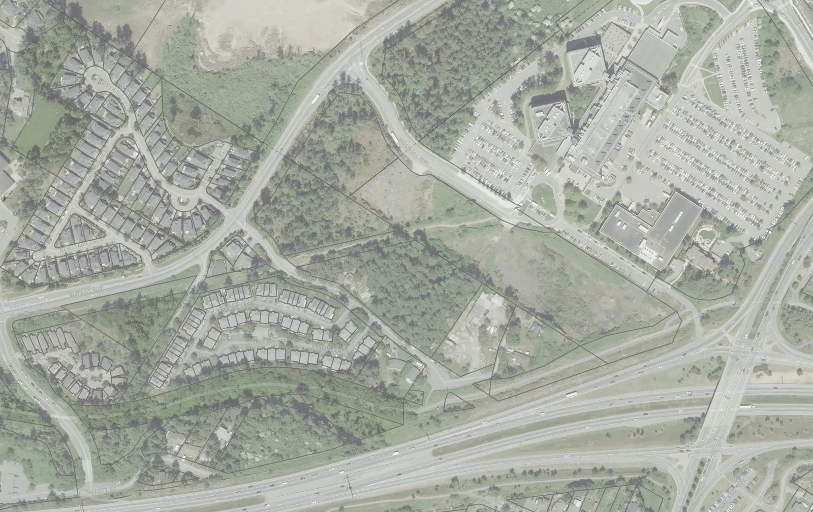
Map Information:
- HOSPITAL: 0.64km, 7 MINUTE WALK
- BUS STOPS: 0.40km, 3.5 MINUTE WALK
- BUS STOPS: 0.30km, 3-4 MINUTE WALK
- Scale: 1:2,500
Legend:
- Regional District Boundary
- Electoral Area Boundary 1-7.5
- Municipal Boundary 1-7.5K
- International Boundary
- Community Labels
- Geographic Labels
- Coastal Water Labels
- Building Footprint
- Civic Sites (Airport, Paramedic, Recreation Center, Office, Library, Museum, Firehall, Hospital, Police, School, Golf, Ferry, Station)
- Road Labels 1500-5k
- E & N Railway
- All Road Types 1.5K-5K
- Ferry Route
- Lakes & Wetlands 1-75K
- Park (Park, Park Water Extension)
- First Nation Reserve
- Ocean
- Regional District
- Land and Islands