EAGLES NEST Development Proposal Presentation
A visual presentation for the 'Eagles Nest' development project covering traffic impact assessments, community engagement history, site evolution, and the proposed development plan.
Traffic Impact Assessment
WATT Consulting completed a Traffic Impact Assessment (TIA) for the project. The following summarizes the key findings:
- Existing conditions at the Helmcken / Watkiss / Chancelor intersection indicate unstable conditions for the eastbound left turn movement during the AM peak and severe westbound queuing and delay that spills back ~1 km beyond Burnside Road during the PM peak.
- Existing conditions at the Helmcken / Burnside intersection indicate failing conditions for northbound and southbound movements on Burnside Rd during the AM peak and failing conditions for northbound movements on Burnside Rd during the PM peak.
- Site generated traffic will add one vehicle to the study area road network approximately every 45 seconds during the AM peak and every 35 seconds during the PM peak.
- Site generated traffic will have a negligible impact on traffic operations at the Helmcken / Watkiss / Chancelor and Helmcken / Burnside intersections at buildout (2023) and 10 years beyond buildout (2033).
- The site access will operate well 10 years beyond full buildout and does not require a northbound left turn lane.
- Transportation Demand Management strategies may reduce the development’s impact on traffic operations at study area intersections.
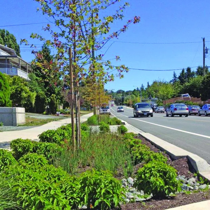
- A sidewalk is recommended along the site’s frontage on Helmcken Road and Burnside Road West.
- The installation of bus bay on Helmcken Rd fronting the site should be discussed with BC Transit.
- Since December 2019 when the McKenzie / Highway 1 underpass was opened, media estimates indicate commute times between Langford and Victoria have been reduced 10 – 15 minutes. The McKenzie interchange project may in turn improve conditions on Helmcken Road and Burnside Road which should be reassessed once the interchange project is complete.
2.0 Community Engagement & Site Planning
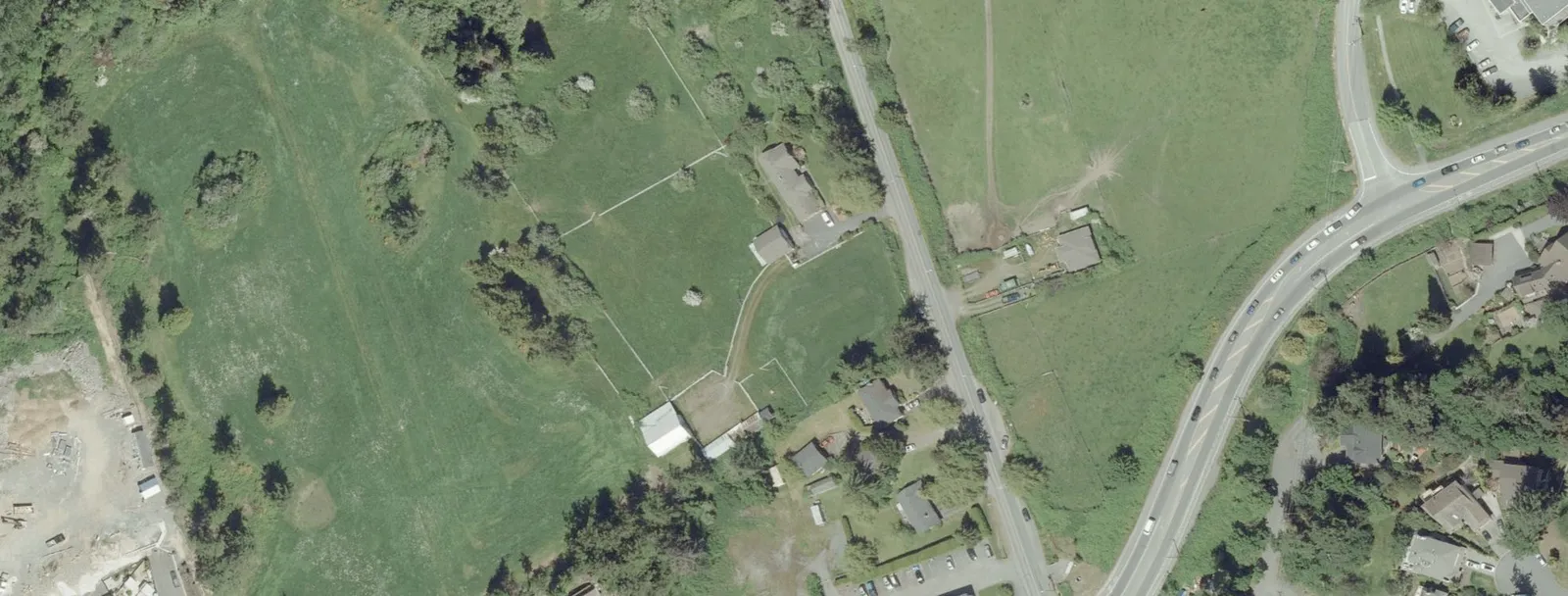
The site was the subject of a previous Rezoning Application, originally submitted in 2018 and withdrawn in 2019, to allow more community engagement and further site and technical analysis. This new application builds upon the input received during the original application process, and has benefited from collaborative consultation with the immediate neighbours to bring about a renewed and refined site plan.
At its core, however, the application remains committed to implementing the goals and objectives of the OCP and realizing a contribution to the regional housing needs with a site design that is respectful and responsive to its neighbourhood context.
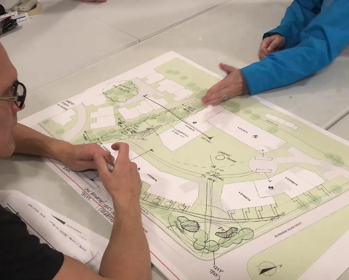
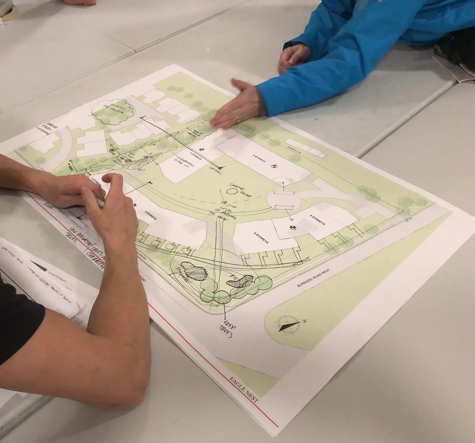
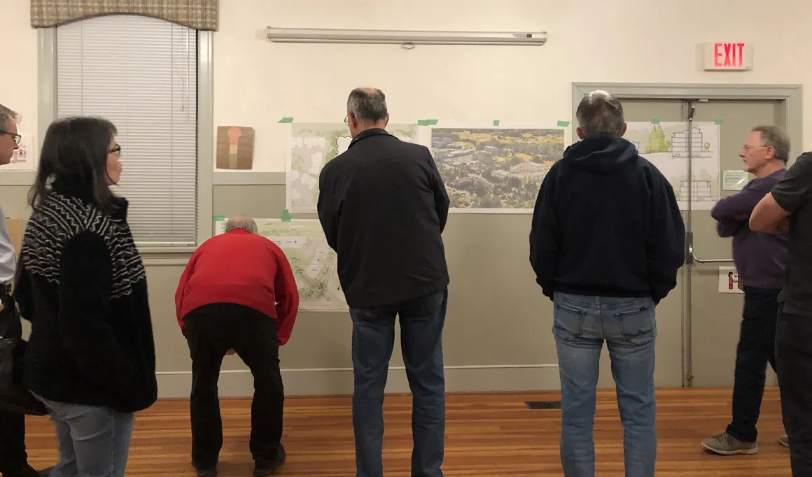
The development planning team hosted two workshops with neighbours in November and December of 2019. The purpose of the workshops was to invite the immediate neighbours to participate in the planning process as the project reset and worked toward a new application. The workshop sessions were designed to allow collaborative discussion and engagement around the site plan to gather input and ideas to help shape the proposed buildings. A review of the View Royal planning policies for the site was shared, highlighting the community goal of achieving a greater variety of housing choice, affordability and better use of land. The team listened to gather input on issues and opportunities to be addressed by the plan.
The topics of traffic, transportation, tree retention, privacy, and building heights and stepping were discussed at the workshops. Input received during the first session in November informed refinement to the site plan, which was then brought forward for review and discussion at the second session in December.
A Community Meeting was scheduled to be hosted on January 15, 2020 to present the new plan and proposal prior to submission of this new Rezoning Application. Due to winter weather conditions, the Community Meeting had to be postponed, and is now scheduled for Monday, February 3, 2020.
The planning and design team believes the plan has been positively shaped by the community input and now better responds to a number of key issues raised.
Site Plan Evolution with Community Input
Site Plan Version 1
OCTOBER 23, 2018 Community Meeting +/- 70 attendees (52 signed-in)
What we heard:
Traffic
- concern about commuter traffic on Helmcken and capacity to accommodate proposed growth given regional traffic issues
- challenge getting in and out of residential driveways
- turnaround traffic into Hidden Oaks’ driveway
Building Height/Shadowing
- concern about potential overshadowing of Hidden Oaks townhouses
- question about the building massing/presence at the corner
Density
- some concern about density, particularly relative to traffic impacts
Streetscape
- questions about streetscape design - sidewalks?
Site Plan Version 2
JANUARY 9, 2019 Hidden Oaks Resident Meeting 9 attendees
What we heard:
Traffic
- concern about turn-around traffic into Hidden Oaks’ driveway
- discussion on strategies to deter turn-around traffic (signage, dedicated left-hand turn lane into Eagle Creek Village off of Helmcken.
Building Height/Shadowing
- concern about 6-storey building being located adjacent to townhouses
Site Plan Version 3
JULY 9, 2019 Community Meeting 50 attendees (all signed-in)
What we heard:
Traffic
- concern about traffic and impact of development on an already challenging traffic situation
Building Height/Shadowing
- concern about 8-storey building at the back of the site
Neighbours’ Workshops
NOVEMBER 18, 2019
Neighbours’ Workshop #1 13 attendees Site & Landscape Design
Discussion Topics:
- Building heights & distribution
- Site access & circulation
- Edge conditions and screening / buffer
- Landscape design ideas
- Streetscape improvements
- Density, traffic impacts
DECEMBER 2, 2019
Neighbours’ Workshop #2 8 attendees Site Plan Revisions
Discussion Topics:
- Building heights & distribution
- Traffic, speed and volume
- Density measurements and design
- Site access & circulation
- Edge conditions and screening / buffer
- Site grades and topography and stormwater management
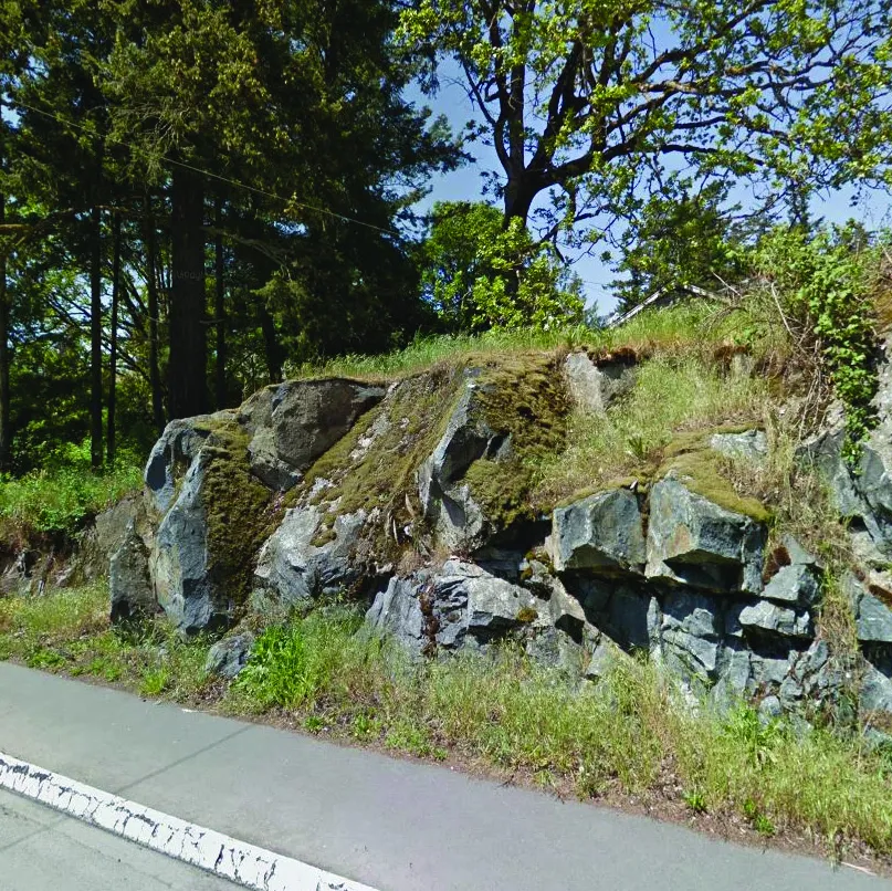
- Potential to retain some existing trees for privacy
- Potential to retain rocky outcropping at western edge of site
- Design of internal courtyard, on-site circulation
3.0 Proposed Development Plan
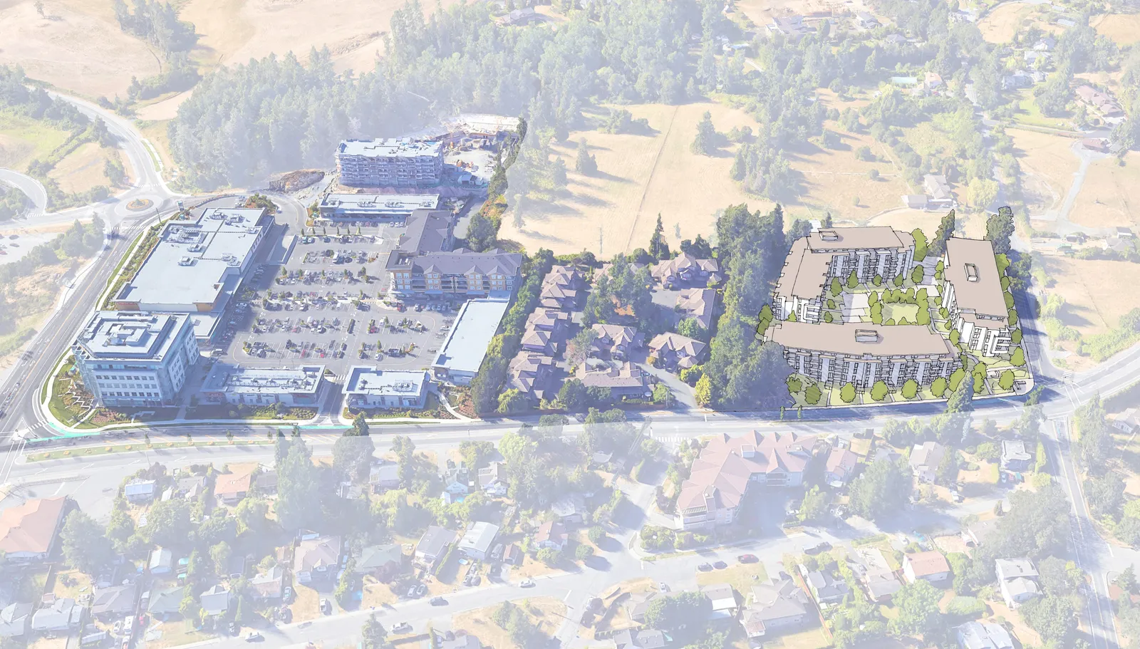
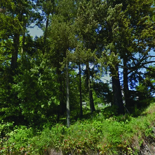
To reset the site planning process, the team revisited the site analysis in collaboration with the neighbours’ planning workshops. This approach was informed by detailed site and tree surveys along with input from the neighbours with respect to building location, setbacks, height, stepping and privacy. Existing trees along the western property line were assessed and it was determined that setting the buildings back away from the property line would allow retention of important existing trees, and the rocky outcropping, that serve to provide privacy, screening and a natural setting for the neighbours.
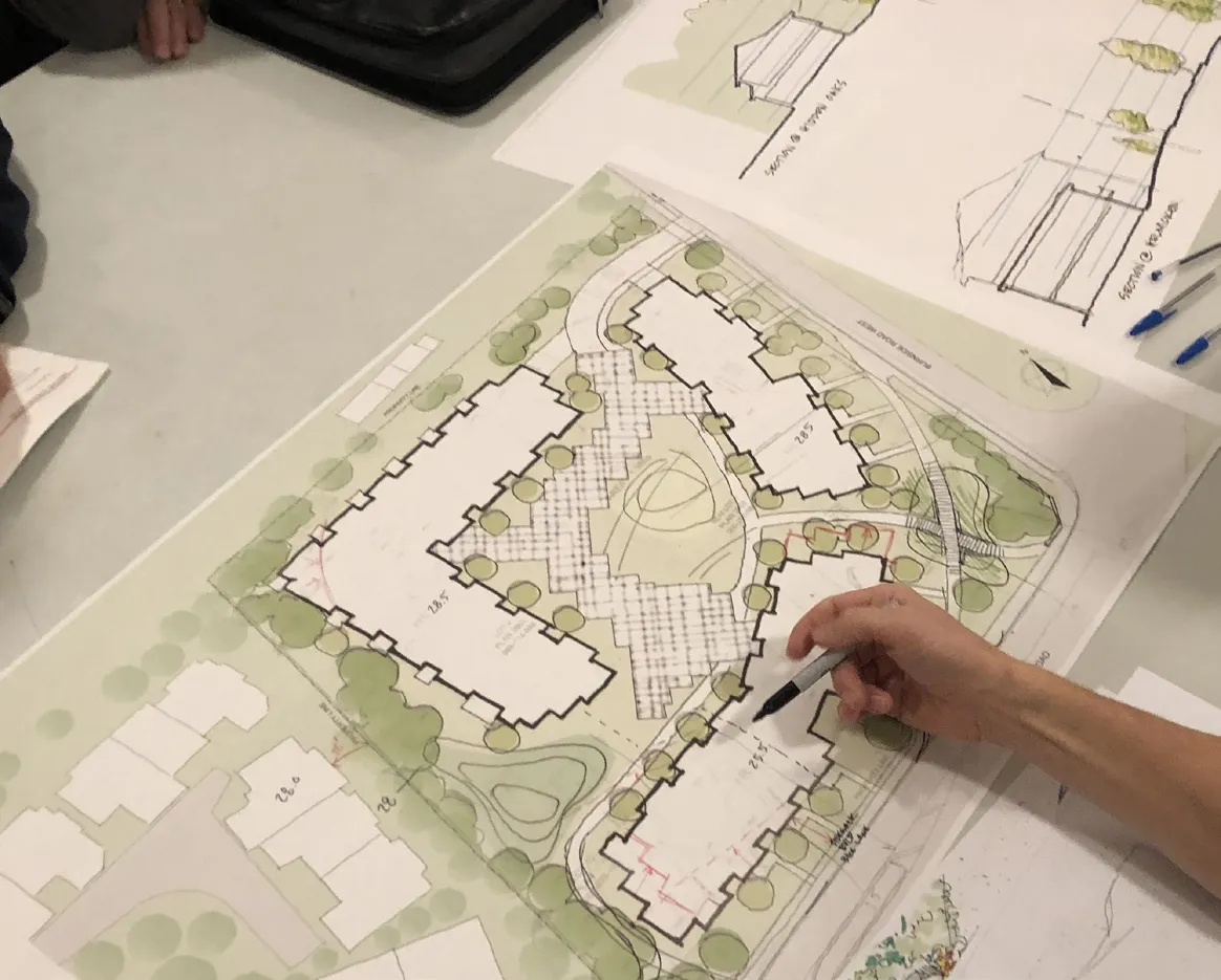
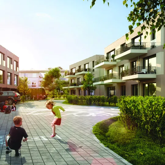
The plan was also shaped by an urban planning objective to create strong pedestrian-oriented streetscapes along Helmcken Road and Burnside Road West. Buildings along these frontages are designed with ground-floor units that each have their own individual entry from the street. These units, and the daily activity of residents coming and going provide ‘eyes on the street’ and contribute to the place-making that can help encourage walking.
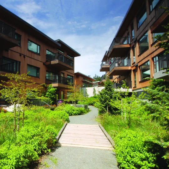
With all parking located underground, the internal courtyard is designed as a ‘woonerf’, a Dutch concept of a ‘living street’ with room for pedestrians, cyclists and cars. While the space allows for pick-up and drop-off vehicular use, it is intended as a social place for gathering, play, and interaction, rather than a space solely for vehicles. The adjacent central green space provides an additional amenity for residents and contributes to the overall greening of the site, with more landscaping and pervious surface than has been achieved within neighbouring developments that devote more space to paved vehicular use.
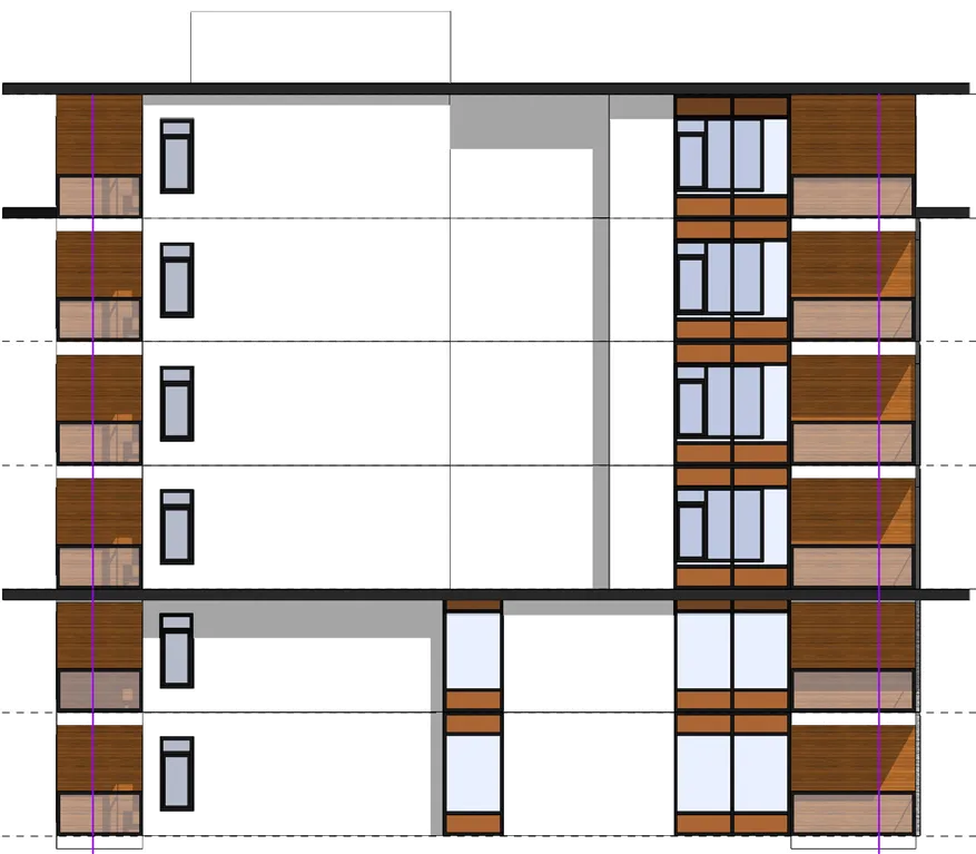
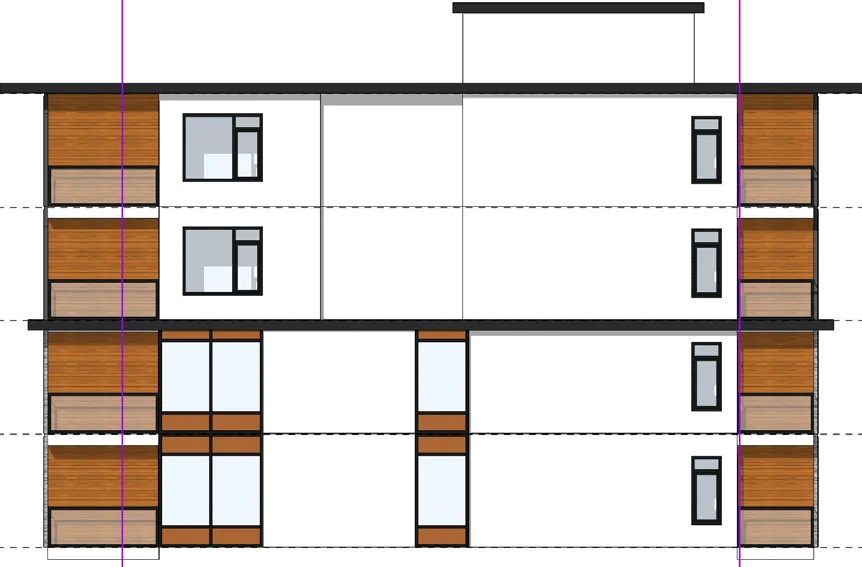
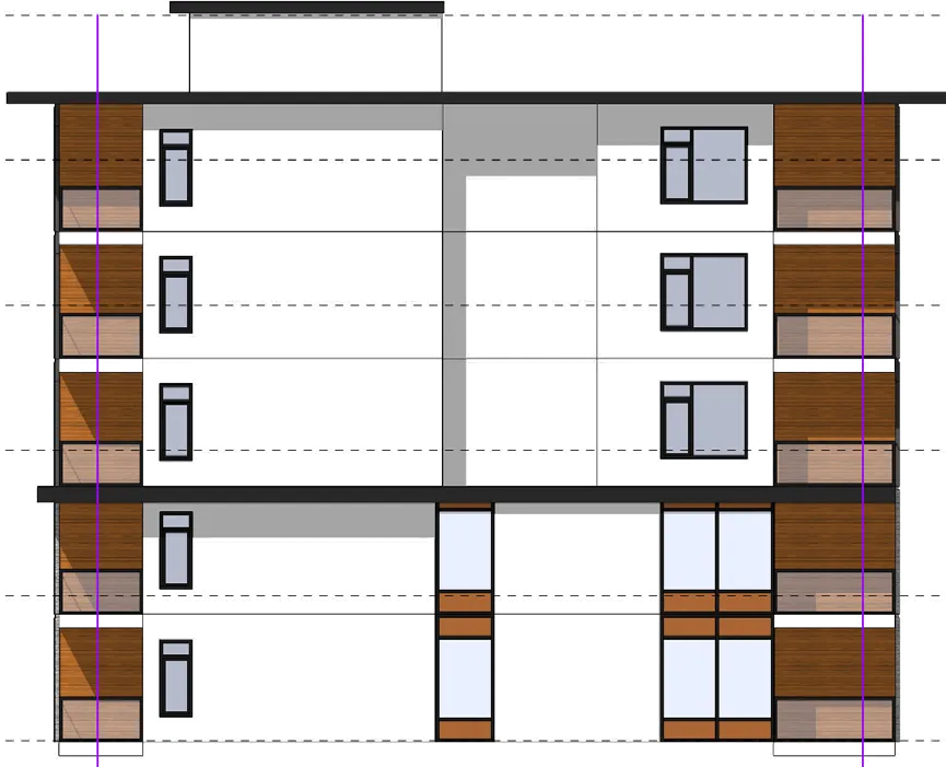
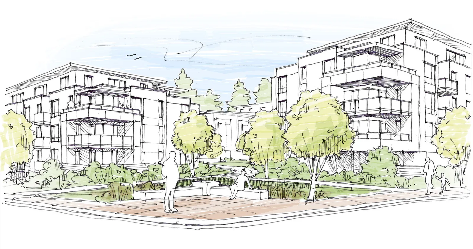
Building heights have been strategically stepped from three to six storeys, to maximize privacy for adjacent neighbours and to respond to site topography. The building massing and architecture contribute to creating a strong gateway at the important intersection of Burnside Road West and Helmcken Road, marking a welcome to View Royal. The landscape at the corner includes a feature rain garden and a small plaza space that contribute to the public realm.
The project proposes a development density of 1.5 FSR, with 247 units, including one-bedroom, two-bedroom, and family-friendly three-bedroom units. With close proximity to shopping and services at Eagle Creek Village, new residents will have access to daily needs within walking distance. A new bus bay on Helmcken supports access to transit and connectivity to the Galloping Goose Regional Trail further supports alternate transportation. The project is also investing in Transportation Demand Management (TDM) strategies, including an e-bike rebate and car share program.
Proposed Site Plan & Development Statistics
Development Data
| Category | Value |
|---|---|
| Site Area (sf) | 148,120 |
| Total Units | 247 |
| Units Per Hectare | 179 |
| Gross Floor Area (sf) | 228,750 |
| FAR | 1.5 |
| Coverage | 33% |
| Height (ft) | 64 |
| Height (storeys) | 3 - 6 |
Unit Type
| Unit Type | Count | Percent |
|---|---|---|
| 1-Bed (587 sf) | 97 | 39% |
| 2-Bed (878 sf) | 138 | 56% |
| 3-Bed (1,050 sf) | 12 | 5% |
Setbacks (m)
| Setbacks (m) | Required Minimum | Proposed Minimum | Proposed Average |
|---|---|---|---|
| Front (Helmcken) | 7.5 | 10.5 | 16.2 |
| Flanking (Burnside) | 4.0 | 8.2 | 8.2 |
| Side (West) | 4.0 | 11.2 | 16.4 |
| Side (North) | 4.0 | 8.1 | 8.1 |
Site Analysis: Impervious Surfaces vs. Green Space
Perspective Rendering of Corner Gateway & Site Sections

Aerial Perspective Rendering
Site & Landscape Plan

Landscape Site Sections
Timeline
SUMMER 2018 Pre-Application
- Site & Technical Analysis
- Review of Planning Regulations/OCP
- Initial Meetings with View Royal Staff
- Conceptual Design
FALL 2018 Rezoning Application
- Submission to View Royal
- Technical review and feedback
- Response to Staff comments
OCTOBER 23, 2018 Community Meeting Site Plan Version 1
NOVEMBER 13, 2018 Committee of the Whole
- Concern about density
- Concern about massing at the corner
WINTER 2018/2019 Site Plan Revisions
- Site & Technical Analysis
- Response to community and COTW comments
JANUARY 9, 2019 Hidden Oaks Resident Meeting Site Plan Version 2
SPRING/SUMMER 2019 Site Plan Revisions
- Site plan revisions, response to community input
Committee of the Whole
- Delegation, April 9, 2019
JULY 9, 2019 Community Meeting Site Plan Version 3
SEPTEMBER 17, 2019 Committee of the Whole
- Withdrew application
NOVEMBER 18, 2019 Neighbours’ Workshop #1 Site & Landscape Design
DECEMBER 2, 2019 Neighbours’ Workshop #2 Site Plan Revisions
NOVEMBER/DECEMBER 2019 Site Plan Revisions
- Site plan revisions, response to neighbours’ input
- Site analysis, technical analysis
- Preparation of new site plan
FEBRUARY 2, 2020 Community Meeting
Next Steps
JANUARY - FEBRUARY 2020 Rezoning Application
- Submission to View Royal
- Technical review and feedback
- Response to Staff comments
Committee of the Whole, February 11, 2020
SPRING 2020 Public Hearing
SUMMER 2020 Rezoning Final Adoption
FALL 2020 Development Permit Application
- Submission to View Royal
- The DP may run concurrently with the Rezoning, or could follow Final Adoption of the zoning.
- Technical review and feedback
- Response to Staff comments
FALL/WINTER 2020 Development Permit Approval
SPRING 2021 Building Permit
SPRING 2021 Construction Start
SPRING 2023 Construction Finish
Document Images
(24)

Photograph of a pedestrian path and small bridge within a landscaped area

Cross-section drawing 1 "Section 1 Through Western Landscape" (Scale: 1:100)


Perspective sketch of the corner gateway showing modern buildings and landscaped plaza

Site section drawing "Section @ Hidden Oaks" showing the relationship between proposed buildings and existing townhouses

Illustration of children playing in a large open green space

Photograph of a preserved natural rock outcropping on the site

Cross-section drawing 4 "Section 4 Through Pedestrian Path" (Scale: 1:100)

Cross-section drawing 5 "Section 5 Through Helmcken Road" (Scale: 1:100)