Appendix B Select Aerial Photographs
Historical aerial photographs of the site used for interpretation of past land uses and development stages.
Appendix B
Select Aerial Photographs
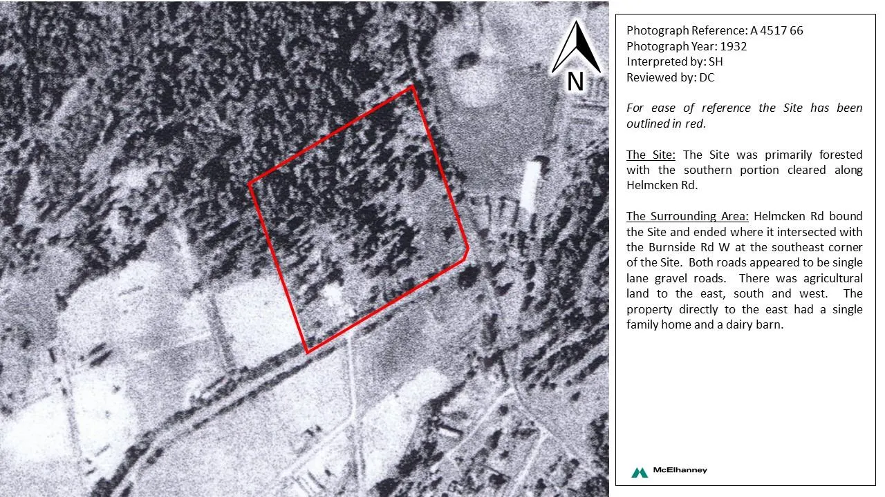
Photograph Reference: A 4517 66 Photograph Year: 1932 Interpreted by: SH Reviewed by: DC
For ease of reference the Site has been outlined in red.
The Site: The Site was primarily forested with the southern portion cleared along Helmcken Rd.
The Surrounding Area: Helmcken Rd bound the Site and ended where it intersected with the Burnside Rd W at the southeast corner of the Site. Both roads appeared to be single lane gravel roads. There was agricultural land to the east, south and west. The property directly to the east had a single family home and a dairy barn.
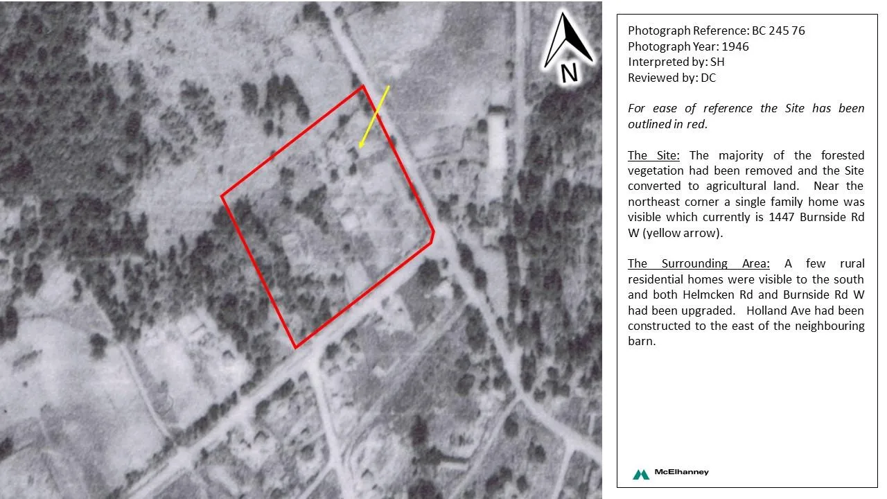
Photograph Reference: BC 245 76 Photograph Year: 1946 Interpreted by: SH Reviewed by: DC
For ease of reference the Site has been outlined in red.
The Site: The majority of the forested vegetation had been removed and the Site converted to agricultural land. Near the northeast corner a single family home was visible which currently is 1447 Burnside Rd W (yellow arrow).
The Surrounding Area: A few rural residential homes were visible to the south and both Helmcken Rd and Burnside Rd W had been upgraded. Holland Ave had been constructed to the east of the neighbouring barn.