Phase I ESA: Helmcken Rd & Burnside Rd W - Aerial Photographs
A series of historical aerial photographs and interpretations (1956–2017) of the site at Helmcken Rd and Burnside Rd W as part of an Environmental Site Assessment.
Phase I ESA: Helmcken Rd & Burnside Rd W, View Royal, BC
Historical Aerial Photographs
1956 Aerial Photograph
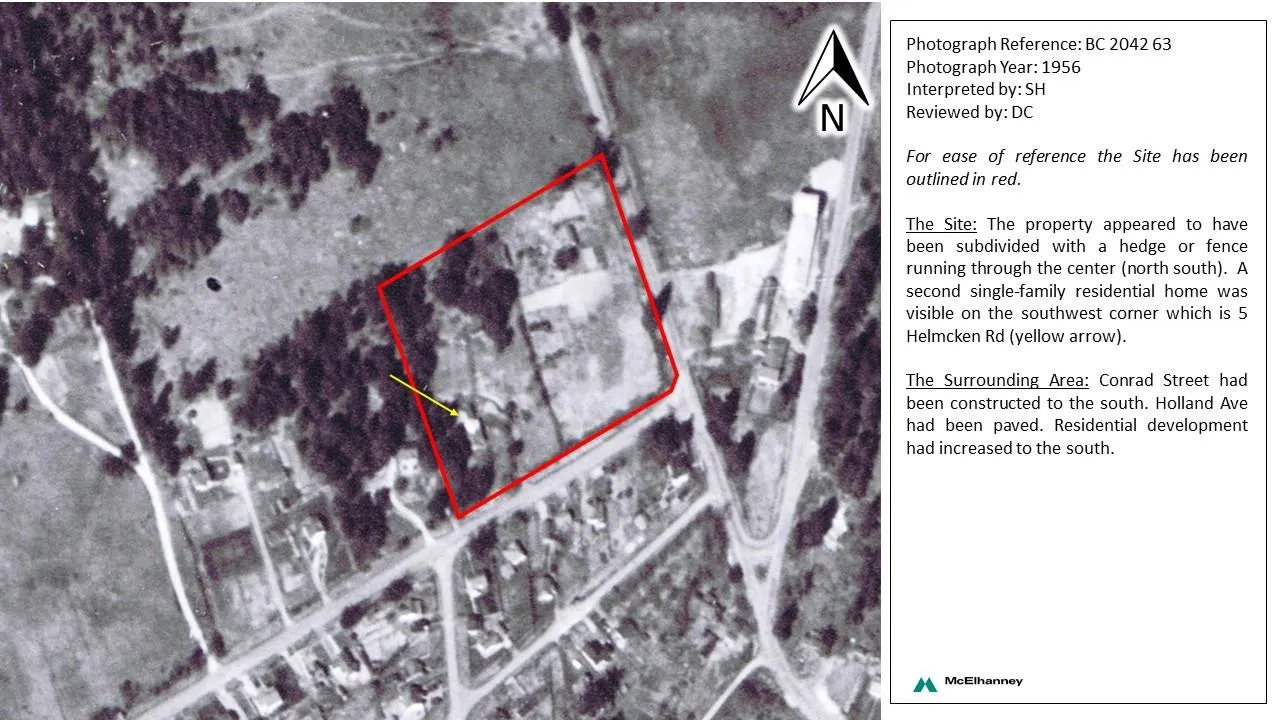
- Photograph Reference: BC 2042 63
- Photograph Year: 1956
- Interpreted by: SH
- Reviewed by: DC
For ease of reference the Site has been outlined in red.
The Site: The property appeared to have been subdivided with a hedge or fence running through the center (north south). A second single-family residential home was visible on the southwest corner which is 5 Helmcken Rd (yellow arrow).
The Surrounding Area: Conrad Street had been constructed to the south. Holland Ave had been paved. Residential development had increased to the south.
1968 Aerial Photograph
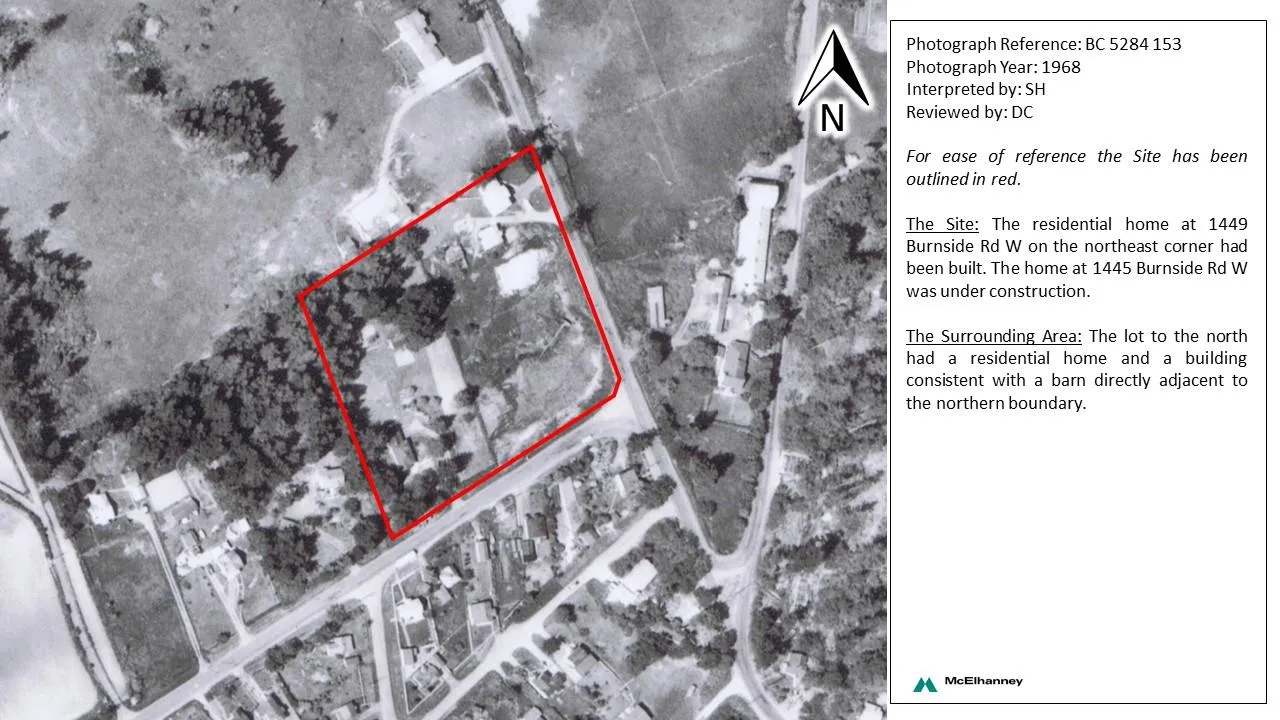
- Photograph Reference: BC 5284 153
- Photograph Year: 1968
- Interpreted by: SH
- Reviewed by: DC
For ease of reference the Site has been outlined in red.
The Site: The residential home at 1449 Burnside Rd W on the northeast corner had been built. The home at 1445 Burnside Rd W was under construction.
The Surrounding Area: The lot to the north had a residential home and a building consistent with a barn directly adjacent to the northern boundary.
1974 Aerial Photograph
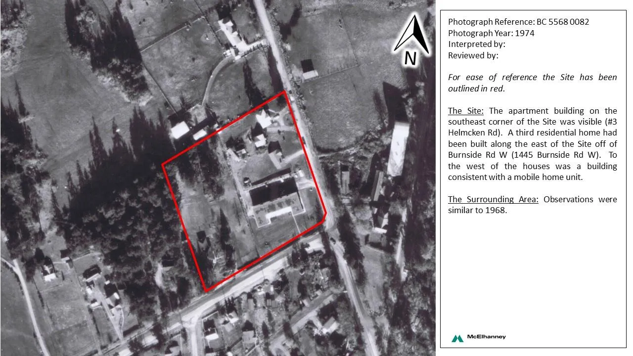
- Photograph Reference: BC 5568 0082
- Photograph Year: 1974
- Interpreted by:
- Reviewed by:
For ease of reference the Site has been outlined in red.
The Site: The apartment building on the southeast corner of the Site was visible (#3 Helmcken Rd). A third residential home had been built along the east of the Site off of Burnside Rd W (1445 Burnside Rd W). To the west of the houses was a building consistent with a mobile home unit.
The Surrounding Area: Observations were similar to 1968.
1980 Aerial Photograph
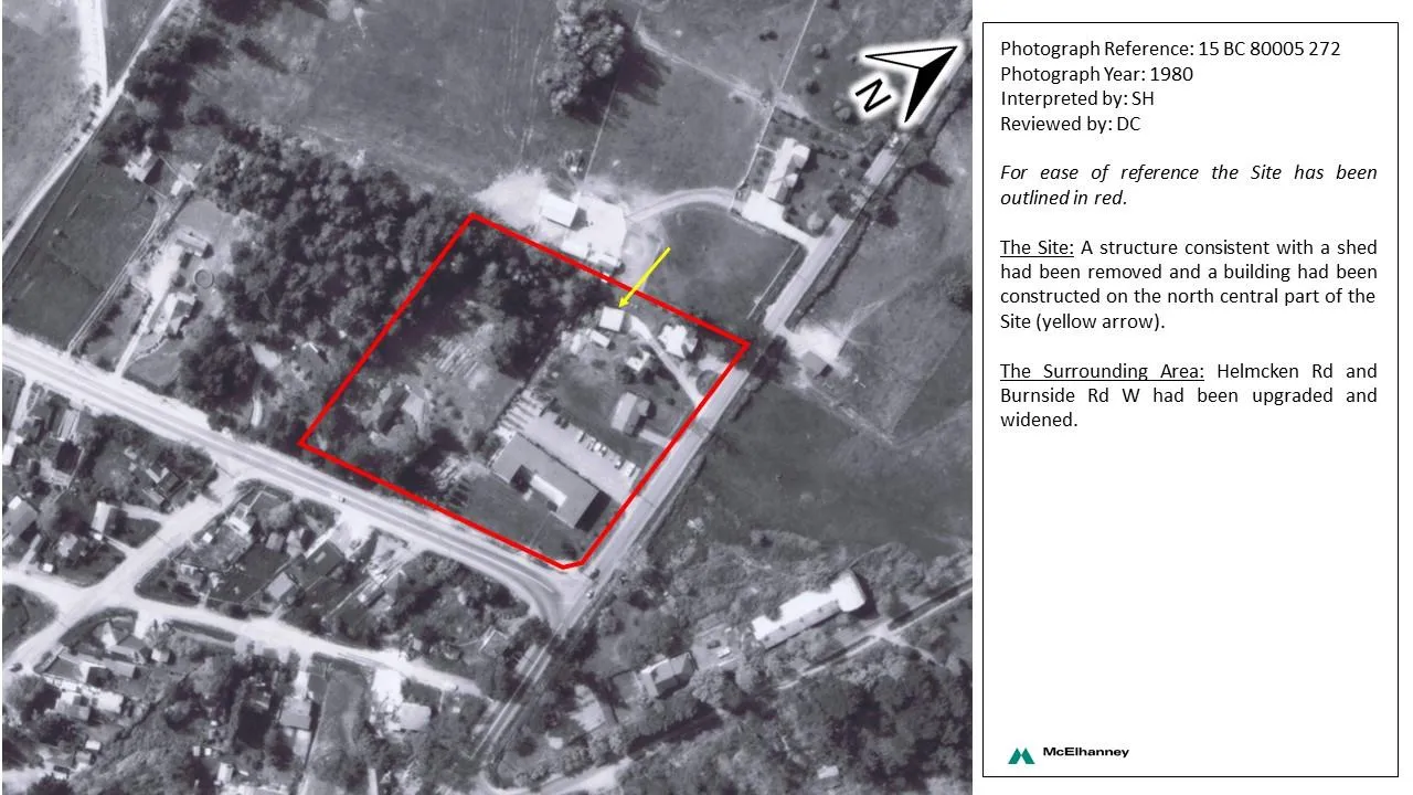
- Photograph Reference: 15 BC 80005 272
- Photograph Year: 1980
- Interpreted by: SH
- Reviewed by: DC
For ease of reference the Site has been outlined in red.
The Site: A structure consistent with a shed had been removed and a building had been constructed on the north central part of the Site (yellow arrow).
The Surrounding Area: Helmcken Rd and Burnside Rd W had been upgraded and widened.
1986 Aerial Photograph
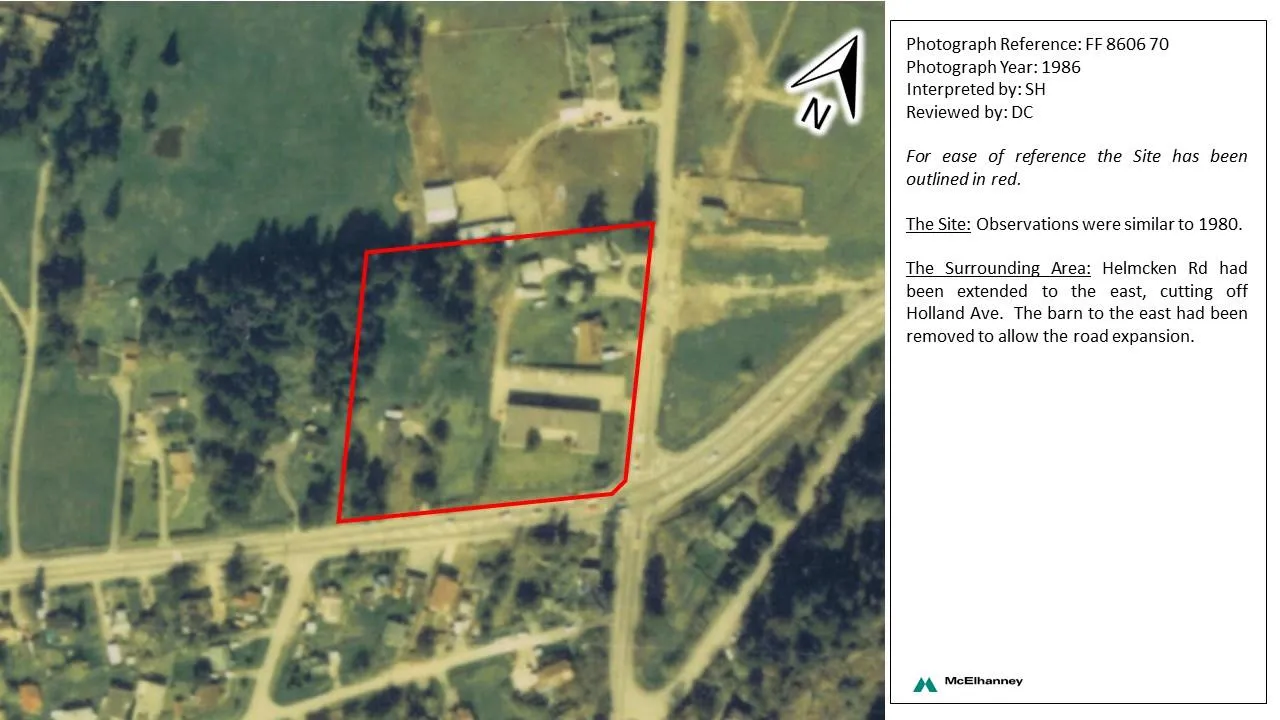
- Photograph Reference: FF 8606 70
- Photograph Year: 1986
- Interpreted by: SH
- Reviewed by: DC
For ease of reference the Site has been outlined in red.
The Site: Observations were similar to 1980.
The Surrounding Area: Helmcken Rd had been extended to the east, cutting off Holland Ave. The barn to the east had been removed to allow the road expansion.
1997 Aerial Photograph
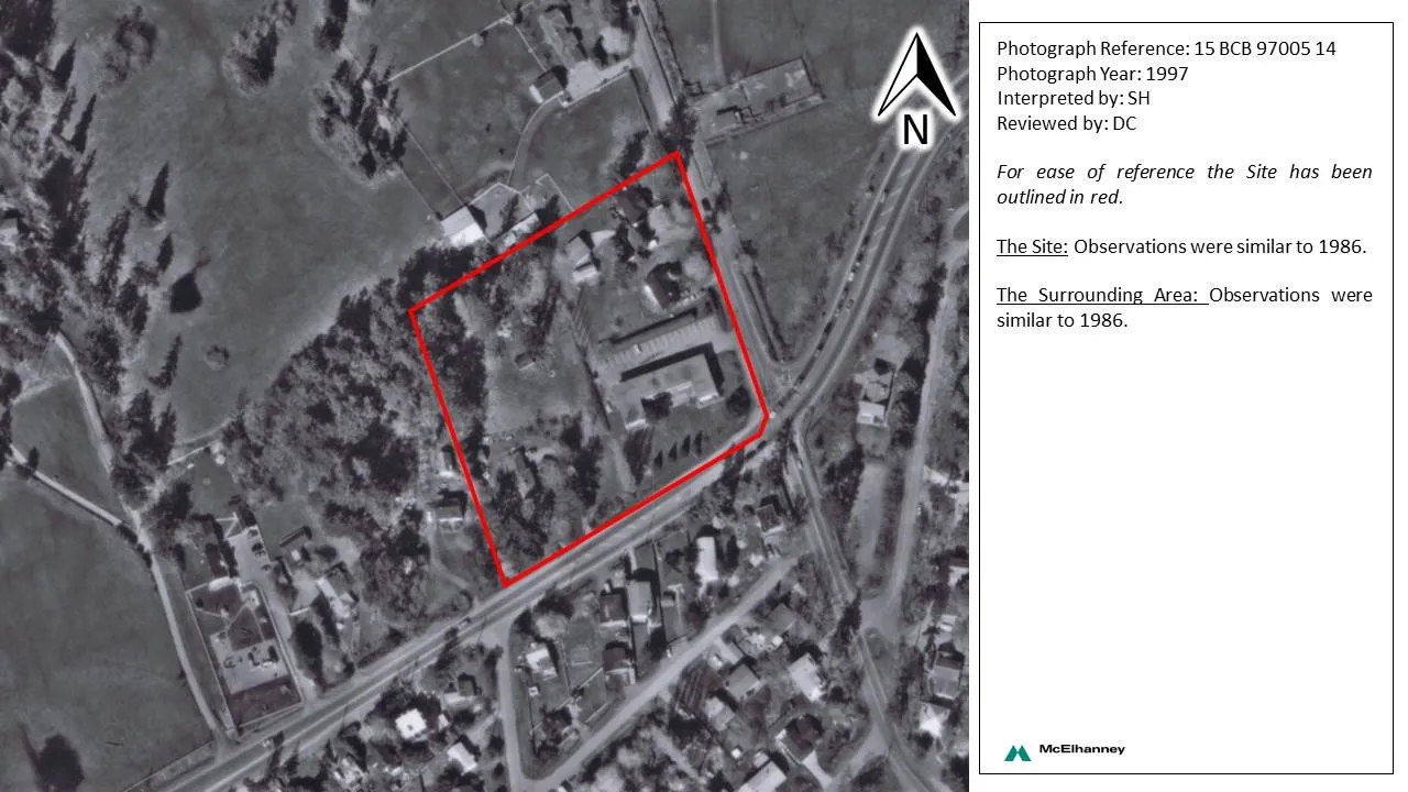
- Photograph Reference: 15 BCB 97005 14
- Photograph Year: 1997
- Interpreted by: SH
- Reviewed by: DC
For ease of reference the Site has been outlined in red.
The Site: Observations were similar to 1986.
The Surrounding Area: Observations were similar to 1986.
2005 Aerial Photograph
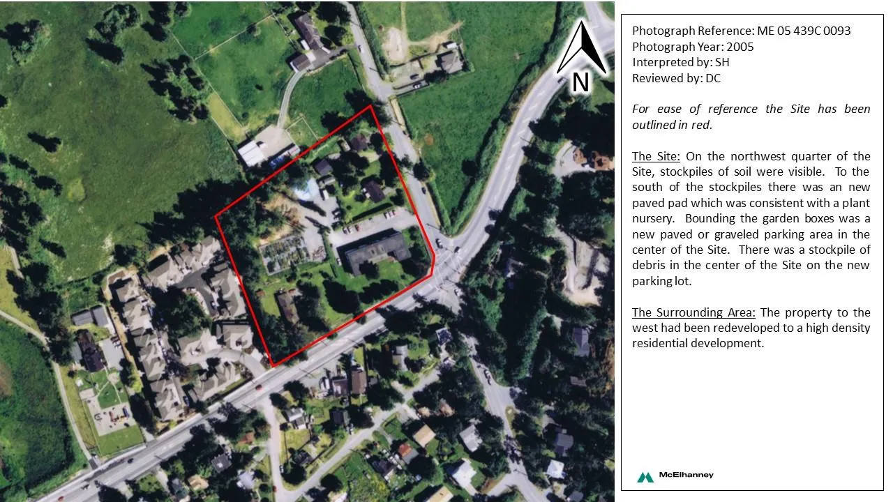
- Photograph Reference: ME 05 439C 0093
- Photograph Year: 2005
- Interpreted by: SH
- Reviewed by: DC
For ease of reference the Site has been outlined in red.
The Site: On the northwest quarter of the Site, stockpiles of soil were visible. To the south of the stockpiles there was an new paved pad which was consistent with a plant nursery. Bounding the garden boxes was a new paved or graveled parking area in the center of the Site. There was a stockpile of debris in the center of the Site on the new parking lot.
The Surrounding Area: The property to the west had been redeveloped to a high density residential development.
2010 Google Earth Image
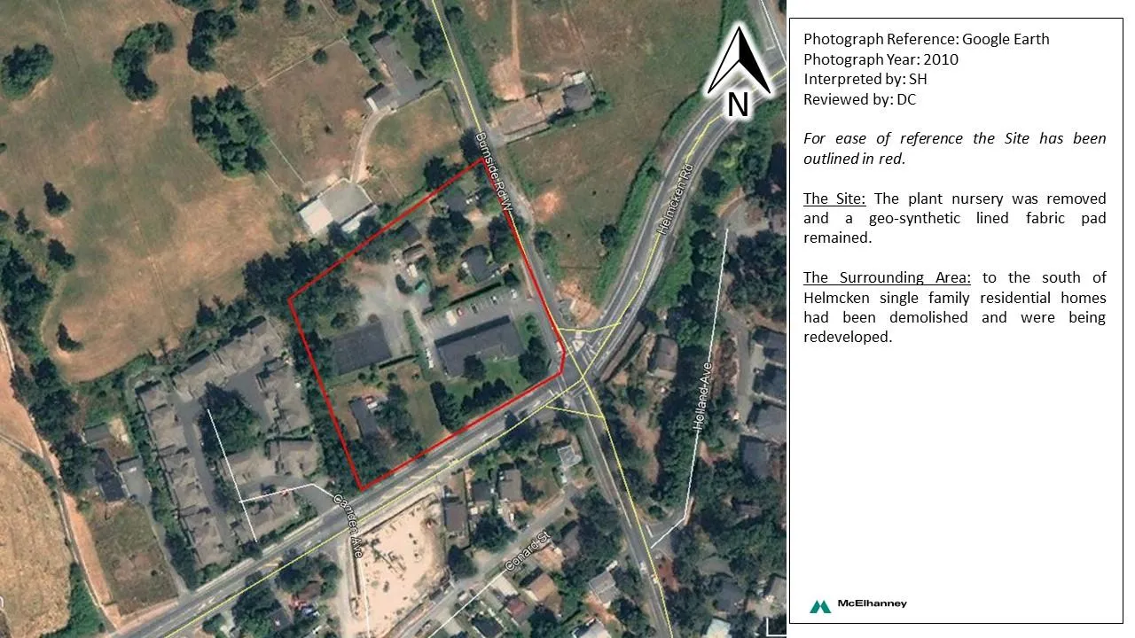
- Photograph Reference: Google Earth
- Photograph Year: 2010
- Interpreted by: SH
- Reviewed by: DC
For ease of reference the Site has been outlined in red.
The Site: The plant nursery was removed and a geo-synthetic lined fabric pad remained.
The Surrounding Area: to the south of Helmcken single family residential homes had been demolished and were being redeveloped.
2014 Google Earth Image
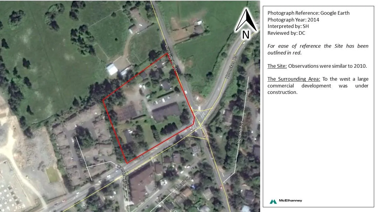
- Photograph Reference: Google Earth
- Photograph Year: 2014
- Interpreted by: SH
- Reviewed by: DC
For ease of reference the Site has been outlined in red.
The Site: Observations were similar to 2010.
The Surrounding Area: To the west a large commercial development was under construction.
2017 Google Earth Image
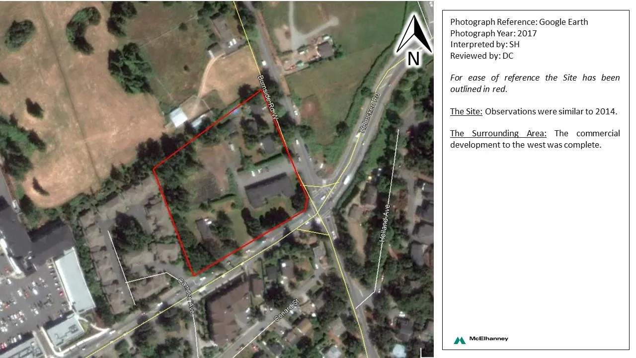
- Photograph Reference: Google Earth
- Photograph Year: 2017
- Interpreted by: SH
- Reviewed by: DC
For ease of reference the Site has been outlined in red.
The Site: Observations were similar to 2014.
The Surrounding Area: The commercial development to the west was complete.