Appendix
Attachment 3: Topographic Survey - 2401 Burnside Road West
March 13, 2018Pages 104–1051 section
Detailed survey plans showing the existing topography, property lines, and statutory rights-of-way for the Burnside Road site.
Date of Field Survey: September 5, 2017Identifies BC Hydro transmission line and CRD water main rights-of-way
BC TRANSIT HANDY DART FACILITY
Burnside Road West Legal Base Plan
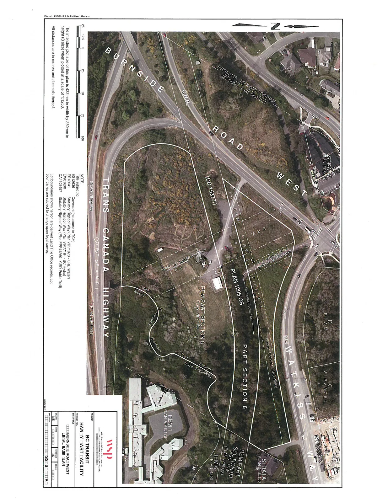
NOTE Title subject to:
- ES12636: Covenant (no access to TCH)
- ES12641: Statutory Right of Way (Plan VIP71973 - CRD Water)
- EW81608: Statutory Right of Way (Plan VIP77164 - BC Hydro)
- CA4330457: Statutory Right of Way (Plan EPP44260 - CRD Public Trail)
Lot boundaries shown hereon are derived from Land Title Office records. Lot boundaries are subject to change upon legal survey.
Burnside Road West Topographic Survey
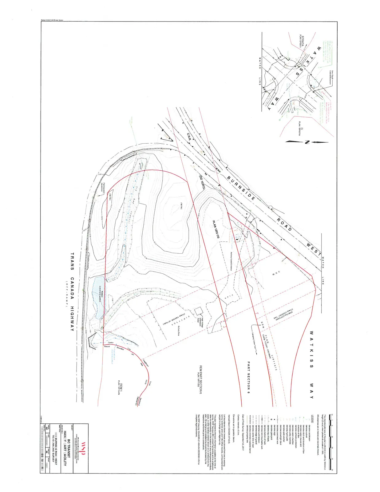
Legend
- denotes catch basin
- denotes culvert
- denotes spot elevation and direction of flow
- denotes water valve/meter
- denotes water course and direction of flow
- denotes cathodic protection
- denotes utility junction
- denotes hydro/utility pole
- denotes anchor
- denotes luminaire
- denotes streetlight/utility pole
- denotes gas valve/meter
- denotes overhead wire
- denotes sign
- denotes tree
- denotes bottom of bank
- denotes top of bank
- denotes legal boundary
- denotes non-mountable curb
- denotes mountable curb
- denotes edge of gravel
- denotes asphalt edge
- denotes concrete roadside barrier
- denotes property line
Notes
- Date of Field Survey: September 5-6, 2017
- Contour interval = 0.5 m.
- Elevations are in geodetic meters.
- Vertical Datum: CGVD28 (HTv2.0).
- Lot boundaries shown hereon are derived from Land Title records and are not the result of a field survey.
- This plan represents the best information available at the time of survey. WSP Surveys (BC) Limited Partnership and its employees accept no responsibility for errors, omissions, or inaccuracies on this plan, or other liabilities arising from the use of information from this plan. All underground installations should be located by the respective authorities prior to construction.
- See WSP drawing 161-00385-21-300-DS-SUR0301-R0 for complete legal information.
Page 104–105
Extracted from: 2018 03 13 Committee of the Whole Agenda - Agenda - Pdf