Intertidal and Sub-tidal Habitat Assessment of View Royal Emergency Rescue Boat Launch Proposal – Shoreline Road Site – July 2016
Technical environmental assessment of the proposed Shoreline Road boat launch site, identifying key species like Olympia oysters and Littleneck clams.
Intertidal and Sub-tidal Habitat Assessment of View Royal Emergency Rescue Boat Launch Proposal
Shoreline Road Site
July 2016
On May 10, 2016 Tracy Motyer from Aqua-Tex Scientific Consulting and Steve Voller from Seamount Consulting conducted an assessment of the intertidal and sub-tidal habitat of the Portage Inlet at the end of a Municipal right-of-way located between 2771 and 2775 Shoreline Drive in View Royal, BC (see Figures 1&2). The purpose of the assessment was to determine the feasibility of constructing a boat launching ramp for the View Royal Fire Department Emergency Rescue crew to use to launch their rescue inflatable boat. Currently, View Royal Fire Department launches from other locations in Portage Inlet with informal boat launching facilities which can lead to a delayed response time to certain parts of Portage Inlet. In emergency rescue situations, particularly in marine situations, lost minutes of response time can literally be the difference between “life or death”. The boat ramp would only be used by vehicular traffic when the Emergency Rescue team is training or responding to an emergency. A bollard will be put in place and locked to prevent use by the general public for launching boats. Students from Shoreline school, located across the road from the site, may use the ramp to launch kayaks and canoes as part of their outdoor recreation curriculum.
On the date of our visit, the weather was sunny with calm winds and water surface. The tide was dropping from a high of 1.1 meters at 05:28 to a low of 0.1 meters at 16:35. Tidal amplitude for Portage Inlet, at a tidal station located at a point approximately 900 meters south-east (48.450° N -123.41670° West) from the proposed boat ramp is approximately 1.33 meters. A resident of the home immediately to the south of proposed boat ramp reports that on the highest tide, the water level reaches a point just over the top of her 1.25 m seawall, which would be approximately 1.8 meters above chart datum according to our observations. This may be a result of high freshwater input from local streams filling the basin more than the constriction at Craigflower Road bridge crossing (300 meters down the inlet) can handle, or the distance from this point to the tidal station where levels are recorded or a mixture of both factors. The constriction at Tillicum bridge (approximately 2 km down the inlet) is responsible for separating the diurnal tidal pattern at this site from the mixed semi-diurnal tidal pattern experienced in open marine waters off the coast of British Columbia.
We began a visual assessment of the site at approximately 09:00 hours, including an offshore assessment by rowboat during the higher tidal elevation and followed the tide down to conduct some quadrat assessments of the intertidal substrate.
Foreshore Habitat
The foreshore in this area has been extensively modified over the years, predominantly for residential housing. Most of the shoreline in the immediate area and over much of the Gorge Waterway has been fortified against erosion with the construction of vertical concrete sea-walls. Sea-walls to a height of approximately 1.25 meters are present on the lots bordering either side of the right of way where the boat launch is proposed (see Figure 3).
The right-of-way is composed of mowed grass from Shoreline Road to the high tide line. From the high tide line down to the inter-tidal beach is a 6.5-meter wide boulder rip-rap slope of approximately 39% gradient for 2.8 meters onto a gently sloping (4%) mud beach. Clumps of sea asparagus (Salicornia virginica) are present within the spaces between this rip rap, totaling 7 square meters (see Figure 4). A length of green wire chain-link fencing has collapsed and was covering the sea asparagus and trapped eel-grass (Zostera marina) fronds and debris, obscuring the sea asparagus. We removed the fencing to allow the sea asparagus to grow.
Two of the sea-walls located to the south-east of the right-of-way are showing signs of undermining and it appears that small boulders and large cobble sized rock has been placed in the gap beneath the walls to protect from further undermining and large drain rock has been put down on the beach to prevent further beach erosion (see Figures 5&6).
A lot located three lots to the north west of the proposed boat ramp does not have a sea-wall in place (see Figure 7) and the lower elevation of the shoreline slope is densely vegetated in sea asparagus and the upper elevation is covered in a mix of rushes (Juncus spp.) and Lyngby’s sedge (Carex lyngbyei).
Intertidal Zone.
The intertidal zone is represented by a gently sloping (2-4% gradient) substrate that extends approximately 11 meters out from the sea-wall to the level representing chart datum. Figure 3 shows the location of the proposed boat ramp with a tidal level at very close to chart datum. We placed a one square meter quadrat at four locations in the vicinity of the location of the proposed boat ramp. The first two were spaced 5.4 and 8.4 meters from shore (the sea-wall) and the substrate was excavated with a shovel and invertebrates (mostly bivalves) were observed and counted. The third was located in the sub-tidal side of chart datum (which is located at 11 meters from shore), at a point approximately 13 meters from shore. As this quadrat was inundated with 10 cm of water, we did not attempt to excavate here as it would have been constantly caving in from the sides and turbid water would have reduced visibility to near zero. At this quadrat, and another located near the end of the dock to the south west (23 meters from shore) we just made visual observations and estimated invertebrate abundance.
The intertidal zone is composed of a thin layer of fine mud (see Figure 8) covering a 5-10 cm deep layer of muddy gravel, followed by a dense blue clay (see Figures 9, 10 and 11). The gravel layer increased to approximately 20cm in quadrat 2, located approximately 7.4 meters from the sea-wall and was, again, underlain by dense blue clay (see Figure 12 and 13). Numerous clam shells and a few cobble-sized rocks are scattered along the intertidal zone. In addition to the cobbles, boulders and gravel placed at the base of the sea-walls to the south-east, a pile of boulders and concrete rubble is present at the base of a sea-wall located to the north west, presumably to reduce erosion and undermining here, also (see Figure 14).
Quadrat 1
This quadrat was located 5.4 meters from shore, within the path of the proposed boat ramp. As mentioned, the substrate was a thin layer of mud over approximately 10-20 cm of muddy gravel. Sorting through the gravel, we located 6 Pacific Littleneck clams (Protothaca staminea) within the gravel layer (see Figure 15). Some polychaetes and nemerteans were also present in the gravel. The dense blue clay was mostly barren, but a few burrows up to approximately 5-10 mm in diameter were present, likely made by the polychaetes and nemerteans. We did not dig into the blue clay layer as it would have broken in distinct chunks and would have destroyed any organisms present that were straddling the fracture line between chunks. After the clams were counted, they were scattered within the quadrat and the gravel that had been excavated was used to cover them again.
Quadrat 2
This quadrat was located approximately 7.4 meters from shore and was also in the path of the proposed boat ramp. At the time of the survey for this quadrat, the water level was approximately 1 meter offshore from the quadrat. Substrate composition was similar to that of quadrat 1 with a thin layer of fine mud over gravel that was shallower here, at approximately 5-10 cm, then again down to dense blue clay (see Figures 12 & 13).
This quadrat produced a larger number of Littleneck clams, with a total of 189 individuals being counted despite the gravel layer ranging from approximately 25-50% of the depth of that present in quadrat 1. The more prolonged tidal inundation at quadrat 2 is likely the main factor in the marked increase in numbers of clams found in quadrat 2 as compared to quadrat 1. Some polychaetes and nemerteans were also present in the gravel and similar burrows to those in quadrat 1 were present down into the dense blue clay layer. Again, we did not dig down into the clay layer.
Quadrat 3.
This quadrat was located approximately 11 meters from shore, on the water side of the tidal interface at a time of 14:49 when the tide was approximately 0.15 meters above chart datum. Water depth just barely covered the quadrat, estimated at 5 cm deep at the time of the survey and corresponds approximately with chart datum (see Figure 16). Due to tidal inundation and the fact that excavation of the quadrat would likely result in caving in of the sides, we did not dig out this quadrat but made visual observations.
We estimated approximately 200 small burrows in the substrate which appear to be clam burrows. We also observed 3 broken back shrimp (Heptocarpus spp.) We weren’t aware of it at the time of the survey as we had not developed a “search image” for the presence of Olympia oysters (Ostria conchaphila) but subsequent viewing of Figure 16 shows approximately 10 Olympia oysters buried in the substrate with just the tips of their shells showing. Just outside of the quadrat was a cobble approximately 5cm x 10cm that had 3 Ostria conchaphila attached to it (see Figure 17). Numerous other cobble sized rocks in the vicinity also had Olympia oysters attached. The Olympia oyster is listed as a Species of Special concern under the Species at Risk Act.
Sub-tidal zone.
Our initial intent was to swim the sub-tidal are off the boat ramp with dry suit and snorkel to record the substrate and flora and fauna in this area. However, the tide was so low and the slope so gentle for such a long distance that water depth would have been less than 1 meter and, with any disturbance from snorkeling, the fine mud substrate would be stirred up rendering visibility to next to nil. We opted, instead, for a review of this habitat by row boat.
The fine mud substrate persisted for approximately 80 meters before we encountered a dense eel-grass meadow located in approximately 2-3 meters of water. We were obviously unable to excavate below this mud layer, but I would assume that the gravel overlaying blue clay will also be present here.
Quadrat 4
This quadrat was located 12.7 meters from shore, at an estimated tidal level of 0.06 meters below chart datum (see Figure 18). Having observed a number of oysters mostly buried in the substrate, we had by now developed a search image for what we were looking for in locating Olympia oysters in the substrate (see Figure 19) and were able to estimate approximately 30 Olympia oysters in the quadrat. Approximately 5 burrows (possibly clams) were present in the quadrat.
Quadrat 5
This quadrat was located parallel to the end of dock to north, approximately 23 meters from shore (see Figure 20). Due to glare, a close-up picture was not a useful illustration. Olympia oyster density had diminished here to 10 within the quadrat. Only 2 burrows (likely clams) were present here.
Quadrat 6
This quadrat was located between the float and the last piling of the north dock (approximately 20m from shore). Again, due to glare, photo imagery was not useful. Within this quadrat, 25 Olympia oysters were present. No clam burrows were noted.
In summary, Ostria conchaphila began to be visible at a point 11 meters from shore at densities estimated at 10 individuals per square meter. Between 14 meters from shore and 20 meters from shore, the density of Olympia oysters increased to 25-30 individuals per square meter, almost entirely buried in the mud. At a point 23 meters from shore, they were present in densities of 10 individuals per square meter and tapered off to none at 25 meters from shore.
While rowing around in the boat in the vicinity of the proposed boat ramp, we observed that any structure offering vertical relief from the substrate further out than the 25-meter distance from shore did support the oysters, including logs and a section of tire that seems to have broken off from someone’s dock (see Figure 21).
Within the lower intertidal zone and upper sub-tidal zone in the vicinity, we found Olympia oysters attached to everything from sticks, beer cans, a section of aluminum roofing (1 meter by 20 cm approximately) with about 50 Olympia oysters attached (see Figure 22) and one medium sized clamshell had 18 Olympia oysters attached to it (see Figure 23). Oysters that appeared to be free-living in the mud, on closer inspection, were attached to small pieces of rock or shell which they evidently settled upon and grew around as they grew larger. Olympia oysters were also present on the concrete footings of docks in the lower intertidal and upper sub-tidal zone (see Figure 24).
The Littleneck Clams were sparse at 5.7 meters from shore (6/m²) and at their highest density from 7 meters to 12 meters from shore (approximately 200/m²). It is unclear as to why the Littleneck clams tapered off sub-tidally as we observed no sea-stars that would predate upon them.
Trans-Canada Highway Site
Having found the Olympia oysters at the Shoreline Road site, we performed a cursory inspection of an alternate site, located off of St. Giles Street at the head of the inlet (see Figure 1). The site was less favorable from an emergency response point of view as access to the boat ramp for emergency response would be hindered in the traffic congestion locally referred to as the “Colwood Crawl”. Considerable work would also be required to construct an access lane off of Highway # 1 to provide access with the boat and trailer as there is currently a concrete barrier in place at this location.
What appeared to be a small bedrock promontory on satellite photo imagery turned out to be rock rip-rap placed for an unknown purpose on the foreshore (see Figure 25) that was situated beside a very gently sloping mud intertidal and sub-tidal zone (see Figures 26). Olympia oysters were present in the same densities on any hard surface (see Figures 26-28) and within the mud as were present at the Shoreline Road site, so potential location of the boat ramp here would present the same ecological challenges as well as logistical challenges for emergency response personnel.
Boat and trailer description
The boat that is used for emergency rescue is a 4.8-meter long inflatable with an outboard motor, towed on a trailer (see Figures 29 and 30) by a 4 wheel drive, one-ton truck. The boat will float, without the motor tilted down, in approximately 30 cm of water. With the motor fully tilted down, the boat draws approximately 60 cm of water. The boat can be run for short distances and slowly with the motor partially tilted in approximately 50 cm of water. The depth required from the bottom of the trailer tires to a point that will float the boat off the trailer is slightly less than a meter. The length from the rear wheels of the truck to the rear of the trailer is 7.2 meters.
Ramp design
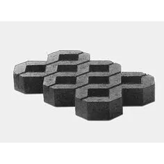
To minimize vertical intrusion into the water column that may alter longshore drift and also to obviate the need for a wider road prism that a raised road surface would require, we have opted for the use of concrete “grass pave” blocks, laid down in an excavated (50 cm deep) swath (see Figure 40). The excavated swath will be lined with geotextile fabric before placement of the pavers (see Figure 31), which will sit nearly flush with the surrounding substrate surface. The spaces within the grass pavers will be filled with 1” minus crushed limestone to a depth level with the top surface of the pavers. The crushed limestone will further dissipate the weight of the truck, provide traction for the vehicle, and will also provide an attachment substrate for Olympia oysters within the depth range that they prefer. Obviously, some encrusting organisms such as the Olympia oysters will be crushed during boat launching activities, however, the area outside of the wheel tracks should remain relatively undisturbed and will provide some long term habitat. For habitat impact assessment purposes, we are counting the entire surface as lost habitat. The width of the driving surface will be 5.5 meters.
As the inter-tidal and sub-tidal zone at this site is very gently sloping, adequate depth to float the boat (30 cm) at an extreme low tide is not present until 23 meters from shore (at a depth of 38 cm below chart datum) and the depth to launch it off of the trailer (just less than a meter) is not present for considerably further than that (See Figures 32, 33 and 40). In order to minimize the ecological impact of building an elevated ramp from the 1.25-meter high seawall to the level of the mud beach, we intend to excavate the foreshore from the elevation of the beach back some 6-10 meters into the right-of-way (see Figures 31, 32 and 39). This would obviate the need to construct a 6.5-meter ramp as well as the sloping sides out onto the natural beach habitat that would be required to provide stability of such a ramp, reducing ecological impact. A rock retaining wall lining either side of the ramp on the foreshore portion will prevent the sides from sloughing in (see Figure 38).
In order to avoid construction of a driving surface some 30 meters or more from shore to attain sufficient depth to launch the boat, we propose to construct a 5.5 meters wide driving surface (as described above) at the present slope of the beach to a distance approximately 8 meters from shore (present elevation 0.1 meters above chart datum). We then propose to excavate a basin to a depth of approximately 1 meter below chart datum and slope the shoreward side at a 6:1 slope and continue the driving surface along this to provide a track for the trailer to provide a steep enough angle of attack to float the boat off the trailer (see Figures 33 and 35). The offshore end of this slope will be located 14 meters from shore. The basin would be wide enough (5.5 meters full excavation) plus 1:1 sloping sides (an additional 1.5 meters either side) to turn the boat around in preparation to exit the basin. The basin would be fully excavated to a point located 18 meters from shore where a 1:1 slope will taper to a shallow excavated slope to provide the 50cm depth required to run the motor partially tilted, until natural substrate is reached at 23 meters from shore.
Excavation of as much of the ramp path as possible will be conducted at low tides. The small sub-tidal excavation will be conducted at low tide also and sediment fencing will be deployed around the site during construction and removed after the majority of the sediment has settled.
Machinery will be in good working condition with no visible fuel, hydraulic or lubrication leaks and a spill kit will be on-site. All work will be overseen by an environmental monitor.
Habitat impacts
Sea asparagus.
At the foreshore/inter-tidal interface (artificially truncated here due to the presence of the sea-walls), the spaces between the rock comprising the rip-rap slope is currently home to approximately 7 square meters of sea asparagus, which is frequently present in salt-marsh and upper intertidal plant communities. This clump of sea asparagus would be removed to construct the boat ramp. This plant provides cover for invertebrates that would be food items at higher tides for fish such as juvenile herring as well as coho salmon and cutthroat trout (both adult and juvenile for both these salmonids) from nearby Colquitz River and Craigflower Creek. This plant is also grazed upon by wildfowl such as ducks, geese, trumpeter and mute swans (2 of which we saw on our visit, see Figure 36). As mentioned earlier in this report, much of Portage Inlet’s foreshore has been converted from natural shoreline to vertical concrete sea-walls. This practice very likely would have obliterated large areas of valuable saltmarsh communities including sea asparagus.
Upper Inter-tidal area
The driving surface for the truck and trailer will be 5.5 meters wide. As mentioned earlier in this report, preparation for this driving surface would entail excavation to a depth of 50 centimeters, placement of geotextile fabric, placing the grass pave blocks in place and adding the limestone crush into the spaces in the pavers. This would destroy the present high intertidal muddy sand over blue clay substrate to the detriment of organisms using this habitat. Littleneck clams were sparse until 7 meters from shore. This habitat type is very abundant in the area, so loss of an area 7 meters long by 5.5 meters wide (38.5 m²) will not have significant impacts on the CRA fishery resource.
Lower Intertidal area
The lower intertidal area offers higher value habitat as the tidal inundation is for a longer duration and will be thus exposed to longer periods of foraging by fish and invertebrates. This is also where the highest densities of Littleneck clams were present, at approximately 200 individuals per m². Although this area is closed for clam harvesting due to pollution, the larvae that these densities of clams produce, that are then available for food for other species that are present in CRA fisheries (herring larvae/juveniles and juvenile salmonids, for instance) does make this resource of some value. The excavation of the muddy sand overlaying the blue clay will remove the habitat used by these clams so this habitat will be permanently lost. The clams were present from a distance of 7 meters to 11 meters from shore, or a length of 4 meters. This, multiplied by the width of 5.5 meters yields an area of 22.5 m² of high value habitat for this species that will be permanently lost. A few cobble sized rocks exposed at low tide in this area did support some Olympia oysters (Ostria conchaphila) which is listed as a species of special concern under Federal Species at Risk (SARA) legislation.
Sub-tidal area
We determined from observing tidal elevations relative to tide tables that chart datum was located at approximately 11 meters from shore. Littleneck clams were, as mentioned above, present in high densities in the lower intertidal area and to approximately 12 meters from shore, or about 1-meter into the sub-tidal zone.
It was at the inter-tidal/sub-tidal interface that Olympia oysters became most numerous at a density of approximately 30/m² within the soft mud substrate. These oysters were found to be attached, for the most part, to small hard particles that they had settled upon and then “outgrew” and became anchored by the surrounding mud with just the tips of their valves protruding.
Approximately 77 m² of this habitat will be excavated for preparing the base of the proposed driving surface and to create a basin to obtain sufficient depth to launch the boat and link the basin with existing depth below chart datum to float the boat out of the basin. Of this total, 38 m² will remain within the depth range that Olympia oysters were observed in so will not be lost permanently. This leaves 49 m² of permanently altered habitat for Olympia oysters.
Explanation of offsetting table
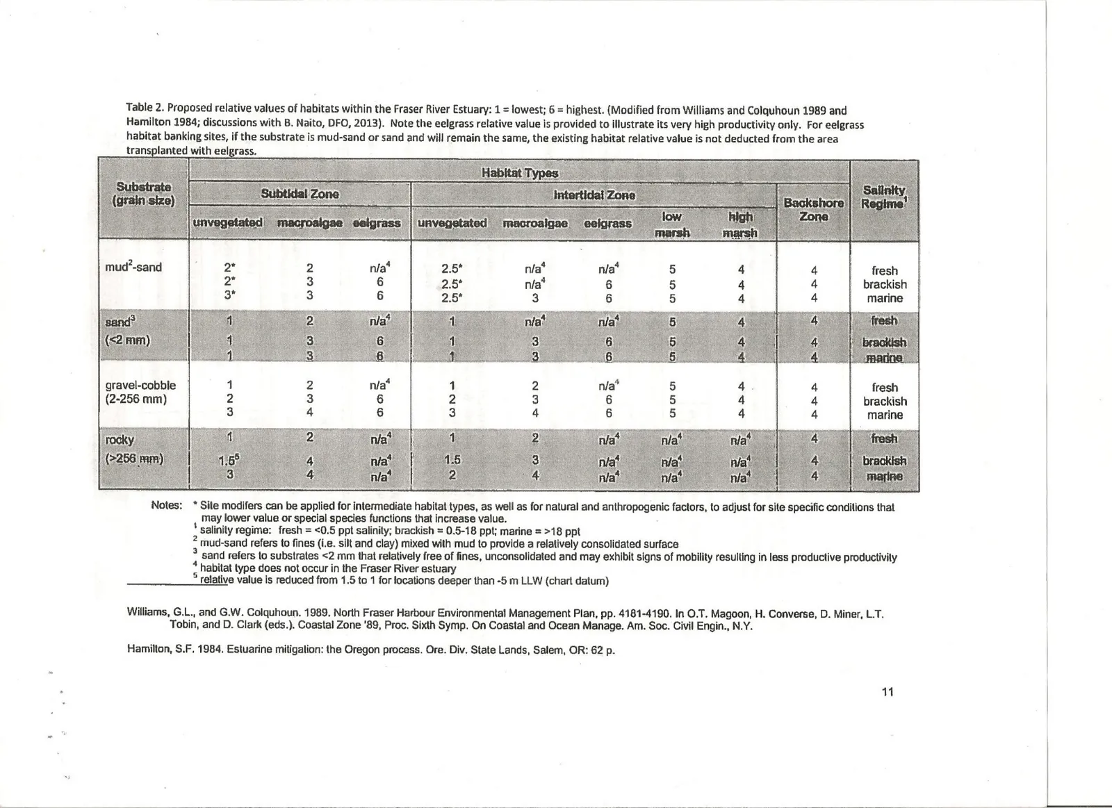
Table 1 is an attempt at presenting a simple, transparent table that shows, step-by step, the relative values of the various habitat types that are either being impacted or created, and how they relate to each other in application of a habitat balance sheet. The table provides the area in square meters of habitat impacted and applies a factor based on relative habitat value in column 4 (from Williams, G. L. and G.W. Colquhoun. 1989.) and compares it with the relative value of the proposed offsetting habitat (column 6) as a ratio, multiplied by the area impacted (in square meters) to give a corrected area target (column 7). Then a factor for uncertainty is applied that yields an area in square meters that is required to be added to the initial offsetting target. The time lag factor is also applied to the initial offsetting target to yield an area (in square meters) to account for time lag. The additional areas for uncertainty and time lag are then added to the initial offsetting target area to obtain the total offsetting area required. The process is followed for each habitat type until a balance remaining is injected into the start of the final line (column 3) and that habitat is accounted for and a final balance is arrived at.
Explanation of areas provided for habitat types in impacts and offsetting calculations in the offsetting table
Item 1 (saltmarsh)
This is the 7 m² patch of sea asparagus that is growing within the rip-rap slope currently occupying the space between the seawalls where the boat ramp is proposed. Offsetting for this clump of sea asparagus will be via a 30x2 meter (60m²) saltmarsh terrace proposed to be constructed at the base of the seawall located immediately to the north of the proposed boat ramp (see Figure 41). A row of rocks approximately 30-40 cm diameter will be placed approximately 2 meters out from the seawall on the properties either side of the proposed boat ramp, which would be in the tidal elevation in which Fucus grows as evidenced by the presence of this algae on the base of nearby seawalls (see Figures 5 and 6). This will place the elevation of the terrace at the same elevation as the sea asparagus was found to be growing within in surrounding areas. The space between the row of rock and the seawall will be filled with material excavated from the basin to provide suitable substrate for sea asparagus and other saltmarsh species. Some gravel will be brought in to top it with to minimize sediment release at high tides. The terrace will slope down matching the gradient of the surrounding beach to facilitate drainage and provide a slight elevational difference which may accommodate different plant communities. The sea asparagus (7 m²) that is presently growing within the rip-rap slope in the path of the proposed boat ramp will be salvaged and distributed throughout the two saltmarsh terraces. Additional sea asparagus plants will be purchased for planting. The offsetting area is greater than the impact so a net gain is realized for this habitat component.
As mentioned earlier in this report, the construction of seawalls in a large number of properties bordering Portage Inlet and the Gorge Waterway has likely resulted in the loss of vast areas of saltmarsh habitat, to the detriment of fish and wildlife using this area. The creation of this high value, rare habitat in place of lower value, plentiful mudflat will provide a net benefit to the ecology of the area.
Item 2 (upper intertidal mudflat)
This is the high intertidal mudflat that will be covered by the driving surface from the seawall out to a distance of 7 meters from shore (less the 7 m² of sea asparagus). The outer edge of this area marks the inner boundary of the zone where Littleneck clams were present, meaning this species was present on the outside of this zone, and not within. Substrate is muddy gravel over blue clay. No vegetation was present and no burrows or surface adhering invertebrates were observable to the naked eye. Area is arrived at by multiplying the distance from the seawall to the outer edge of the habitat type (7 meters) by the width of the driving surface (5.5 meters) subtracting the 7 m² of sea asparagus, yielding 31 m² of impacted area. Most of the upper intertidal area of Portage Inlet and the connected Gorge waterway is comprised of gently sloping mudflats, so loss of this small area will not offer significant impact to CRA fisheries species. This area of impact will be offset by the creation of a similar saltmarsh terrace to that mentioned above, but located on the south of the proposed boat ramp. The offsetting area is greater than the impact so a net gain is realized for this habitat component.
Item 3 Lower intertidal area
This zone extends from a point located 7 meters from shore out to 11 meters from shore (approximately chart datum). This zone will be covered with the 5.5 meter-wide driving surface, which will permanently destroy this habitat This zone was found to support littleneck clams in densities to approximately 180-200 individuals per square meter. The 4 lineal meters that encompass this zone, multiplied by the 5.5-meter width of the driving surface yields an impact area of 22.5 square meters. Multiply this by 200 clams/m² and this will impact approximately 4500 clams. These clams will be raked and relocated into the basin described in item 4, below.
Item 4 Upper subtidal area (deep excavation).
This zone extends from the 11-meter from shore mark (chart datum) out to a point approximately 19 meters from shore and encompasses approximately 51.5 m². This zone was found to support Olympia oysters to a density of roughly 30/m². This zone will be excavated deeper to provide a steep slope for launching the boat and a deeper basin for maneuvering the boat in preparation for departure. Of the 51.5 m², 16.5 m² will be permanently impacted by the driving surface.
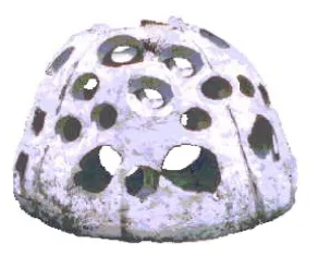
The remaining 35 m² of the basin will be excavated to approximately 1 meter below its present depth. For some reason, the Olympia oysters were not found beyond a point 25 meters from shore, possibly due to increased depth for whatever reason. As such, we are assuming that the depth of the basin will preclude their survival and future settlement. Rather than “reinventing the wheel” with regards to salvaging the Olympia oysters and designing and implementing the offsetting habitat for this species, we chose to enlist the assistance of Joachim Carolsfeld from the World Fisheries Trust. This organization has been involved in salvage and relocation of Olympia oysters, notably from the Craigflower bridge replacement wherein a large number of this species were removed from the bridge pilings and relocated onto reefs constructed of piled up Japanese oyster (Crassostria gigas) shells. Relocating the salvaged oysters in this instance met with limited success, and the newly created oyster shell reefs tended to accumulate fine sediment and smothered the Olympia oyster. We will salvage the Olympia oysters by gently raking the surface substrate that they are located within and place them in totes to be relocated to some existing Japanese oyster shell reefs which World Fisheries Trust have constructed at Christie Point (within a kilometer of the proposed boat launch ramp). It is our opinion that efforts to re-introduce this species in areas where their numbers are struggling would be more beneficial than increasing the number of this species within an area that is already densely populated with them as Portage Inlet is. With approximately 51.5 m² of Olympia oysters at a density of 30/ m² this component of the construction would result in the destruction of 1596 Olympia oysters, but they will be relocated and their survival monitored as per World Fisheries Trust schedule. Following, in italics, is the rationale of World Fisheries Trust for re-locating a series of concrete structures called reefballs (see Figure 42). These are semi-spherical hollow structures composed of concrete with numerous holes in them which allow access for marine organisms to both the outside and the inside of the structure. The reefballs will be have been allowed to be colonized by Olympia oysters from Portage Inlet to other locations that are sparsely populated with Olympia oysters. In the habitat offsetting table, the mudflat habitat within the path of the proposed boat ramp has been given a relative value of 2.5 whereas the reefballs have been given a value of 4, or a ratio of 1.6:1 for comparative purposes. In reality, World Fisheries Trust estimates densities of up to 300 individuals per square meter, or 10 times the density that we observed in the mudflat habitat at the site. So strictly from the perspective of offsetting for Olympia oysters, the relative value of a hard surface like reefballs would be more like 25 vs the mudflat habitat’s relative value. However, other species use the mudflat also, so we have retained the relative habitat value of the reefballs at 4.
The deep excavated basin that will not comprise driving surface will total 35 m². We will distribute sandy gravel to a depth of approximately 10 cm in the bottom of this basin to provide substrate for littleneck clams to be relocated to.
Habitat Compensation Using Native Oyster Reef Balls
For: Aqua-Tex Consulting Ltd.
World Fisheries Trust has been a leader in Olympia Oysters research and restoration for over a decade through regular water sampling, adult and larval surveys, and community outreach. In 2013, we led the Olympia Oyster Relation Project prior to the construction of the new Craigflower Bridge. During this project, we constructed two artificial reefs in the Gorge Waterway: at Christie Point and near Esquimalt Gorge Park. Since then, the Christie Point population has thrived and even begun seeding a regenerative population on the piles of the new bridge. While we think this site is suitable for the relocation of the oysters from the Project site, we feel that expanding our existing artificial reef in this area is not the most productive approach to creating new oyster habitat. Instead, we propose that the project uses oyster reef balls to meet this requirement.
Reef balls are large, concrete dome shaped structure designed to provide rich marine habitat for rehabilitation, restoration and habitat compensation with a small benthic footprint. Reef balls have been used successfully in over 70 countries, including the west coast of Canada. Reef balls deployed off the Bevan Pier in Sidney and East of the breakwater at Ogden Point support a great diversity of life, including benthic invertebrates, kelp, crabs, rockfish and lingcod. Reef balls are being increasingly used for oyster restoration and habitat creation with great success. Up to 300 Olympia oysters per m² have been reported on reef balls used for Conservancy’s San Francisco Bay Living Shorelines Project (Waason et al, 2014).
Reef ball colonization and deployment is an appropriate option for the Project’s compensation requirements for several reasons. Reef balls provide hard substrate for Olympia oyster to settle on – considered one of the most critical requirements for survival. Further, compared to the current artificial reefs in the Gorge, reef balls have a higher profile, hindering sedimentation that often limits adult oyster survival and reduces surface area available for larval settlement. Finally, the mobility of reef balls provides opportunities to expand the range of Olympia oysters not only in the Gorge, but throughout other areas of Victoria.
The current Project site consists of 50 m² unproductive, muddy substrate that supports about 30 oysters per m² for a total of roughly 1,500 oysters. We currently have 11 reef balls, each with a surface area of about 7 m² in our possession that will provide a total of 77 m² of highly optimal, hard-substrate oyster habitat that have the potential to support over 23,000 oysters. We feel that this is more than sufficient compensation for the lost habitat area of the project.
The reef balls would be colonized beneath the Craigflower Bridge where there is high abundance of Olympia oysters and deployed at both in the Gorge and at Fisherman’s Wharf – the former being an area of flourishing populations and the latter with very low abundance. Both these locations provide ample opportunities for public outreach and education in addition to creating habitat that supports Olympia oysters, among many other marine fish, algae and invertebrate species.
Item 5 Upper subtidal excavated area (shallow)
This zone extends from 19 meters from shore to 23 meters from shore (28m²) and is a continuation of the area that was found to support Olympia oysters at 30 individuals/m² as in item 4 (above). The difference being that this zone will have minimal excavation required for the boat to traverse to water of adequate depth at low tide (roughly 30 cm to be excavated). This will leave this area within the depth range within which Olympia oysters were observed. Excavation will remove the top layer, likely down to the layer of clay that is present and, in so doing, will remove particles of hard substrate (pebbles, shell fragments etc.) for subsequent Olympia oyster settlement. To counter this, we will scatter some of the limestone crush that will be used for the driving surface in a thin layer over the excavated substrate to encourage oyster recolonization. Based on the observed attachment of Olympia oysters on everything from rocks, clam shells, twigs, beer cans and aluminum roofing, it appears as though providing suitable hard substrate in the correct depth range will promote settlement of this species. For this reason, there is no factor for uncertainty for success for this habitat type, just for time lag as it will take a few years for oysters to settle and enter to breeding population.
Monitoring
Monitoring will be conducted in years 1,3,5 and 7.
Saltmarsh
Year 1 will address the physical stability of the saltmarsh terraces and survivorship and spreading of plant species and determine whether fill-in planting is required. Years 3, 5 and 7 will monitor the establishment off the saltmarsh for natural colonization.
Clam beds
The clam bed in the excavated basin will be monitored in years 1,2,5 and 7. As this will be too deep to dig for the clams but a snorkel survey will be conducted to assess the density of burrows attributed to clams. A control transect will be identified within the same depth range from which the clams were salvaged to compare with.
The shallow excavation at the end of the basin will be monitored for attachment of Olympia oysters on the scattered gravels and for clam burrows within fine substrate.
Olympia oysters
The reefballs will be monitored for survivorship of settled Olympia oysters and recruitment of juveniles at years 1,2, 5 and 7. A control site on concrete footings of the Craigflower Bridge will be identified and used for comparison.
Literature Cited
Wasson, K., Zabin, C., Bible, J., Ceballos E., Chang, A., Cheng, B., Deck, A. 2014. A Guide to Olympia Oyster Restoration and Conservation: Environmental conditions and sites that support sustainable populations in Central California. San Francisco Bay National Estuarine Research Reserve.
Williams, G. L. and G.W. Colquhoun. 1989. North Fraser Harbour Environmental Management Plan, pp4181-4190. In O.T.Magoon, H. Converse, D. Miner, L.T. Tobin , and D. Clark (eds.). Coastal Zone ’89 Proc. Sixth Symp. On Coastal and Ocean Manage. Am. Soc. Civil Engin. N.Y.
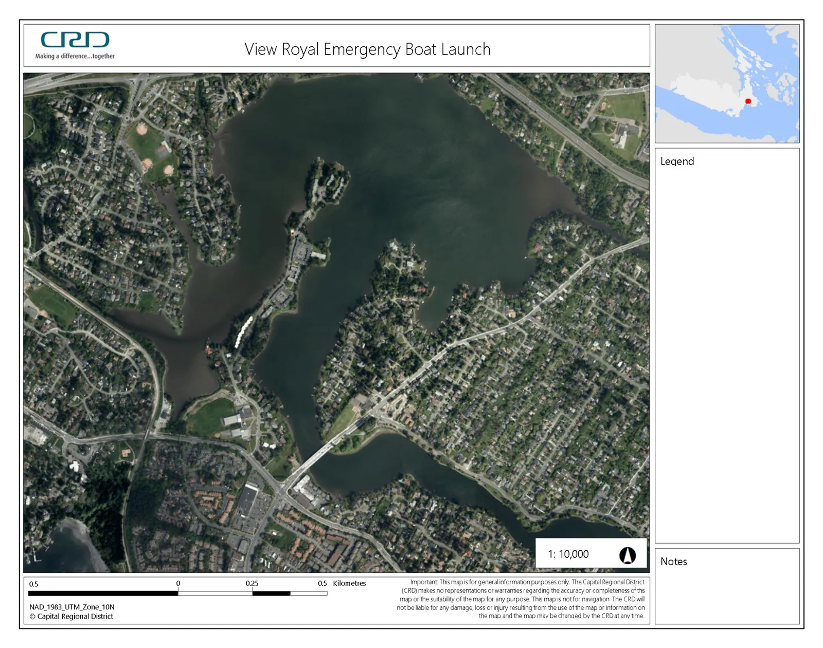
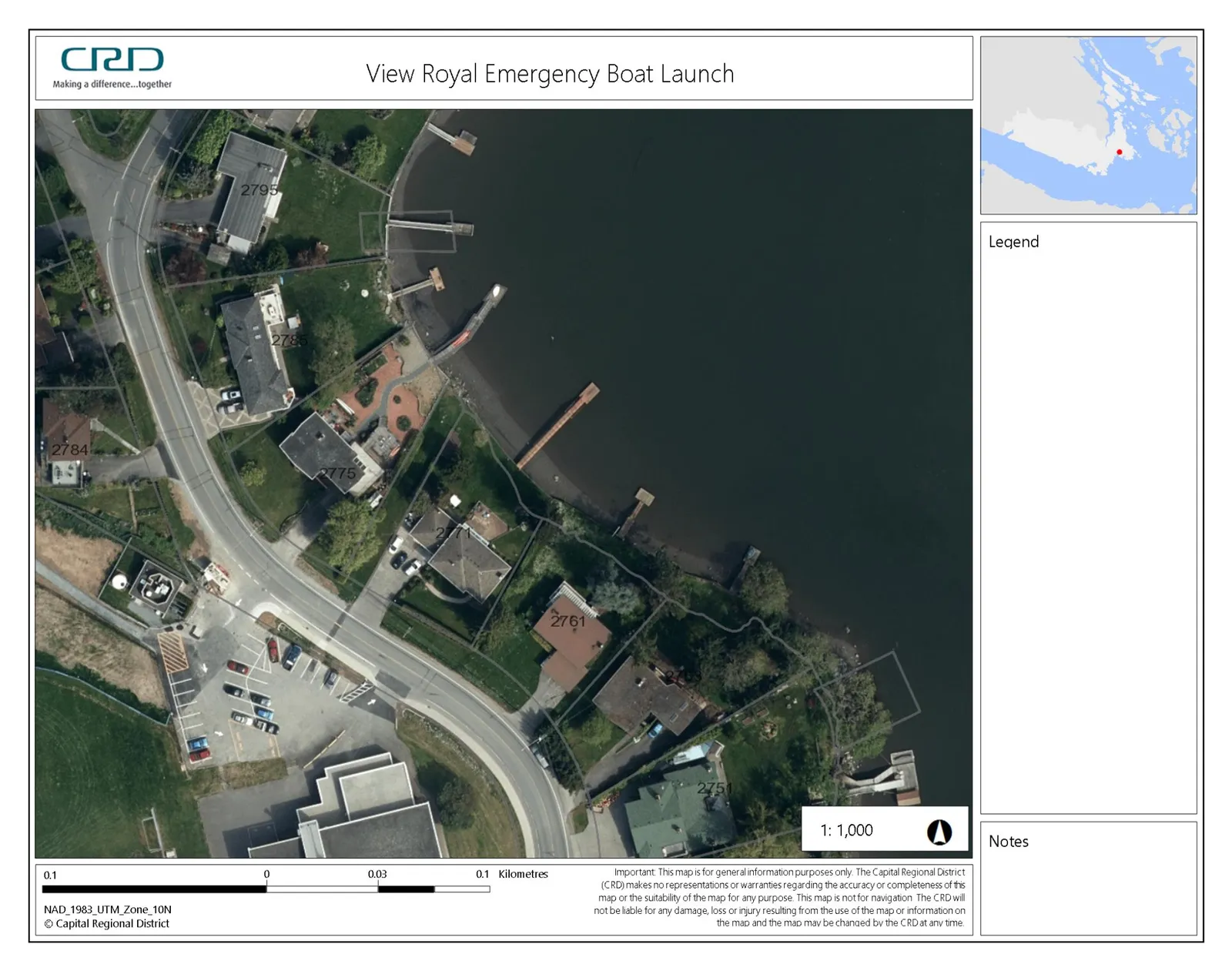
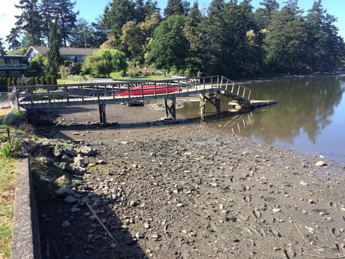
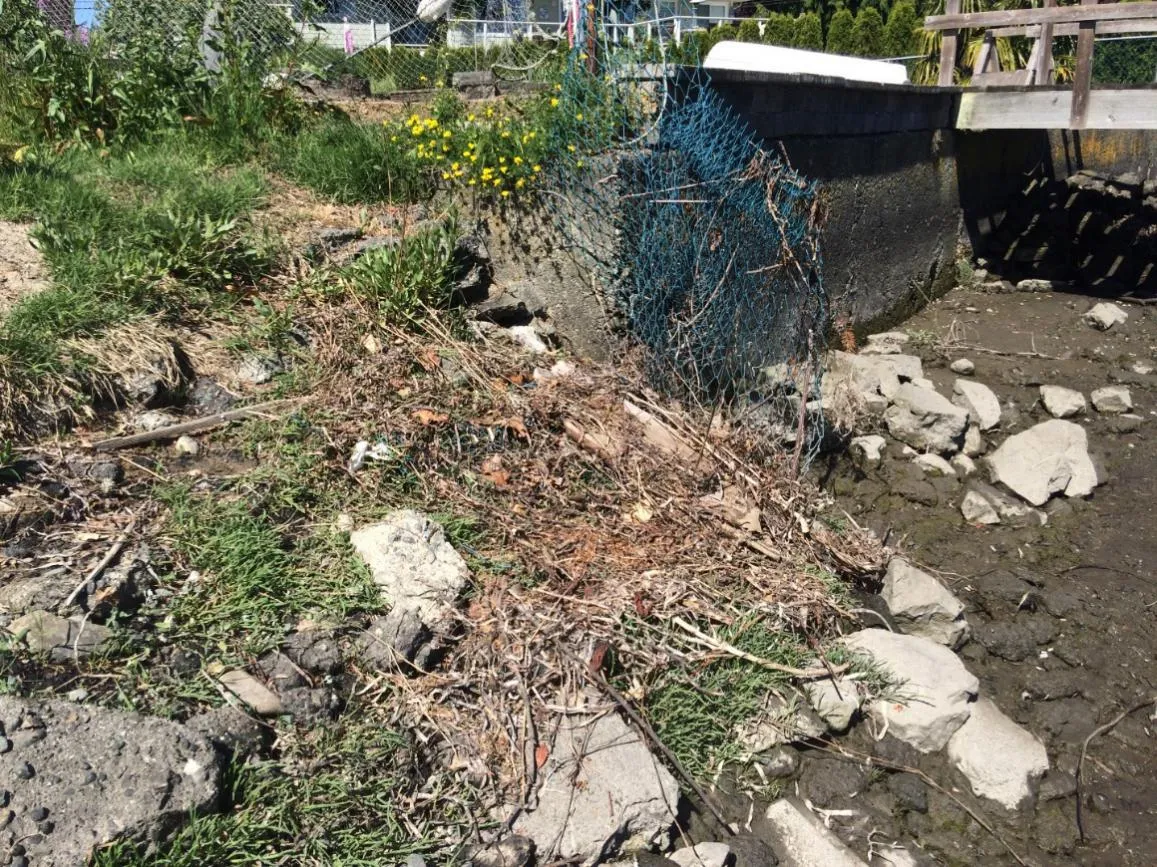
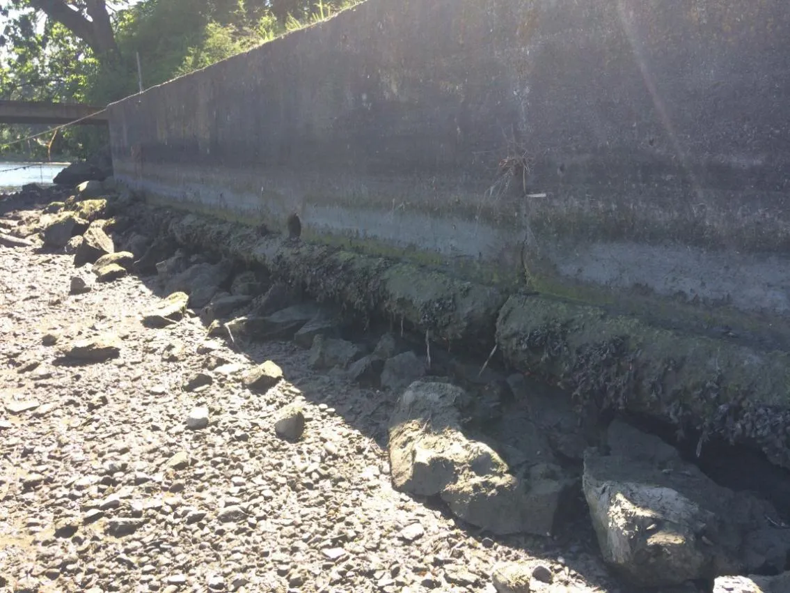
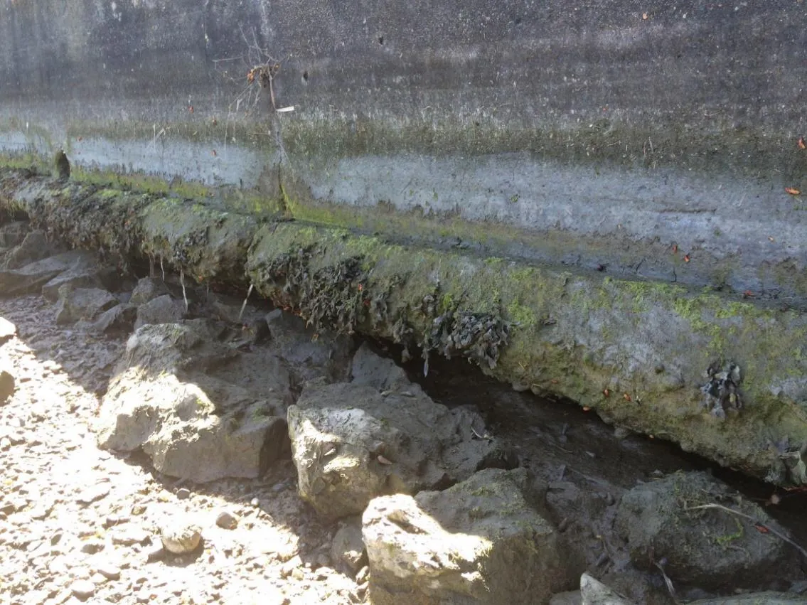
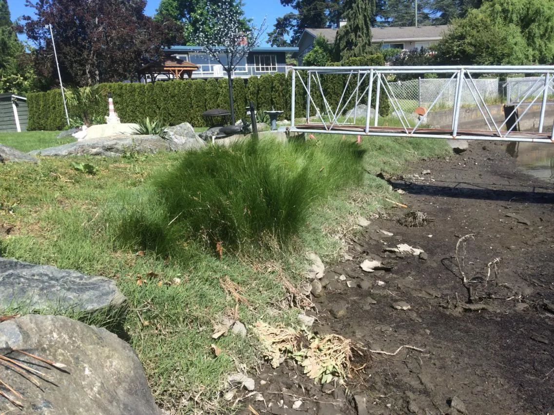
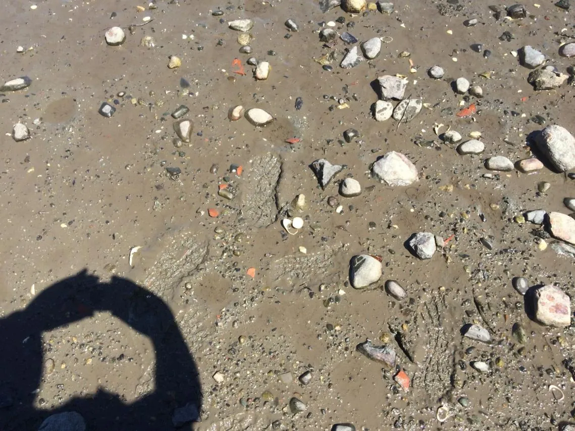
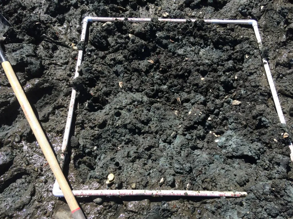
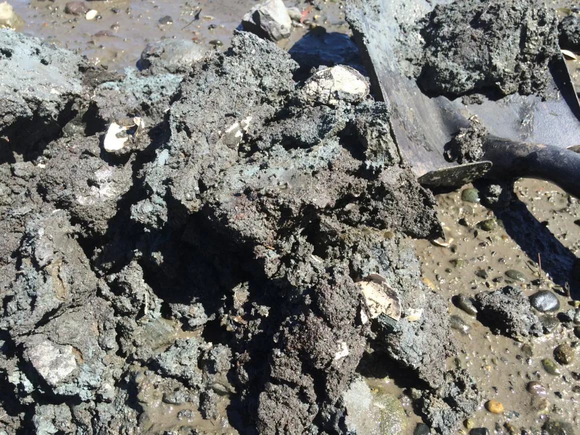
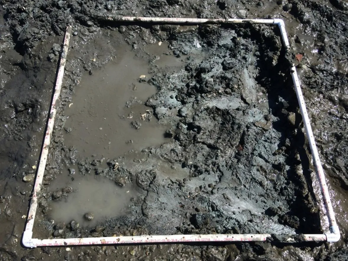
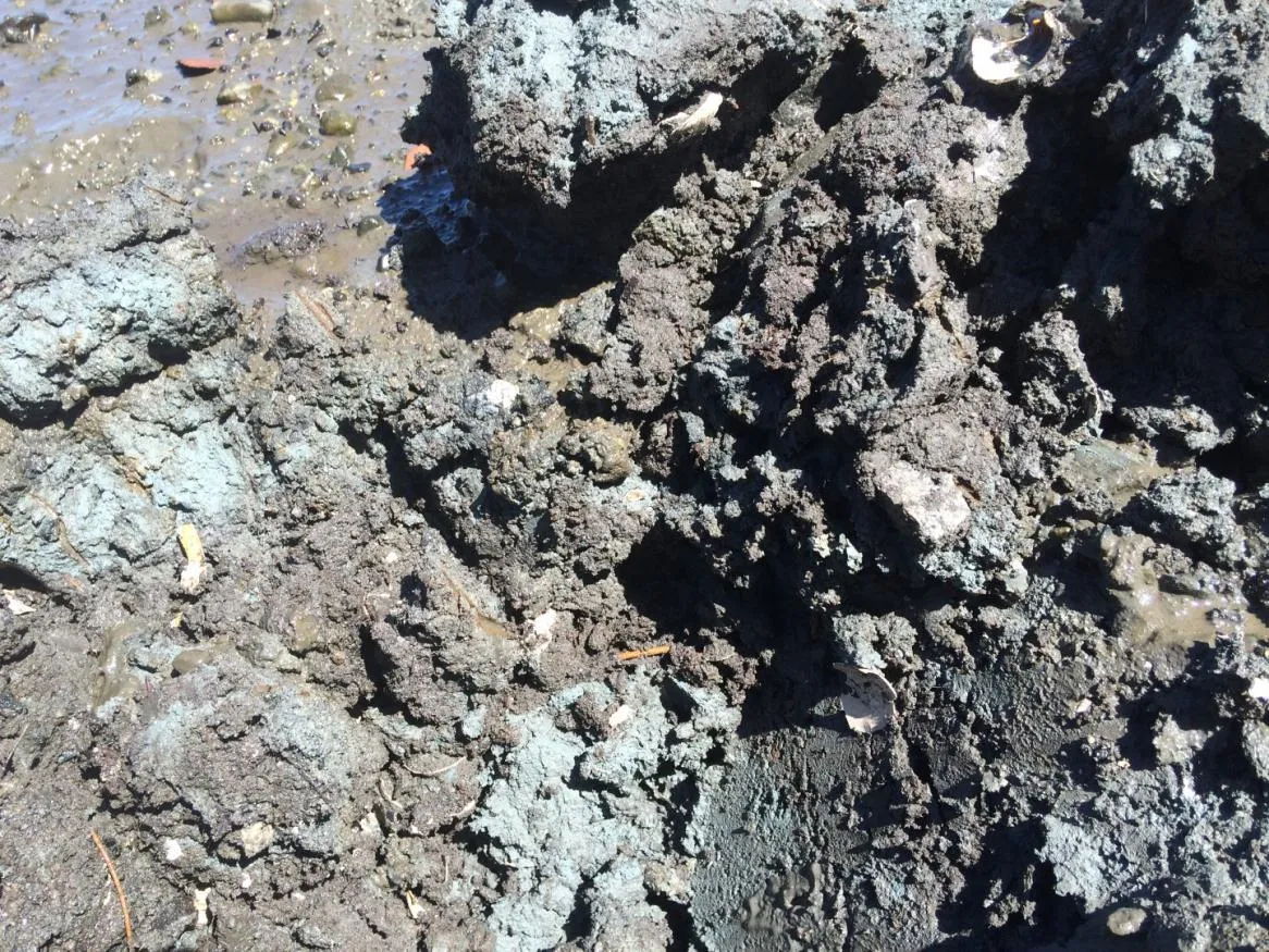
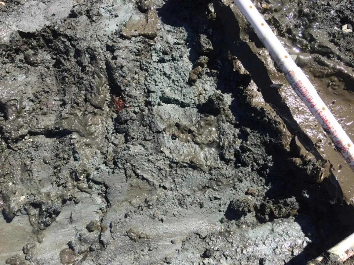
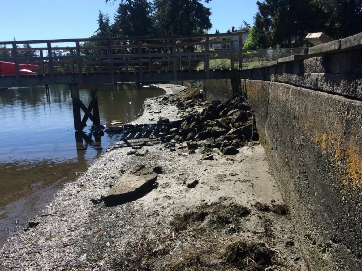
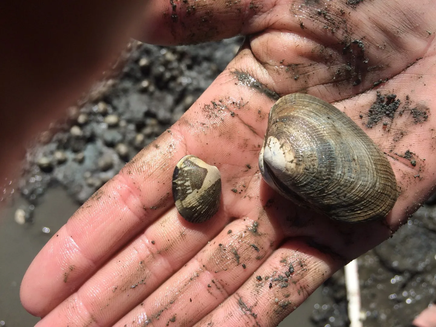
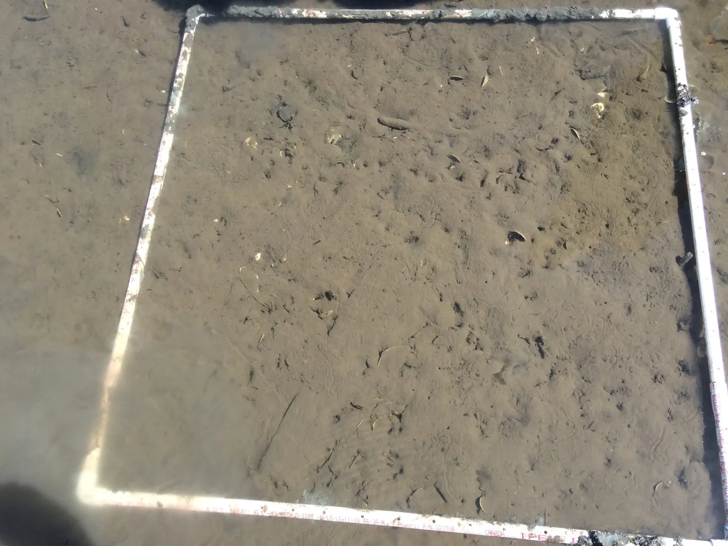
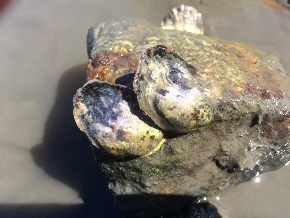
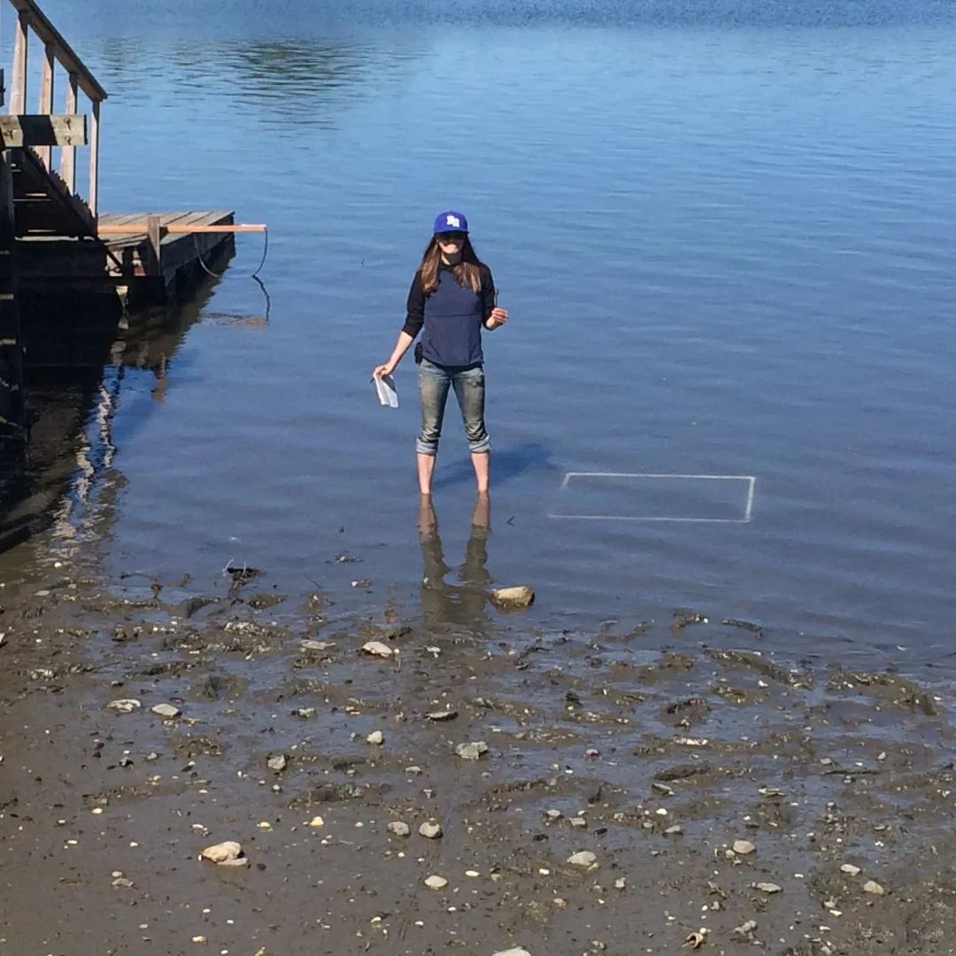
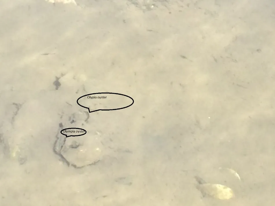
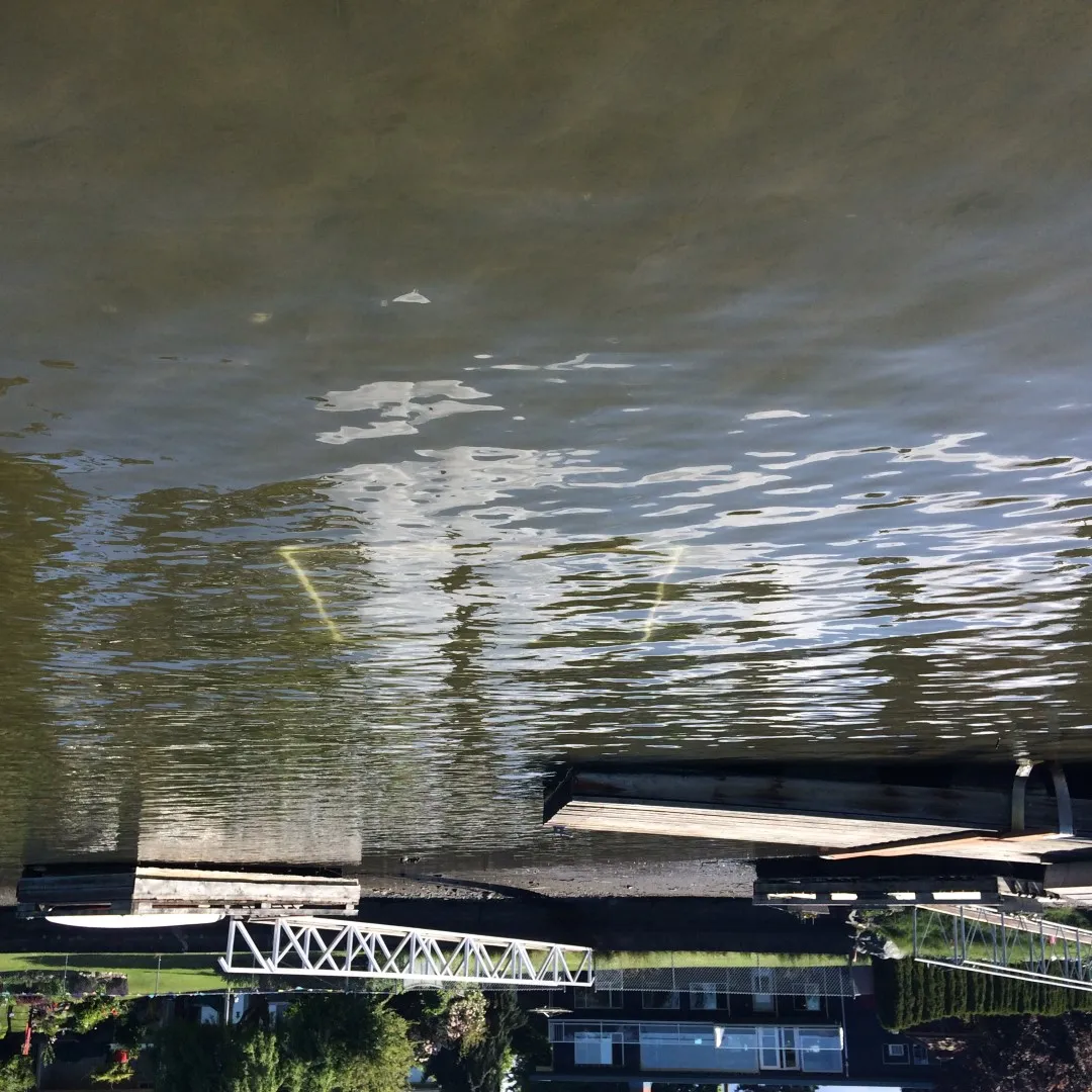
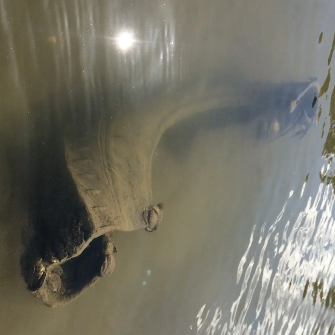
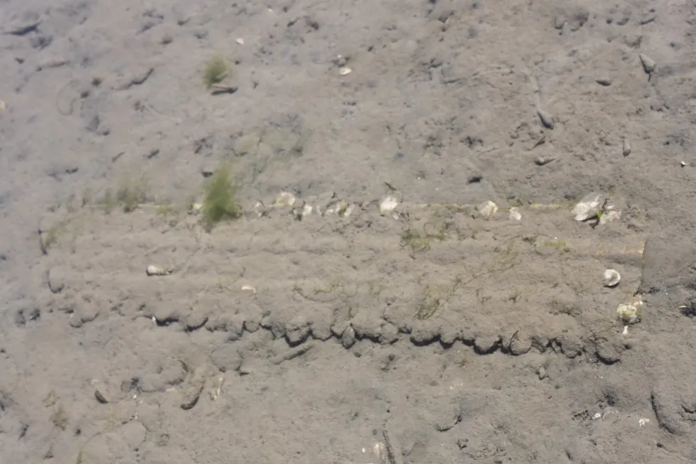
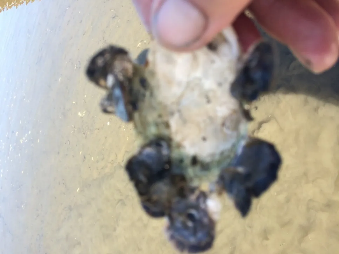
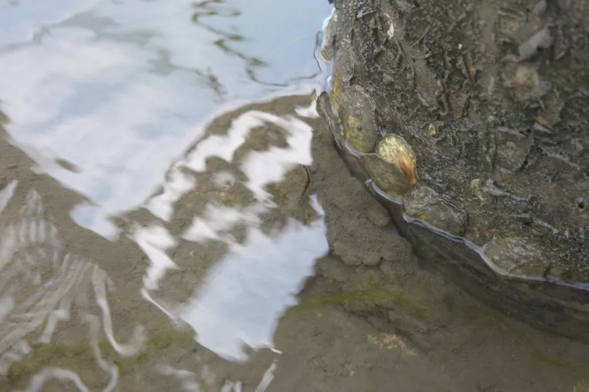
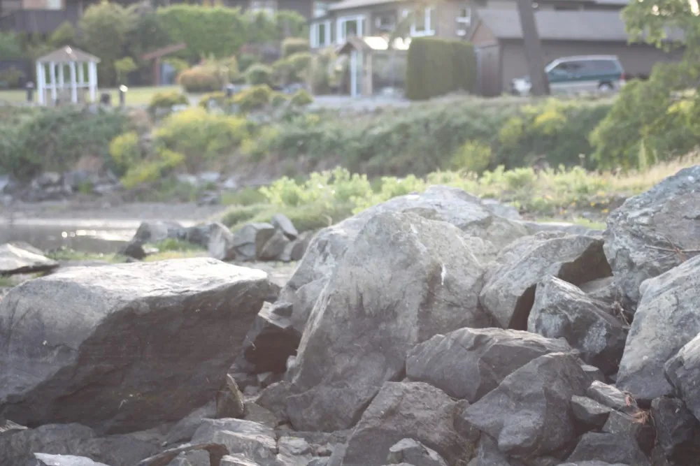
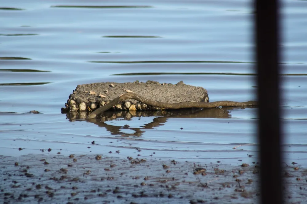
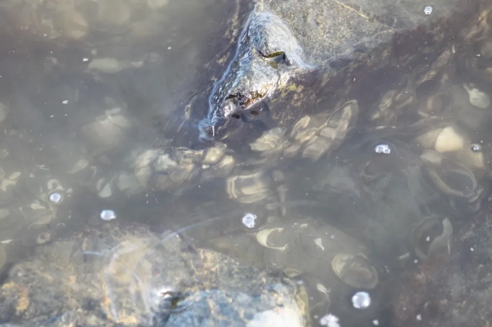
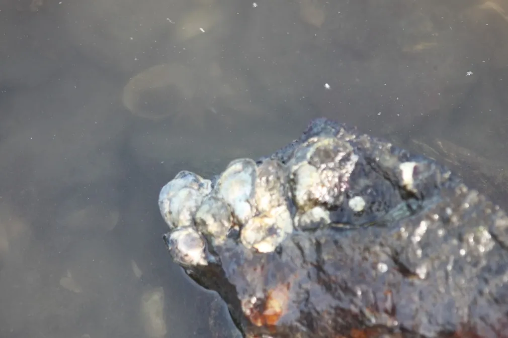
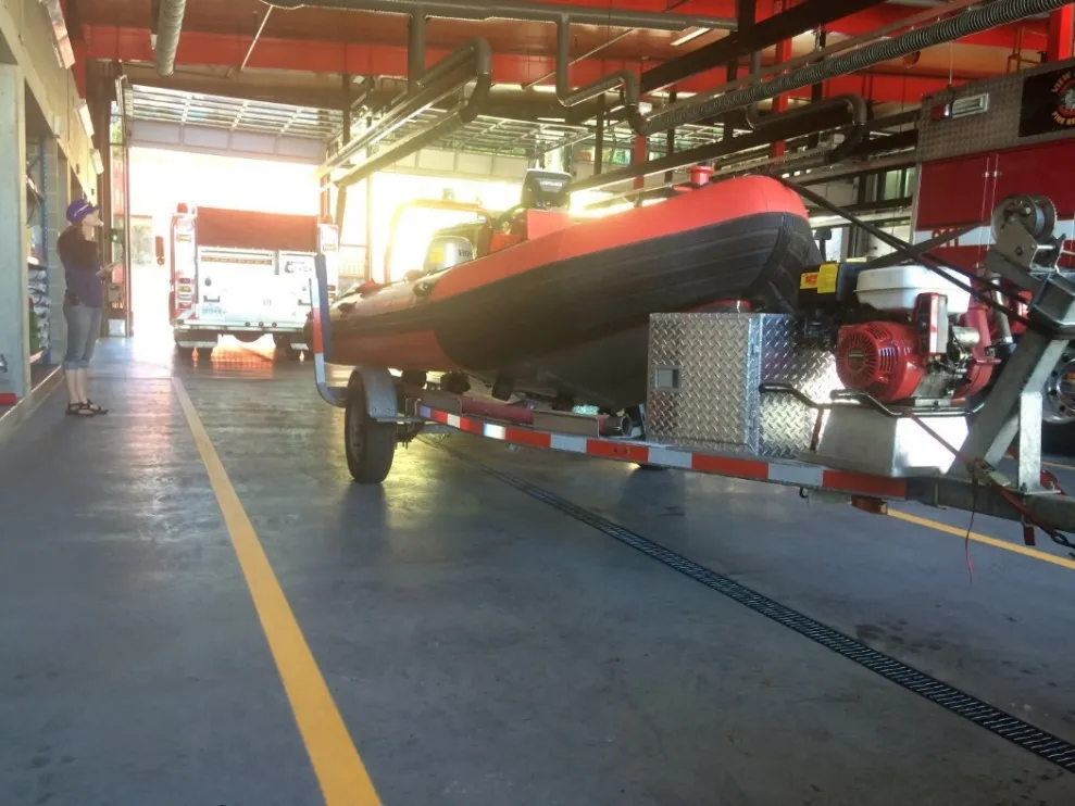
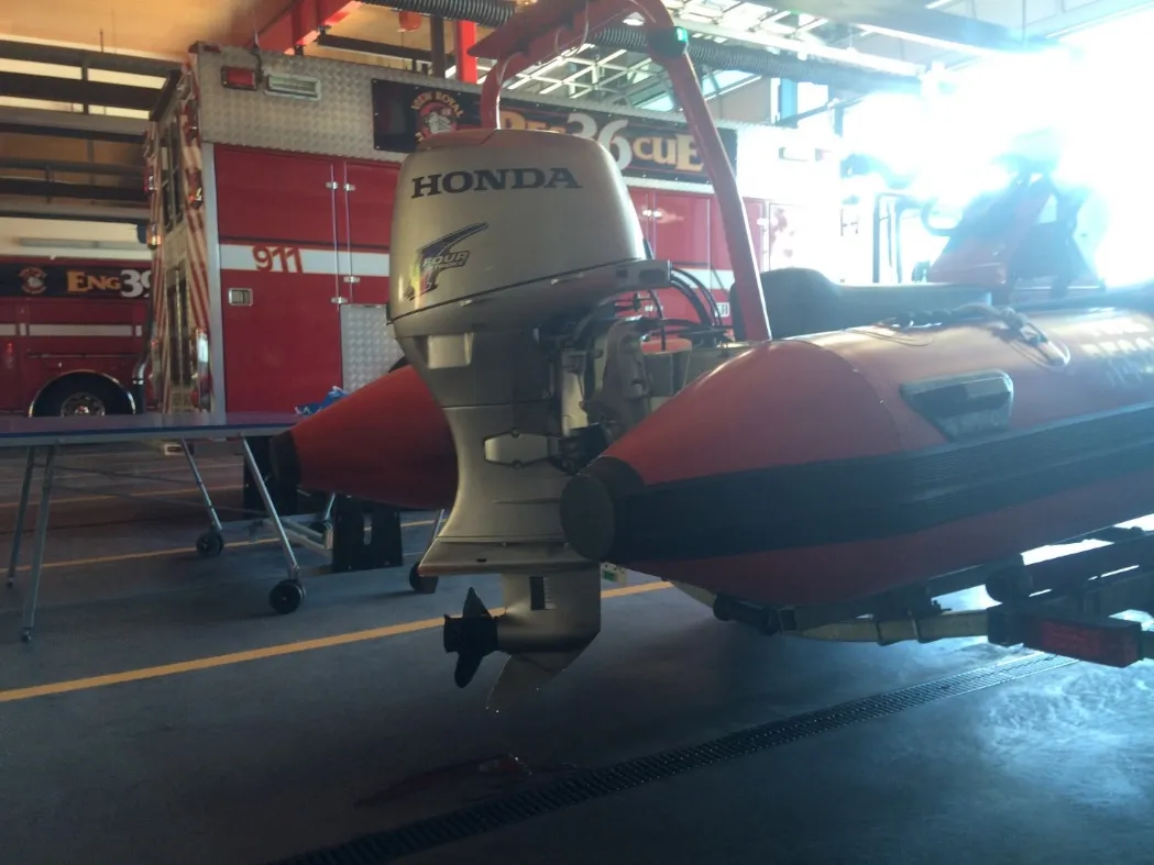
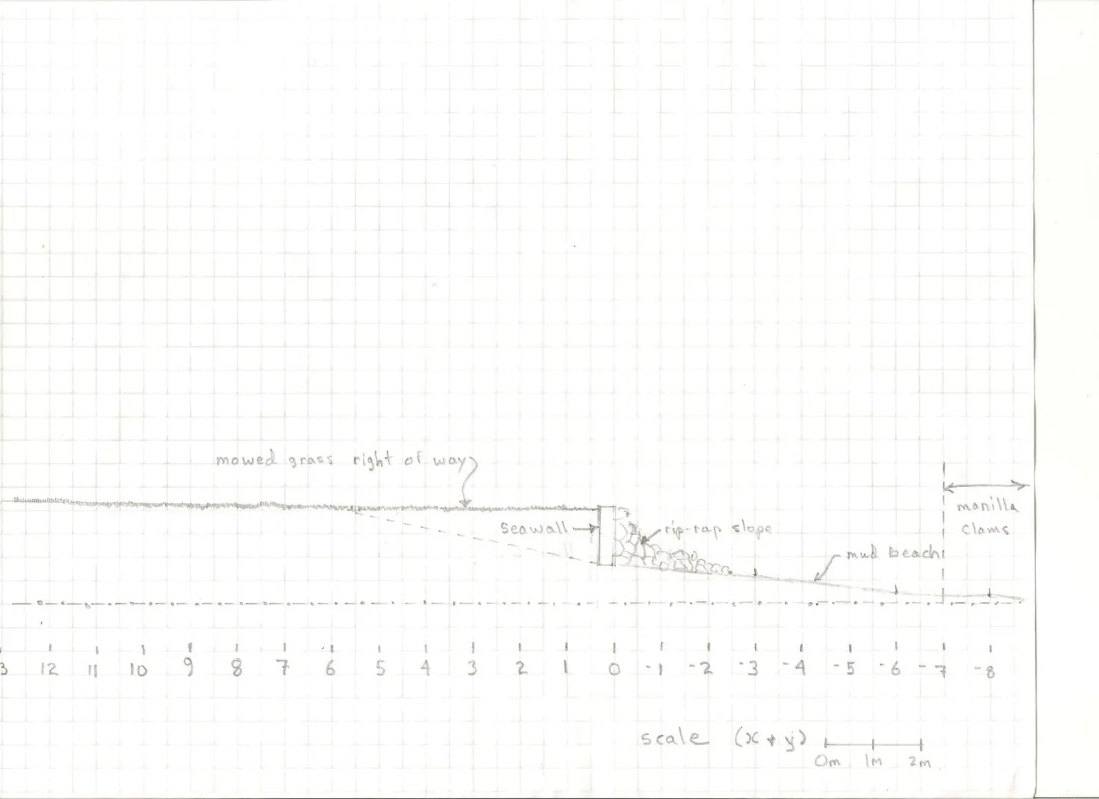
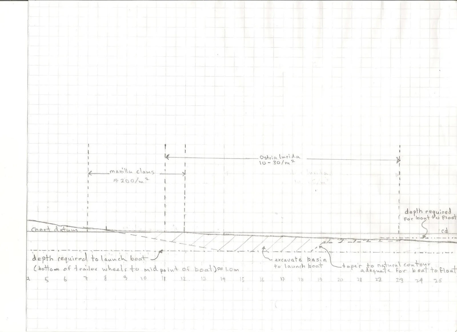
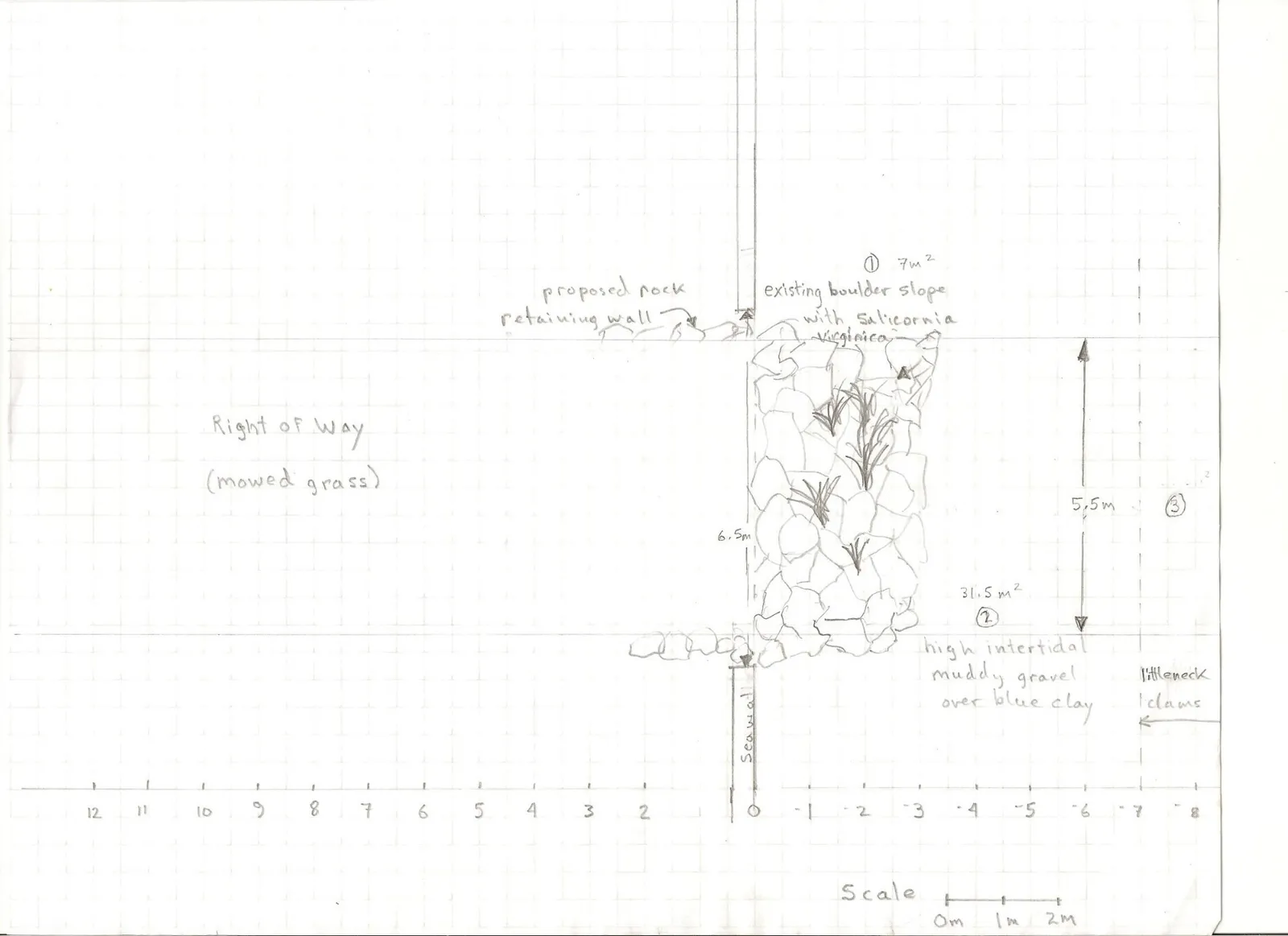
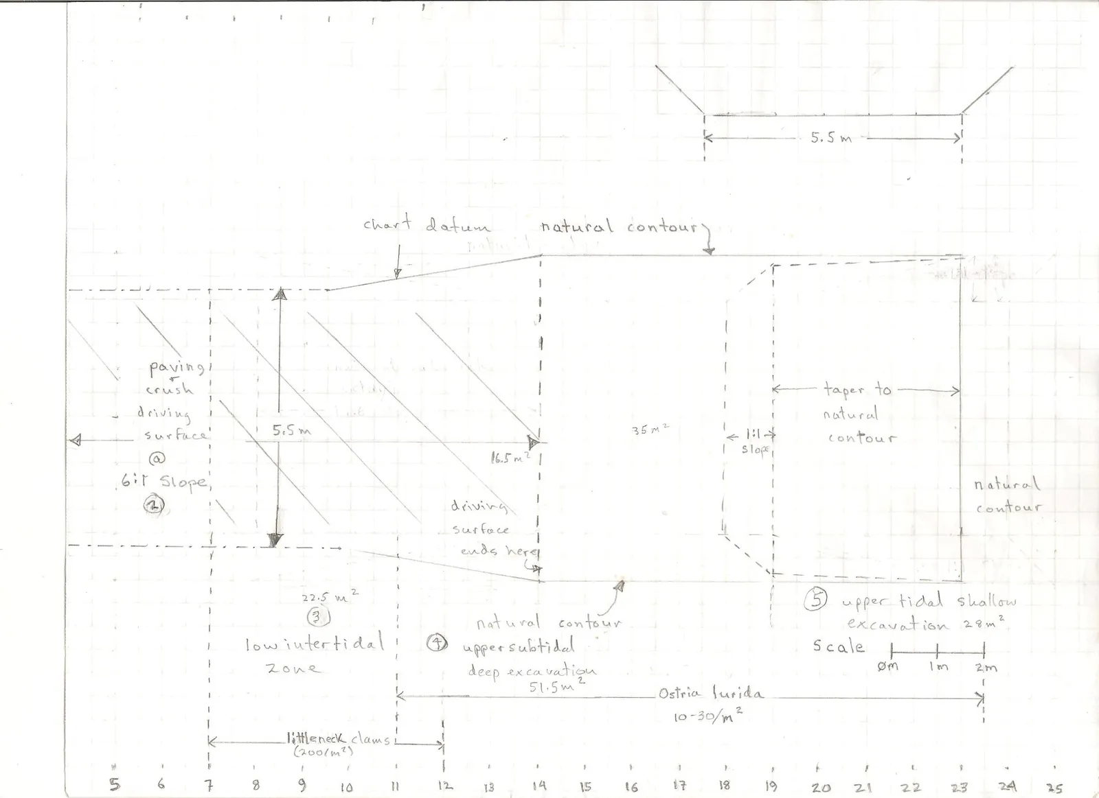
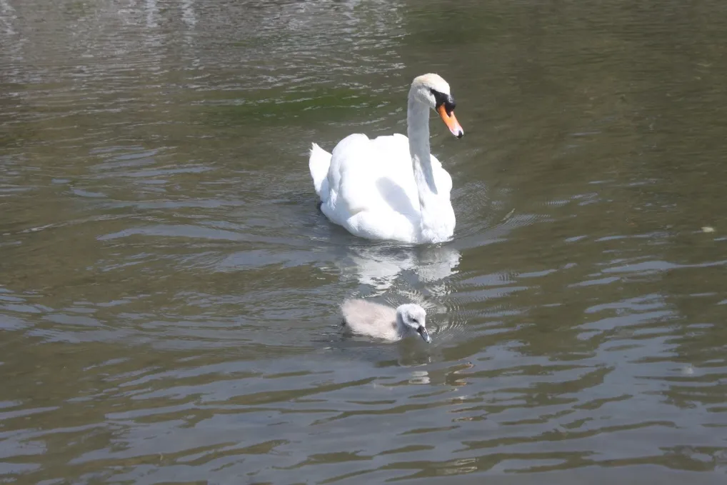
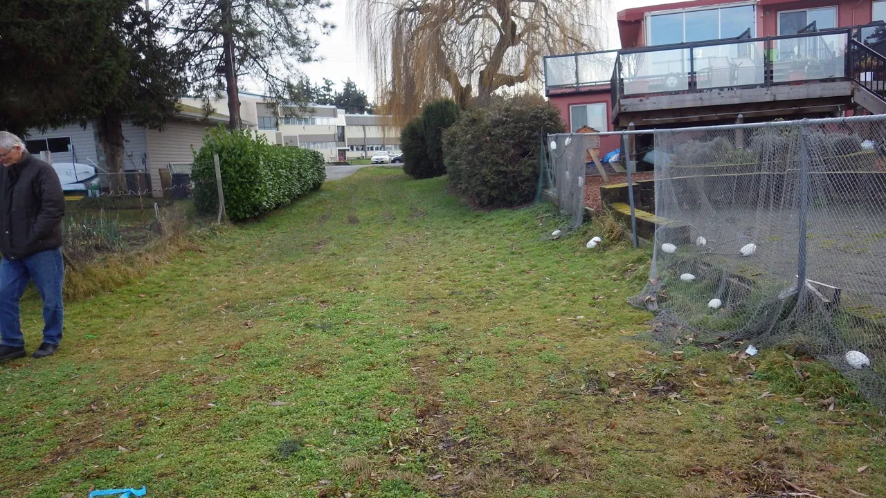
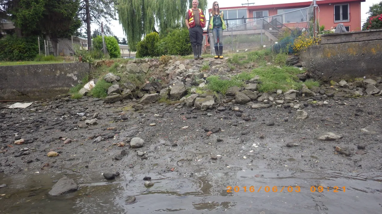
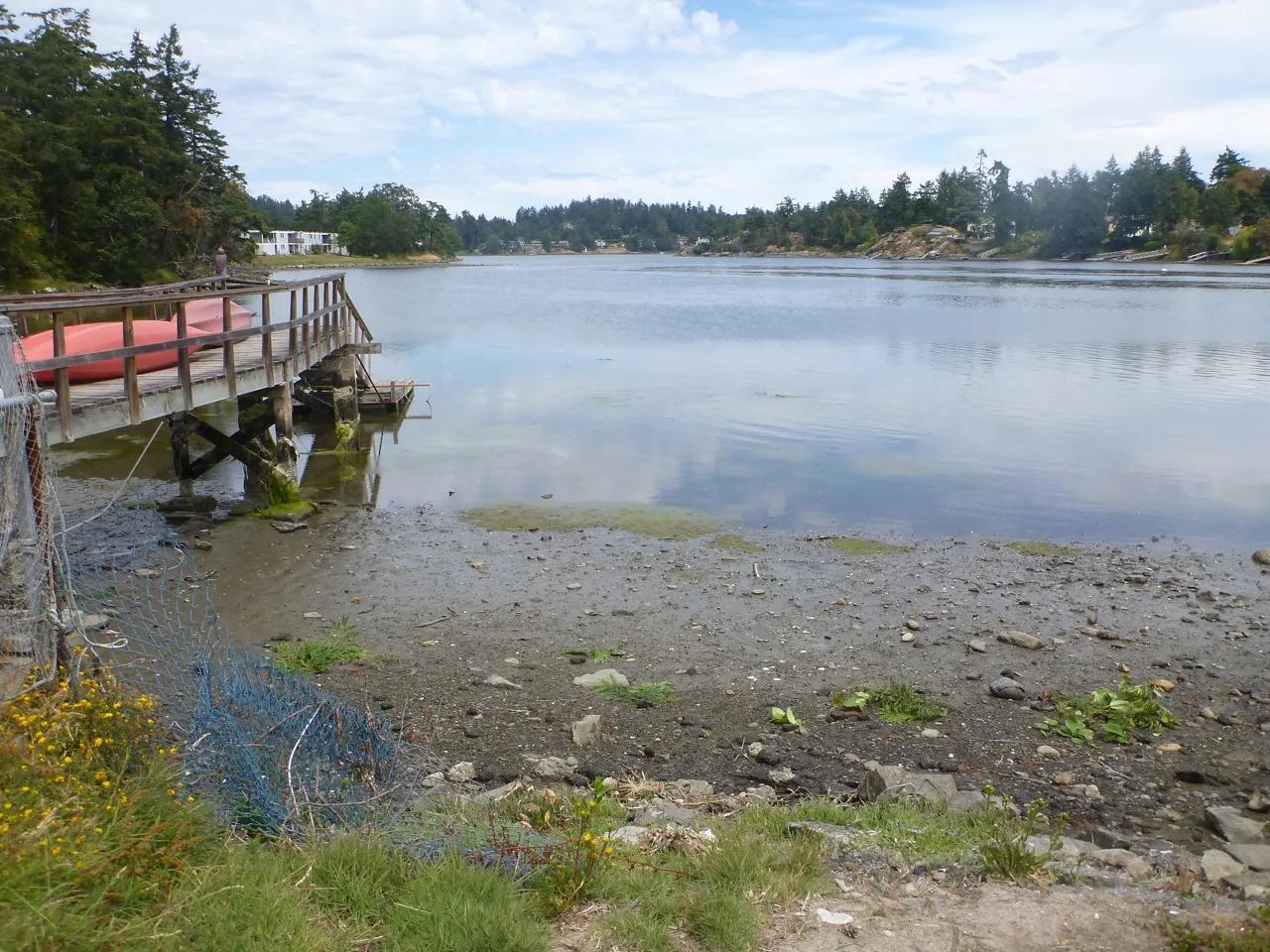

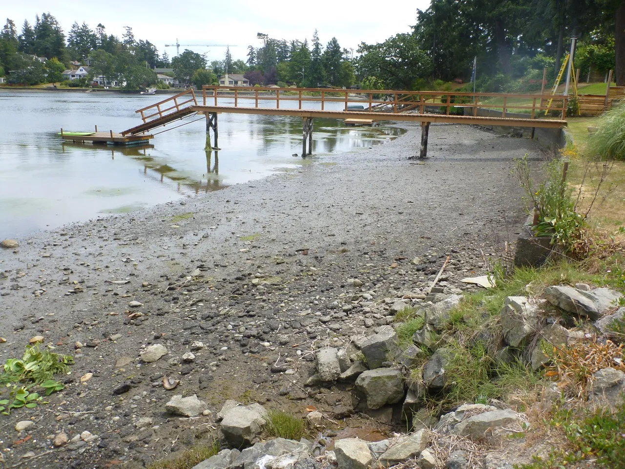
Table 1. Habitat Offsetting Table
| Item # | Habitat type | area impacted (m²) | relative habitat value | Habitat type | relative habitat value | base offsetting area required (m²) | uncertainty factor | additional area required for uncertainty | time lag factor | additional area required for time lag | total area required for offsetting | offsetting area proposed | individual habitat balance | Total habitat balance |
|---|---|---|---|---|---|---|---|---|---|---|---|---|---|---|
| 1 | saltmarsh | 7 | 5 | saltmarsh (north) | 5 | 7 | 0.5 | 3.5 | 0.5 | 3.5 | 14 | 60 | 46 | 46 |
| 2 | upper intertidal mudflat | 24.5 | 2.5 | saltmarsh (south) | 5 | 12.25 | 0.5 | 6.125 | 0.5 | 6.125 | 24.5 | 60 | 35.5 | 81.5 |
| 3 | lower intertidal mudflat | 22.5 | 2.5 | N/A | 2.5 | 22.5 | 0 | 0 | 0 | 0 | 22.5 | 0 | -22.5 | 59 |
| 4 | subtidal mudflat (permanent) | 16.5 | 2.5 | N/A | 2.5 | 16.5 | 0 | 0 | 0 | 0 | 16.5 | 0 | -16.5 | 42.5 |
| 5 | subtidal mudflat (temporary) | 35 | 2.5 | subtidal mudflat (deep) | 2.5 | 35 | 0.5 | 17.5 | 0 | 0 | 52.5 | 35 | -17.5 | 25 |
| 5 | subtidal mudflat (shallow) | 30 | 2.5 | subtidal mudflat (shallow) | 2.5 | 30 | 0 | 0 | 0.5 | 15 | 45 | 28 | -17 | 8 |
| 6 | Balance remaining | 52 | 2.5 | Reef balls | 4 | 32.5 | 0.5 | 16.25 | 0.5 | 16.25 | 65 | 77 | 12 | 20 |
Table 2. Relative habitat values used in Table 1.
Proposed relative values of habitats within the Fraser River Estuary; 1 = lowest; 6 = highest. (Modified from Williams and Colquhoun 1989 and Hamilton 1984; discussions with B. Naito, DFO, 2013). Note the eelgrass relative value is provided to illustrate its very high productivity only. For eelgrass habitat banking sites, if the substrate is mud-sand or sand and will remain the same, the existing habitat relative value is not deducted from the area transplanted with eelgrass.
| Substrate (grain size) | Subtidal Zone - unvegetated | Subtidal Zone - macroalgae | Subtidal Zone - eelgrass | Intertidal Zone - unvegetated | Intertidal Zone - macroalgae | Intertidal Zone - eelgrass | Intertidal Zone - low marsh | Intertidal Zone - high marsh | Backshore Zone | Salinity Regime¹ |
|---|---|---|---|---|---|---|---|---|---|---|
| mud²-sand | 2* | 2 | n/a⁴ | 2.5* | n/a⁴ | n/a⁴ | 5 | 4 | 4 | fresh |
| 2* | 3 | 6 | 2.5* | n/a⁴ | 6 | 5 | 4 | 4 | brackish | |
| 3* | 3 | 6 | 2.5* | 3 | 6 | 5 | 4 | 4 | marine | |
| sand³ (<2 mm) | 1 | 2 | n/a⁴ | 1 | n/a⁴ | n/a⁴ | 5 | 4 | 4 | fresh |
| 1 | 3 | 6 | 1 | 3 | 6 | 5 | 4 | 4 | brackish | |
| 1 | 3 | 6 | 1 | 3 | 6 | 5 | 4 | 4 | marine | |
| gravel-cobble (2-256 mm) | 1 | 2 | n/a⁴ | 1 | 2 | n/a⁴ | 5 | 4 | 4 | fresh |
| 2 | 3 | 6 | 2 | 3 | 6 | 5 | 4 | 4 | brackish | |
| 3 | 4 | 6 | 3 | 4 | 6 | 5 | 4 | 4 | marine | |
| rocky (>256 mm) | 1 | 2 | n/a⁴ | 1 | 2 | n/a⁴ | n/a⁴ | n/a⁴ | 4 | fresh |
| 1.5⁵ | 4 | n/a⁴ | 1.5 | 3 | n/a⁴ | n/a⁴ | n/a⁴ | 4 | brackish | |
| 3 | 4 | n/a⁴ | 2 | 4 | n/a⁴ | n/a⁴ | n/a⁴ | 4 | marine |
Notes:
- Site modifiers can be applied for intermediate habitat types, as well as for natural and anthropogenic factors, to adjust for site specific conditions that may lower value or special species functions that increase value. ¹ salinity regime: fresh = <0.5 ppt salinity; brackish = 0.5-18 ppt; marine =>18 ppt ² mud-sand refers to fines (i.e. silt and clay) mixed with mud to provide a relatively consolidated surface ³ sand refers to substrates <2 mm that relatively free of fines, unconsolidated and may exhibit signs of mobility resulting in less productive productivity ⁴ habitat type does not occur in the Fraser River estuary ⁵ relative value is reduced from 1.5 to 1 for locations deeper than -5 m LLW (chart datum)
Williams, G.L., and G.W. Colquhoun. 1989. North Fraser Harbour Environmental Management Plan, pp. 4181-4190. In O.T. Magoon, H. Converse, D. Miner, L.T. Tobin, and D. Clark (eds.). Coastal Zone '89, Proc. Sixth Symp. On Coastal and Ocean Manage. Am. Soc. Civil Engin., N.Y. Hamilton, S.F. 1984. Estuarine mitigation: the Oregon process. Ore. Div. State Lands, Salem, OR: 62 p.