Appendix
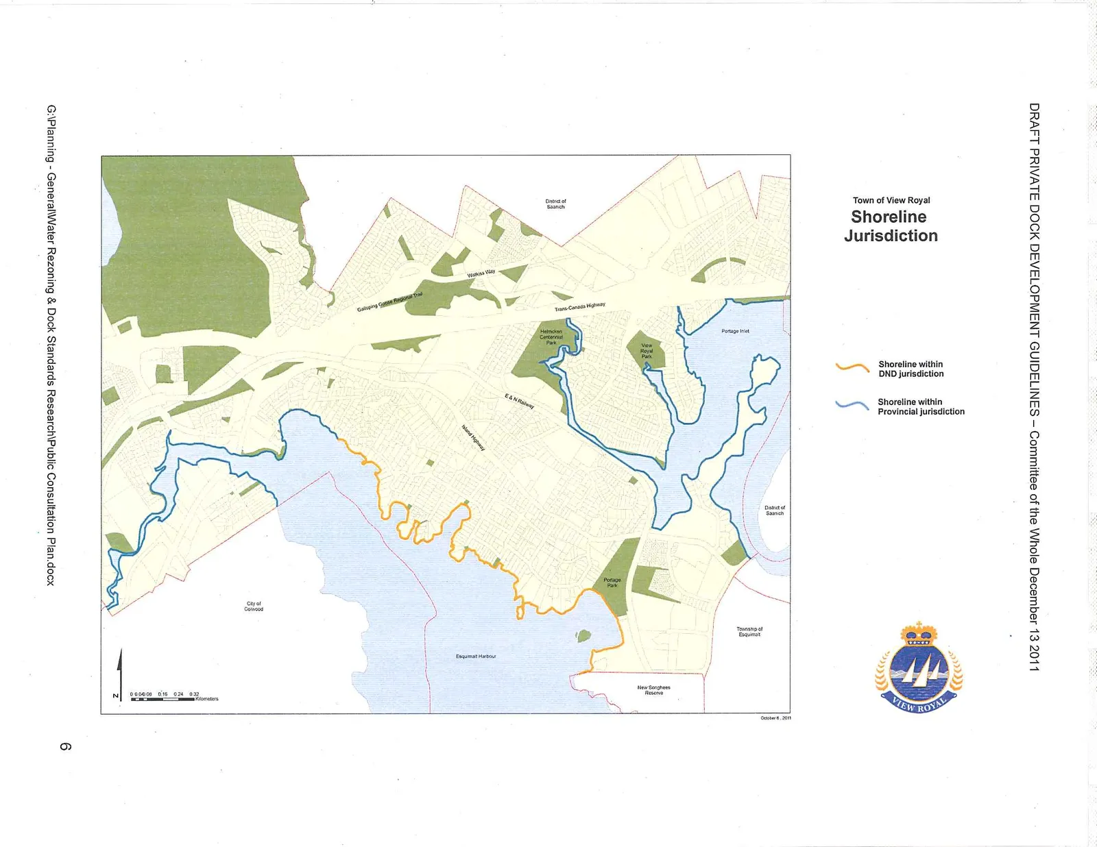
Town of View Royal Shoreline Jurisdiction Map
December 13, 2011Page 701 section
Map showing the different administrative jurisdictions (DND vs Provincial) along the town's shoreline.
October 6, 2011 date on map
Town of View Royal Shoreline Jurisdiction
Legend
- Shoreline within DND jurisdiction (indicated by orange line)
- Shoreline within Provincial jurisdiction (indicated by blue line)
Map Features and Landmarks
- District of Saanich
- Watkiss Way
- Galloping Goose Regional Trail
- Trans Canada Highway
- Helmcken Centennial Park
- Portage Inlet
- View Royal Park
- E&N Railway
- Island Highway
- Portage Park
- City of Colwood
- Esquimalt Harbour
- Township of Esquimalt
- New Songhees Reserve
October 6, 2011
Page 70
Extracted from: 2011 12 13 Committee of the Whole Agenda