Appendix
Subject Property Map and Orthophoto - 55 Tovey Crescent
January 12, 2016Pages 138–1392 sections
Geographic maps identifying the parcel boundaries and overhead view of the property at 55 Tovey Crescent.
55 Tovey CrescentProperty adjacent to Esquimalt Harbour
Subject Property Map - 55 Tovey Crescent
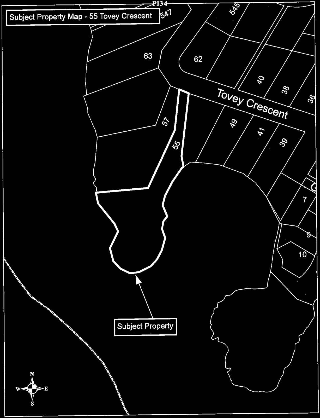
Page 138–139
55 Tovey Crescent
Subject Property Orthophoto
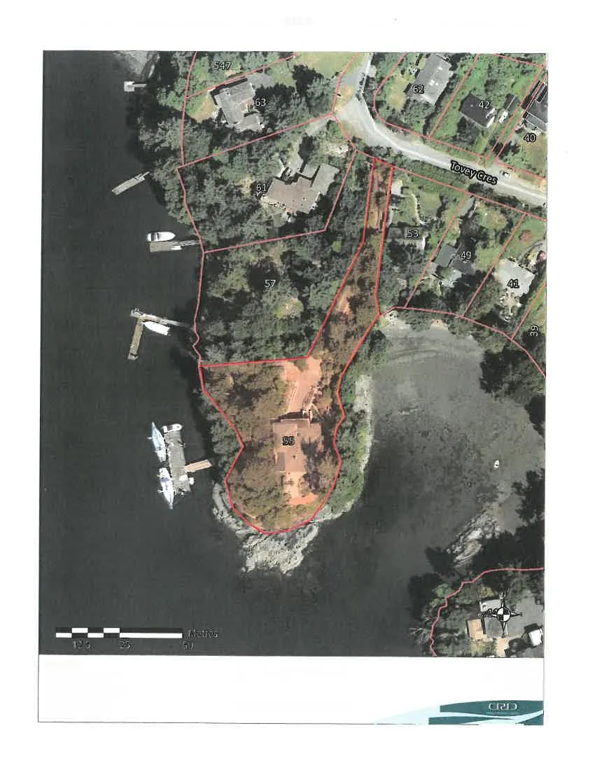
Important This map is for general information purposes only. The Capital Regional District (CRD) makes no representations or warranties regarding the accuracy or completeness of this map or the suitability of the map for any purpose. This map is not for navigation. The CRD will not be liable for any damage, loss or injury resulting from the use of the map or information on the map and the map may be changed by the CRD at any time.
Intramap 2.0 Capital Regional District gis@crd.bc.ca http://www.crd.bc.ca
Page 138–139

Extracted from: 2016 01 12 Committee of the Whole Agenda