Appendix
McKenzie Lake Group - Area Map
February 13, 2024Page 701 section
Map showing escape routes, resident locations, and proposed water tower location for the McKenzie Lake community.
Proposed Water Tower LocationPresent Escape Route via Westoby Rd to Munn Rd
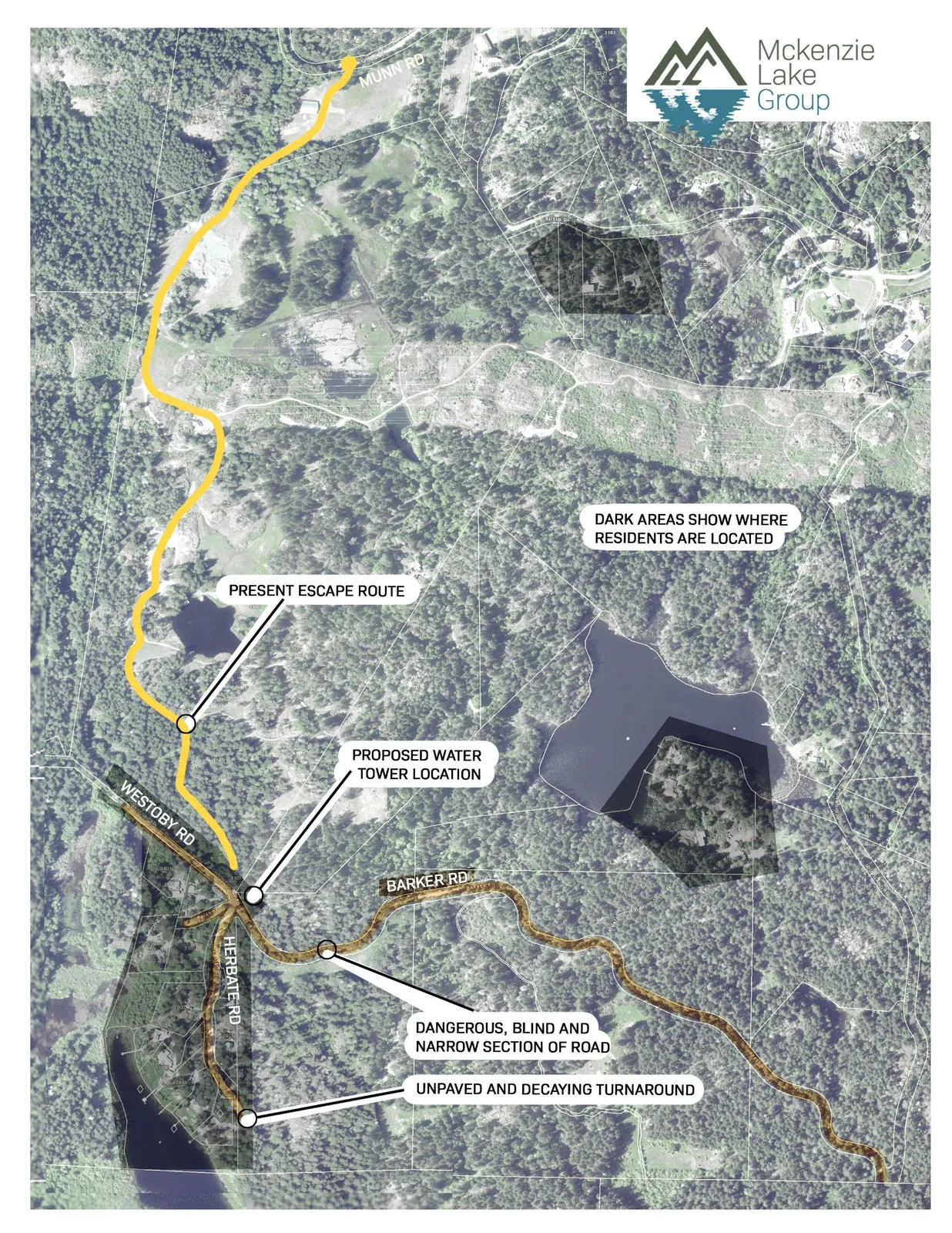
Map Annotations
- PRESENT ESCAPE ROUTE
- DARK AREAS SHOW WHERE RESIDENTS ARE LOCATED
- PROPOSED WATER TOWER LOCATION
- DANGEROUS, BLIND AND NARROW SECTION OF ROAD
- UNPAVED AND DECAYING TURNAROUND
Roads Identified
- MUNN RD
- WESTOBY RD
- HERBATE RD
- BARKER RD
Page 70
Extracted from: 2024 02 13 Committee of the Whole Agenda - Agenda - Pdf