Appendix
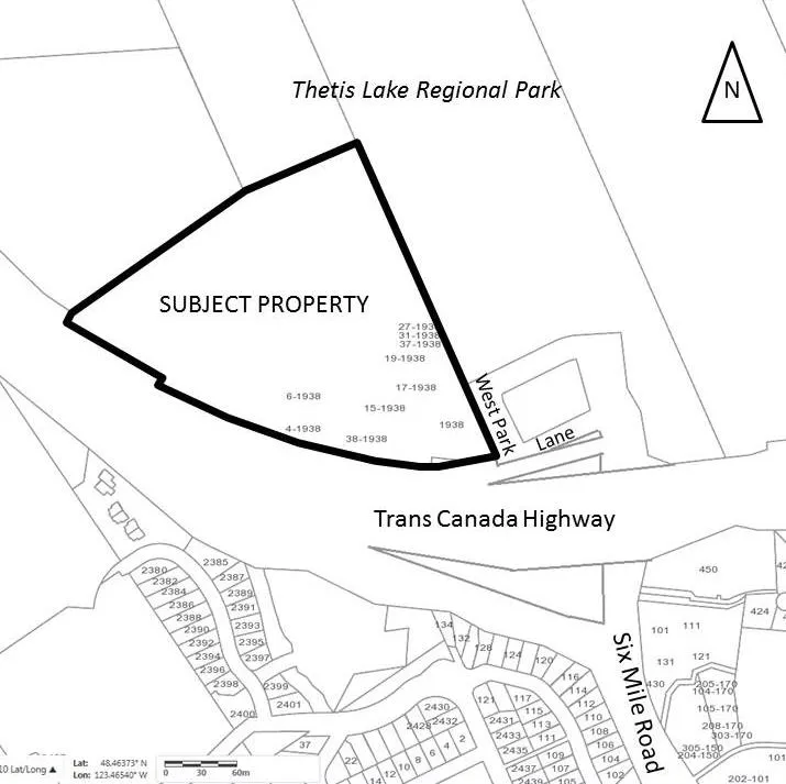
Attachment 1. Location Plan - 1938 West Park Lane
June 13, 2017Page 452 sections
Geographic map showing the location of the subject property at 1938 West Park Lane in relation to Thetis Lake Regional Park.
1938 West Park LaneAbuts Thetis Lake Regional Park
Report to Committee of the Whole
OCP Amendment / Rezoning Application - 1938 West Park Lane Meeting Date: June 13, 2017
- Location Plan – Lund Road property
- Letter from Applicant
- Thetis Lake Residential Conceptual Site Plan- Wensley Architecture
- Thetis Lake Residential Project Statistics - Wensley Architecture
- Thetis Lake Residential Development (subdivision concept) - Mullin DeMeo Barristers and Solicitors, May 23, 2017
- Proposed Development Plan - Island Land Surveying, May 23, 2017
- Traffic Impact Assessment – Watt Consulting, May 2017 ()
- Wildland-Urban Interface Hazard Assessment– Strathcona Forestry Consulting, April 28, 2017/June 1, 2016 (19 pages)
Page 45
Attachment 1. Location Plan
Page 45
Extracted from: 2017 06 13 Committee of the Whole Agenda - Agenda - Pdf