Appendix
SITE CONTEXT Map - 110 High Street
April 12, 2022Page 2331 section
A context map showing the subject property relative to neighboring residential lots and the municipal boundary.
110 High StreetMunicipal boundary
SITE CONTEXT (1)
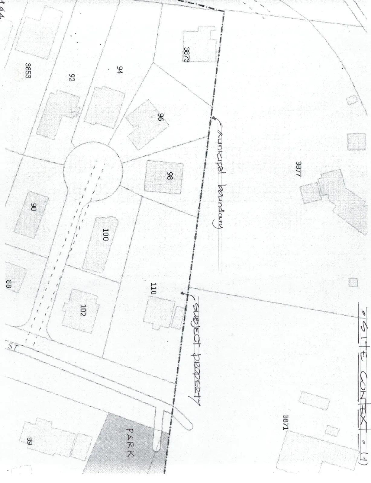
The site context map includes the following annotations and features:
Handwritten Notes:
- Municipal boundary (indicated by a dashed line)
- SUBJECT PROPERTY (indicated by an arrow pointing to Lot 110)
Lot Numbers and Features:
- Subject Property: 110
- Surrounding Lots: 88, 89, 90, 92, 94, 96, 98, 100, 102, 3853, 3871, 3873, 3877
- Park: A shaded area labeled "PARK" is located south of Lot 102.
- Street: The lots are served by a cul-de-sac connected to a street labeled "ST".
Page 233
Extracted from: 2022 04 12 Committee of the Whole Agenda - Agenda - Pdf