Appendix
Legal Survey Site Plan - 110 High Street
April 12, 2022Page 2341 section
A legal survey plan for 110 High Street showing existing lot dimensions, structures, and trees including Oak and Fir.
Dated January 14, 2019Lot area: 1942 m2PID 007-490-437
Site Plan Of: Block 17, Section 9, Esquimalt District, Plan 1407
P.I.D. 007-490-437
Dated this 14th day of January, 2019. Scale = 1:250
Distances and elevations shown are in metres. Elevations are based on an assumed datum.
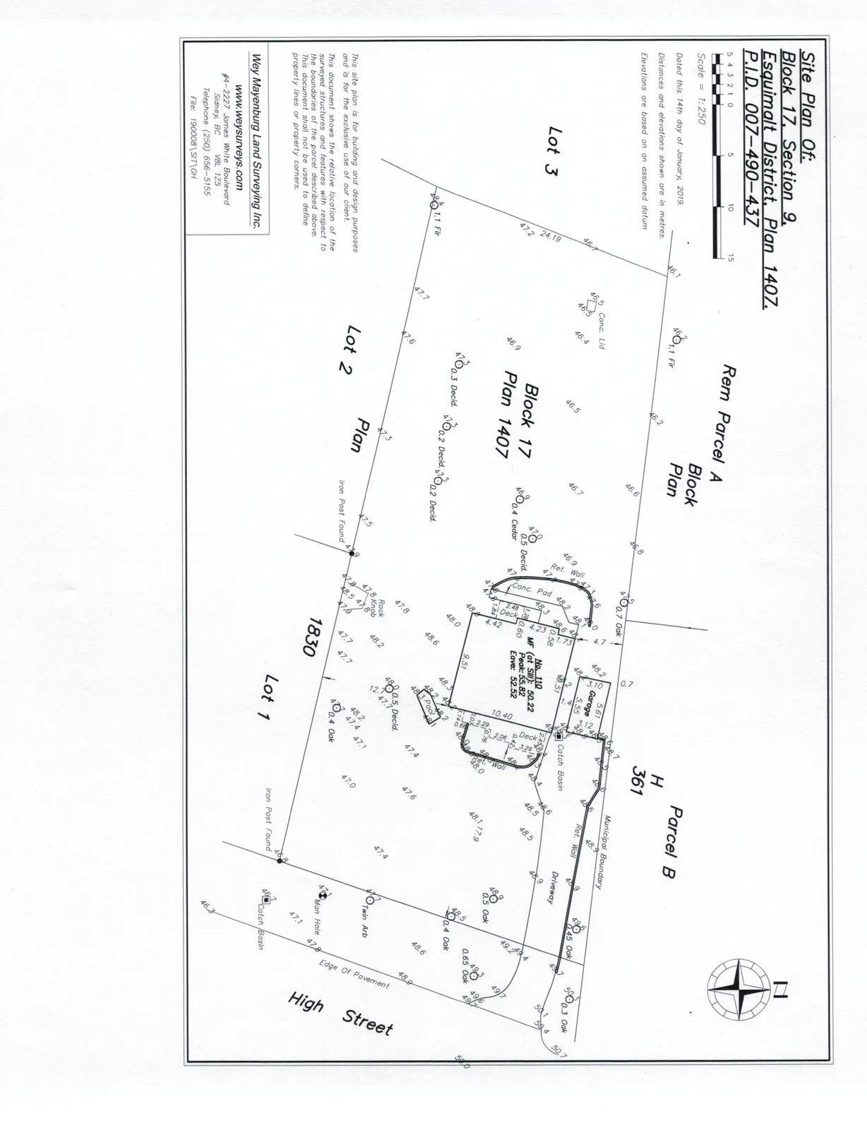
Building Elevation Data (No. 110)
- MF (at SW): 50.22
- Peak: 55.82
- Eave: 52.52
Surveyor Contact Information
Wey Mayenburg Land Surveying Inc. www.weysurveys.com #4-2227 James White Boulevard Sidney, BC V8L 1Z5 Telephone (250) 656-5155 File: 190008\SIT\GH
Plan Notes
This site plan is for building and design purposes and is for the exclusive use of our client.
This document shows the relative location of the surveyed structures and features with respect to the boundaries of the parcel described above. This document shall not be used to define property lines or property corners.
Page 234
Extracted from: 2022 04 12 Committee of the Whole Agenda - Agenda - Pdf