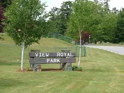
Town of View Royal OFFICIAL COMMUNITY PLAN DRAFT JUNE 2022
The draft version of the Town's long-range policy plan, outlining goals and policies for growth, housing, and environment through 2036.
5 | NATURAL ENVIRONMENT, ENERGY AND CLIMATE CHANGE
OVERVIEW
View Royal has an abundance of natural amenities, including Thetis Lake, Millstream Creek, Craigflower Creek, Esquimalt Harbour, and Portage Inlet. Our natural environment enhances the health of the community, provides valued recreational opportunities to residents and visitors, and supports diverse ecosystems. The rich variety of saltwater, freshwater, and terrestrial ecosystems in View Royal provide for an abundance of species, including those that are threatened or endangered. It is critical that we ensure the protection of these ecologically sensitive areas and work to maintain the integrity of our natural amenities for many reasons, including reducing the impacts of climate change.
Natural spaces are also integral to community health and the quality of life in View Royal. As View Royal’s population continues to grow, protecting natural environments and increasing public access to natural amenities is vital. With ongoing development and climate change, we know that environmental stewardship will become both more important but also more challenging. Policies and actions can help View Royal plan for and adapt to unavoidable sea level rise while also working to maintain access to the shoreline and stewarding critical coastal habitats. We recognize the need for tree protection and the importance of growing our urban tree canopy to help mitigate summer heat, better manage urban stormwater, and help mitigate greenhouse gas emissions. View Royal will continue to provide and improve access to nature for the health and well-being of View Royal residents and visitors.
Policies can help to reduce building emissions and energy bills. The greatest energy and emissions reductions can be made by switching building space heating systems to heat pumps, electrifying water heaters, and retrofitting older homes and new multifamily homes that are higher energy efficiency performance. Combined efforts will make buildings more comfortable, ensure better air quality and lower energy costs, contribute to climate action goals, and provide a diversity of housing. ‘Greening’ new and existing buildings also benefit long-term affordability and local economic opportunities. In addition, employment is generated from retrofitting local buildings, improving energy efficiency, and updating systems.
GOALS
- As the community grows, recognize the unique relationship between the highly valued natural and residential characteristics of View Royal, and maintain these values.
- Confirm View Royal as an environmentally responsible community committed to becoming a more sustainable place, conserving the natural environment, and building resilience for climate change impacts.
- Recognize the regional role of View Royal’s environmental systems and cooperate with neighbouring municipalities and governments to address regional issues while protecting the environment, local values and promoting long-term sustainability.
VIEW ROYAL TODAY
View Royal residents recognize the need to protect the integrity of the natural environment and the health of ecosystems. Locals also cherish the local natural setting for its recreational opportunities and aesthetic beauty – two of View Royal’s defining features.
Environmental conservation and stewardship have become even of greater importance to local, regional, and global communities due to continued threats to the natural environment by climate change, development, and human settlement activities. Tree conservation, supported by View Royal’s tree protection bylaw (2022), is one component of stewardship. Trees play an important role in improving the land’s capacity to adapt to climate change, storing carbon, moderating local climates, and providing wildlife habitat.
The natural environment factors into every facet of how we plan and manage developed areas. Initiatives by the Province of British Columbia, the CRD, the Town of View Royal and environmental groups aim to educate the public, increase the amount of protected habitat; and promote land use, transportation, servicing, consumption, and waste management practices that have less impact on the natural environment and human health.
Development Permit Areas play an important role in preserving terrestrial, freshwater, and coastal environments. Development Permits for environmentally sensitive areas establish conditions that minimize development impacts on ecosystems, rare or endangered plants and animals, and fisheries and wildlife resources.
VIEW ROYAL’S ECOSYSTEMS
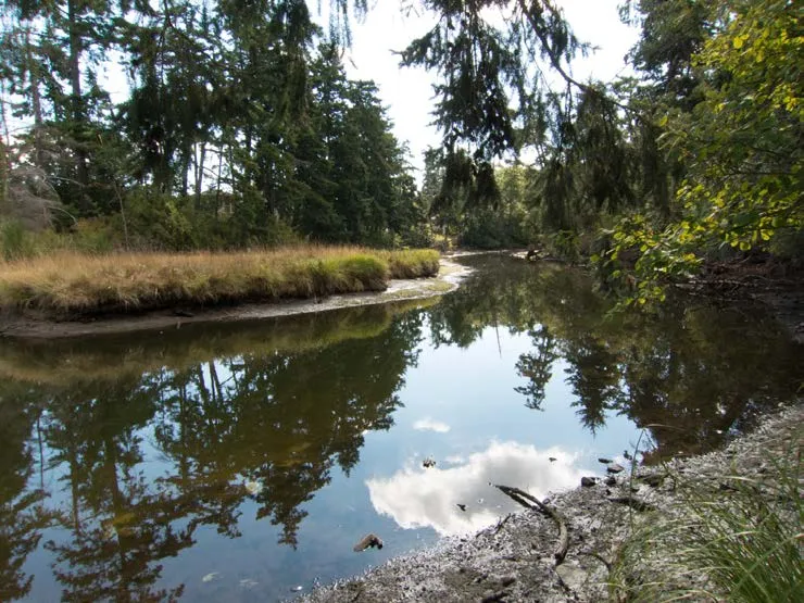
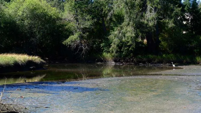
Biodiversity depends upon the conservation of ecosystems, which support habitats for all flora and fauna. The environment of View Royal is home to a rich variety of ecosystems. Marine systems occupy the salt waters of Esquimalt Harbour and Portage Inlet and their long foreshores and shorelines. A blending of salt and freshwater ecosystems occurs in Craigflower and Millstream Creeks and in their estuaries. Freshwater systems are found in Thetis, Prior, Pike and McKenzie Lakes, and they intermingle with terrestrial ecosystems on the lakeside foreshores and along the shorelines and riparian zones of the rivers. Terrestrial ecosystems are equally varied. The land rises from foreshores to the slopes of Mill Hill, Scafe Hill, and Knockan Hill, where rocky outcrops and cliffs stand watch over marshlands and meadows. The Coastal Douglas Fir is the primary terrestrial ecosystem in the Town. It is one of the smallest ecological zones in BC but supports one of the most abundant and diverse ranges.
These ecosystems range from the Douglas fir forest habitat to dry, open outcroppings and slopes that support the rare and rich Garry Oak Meadows, where rare and endangered species live. Portions of both the Gorge Waterway and Esquimalt Harbour regional watersheds occupy an area in View Royal. Other important watersheds include Craigflower Creek, Millstream Creek and Hospital Creek.
MAP 6: SENSITIVE ECOSYSTEM INVENTORY
CLIMATE CHANGE
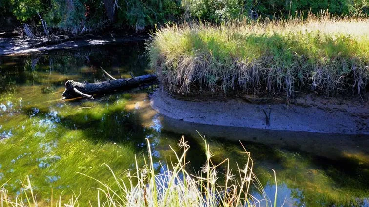
As a signatory to the BC Climate Action Charter, View Royal is one of over 170 local BC governments committed to becoming a carbon-neutral and sustainable community. View Royal’s greatest influence over reducing greenhouse gas emissions (GHG) and advancing meaningful climate actions is through influencing municipal infrastructure and waste management, setting buildings energy efficiency standards, and guiding future land use and transportation choices. Low carbon actions for future land use, buildings and transportation are included in this OCP.
Climate change is here, and actions will be required to respond to real impacts. With air quality impacts from wildfires, record temperatures, and rising sea levels, the Town of View Royal is now experiencing the impacts of climate change.
Recognizing the growing challenge, View Royal joined nearly 1,500 jurisdictions worldwide in declaring a climate emergency and View Royal is committed to implementing its Community Climate Action Strategy. Now, more than ever before, residents understand the link between human activity and climate change and that our future sustainability and prosperity depend on the decisions we make in the near term.
WHAT ARE THE RISKS?
SEA LEVEL RISE AND STORM SURGE – With higher sea levels and more intense and frequent severe weather episodes, coastal storm surge is a major issue for View Royal and large areas of the region. Coastal portions of Craigflower, Harbour, and Helmcken neighbourhoods are particularly at risk from sea-level rise and coastal flooding. Municipal infrastructure is also at risk.
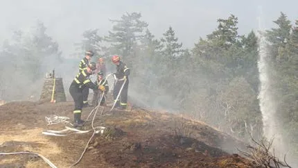
WILDFIRE – climate change is raising forest fire risk in the region, and developments close to forested areas, known as “wildland/urban interfaces,” need to be FireSmart to protect buildings and the surrounding trees from fire risk.
CHANGING CLIMATE – climate change is having an impact on weather, particularly temperatures and precipitation events. We can expect drier summers with more uncomfortably warm days and more extreme precipitation events in the winter months.
NATURAL ENVIRONMENT OBJECTIVES AND POLICIES
This section provides specific objectives and policies to guide Town decision-making related to the natural environment and natural hazards.
OBJECTIVE NE1
Environmental Conservation – Conserve and protect the Town’s sensitive and unique natural ecosystems to ensure the long-term sustainability of the natural environment.
POLICIES
NE1.1 Environmental Conservation Ensure the long-term health and sustainability of important terrestrial, aquatic and riparian ecosystems, species of concern, and Environmentally Sensitive Areas (ESAs). Protection and conservation strategies may include:
- Development Permit designations.
- Negotiations at the time of rezoning for park land dedication.
- Public land acquisition at the time of subdivision.
- Permissive tax exemptions.
- Transfer of development rights (TDRs.)
NE1.2 Environmentally Sensitive Areas Development Permit Areas Designate ESAs as Development Permit Areas (DPAs) on public and private land for the purpose of protecting representative and special ecosystems and restricting development within natural hazard areas. Proposed development in these areas must identify ecosystems and plant and animal species of concern and take one or more measures to ensure their protection. Measures to protect ESAs may include:
- Designation as a natural park with special management criteria.
- Dedication as a private land trust for conservation purposes.
- Actions that promote energy efficiency and climate adaptation and mitigation.
NE1.3 Scientific Data ESAs and other environmental information and mapping should be based on the best available scientific data. Municipal environmental policies and programs should be regularly reviewed and updated to incorporate new and proven scientific data and best practice.
NE1.4 Aquatic and Riparian Resources and Ecosystems Ensure the protection of aquatic habitat, riparian ecosystems, and marine waterfronts. Protection and conservation strategies should follow current Riparian Areas Regulations. Most land altering activities, including subdivision, building construction, major landscaping works and native species removal, on waterfront properties and properties with natural watercourses will require a Development Permit (See Part 3.).
NE1.5 Native Trees and Vegetation Encourage the protection of native trees and vegetation in natural and developed areas. Promote the retention and restoration of native habitat. Actively promote the removal of invasive trees and plants, and the use of native species in private and public landscaping through education, incentives, and regulations. Encourage the use of native trees and plants species in all municipal landscaping and public works projects. Exceptions may be allowed for seasonal projects, such as hanging baskets and targeted annual gardens. Enforce the provisions of Town’s Tree Protection bylaw. A permit is required for cutting down or altering trees of specific species and size.
NE1.6 Urban Forest Maintain a healthy urban forest by encouraging the retention of trees and ecological features, promoting tree coverage expansion, and enhancing wildlife biodiversity.
NE1.7 Nature Corridors Ensure natural areas, parks and open spaces are connected to facilitate the movement of wildlife and greater biodiversity. Support the protection of nature corridors to connect natural habitat areas in conjunction with initiatives by the Provincial Capital Commission and Capital Regional District.
NE1.8 Watershed Planning Work cooperatively with the CRD, other municipalities and organizations to protect local and regional watersheds. Support and implement watershed plans established for Millstream Creek, Hospital Creek and Craigflower Creek.
NE1.9 Community Stewardship Encourage residents, businesses, schools, and community groups to get involved in conserving the health of the natural environmental. Community-based initiatives such as the following will be encouraged:
- Habitat restoration and monitoring.
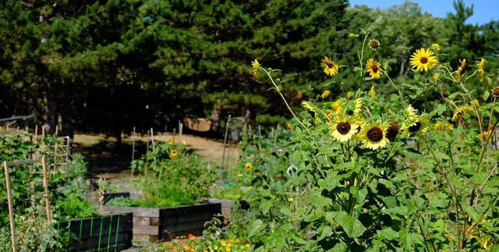
- Community gardens.
- Recycling and composting.
- Greenspace and farmland conservation.
- Water, energy and natural resource conservation, and pollution reduction.
- Habitat clean-up days.
- Carpooling programs and car alternative transportation campaigns.
NE1.10 Public Education Work with other municipalities and levels of governments, local community groups, schools, and environmental organizations to develop and disseminate environmental conservation and community stewardship information to the public.
OBJECTIVE NE2
Achieve a balance between the living biological environment and the non-living built form of the community.
POLICIES
NE2.1 Human-Nature Interface Minimize the impact of development and human activity on ESAs and other ecological areas through careful planning at interfaces. Planning considerations should include:
- Limiting human and dog access and activities with potentially detrimental impacts.
- Encouraging lower intensity uses, such as park, and rural uses along interface areas in lands north of Thetis Lake.
- Requiring development and infrastructure projects in interface areas to adhere to ecologically sensitive design standards.
- Providing educational information and signage to advise the public of habitat and wildlife concerns, the ecological significance of ESAs, regulations, or other relevant information.
- Incorporating FireSmart Wildland/Urban interface management strategies.
- Promoting bird and pollinator friendly design in buildings and landscapes.
- Discouraging herbicides and pesticides.
NE2.2 Access to Nature Encourage interaction between residents and the Town’s natural environment, including riversides and seashores, by providing defined access opportunities that protect native vegetation and do not harm the health of ecosystems. Develop standards for construction of trails and access installation to ensure avoidance and mitigation of harmful impacts on the natural environment.
NE2.3 Ecological Development Consider ecological development in planning decisions. Planning considerations for ecological development should include:
- Protecting open space and greenspace.
- Mitigating the detrimental impacts of urban development and infrastructure on ecological features.
- Protecting and enhancing the verges and boulevards of roads as natural spaces, providing shade, shelter, texture and colour, and habitat.
- Planting hedgerows and groves of trees along roadways to absorb noise and the effects of pollution.
- Encourage the planting of native species that are drought tolerant
- Building design and glass treatment that prevents bird collisions and fatality.
- Maintaining important public views to natural areas and scenic vistas.
- Enhancing low impact development standards, rainwater retention and best practices for stormwater management.
- Continuing to locate and eliminate cross-connections between storm and sanitary sewer infrastructure.
- Encouraging the use of renewable energy sources and low carbon energy sources.
NE2.4 Environmental Impacts Consider the natural limitations of the land when assessing the type and intensity of proposals for development in View Royal. Enact and enforce environmental impact assessment standards for the Town in concert with federal, provincial, and regional governmental agencies, and ensure the proper undertaking and supervision of environmental reviews.
NE2.5 Ecologically Sensitive and Energy Efficient Design Ensure that all private and public building and infrastructure projects support environmental enhancement practices and the policies contained in this OCP. Encourage development proposals that design “with the land” and employ best practices for ecological sensitivity and energy efficiency. Planning and design considerations should include:
- Integration of natural features and topography into the planning and design.
- Measures to maximize the amount of greenspace and reduce the development footprint.
- Protection of soil and vegetation during construction.
- Use of native landscaping.
- Energy and water efficient building design.
- Bio-retention, alternative energy, and best practices for reducing energy needs, and promoting resource conservation, onsite wastewater management and natural systems.
- Measures to minimize impermeable surface areas.
- Measures to avoid light pollution from artificial lighting and mitigate noise from development, transportation, and other human-generated sources.
- Restriction of utilities to underground corridors wherever possible.
NE2.6 Environmental Inventories Development application packages should include a complete environmental inventory of existing vegetation, wildlife, topography, soils, and drainage. The resulting detailed understanding of natural factors will provide the basis for comprehensive planning.
NE2.7 Stormwater Discharge Ensure that the discharge of stormwater does not negatively impact adjacent water quality and that there is no increase in stormwater discharges because of new development. Encourage innovative design techniques that maximize groundwater recharge. Ensure that stormwater management designs for new development take the changing climate in BC into account. Consider the use of covenants to ensure that stormwater management facilities on private properties are regularly maintained.
NE2.8 Ecosystem Restoration Ensure that ecosystems degraded by construction, drainage, enclosure, contamination, and invasive or introduced plant species are restored to the capacity to sustain themselves indefinitely.
NE2.9 Development Approval Information Bylaw Adopt a development approval information bylaw to ensure that applicable studies and relevant information are provided to the Town to evaluate the impact of a development proposal. A wide range of development approval information may be required when the development proposal requires Zoning amendment, development permit or temporary use permit.
NE2.10 Amenity Zoning and Density Bonusing Consider the use of amenity zoning and density bonusing in exchange for environmental protection and restoration. The concept of “amenity zoning”, represented by the clustering of development on parcels to free up greenspace, shall be fully supported in conjunction with the use of parkland dedication to permanently prevent intrusions into such greenspace. Amenity zoning may be applied to detached, single-family homes on downsized, clustered lots and is not restricted to multiple-family residential development. Through the zoning bylaw, a landowner may be entitled to a higher development density than generally allowed in return for the provision of public amenities, such as parks and trails.
NE2.11 Comprehensive Development Zoning Comprehensive Development zoning may be required in areas that require special care in dealing with difficult terrain, preservation of natural features and access challenges. Due regard should be given to maintaining special natural characteristics.
NE2.12 Urban Containment Boundary Maintain an Urban Containment Boundary to preserve greenspace and habitat outside of the Boundary and encourage more sustainable development settlement patterns within the boundary.
NE2.13 Pesticides and Integrated Pest Management Strategy Encourage the use of Integrated Pest Management (IPM) to minimize the nonessential use of pesticides on both public and private lands within View Royal to the benefit of environmental and human health.
NE2.14 Chemical Pesticides Support regional effort to closely regulate or ban the cosmetic use of chemical herbicides and pesticides. Ensure that regulations enforced in View Royal are based on the best available scientific data.
NE2.15 Resource Areas Work with higher levels of government to identify, map and regulate resource areas in View Royal. Support limited and sustainably managed resource extraction, agriculture, and related uses north of Thetis Lake Regional Park. Ensure that such uses do not threaten the long-term integrity of the natural environment. There are no known sand or gravel resources within the Town.
OBJECTIVE NE3
Identify natural hazardous areas, and closely regulate any development in these areas to ensure public safety and protect the natural environment.
POLICIES
NE3.1 Natural Hazardous Areas Development Permit Areas Identify, map, and designate natural hazardous areas as DPAs (See Part 3.). Any application to subdivide, build or alter an existing building may require a Development Permit. This includes areas susceptible to sea level rise, major storm events, overland flooding and wildfires, and lands with steep slopes of more than a 20% grade.
NE3.2 Steep Slopes Establish and enforce criteria for development and infrastructure projects on steep slopes. Requirements may include: Geotechnical assessments and, subsequently, covenants to be registered to title that indicate that the land may be used safely, subject to conditions contained in the geotechnical report. Specified measures to avoid or remediate the hazard(s) and ensure the protection of surrounding lands and properties. These may include protection of special natural features such as rock outcrops, ridges, and cliffs; restricted removal of soil and rock; minimized disturbance of vegetation; prohibited filling or dumping; and stabilizing slopes with native plants and other erosion prevention strategies.
NE3.3 Wildfires Develop strategies to prevent and reduce wildfires. This includes the integration of FireSmart principles for vegetation management, the development of defensible space, community firebreaks, and building and landscaping standing standards into Town policies and bylaws.
NE3.4 Natural Disasters Work with other levels of government to identify areas susceptible to impacts from natural disasters, such as tsunamis and earthquakes. Integrate best practices for regulating development in these areas to reduce or avoid threats to human life, property, and the natural environment.
ENERGY AND CLIMATE CHANGE OBJECTIVES AND POLICIES
This section provides specific objectives and policies for addressing planning issues related to climate change, setting Greenhouse Gas Emissions reduction targets, and promoting energy efficiency.
OBJECTIVE NE4
Plan for climate change mitigation, adaption, and leadership.
POLICIES
NE4.1 Reduction of Greenhouse Gas Emissions (GHG) Work with other municipalities and levels of government, public agencies, and organizations to reduce GHG emissions through land use, building energy efficiency and transportation planning; infrastructure design; water and energy conservation; solid waste management; and green procurements.
NE4.2 Community Greenhouse Gas Emissions Reduction Targets Achieve or exceed the provincial targets for community wide GHG emissions from 2007 levels. The baseline figures for these targets are derived from the BC Ministry of the Environment’s Community Energy and Greenhouse Gas Emissions Inventory (CEEI) for View Royal.
- 45% reduction in emissions below 2007 levels by 2030
- 100% reduction in emissions below 2007 levels by 2050
NE4.3 Sector-specific Greenhouse Gas Emissions Reduction Targets Endeavour to meet or exceed a community-wide 45% reduction of on-road transportation and building source GHG emissions from 2007 levels by 2030.
NE4.4 Corporate Energy and Emissions Strategy Update the View Royal’s Corporate Energy and Emissions Strategy and include corporate GHG targets.
NE4.5 Corporation Carbon Neutrality Reduce GHG emissions caused by Town of View Royal operations, transport, facilities, and waste, and continue purchase offsets to pursue carbon neutrality.
NE4.6 Energy Efficiency Promote greater energy efficiency in new development and through the retrofit of existing buildings and infrastructure. Strategies for encouraging best practices include:
- Consider advancing adoption of steps 4 and 5 of the BC Energy Step Code to implement higher energy efficiency requirements for all new construction.
- Encouraging residential rezoning applications to meet or exceed BuiltGreen® “Gold”, EnerGuide 80 or an equivalent certification for energy efficiency.
- Encouraging low carbon energy systems in buildings.
- Updating municipal bylaws, regulations, and guidelines to encourage energy efficiency and climate change mitigation.
- Supporting the development of local renewable energy production and energy conservation techniques.
NE4.7 Adaptation Work with other public agencies to identify and plan for the long-term impacts of climate change. This includes developing adaptation strategies to manage impacts caused by sea-level rise, increased fire risk, altered seasonal temperatures and precipitation, air pollution and waterborne contaminants.
NE4.8 Alternative Transportation In accordance with other sections of this plan, encourage the use of car alternative transportation and support the reduced dependence on private vehicle travel.
NE4.9 Public Education Gather, develop, and disseminate information on climate change, GHG emissions reduction, and energy conservation and efficiency. This information should be made available to municipal staff, development and building professionals, and community members to increase the shared understanding of these matters and promote sustainable planning.
6 | PARKS AND RECREATION
OVERVIEW
Parks and recreation are defining characteristics of View Royal. Recreation spaces constitute a significant portion of the Town’s land and support an active lifestyle close to nature. View Royal’s natural environment enhances the health of the community, provides valued recreational opportunities to residents and visitors, and supports diverse ecosystems. More accessible and adaptive parks and recreation spaces enhance the well-being of the community. The protection and expansion of existing parks the Town makes have significant impacts on the future well-being of the community and environment and contribute to a thriving economy by attracting visitors and supporting eco-tourism.
Protecting the diversity of the natural environment, creating accessible and connected parks and recreation spaces, and keeping the community involved throughout all require more engaged approaches. The benefits of parks and recreation spaces are threatened by ongoing development, growth, and climate change. Development and growth could reduce the abundance of parks and recreation spaces. Projected sea level rise, storms and fire may impact the health of critical coastal habitats. Connecting people to natural spaces and fostering a healthy natural environment alongside these threats requires adaptation and preparing for change.
GOALS
- Confirm View Royal as an environmentally responsible community committed to sustainability and planning for climate change.
- Design and maintain parks and recreational spaces to encourage residents of all ages and abilities to enjoy a healthy, active lifestyle.
- As the community grows, recognize the unique relationship between the highly valued natural and residential characteristics of View Royal, and maintain these values.
- Ensure that community services and amenities can be provided within the financial means of the municipality and strengthen partnerships with regional service providers to increase local opportunities.
VIEW ROYAL TODAY
Information for this section was obtained from the View Royal Parks Master Plan, 2017.
As a community, View Royal is well served by parks and recreation resources. More than 50 parks and water accesses account for approximately 40% of the municipality’s land base. The largest among these is Thetis Lake Regional Park. Over 540 hectares of the 835-hectare park are situated in View Royal. In addition to providing many unique recreation opportunities to local and regional residents, the park also serves to protect environmentally sensitive areas and natural features. The largest local park is the 6.6-hectare (16.3 acres) View Royal Park. Indoor and more structured recreation facilities are largely provided to residents through the Juan de Fuca Recreation Centre, located just outside of View Royal in Colwood. View Royal is one of six jurisdictions that contribute funds to the recreation centre. Residents can access a multitude of facilities and activities including an arena, pool, gym and studio space, sports fields and courts, community and seniors meeting rooms, curling, and a nine-hole golf course. Other recreation facilities frequented by View Royal residents include local schools and the Pearkes Recreation Centre (in the District of Saanich).
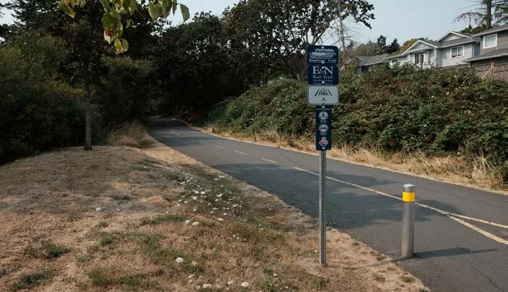
The 55-km Galloping Goose Trail is a regional recreation and commuter trail running east‐west through the Town, connecting View Royal to Victoria and other communities. The E&N Rail Trail stretches from Langford through Esquimalt and is currently under construction to further expand it. These long multi‐use trails are supported by a local trail system that includes a variety of pedestrian and cycling routes.
REGIONAL PARKS
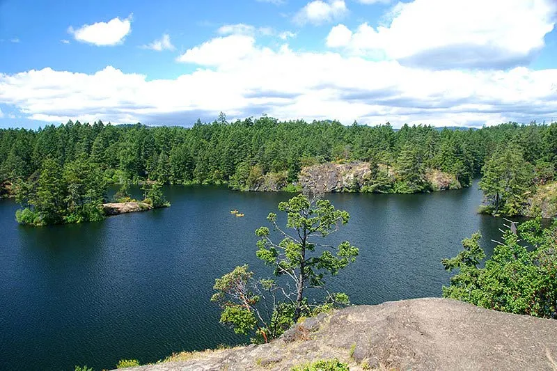
Two regional parks lie within the Town’s boundaries – Thetis Lake Regional Park in the northwest and Mill Hill Regional Park in the west. Thetis Lake Regional Park, established in 1993, encompasses 835 ha of land in View Royal, Highlands, and Saanich, with the vast majority of this located in View Royal. The park contains extensive ecosystems, freshwater lakes, beaches, picnic areas, and hiking trails. Mill Hill Regional Park includes 61 hectares of land in View Royal and Langford, with about 22 ha in View Royal. This park is known for its Garry Oak forests and herbaceous ecosystems and provides hiking trails and expansive viewpoints.
While the regional parks are managed and maintained by the CRD, methods of incorporating these significant areas into View Royal’s recreation system should be considered, with special attention to providing access and connections from other parks, trails, and neighbourhoods. It is important to make these parks accessible to View Royal residents, including those who live in the eastern sections of Town.
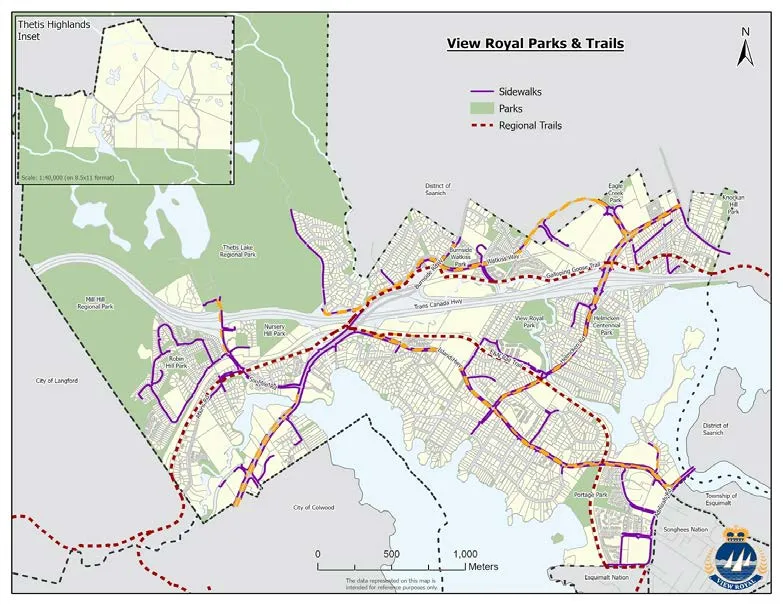
MAP : PARKS AND TRAILS
Despite having many exceptional parks, trails, natural areas and other recreation resources, the Town is confronted with challenges in meeting the recreation needs of local residents. The 2017 Parks Master Plan plans to address many of these planning issues including:
UNDERSERVED NEIGHBOURHOODS. The distribution of parkland in View Royal is not equal throughout the Town. Several neighbourhoods lack sufficient park space and/or access to types of recreation facilities. The Hospital and Harbour neighbourhoods are underserviced with parks and are physically isolated from parks located south of the TransCanada Highway and in the northwest portion of the Town. Some neighbourhoods have an adequate amount of parkland but do not have park amenities or facilities designed to meet the needs of local residents. For example, some neighbourhoods are without play areas for small children or recreation features suitable for older youth.
UNDERSERVED DEMOGRAPHIC GROUPS. On average, View Royal has a higher percentage of youth and families than elsewhere in the CRD. However, very few recreation spaces have been designed specifically for teenagers and several neighbourhoods continue to be underserved by play areas for young children. View Royal is also home to many older adults and seniors with their own unique health and recreation needs.
CONNECTIVITY. Fragmentation due to the Trans-Canada Highway, Island Highway, and watercourses makes accessing nearby parks difficult for many residents. Residents in the eastern portion of the Town have the additional challenge of overcoming longer distances to access the regional parks and the Juan de Fuca Recreation Centre. Some gaps in the trail system still exist that further isolate areas and obstruct non‐vehicular transportation alternatives.
ECOLOGICAL CONNECTIVITY is also a planning issue within View Royal recreation spaces. Parks and trails provide important habitat for plant species and wildlife. Natural connections between these spaces should be maintained to provide wildlife corridors, support biodiversity, and ensure the overall integrity of the natural environment.
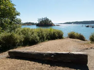
SHORELINE AND WATER ACCESS. Most lands along Millstream and Craigflower Creeks and the shores of Portage Inlet and Esquimalt Harbour are under private ownership. Several of the existing publicly owned accesses are undeveloped, located in inaccessible locations, or do not provide amenities that encourage park use. However, these watercourses and shoreline areas are valuable open space resources for the community. Some of these accesses have potential to be utilized in a manner that protects the fragile waterfront ecosystems, while providing public access to the shoreline.
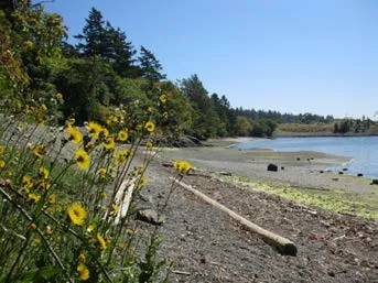
LAUNCH FACILITIES. The Town is served by a non-motorized launch facility accessed off Shoreline Drive that allow residents and visitors to launch and land their kayaks, canoes, and small boats. A canoe and kayak launch is also available at the end of Stewart Avenue.
COMMUNITY GATHERING PLACE. COVID-19 has highlighted the need for large, sheltered, outdoor public spaces for hosting both small gatherings and community events, festivals, farmers markets that bring together broad sections of the community. View Royal Park, Centennial Park and Portage Park were all mentioned as existing public spaces that could be better designed to facilitate large gatherings and special events. Future opportunities for this type of public space are desired to be distributed throughout the community and the future Town Centre.
WASHROOM FACILITIES. View Royal parks and public spaces are currently underserved by public washroom facilities.
FISCAL SUSTAINABILITY. Developing parks and recreation facilities, and providing amenities and upkeep is resource intensive. The Town will need to look for funding and partnership opportunities and set investment priorities to maintain high standards expected by the community.
PARK CLASSIFICATIONS
To acquire parks and open space through the development and subdivision process, the demand for park space has been classified according to the eight types of parks. Each of the five types of parks has a different function and serves a different user group. It is important that all neighbourhoods have access to the various types of parks, and that there are pedestrian pathways and natural open space linkages between the parks.
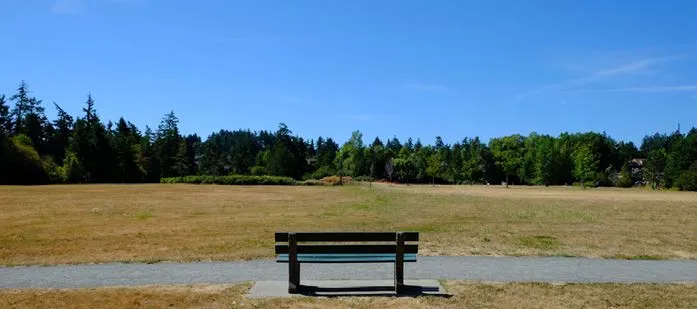
TOWN PARK Large parks with a variety of active recreational facilities that serve the entire population of the municipality. They also provide passive recreation areas, often with special natural features. View Royal Park is an example of this type of park.
COMMUNITY PARK Generally large parks providing passive and active recreation options, with a range of amenities of interest to the entire community. These spaces may also contain significant environmental features.
NEIGHBOURHOOD PARK These are generally smaller in area than community parks and respond to the open space and recreation needs of local residents. Amenities include passive and active recreation uses, along with significant open space
NEIGHBOURHOOD GREENSPACE These are small, open spaces in residential areas, some offering playground equipment intended for use by local residents. Ideally, all residents have access to a Neighbourhood Greenspace within ½ kilometre walking distance from their home.
NATURAL GREENSPACE These areas protect natural systems and preserve sensitive ecosystems. Recreational use is limited to passive enjoyment and pedestrian trails.
SHORELINE ACCESS There are several parks that provide waterfront access, as well as a network of shoreline access points that are in some cases undeveloped or inaccessible to residents.
REGIONAL PARK These parks are managed by the CRD and provide recreational facilities for View Royal residents, citizens of surrounding municipalities, and visitors to the area. These regional parks generally focus on the connection between humans and nature.
LINEAR PARK Linear parks play a role in providing connections between park spaces, as well as providing for walking, hiking, and biking opportunities.
PUBLIC SCHOOL Schools have an important role in providing learning and recreation space to local students during school hours, and community access to sports fields and playgrounds on weekends and evenings. The three public schools in View Royal are owned and maintained by the Greater Victoria School District.
SPECIAL PURPOSE AREAS These areas include points of historical and cultural interest that are of special interest in the Town. Examples of these special purpose areas include Craigflower Manor and the Hart Road Lime Kiln.
TRAIL CLASSIFICATIONS
Four types of trails and trail connections compose the trail network in View Royal.
MULTI‐USE TRAIL Multi‐use trails are pathways suitable for both walking and cycling. These trails are separate from roads and adjacent land uses. These paths are generally wider that the other pedestrian facilities (sidewalks, trails), and are part of a larger system that connects to significant destinations. Multi‐use trails are used by local residents, visitors, and tourists for recreation and commuting.
WALKING/HIKING TRAIL Walking/hiking trails provide pedestrian access within parks, natural areas, and neighbourhoods. Walking/hiking trails can vary in width and generally follow the natural contours of the land. These trails provide recreational opportunities and alternative travel options.
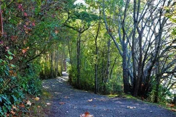
SIDEWALK While sidewalks are not trails in a traditional sense, they play a key role in View Royal’s overall pedestrian network. They are separated from vehicular lanes by boulevards and/or curbs, are surfaced with concrete or asphalt. They can connect trails and can run along road rights‐of‐way without encroaching on private property.
SHARED ROADWAY Shared roadways are routes that incorporate pedestrian and/or cycling movement with vehicular traffic. There are two types:
- Quiet residential or rural roads that provide pleasant cycling and walking opportunities.
- Highways that have wide paved and maintained shoulders, used especially by cyclists.
PARKS, RECREATION AND TRAIL PLANNING
In 2017, the Town completed a Parks Master Plan intended to guide parks and trails development over a ten-year period. This plan contains a significant amount of information regarding current conditions, community needs and parks trends, and recommends a vision, improvement opportunities and implementation process for enhancing community’s park and trail system.
The vision outlined in the Master Plan is as follows: “The parks system is integral to the unique spirit of place of view royal. The park system supports and enhances the health of the community for residents, wildlife, and ecosystems. Maintaining opportunities to connect people to nature and recreation through strategic investment and management is vital to maintaining the high quality of life in view royal.”
The Parks Master Plan also established several priorities to guide enhancements and improvements:
ECOLOGICAL DIVERSITY & HABITAT CONSERVATION. Move beyond preservation of natural systems, to rehabilitation and enhancement.
WATER. Emphasize water as a defining feature of the community.
LINEAR LINKAGES. Link the Town’s natural and recreation resources to form a complete greenspace network. Spaces for Everyone. Provide a variety of open spaces are needed to suit people of different ages, activity levels, abilities, and interests, including washrooms.
SUSTAINABILITY. Ensure ecologically and physical sustainability – that the Town can maintain a high standard of service delivery as the community grows.
HERITAGE. Incorporate View Royal’s rich history into park planning and design.
EQUITABILITY. Locate and service parks so that all residents may benefit from nearby outdoor greenspace.
Other important parks and trails planning documents include the 2018 Regional Growth Strategy, and the Capital Regional District Community Green Map (2016). The Regional District Community Green Map identifies Thetis Lake Regional Park, and Mill Hill Regional Park as significant greenspaces already protected. It suggests that significant greenspaces not currently protected are found in the lands north of Thetis Lake Regional Park. It points out blue spaces that require protection, including the mouth of Millstream Creek, the creek itself, Portage Inlet and Craigflower Creek.
OBJECTIVES AND POLICIES
The objectives and policies in this section will guide Town planning decisions related to parks and recreation.
OBJECTIVE PR1
Provide a variety of parks and recreation amenities that meet the diverse social and recreational needs of current and future residents.
POLICIES
PR1.1 Neighbourhood Greenspace Provide each neighbourhood with easily accessible greenspace to meet the social and recreational needs of local residents. Prioritize parkland acquisition and improvements in neighbourhoods with an identified shortage of greenspace, such as the Hospital and Harbour Neighbourhoods, or where current parks lack amenities necessary for meeting residents’ needs. Special attention should be given to underserved demographic groups, such as children and teenagers, and other groups with unique recreation and access needs.
PR1.2 Accessibility Remove barriers and improve access, including ease of access for seniors, people with disabilities and small children, to all parks, recreational facilities, public waterfront areas, viewpoints, and greenways while remaining sensitive to the preservation of natural habitat areas. Support the incorporation of universal design standards into all parks and recreation facilities, including outdoor play areas for children.
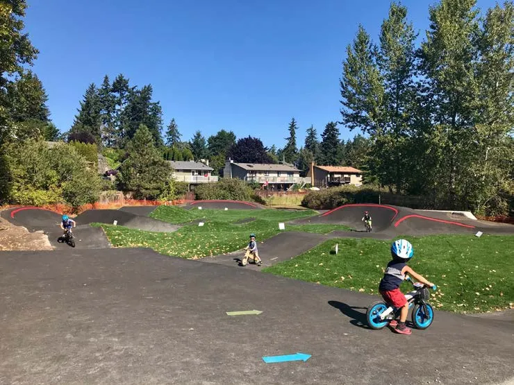
PR1.3 Youth Recreation Increase the number of recreation opportunities for youth throughout View Royal. Encourage the development of new facilities as well and improvements to existing assets. Potential improvements may include:
- Additional playing fields, basketball courts, and active outdoor recreational facilities.
- New mountain bike trails.
- A skateboard or bike park.
- Additional play equipment, including climbing walls.
- Beach and shoreline facilities.
- Interactive water features, swimming facilities or waterpark.
- Asphalt hockey or lacrosse court.
Youth oriented facilities should be prioritized in neighbourhoods with high percentages of young families and/or where a school is located, such as the Helmcken, Craigflower and Atkins neighbourhoods. Facilities intended for teen use should be planned to be accessible via transit.
PR1.4 Parkland Standard As a broad guideline, use a minimum standard of 5.0 hectares (10 acres) of parkland per 1,000 people, and neighbourhood/community parks at a ratio of one hectare (2 acres) for each 1,000 people, excluding regional parks and schools, while considering other significant factors affecting acquisition.
PR1.5 Parkland and Recreation Facilities Acquisition and Development Consider and use the following methods and strategies to acquire, improve and maintain parks and recreation facilities that meet the needs of current and future residents:
- Depending on the circumstances, at the time of subdivision of land, either acquire parkland of an amount and in a location acceptable to the Town or secure an amount that equals the market value of the land (Section 941, Local Government Act). Acquire parkland or secure an amount that equals market value with the subdivision of land.
- Acquire parkland or recreational facilities in exchange for rezoning for higher density.
- Acquire park improvements or recreational facilities in partnerships with other organizations and levels of government. This may include providing Town-owned land as an incentive for external investments.
- Strengthen partnerships with organizations and governments for park improvements.
PR1.6 Neighbourhood Priorities The type of park or greenspace to be acquired through any of the methods and strategies set out in Policy PR1.5 should be defined in response to ecological, social, and recreational priorities for each neighbourhood and in accordance with PR1.1.
PR1.7 Minimum size at Time of Subdivision In relation to the parkland dedication, at the time of subdivision the minimum area must be 1,000 (contiguous) square metres in a location suitable to the Town. If this is not achievable, cash in lieu of land will be required by the Town.
PR1.8 Juan de Fuca Recreation Centre Continue to support the Town’s inter‐municipal facility sharing agreement for the Juan de Fuca Recreation Centre. Explore options for increasing local benefits from this partnership.
PR1.9 Facility Sharing and Partnerships Consider cost sharing recreational facilities on an inter‐municipal basis when:
- It is not economical for the Town to independently develop and manage recreational facilities.
- It is determined to be in the overall best interests of the Town.
PR1.10 Sustainable Investments Ensure that recreation investments are sustainability over the long‐term and that the Town can maintain high quality parks and facilities.
PR1.11 Safety and Crime Prevention Support the safety and comfort of parks and recreation facility users by employing best practices for crime prevention, play equipment safety, natural, and active surveillance, and public awareness information.
OBJECTIVE PR2
Create an integrated network of parks and trails that facilitate connectivity between Neighbourhood Centres, Community Corridors, neighbourhoods, recreation areas, and schools.
POLICIES
PR2.1 Connectivity Encourage improved connections between parks, greenspaces, recreation facilities, schools and residential areas via linear parks, public trails, transit, and sidewalk connections. Support the establishment of multi‐use corridors that connect neighbourhoods with other areas of the Town and the regional trail system. Recognize that improved connections to parks and recreation facilities will better integrate these assets into the community, increase the walkability of the Town and promote healthy lifestyles. Also recognize that parks themselves can serve as connectors and links between neighbourhoods and residential areas. Ensure Park entries and pathways are designed to connect and benefit all adjacent areas.
PR 2.2 Improve Access to parks Develop a parking and transportation strategy for Community Parks that limits intrusions into residential areas, and explores options for alternative transportation
PR2.3 Connect Major Facilities On a town‐wide basis, prioritize improving connections to the Juan de Fuca Recreation Centre, Thetis Lake Regional Park, and View Royal Park so that all residents have access to and a sense of ownership of these public assets.
PR 2.4 Connect People with places and Nature Implement the View Royal Wayfinding Strategy in parks.
OBJECTIVE PR3
Increase public access to the water and shoreline to provide all residents opportunities to enjoy these natural features.
POLICIES
PR3.1 Water and Shoreline Access Develop public accesses, identified in the Parks Master Plan, to the water, beach, shoreline areas and significant viewpoints. Planning considerations for development of water and shoreline accesses include:
- Avoiding or minimizing ecological impacts. This may necessitate excluding people and dogs from vegetated shoreline buffers.
- Ensuring safety, convenience, accessibility, and good wayfinding.
- Prioritizing accesses in areas where access is currently most limited or where the greatest public benefit can be achieved.
- Creating connections to other parks and trails.
- Flood construction level that considers both Sea Level Rise and tsunami risk.
Design for road ends shall include:
- Chain link fencing to delineate private property, implementation of best practices for shoreline restoration.
- Addition of seating areas.
- Not permit off-leash areas
- Consideration of landscaping to remove invasive species and encourage native habitat
PR3.2 Waterfront Development Sites In reviewing development proposals for waterfront sites, encourage new public water and shoreline accesses, parks, and boat launches depending on current Flood Hazard Land Management Guidelines to allow for sea level rise to year 2100.
PR3.3 Public Boat Launches Support the establishment of public launches for non‐motorized boats at public waterfront access points. Opportunities for new public launches should be pursued at sites currently owned by the municipality as well as other sites. Boat launch planning should occur in consultation with local residents.
PR3.4 Non-motorized Public Boat Launch Consider development of a non-motorized launch site for canoes and kayaks at the Portage Inlet Linear Park
OBJECTIVE PR4
Identify and develop spaces for large, outdoor events, festivals, farmers markets and other community gatherings.
POLICIES
PR4.1 View Royal Park Support investment in View Royal Park as the primary town park. In addition to providing for a range of recreation activities that will attract a broad section of the community, ensure that there is sufficient space and amenities to facilitate large community gatherings such as festivals and group picnics.
PR4.2 Social Gathering Places Support the development of rain and sun protected outdoor social gathering places in larger parks and public areas and as part of large development proposals.
PR4.3 Public Washrooms As a guideline, View Royal will work toward providing public washrooms at all Town and Community Parks and will partner with CRD Parks to advance this objective in regional parks.
PR 4.4 Parks Programming Encourage Westshore Parks and Recreation to program a range of events and activities in appropriate parks over the summer months.
OBJECTIVE PR5
Protect and restore ecologically sensitive areas and features within the parks and trail system to ensure the integrity of the natural environment, maintain the natural setting, and preserve these features for the appreciation of future generations.
POLICIES
PR5.1 Green and Blue Spaces Acquire, develop, manage, and preserve various forms of green/blue spaces in suitable locations throughout the Town that meet the needs of both present and future View Royal residents.
PR5.2 Environmentally Sensitive Areas Continue to identify and review Environmentally Sensitive Areas (ESA) to ensure that these areas are adequately protected within Development Permit Areas (DPA). Periodically update DPA guidelines to respond to new scientific information and incorporate best practices.
PR5.3 Ecologically Sensitive Planning and Design Support ecologically sensitive park/trail planning and design. Planning consideration to include:
- Maintaining biodiversity and natural features.
- Designing with natural networks and systems. This includes respecting existing terrain and drainage patterns and identifying the least intrusive approaches to facilitating recreation needs.
- Providing a context for learning and understanding the natural systems within the Town.
PR5.4 Sound Parks Management and Construction Practices Protect ecosystems in natural parks through sensitive management and minimal construction, ensuring that any works shall be carried out in an environmentally sensitive manner with proper professional consultation.
PR5.5 Parks and Environmental Health Recognize and support parks as contributors to the environmental health of View Royal and the region through stormwater management, riparian area protection, climate change adaptation and mitigation, increased shade, and CO2 sinks.
PR5.6 Parks and Population Health Recognize and support parks as contributors to the overall health and well-being of View Royal and regional residents by providing opportunities for fitness and passive enjoyment.
PR5.7 Integrate Parks and Recreation Planning Ensure Park and recreation planning is integrated with broader Town planning efforts, land use and transportation decisions, and public realm planning and design.
PR5.8 Invasive Species Removal and Habitat Restoration Support the rehabilitation of areas degraded by invasive plants and species, and the restoration of native vegetation. When possible, employ preventative measures to protect native habitat within View Royal parks.
PR 5.9 Support and Enhance the Health of Ecosystems Encourage the CRD to update Sensitive Ecosystem Mapping.
OBJECTIVE PR6
Implement recommendations from the Parks Master Plan.
POLICIES
PR 6.1 Maintain and Improve Existing Parks Build on the existing Amenity List that specifies a range of infrastructure and actions unique to neighborhoods needs and wants (for example, benches, trees, and bike racks) to inform annual capital plan priorities and to encourage involvement from individuals and groups.
PR 6.2 Provide Diverse and Inclusive Recreational Opportunities Maintain View Royal Park as the primary focal point of the parks system, including additional site furnishings, improved riparian areas, playground upgrades and a community gathering space. Emphasize the historical and cultural significance of Portage Park and other parks. Add interpretive improvements to the park documenting First Nation’s history and early European settlement in the area.
7 | COMMUNITY INFRASTRUCTURE AND SERVICES
OVERVIEW
Decisions made today about View Royal’s infrastructure and services will affect its performance both fiscally and in meeting the climate actions. Better connected, compact neighbourhoods are more cost-effective to service and maintain long term. The servicing and infrastructure investments the Town makes have far-reaching impacts on the community’s future well-being and fiscally responsible management.
Distributing water, treating wastewater, and collecting and treating solid waste all require more energy-efficient approaches. Climate change impacts threaten the reliable functioning of this complex network of infrastructure in View Royal. Projected decreases in precipitation and snowfall may reduce water supplies in the coming years. Increased risks of flooding, storm surges, saltwater ingress, extended drought conditions, and more frequent and severe rainfall events are anticipated to strain municipal infrastructure systems. These changes require planning for adaptation and resiliency.
GOALS
- Confirm View Royal as an environmentally responsible community committed to becoming a more sustainable place and planning for global climate change.
- Ensure that community services and amenities can be provided within the financial means of the municipality and strengthen partnerships with regional service providers to increase local opportunities.
- Recognize the regional role of the community as a link in major transportation and environmental systems and cooperate with other municipalities and other governments to address regional issues while also protecting local values and promoting long-term sustainability.
VIEW ROYAL TODAY
Today, the vast majority of residents and businesses are located inside the Urban Containment Boundary and are connected to urban infrastructure and services. These include urban sanitary sewer, potable water and drainage systems, garbage, composting and recycling collection. A major challenge for the Town is continuing to provide the high-quality infrastructure and services the community expects in a fiscally sustainable manner. The Town also needs to identify and pursue opportunities to incorporate environmentally sustainable technologies and service delivery methods into its established systems. Since the Capital Regional District (CRD) provides many of the community services in View Royal, it will be necessary for the Town to collaborate with the CRD and other agencies in addressing these challenges.
Residents also have access to two library systems and a variety of other community services and opportunities that support social health and community wellbeing.
WATER SYSTEM
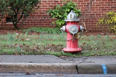
View Royal is connected to the regional water distribution system. The system is owned, operated, and maintained by the CRD Water Department. Residents and businesses in the Town are on metered water services and receive direct billing from CRD for water consumption. The CRD installs fire hydrants at locations requested by the View Royal Fire Department. The cost of installing hydrants is borne by the CRD (most often paid for by new developments). The costs of maintenance, amortization of capital costs, and water consumed are included in the retail water rates.
Water distribution mains to the majority of the Town provide sufficient quantities of potable water for current commercial, institutional and domestic uses, as well as for fire protection purposes. Areas outside the Urban Containment Boundary, in the Thetis neighbourhood, have more limited water service. Several properties rely on alternative sources for both consumable water and fire protection.
Four Water supply (transmission) mains do exist within View Royal. Contrary to the water distribution system, these supply mains carry bulk water from the Sooke Reservoir to the Capital Region. As these supply mains pass through View Royal to service the other Municipalities in the Capital Region, View Royal must be aware of the location of these systems prior to construction activities to avoid disrupting this regional system.
SEWER SYSTEM
View Royal's sewer system consists of approximately 50 kilometres of pipeline and 17 pump stations, which are electronically monitored on a continual basis. In addition to the Town managed system, there are also privately managed sewer grinder pumps on properties that are lower than the gravity sewer system. All domestic sewage is eventually pumped from the Craigflower Pump Station on Shoreline Drive to McCauley Point in Esquimalt. These last two components of the system are operated and maintained by the CRD. View Royal’s Sanitary Plan outlines the desired upgrades to the sanitary sewer system with a detailed renewal program.
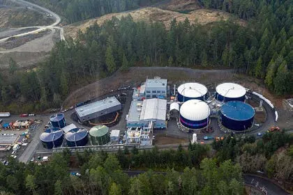
The CRD's Environmental Services Department has a Regional Source Control program aimed at reducing the amount of contaminants discharged into sanitary sewer systems. The program accompanies the CRD's Sewer Use Bylaw, which specifies the types of wastes that are prohibited or restricted for discharge into the sanitary sewer systems. The purpose of these initiatives is to ensure the functionality of the system and protect human and environmental health.
The existing sewer system is adequate for the existing residential and commercial development within the Urban Containment Boundary. However, sewer system upgrading is required for any substantial development or redevelopment to occur.
DRAINAGE SYSTEM
For much of View Royal, stormwater management is addressed through open ditches, culverts, and driveway culverts that drain to either Craigflower or Millstream Creeks or directly into the Esquimalt Harbour or Portage Inlet.
The open ditch drainage system has provided reasonable protection against local flooding; however, this may change due to a changing climate. For example, Provincial Flood Hazard Area Land Use Management Guidelines recommend planning for a Global Sea Level Rise of 0.5m by 2050, 1.0m by 2100 and 2.0m by 2200. Mitigation and adaptation strategies for existing municipal services and other infrastructure vulnerable to Sea Level Rise and storm surge impacts will be needed.
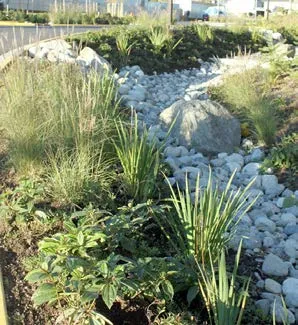
The Town's Master Drainage Plan was developed with consideration of climate change effects, including increased frequency, duration and intensity of storm events and flooding. The Town of View Royal has an aggressive fifteen year drainage program and has been working systematically to improve the quality of stormwater that reaches Esquimalt Harbour and Portage Inlet. This includes major investments in bioswales and treatment wetlands associated with road improvement projects. In addition, all new development is required to develop a stormwater management plan that addresses stormwater quality and volume issues. This includes both on and off-site strategies and a range of solutions from small rain gardens to infiltration systems, roadside bioswales, and large, constructed wetlands.
GARBAGE, COMPOSTING, AND RECYCLING COLLECTION
The Town contracts a company to collect residential garbage and household food waste on a weekly basis. These two waste streams are collected in separate colour coded containers supplied to each household by the company. Residential garbage is disposed of at the Hartland Road Landfill, which is owned and operated by the CRD. Food waste is taken to a composting facility.
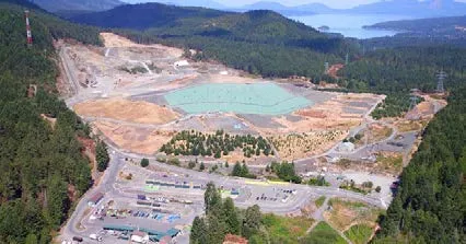
The Canteen Composting Facility in Esquimalt is available to View Royal residents free of charge at the gate. Lawn and garden waste is also collected three times per year at the curbside. Weekly curbside recycling is offered to all View Royal residents through the CRD Environmental Services Branch. The CRD also operates a recycling program for condos and apartments.
FIRE PROTECTION
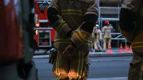
The Town of View Royal has a Fire Department with seven full time staff and thirty part-time firefighters. In addition to responding to fire and rescue-related incidents, the Fire Department provides fire prevention and education, emergency response and life saving services, code inspections and enforcement, and it participates in regional emergency and safety initiatives. The Fire Department works cooperatively with other municipal departments and adjacent municipalities through mutual and automatic aid to ensure the best available coverage for all area residents and businesses.
TOWN OF VIEW ROYAL EMERGENCY PROGRAM
The View Royal Emergency Program comprises Town staff and dedicated volunteers who serve their community to prepare, respond, and recover from emergencies and disasters that may affect our municipality. It is a dynamic organization run by the View Royal Fire Rescue staff itself in order to meet provincial mandates, comply with the British Columbia Emergency Management System (BCEMS), and the current needs of its residents, businesses and infrastructure. The View Royal Emergency Program encompasses the following areas:
- Emergency Support Services (ESS)
- Neighborhood Emergency Preparedness Programs (NEPP)
- Emergency Radio Communication
- Emergency Operations Centre
- Public Education
- Staff and Volunteer Training
The Emergency Management staff maintains and manages emergency plans, emergency supplies and equipment, Emergency Operations Centre (EOC) and Emergency Reception Centres. We coordinate and facilitate training for staff and volunteers and host emergency preparedness workshops for the public. We are active in regional initiatives and a member of the Local Government Emergency Program Advisory Committee (LGEPAC) and the Regional Emergency Program Advisory Committee (REPAC).
View Royal's Emergency Program works closely with Emergency Management BC (EMBC) and the Federal department, Public Safety and Emergency Preparedness Canada (PSEPC). The Emergency Program also includes Emergency Support Services (ESS). ESS is a community based provincial emergency response program providing short-term assistance to people forced to leave their homes because of fire, floods, earthquakes, or other emergencies. This assistance includes food, lodging, clothing, emotional support, and family reunification. The ESS provides relief for small to large groups of people for up to seventy-two hours.
POLICE PROTECTION
The Town of View Royal is serviced by the West Shore Royal Canadian Mounted Police (RCMP) detachment located at 698 Atkins Avenue in Langford. The detachment provides policing services to four other municipalities including the Cities of Langford and Colwood and the Districts of Metchosin and Highlands. West Shore RCMP also serves the Songhees and Esquimalt Nations and portions of the Malahat. West Shore RCMP has approximately one-hundred and three regular members and more than fifty support staff under the supervision of the Officer in Charge, a Superintendent. The detachment provides 24-hour police service covered by five General Duty Watches and averages more than 25,000 files each year.
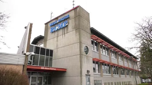
West Shore RCMP also comprises several specialized units, such as the Police Dog Services, Bike Unit, Uniformed Gang Enforcement Team, Indigenous Policing Services, Serious Crime Unit, Traffic Services, Community Policing Section, Crime Reduction Unit, Drug & Organized Crime Unit, and Special Victim’s Unit.
In addition to the regular policing services provided by West Shore RCMP, the detachment is also dedicated to various community-based services and programs administered by over fifty volunteers. These services and programs include Keep in Touch, Restorative Justice, Speed Watch, Victim Services referrals, Community Policing Advisory Committee, and the Auxiliary Constable program.
OBJECTIVES AND POLICIES
This section contains the Town’s objectives and policies related to providing and maintaining community infrastructure and services in View Royal.
OBJECTIVE IS1
Coordinate infrastructure and services with land use planning – Ensure that infrastructure and services investments are planned to coincide with the community Vision and long-term land-use planning priorities. This includes supporting compact development near existing infrastructure and protecting natural areas and ecosystems.
POLICIES
IS1.1 Resilience Ensure that infrastructure and services are resilient to the risks and impacts of climate change and disasters.
IS1.2 Sustainable Development Pattern Plan new infrastructure and services to support compact and sustainable development. Prioritize investments that support new housing, commercial and facility development within the planned Town Centre, Neighbourhood Centres, and Community Corridor areas. Extension into un-serviced areas will only be built in tandem with new development and will be financed by development projects. Extension of services in areas outside the Urban Containment Boundary or for developments that are not in conformance with the policies of this plan will not be supported.
IS1.3 Adequate and Appropriate Infrastructure Ensure that development will only occur if appropriate infrastructure systems (water, wastewater, and sewer) and standards are in place and designed to the satisfaction of the Town. Work with developers and regional agencies to ensure adequate systems that promote conservation and expand only as necessary to accomplish goals and policies within this plan. The presence of adequate infrastructure is not in itself a justification for development.
IS1.4 Servicing Standards Municipal infrastructure projects follow the Master Municipal Construction Documents (MMCD) and aim to advance green infrastructure practices.
IS1.5 New Development Ensure that developments utilize best practices for infrastructure design, operations, and maintenance. Developers will be required to meet the Town’s standards and should be encouraged to incorporate innovative strategies, such as:
- On-site stormwater management and surface stormwater treatment.
- Net-zero runoff policy, with raw land as starting measuring point.
- Underground services.
- Water conservation and wastewater reduction.
- Use of pervious surfaces and permeable landscaping materials.
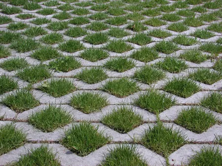
IS1.6 Comprehensive Drainage Studies Require comprehensive drainage studies that include drainage improvement recommendations and implementation procedures for all major developments.
IS1.7 Curbs and Gutters Curbs and gutters will be required for new development in all commercial, mixed residential and mixed-use areas. The Town may adjust this requirement if a development proposal includes alternative approaches to stormwater management that support sustainable development, protect the natural environment, and are designed and implemented to the satisfaction of the Town.
IS1.8 On-site Sewage Disposal Require strict adherence to the Vancouver Island Health Authority and Ministry of Environment guidelines for on-site sewage disposal and private wells in areas not served by the Town’s sewer system.
IS1.9 Emergency Access Require developments to make adequate provision for emergency vehicle access and manoeuvrability and ensure that the infrastructure necessary to support fire protection activities is in place.
IS1.10 Fire Protection Ensure fire protection is an important element in site and building design, with the view to shifting the burden of fire suppression to the developer and property owner.
IS1.11 Coordinate Public Projects Plan new infrastructure in conjunction with roads, community facilities, parks, and other public spaces. Planning considerations should include:
- Stormwater management.
- Watershed issues.
- Integration of parks, greenways, and natural systems.
- Pedestrian, cyclist, and transit connectivity.
OBJECTIVE IS2
Environmental sustainability and protection – Preserving the integrity of the natural environment and protecting human health should be a major determinant in all infrastructure and services decisions. Ensure that new growth is balanced with the capacity of natural systems.
POLICIES
IS2.1 Environmentally Sensitive Design Ensure that infrastructure and services are designed and located to be sensitive to surrounding land uses and reduce or eliminate run-off and adverse impacts on the natural environment. Design considerations should include:
- High energy efficiency building retrofits and new construction
- Utilizing natural features and systems such as trees, vegetation, and riparian areas for natural stormwater absorption and treatment
- Mimicking and incorporating natural systems
- Strategies to minimize the amount of stormwater entering the sewer system
- Sustainable approaches to wastewater management, such as site-specific wastewater infrastructure for private developments
- Utilizing pervious surfaces on driveways, parking lots and access roads
- Xeriscaping, infiltration basins, and green roofs as a means of reducing stormwater runoff and the heat island effect.
IS2.2 Green Infrastructure Expand green infrastructure systems throughout the Town. Green infrastructure includes existing natural watercourses and drainage systems, engineered bioswales and groundwater recharge areas, green roofs, permeable surfaces, etc.
IS2.3 Sustainable Standards Establish sustainable infrastructure standards for the Town of View Royal that incorporate innovative technologies and green infrastructure and ensure long-term resiliency and stability of services.
IS2.4 Water Conservation Support strategies and develop incentives for reducing water consumption and wastewater generation. Strategies could include rainwater collection, greywater reuse (Including treated water for irrigation purposes) and dual piping systems.
IS2.5 Safe Water Supply Work with the CRD and other agencies to protect the drinking water supply and prevent water contamination.
IS2.6 Stormwater Discharge Ensure that the discharge of stormwater does not negatively impact adjacent water quality. Diverted stormwater collection and discharge systems require provision for grease, oil, hydrocarbon, and sedimentation removal facilities and ongoing maintenance of these facilities. Such systems shall be engineered to the satisfaction of the Town. Where a net benefit for fish habitat can be demonstrated, the Town may consider proposals from applicants to enhance fish habitat, including in-stream works or the creation of wetland areas, as part of alternative design options for development projects. These projects may be subject to approval from applicable provincial and federal government authorities.
IS2.7 Infiltration and Detention Support stormwater management practices that emphasize infiltration and detention to minimize the effect of stormwater discharge into Esquimalt Harbour, Craigflower Creek, Millstream Creek and other natural watercourses.
IS2.8 Siltation Prevention Ensure construction and other human activities are carried out to minimize siltation effects.
IS2.9 Waste Reuse Recognize waste as a viable resource. Work with the CRD, other agencies and businesses to develop strategies to reuse solid waste, liquid waste and wastewater generated in View Royal.
IS2.10 Systems Longevity Facilitate adequate operation and maintenance programs in order to maximize the life of infrastructure systems, reduce the frequency of replacement, and ensure proper functionality.
OBJECTIVE IS3
Fiscal sustainability— Ensure infrastructure and services are planned within the financial means of the Town and that investments continue to meet the high standards expected by the community.
POLICIES
IS3.1 Prioritize Investments Prioritize infrastructure and services investments throughout the Town to best address local needs and maximize community benefit.
IS3.2 New Development Costs Require that the cost of system upgrades to accommodate new development be borne by developers.
IS3.3 Local Improvements Encourage the use of local improvements financing for systems upgrades and improvements in residential areas. “Local Improvements” refers to those works and services that directly benefit a local area or neighbourhood and not necessarily the community at large. Property owners may petition Council to undertake local improvements, whereupon Council would determine an appropriate proportionate sharing of the cost (e.g., 100% local area, 60% - 40%, etc.).
OBJECTIVE IS4
Solid waste management – Reduce the amount of solid waste entering the landfill from View Royal.
POLICIES
IS4.1 Waste Separation Continue to work with the Capital Regional District and the private sector to maintain three-stream waste separation systems (garbage, recycling, composting) as a means of reducing the amount of solid waste reaching the landfill. Ensure that all collection programs are convenient and well-promoted to increase participation at the unit level, building level, in businesses and public institutions.
IS4.2 Household Food Waste Collection Explore the expansion of the household food waste collection program to condos and apartments.
IS4.3 On-site Composting Support small-scale composting on appropriate residential properties and in community gardens.
IS4.4 Construction Waste Support regional initiatives to reduce construction waste and encourage sustainable waste reduction practices.
OBJECTIVE IS5
Protective services—Maintain a high level of protective services presence and programs in View Royal to ensure community safety and security.
POLICIES
IS5.1 Safety and Policing Coordinate directly with the West Shore RCMP on safety and policing matters. Enhance the community’s sense of safety, security, and confidence in its police service by ensuring that:
- Emergency calls and complaints are consistently handled in an appropriate professional manner.
- Traffic control and the response to traffic accidents are as effective as possible.
- Bylaw enforcement is consistently carried out.
- Citizen participation in crime prevention activities is improved.
- The principles of Crime Prevention Through Environmental Design (CPTED) are systematically applied to ongoing and future development in View Royal.
IS5.2 Fire Protection Maintain a composite Fire Department comprised of career and part-time firefighters. Continue the Fire Department’s commitment to providing the highest level of life and property safety with caring professionalism through effective training in the delivery of fire prevention, control, rescue, and public education services. Enhance the delivery of fire protection services through a well-coordinated approach to infrastructure improvements and review of development projects.
IS5.3 Comprehensive Emergency Plan Enhance disaster preparedness through the ongoing review and implementation of a comprehensive emergency plan.
IS5.4 Sea-level Rise and Flood Planning Plan for the safety of people and property in the occurrence of major flood events:
- Require assessment of minimum flood construction elevation by a qualified professional for new waterfront developments.
- Identify flood-prone areas and discourage development within floodplains.
- Require buildings located in areas susceptible to flooding to be adequately flood-proofed.
- Collaborate with adjacent municipalities to establish a routing strategy for major storm events.
- Coordinate flood planning with the CRD and other agencies.
- Establish Development Permit area guidelines for flood-prone areas that follow current Flood Hazard Land Management Guidelines for all new developments, subdivisions, and zoning to allow for sea-level rise to the year 2200.
8 | COMMUNITY FACILITIES AND SOCIAL WELLBEING
OVERVIEW
This chapter addresses community, cultural, and heritage resources in View Royal and establishes goals, objectives, policies and implementing actions for protecting these resources and better integrating them as assets into the community’s social and physical landscape.
The chapter also includes general statements related to well-being. Community facilities support social connections and increase community resilience, mental and physical health, and connection to place. Through its authority to plan and make decisions within its jurisdiction, the Town will have a significant influence on social and community well-being. The Town can also support the efforts of other governments, public agencies, and service providers in a collective effort to work towards social sustainability.
GOALS
- Honouring and building relationships with the Esquimalt Nation and Songhees Nation in the spirit of Reconciliation.
- Identify, preserve, and protect the historic and cultural sites in View Royal.
- Provide or facilitate community services and facilities that meet the needs of View Royal’s residents of all ages, abilities, and cultural backgrounds.
- Enhance the quality of life for the full diversity of View Royal residents.
- Identify ways to better engage youth and families.
- Promote a strong sense of community in all areas and neighbourhoods of the Town and create an enhanced sense of place and identity throughout.