Official Community Plan - Western Gateway Corridor - Mayor Tobias
A report and series of maps provided by Mayor Tobias regarding a reconsideration of the study area for the Western Gateway Community Corridor.
Mayor’s Reconsideration for the Western Gateway Area of Study
On 17 June Council directed staff to:
C-105-25 THAT the “Draft Vision and Land Use Survey” attached to the report titled “Official Community Plan Review Update: Draft Vision and Land Use Survey” dated June 2, 2025 from the Senior Planner be amended prior to publication to reflect the modified Option 2 put forward by the Committee at its June 10, 2025 meeting as the option to move forward with for Phase 1 of the Official Community Plan Review and Update; AND THAT the “Draft Vision and Land Use Survey”, once amended, be provided for comments prior to publication; AND FURTHER THAT staff subsequently initiate engagement on the draft vision statement and goals as well as the Western Gateway Community Corridor. CARRIED 3. Ongoing Review of 2025 Capital Project and Non-Core Project Summaries MOVED BY: Councillor Mattson Council SECONDED: Councillor Rogers
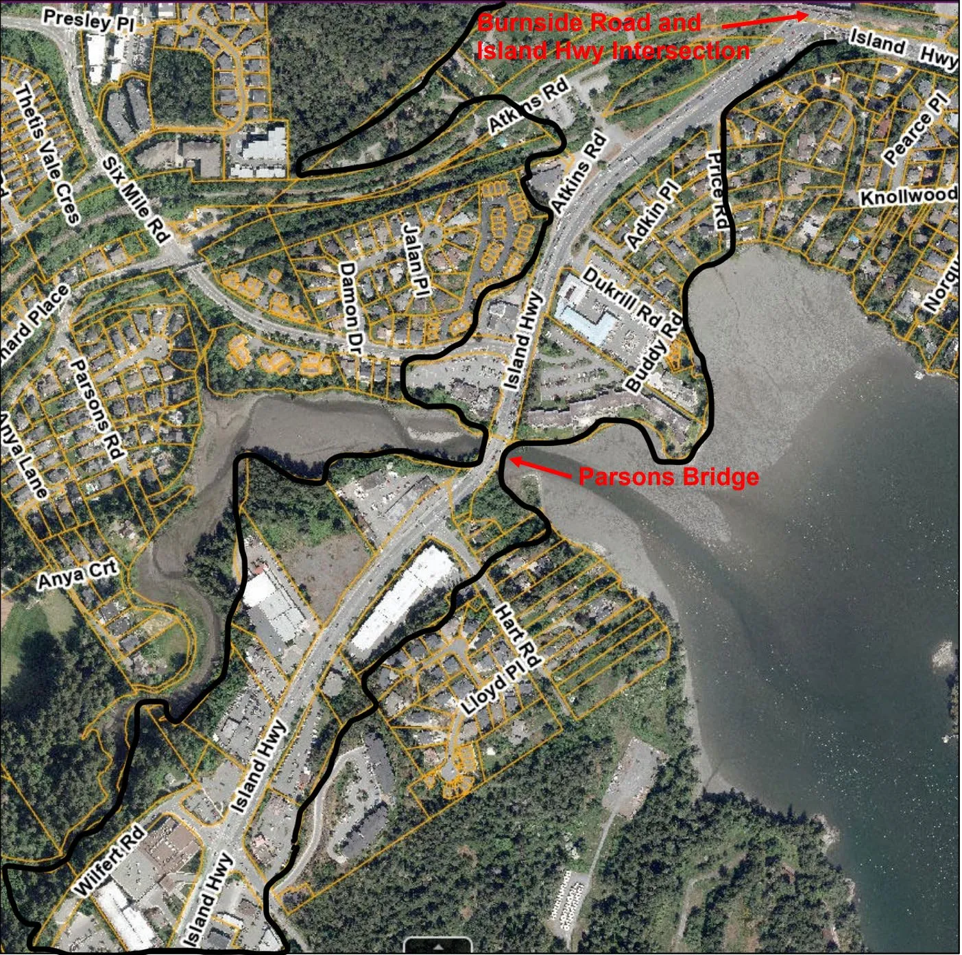
At the CoW Meeting in 9 September 2025 Council was presented with the following area for the Western Gateway Study Report
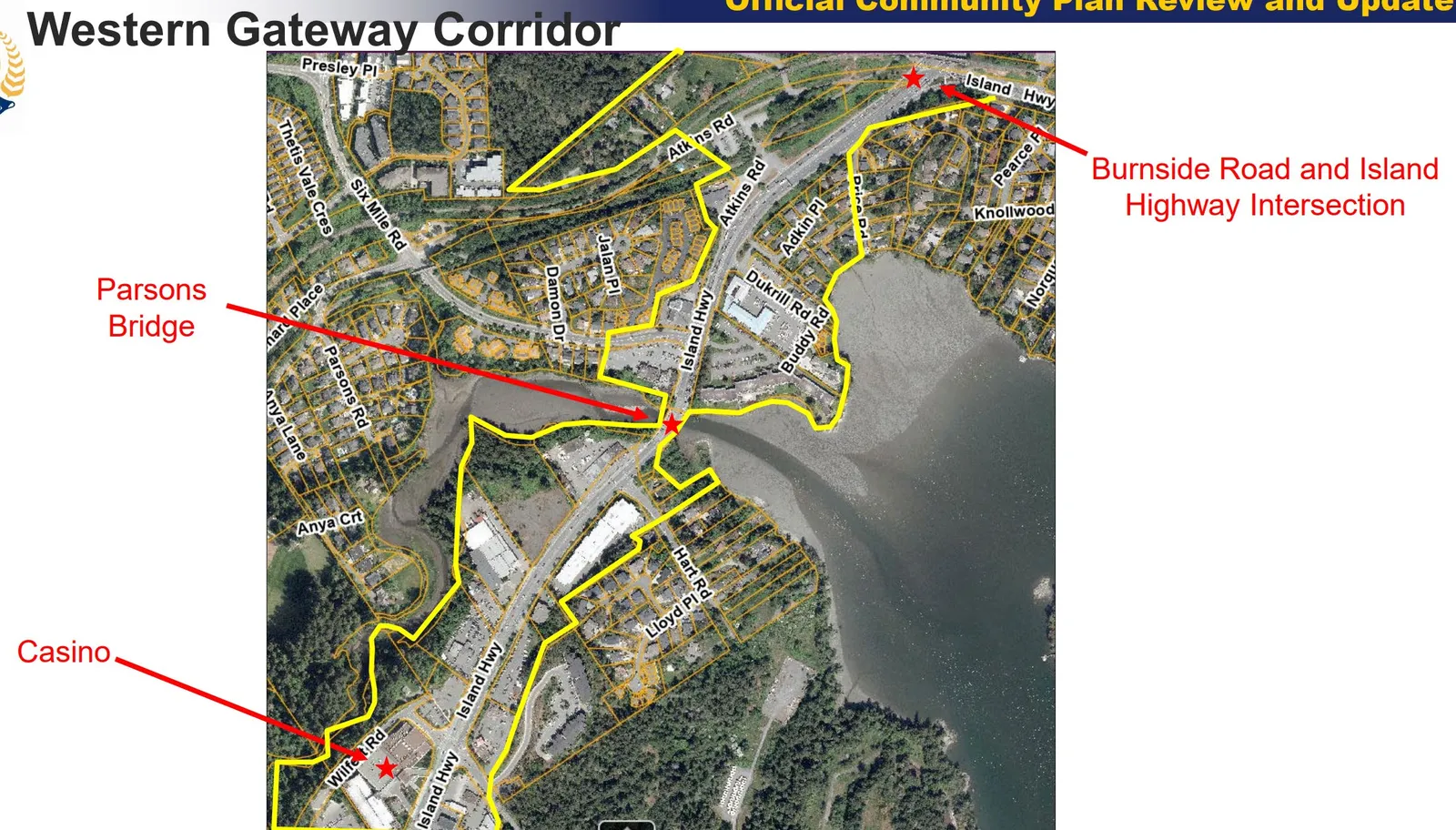
Another map of the area from the Staff Presentation
At the Special Council Meeting Council 24 February 2026 we were presented with the following area for the Western Gateway
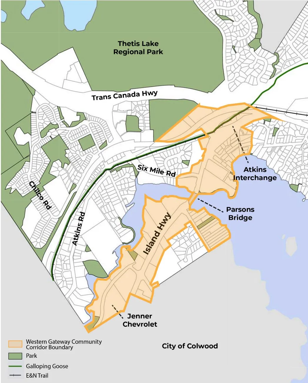
Council has accepted the receipt of the report even though areas had changed within the study area without Council direction for the addition of Hart Rd. I did not catch the change at the time.
Motion: That the study area for the Western Gateway exclude the area of Hart Rd for the Western Gateway Community Corridor Boundary as it was not the initial intent of the Area of Study agreed upon by Council.