View Royal Official Community Plan (OCP) - Draft
A detailed excerpt from the draft Official Community Plan covering land use designations, reconciliation with First Nations, housing targets, and environmental protection policies.
Page 1
I. Explore the viability of density bonusing for the Hospital Transit-Oriented Area and Western Gateway Corridor to determine building heights and density that are viable for development. Findings could be integrated into the Zoning Bylaw and Official Community Plan.
J. Apply Universal Design principles and guidelines for accessibility when designing public space and improvements.
K. Maintain the Urban Containment Boundary by continuing to direct urban development and improvements to areas within the boundary, thereby preserving agricultural land, natural areas, and rural character.
L. Integrate community safety principles and best practices into all design guidelines, such as the Crime Prevention Through Environmental Design framework or equivalent. This includes: i) Increasing visual permeability of areas such as building entrances, stairwells, building facades, playgrounds, etc. through the strategic use of windows, fencing material, and landscaping; ii) Orienting driveways and paths towards building entrances and windows; iii) Lighting pathways and other areas where opportunities for natural surveillance exist; iv) Developing public spaces in ways that encourage activity and natural surveillance, including sidewalk patios, seating areas, dynamic spaces that accommodate community uses (such as markets, festivals, placemaking projects, etc.), and other amenities; v) Landscaping to provide a natural barrier between conflicting uses and clear definition of spaces; vi) Providing clear signage, pavement markers, and other visual cues to provide clear direction for transitional spaces between public, semi-public, and private spaces; and vii) Opportunities for placemaking through street art and festivals.
Page 2
5.1.4 CORRIDOR POLICIES
A. Establish the corridors as shown on Map 3 as main thoroughfares that serve local residents and those travelling through the community to other areas of the region. This can be achieved by supporting applications for development along corridors that provide: i) a mix of local- and regional-serving amenities and businesses; ii) maximum permitted housing densities established through applicable land use designations outlined in Sections 5.2 to 5.13 of this Part; iii) infrastructure that allows for walkable connections between the corridor and surrounding neighbourhoods; iv) support for increased frequency of transit service through the concentration of employment and housing densities; and v) strong public realm design elements that support walkability, such as public gathering space, landscaping, seating, and lighting features, amongst others.
5.1.5 MOBILITY HUB POLICIES
A. Establish the Atkins Neighbourhood Village and the Hospital Transit-Oriented Area as View Royal’s mobility hubs, as shown on Map 4, to create conditions for the following: i) Centralized access to a range of services and amenities; ii) Convenient access to transportation services such as bus stops, cycling routes, local and regional multi-use trails, bike parking, car share options, amongst others; iii) Increased accessibility, safety, and comfort for everyone by ensuring inclusion of wide sidewalks, pedestrian-friendly road crossings, increased connections, accessible parking, accessible building access, and passenger loading areas; iv) Encourage and support local economic development; and v) Integrated public spaces and amenities into site design such as landscaping features, trees, outdoor amenity spaces, public art, and seating elements.
B. Encourage transit supported uses and medium to high densities such as mixed-use community-wide destination retail, small format retail, health services, community and social services, recreation facilities, educational, and arts and cultural spaces.
C. The public realm component of new development in mobility hubs should be designed in a manner that allows for strong pedestrian, cycling, rolling, and transit connections to other existing and new development within the same mobility hub. Proposals that strengthen connections between the two mobility hubs will be supported.
Page 3
5.1.6 REDEVELOPMENT POLICIES
A. Consider incorporating provisions for density bonusing to secure community and neighbourhood amenities associated with new development such as parks, plazas, playgrounds, community meeting spaces, heritage retention, and frontage improvements.
B. Where growth is planned, consider financial tools to collect funds for community amenities such as community centres, recreation facilities, libraries, childcare facilities, landmarks, and public spaces.
C. Collaborate with the Xʷsepsəm and Songhees Nation on land use and development opportunities that are mutually beneficial, and explore land use directions that further advance the Official Community Plan, long-term reconciliation, and meets the needs of the Xʷsepsəm and Songhees Nations.
D. Maintain alignment of the Development Cost Charges Bylaw with market trends, and ensure the costs of providing infrastructure services associated with community growth are recovered.
E. Where heritage, archeological or cultural assets that may be significant to the Town, Xʷsepsəm or Songhees Nations are potentially impacted by redevelopment, require applicants to protect, rehabilitate, restore, and/or formally designate these assets, as appropriate on a case-by-case basis and in consultation with the Town and/or First Nations, by securing commitment through tools such as a covenant on title, or other protocols.
F. Support the reuse or retrofit of historically significant buildings, structures, and sites identified in the Town’s Heritage Register in a manner that preserves the heritage features of significance.
G. Explore opportunities to establish a standard for required professional reporting requirements for development applications.
H. Explore the opportunity to integrate Development Approval Information authority into the Development Application Procedures Bylaw to give Town staff the authority to request additional information about a development proposal, such as environmental reports, renderings, etc. that would aid the Town in its evaluation.
I. Notwithstanding the permitted building heights (i.e. number of storeys) within the Land Use Designations, consideration for increased building heights for rezoning and amendments to the Official Community Plan may be considered where proposed developments would achieve one or more of the following: i) Advance overall plan objectives; ii) Are on sites with substantial grade differences; iii) Meet specified density bonus zoning provisions;
Page 4
iv) Achieve retention of high value trees or natural features and increased on-site open space; v) Demonstrate site design and architectural excellence; or vi) Provide a significant public benefit, including securing non-market or supportive housing, parks, or community facilities.
J. Expand housing choice by supporting sensitive and strategic infill development, ensuring that new housing integrates seamlessly with the existing character, scale, and livability of established residential areas.
K. Where redevelopment is considered, the built form should respect the natural topography and ecology integrity of the site, including but not limited to, natural contours, rocky outcrops and bluffs, environmentally sensitive areas, and other natural areas.
L. To ensure new development is thoughtfully integrated into existing neighbourhoods, consider developing Infill Design Guidelines.
M. Development should strive to assemble properties in a manner that: i) Facilitates a desirable and replicable pattern of development that supports livability and enables neighbouring sites to develop to an equal standard; ii) Accommodates desired housing types and forms, including a mix of unit sizes; and iii) Enables high-quality built forms, landscaping, and tree planting, and contributes to the public realm.
Page 5

Page 6
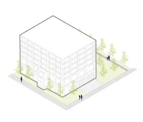
Density describes the intensity of people, jobs, housing units, commercial units, or industrial units within a defined area. Building height and Floor Space Ratio are common measures of density. In View Royal, density is classified as follows:
- Low-density – buildings with heights up to 3 storeys
- Medium-density – buildings with heights between 4 and 6 storeys
- High-density – buildings with heights 7 storeys or greater
Maximum density is expressed as Floor Space Ratio or FSR, which is the ratio of built (or buildable) area to land area. FSR is a tool used by planners, designers, and developers to model building mass in relation to lot. Density regulations and FSR exclusions for all land uses are specified in the Zoning Bylaw.
5.1.7 LAND USE DESIGNATIONS SUMMARY
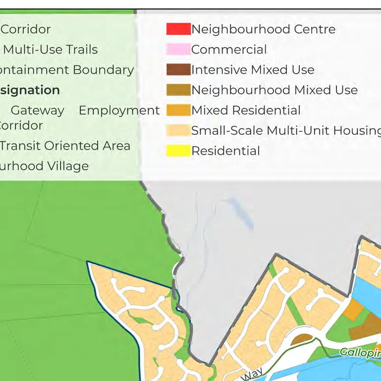
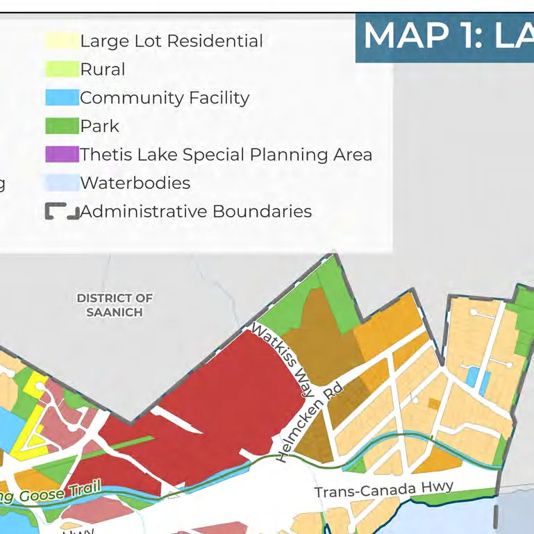
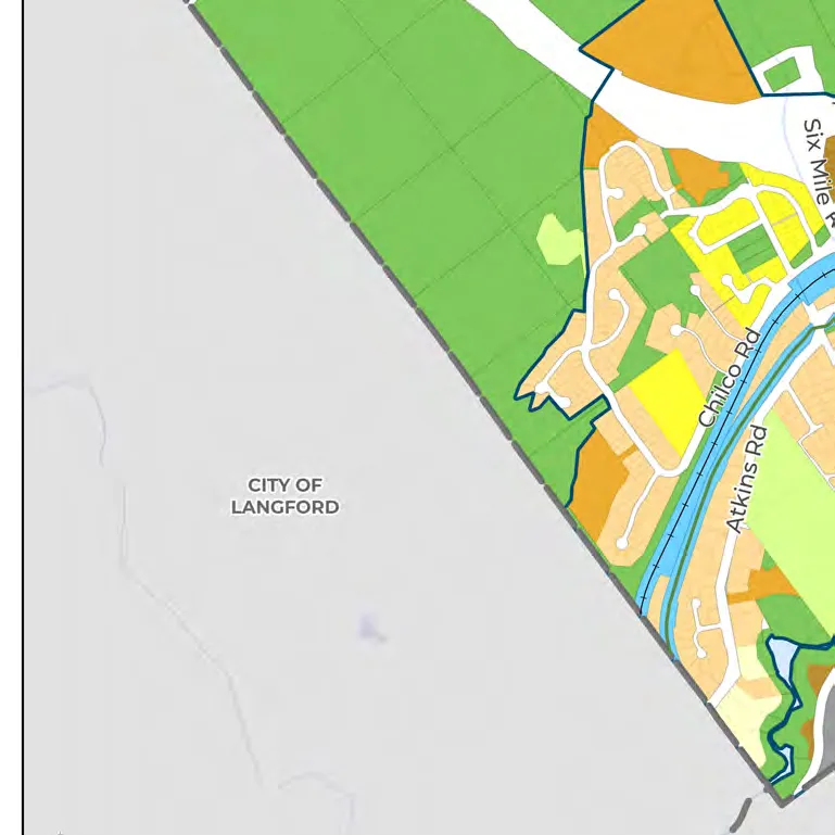
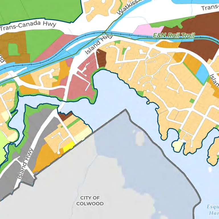
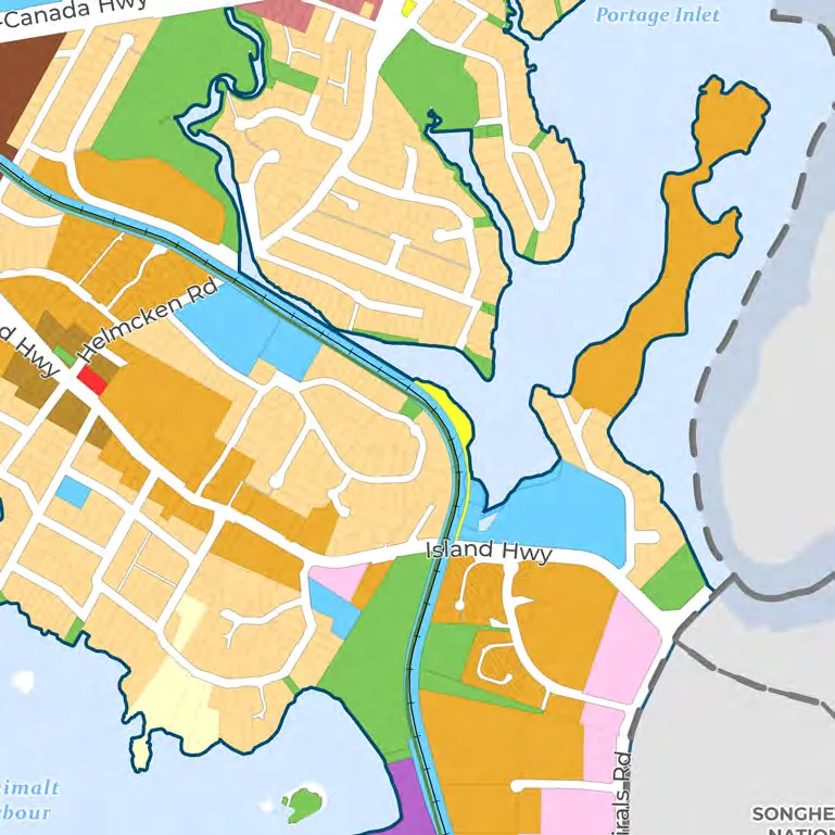
The following land use designations shall apply to lands within View Royal, as shown in Map 1:
| Designation | Description | Maximum Height/Density |
|---|---|---|
| Western Gateway Employment District Corridor | Uses include a mix of flexible and adaptable building forms that support a range of employment functions suitable for commercial, light industrial, arts and culture, and tourist accommodations. The following uses are supported: • Commercial space in the form of retail, restaurants, visitor accommodations, artist studios, and offices; • Light industrial space that includes distribution, repair, light manufacture, technology, and processing; and • Research, innovation and technology uses. |
• Up to 6 storeys • Up to 2.5 FSR |
| Hospital Transit-Oriented Area | Uses include a mix of residential (e.g. apartments), commercial (e.g. visitor accommodations, restaurants, retail, office), institutional (e.g. hospital), and civic uses (e.g. daycares, libraries, public gathering and amenity spaces). | • Up to 10 storeys • Up to 3.5 FSR |
Page 7
| Designation | Description | Maximum Height/Density |
|---|---|---|
| Neighbourhood Village | Uses include mixed-use buildings, such as multi-unit housing, community care facility, and community serving commercial and civic uses (e.g., daycares, libraries, public gathering and amenity spaces). This designation also supports schools, offices, restaurants, retail, grocery stores, and community spaces. | • Up to 6 storeys • Up to 2.5 FSR |
| Neighbourhood Centre | Uses include small-scale mixed-use development, including apartments with community-serving commercial and civic uses, such as daycares, schools, libraries, offices, restaurants, retail, small grocery stores, and community spaces. | • Up to 6 storeys • Up to 3.0 FSR |
| Commercial | Uses include a variety of commercial uses, including retail, offices, technology, services, and restaurants. | • Up to 4 storeys • Up to 2.5 FSR |
| Intensive Mixed Use | Uses include low-rise mixed-use development in the form of townhouses and low-rise apartments, designed to include ground floor commercial space and upper floors designated for residential dwellings. Ground floor commercial space may include one or more of the following: retail, restaurants, medical offices, offices, and civic uses (e.g. daycares, libraries, public gathering and amenity spaces). | • Up to 4 storeys • Up to 2.5 FSR |
| Neighbourhood Mixed Use | Uses include low-rise mixed-use development in the form of townhouses and low-rise apartments, designed to include ground floor commercial space and upper floors designated for residential dwellings. Ground floor commercial space may include one or more of the following: retail, restaurant, medical offices, offices, civic uses (e.g. daycares, libraries, public gathering and amenity spaces). | • Up to 3 storeys • Up to 1.5 FSR |
Page 8
| Designation | Description | Maximum Height/Density |
|---|---|---|
| Mixed Residential | Uses include detached and attached dwellings, such as single detached, duplexes, secondary suites, garden suites, rowhouses, townhouses, houseplexes, and apartments. | • Up to 3 storeys / 1.25 FSR • Up to 4 storeys / 1.6 FSR for apartments |
| Small-Scale Multi-Unit Housing | Uses include detached and attached dwellings, such as single detached, duplexes, secondary suites, garden suites, rowhouses, townhouses, houseplexes, and apartments. | • Up to 3 storeys • Up to a maximum of 6 dwelling units |
| Residential | Uses include single-detached and attached dwellings, duplexes, rowhouses, townhouses, houseplexes that are accessed via separate entrances at the ground level, secondary suites, and garden suites. | • Up to 2.5 storeys • Up to 0.6 FSR for appropriate infill |
| Large Lot Residential | Uses include detached homes on large lots and yards. | • Up to 2.5 storeys |
| Rural | Uses include single-detached dwellings on large rural lots, as well as recreation, and agriculture. | • Up to 2 storeys • Up to 1 unit per 10 hectares permitted |
| Community Facility | Uses include government buildings and publicly owned facilities providing a range of services, amenities, and utilities for the community, including health care facilities, emergency service buildings, community halls, libraries, water and sewer treatment plants and facilities, and schools. | Varies |
Page 9
| Designation | Description | Maximum Height/Density |
|---|---|---|
| Parks, Trails and Open Space | Uses include a mix of active and passive parks, trails, natural and green spaces, and outdoor recreation facilities. | N/A |
| Thetis Cove Special Planning Area | This land use designation has been created with the expectation that this land will be transferred to Xʷsepsəm Nation within the lifespan of this Official Community Plan. Administration of this process will be led by the Province of British Columbia. | N/A |
Page 10
5.2 WESTERN GATEWAY EMPLOYMENT DISTRICT CORRIDOR DESIGNATION
5.2.1 CONTEXT
The Western Gateway Corridor is made up of four distinct land use designations, including the Western Gateway Employment District Corridor, as shown on Map 1. This land use designation is strategically located along the corridor to create a future employment hub that attracts investment and enhances services and amenities in the community and region.
The Western Gateway Employment District Corridor land use designation supports medium-density commercial and light industrial land uses located along the Island Highway from the Colwood border to the south of Parsons Bridge, as shown on Map 1. It is View Royal’s vision that this corridor will transform into a medium-density employment hub for the Town, the West Shore, and the broader region.
In addition, this corridor will support the Atkins Neighbourhood Village located to the north, as shown on Map 4. The corridor will also support future transportation investment and surrounding residential areas by providing an abundance of employment opportunities, services, and amenities.
Employment opportunities facilitated through a mix of light industrial, commercial, arts and culture, and hospitality uses are encouraged. As discussed in Section 10.0, the Town aims to support new and existing businesses in the research, technology and innovation sectors, as well as those that support tourism and the healthcare industry, such as hotels, research labs, and biomedical services, amongst others. Given the Town’s central location within the region and existing healthcare assets such as the Victoria General Hospital, such investment opportunities would be highly supported in the Western Gateway Employment District Corridor.
Development in the corridor is intended to support pedestrian-oriented activity, encourage non-auto-oriented travel, and increase connections to the Millstream Creek greenway, as well as access to the nearby public waterfront along Millstream Creek and Esquimalt Harbour. Urban design that supports a strong public realm will be highly encouraged for new development, with connections to transit, trails, pedestrian-friendly streetscapes, and bike lanes provided wherever possible, particularly those that support the objectives of the transportation and mobility objectives outlined in Section 8.0.
Page 11
5.2.2 PERMITTED HEIGHTS AND DENSITIES
A. Heights and densities permitted in this land use designation are as follows: i) Building heights up to 6 storeys ii) Maximum density of 2.5 Floor Space Ratio
Page 12
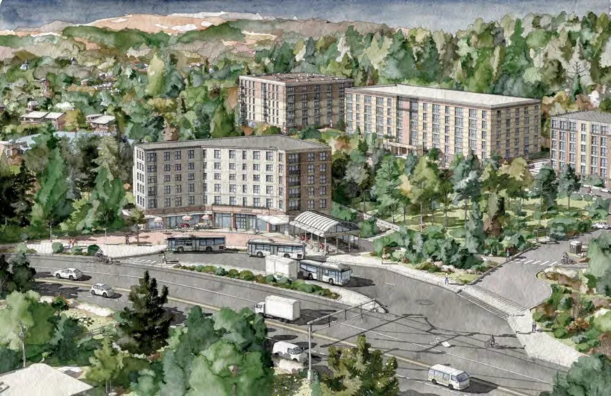
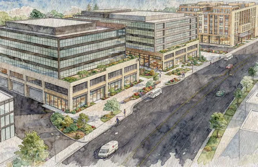
The Western Gateway Corridor has two components: an employment district and a neighbourhood village. The employment district applies to lands located along Island Highway between Parsons Bridge and the Colwood border. The illustration above depicts what this area could look like with mixed commercial - industrial development. In the illustration below, a future mobility hub is shown within the Atkins Neighbourhood Village. The illustration shows a mixed-use building connected to transit stops and the Galloping Goose trail just off Island Highway, and apartment buildings on the north side of the trail.
Page 13
5.2.3 POLICIES
A. Collaborate with the City of Colwood to establish the Western Gateway Corridor as a regional employment hub, that prioritizes economic development and attracts business investment.
B. Encourage redevelopment of lands designated as Western Gateway Employment District Corridor to promote medium-density mixed-use development, with an emphasis on commercial, light industrial, arts and culture, and hospitality uses, and a high-quality urban design. Development in the Western Gateway Employment District Corridor land use designation should aim to achieve: i) A mix of employment uses including office, retail, hotel, research labs, community/civic use, arts and culture, and light industrial (e.g. light manufacturing and processing of goods, distribution). ii) Integration of entertainment, arts and culture uses in the Atkins Mobility Hub. iii) Strong public realm design and a pedestrian-friendly streetscape that is designed to attract visitors to the area through orienting buildings towards the street, locating parking underground, below-grade, and behind the building and using landscaping features such as plantings, street trees, and seating to welcome users to the space, providing sidewalk and trail connections to transportation options, Millstream Creek, the waterfront, and other key businesses in the corridor, and supporting the nearby Atkins Mobility Hub. iv) Compatibility with nearby residential development through thoughtful design and landscape buffers, where appropriate. v) Long-term protection of Millstream Creek and the shoreline by dedicating park land for green space and / or recreational trails wherever possible. vi) Enhanced economic development opportunities for the Town, particularly local businesses and investments in emerging industries.
C. Enable the provision and viability of light industrial development by establishing greater flexibility in the design and configuration of buildings with industrial uses, such as exploring opportunities to support stacked development and buildings with high ceiling heights on the first two floors, amongst others.
Page 14
5.3 HOSPITAL TRANSIT-ORIENTED AREA DESIGNATION
5.3.1 CONTEXT
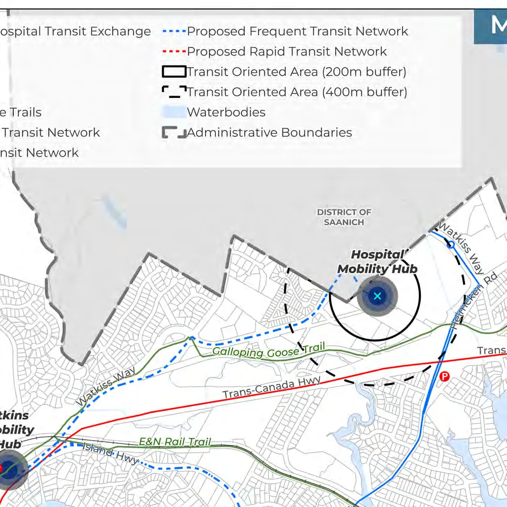
Provincial regulations have designated the area west of Victoria General Hospital around the existing bus exchange as a Transit-Oriented Area, as shown on Map 4. To comply with Bill 47: Housing Statutes (Transit-Oriented Areas) Amendment Act, the Hospital Transit-Oriented Area designation applies to lands within 200 metres of the Hospital Transit-Oriented Area’s prescribed bus exchange.
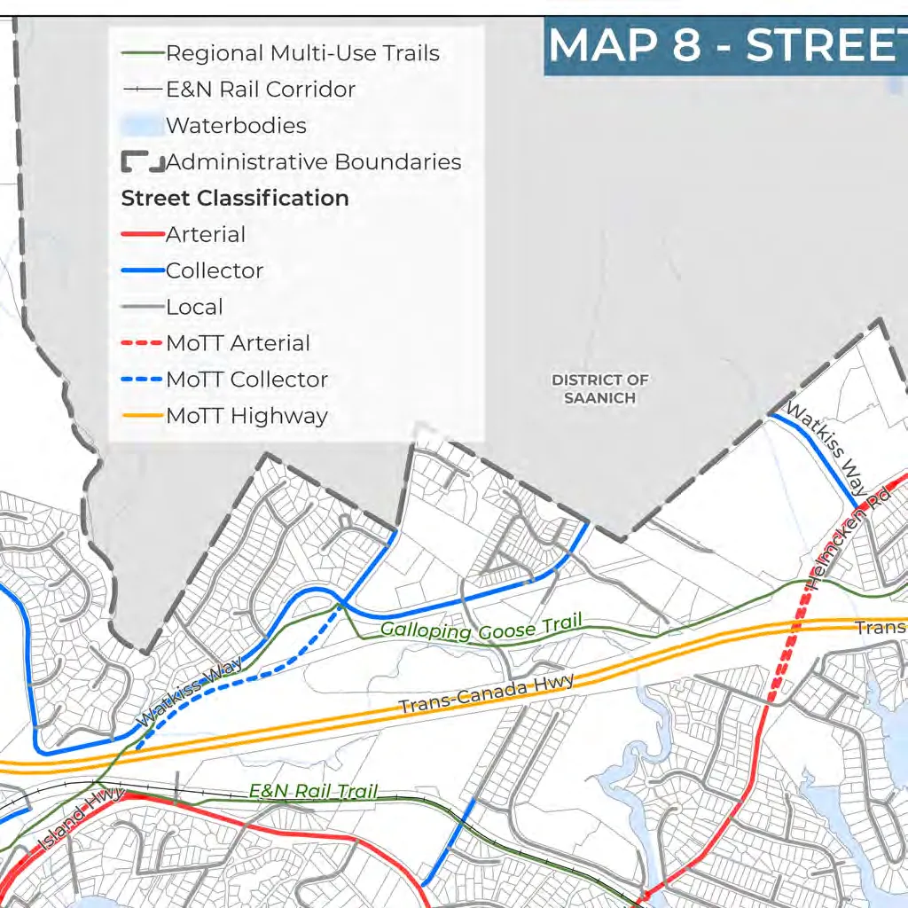
The hospital is expected to expand its services and construct new buildings in the coming decade, ideally co-locating with primary care facilities and ancillary medical service providers. Higher density residential uses in the form of apartments have started developing in recent years and are planned to continue to be built along Watkiss Way, Hospital Way, and Erskine Lane to provide more housing, support the expanding demand for amenities and services, and take advantage of current and future investments in bus rapid transit.
The Victoria General Hospital Transit Exchange is presently served by a single frequent transit service route. The service connects Victoria, View Royal, Colwood, and Langford on a single route, providing rapid bus service within the region. There is potential to expand frequent transit service and provide additional rapid transit service if the parcels within the Transit-Oriented Area surrounding the hospital are developed to densities that can support such service. The Victoria General Hospital Transit Exchange is ideally located to become a major mobility hub for the community because it is located near the Helmcken Park and Ride, Galloping Goose Regional Trail, and Highway 1. Helmcken Road is another key corridor, which connects neighbourhoods in View Royal and the neighbouring District of Saanich.
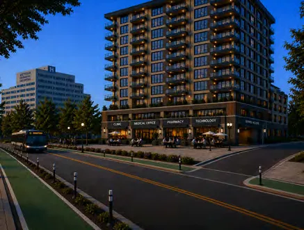
The Hospital Transit-Oriented Area is envisioned as a vibrant, high-density mixed-use community that integrates residential, tourist accommodation, medical, and commercial spaces to support the Victoria General Hospital and regional rapid transit system. Transit, cycling, and walking are envisioned to be the primary modes of transportation in this area to encourage active transportation connections, enhance the public realm, and create a safe, walkable, pedestrian-friendly environment for residents and visitors alike.
5.3.2 PERMITTED HEIGHTS AND DENSITIES
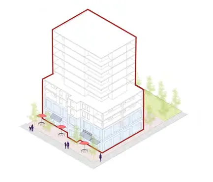
A. Heights and densities permitted in this land use designation are as follows: i) Building heights up to 10 storeys ii) Maximum density of up to 3.5 Floor Space Ratio
Page 15
Page 16
5.3.3 POLICIES
A. Encourage redevelopment of lands designated as Hospital Transit-Oriented Area.
B. Prioritize high-density, mixed-use development in the Hospital Transit-Oriented Area that aims to provide, or create conditions for the following: i) New residential dwellings, medical-related office spaces, tourist accommodations, and retail uses that benefit from and support Victoria General Hospital. ii) A regional health hub with facilities that provide comprehensive care across all stages of life. iii) Provide a mix of housing types and tenures to diversify the housing stock, including opportunities for family-friendly, senior, below-market and affordable housing options. iv) Diverse employment and commercial services that strengthen the local economy and support or complement existing local businesses and services. v) Rapid and frequent transit service routes. vi) Ground floor commercial space that activates the streetscape and public realm. vii) Underground or sub-surface parking facilities that promote a safe and enjoyable pedestrian environment. viii) A high-quality streetscape and public realm to accommodate people gathering, socializing, and recreating including plazas, playgrounds, greenspace, or other off-street public spaces. ix) Improved access and traffic circulation within the area. x) Construction of, or partnership with the Town to provide, active transportation infrastructure to connect new development to the Victoria General Hospital Transit Exchange, Victoria General Hospital, Galloping Goose Regional Trail, Eagle Creek Village, and the established residential area southeast of Helmcken Road.
Page 17
5.4 NEIGHBOURHOOD VILLAGE DESIGNATION
5.4.1 CONTEXT
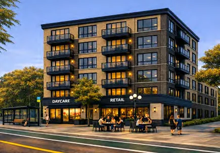
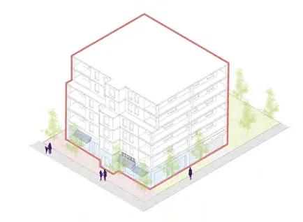
Neighbourhood Villages are situated near the lands comprising and surrounding the Atkins Neighbourhood Village and Hospital Mobility Hubs to create density conditions that support rapid and frequent transit service, as shown on Map 4. The Neighbourhood Village designation includes mixed-use buildings, such as multi-unit housing and community serving commercial and civic uses such as schools, offices, restaurants, retail, grocery stores, community care facilities, and community spaces.
To comply with the Bill 47: Housing Statutes (Transit-Oriented Areas) Amendment Act, the Neighbourhood Village designation applies to lands within 201 - 400 metres of the Hospital Transit-Oriented Area’s prescribed bus exchange. It is acknowledged that many lands in this designation are already built out or are under development, reducing the likelihood of redevelopment within the lifespan of this Official Community Plan.
5.4.2 PERMITTED HEIGHTS AND DENSITIES
A. Heights and densities permitted in this land use designation are as follows: i) Building heights up to 6 storeys ii) Maximum density of up to 2.5 Floor Space Ratio
Rapid Transit and Frequent Transit are two types of transit service.
| Service Type | Description | Frequency |
|---|---|---|
| Rapid Transit | Routes are designed to move large volumes of passengers between major destinations and stop less often than Frequent Transit service. | Customers can expect buses to arrive at least every 15 minutes between 7:00 a.m. and 10:00 p.m. every day of the week. |
| Frequent Transit | Routes operate at a 15 minute frequency between a specific period of time. Routes generally operate on arterial roads, serve corridors with mixed land use and provide connections between urban centres. | Customers can expect buses to arrive every 15 minutes or better service, 7:00 a.m. to 7:00 p.m., Monday through Friday. |
Page 18
5.4.3 POLICIES
A. Enable better transit service and connections of mobility hubs through increased densities and public realm design.
B. Create walkable and safe linkages to the surrounding neighbourhoods, parks, and trails at the following locations: i) The Neighbourhood Village designated area within the Western Gateway Corridor, between the Atkins Neighbourhood Village, Parsons Bridge, and Price Bay Road. ii) The Neighbourhood Village designation within the Hospital Transit-Oriented Area providing access to Craigflower Creek, the Galloping Goose Regional Trail, View Royal Park, and other existing parks.
C. Prioritize medium-density, mixed-use development in the Neighbourhood Village and promote the village designation as vibrant hubs that aims to provide, or create conditions for the following:
Page 19
i) Provide a mix of housing types and tenures to diversify the housing stock, including opportunities for family-friendly, senior, below-market and affordable housing options. ii) Diverse local-serving commercial uses that strengthen the local economy and support or complement existing local businesses and services. iii) Ground floor commercial space that activates the streetscape and public realm. iv) Incorporate community spaces that support arts, culture and recreation opportunities for residents and visitors. v) Underground or sub-surface parking facilities that promote a safe and enjoyable pedestrian environment. vi) A high-quality streetscape and public realm to accommodate people gathering including outdoor seating, plazas, or other off-street public spaces.
5.5 NEIGHBOURHOOD CENTRE DESIGNATION
5.5.1 CONTEXT
The Neighbourhood Centre designation allows medium-density, mixed-use development to serve local neighbourhood needs. The designation currently applies to a single parcel at the intersection of Island Highway and Helmcken Road, as shown on Map 1. This designation is envisioned to encourage walkability by providing multi-unit housing forms and community-serving commercial and civic uses with active street frontages.
5.5.2 PERMITTED HEIGHTS AND DENSITIES
A. Heights and densities permitted in this land use designation are as follows: i) Building heights up to 6 storeys ii) Maximum density of up to 3.0 Floor Space Ratio
Page 20
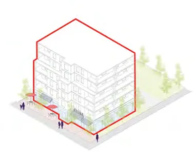
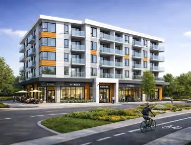
The Neighbourhood Centre designation is intended to support an active neighbourhood corridor with a diverse range of uses, increased densities, and good public realm design. The concept shown here combines ground floor commercial and civic uses with residential space on the upper storeys of a mixed 6-storey building to make the intersection of Island Highway and Helmcken Road a walkable neighbourhood destination.
5.5.3 POLICIES
A. Encourage mixed-use residential and commercial development at the intersection of the Island Highway and Helmcken Road to support greater transit service and mobility, and to provide greater access to services that meet the daily needs of residents in surrounding established neighbourhoods.
B. Ground floor commercial and civic uses may include schools, offices, restaurants, retail, small grocery stores, and community spaces.
C. Mixed-use development should be reviewed to consider the following: i) Opportunities to establish connections across Island Highway and Helmcken Road to enhance pedestrian safety. ii) Pedestrian-friendly street frontages that accommodate people arriving by all modes. iii) Strong and safe connections to surrounding residential areas, the waterfront, Helmcken Road, and View Royal Elementary School.
Page 21
iv) High-quality architecture, landscaping and public realm that enhances the neighbourhood context. v) Underground or sub-surface parking facilities that promote a safe and enjoyable pedestrian environment.
5.6 COMMERCIAL DESIGNATION
5.6.1 CONTEXT
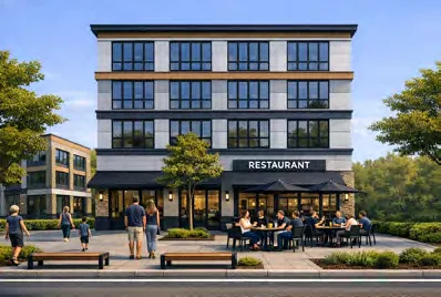
Lands in the Commercial designation should help create more local jobs as View Royal grows, while providing services and amenities to residents. The designation permits a variety of commercial uses, including retail, office, technology, services, and restaurants. Commercial services are primarily located along the Admirals Road and Island Highway Corridors.
5.6.2 PERMITTED HEIGHTS AND DENSITIES
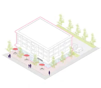
A. a) Heights and densities permitted in this land use designation are as follows: i) Building heights up to 4 storeys ii) Maximum density of up to 2.5 Floor Space Ratio
Page 22
5.6.3 POLICIES
A. Promote development of commercial lands along the Admirals Road Corridor as a commercial centre that supports a mix of employment uses, including retail, office, technology, services, and restaurants.
B. Encourage new development along Admirals Road and adjacent areas to facilitate a strong pedestrian-oriented streetscape. Development applications should be reviewed to consider opportunities for: i) Incorporating high quality urban design features in buildings and public spaces; ii) Strong and safe pedestrian and cycling connections; and iii) Active street frontages.
C. Support public space enhancements along Admirals Road, Hallowell Road, and Island Highway, in collaboration with Xʷsepsəm and Songhees Nations, to create a safe, walkable, and enjoyable pedestrian environment, and to reinforce the development of this area as the Admirals Road Corridor. Enhancements may include: i) Sidewalk widening and improvements; ii) Coordinated street furnishing and lighting standards; iii) Public art, banners and gateway features; iv) Wayfinding signage; and v) Improved bike facilities and crossings.
Page 23
5.7 INTENSIVE MIXED USE DESIGNATION
5.7.1 CONTEXT
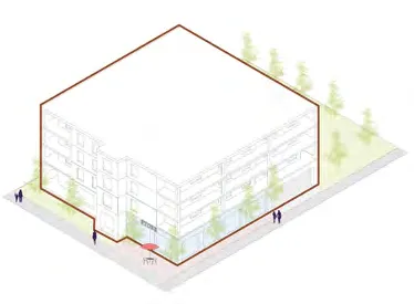
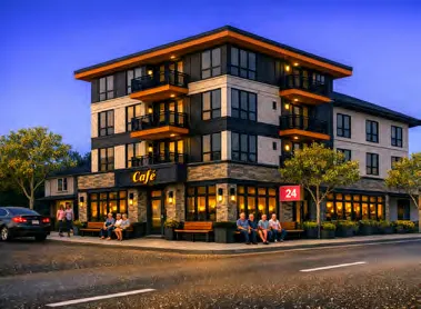
The Intensive Mixed Use designation is intended to provide low-rise mixed-use development in the form of townhouses and low-rise apartments, designed to provide ground floor commercial space and upper floors designated for residential dwellings. Lands with this designation are located throughout View Royal, including the Fort Victoria RV Park, the Western Gateway Corridor, and near the Atkins Mobility Hub, as shown on Map 1.
5.7.2 PERMITTED HEIGHTS AND DENSITIES
A. Heights and densities permitted in this land use designation are as follows: i) Building heights up to 4 storeys ii) Maximum density of up to 2.5 Floor Space Ratio
Page 24
5.7.3 POLICIES
A. Support low-rise mixed-use development in the form of townhouses and low-rise apartments, with ground floor commercial space.
B. Ground floor commercial uses may include retail, restaurants, medical offices, offices, and civic uses (e.g. daycares, libraries, public gathering and amenity spaces).
C. Mixed-use development should be reviewed to consider the following: i) Pedestrian-friendly street frontages that accommodate people arriving by all modes of transportation. ii) Strong and safe connections to surrounding residential areas, the Western Gateway Corridor, the Atkins Mobility Hub, the local and regional multi-use trails, and Island Highway. iii) High-quality architecture, landscaping and public realm that enhances the neighbourhood context.
5.8 NEIGHBOURHOOD MIXED USE DESIGNATION
5.8.1 CONTEXT
The Neighbourhood Mixed Use designation supports the development of corridors and mobility hubs with low-rise multi-unit residential and commercial uses serviced by active and public transportation infrastructure. As View Royal grows, mixed-use development will be crucial for creating a walkable community where residents can easily access daily needs such as work, education, childcare, recreation, and health services without passenger vehicles.
Key Neighbourhood Mixed Use areas include the Helmcken Corridor (Eagle Creek Village), Island Highway at the intersection of Helmcken Road, and Lakeside Village south of Thetis Lake along Six Mile Road, as shown on Map 1. The proximity of the Neighbourhood Mixed Use area at Eagle Creek Village to the Hospital Transit-Oriented Area will support the View Royal’s vision of a vibrant mixed-use transit-supported mobility hub. It is acknowledged that most of Eagle Creek Village and Lakeside Village are built out at this time (the two commercial centres were constructed in the late 2010s), reducing the likelihood of redevelopment within the lifespan of this Official Community Plan.
Page 25
5.8.2 PERMITTED HEIGHTS AND DENSITIES
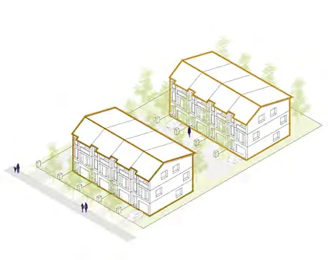
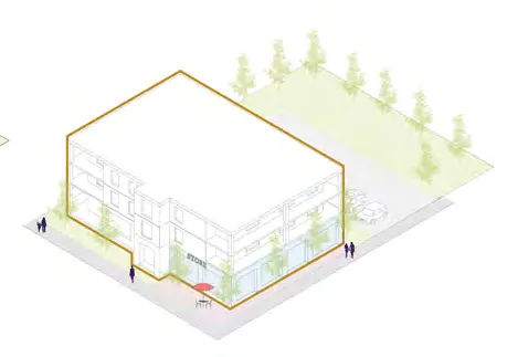
A. Heights and densities permitted in this land use designation are as follows: i) Building heights up to 3 storeys ii) Maximum density of up to 1.5 Floor Space Ratio
Page 26
5.8.3 POLICIES
A. Support low-rise mixed-use development, such as townhouses and low-rise apartments with ground floor commercial space and upper floors designated for residential dwellings.
B. Ground floor neighbourhood-serving commercial uses may include one or more of the following: retail, restaurant, medical office, office, and civic use (e.g., daycare, library, amenity space).
C. Encourage mixed-use development near the intersection of Island Highway and Helmcken Road to support greater transit service and mobility.
D. Mixed-use development should be reviewed to consider the following: i) Opportunity to establish connections across Island Highway and Helmcken Road to enhance pedestrian safety. ii) Pedestrian-friendly street frontages that accommodate people arriving by all modes. iii) Strong and safe connections to surrounding residential areas, the waterfront, Helmcken Road, and View Royal Elementary School. iv) High-quality architecture, landscaping and public realm that enhances the neighbourhood context.
Page 27
5.9 MIXED RESIDENTIAL DESIGNATION
5.9.1 CONTEXT
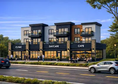
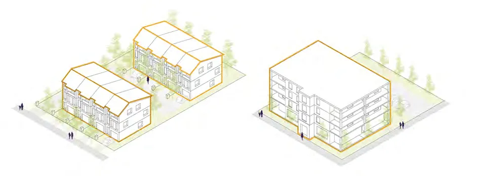
The Mixed Residential designation permits detached and attached dwellings, such as small lots, duplexes, secondary suites, garden suites, rowhouses, townhouses, houseplexes, and apartments. Its purpose is to increase housing choices along key corridors and in areas where services and amenities are concentrated. Mixed Residential is primarily located along Island Highway, Christie Point, to the west of Admirals Corridor, and in several other areas. Medium density development in these areas will help improve mobility, including access to non-automobile transportation options, especially near the Atkins Mobility Hub.
5.9.2 PERMITTED HEIGHTS AND DENSITIES
A. Heights and densities permitted in this land use designation are as follows: i) Building heights up to 3 storeys/Maximum density of up to 1.25 Floor Space Ratio ii) Building heights up to 4 storeys/Maximum density of up to 1.6 Floor Space Ratio for apartments
Page 28
5.9.3 POLICIES
A. Support a variety of housing options, including opportunities for infill and gentle density in the form of duplexes, secondary suites, garden suites, rowhouses, townhouses, houseplexes, and apartments in established neighbourhoods.
B. Mixed Residential development along corridors should be carefully reviewed to consider the following: i) Right-of-way conditions and pedestrian safety, including connections across Island Highway and Helmcken Road. ii) Pedestrian-friendly street frontages that accommodate people arriving by all modes of transportation. iii) Strong and safe connections to surrounding residential areas, the waterfront, Helmcken Road, and View Royal Elementary School. iv) High-quality architecture, landscaping and public realm that enhances the neighbourhood context.
Page 29
5.10 SMALL-SCALE MULTI-UNIT HOUSING DESIGNATION
5.10.1 CONTEXT
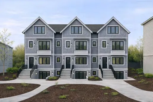
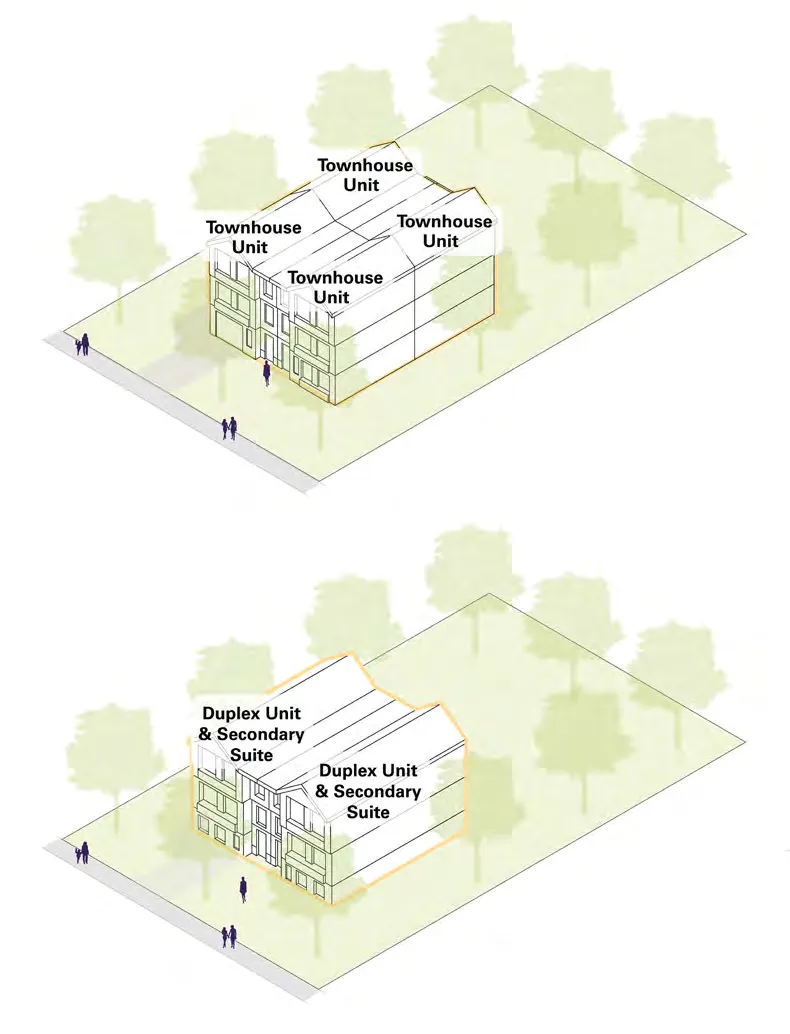
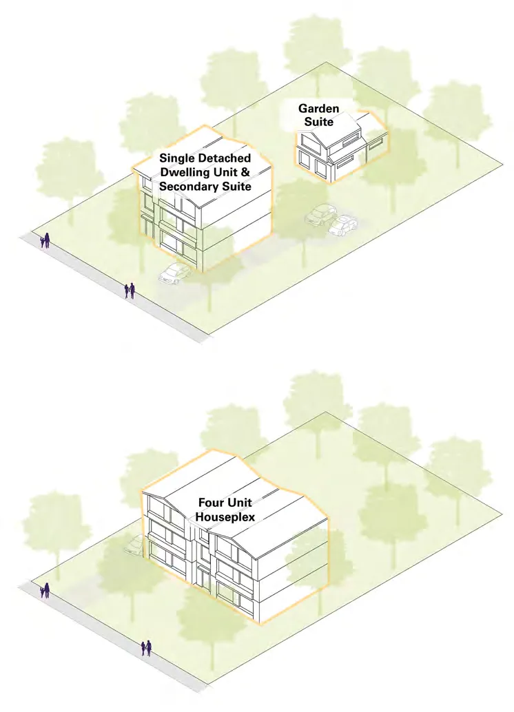
The Small-Scale, Multi-Unit Housing designation supports a variety of housing types in established residential neighbourhoods including detached and attached dwellings, duplexes, secondary suites, garden suites, rowhouses, townhouses, houseplexes, and apartments up to three storeys in height. This designation has been established to align with the province’s Bill 44: Housing Statutes (Residential Development) Amendment Act and applies in many of the established low-density residential neighbourhoods in the community. Small-Scale, Multi-Unit Housing offer greater housing choice and improve attainability. It is anticipated that Small-Scale, Multi-Unit Housing will be a key factor in addressing the demand for ground-oriented housing in View Royal.
5.10.2 PERMITTED HEIGHTS AND DENSITIES
A. Heights and densities permitted in this land use designation are as follows: i) Building heights up to 3 storeys ii) Maximum density of up to 4 dwelling units or 6 dwelling units for parcels within 400m of a Prescribed Transit Stop
Page 30
Page 31
Page 32
5.10.3 POLICIES
A. New development should contribute to and enhance the residential form and character of the surrounding neighbourhood. B. Protect and enhance the tree canopy and preserve natural features. C. Strengthen connections between existing residential neighbourhoods and mixed-use developments, such as those included in View Royal’s mobility hubs and corridors (as shown on Maps 3 and 4), through urban design, public space improvements, and pedestrian, bike, and transit supportive facilities. D. When reviewing applications for infill developments, adhere to the redevelopment policies outlined in Section 5.1.6.
5.11 RESIDENTIAL DESIGNATION
5.11.1 CONTEXT
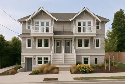
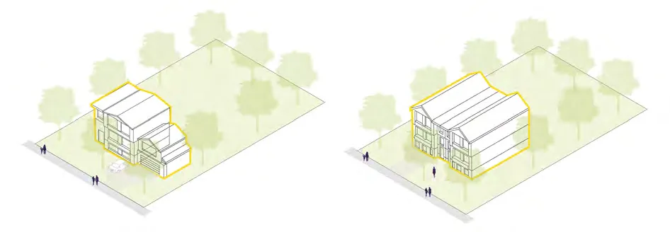
The Residential designation supports development of single detached dwellings, secondary suites, garden suites, duplexes, rowhouses, and townhouses that are accessed via separate entrances at the ground level. This designation applies to parcels that do not meet provincial legislative criteria for Small-Scale Multi-Unit Housing.
5.11.2 PERMITTED HEIGHTS AND DENSITIES
A. Heights and densities permitted in this land use designation are as follows: i) Building heights up to 2.5 storeys ii) Maximum density of up to 0.6 Floor Space Ratio for appropriate infill
Page 33
Page 34
5.11.3 POLICIES
A. Support low density housing forms in existing residential neighbourhoods, including detached and attached dwellings, such as the following: single detached dwellings, duplexes, secondary suites, and garden suites. B. New development should contribute to and enhance the residential form and character of the surrounding neighbourhood. C. Strengthen connections between existing residential neighbourhoods and mixed-use developments, such as those included in View Royal’s mobility hubs and corridors (as shown on Maps 3 and 4), through urban design, public space improvements, pedestrian, bike, and transit supportive facilities. D. Protect and enhance the tree canopy and preserve natural features. E. When reviewing applications for infill developments, adhere to the redevelopment policies outlined in Section 5.1.6.
5.12 LARGE LOT RESIDENTIAL DESIGNATION
5.12.1 CONTEXT
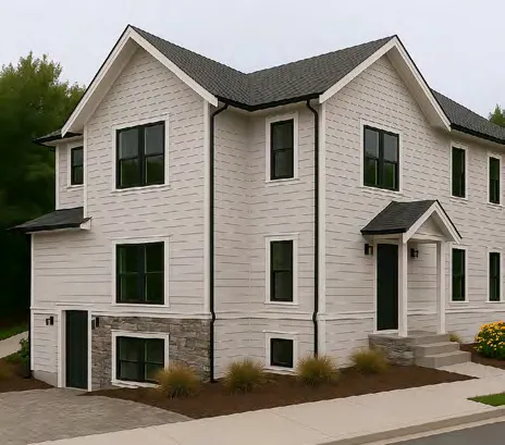
Large Lot Residential consists of detached dwellings that are located on large lots within established neighbourhoods. Limited redevelopment is anticipated for these parcels.
5.12.2 PERMITTED HEIGHTS AND DENSITIES
A. Heights and densities permitted in this land use designation are as follows: i) Building heights up to 2.5 storeys
5.12.3 POLICIES
A. Support detached dwellings and secondary suites in existing residential neighbourhoods. B. Protect and enhance the tree canopy and preserve natural features. C. New development should be designed in a way that complements the existing surrounding neighbourhood.
Page 35
5.13 RURAL DESIGNATION
5.13.1 CONTEXT
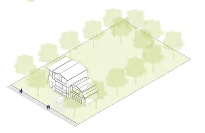
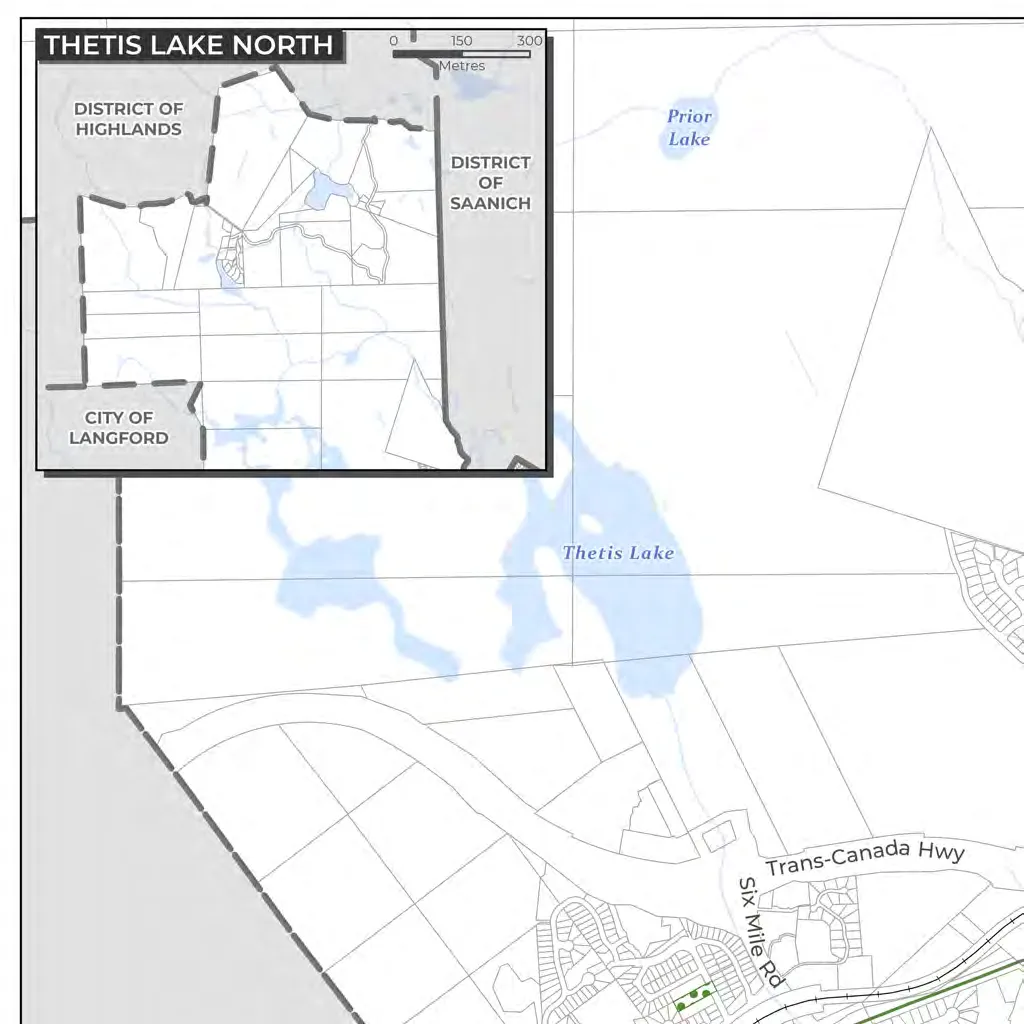
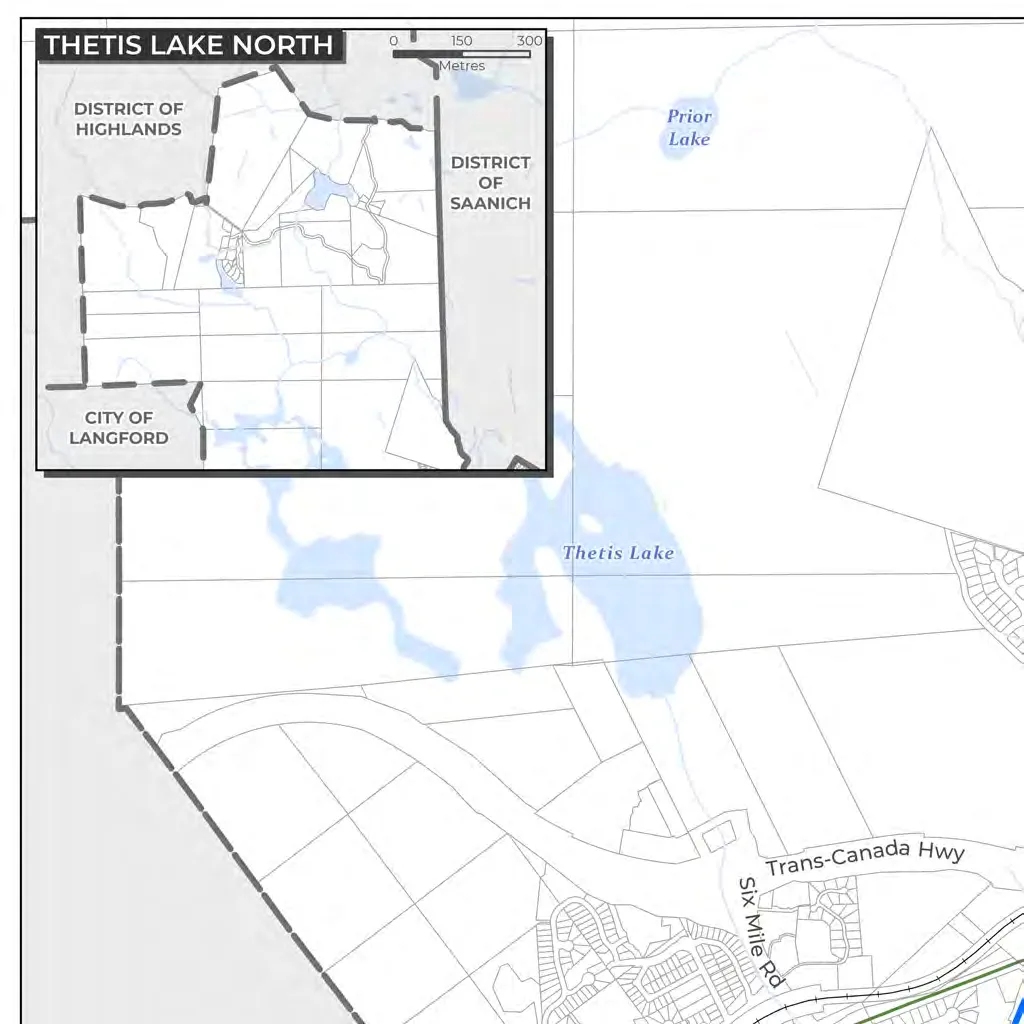
The Rural designation applies to lands used for agriculture, recreation, or for large lot residential uses. These lands are primarily located north of Thetis Lake Regional Park outside the Urban Containment Boundary, with the exception of two parcels on Atkins Road, as shown on Map 1. There is limited servicing available to parcels designated as Rural and therefore, development potential is limited.
5.13.2 PERMITTED HEIGHTS AND DENSITIES
A. Heights and densities permitted in this land use designation are as follows: i) Building heights up to 2 storeys ii) Maximum density of up to 1 unit per 10 hectares
5.13.3 POLICIES
A. Support the retention of rural lands north of Thetis Lake Regional Park by maintaining the Urban Containment Boundary. B. Maintain farming, agriculture, and low-density residential as the primary land use on rural lands, to preserve the rural character of the area.
Page 36
5.14 COMMUNITY FACILITY DESIGNATION
5.14.1 CONTEXT
The Community Facility designation applies to existing government buildings and publicly owned facilities providing a range of civic and institutional services and uses, amenities, and utilities for the community including health care facilities, emergency service buildings, community halls, libraries, supportive housing, places of worship, schools, public childcare, transit facilities such as park and rides and bus exchanges, and utility services such as water, sanitary sewer, and hydro.
The Town’s prominent community facilities include the following:
- Town Hall and Public Safety Building on Island Highway;
- Three schools, including Shoreline Community Middle School, View Royal Elementary, and Eagle View Elementary;
- Three community centres, including the Strawberry Vale Community Club, View Royal Community Association, and Victoria Scottish Community Centre;
- Victoria General Hospital;
- Capital Regional District’s Infrastructure and Water Services building on Island Highway; and
- Two existing park and ride facilities located in the Atkins Neighbourhood Village and on Helmcken Road.
5.14.2 PERMITTED HEIGHTS AND DENSITIES
A. Heights and densities permitted in this land use designation vary from site to site.
5.14.3 POLICIES
A. Promote a variety of public, non-profit, or utility uses, including community halls/centres, schools, public health facilities, community care facilities, supportive housing, emergency facilities, libraries, government buildings, childcare, and schools.
Page 37
B. Retain existing Community Facility parcels and seek opportunities to expand and consolidate parcels to accommodate future growth. C. Ensure all community facilities provide accessibility infrastructure at all existing and new community facilities to ensure these spaces may be reasonably accessed by people of all mobility levels. D. Support the development of the Atkins Mobility Hub as a Community Facility that will provide rapid transit service and support the growth of surrounding land uses. E. Encourage institutional landowners to preserve on-site open space and make it publicly accessible where possible.
F. Where redevelopment is being considered on Community Facility designated land: i) Prioritize the retention of community or non-profit ownership of the property. ii) Support the use of the site for non-profit rental housing or non-market housing where the development can also provide a community facility, commercial uses, or other compatible uses.
5.15 PARKS, TRAILS AND OPEN SPACE DESIGNATION
5.15.1 CONTEXT
The Parks, Trails, and Open Space designation applies to active and passive parks, trails, natural conservation areas, green spaces, waterfront areas, and outdoor recreation facilities. Parks, Trails, and Open Spaces provide opportunities to facilitate walkable connections to key areas within the community, including mobility hubs.
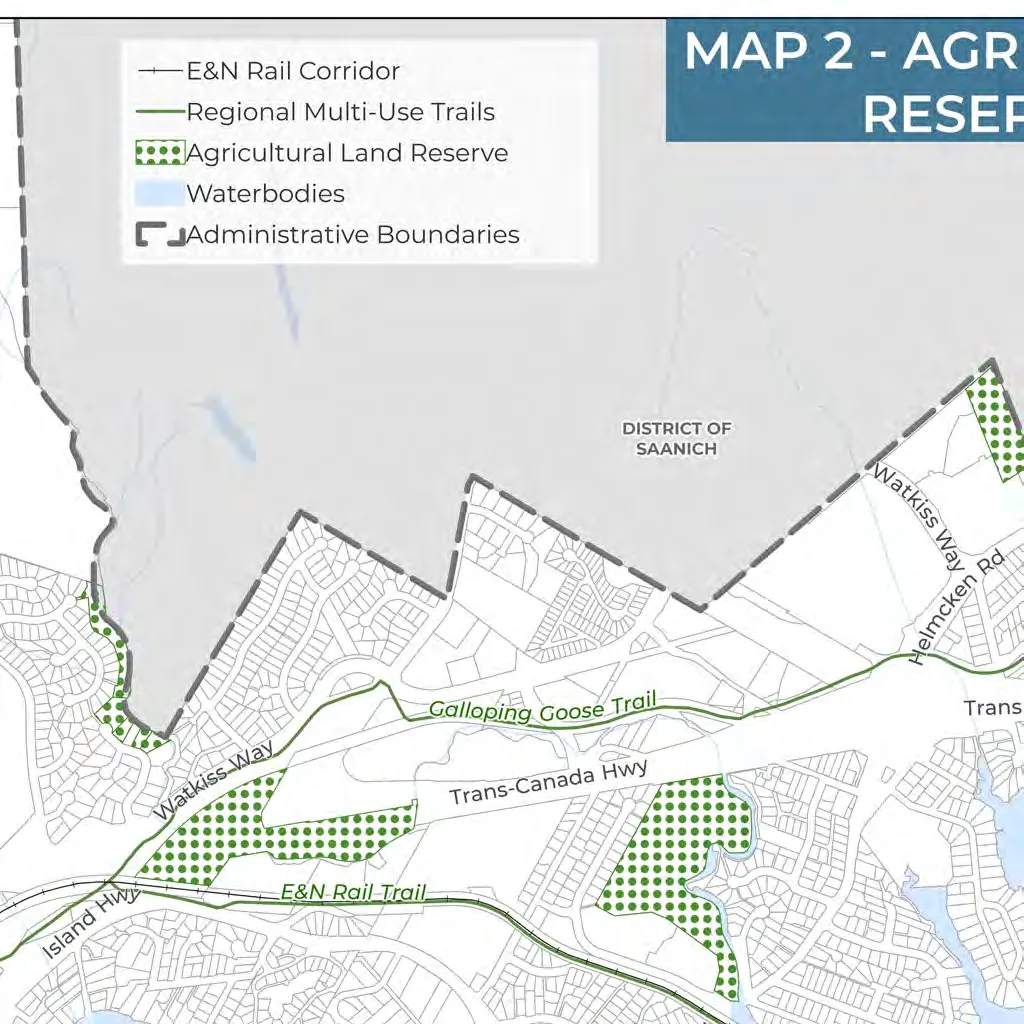
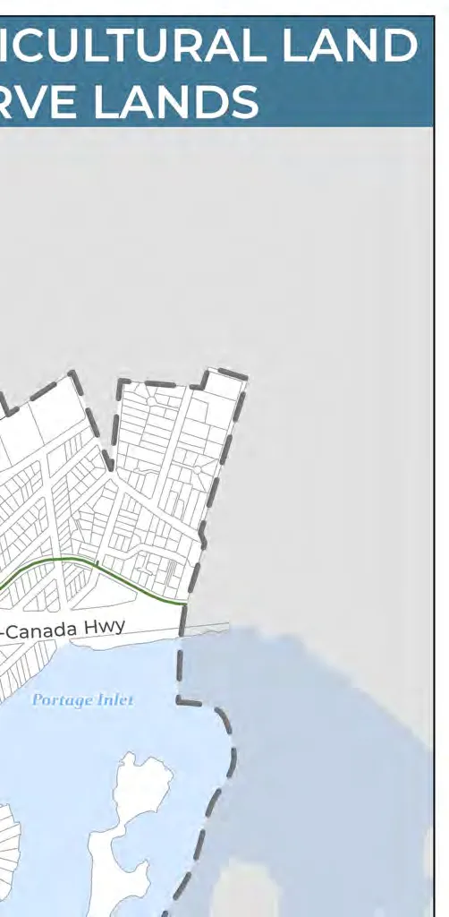
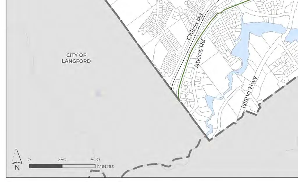
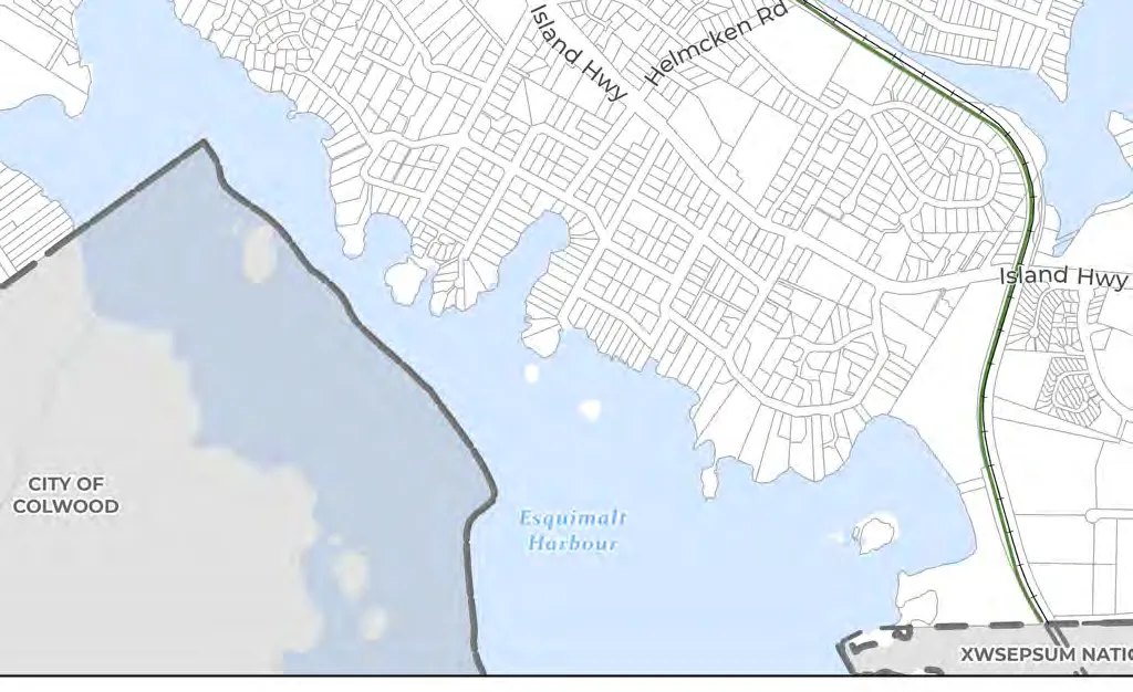
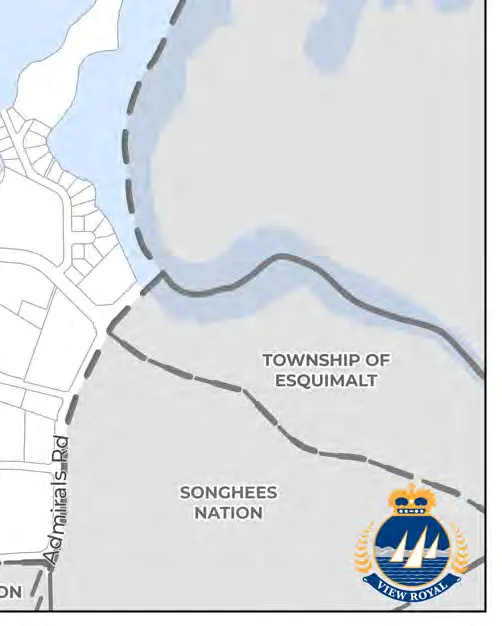
The Parks, Trails, and Open Space designation may apply to the Provincial Agricultural Land Reserve parcels, which are intended for long-term farm use to support the local economy and food security. As shown on Map 2, the Agricultural Land Reserve applies to the following areas:
- Chilco Park;
- Little Road unnamed park;
- Trans Canada Highway and Atkins Neighbourhood Village road right-of-way at Burnside Road West;
- View Royal Park; and
- Marler Park and 4 neighbouring parcels.
Page 38
The Town could consider excluding these parcels from the Agricultural Land Reserve in the future as they no longer serve the intended purpose of the Agricultural Land Reserve designation; however, no immediate action is planned.
5.15.2 PERMITTED HEIGHTS AND DENSITIES
A. Heights and density permissions are not applicable for this land use designation.
5.15.3 POLICIES
A. Enhance on-site green space by considering the needs of green space requirements over parking space requirements, when considering a development variance permit, development permit, temporary use permit, an official community plan amendment or zoning bylaw amendment. B. Protect the natural environment along Millstream Creek and support opportunities for fish habitat, wildlife corridors, historic interpretation signage, public access to the shoreline, and connection to the Western Gateway Corridor and nearby Neighbourhood Village. C. Continue to support the preservation of Thetis Lake and Mill Hill Regional Parks as important recreational amenities and significant natural resources. D. Collaborate with Capital Regional District and the View Royal FireSmart Program to develop and implement strategies to mitigate the risk of wildfires within Thetis Lake and Mill Hill Regional Parks. E. Improve local and regional access and connections to Thetis Lake and Mill Hill Regional Parks from surrounding neighbourhoods. F. Collaborate with the Capital Regional District to expand regional park boundaries where appropriate. G. Ensure that current and future use of land designated as Agricultural Land Reserve is compliant with Agricultural Land Commission legislation and regulations.
Page 39
Page 40
5.16 THETIS COVE SPECIAL PLANNING AREA DESIGNATION
5.16.1 CONTEXT
The land designated as Thetis Cove Special Planning Area, as shown on Map 1, is located in the area known as Thetis Cove. This land is adjacent to the Xʷsepsəm Nation Reserve. The Province purchased the land to transfer to the Xʷsepsəm Nation as part of the negotiations at the Recognition of Indigenous Rights and Self-Determination table. The transfer of land is likely to occur within the lifespan of this Official Community Plan.
5.16.2 PERMITTED HEIGHTS AND DENSITIES
A. Heights and density permissions are not applicable for this land use designation.
5.16.3 POLICIES
A. Collaborate with Xʷsepsəm and Songhees Nations to return the land to Xʷsepsəm Nation to advance reconciliation efforts. B. Review the Town’s boundary following the transfer of the lands to Xʷsepsəm Nation.
Page 41
Part Three
Reconciliation
6.0 Reconciliation 77
Page 42
6.0 Reconciliation
6.1 CONTEXT
View Royal approaches reconciliation as a long-term priority grounded in relationship-building, learning, collaboration, accountability, and action. View Royal is committed to integrating a reconciliation-centric approach to current and future Town initiatives. This includes recognizing the impacts of colonization on the community as it is today and acknowledging the injustices experienced by the First Nations peoples whose lands the Town is located upon. It will take time and commitment for View Royal to advance decolonizing practices and build respectful, meaningful relationships with the Xʷsepsəm and Songhees Nations.
Given the influence of Official Community Plans on long-term community initiatives and decision-making processes, this section focuses on practical and achievable policy direction to support ongoing reconciliation, collaboration, partnership, and relationship-building initiatives with the Xʷsepsəm and Songhees Nations so that community planning and priorities reflect the enduring presence and stewardship of the lək̓ʷəŋən Peoples. Through a reconciliation, collaboration and relationship-building lens, the Town worked with the advisors representing Xʷsepsəm and Songhees Nations on the review and update of the Official Community Plan. Both Nations provided comments on many aspects of the Official Community Plan to strengthen the objectives and policies and guide the Town on important matters related to self-determination, culture, land stewardship, and economic development.
The following Official Community Plan Goals may be achieved through the objectives and policy direction provided in this section:
- Community Well-Being
- Economic Development
- Reconciliation
- Regional Partnerships
Page 43
6.2 OBJECTIVES
6.2.1 GOVERNMENT-TO-GOVERNMENT RELATIONSHIPS AND RECONCILIATION IN DECISION-MAKING Build respectful, government-to-government relationships with the Xʷsepsəm and Songhees Nations, and integrate reconciliation frameworks into View Royal’s community planning initiatives, particularly for decisions impacting the Nations’ interests and self-determination goals.
6.2.2 INDIGENOUS PRESENCE, IDENTITY, AND CULTURAL EXPRESSION Recognize, respect, and enhance the presence of Indigenous Peoples by promoting an inclusive atmosphere for those identifying as Indigenous in View Royal, and ensure that representation of Indigenous communities reflects their historical, continuing, and enduring significance within the community.
6.3 POLICIES
6.3.1 GENERAL A. Identify a joint vision for reconciliation in View Royal in partnership with the Xʷsepsəm and Songhees Nations. B. Continue to develop and implement existing Memorandums of Understanding and/or protocol agreements with the Xʷsepsəm and Songhees Nations around shared commitments.
6.3.2 COMMITMENT TO CULTURAL AWARENESS AND LEARNING A. Align municipal policies with the United Nations Declaration on the Rights of Indigenous Peoples & the provincial Declaration on the Rights of Indigenous Peoples Act to ensure Indigenous rights are explicitly recognized. B. Work with Xʷsepsəm and Songhees Nations to identify and deliver appropriate public education and reconciliation programming for View Royal residents and staff. C. Respect Indigenous data governance and sovereignty including through application of principles for Ownership, Control, Access, and Possession of data principles, and collaborate with Xʷsepsəm and Songhees Nations on municipally based data gathering.
6.3.3 ADVANCING RECONCILIATION IN LAND USE DECISIONS A. Remain committed to recognizing the Xʷsepsəm and Songhees Nations’ rights to make decisions over their lands, resources, and economic future that reflect their laws, values, and community priorities. B. Proactively engage, and collaborate meaningfully and respectfully, with Xʷsepsəm and Songhees Nations on land use initiatives and decisions by which they may be affected to respect rights recognition and shared decision-making.
Page 44
C. Follow procedures and protocols for respectful engagement and consultation as outlined by Xʷsepsəm and Songhees Nations referrals processes. D. Support economic reconciliation with lək̓ʷəŋən Peoples by collaborating on land use and development projects led by Xʷsepsəm and Songhees Nations. E. Consider the impact of land use decisions to the long-term needs of the Xʷsepsəm and Songhees Nations and ensure land use directions support and advance reconciliation efforts. F. Promote awareness of the responsibility of the Town and property owners to protect archeological sites and artifacts, including those of Indigenous significance, and encourage compliance under the Heritage Conservation Act.
6.3.4 UNDERSTANDING INDIGENOUS LAND AND WATER MANAGEMENT A. Work with Xʷsepsəm and Songhees Nations to learn about Indigenous land and water stewardship practices, values, and rights. B. Work actively with Xʷsepsəm and Songhees Nations to integrate Indigenous knowledge systems with Western science for land and water stewardship initiatives, such as habitat restoration, culturally informed ecological management, resilient food systems, and conservation of natural assets.
6.3.5 SUPPORTING ECONOMIC RECONCILIATION AND RIGHT TO SELF-DETERMINATION A. Collaborate with Xʷsepsəm and Songhees Nations to identify and pursue opportunities for Indigenous led land and economic development initiatives, such as Nation-led housing, mixed use, and economic projects. B. Support Indigenous-led economic initiatives through locally-forged business partnerships with Xʷsepsəm and Songhees Nations and support Indigenous business development and Indigenous development corporations.
6.3.6 CELEBRATING INDIGENOUS IDENTITY WITHIN VIEW ROYAL A. Expand Indigenous cultural representation in public space, by supporting public art from Xʷsepsəm and Songhees artists, seeking opportunities for First Nations naming of parks, facilities, and streets, and exploring opportunities to develop interpretive materials coauthored with Xʷsepsəm and Songhees Nations to reflect the current presence of lək̓ʷəŋən People.
Page 45
Part Four
Policies
- 7.0 Housing 81
- 8.0 Transportation and Mobility 88
- 9.0 Community Infrastructure and Services 105
- 10.0 Economic Development 114
- 11.0 Natural Environment and Hazards 119
- 12.0 Climate Action and Sustainability 132
- 13.0 Parks, Trails, and Recreation 138
- 14.0 Community Well-Being and Culture 145
Page 46
7.0 Housing
7.1 CONTEXT
Housing in View Royal and the Capital Regional District as a whole is increasingly challenged by rising land and construction costs, demographic shifts, and limited land availability for new development. Many residents are living in housing that is no longer suitable for their needs, including older adults seeking to downsize and families seeking attainable, appropriately sized homes. Inadequate housing options and growing risks of homelessness further highlight the need for greater diversity in housing types and tenures.
The 2024 View Royal Interim Housing Needs Report outlined the most current housing conditions in the community and found that 0.9% of owner households and 7.81% of renter households are in extreme core housing need in 2021.
A total of 842 dwelling units are necessary to address extreme core housing need, persons experiencing homelessness, suppressed household formation, anticipated growth, rental vacancy rate adjustment, and local demand in View Royal by 2026, and a total of 2,889 dwelling units are need by 2041. The Interim Housing Needs Report estimates that the total number of Extreme Core Housing Need dwelling units needed by 2041 is 174, this is approximately 12 new units per year between 2026 and 2041. Considering the lifetime of this Official Community Plan extends beyond the year 2041 to 2050, a total of 4,189 units may be...
A household is said to be in extreme core housing need if its housing falls below at least one of the adequacy, affordability or suitability standards and it would have to spend 50% or more of its total before-tax income to pay the median rent of alternative local housing that is acceptable (meets all three housing standards)
Suppressed household formation is said to be new households that would have been formed but are not due to a lack of attainable options. The persons who would have formed these households include, but are not limited to, many adults living with family members or roommates and individuals wishing to leave unsafe or unstable environments but cannot due to a lack of places to go.
Rental vacancy rate adjustment adds surplus rental units to restore local vacancy rates to levels representing a healthy and well-functioning rental housing market. Typically, rates between 3% and 5% are considered healthy vacancy rates.
Page 47
...necessary to meet long-term housing needs in the community, based on findings identified in the Interim Housing Needs Report.
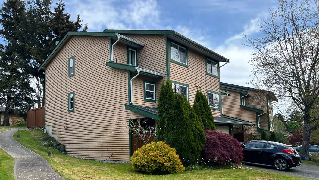
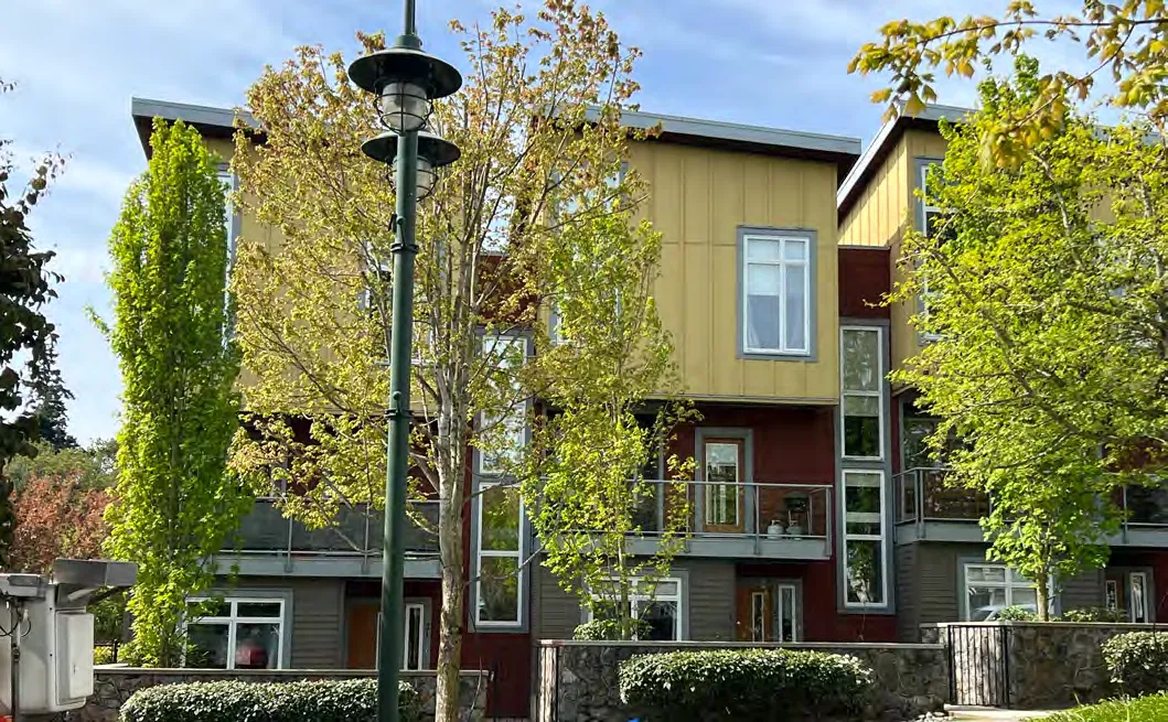
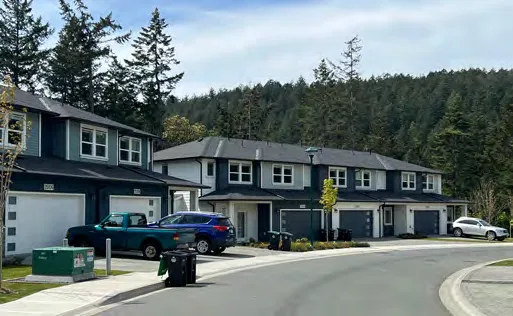
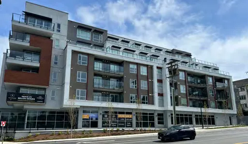
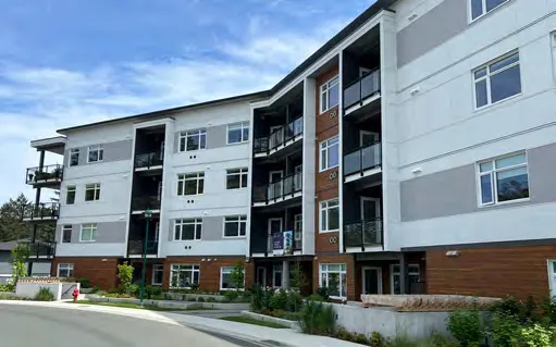
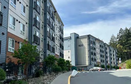
With little vacant land remaining within the Urban Containment Boundary, most new residential development will occur through the redevelopment of older housing stock and infill within existing neighbourhoods. Addressing community housing needs and desires will require an expanded supply of ground oriented, family-friendly housing, such as secondary and garden suites, duplexes, houseplexes, rowhouses, and townhouses. The development of new detached dwellings that occupy a smaller building footprint may also be viable to fill housing gaps and address community needs.
The purpose of this section is to provide policy direction that supports suitable, attainable, and affordable housing forms for all residents.
The following Official Community Plan Goals may be achieved through the objectives and policy direction provided in this section:
- Diverse and Affordable Housing
- Regional Partnerships
The Town’s 2024 Housing Needs Assessment Report identifies the breakdown of existing housing need in View Royal and the type of housing that is required to address this need.
Page 48
7.2 OBJECTIVES
7.2.1 HOUSING DIVERSITY AND SUPPLY Support the diversification and overall supply of housing throughout the Town, including affordable, supportive, and nonmarket rental housing.
7.2.2 AGE-FRIENDLY HOUSING Encourage accessible housing design that allows residents to age-in-place and enables residents to live and remain in their community, despite differences and changes in individual lifestyle, income, and health.
7.2.3 PRESERVE STABLE LONG-TERM RENTALS Seek opportunities to preserve long-term rental housing stock that is suitable, adequate, and affordable, to ensure long-term housing stability and affordability in the community.
7.2.4 HOUSING FOR PEOPLE Continue to support the provision of a diverse range of housing types and tenures to meet the diverse needs of current and future residents, including families, seniors, people with diverse abilities, physical disabilities, and low-income households.
7.2.5 HOUSING PARTNERSHIPS Explore opportunities to develop new partnerships and strengthen existing partnerships with non-profit housing providers, BC Housing, and the Capital Region Housing Corporation to ensure View Royal can continue to support affordable housing initiatives in the community.
7.3 POLICIES
7.3.1 GENERAL A. Continue to update the Housing Needs Report every five years using the provincial standardized Housing Needs Report Method, following the timeline and requirements specified in the Local Government Act to inform housing priorities. B. Research what forms of amenity space are needed and desired to create strong, socially connected communities and explore how the Zoning Bylaw may implement amenity space requirements in multi-unit residential developments.
Page 49
7.3.2 HOUSING SUPPLY A. Continue to consider opportunities to facilitate an increase in housing supply by streamlining development approval and permitting processes. B. Research what forms of non-traditional housing ownership and building construction types (e.g. market rental, cooperatives, mixed market and non-market projects, mass timber, prefabrication) are needed, desired, and may be viable. C. Review annual housing starts data to identify and track progress towards housing goals, and to find opportunities to increase housing supply. D. Continue to review, monitor and enforce zoning regulations that regulate Short-Term Rental accommodations to increase the availability of long-term rental housing supply, and prevent the commercialization of residential dwellings.
7.3.3 AFFORDABLE AND RENTAL HOUSING A. Support the attainment of affordable housing in View Royal by achieving a minimum of 1 unit of below-market housing for every 15 units of market housing, and 1 unit of supportive housing for every 44 units of market housing being built in the Town. B. Undertake financial feasibility analyses to identify if density bonusing and inclusionary zoning are viable tools to utilize in the Zoning Bylaw to increase affordable market and non-market rental housing supply.
Page 50
C. Collect in-kind and cash-in-lieu contributions towards affordable housing, where possible, through the establishment of relevant tools, including reserve funds and amenity contribution policies. D. Protect below-market and affordable rentals where redevelopment of existing ground-oriented rental and cooperative housing units are proposed by considering how to retain rental units of the same quantity, size, and where possible, maintain the equivalent monthly rental rate for tenants. Achieve a minimum replacement of 1:1 for all below-market and affordable rentals that are lost through redevelopment. E. Where the redevelopment of an existing cooperative housing site is considered, an increase in residential density will be supported only if additional cooperative housing units are provided. F. Continue to review the Town’s Tenant Assistance Policy to ensure it is designed to mitigate the loss of existing affordable units and protect tenants who are displaced during the redevelopment or renovation of older rental buildings. G. Investigate additional measures to protect tenants displaced by the redevelopment or renovation of purpose-built rental housing, such as regulations that ensure existing tenants have adequate time to find new housing, are provided compensation where applicable, and receive priority for new housing.
Page 51
7.3.4 FAMILY HOUSING A. Support family-oriented housing by requiring new multi-unit residential developments of four or greater storeys, with the exception of seniors housing, supportive housing, and affordable rental housing projects, to allocate a proportion of units as follows: i) a minimum of 30% of units with two bedrooms or more; and ii) a minimum of 10% of units with three bedrooms or more B. Investigate how family housing needs can be better addressed in View Royal, including access to supports and amenities such as childcare facilities, schools, and parks. C. Promote ground-oriented, family-friendly housing within neighbourhoods close to schools and amenities.
7.3.5 ACCESSIBILITY IN HOUSING A. Incorporate Universal Design principles in the design of common and amenity spaces, such as entryways, hallways, stairwells, patios, and multi-purpose rooms, amongst others. B. Achieve 10% of units in all new multi-unit housing developments of four or more storeys to be accessible or adaptable units, particularly in below-market developments, and at least be designed and constructed in accordance with the BC Building Code, or an equivalent standard. These units should be provided on the ground floor wherever possible.
Page 52
7.3.6 COORDINATION AND PARTNERSHIPS A. Strengthen partnerships to deliver more affordable housing and supportive housing. B. Build community capacity to support the development of affordable housing, for example by connecting non-profits with funding streams, land opportunities, and market developers for potential partnerships. C. Work together with housing agencies, stakeholders, and senior levels of government to identify sites and collaborate, where possible, on the provision of supportive housing projects with social and mental health support. D. Continue annual financial contributions to the Regional Housing Trust Fund, administered by the Capital Region Housing Corporation, to support the acquisition, development, and retention of housing that is affordable to households with low or moderate incomes. E. Continue to collaborate with the Capital Regional District and other regional stakeholders to implement the Regional Housing Affordability Strategy and continue to support and contribute to regional housing initiatives and programs.
Page 53
8.0 Transportation and Mobility
8.1 CONTEXT
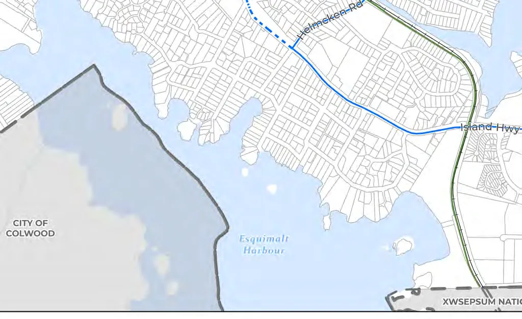
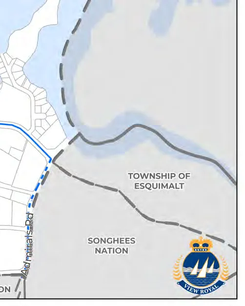
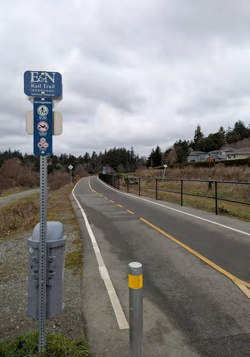
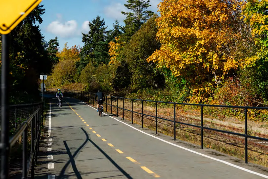
The transportation and mobility choices existing within a community define how community members can get around. View Royal’s central location with the Capital Regional District and as the gateway to the West Shore makes it well-connected to the broader region. The Trans-Canada Highway (owned and maintained by the Ministry of Transportation and Transit), Island Highway, Galloping Goose Regional Trail, E&N Rail Trail, and BC Transit’s bus routes including the 95 Blink Rapid Bus, number 14 (Vic General / UVic), and number 40 (UVic/Dockyard via McKenzie-Admirals) traverse View Royal and provide connections to key destinations within adjacent communities and beyond.
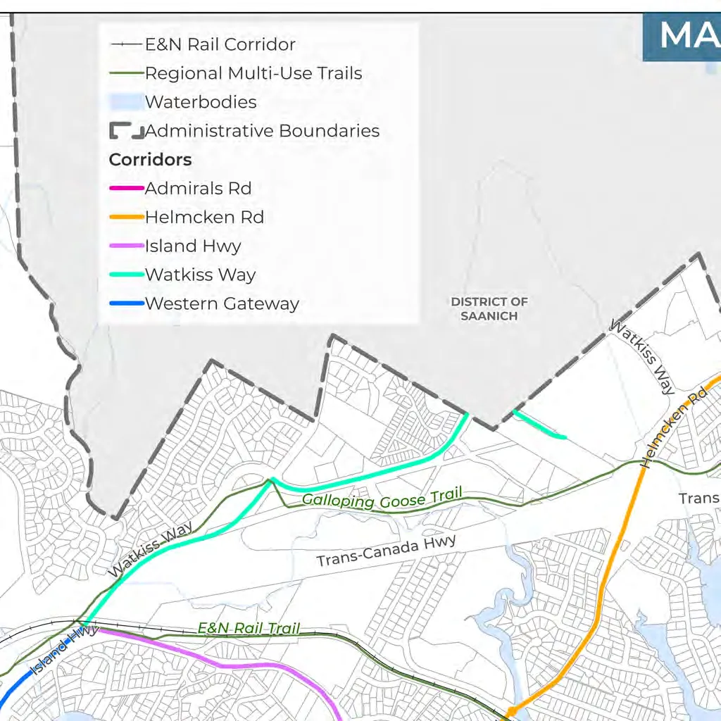
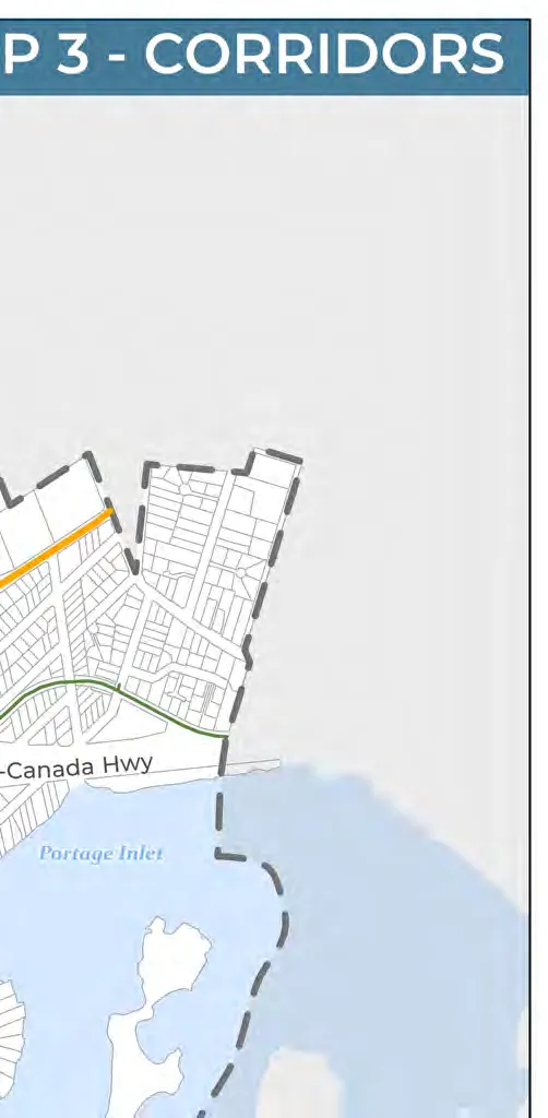
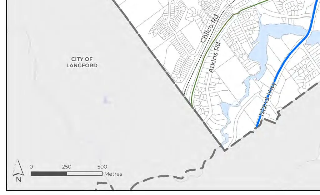
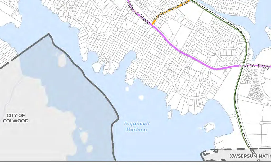
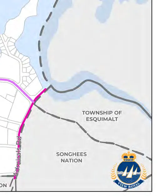
Within View Royal, there are five key corridors along which amenities and services are concentrated, as shown on Map 3: Island Highway, Admirals Road, Helmcken Road, Watkiss Way, and the Western Gateway Corridor. These corridors serve key transportation functions in their ability to move goods and people within the Town and provide connections to neighbouring communities. It is anticipated that higher levels of density will be concentrated along these corridors to enable alternate modes of transportation beyond the private car and to ensure that residents can easily access the services and amenities they need daily near their home. The foundation for this is embedded within the Official Community Plan’s land use policy, included in Part Two.
Corridors are primary transportation routes where increased development density is generally encouraged to maximize accessibility for vehicles, public transit, and pedestrians. In View Royal, key corridors include Admirals Road, Helmcken Road, Island Highway, and the Western Gateway Employment District Corridor.
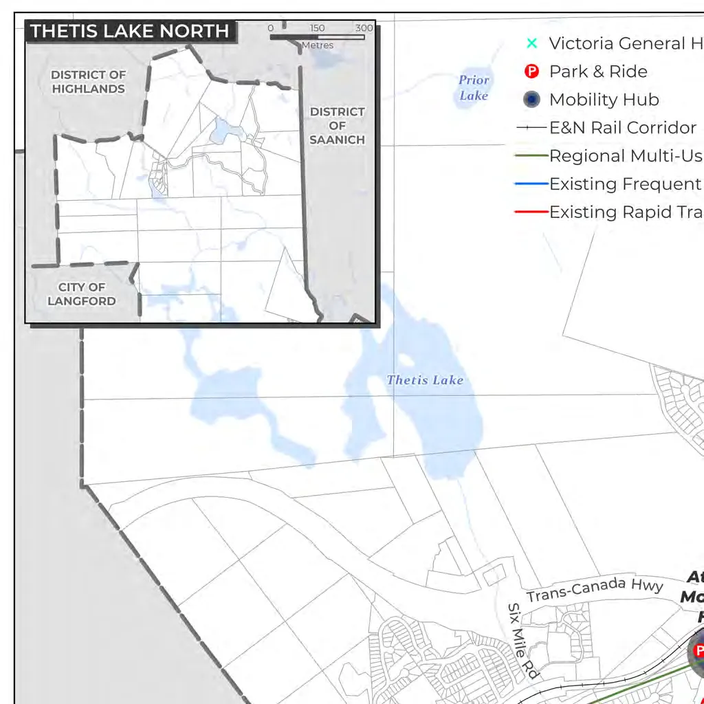
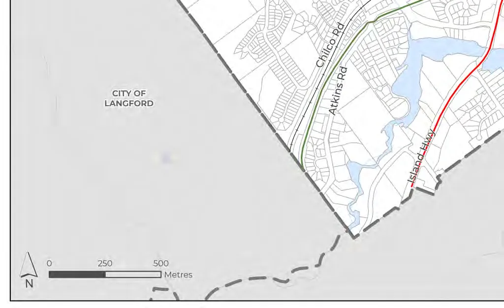
Each of the corridors noted are also supported by one of View Royal’s two mobility hubs. As shown on Map 4, these are located at the site of the provincially designated Hospital Transit-Oriented Area, which comprises the existing Victoria General Hospital Transit Exchange and the Atkins Neighbourhood Village. Both mobility hubs are located within proximity to the Galloping Goose Regional Trail and the Trans-Canada Highway which provide opportunities for travel within the region by cycling, rolling, walking, or car. In addition, they are each serviced by transit routes that provide connections within View Royal and beyond. BC Transit is updating the Victoria Regional Transit Plan to address network...
Page 54
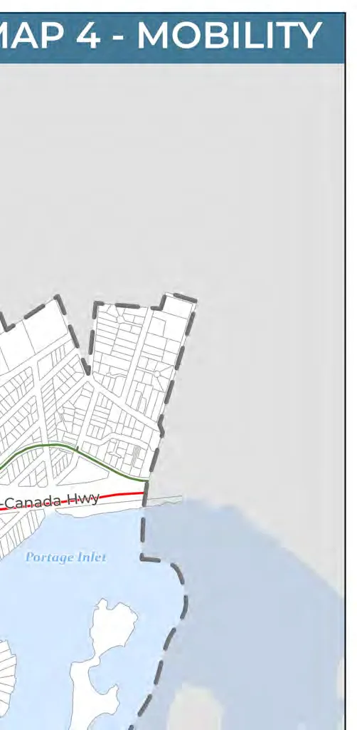
...design priorities and infrastructure and service improvements. A bus rapid transit route already serves the Atkins Mobility Hub, and additional connections may be identified for the Hospital Transit-Oriented Area and Atkins Mobility Hub, as shown on Map 4, once BC Transit has adopted the Victoria Regional Transit Plan. Increased densities are permitted in and around these mobility hubs to promote alternate modes of transportation through enhanced public realm design that creates a pedestrian-friendly environment and provides connections to key active transportation infrastructure such as trails.
The objectives and policies included in this section aim to enhance mobility options for getting around View Royal and travel through the community by employing strategies that encourage alternate transportation behaviours and choices. Such strategies will address primary concerns of residents related to traffic congestion along major routes such as the Trans-Canada Highway and Island Highway by creating alternative modes for a smoother travel experience. In addition, reduced reliance on the automobile yields reduced greenhouse gas emissions, cleaner air, and a healthier community.
Mobility Hub means a strategic location offering access or connections to multiple modes of transport, including transit, cycling, walking, rolling, and private vehicles. These hubs are usually central to concentrations of medium- to high-density development. View Royal has two mobility hubs - the provincially designated Hospital Transit-Oriented Area which comprises the existing transit exchange located at Victoria General Hospital and the Atkins Neighbourhood Village located adjacent to Island Hwy and the Galloping Goose trail.
The following Official Community Plan Goals may be achieved through the objectives and policy direction provided in this section:
- Mobility & Connectivity
- Community Well-Being
- Climate Action and Resilience
- Regional Partnerships
- Sustainable Service Delivery through Asset Management
Page 55
Page 56
Page 57
8.2 OBJECTIVES
Transportation in all forms connects people and places, and plays a significant role in residents’ daily lives, getting to work, school, or accessing recreational amenities. View Royal’s transportation network also advances the Official Community Plan’s objectives for economic development, climate action, housing affordability, and community equity.
8.2.1 BUILDING A CONNECTED MULTIMODAL COMMUNITY Support and encourage the development of View Royal’s active transportation network, which prioritizes walking, cycling, and public transit networks as part of an interconnected multi-modal transportation system within the community.
8.2.2 STRENGTHEN TRANSPORTATION CONNECTIONS AND REGIONAL DESTINATIONS Strengthen transit and active transportation connections to key regional destinations to and from View Royal by collaborating with BC Transit, neighbouring municipalities and regional partners to improve multi-modal connections to parks, regional trails, schools, commercial and institutional centres, the Canadian Forces Base Esquimalt, Victoria General Hospital, University of Victoria, and the West Shore communities.
8.2.3 EQUITABLE, SAFE, AND EFFICIENT MOBILITY Continue to work towards a future transportation and mobility network that provides equitable opportunities for all, and allows users to travel safely, reliably, and comfortably throughout the community regardless of their mode of travel.
Page 58
8.2.4 REGIONAL TRAFFIC AND RESIDENT NEEDS Recognize the unique challenge that View Royal faces as a connection point between Victoria’s urban core, the Saanich Peninsula communities, and the West Shore, and continue to prioritize the needs of residents to move around the Town and mitigate the traffic congestion impacts of regional commuters. Continue to support and encourage programs that will achieve the Town’s mode-share targets and place a greater emphasis on walking, cycling, and transit, over private vehicles.
8.2.5 AFFORDABLE, EQUITABLE TRANSPORTATION OPTIONS Continue to support and encourage programs and tactics that will help the Town in achieving its mode share targets and mitigate local transportation impacts by supporting safe and comfortable multi-modal transportation choices. Moving forward, a greater emphasis on walking, cycling, and transit, over private vehicles should be prioritized.
8.2.6 CLIMATE ACTION THROUGH TRANSPORTATION CHOICE Reduce greenhouse gas emissions by supporting efficient and accessible transit service and active transportation options.
8.3 POLICIES
8.3.1 GENERAL A. To support safe and reliable multi-modal systems for the movement of people throughout View Royal, in accordance with the priorities and strategies established in the Transportation Master Plan and Active Transportation Network Plan, priorities for transportation infrastructure investments should be based on the following modal hierarchy: i) Foundation Access – Pedestrians, people using mobility aids, and emergency personnel and equipment ii) High-Capacity, Low-Impact Mobility - Transit iii) Active and Low-Speed Mobility – Cycling and micro-mobility devices iv) Efficient Shared Use – Shared vehicles v) Economic Backbone – Commercial vehicles vi) Low Priority – Private vehicles
B. To improve overall transportation efficiency and ensure that local roads remain available for emergency vehicles, service delivery, school buses and transit in the community, encourage commuter traffic to utilize regional rapid transit corridors, including Island Highway and Trans-Canada Highway.
Page 59
C. Pursue the following mode share targets by 2050:¹⁹
| Mode | Mode Share (2022) | Mode Share Target (2050) |
|---|---|---|
| Walking, Cycling and Micro-mobility | 12% | 25% |
| Public Transit | 6% | 15% |
| Private Vehicle | 80% | 60% |
¹⁹ 2022 mode share is based on data contained in the CRD Origin Destination Household Travel Survey and represents known travel mode share as of 2022. 2050 mode share targets were identified inline with provincial mode share targets and the Town’s own policy directions to support sustainable transportation options, including a stated target in the Active Transportation Network Plan of 25% of all trips to work and school by active transportation and the Victoria Regional Transit Commission target of 15% of all trips by public transit.
Micro-mobility means transport via a small, typically electric, lightweight device that allows for individual human transport, such as a scooters, hoverboards, bicycles, and skateboards.
Mode share means the proportion of trips using a particular type of transportation to get around, such as walking, cycling, transit, scooting, ride share, or private vehicles.
The most recent regional household travel survey was released by the Capital Regional District' in 2022. Mode share data for the Town of View Royal, along with Xʷsepsəm and Songhees Nations, from this analysis is shown in the figure. Surveys are completed by the Capital Regional District every 5 years, with the next report anticipated in 2027, which can support the Town in tracking progress on mode share targets.
Page 60
8.3.2 ACCESSIBILITY AND INCLUSIVITY A. Apply Universal Design principles in transportation infrastructure design wherever possible to allow all people, including people with disabilities, to use sidewalks, trails, and transit. B. Prioritize transportation improvements in locations with higher concentrations of equity-deserving people to support safe and comfortable access to essential goods and services.
8.3.3 TRANSIT A. Collaborate with BC Transit and neighbouring local governments to establish safe, accessible and high-quality transit service. Service improvement and expansion should prioritize areas of high ridership potential, as discussed in Part Two and shown on Map 4, which include mobility hubs and other areas with high employment and resident population density. B. Ensure that bus stops and stations are planned and designed in accordance with BC Transit’s infrastructure design guidelines and include seating, shade trees, plantings, weather protection, lighting, signage, and accessible paths to and from the stop. C. Pursue transit-supportive infrastructure to facilitate reliable transit service in View Royal and collaborate with the Ministry of Transportation and Transit and BC Transit on similar improvements to provincial corridors.
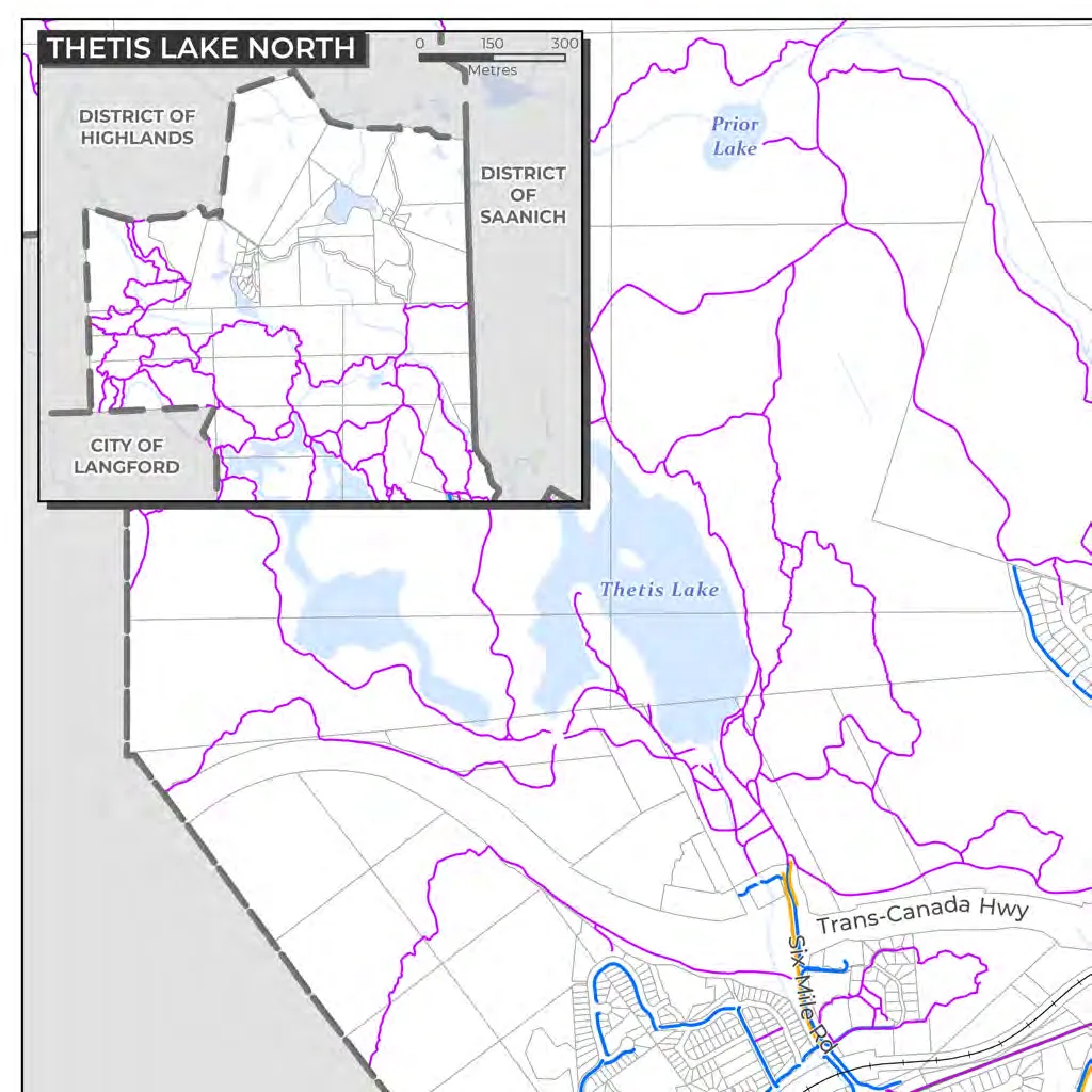
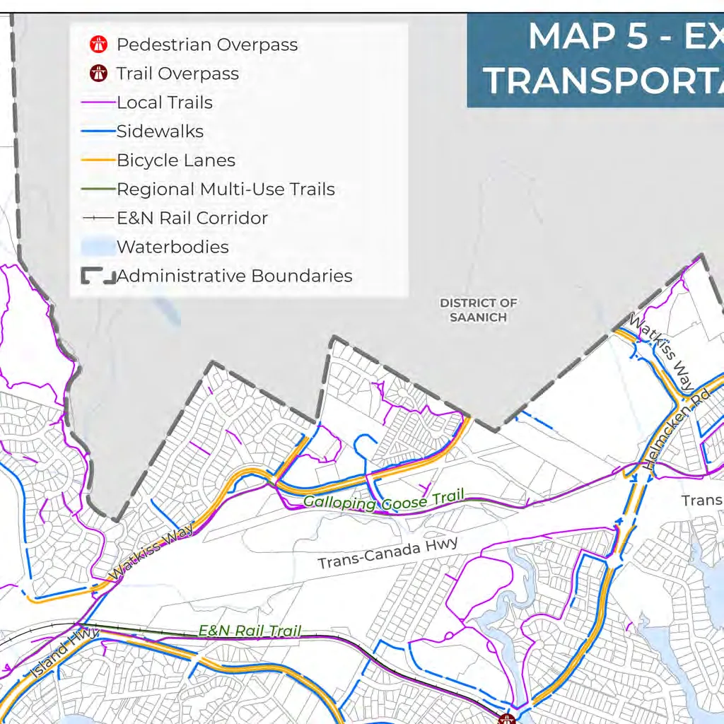
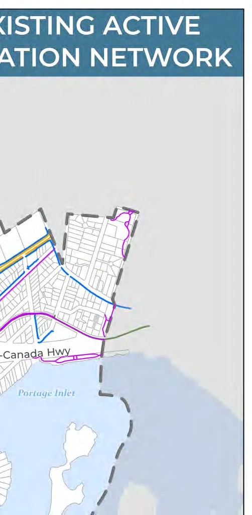
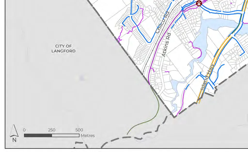
8.3.4 ACTIVE TRANSPORTATION A. Eliminate barriers to active transportation by creating an extensive active transportation network that supports walking, rolling, cycling, and transit opportunities for all ages and abilities (as shown on Maps 5, 6, and 7), improves key intersections along transportation routes to support safe and reliable travel, and provides end-of-trip facilities. B. Separate active transportation users from vehicle traffic on busy streets, where possible, and seek out lowspeed and low-volume streets where people are safe and comfortable as an alternative to travelling on busy streets. C. Develop high-quality active transportation connections to the mobility hubs, as shown on Map 4, to encourage multi-modal trips. D. Ensure transportation infrastructure is designed to reflect community needs and best practices in accessible design, with reference to the British Columbia Active Transportation Design Guide and relevant regional design guidelines. E. Active transportation services and infrastructure are to be designed to support safety, comfort and access at all times, including mitigating against the impacts of weather.
Page 61
F. Advocate for trail widening, separated facilities for different user groups, and lighting along the Galloping Goose Regional Trail within View Royal to improve safety and comfort for all active modes of transportation. G. Provide accessible wayfinding within View Royal to connect residents to active transportation networks and encourage the use of View Royal's active transportation corridors. H. Collaborate with neighbouring municipalities and regional authorities to align active transportation networks and develop safe and comfortable inter-community active transportation connections. I. Develop infrastructure and programs that encourage active travel for students, parents, and staff.
Page 62
Page 63
Page 64
Page 65
8.3.5 STREET NETWORK A. Reduce serious injuries and fatalities on View Royal streets through infrastructure improvements, targeted enforcement, and education to reinforce safe behaviours. B. Investigate opportunities to improve road safety where vehicle collisions, or collisions involving vulnerable road users are most common. C. Support safe vehicle speeds, reduce cut-through vehicle traffic, and provide safe and reliable movement for people walking, cycling, and driving on View Royal streets. D. Plan, design, and maintain streets in View Royal according to the street network classifications as shown on Map 8 and as described below: i) Highway - Major corridors serving regional and inter-regional trips. Highways are under British Columbia Ministry of Transportation & Transit jurisdiction. ii) Arterial – Streets that support View Royal residents make longer-distance trips outside the community. Arterial streets typically support higher traffic volumes and higher travel speeds, separated active transportation facilities, and high-order public transit service, with limited driveway and local street access. iii) Collector – Streets that support both mobility and access, connecting neighbourhoods to the Arterial and Highway street network. Collector streets are intended to support transit service, goods movement and emergency response, and active transportation. iv) Local – Streets that connect neighbourhoods to more major streets (Arterial, Collector), best suited to limited traffic volumes and slow travel speeds to support safe streets and neighbourhoods. E. Transportation investment and planning decisions will consider residents’ needs over regional traffic and minimize the negative impacts of through traffic on View Royal neighbourhoods and Xʷsepsəm and Songhees Nations. F. Continue to address traffic congestion in View Royal, including collaborating with Xʷsepsəm and Songhees Nations and regional partners, such as the Ministry of Transportation and Transit, Capital Regional District, BC Transit, and neighbouring municipalities. G. Actively collaborate with the Ministry of Transportation and Transit to mitigate the impact of provincial transportation corridors and regional travel on the Town’s transportation network.
Page 66
H. Support designated goods movement and prioritize emergency service corridors to ensure safe and efficient movement of these vehicles within the transportation network. I. Enhance and beautify View Royal’s streets through landscaping, street trees, placemaking, and other appropriate measures to improve comfort and safety and support multi-faceted use of public rights-of-way using fiscally sustainable levels of service delivery. J. Collaborate with the City of Colwood to improve multi-modal transportation along the Western Gateway Employment District Corridor designation, as shown on Map 1, and to nearby destinations. Future design of the corridor should consider improving the pedestrian and cyclist experience, reducing traffic congestion, enhancing intersection safety, and beautifying the streetscape.
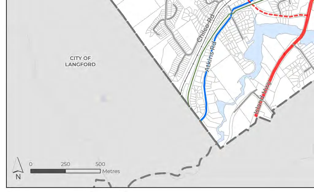
Page 67
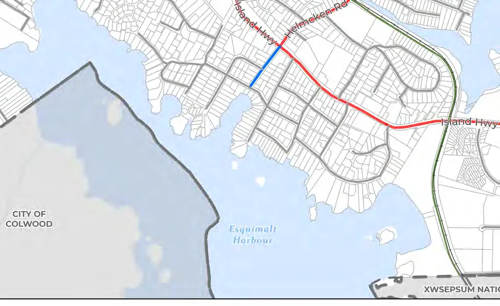
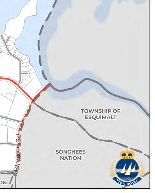
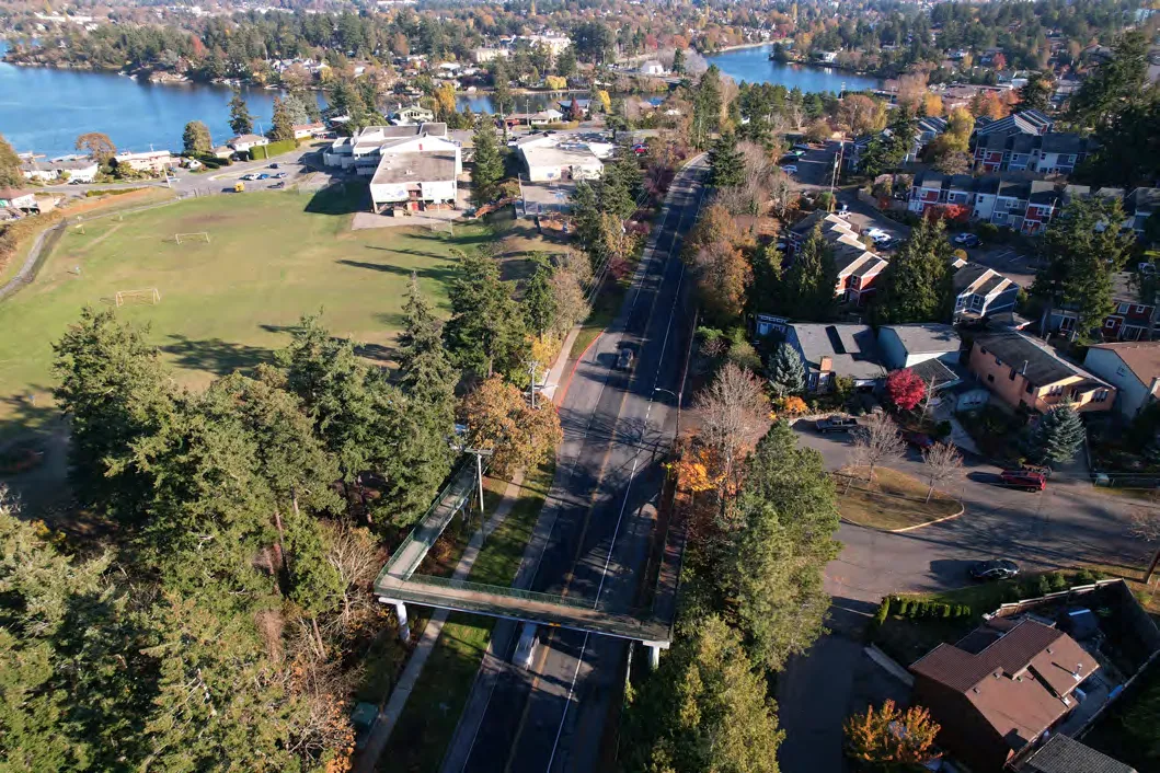
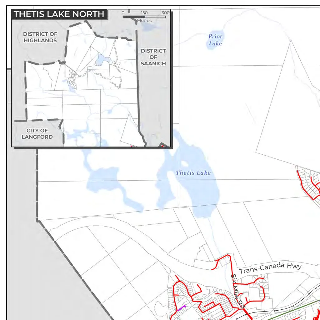
Page 68
8.3.6 REGIONAL TRANSPORTATION PROJECTS A. Continue to collaborate with Xʷsepsəm and Songhees Nations, Island Corridor Foundation, Capital Regional District, municipal partners, and senior levels of government to establish a vision for the future use of the E&N corridor. B. Advocate and explore opportunities to support the Reconciliation Corridor Initiative for regional light rail transit through collaboration with Xʷsepsəm and Songhees Nations, the Island Corridor Foundation, Capital Regional District, the Province, and neighbouring municipalities. C. Support the Capital Regional District’s Regional Transportation Service and due consideration of key corridors and priorities in View Royal as part of the Regional Multi-modal Network.
8.3.7 PARKING + TRANSPORTATION DEMAND MANAGEMENT A. Seek to meet site transportation demand through appropriate on-site parking supply and transportation demand management measures that reduce reliance on private vehicles. B. Prioritize accessible parking and loading space requirements for residential, commercial, industrial, and institutional uses. C. Ensure that commercial and light industrial uses provide parking and loading spaces that support the functional needs of businesses.
Transportation Demand Management comprises strategies that seek to improve the movement of people and goods, reduce dependence of the private car, and encourage travel via modes of alternate transport, such as transit, cycling, walking, rolling, and car share. Common desired outcomes of implementing transportation demand management strategies are reduced traffic congestion, lowered demand for parking, and cleaner air. Examples of transportation demand management strategies include shared mobility service programs such as e-scooter and e-bike rentals, transit subsidies, and car share programs, amongst others.
Page 69
D. Optimize the use of the Town’s public curb spaces with consideration of different demands, including mobility, parking, commercial uses, public space, and waste collection, among others. E. Manage on-street parking to best serve public needs, considering local parking demand, surrounding land use, and the need to accommodate other curbside functions. F. Collaborate with major employers in View Royal, such as Victoria General Hospital and the Capital Regional District, to support sustainable transportation and mitigate traffic and parking impacts. G. Work with regional partners to implement electric vehicle charging infrastructure, informed by the Capital Region EV Infrastructure Road Map and Capital Region Public Electric Vehicle Charging Guide, to increase the supply of EV charging infrastructure in new development, public parking lots, and on-street, where appropriate.
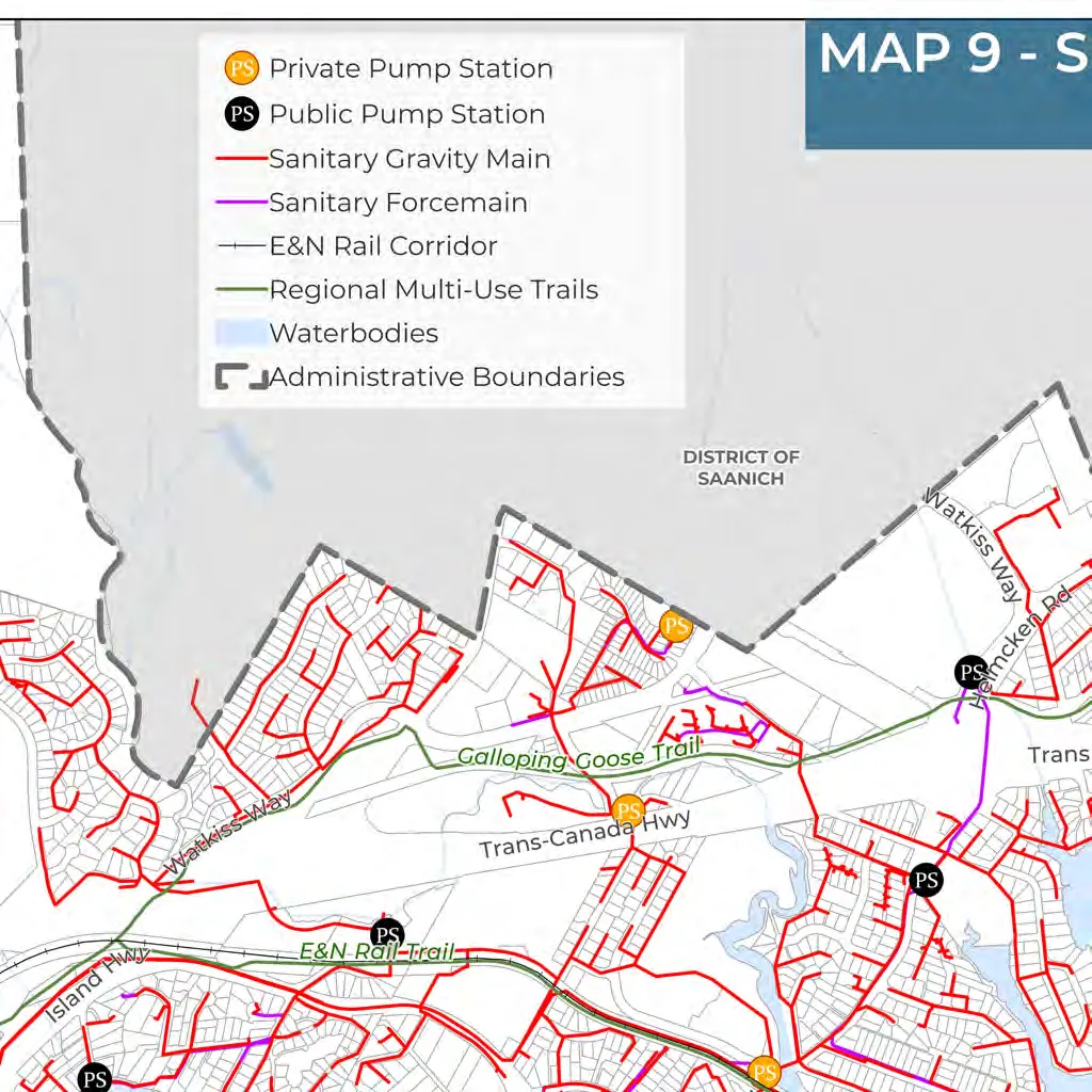
Page 70
9.0 Community Infrastructure and Services
9.1 CONTEXT
The Town owns and maintains infrastructure, such as sewers, bridges, and buildings, to provide environmental, recreational, transportation, and protection services. Certain services are provided through third-party service providers, such as road and drain maintenance, and curbside waste and organics collection, including lawn and garden waste drop-off services. View Royal’s potable water supply is provided by the Capital Regional District. Transportation, and parks, trails, and recreation are discussed in their own unique sections (Sections 8.0 and 13.0, respectively).
The Town seeks to provide infrastructure and services to meet the needs of the population and plan for the long-term sustainable delivery of these services that are impacted by both climate change and development on these systems as the community grows. Community members have expressed a desire to see infrastructure and assets provided and maintained in a manner that is both environmentally and fiscally responsible.
SEWER SYSTEM The Town’s sewer system, as shown on Map 9, comprises a number of pump stations that are electronically monitored. Some lands are located lower than the gravity sewer system, so grinder pumps are located on these properties. The pump stations all work together to pump sewage waste towards the Capital Regional District Sewer Trunk System, ultimately discharging into Craigflower Pump Station and subsequently to the Macaulay Point Pump Station in Esquimalt, both of which are operated and maintained by the Capital Regional District. The system provides services to lands located within the Town’s Urban Containment Boundary, leaving those located north of Thetis Lake to be serviced by on-site private septic systems.
STORMWATER SYSTEM The Town’s stormwater system, commonly referred to as ‘drainage’, as shown on Map 10, is largely comprised of manholes and drain mains, open ditches, and culverts that drain by gravity into Craigflower and Millstream Creeks or directly into Portage Inlet and Esquimalt Harbour.
WATER SYSTEM View Royal is connected to the regional water distribution system that is owned, operated, and maintained by the Capital Regional District, as part of the Juan de Fuca Water Distribution System. Buildings within the town are connected to a water metering system that measures water consumption. Areas located within the Town’s Urban Containment...
Page 71
...Boundary have sufficient water supply for both potable water and fire protection purposes, while those located north of Thetis Lake do not have community water service. Many properties in this area of View Royal rely on alternative water supply sources for this reason. Four water supply mains exist within the Town’s boundary, as shown on Map 11. These mains carry water from the Sooke Reservoir to the Town, and the jurisdictions located beyond.
SOLID WASTE Residential garbage and household organic waste excluding that from large multi-unit residential developments is collected on a weekly basis by a company contracted by the Town to provide this service. Waste classified as garbage is disposed of at the Hartland Landfill, operated and owned by the Capital Regional District. Organic waste is taken to a composting facility. Recycling is a regional service provided through the Capital Regional District’s Blue Box Recycling Program.
The following Official Community Plan Goals may be achieved through the objectives and policy direction provided in this section:
- Growth Management & Community Character Preservation
- Natural Amenities
- Climate Action and Resilience
- Regional Partnerships
- Sustainable Service Delivery through Asset Management
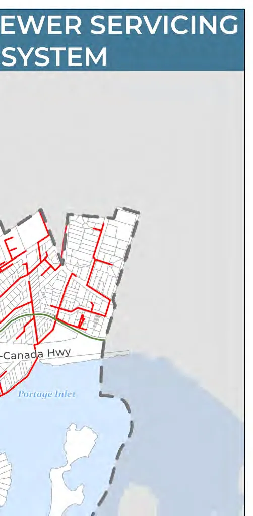
Page 72
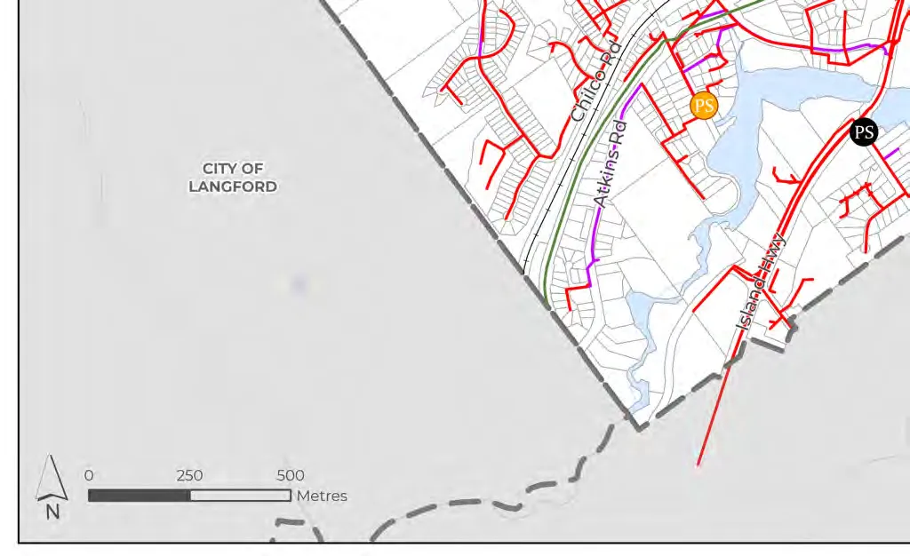
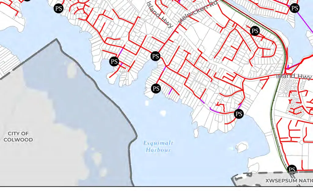
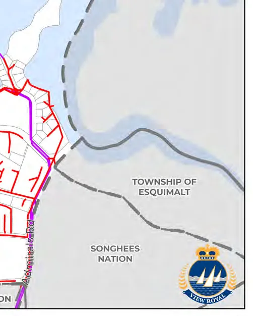
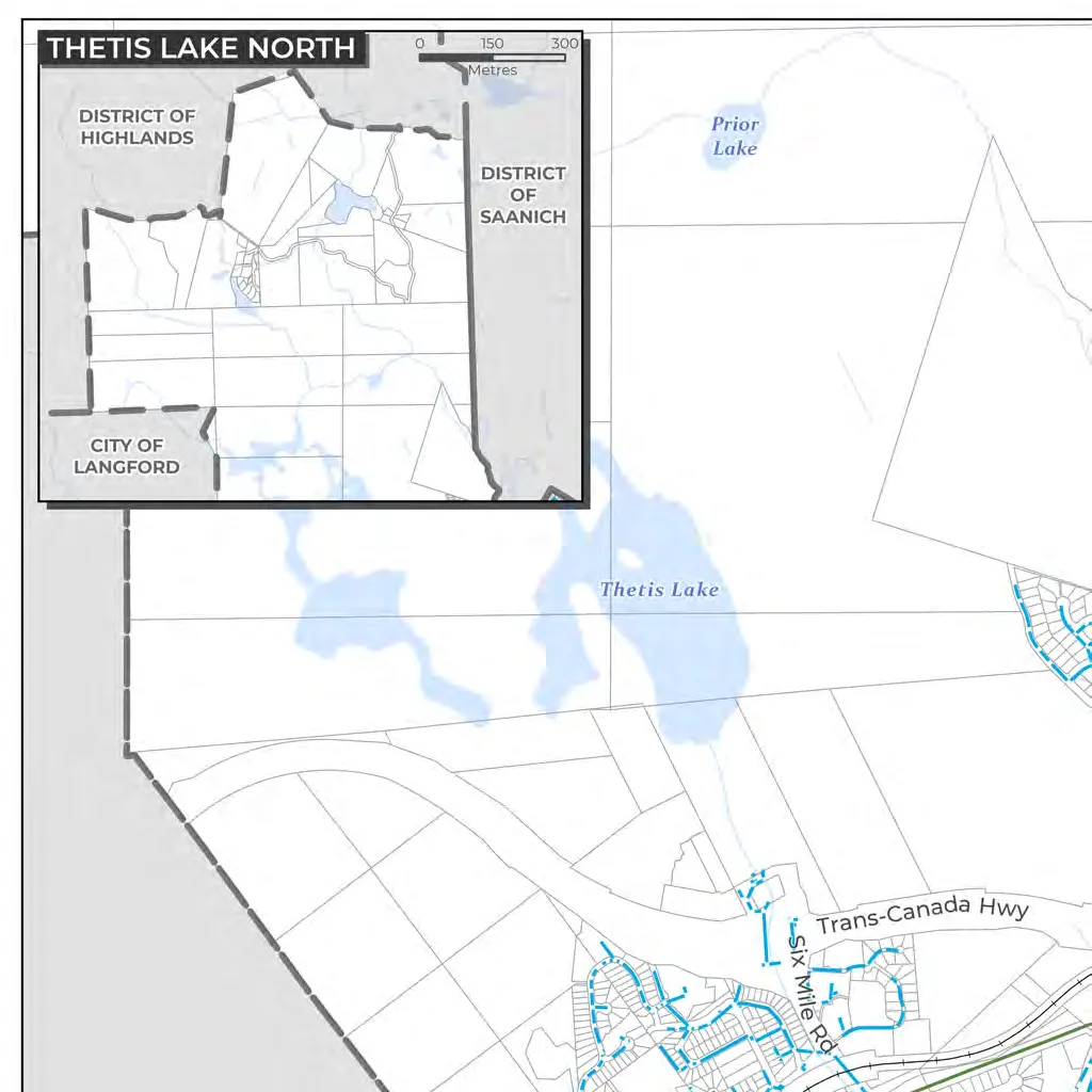
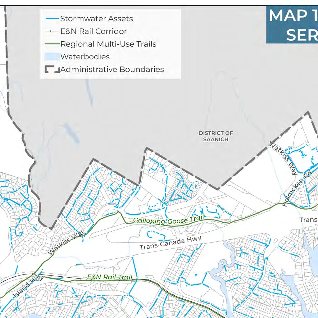
Page 73
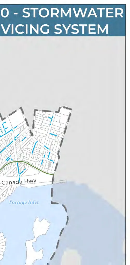
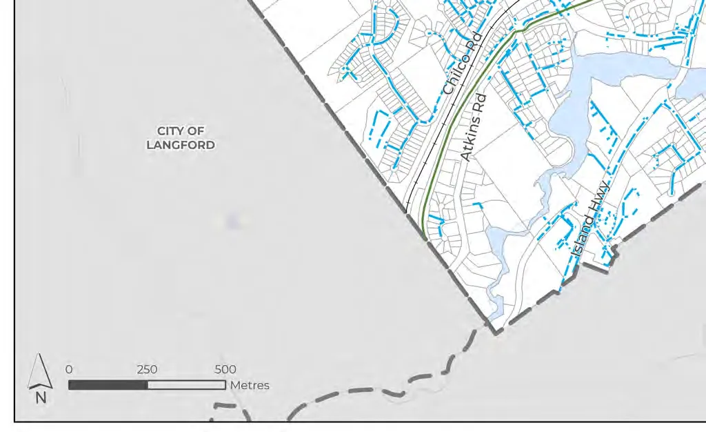
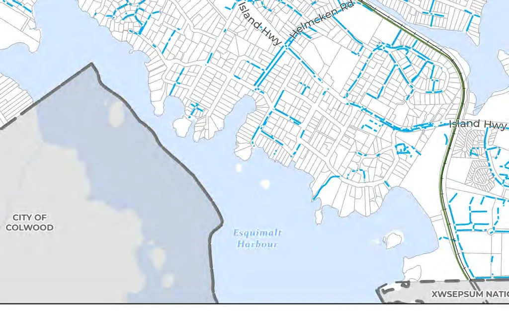
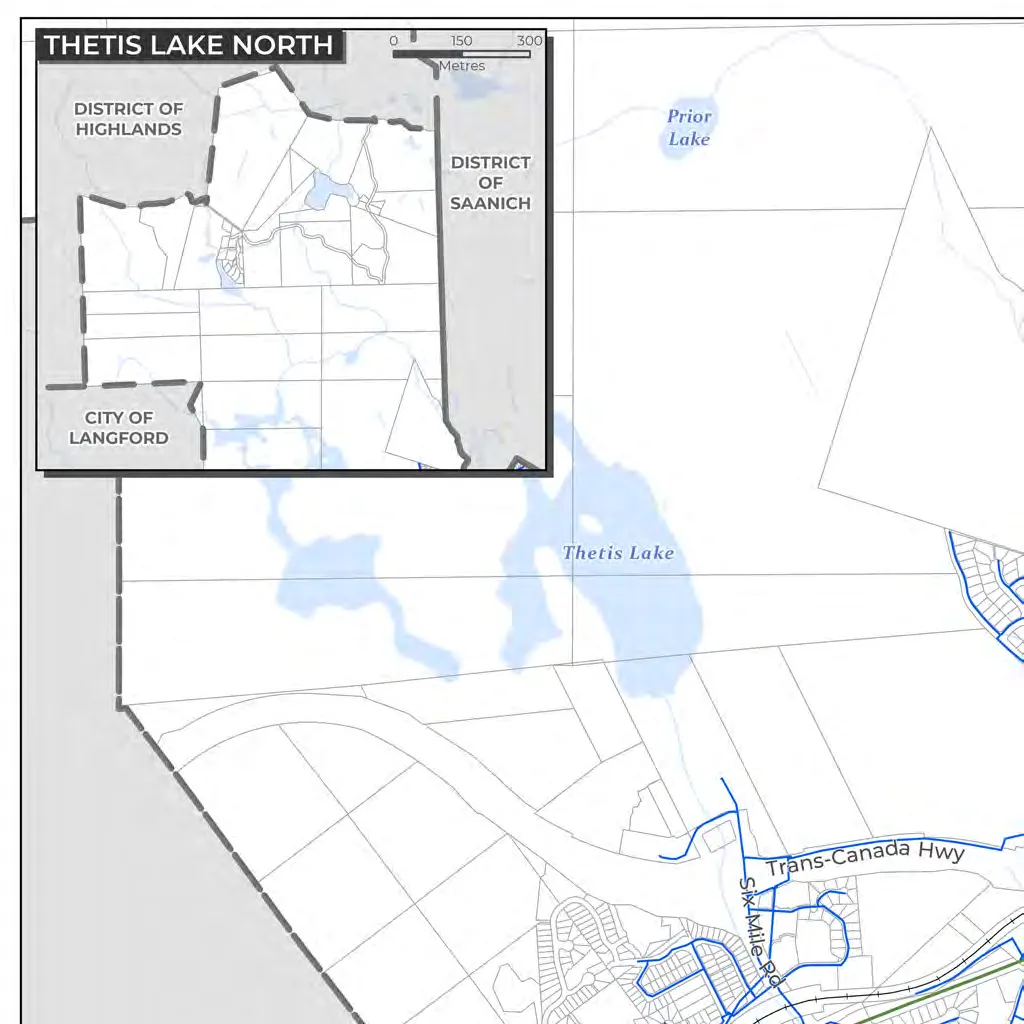
Page 74
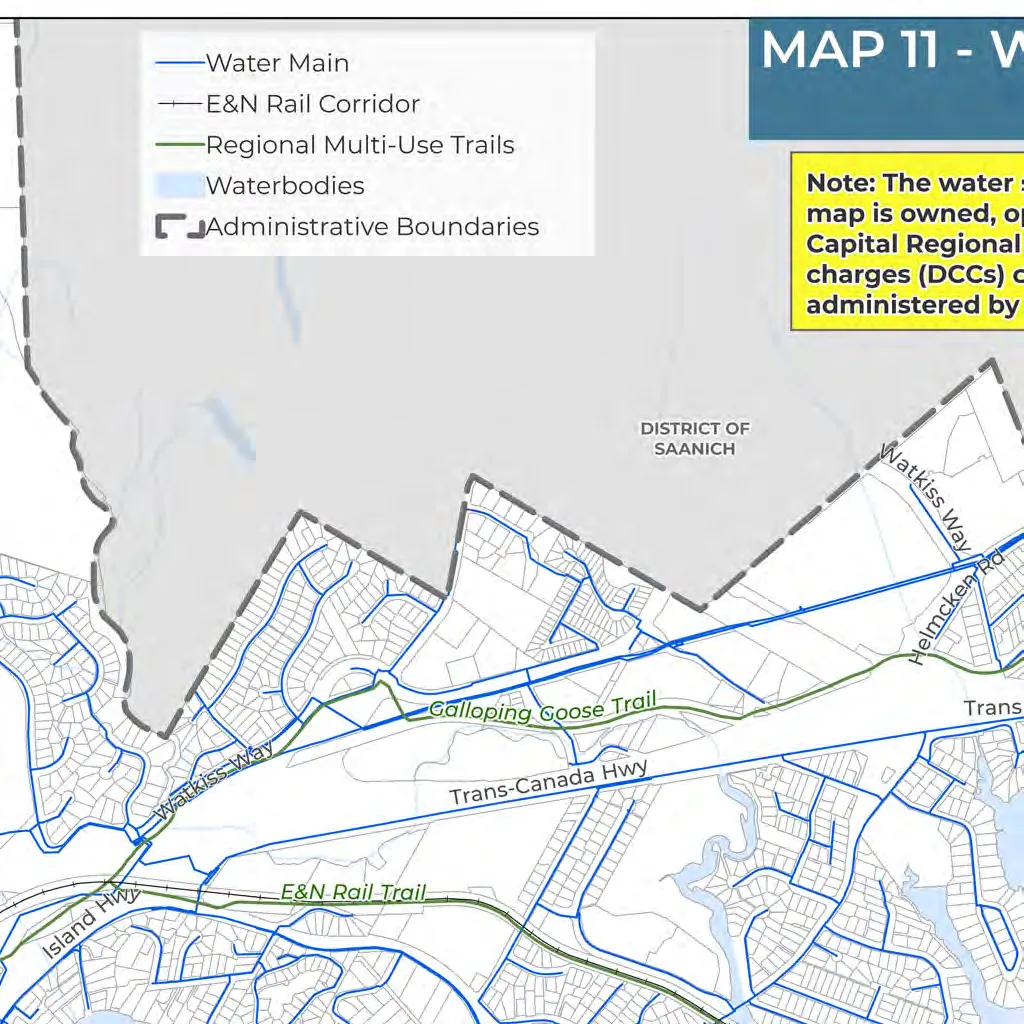
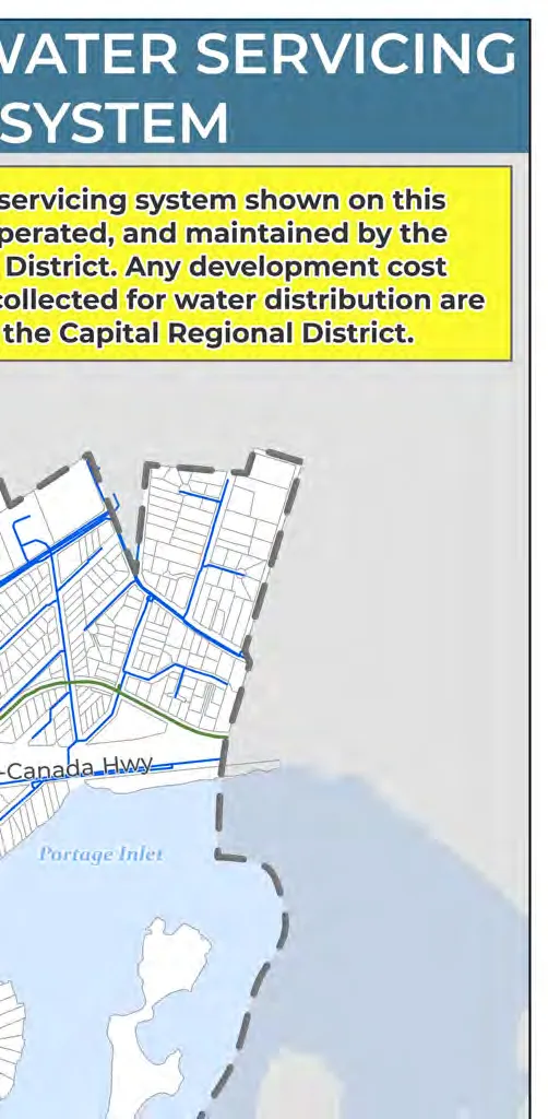
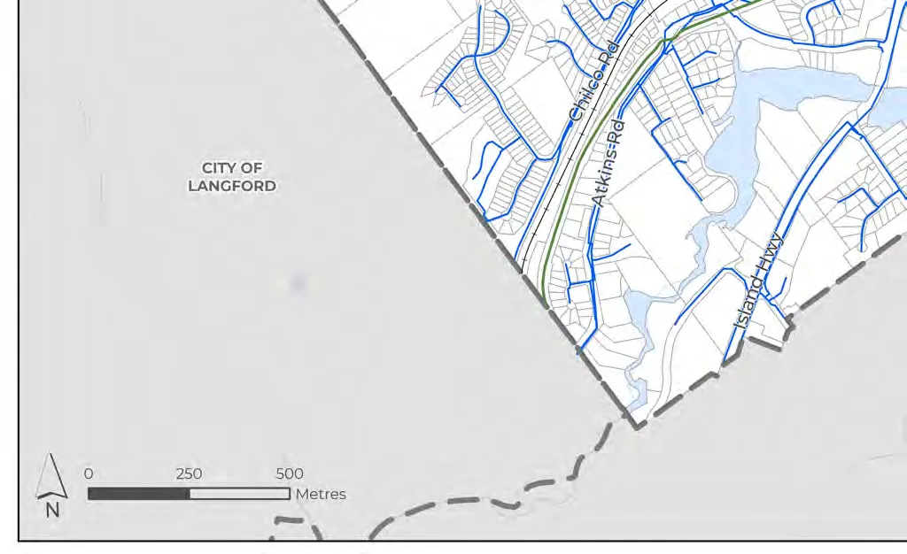
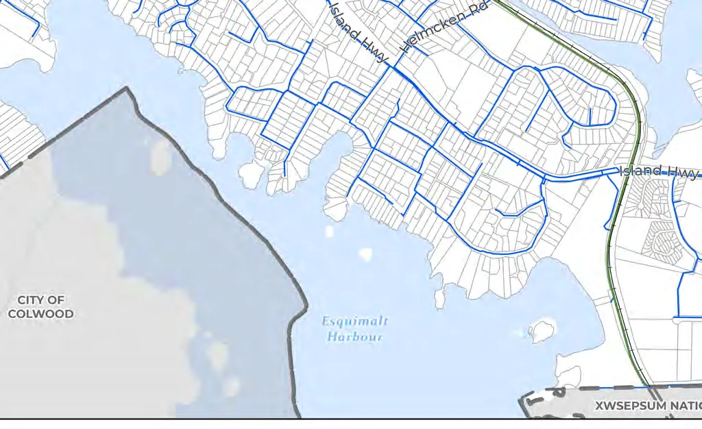
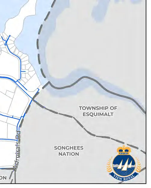
Page 75
9.2 OBJECTIVES
9.2.1 SUSTAINABLE INFRASTRUCTURE Ensure that infrastructure investment and renewal decisions are guided by the Town’s Asset Management Policy and long-term financial plan. To maximize best value and service delivery of the Town's critical assets, align asset management programs, policies, and plan with the requisite funding and resources.
9.2.2 FISCAL RESPONSIBILITY AND DECISION MAKING Ensure that infrastructure and service delivery are planned and implemented in a fiscally responsible manner, and that reserves are funded so that investments are equitably funded by current and future generations.
9.2.3 SERVICE DELIVERY Continue to provide a sustainable level of service for critical infrastructure systems to align with community expectations.
9.2.4 INFRASTRUCTURE INVESTMENT, GROWTH, AND COORDINATION Continue to coordinate infrastructure investments, including maintenance, upgrades, renewals, and improvements to ensure sustainable service delivery, and consider alignment with existing and future land use and growth considerations.
9.2.5 NATURAL ENVIRONMENT Consider the preservation of the natural environment’s integrity and the protection of human health in infrastructure and service delivery when making decisions. Growth should be balanced with the capacity of natural systems.
9.2.6 CLIMATE CHANGE IMPACTS Consider ongoing studies and review of climate projections in the design, upgrade, operations, and maintenance of new and existing infrastructure to make informed decisions on the optimal method of service delivery.
9.3 POLICIES
9.3.1 GROWTH MANAGEMENT AND DEVELOPMENT A. Plan new and upgraded infrastructure and services to support compact and sustainable development, and prioritize investments that support existing and new housing, employment, and civic uses. B. Ensure that development will only occur if appropriate infrastructure systems (water, wastewater, and sewer) with sufficient capacity are in place or provided as part of a development. Infrastructure upgrades should be planned for and installed through municipal finance initiatives.
Page 76
C. Ensure that extension of infrastructure services in areas outside the Urban Containment Boundary or for developments that do not conform with the policies of this plan will not be supported. D. Plan new infrastructure in conjunction with roads, community facilities, parks, and other public spaces. Planning considerations should include: i) Stormwater management ii) Watershed systems and functions iii) Inflow and infiltration reduction iv) Opportunities to integrate parks, greenways, natural systems, and tree canopy improvements v) Transportation safety, pedestrian, cyclist, and transit connections. E. Exercise the Town’s legislative authority to obtain road dedications for sustainable transportation infrastructure as a condition of a building permit.
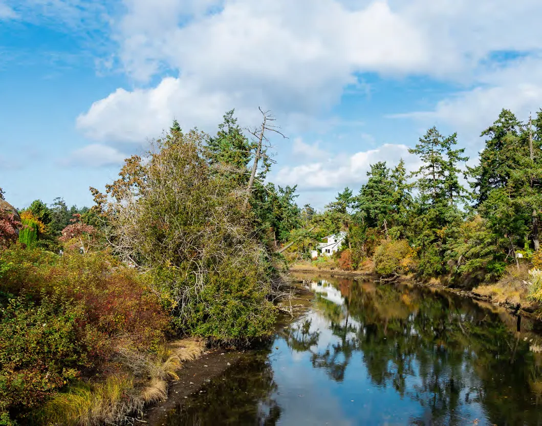
Page 77
9.3.2 INFRASTRUCTURE INVESTMENT A. Use the Town’s master plans and Asset Management Strategy as guides to identify future infrastructure priorities and upgrades, and understand required reserve contributions for long term service demand and delivery. B. Prioritize infrastructure and services investments that best address local needs and maximize community benefits. C. Ensure that the cost of infrastructure investments is borne by those that benefit the most from the provision of the service; with the cost of new or upgraded systems being funded by the developments that trigger them or benefitting property owners.
9.3.3 INFRASTRUCTURE STANDARDS A. Ensure infrastructure is designed in a manner that aligns with the community’s goals and desired levels of service, as well as adheres to the Town’s engineering specifications including the latest Master Municipal Construction Documents so that all infrastructure in View Royal is being constructed to a standard that aligns with best engineering practices. B. Aim to advance green infrastructure (e.g. natural assets, enhanced assets, and engineered assets) practices. C. Consider the full life cycle of infrastructure services, including operations, maintenance and service levels, when designing new systems and upgrades. D. Facilitate adequate operation and maintenance programs to maximize the life of infrastructure systems, reduce the frequency of replacement, ensure proper functionality, and reduce the risk of critical failures. E. Continue to explore strategies and solutions to understand and reduce the inflow and infiltration of stormwater into the sanitary sewer system.
Green infrastructure refers to natural and semi-natural engineered systems that support with managing drainage. Examples include green roofs, permeable pavements, and rain gardens, amongst others.
9.3.4 INFRASTRUCTURE FOR A HEALTHY ENVIRONMENT A. When considering infrastructure renewal priorities, considerations will be given to upgrades to infrastructure and services that will enhance resiliency to the risks and impacts of climate change and disasters. B. Continue to incorporate climate change factors into the Subdivision and Development Servicing Bylaw to ensure that both onsite and offsite infrastructure considers the effects of climate change.
Page 78
C. Continue to explore opportunities to establish a natural asset inventory while supporting the protection, maintenance, and enhancement of existing natural assets and amenities. D. Work with adjacent jurisdictions in the Capital Regional District and other organizations to advance efforts in watershed management and drinking water protection that align with the Drinking Water Protection Act and Regulation. E. Support stormwater management practices that emphasize infiltration and detention, where possible, to minimize the negative effects (e.g. erosion, sediments, and contaminants) of stormwater discharge into Portage Inlet, Gorge Waterway, Esquimalt Harbour, Craigflower Creek, Hospital Creek, Millstream Creek and other natural watercourses and water bodies. F. Consider stricter source control measures and potential upgrades to reduce runoff from private property to mitigate downstream drainage impacts. G. Continue to prioritize sewer infrastructure upgrades and inflow and infiltration reduction to reduce overall sewer flows in the system, mitigating the risk of liquid waste overflowing into the natural environment. H. Investigate opportunities to mitigate downstream drainage impacts, in alignment with regional and provincial standards, and the level of service expected of the public. Opportunities could include rainwater collection, greywater reuse (such as using treated water for irrigation), and dual piping systems.
9.3.5 SOLID WASTE MANAGEMENT A. Continue to work with the Capital Regional District and the private sector to maintain three-stream waste separation systems (garbage, recycling, composting) as a means of reducing the amount of solid waste sent to the landfill. Ensure that all collection programs are convenient and well-promoted to increase participation at the unit level, building level, in businesses and public institutions. B. Support small-scale composting on appropriate residential properties and in community gardens. C. Support regional initiatives to reduce construction waste and encourage sustainable waste reduction. D. Consider opportunities to collaborate with the Capital Regional District and waste collection service providers to improve waste and organics collection for multi-unit residential developments with more than four dwelling units.
Page 79
10.0 Economic Development
10.1 CONTEXT
A strong and diverse local economy is essential to View Royal’s long-term resilience. New and existing businesses provide employment opportunities to residents of both the Town and the broader region. These businesses also provide the community with key services that are necessary for everyday life. The Town is aiming to collaborate with Destination Greater Victoria, West Shore Chamber of Commerce, Xʷsepsəm and Songhees Nations, local businesses, recreation providers, and the broader community to understand what is possible for the local economy and to leverage View Royal’s full economic potential.
View Royal has significant potential to become a regional economic hub – it has many existing conditions and assets that contribute to a strong local economy, and that can be leveraged further to grow the economic standing of the Town. This includes its central location within the Capital Regional District and prime access to major transportation routes such as the Trans-Canada Highway, the regional Island Highway, the Galloping Goose Regional Trail, and the E & N Rail Trail, as well as high-quality local parks and proximity to significant regional parks like Thetis Lake. In addition, View Royal is home to Victoria General Hospital, which has plans for future growth and expansion, as expressed by Island Health. Further, the lands surrounding the hospital have been designated by the Province as a transit-oriented area that will support the greatest density in the community and future increased levels of transit service. Such conditions may support growth in both the tourism and health services sectors, amongst others, resulting in strong demand for commercial tourist accommodations.
Part Two - Land Use aims to establish further conditions that will support new and existing businesses in View Royal by supporting higher density forms of development in areas that are close to existing or planned transit services and active transportation infrastructure. Concentrating populations will allow for a stronger client base for new and existing businesses, leading to greater economic vitality, and in turn, provide residents with access to the services they need within close proximity to their home.
The objectives and policies in this section aim to support economic development in View Royal by attracting new investment in the community and supporting existing businesses.
Page 80
The following Official Community Plan Goals may be achieved through the objectives and policy direction provided in this section:
- Economic Development
- Regional Partnerships
10.2 OBJECTIVES
10.2.1 LOCAL INVESTMENT AND ECONOMIC GROWTH Continue to create conditions that attract local investment and economic growth in the Town, particularly within the Town’s higher density land use designations, as discussed in Section 5.0 and shown on Map 1, including the Hospital Transit-Oriented Area, Neighbourhood Village, and Western Gateway Employment District Corridor.
10.2.2 CREATING A DESTINATION COMMUNITY Support development and local investments that make View Royal more than a drive-through community, but a destination that provides unique and interesting local and regional tourist destinations for visitors.
10.2.3 CAPITALIZE ON REGIONAL CONNECTIONS Explore, identify, and capitalize on opportunities that strengthen the community’s central location as a gateway to the West Shore and the Greater Victoria area, to attract and support entrepreneurs, the health sector, new businesses, and arts and culture.
10.2.4 SUPPORT FOR LOCAL BUSINESS Understand and support the changing needs of local businesses to create a supportive and economically viable market to thrive in the long-term. Consider the needs of traditional fixed businesses and flexible business models, such as farmers, artisans, and mobile vendors.
10.2.5 INVEST IN COMMUNITY HEALTH AND WELL-BEING Recognize and explore the complex relationship between community health and well-being, and the local economy. Consider opportunities to expand the health industry and increase access to local health services and locally grown food sources.
10.2.6 RECREATIONAL TOURISM Consider opportunities to support recreational tourism and economic development that capitalize on the Town’s parks and trails and proximity to regional recreational amenities. Focus on attracting hotel development in the Town to support leisure and business travel.
Page 81
10.2.7 PARTNERSHIPS Create strong, dynamic partnerships with Xʷsepsəm and Songhees Nations, the business community and related organizations, educational institutions, BC Transit, and regional and provincial governments to drive economic development, foster innovation, and attract transformative investment opportunities to establish View Royal as a thriving economic hub.
10.3 POLICIES
10.3.1 STRENGTHENING THE LOCAL ECONOMY A. Engage Xʷsepsəm and Songhees Nations, South Island Prosperity Partnership, Capital Regional District, neighbouring municipalities, the local business community, and related stakeholders to identify the economic vision for View Royal and the broader community as an important regional player. B. Explore economic development partnerships with Xʷsepsəm and Songhees Nations that further advance sustainable initiatives and economic prosperity, remove barriers, and are mutually beneficial. C. Continue to collaborate with Destination Greater Victoria to attract hotel and business investment, leverage the Town’s existing assets, and support and market View Royal as a tourist destination within the region. D. Collaborate with the West Shore Chamber of Commerce to identify opportunities to better support new and existing businesses, and expand economic development opportunities within the Town.
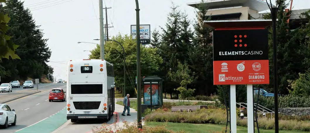
Page 82
E. Identify opportunities for economic innovation, attracting and retaining new business, and stimulating new investment to advance the Town’s commitment to creating a more diverse, equitable, and inclusive community. F. Leverage View Royal’s existing community assets and destinations, including Portage Park, Thetis Lake Regional Park, the Galloping Goose and E & N trails, Victoria General Hospital and medical services, as well as the Town’s regional location along the Trans-Canada Highway, its proximity to the West Shore, and regional destinations such as Royal Roads University, to generate new economic and tourism opportunities for View Royal and the broader region. G. Explore opportunities for expanding the health services industry throughout View Royal, but particularly in the area surrounding Victoria General Hospital, to create a medical services hub through the provision of medical offices, pharmacies, research labs, and related services. H. Continue to liaise with the local business community to understand how the Town can better support local businesses, and strategically respond to emerging business sectors in the region. I. Identify opportunities to streamline processing times for business licenses, particularly for small or locally owned businesses. J. Concentrate growth and economic investment along the Town’s corridors as shown on Map 3, while leveraging transportation infrastructure improvements to drive job and housing creation, and improve accessibility. K. Understand the economic and land use conditions necessary to support the viability of light industry and similar employment uses on lands designated as Western Gateway Employment District Corridor, as shown on Map 1, to identify what action the Town can take to facilitate these conditions, given the benefits that light industry will generate for the local economy, such as a diversified tax base and living wages for residents. L. Explore opportunities and partnerships to attract hotel development and other accommodation uses to View Royal.
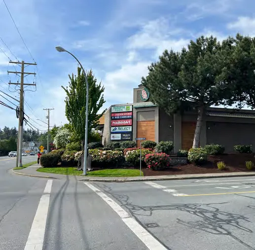
Page 83
M. Explore incentives to attract hotel development, including but not limited to, density bonusing, parking reductions, streamlined application processes, and flexible zoning to allow for a variety of uses to support hotel development to service both the healthcare sector and broader visitor market. N. Support neighbourhood-compatible home-based businesses in areas where residential use is permitted to promote the continued provision of alternative employment options, reduced commutes, and more local services. O. Support home-based businesses in rural areas that fit with the character of the neighbourhood. P. Explore ways to better support high-tech uses in View Royal.
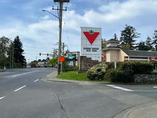
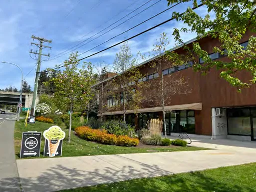
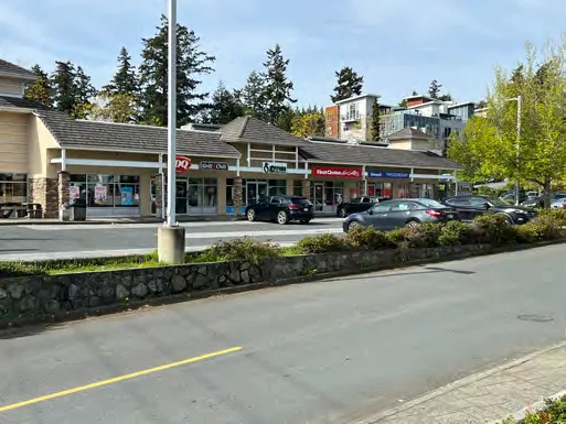
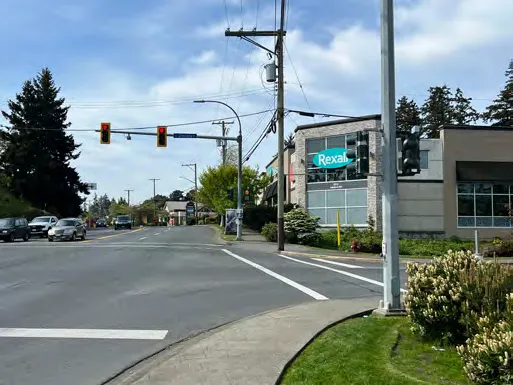
Page 84
11.0 Natural Environment and Hazards
11.1 CONTEXT
The natural environment is interconnected with how View Royal approaches growth, its character and identity, and its long-term stewardship and sustainability objectives. Maintaining, restoring, and expanding healthy ecosystems provides important ecosystem services, including clean air, shade for cooling, natural drainage systems, and erosion mitigation, alongside opportunities for people to connect with nature.
View Royal comprises a diverse array of marine, freshwater, and terrestrial ecosystems and habitats, as shown on Map 12 Environmentally Sensitive Areas. Marine ecosystems comprise Esquimalt Harbour and Portage Inlet, including their coastal shorelines. Freshwater ecosystems merge with the salt waters of these two water bodies in the estuaries of Craigflower, Hospital, and Millstream Creeks. Thetis, Prior, Pike, and McKenzie Lakes all comprise freshwater ecosystems that include foreshore and riparian areas. Terrestrial ecosystems exist throughout the town, though are particularly prevalent in Thetis Lake and Mill Hill Regional Parks, in the form of mature Coastal Douglas Fir forests along with rocky outcrops and Garry Oak meadows. These natural spaces provide important habitat for wildlife and species at risk, as shown on Map 13.
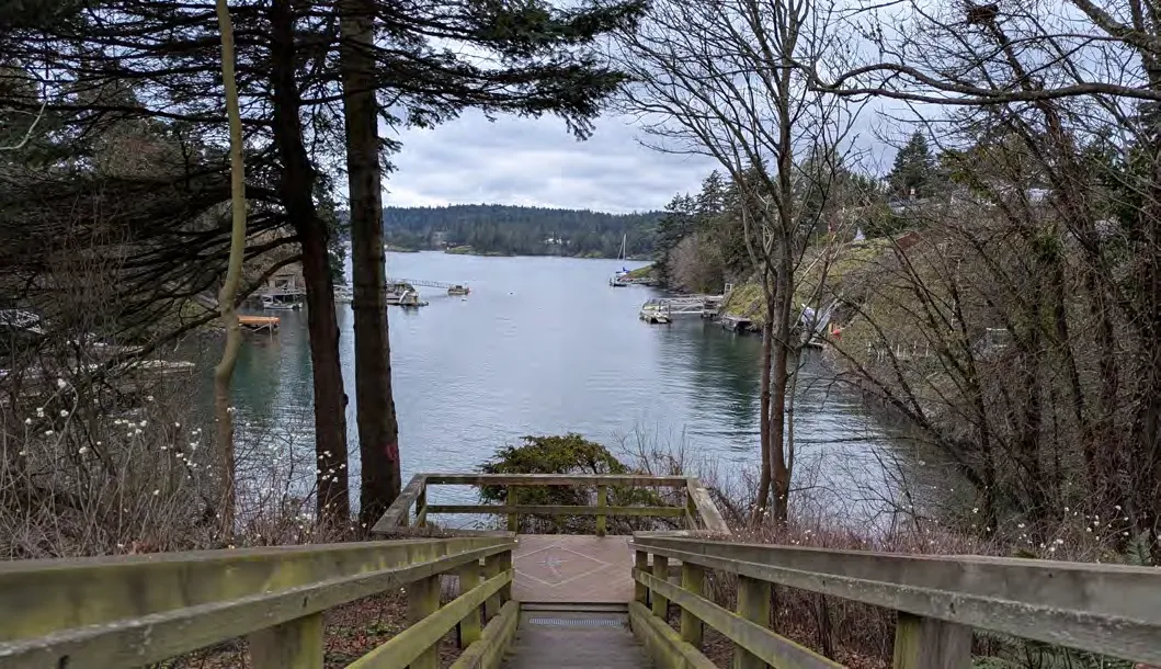
Page 85
In addition to providing habitat for many species, the natural environment also poses some natural hazards such as flooding, tsunamis, steep slopes exceeding 30%, as shown on Map 14, and wildfires. These hazards all pose risks to public safety and potential impacts to the built environment. Construction activities occurring within any zones where the risk to public safety is deemed high because of a natural hazard are subject to the Development Permit Area Guidelines included in Part 6 of this Official Community Plan. This includes restrictions to development in areas where slopes are equal to or greater than 30%²⁰, as shown on Map 14, and where flooding or slope instability may occur. This section discusses considerations and strategies for emergency response to events occurring as a result of such natural hazards, plus wildfires and earthquakes.
Access to the natural environment is a key priority for the View Royal community. Overall health and well-being may be correlated with the level of access that community members have to the natural environment, whether that be through public green space or on privately owned lands. This section aims to work in tandem with Sections 13 and 14 of the Official Community Plan to recognize that protection of the natural environment as places for people to recreate, both passively and actively, will positively impact the physical and mental health of residents. Many natural features and habitats shown on Maps 12 and 13 are designated as parkland as shown on Map 15. The reduction of greenhouse gas emissions, expanded upon in Section 12, and other air pollutants are also essential to maintaining a healthy environment in View Royal and advancing community-wide sustainability for years to come.
²⁰ Restrictions to development in areas where slopes are equal to or greater than 30% is best engineering practice to avoid unsafe development and public safety risks.
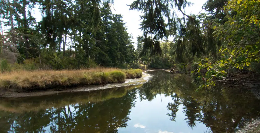
Page 86
It is important to note the key role that trees play in protecting the natural environment, mitigating the impacts of climate change, and improving overall community health and well-being. Many studies discuss the benefits that trees can provide for both physical and mental health, in terms of their ability to provide shade, clean air, and a connection to the natural environment. Areas of high tree canopy coverage may also act as corridors connecting wildlife habitat areas. The Town’s Urban Forest Strategy, endorsed by Council in 2026, aims to recognize the importance of trees in View Royal through establishing a tree canopy coverage goal of 30%. This section aims to further support the vision of the strategy and recognize the role of the urban forest in protecting the natural environment.
The following objectives and policies outline how View Royal can strengthen the long term resilience of the Town’s natural environment and reduce community risk from natural hazards. Together, they support protection from flooding, tsunamis, landslides, wildfires, and earthquakes, while safeguarding environmentally sensitive areas, urban forests, and aquatic environments from potential impacts of development.
Environmentally sensitive areas are ecosystems and/or habitats that provide high value to the natural environment through their ability to support biodiversity, animal and plant species, and natural systems such as purifying the air and water. View Royal has a number of sensitive and significant terrestrial, aquatic, and riparian ecosystems that provide habitat for many species. Examples include:
- Terrestrial ecosystems: old growth and mature forests such as those found in Thetis Lake and Mill Hill Regional Parks
- Aquatic ecosystems: saltwater habitats provided in large waterbodies and their shorelines such as the Portage Inlet
- Riparian ecosystems: freshwater streams and lakes that have the potential to support fish habitat, such as