Council Meeting/Documents/Schedule Q: Environmental Protection and Natural Hazard Development Permit Areas
Appendix
Schedule Q: Environmental Protection and Natural Hazard Development Permit Areas
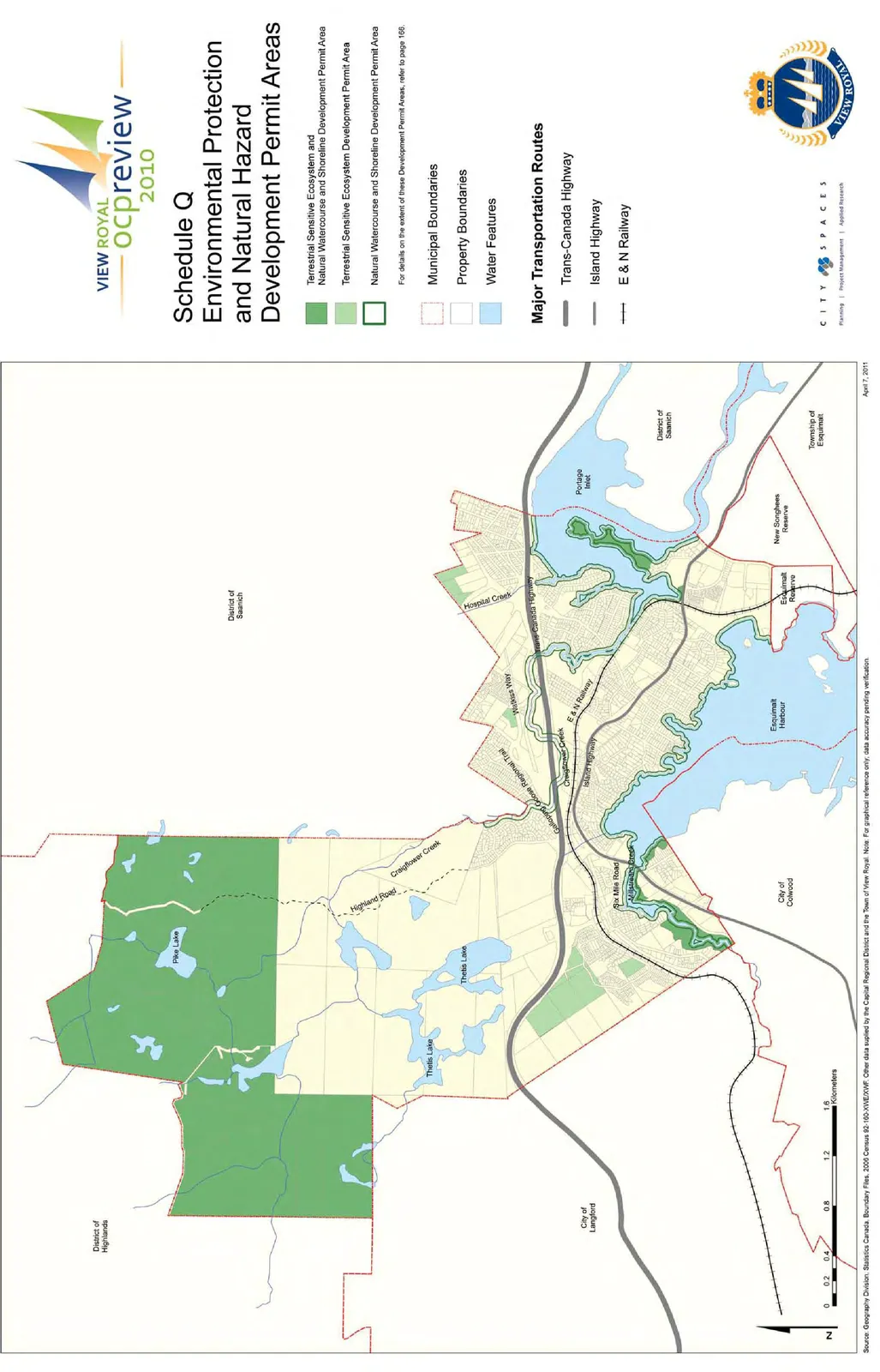
A map depicting terrestrial and water-based sensitive ecosystems and development permit areas within View Royal.
April 7, 2011 revision dateShows Municipal Boundaries, Trans-Canada Highway, and Island Highway
VIEW ROYAL ocp review 2010
Page 399
Schedule Q
Page 399
Environmental Protection and Natural Hazard Development Permit Areas
Legend
Development Permit Areas
- Terrestrial Sensitive Ecosystem and Natural Watercourse and Shoreline Development Permit Area
- Terrestrial Sensitive Ecosystem Development Permit Area
- Natural Watercourse and Shoreline Development Permit Area
For details on the extent of these Development Permit Areas, refer to page 166.
Other Features
- Municipal Boundaries
- Property Boundaries
- Water Features
Major Transportation Routes
- Trans-Canada Highway
- Island Highway
- E & N Railway
April 7, 2011
Source: Geography Division, Statistics Canada, Boundary Files, 2006 Census 92-160-XWE/XWF. Other data supplied by the Capital Regional District and the Town of View Royal. Note: For graphical reference only; data accuracy pending verification.
Page 399
Document Images
(1)
Extracted from: 2026 06 16 Council Meeting - Agenda - Pdf(562 pages total)