View Royal 2050: Our Future View Official Community Plan DRAFT
The redline draft version of the comprehensive 2050 Official Community Plan document covering land use, reconciliation, housing, and mobility.
View Royal 2050: Our Future View
Official Community Plan
DRAFT
Territorial Acknowledgement
The Town of View Royal humbly acknowledges that it is situated upon the unceded traditional territories of the lək̓ʷəŋən (Lekwungen) Peoples, known today as the Xʷsepsəm (Esquimalt) and Songhees Nations. We honour and respect the history, languages, ceremonies, and culture of the First Nations peoples, including the Xʷsepsəm and Songhees Nations, as well as the Métis, Inuit, and Non-Status Aboriginal Peoples whose presence and culture enrich the community.
These lands have been stewarded by the lək̓ʷəŋən Peoples since time immemorial, and their connection to the land and waters and Title and rights in these territories remain intact. As a local government, we are settlers and guests on these lands and acknowledge our responsibility to the land, its resources, and its people. We give thanks to the lək̓ʷəŋən People—past, present, and future—for their stewardship, care, and leadership on these lands.
Contents
The Plan Context (1)
- 1.0 Plan Overview (2)
- 1.1 What is an Official Community Plan? (2)
- 1.2 How We Got Here (5)
- 1.3 How to Use This Official Community Plan (13)
- 2.0 View Royal 2050 (16)
- 2.1 Overview (16)
- 2.2 Vision (16)
- 2.3 Goals (17)
- 2.4 Community Targets (22)
- 3.0 Reconciliation (23)
- 3.1 Context (23)
- 3.2 Xʷsepsəm Nation Today (26)
- 3.3 Songhees Nation Today (26)
- 4.0 The History of View Royal (28)
- 4.1 Colonial Settlement (28)
- 4.2 Physical Setting (29)
- 4.3 Community Traits (29)
Land Use (30)
- 5.0 Land Use (31)
- 5.1 General Framework and Considerations (31)
- 5.2 Western Gateway Employment District Corridor Designation (45)
- 5.3 Hospital Transit-Oriented Area Designation (49)
- 5.4 Neighbourhood Village Designation (52)
- 5.5 Neighbourhood Centre Designation (54)
- 5.6 Commercial Designation (56)
- 5.7 Intensive Mixed Use Designation (58)
- 5.8 Neighbourhood Mixed Use Designation (59)
- 5.9 Mixed Residential Designation (62)
- 5.10 Small-Scale Multi-Unit Housing Designation (64)
- 5.11 Residential Designation (67)
- 5.12 Large Lot Residential Designation (69)
- 5.13 Rural Designation (70)
- 5.14 Community Facility Designation (71)
- 5.15 Parks, Trails and Open Space Designation (72)
- 5.16 Thetis Cove Special Planning Area Designation (75)
Reconciliation (76)
- 6.0 Reconciliation (77)
- 6.1 Context (77)
- 6.2 Objectives (78)
- 6.3 Policies (78)
Policies (80)
- 7.0 Housing (81)
- 8.0 Transportation and Mobility (88)
- 9.0 Community Infrastructure and Services (105)
- 10.0 Economic Development (114)
- 11.0 Natural Environment and Hazards (119)
- 12.0 Climate Action and Sustainability (132)
- 13.0 Parks, Trails, and Recreation (138)
- 14.0 Community Well-Being and Culture (145)
Implementation (154)
- 15.0 Integrated Action Plan (155)
- 16.0 Regional Context Statement (156)
Development Permit Areas (171)
Community Profile (215)
- 16.3 Community Growth (230)
Glossary (246)
Table of Maps
| Map Number | Map Name | Page |
|---|---|---|
| Map 1 | Land Use | 40 |
| Map 2 | Agricultural Land Reserve Lands | 74 |
| Map 3 | Corridors | 90 |
| Map 4 | Mobility | 91 |
| Map 5 | Existing Active Transportation Network | 97 |
| Map 6 | Future Pedestrian Network | 98 |
| Map 7 | Future Cycling Network | 99 |
| Map 8 | Street Classification | 102 |
| Map 9 | Sewer Servicing System | 107 |
| Map 10 | Stormwater Servicing System | 108 |
| Map 11 | Water Servicing System | 109 |
| Map 12 | Environmentally Sensitive Areas | 122 |
| Map 13 | Species at Risk | 123 |
| Map 14 | Steep Slopes | 124 |
| Map 15 | Parks, Open Spaces, Trails, and Community Facilities | 139 |
Part One: The Plan Context
1.0 Plan Overview (2) 2.0 View Royal 2050 (16) 3.0 Reconciliation (23) 4.0 The History of View Royal (28)
1.0 Plan Overview
1.1 WHAT IS AN OFFICIAL COMMUNITY PLAN?
This Official Community Plan titled “View Royal 2050: Our Future View" represents the Town’s vision and goals for the coming decades. It is a comprehensive, long-term policy document that guides how the community will grow and respond to key opportunities that arise. The Official Community Plan provides direction for land use decisions and addresses the provision of community services and amenities. This plan will ensure that future changes and growth align with the community’s values and priorities, supporting a sustainable and vibrant View Royal for generations to come.
Typically, all local government master plans, policies, and bylaws are updated following the adoption of a new Official Community Plan to ensure consistency in policy direction across documents. This consistency informs decision-making by Town Council and staff, in addition to priority setting during annual strategic planning and budgeting cycles.
The Official Community Plan is intended to serve as a living document that will be amended from time to time and updated every 5 years to remain relevant as the community evolves and grows. The last comprehensive Official Community Plan review and update occurred in 2011 and much has changed globally, regionally, and locally. This Official Community Plan addresses the context of View Royal in the years 2025 and 2026.
LEGISLATIVE REQUIREMENTS
The Local Government Act grants local governments in BC the authority to adopt an Official Community Plan. This legislation outlines what must be discussed in an Official Community Plan, along with other items that a local government may choose to include. It also outlines requirements for public and interest holder consultation, such as provincial agencies, school districts, and Indigenous communities.
In November 2023, the provincial government released legislation requiring municipalities to develop an Interim Housing Needs Report, to identify the 5- and 20-year housing needs projected for the community over the next 20 years and support a subsequent review and update of their Official Community Plans and zoning bylaws by December 31, 2025 to align with the Interim Housing Needs Report. The Town fulfilled its legislative requirements by adopting three new land use designations, including the Hospital Transit-Oriented Area, Neighbourhood Village, and Small-Scale, Multi-Unit Housing to provide the necessary housing capacity to meet its housing need, and align with zoning bylaw amendments.
The legislation requires that municipalities prepare Housing Needs Reports every five years, and review and update their Official Community Plans and zoning bylaws thereafter. The next Housing Needs Report must be completed by December 31, 2028, and the Official Community Plan and zoning bylaw alignment must be completed in 2030.
SMALL-SCALE, MULTI-UNIT HOUSING AND TRANSIT ORIENTED AREAS AND PUBLIC HEARINGS
In November 2023, the province adopted Bill 44: Housing Statutes (Residential Development) Amendment Act, 2023 and Bill 47: Housing Statutes (Transit-Oriented Areas) Amendment Act, 2023 to increase the supply of housing and streamline development approvals.
Under Bills 44 and 47, the province mandated municipalities to update zoning bylaws to permit Small-Scale, Multi-Unit Housing (SSMUH), and designate Transit-Oriented Areas, by June 2024. To satisfy the provincial legislation, the Town amended all existing single-family and duplex zones in the Zoning Bylaw to permit SSMUH, which allows up to 3, 4, or 6 dwelling units, depending on lot size and location in the Town.
The Town also amended the Zoning Bylaw to add a new Transit-Oriented Area designation. The Town’s Transit-Oriented Area is located west of the existing Victoria General Hospital Transit Exchange, which is further discussed in Section 5.3. Higher densities are planned to be accommodated to help provide more housing in this area.
Under Bill 44, a local government must not hold a public hearing on a proposed zoning bylaw if the bylaw is consistent with the Official Community Plan and the sole purpose of the bylaw is to permit a residential development in which at least half of the gross floor area of all buildings and other structures is residential.
HOUSING TARGET ORDER
Since receiving the Housing Target Order in July 2024, the Town has completed two housing target reports, a third will be completed in the summer of 2026 and reviewed by Council in the fall. At this time, the approximate total number of completed units is 499. The Town is on track to complete its housing target order within the five-year period.
REGIONAL PLANNING FRAMEWORK
As a member municipality within the Capital Regional District, View Royal’s Official Community Plan must be consistent with the Regional Growth Strategy per requirements outlined in the Local Government Act. Conformity to the Regional Growth Strategy is discussed in greater detail in section 16.0 Regional Context Statement.
1.2 HOW WE GOT HERE
A SUMMARY OF THE PROCESS
The Official Community Plan update is being carried out in three phases, each phase focusing on specific content in the document. The work completed between January 2025 and the summer of 2026 focused on the completion of the first two phases, with the third phase scheduled for completion in 2027.
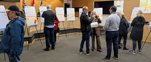
Phase 1 (January 2025 to December 2025) The first phase focused on establishing a new vision for the Official Community Plan, a foundational element of the document that provides a forward thinking target for where the community envisions it will be in the future. This vision statement is supported by 12 new goals, which act as guiding principles for decision-making.
This phase also required that the Town align its 2024 Interim Housing Needs Report with the Official Community Plan by December 31, 2025, a date established through provincial legislation. The alignment required that the land use map be updated to provide capacity to meet the anticipated 20-year housing need, and to establish housing policies that addressed each of the six key components as part of the standardized Housing Needs Report methodology.
Phase 2 (October 2025 to July 2026) The second phase shifted focus to a review of the nine policy chapters in the Official Community Plan. Each policy chapter is built on a series of objectives, which outline the overall purpose of the policies. The policies inform decision making processes in the Town which aid in development and planning processes, operations, budgeting, and additional plan and policy development.
To support each of the policy chapters, actions were created to clearly identify what is required to achieve desired outcomes, the timing, and which municipal department is responsible.
This phase also required a review and update of the Regional Context Statement, to ensure alignment with the Regional Growth Strategy.
Phase 3 (Fall 2026 to 2027) The final phase will focus on updating Form and Character and Environmental Development Permit Areas and guidelines. In addition, this phase will also consider the opportunity to develop new Development Permit Areas, including hazard areas prone to wildfire and flooding.
A SUMMARY OF ENGAGEMENT
The update of the Official Community Plan has provided multiple engagement touchpoints to inform updates to the Plan. The phased approach outlined above has supported a comprehensive process that balances technical analysis with community feedback to shape a vision, goals, and policies that reflect the needs and aspirations of View Royal residents.
Throughout the process, Council, the Committee of the Whole, and the Town’s Official Community Plan Review Advisory Committee have provided input and perspectives on key issues related to the Official Community Plan update. Together, they have participated at key milestones by reviewing draft materials, sharing community insights, and providing feedback on engagement activities, and emerging policy directions.
Official Community Plan Review Advisory Committee: A group of community members appointed by Council to assist with the review and provide feedback on draft content and engagement material.
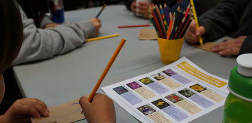
- 8 Pop-up events
- 6 Open houses
- 6 Workshops
- 2,110 Video views
- 7 OCP Advisory Committee Meetings
- 17 Presentations to Council / Committee of the Whole
- 6 Stakeholder emails
- 12 Subscriber email campaigns
- 199 Social media posts
- 540 Survey responses
- 86 Youth survey responses
- 54 Map comments
- Project website: engage.viewroyal.ca
- 3,452 Unique visitors
- 6,681 Views
- 181 People on the mailing list
Across these engagement touchpoints, residents participated through surveys, open houses, workshops, pop ups, and stakeholder meetings. Feedback from each phase was summarized in What We Heard Reports and shared with Council and the Official Community Plan Advisory Committee to help inform the evolving draft, which is a reflection of the cumulative input received through each stage of engagement.
The draft Official Community Plan reflects five rounds of community engagement, each focused on a different component of the Plan. While participation levels varied between engagement phases, feedback received was considered alongside technical studies, legislative requirements, and Council feedback.
ENGAGEMENT AT A GLANCE
2024
- September: Staff met with the Esquimalt Nation Executive team
2025
- January 13: Official Community Plan Advisory Committee Meeting #1
- January 24: View Royal 2050 website launch
- January 24 – February 18: Vision and Guiding Principles Survey
- February 5, 8, 10, 13: Vision and Guiding Principles Pop-ups
- February 21 – 28: Youth Vision Survey
- February 24: Official Community Plan Advisory Committee Meeting #2
- March 6: Official Community Plan Business Mixer Workshop
- March 7 – April 4: Community Growth Survey and Social Mapping Activity
- March 8: Community Growth Open House and Workshop
- March 12: Community Growth Open House
- March 13: Community Growth Virtual Workshops (2)
- March 26, 28: Community Growth Engagement Pop-ups
- April: Staff met with Esquimalt Nation Executive team and Councillors
- May 5: Official Community Plan Advisory Committee Meeting #3
- June 2: Official Community Plan Advisory Committee Meeting #4
- June 4: Staff presented on the Official Community Plan to Songhees Chief and Council
- July 18 – September 7: Vision and Goals Survey
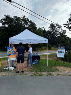
- August 20: Vision and Goals Pop-up
- August 25: Official Community Plan Advisory Committee Meeting #5
- October 7 – November 12: Western Gateway Community Corridor Survey
- October 18: Western Gateway Community Corridor Open House and Workshop
- October 21: Western Gateway Corridor Focus Group: Business & Land Owner Workshop
- October 22: Western Gateway Community Corridor Open House
- November 3: Official Community Plan Advisory Committee Meeting #6
- November 8 – November 30: Policy Review Survey
- November 8, 13: Policy Review Open Houses
2026
- February 24: Special Council Meeting on the Western Gateway Corridor
- March 30: Official Community Plan Review Advisory Committee Meeting - First Draft Official Community Plan Review
- March 31: Special Council Meeting - First Draft Official Community Plan Review
- April 7: Council Meeting - First Draft Official Community Plan Review
ENGAGEMENT TOUCHPOINT #1: VISION AND GUIDING PRINCIPLES (JANUARY - FEBRUARY 2025)
Participants were asked to provide input on the future vision of View Royal. Feedback was collected through an online survey and pop-ups.
Key Takeaways:
- 2 surveys
- 1 workshop
- 4 pop-up events
- Participants identified the following foundational values for their future community: protecting parks and natural areas; maintaining safe and walkable neighbourhoods; improving transportation options; and supporting diverse and affordable housing.
Who Participated:
- 130 survey participants
- 86 youth survey participants
- 36 workshop participants
- 158 pop-up event participants
How People Heard:
- 1,158 Engage View Royal project website visits
- 9 Facebook posts, 2 Instagram posts, and 6 Bluesky posts
- 250 stakeholder emails
- 30 posters
- 1 Inside View Royal e-newsletter
- 1 newspaper ad
- 1 news releases
- 1 project video
- 4 pop-up events
ENGAGEMENT TOUCHPOINT #2: HOW WE GROW ENGAGEMENT (MARCH – APRIL 2025)
Participants were asked to provide feedback on how and where the community may grow and change over the next 20 years. Participants were asked to consider the Town’s existing growth areas and corridors, and provide feedback on potential opportunities for additional housing, services, employment space, and amenities.
Key Takeaways:
- 1 survey
- 1 online mapping activity
- 2 pop-up events
- 2 virtual community workshops
- 1 open house
- Participants indicated overall support for an increase in residential height and density and mixed-use development in both existing growth areas and along corridors in the community.
Who Participated:
- 176 survey responses
- 54 social map responses
- 42 open-house participants
- 11 virtual workshop participants
- 16 pop-up event participants
How People Heard:
- 930 Engage View Royal project website visits
- 19 Facebook posts, 19 Instagram posts, and 19 Bluesky posts
- 250 stakeholder emails
- 17 posters
- 2 Inside View Royal e-newsletters
- 1 newspaper ad
- 4 news releases
- 2 pop-up events
ENGAGEMENT TOUCHPOINT #3: VISION SURVEY (JULY – SEPTEMBER 2025)
Participants were asked to provide feedback on three draft vision statements and 11 community goals, developed from earlier feedback.
Key Takeaways:
- 1 survey
- 1 pop-up event
- Participants preferred vision statement that focused on the community’s relationship with nature and green space, and the need to be forward thinking as a community leader to ensure action is taken on environmental stewardship, climate action, affordable housing, and economic development.
Who Participated:
- 85 survey responses
- 16 pop-up event participants
How People Heard:
- 886 Engage View Royal project website visits
- 11 Facebook posts, 11 Instagram posts, and 8 Bluesky posts
- 250 stakeholder emails
- 17 posters
- 1 Inside View Royal e-newsletter
- 1 pop-up event
- 1 news releases
[Image 16a: Photo of an outdoor engagement pop-up tent with posters]
[Image 16b: Photo of a community mapping activity with sticky notes on a large map]
ENGAGEMENT TOUCHPOINT #4: WESTERN GATEWAY COMMUNITY CORRIDOR (OCTOBER – NOVEMBER 2025)
The Western Gateway Corridor was identified as a key growth area with opportunities for new housing, businesses, services and employment space. Participants were asked to provide feedback on the three growth scenarios for the Western Gateway Corridor, including low, medium, or high potential development scenarios.
Key Takeaways:
- 1 survey
- 2 workshops
- 2 open-houses
- Participants preferred a medium growth scenario that focused on the development of the Western Gateway south of Parson’s Bridge as a commercial and light industrial area, and the area north of Parson’s Bridge as a mixed-use neighbourhood village. Feedback provided through engagement informed a proposed land use scenario for the Corridor area.
Who Participated:
- 59 survey responses
- 11 workshop participants
- 7 focus group business workshop participants
- 43 open house participants
How People Heard:
- 668 Engage View Royal project website visits
- 9 Facebook posts, 9 Instagram posts, and 7 Bluesky posts
- 250 stakeholder emails
- 10 posters
- 2 Inside View Royal e-newsletters
- 1 news releases
- 1 newspaper ad
- 50 hand delivered notices to residents
- 50 (approximately) notices to businesses
ENGAGEMENT TOUCHPOINT #5: POLICY REVIEW ENGAGEMENT (NOVEMBER 2025)
Participants were asked to provide feedback on draft policies from each of the policy chapters in the draft Plan. This gave participants an early snapshot of draft content. Early feedback helped shape and further revise new draft policies on major topic areas, such as housing, transportation and mobility, economic development, parks and recreation, environment, climate action, and infrastructure.
Key Takeaways:
- 1 survey
- 2 open house events
- The survey respondents indicated that they support the draft policies overall. However, there are some policies that respondents provided mixed feedback on, indicating that further review and revisions could be required if desired.
- Participants identified the challenges with traffic congestion, the need to provide more diverse and accessible employment opportunities and services in the community, and more affordable housing. The preservation and enhancement of the Town’s parks and natural spaces is also important to the community.
Who Participated:
- 43 survey responses
- 16 open house participants
1.2.1 HOW PEOPLE HEARD:
- 579 Engage View Royal project website visits
- 11 Facebook posts, 11 Instagram posts, and 8 Bluesky posts
- 250 stakeholder emails
- 1 Inside View Royal e-newsletters
- 1 newspaper ad
- 1 news releases
- 2 newspaper ads
ENGAGEMENT TOUCHPOINT #6: FIRST DRAFT REVIEW (MARCH TO APRIL 2026)
Participants were asked to review and provide feedback on the draft Official Community Plan through an online survey. To make participation flexible and accessible, respondents could choose to answer the full survey or focus only on specific chapters within the draft Official Community Plan. A supporting summary document highlighted the major shifts in the draft document from the previous (2011) Official Community Plan was also made available for participants.
Key Takeaways:
- 1 survey
- The survey respondents expressed strong support for the draft vision statement, goals, and policy objectives, particularly those related to natural amenities, housing, mobility, community well-being, and sustainable service delivery.
- While feedback was generally positive, some respondents raised concerns related to growth management, transportation impacts, and reconciliation, with several participants seeking greater clarity on how policies would be implemented and balanced with community character.
Who Participated:
- 47 survey responses
1.2.2 HOW PEOPLE HEARD:
- 1,035 Engage View Royal project website visits
- 14 Facebook posts, 14 Instagram posts, and 12 Bluesky posts
- 1 town-wide postcard mail-out, sent to approximately 3,500 homes and businesses
- 250 stakeholder emails
- 1 project video
- 1 Inside View Royal e-newsletters
- 2 newspaper ads
- 2 news releases
1.3 HOW TO USE THIS OFFICIAL COMMUNITY PLAN
The primary objective of this Official Community Plan is to establish a clear framework for decision-making to guide View Royal Council and staff, residents, partners, agencies, developers, and other interest holders in the Town. All sections are interconnected and considered through the lens of the vision statement and twelve goals, which are referenced in Section 2.0 of View Royal 2050. When evaluating concepts within the Official Community Plan and determining how policies apply to specific developments, projects, or decisions, it is crucial to acknowledge the broad scope of the document and how the initiative would be considered holistically across all policy areas of the Official Community Plan.
The Official Community Plan will be interpreted and applied with care by Council, staff, residents, partners and other interest holders in the town. Departure from the plan must demonstrate clear public benefit and support the community’s vision and goals for growth and development.
Navigating the Official Community Plan requires consideration of its six parts, descriptions for which are provided below.
Part One: The Plan Context
This part encompasses introductory elements of the plan, including what an Official Community Plan is, presentation of the community’s vision and goals for the year 2050, discussion on the Town’s commitment to ongoing reconciliation and government-to-government relationships with the Xʷsepsəm and Songhees Nations, and providing context on the community related to its geography, traits, and community statistics, along with context on regional trends that were factors considered at the time of writing this plan.
Part Two: Land Use
This part outlines how View Royal will develop over time and how land may be used. It includes objectives and general policies for growth and development that will be considered as part of the development approvals process. In addition, land use designations are identified and apply to different areas of the community, with each designation providing specific context, intended uses, heights, and densities, and supporting policies that apply.
Part Three: Reconciliation
This part outlines objectives and policies that support View Royal’s reconciliation and government-to-government relationships efforts with Xʷsepsəm and Songhees Nations and enable the Nation’s journeys towards self-determination. Part Three provides objectives and policy direction to support collaboration and long-term partnerships with Xʷsepsəm and Songhees Nations by focusing on strengthening government-to-government relationships, advancing First Nations presence and cultural recognition in the community, and supporting reconciliation in decision-making, land use decisions, land stewardship, and economic development.
Part Four: Policies
This part provides high-level direction across a range of topic areas within the scope of a local government through objectives and policies. These are organized by chapters, including Housing, Transportation and Mobility, Community Infrastructure and Services, Economic Development, Natural Environment and Hazards, Climate Action and Sustainability, Parks, Trails, and Recreation, and Community Well-Being and Culture.
Part Five: Implementation
This part describes how the Town may transform the policy direction outlined in Parts Two and Three into concrete actions. Actions are categorized into one of four timeframes for implementation (short-, medium-, long-term, and ongoing) with relevant policies and implementing Town departments referenced. This part also includes the Regional Context Statement, which explains how the Official Community Plan aligns with the Capital Regional District’s Regional Growth Strategy.
Part Six: Development Permit Areas
This part identifies and designates seven development permit areas in the Town applicable to areas that require special development considerations. The permit areas are split across two development permit area classifications: Form and Character, and Environmental. Development permit guidelines inform the Town in the decision-making process when considering a development permit application. Overall, the intent of development permit areas is to achieve the following:
- Protection of the natural environment, its ecosystems and biological diversity;
- Protection of the public, buildings, and development from hazardous conditions;
- Establishment of objectives for the form and character of garden suite development; and
- Establishment of objectives for the form and character of commercial, industrial or multi-family residential development.
2.0 View Royal 2050
2.1 OVERVIEW
The Official Community Plan’s vision and goals are intended to guide the community to the year 2050. The policy direction of this plan stems from these key guiding statements. The vision and goals are informed by input received from the community as part of engagement undertaken in 2025 and 2026.
2.2 VISION
The following statement outlines the Town’s aspirations to the year 2050 and beyond:
View Royal is a thriving, welcoming, inclusive community where people live close to nature, services, and amenities that foster health and well-being.
2.3 GOALS
1. MOBILITY & CONNECTIVITY
Goal: Provide a variety of transportation options within a well-connected network to support mobilizing all ages and abilities.
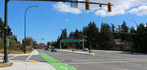
While private vehicles are still the primary method of travel, the Town continues to strive towards the creation of an improved transportation network. Developing a well-connected regional network will ensure that residents are able to get where they need to go via different transportation modes: walking, cycling, rolling, transit, and vehicular use. The Town will work closely with the Capital Regional District and nearby municipalities to address ongoing traffic challenges and streamline local and regional connections.
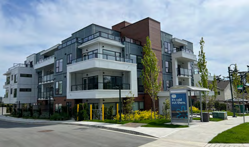
2. DIVERSE AND AFFORDABLE HOUSING
Goal: Provide diverse, attainable, and affordable housing types and tenures for all residents.
Encouraging the development of a wide range of market and non-market housing options will ensure existing and future residents can continue to call the Town home. Emphasis will be placed on housing that supports aging-in-place, multi-generational households, and the creation of more rental and home ownership opportunities. Where possible, these options will be within close proximity to transportation and everyday services and amenities.
What is affordable and attainable housing? What constitutes ‘affordable’ is directly tied to a household’s gross annual income. Households who spend less than 30% of their before-tax income on housing are deemed to have ‘affordable’ housing. Attainable housing considers what a household needs in terms of size and type of housing, as well as what level of housing costs may be appropriate for a household given the cost of living in a community.
3. GROWTH MANAGEMENT & COMMUNITY CHARACTER PRESERVATION
Goal: Allow for context-sensitive, fiscally responsible growth and development throughout the community.
As a desirable community to live in, View Royal must balance opportunities for growth and the need for infrastructure services, while ensuring the character of the community is considered to complement or inspire new development. Natural amenities comprise much of the Town’s existing character, and these attributes are highly valued by the community. New development must ensure these amenities can be appreciated by existing and new residents alike.
4. COMMUNITY WELL-BEING
Goal: Enhance community well-being by providing safe, inclusive, and accessible spaces, while integrating arts and culture into everyday life.
Community well-being is achieved when every member feels safe, included, and has access to essential services and opportunities. It means embracing diversity and ensuring that all voices are heard and valued, creating a sense of belonging for everyone. Integrating arts and culture enriches our community by celebrating creativity and heritage, fostering a vibrant and dynamic environment that brings people together and enhances the quality of life for all.
5. RECONCILIATION
Goal: Strengthen government-to-government relationships with the Xʷsepsəm and Songhees Nations to support their efforts towards self-determination and autonomy. Collaborate with both Nations on shared priorities and decision-making that advance reconciliation across Town programs and services.
View Royal is located on the traditional, ancestral, and unceded territories of the lək̓ʷəŋən speaking peoples. To support community interest in advancing reconciliation efforts and government-to-government relationships, the Town will continue to build relationships with the Xʷsepsəm and Songhees Peoples. Emphasis will be placed on facilitating increased collaboration, supporting the Nations’ efforts towards self-determination, celebrating values and culture, and fostering synergies between our communities to better understand where alignment exists on core values.
Reconciliation is the ongoing process of establishing and maintaining mutually respectful relationships between Indigenous and non-Indigenous Peoples, grounded in recognition and respect of rights, histories, traditions, cultures, languages, and perspectives of Indigenous Peoples, and commitment to learning from and working in partnership with First Nations.
6. NATURAL AMENITIES
Goal: Preserve, protect, and expand the Town’s natural assets and amenities.
Parks, trails, and green space are regularly identified as some of the greatest benefits of living in the Town. Ensuring the coastal and forested landscapes are preserved and protected for the enjoyment of current and future generations is a community priority. These efforts will include ensuring a balanced approach to growth and adopting strong climate change adaptation and mitigation strategies.
Natural amenities are place-based attributes created by the environment that provide local benefits. Examples of natural amenities may be parks where community members can hike, lakes where kayaking can be enjoyed, trees that clean the air, and creeks that support with managing drainage.
7. COMMUNITY SAFETY & SECURITY
Goal: Foster a safe and secure community that is prepared for emergencies.
Community safety and security are achieved when people feel that their needs and quality of life are a priority. It means integrating best practices related to Crime Prevention Through Environmental Design and working collaboratively to better understand what community safety and security means to View Royal residents and business owners. Preparing and responding to health and climate emergencies, such as pandemics, climate disasters, earthquakes, etc., will strengthen the community over the long-term.
8. CLIMATE ACTION AND RESILIENCE
Goal: Undertake climate adaptation and mitigation initiatives to support the community’s resiliency.
As a forested coastal town, View Royal is particularly vulnerable to wildfires, coastal storms, flooding, and sea level rise attributable to the changing climate. In response, the Town is taking initiative to become a low carbon community, reduce its greenhouse gas emissions, and adopt climate adaptation and mitigation strategies to continue maintaining a high quality of life for everyone.
Greenhouse gas emissions, commonly known as GHGs, are gases released by human activities such as the burning of fossil fuels. These gases trap heat in the atmosphere and impact the global climate.
9. ECONOMIC DEVELOPMENT
Goal: Identify and incentivize opportunities for tourism and mixed-use and non-residential development to support local and regional economic priorities.
Encouraging non-residential growth through development incentivization and policy amendments will support View Royal’s economy and further develop employment lands, including the Western Gateway Employment District Corridor and Transit-Oriented Development areas. By attracting investment and business into the Town, this additional economic activity will support local demand for shops, restaurants, and services within walking distance of neighbourhoods and create more opportunities for regional economic growth in adjacent communities. In addition, many opportunities exist to expand and enhance tourism in View Royal due to its central location within the Capital Regional District, and become a regional hub for health and medical services adjacent to the Victoria General Hospital.
10. COMMUNITY INPUT AND GOVERNANCE
Goal: Ensure View Royal community members are meaningfully informed and involved in the advancement of community goals and priorities.
As View Royal grows and evolves, the Town will continue to build capacity and seek feedback and input from all community members, especially from those who have been marginalized or historically underrepresented. Through good governance, community leaders will steward decision-making processes and ensure they remain transparent.
11. REGIONAL PARTNERSHIPS
Goal: Continue to strengthen the Town’s relationships with partners and stakeholders, including member municipalities, on regional matters.
View Royal is a gateway community bordering seven jurisdictions within the Capital Regional District. Maintaining strong relationships with these local governments and First Nation communities is important to ensure alignment on regional priorities, such as the enhancement of regional transportation management and connectivity.
12. SUSTAINABLE SERVICE DELIVERY THROUGH ASSET MANAGEMENT
Goal: Manage the Town’s assets over their full lifecycle to support long-term, sustainable service delivery that meets community needs.
The Town provides a wide range of services though the management of engineered and natural assets (e.g. roads, culverts, parks). Recognizing the importance of ensuring equitable and sustainable services for current and future generations, emphasis will be placed on a holistic and systematic approach to asset management that balances service delivery with cost and risk.
Asset management is an integrated approach to planning, operating, and maintaining physical infrastructure and amenities, such as roads, sewer systems, and treatment facilities, amongst others.
2.4 COMMUNITY TARGETS
Following a legal review, the title of this section has changed from "Commitments and Targets" to "Community Targets".
Delivering on the View Royal 2050 vision requires steady progress toward clear targets and milestones that support the Town’s long-term goals. A number of targets are identified throughout this Official Community Plan to support the achievement of the vision and goals identified in sections 2.2 and 2.3. These targets represent outcomes the Town will seek to achieve through policy, partnerships and advocacy. Tracking the targets can aid Town staff, Council, and the community in keeping apprised of progress towards their achievement.
A summary of this Official Community Plan’s targets is provided in this section, which is intended to complement the Action Plan in Section 15.0. Unless otherwise stated, targets are measured from a 2025 baseline. Both sections may guide annual departmental planning, budgeting, and coordination. Progress will be reviewed and reported on at least annually through the Town’s strategic priority setting and planning process. Targets and actions may be updated over time to reflect changes in policy or new information.
OUR COMMUNITY TARGETS
- Achieve 1 unit of below-market housing for every 15 units of market housing constructed in View Royal.
- Achieve 1 unit of supportive housing for every 44 units of market housing constructed in View Royal.
- Achieve a minimum replacement of 1:1 for all below-market and affordable rentals that are lost through redevelopment.
- Achieve a minimum of 30% of units with two bedrooms or more and a minimum of 10% of units with three bedrooms or more in new multi-unit residential developments of four or greater storeys, with the exception of seniors housing, supportive housing and affordable rental housing projects.
- Achieve 10% of units in all new multi-unit housing developments of four or more storeys to be accessible or adaptable units designed and constructed in accordance with the BC Building Code, or an equivalent standard.
- Pursue the following mode share targets by the year 2050: 25% walking, cycling and micromobility; 15% public transit; and 60% private vehicle.
- Achieve 30% canopy coverage by 2045.
- Work towards a 45% reduction in emissions below 2007 levels by 2030, and a 100% reduction in emissions below 2007 levels by 2050.
- Achieve a minimum of 5.0 hectares (12.4 acres) of parkland per 1,000 people, residents living within a 400 m radius, or a 5-minute walk of usable park space, excluding regional parks and schools.
3.0 Reconciliation
3.1 CONTEXT
In 2007, the United Nations passed the United Nations Declaration on the Rights of Indigenous Peoples (UNDRIP), a legally non-binding resolution. In 2015, Canada’s Truth and Reconciliation Commission (TRC) released 94 Calls to Action. The following actions call upon municipal governments to take action:
- Action 43: fully adopt and implement UNDRIP as the framework for reconciliation;
- Action 47: repudiate concepts used to justify European sovereignty;
- Action 57: provide education to public servants on the history of Aboriginal Peoples and intercultural competency skills-based training;
In 2019, the Province of British Columbia enacted the Declaration on the Rights of Indigenous People Act (DRIPA), becoming the first jurisdiction in Canada to formally adopt the internationally recognized standards. The Declaration on the Rights of Indigenous People Act provides the framework for reconciliation in British Columbia, focusing on four themes:
- the right to self-determination;
- the right to be recognized as distinct Peoples;
- the right to free, prior, and informed consent; and
- the right to be free from discrimination.
The United Nations Declaration on the Rights of Indigenous Peoples, commonly referred to as UNDRIP, was adopted in 2007 as a tool to support the rights of Indigenous peoples. It provides guidance on matters related to self-determination, culture, and land rights, and serves as a framework for reconciliation within Canada. The Province of British Columbia aims to endorse UNDRIP through its Declaration on the Rights of Indigenous Peoples Act.
The journey of Truth and Reconciliation for municipalities in relation to the United Nations Declaration on the Rights of Indigenous Peoples adoption and implementation begins after foundational groundwork has been established. View Royal is committed to integrating a reconciliation-centric approach to current and future planning initiatives, as evident in the policy direction threaded throughout this Official Community Plan, and particularly in Part Three which aims to establish a joint vision for reconciliation. The Town aims to take concrete and meaningful actions towards reconciliation and government-to-government relationships, beginning with incremental relationship-building measures.
View Royal is committed to actively supporting economic reconciliation by creating partnerships that advance the Nations' economic interests and capacity, and by encouraging initiatives that promote local economic development led by Xʷsepsəm and Songhees Nations. View Royal is also committed to creating opportunities to collaborate with the Xʷsepsəm and Songhees Nations to ensure municipal planning is grounded in the history, ongoing land stewardship, and enduring presence of the lək̓ʷəŋən Peoples. As stewards of the land, View Royal recognizes its responsibility to protect and sustain the natural environment for future generations, ensuring that decisions made today honour both First Nations and municipal values. The recognition of the Xʷsepsəm and Songhees Nations remains central to View Royal’s planning for both the present and the future.
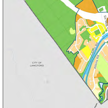
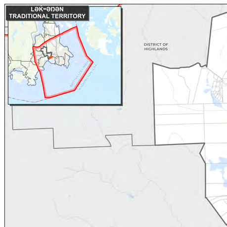
The Xʷsepsəm and Songhees Nations are stewards of both reserve lands and the broader traditional territory, which extends across much of the Greater Victoria area, including what is now known as View Royal, Esquimalt, Langford, Colwood, and Oak Bay, as shown on Figure 1. The Xʷsepsəm and Songhees Nations are actively planning for their communities within current reserve boundaries and through potential acquisition of future lands. Reconciliation acknowledges the Nation's rights to make decisions over their lands, resources, and economic future.
3.2 XʷSEPSƏM NATION TODAY
Xʷsepsəm Nation, also spelled Xwsepsum, is a Nation located on the waters of Esquimalt Harbour, immediately adjacent to the Songhees Nation and Town of View Royal. The Nation has approximately 385 members who are descendants of the lək̓ʷəŋən People, with close to half living in the main community on the approximately 19-hectare Esquimalt reserve.
The Nation’s connection with the land and resources of its large territory goes back thousands of years. In that time, Xʷsepsəm Nation have learned to live in a finely balanced relationship with the seasons, the lands, the tides, and the seasons of their lives that have sustained them. Xʷsepsəm has repaid the land through their commitment to stewardship and through ceremonies which are understood as their Sacred Trust. The Sacred Trust has been transmitted through oral teachings, usually contained in the stories of the Nation, and they articulate a set of Natural Laws. The Sacred Trust determines the relationships between the land, water, and resources, the Community and the Spiritual Path.
Xʷsepsəm Nation’s mission statement is rooted in a desire for promoting the importance of traditional teaching and values, and importantly for View Royal, a desire of the Nation to work with their partners for beneficial goals. It is important that the Town cultivates a respectful and meaningful partnership with Xʷsepsəm Nation through its commitment to reconciliation.
The Nation’s mission is: Our mission is to build a legacy for present and future generations of Esquimalt Nation members by ensuring our work is rooted in the teachings and natural laws that flow from the Sacred Trust. We will promote and advance holistic health, self-sufficiency and safety of Esquimalt Nation members by offering meaningful programs and services, and working with our partners for mutually beneficial goals.
3.3 SONGHEES NATION TODAY
Songhees Nation are a lək̓ʷəŋən People with a longstanding and ongoing presence in the region. The Nation has approximately 690 members, with over half living on the Songhees Reserve located immediately adjacent to the Town of View Royal and Xʷsepsəm First Nation. The community is approximately 60 hectares and is developed with a mix of residential and commercial areas.
The Songhees community is comprised of five main families and several smaller families descended from the lək̓ʷəŋən speaking signatories of the Douglas Treaties in 1850. Traditional governance is by consensus among extended family heads, guided by their families. Today, the community is still guided by consensus among families represented by advisory committees, focus groups and an elected Chief and Council. Referendums and ratification votes are held for important Community decisions.
The Nation’s mission, vision, and values are significant, serving as a reflection of the relationship that View Royal seeks to establish and its intent to encapsulate the core principles upheld by the Nation.
The Nation’s mission is: Songhees Nation strives to achieve community vision through good governance, delivering programs and pursuing projects and initiatives for the benefit of the Songhees People.
The Nation’s vision is: A healthy, self-reliant, progressive community that honours tradition and culture and invests in future generations.
The Nation’s Values are: With One Heart and One Mind, we commit to help one another, to forgive one another and to love one another with respect, honesty and courage.
4.0 The History of View Royal
4.1 COLONIAL SETTLEMENT
The early documented history of View Royal began in the 1850s when the Puget Sound Agricultural Company commenced corporate farming along the shores of Esquimalt Harbour. This company was a subsidiary of the Hudson’s Bay Company and was responsible for colonizing and settling communities across Vancouver Island under the Royal Charter of Grant from the British Empire. The establishment of agricultural enterprises was a significant shift from the long-established fur trade economy at the time.
The development of Maple Point farm began in 1853 by Mr. Kenneth McKenize. The area was renamed Craigflower Manor and was completed in 1856 with the addition of a sawmill, flour mill, blacksmith shop, brick kiln, slaughterhouse, general store, as well as multiple farm dwellings. Maple Point School, later known as Craigflower Schoolhouse, was completed in 1855 and provided education to those living in Craigflower Country, as well as the surrounding area. The school provided living space for the teacher’s family as well as boarders. The Craigflower Schoolhouse remains the oldest surviving school building in Western Canada.
Craigflower Manor is located at 1801 Admirals Road, at the intersection of Admirals Road and Island Highway, and the Craigflower Schoolhouse is located at 2755 Admirals Road, on the Gorge Waterway, within the District of Saanich. Each site is located at opposite ends of the Craigflower Bridge.
Four Mile Pub at 199 Island Highway and the Six Mile Pub at 494 Island Highway are two historic sites, originally operated as ‘roadhouses’. The pubs have been serving patrons for over 160 years. Originally built for mail delivery service for stagecoaches along the E&N railway, the sites continue to operate as well-loved local eateries. The Six Mile Pub stands at the site of the former Millstream Mill.
The name View Royal was originally coined circa 1910 by a real estate developer promoting the area's “royal views” of Esquimalt Harbour. At the time, the area was marketed as a getaway destination with seasonal cottages. Urbanization of View Royal started to take off by the 1930s, which saw increased development near Esquimalt Harbour and Portage Inlet.
[Image 34a: Historical photo of the Four Mile Pub] [Image 34b: Historical photo of the Six Mile Pub]
4.2 PHYSICAL SETTING
View Royal is located on Southern Vancouver Island in the Capital Regional District. It is situated between the West Shore, which includes the District of Sooke, District of Metchosin, City of Colwood, District of Highlands, City of Langford, and the region’s core area, comprising the City of Victoria, Township of Esquimalt, Xʷsepsəm Nation, Songhees Nation, District of Oak Bay, and District of Saanich. Its geographic location and major transportation corridors such as the Trans-Canada Highway, regional Island Highway, and regional trails (Galloping Goose and E&N Trail) allow the community to function as a gateway within the region, serving as an integral connection point between the West Shore and the core areas of Greater Victoria. While View Royal’s location presents various opportunities for the community’s future growth and development, its location also poses local and regional challenges.
View Royal is a growing community of over 12,500 people. It is largely residential and offers a high standard of living with natural amenities like the Esquimalt Harbour, Portage Inlet, Thetis Lake Regional Park, and Craigflower and Millstream Creeks. View Royal is shaped by a rich variety of ecosystems, including its marine environments, estuaries, and freshwater lakes, as well as terrestrial environments from moist Douglas Fir forests to Garry Oak meadows. View Royal also hosts historic structures, the most notable being Craigflower Manor.
4.3 COMMUNITY TRAITS
Since incorporation in 1988, the Town of View Royal has been transforming from a quiet suburb into a distinct and vibrant community, complete with its own unique neighbourhoods, commercial services, and highly desired parks and green spaces. View Royal is home to the regionally critical Victoria General Hospital, a growing development node supporting health care and services in the Capital Regional District. Residents enjoy recreation services through West Shore Parks and Recreation, which oversees the Juan de Fuca Recreation Centre, along with the many parks and natural green spaces located throughout the Town. The Western Gateway Corridor straddles the View Royal and Colwood border, offering a mix of business, as well as much future development potential. The community is serviced by two other large commercial hubs, including the Eagle Creek Shopping Centre, located just east of Victoria General Hospital and Admirals Walk, located along Admirals Road.
- Current population (2025): 12,539
- Projected population (2050): 21,574
- Growth scenario: Medium Growth of 2.2% annually
Part Two: Land Use
- 5.0 Land Use (31)
- 5.1 General Framework and Considerations (31)
- 5.2 Western Gateway Employment District Corridor Designation (45)
- 5.3 Hospital Transit-Oriented Area Designation (49)
- 5.4 Neighbourhood Village Designation (52)
- 5.5 Neighbourhood Centre Designation (54)
- 5.6 Commercial Designation (56)
- 5.7 Intensive Mixed Use Designation (58)
- 5.8 Neighbourhood Mixed Use Designation (59)
- 5.9 Mixed Residential Designation (62)
- 5.10 Small-Scale Multi-Unit Housing Designation (64)
- 5.11 Residential Designation (67)
- 5.12 Large Lot Residential Designation (69)
- 5.13 Rural Designation (70)
- 5.14 Community Facility Designation (71)
- 5.15 Parks, Trails and Open Space Designation (72)
- 5.16 Thetis Cove Special Planning Area Designation (75)
5.0 Land Use
Land Use determines the physical framework of the community, providing direction for how and where View Royal will grow in the future. This plan provides guidance on the approach and priorities for where development and growth are supported and in what form.
5.1 GENERAL FRAMEWORK AND CONSIDERATIONS
5.1.1 CONTEXT
View Royal has a long rural and suburban history, but has transformed into a vibrant community with local and regional services. Most of the land within the Urban Containment Boundary has been developed. Future growth will have to occur through redevelopment and infill of existing lands. There are also land use and density constraints as a result of View Royal’s geographical location and limited transportation commuter infrastructure.
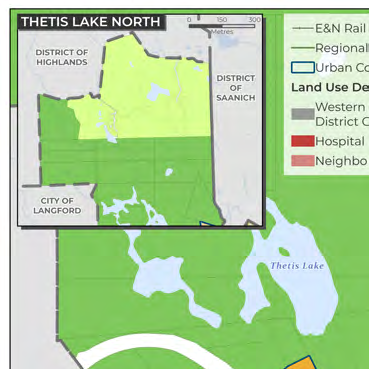
Thetis Lake Regional Park is an expansive natural regional recreational amenity located in the north part of View Royal. It provides a buffer between developed areas and the rural areas to the north of Thetis Lake Regional Park. The Thetis Lake area has some existing low-density housing, but it is largely preserved and protected for long-term green space use.
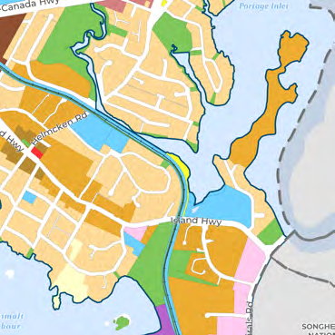
Higher residential density and commercial activity in View Royal are currently concentrated along Island Highway, Admirals Road, Helmcken Road and at key intersections. These areas are referred to as corridors (as shown on Map 3) and provide the potential for further infill development and opportunities for enhancement as there are many underutilized parcels of land that could accommodate residential and commercial growth near transit and active transportation infrastructure.
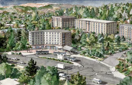
In recent years, commercial and institutional development along with multi-unit residential development have steadily increased, highlighting the growing demand for businesses and services in View Royal. For example, the opening of Eagle Creek Village in 2016 has encouraged further development of the Victoria General Hospital area as an important node with mixed-use, providing key commercial, office, retail, restaurant, healthcare, and other related services. The regional significance of this area was recognized through the designation of the Hospital Transit-Oriented Area (see Section 5.3) in 2024.
View Royal has two mobility hubs – the Atkins Mobility Hub and the Hospital Mobility Hub – which serve as key intersections of land use and transportation. These mobility hubs act as central community gathering spots that promote connection and access to community and regional services and amenities.
Mixed-use is a development typology that accommodates a variety of uses with clear and convenient connections to the public realm. Mixed-use developments typically have retail, commercial, civic, or industrial uses located on the ground level and lower floors, and residential or office units occupying the upper floors. Mixed-use developments provide conveniently located amenities and services accessed by multi-modal transit within a neighbourhood.
Mobility Hubs are mobility-oriented development areas that offer seamless access to multiple transportation modes, connecting people to key destinations, employment, and services with quality public spaces and clear wayfinding. Mobility Hubs are the strategic intersection of frequent transit corridors and shared mobility infrastructure supported by high density residential and employment land uses.
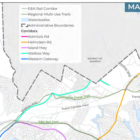
The vision for View Royal is to provide more commercial space, amenities, and services to a growing community in the form of mixed-use development focused along the five major corridors (as shown on Map 3, Section 8.0), including Admirals Road, Helmcken Road, Island Highway from Admirals Road to Atkins Road, Watkiss Way, and the Western Gateway Corridor portion of Island Highway from Atkins Road to the Colwood border. The intersection of Helmcken Road and Island Highway, Six-Mile Road and Island Highway, and Watkiss Way and Helmcken Road have the opportunity to be established as walkable areas providing neighbourhood level, mixed-use amenities and services.
The following Official Community Plan Goals may be achieved through the policy direction provided in this section:
- Mobility and Connectivity
- Diverse and Affordable Housing
- Growth Management and Community Character Preservation
- Economic Development
- Reconciliation
5.1.2 OBJECTIVES
- Spaces for Sustainable, Compact, and High-Density Development: Create a more complete, walkable, and sustainable community by directing most new growth to the corridors and mobility hubs which focus on mixed-use, transit-oriented development and urban design.
- Small-Scale, Multi-Unit Housing and Infill Development: Encourage the development of new compact housing near amenities, services, and transit-serviced routes within existing Small-Scale Multi-Unit Housing areas inside the Urban Containment Boundary as desirable forms of small-scale infill development.
- Quality and Complementary Built Form: Support high-quality development that complements existing built forms and achieves sustainable urban and building design, safety, and dynamic public and private spaces.
- Community Connections: Continue to advance opportunities to enhance existing connections and identify opportunities to establish new access connections between neighbourhoods and mobility hubs.
- Manage Development and the Natural Environment: Manage development to protect, preserve, and enhance the natural environment, parks, trails, and waterbodies and recognize these spaces as vital physical features that define the Town.
- Functional, Connected Green Spaces: Establish a functional and interconnected greenspace and trail network in the Western Gateway Corridor, focusing on the areas along Millstream Creek and Esquimalt Harbour. This network will support ecological connectivity, recreational opportunities, and enhanced access for residents, while integrating within the Town’s broader system of parks, trails, and natural spaces.
- Spaces for People: Enhance the social fabric of the community by planning and designing public and private spaces that meet the diverse daily needs of residents to foster a sense of community, encourage social cohesion, and interaction through planned and unplanned events and activities.
5.1.3 GENERAL POLICIES
A. Create viable conditions for local businesses to thrive and provide for the diverse needs of residents by directing higher levels of housing and employment densities to nodes, mobility hubs, and corridors.
B. Prioritize the review of development applications that meet one or more of the following criteria for approval by Council or staff for permit issuance: i) Below-market housing developments; ii) Purpose-built rental housing; iii) Supportive housing; iv) Age-friendly housing; v) Provide significant public benefit, including parks, and/or community facilities; vi) Housing led by non-profit organizations; vii) Hotel development; or viii) Advance overall Official Community Plan objectives.
C. Strengthen connections between existing residential neighbourhoods, nodes, corridors, and mobility hubs by: i) Providing multi-modal trails and pathways; ii) Creating linear parks; and iii) Enhancing public spaces and streetscape improvements (i.e. street trees, landscaping, wide sidewalks, street furnishings, pedestrian scale lighting, etc.).
D. Integrate existing neighbourhood characteristics into the design of new developments to acknowledge the unique social, cultural, and environmental characteristics of the town.
E. Encourage the development of public gathering places such as parks, plazas, and landscaped seating areas near activity-generating uses, including nodes, corridors, and mobility hubs.
F. Developments of four storeys or greater should incorporate commercial or public use space.
G. Do not support rezoning or bylaw variances that would facilitate the subdivision of waterfront lots in order to protect the integrity of the shoreline, aquatic environments, and ecologically sensitive areas.
H. Do not support aggregate extraction activities within Town boundaries. Aggregate materials should be sourced from neighbouring regional communities to meet development needs, given the non-existence of aggregate extraction operations within View Royal.
I. Explore the viability of density bonusing for the Hospital Transit-Oriented Area and Western Gateway Corridor to determine building heights and density that are viable for development. Findings could be integrated into the Zoning Bylaw and Official Community Plan.
J. Where transportation infrastructure and services are not keeping pace with population and employment growth, the Town may advocate for transportation investment and capacity improvements before significant additional growth is accommodated.
K. Apply Universal Design principles and guidelines for accessibility when designing public space and improvements.
L. Maintain the Urban Containment Boundary by continuing to direct urban development and improvements to areas within the boundary, thereby preserving agricultural land, natural areas, and rural character.
M. Integrate community safety principles and best practices into design guidelines, such as the Crime Prevention Through Environmental Design framework or equivalent. This includes: i) Increasing visual permeability of areas such as building entrances, stairwells, building facades, playgrounds, etc. through the strategic use of windows, fencing material, and landscaping; ii) Orienting driveways and paths towards building entrances and windows; iii) Lighting pathways and other areas where opportunities for natural surveillance exist; iv) Developing public spaces in ways that encourage activity and natural surveillance, including sidewalk patios, seating areas, dynamic spaces that accommodate community uses (such as markets, festivals, placemaking projects, etc.), and other amenities; v) Landscaping to provide a natural barrier between conflicting uses and clear definition of spaces; vi) Providing clear signage, pavement markers, and other visual cues to provide clear direction for transitional spaces between public, semi-public, and private spaces; and vii) Opportunities for placemaking through street art and festivals.
5.1.4 CORRIDOR POLICIES
A. Establish the corridors as shown on Map 3 as main thoroughfares that serve local residents and those travelling through the community to other areas of the region. This can be achieved by supporting applications for development along corridors that provide: i) a mix of local- and regional-serving amenities and businesses; ii) maximum permitted housing densities established through applicable land use designations outlined in Sections 5.2 to 5.13 of this Part; iii) infrastructure that allows for walkable connections between the corridor and surrounding neighbourhoods; iv) support for increased frequency of transit service through the concentration of employment and housing densities; and v) strong public realm design elements that support walkability, such as public gathering space, landscaping, seating, and lighting features, amongst others.
5.1.5 MOBILITY HUB POLICIES
A. Establish the Atkins Neighbourhood Village and the Hospital Transit-Oriented Area as View Royal’s mobility hubs, as shown on Map 4, to create conditions for the following: i) Centralized access to a range of services and amenities; ii) Convenient access to transportation services such as bus stops, cycling routes, local and regional multi-use trails, bike parking, car share options, amongst others; iii) Increased accessibility, safety, and comfort for everyone by ensuring inclusion of wide sidewalks, pedestrian-friendly road crossings, increased connections, accessible parking, accessible building access, and passenger loading areas; iv) Encourage and support local economic development; and v) Integrated public spaces and amenities into site design such as landscaping features, trees, outdoor amenity spaces, public art, and seating elements.
B. Encourage transit supported uses and medium to high densities such as mixed-use community-wide destination retail, small format retail, health services, community and social services, recreation facilities, educational, and arts and cultural spaces.
C. The public realm component of new development in mobility hubs should be designed in a manner that allows for strong pedestrian, cycling, rolling, and transit connections to other existing and new development within the same mobility hub. Proposals that strengthen connections between the two mobility hubs will be supported.
5.1.6 REDEVELOPMENT POLICIES
A. Consider incorporating provisions for density bonusing to secure community and neighbourhood amenities associated with new development such as parks, plazas, playgrounds, community meeting spaces, heritage retention, and frontage improvements.
B. Where growth is planned, consider financial tools to collect funds for community amenities such as community centres, recreation facilities, libraries, childcare facilities, landmarks, and public spaces.
C. Collaborate with the Xʷsepsəm and Songhees Nation on land use and development opportunities that are mutually beneficial, and explore land use directions that further advance the Official Community Plan, long-term reconciliation, and meets the needs of the Xʷsepsəm and Songhees Nations.
D. Maintain alignment of the Development Cost Charges Bylaw with market trends, and ensure the costs of providing infrastructure services associated with community growth are recovered.
E. Where heritage, archeological or cultural assets that may be significant to the Town, Xʷsepsəm or Songhees Nations are potentially impacted by redevelopment, require applicants to protect, rehabilitate, restore, and/or formally designate these assets, as appropriate on a case-by-case basis and in collaboration with the Town and/or First Nations, by securing commitment through tools such as a covenant on title, or other protocols.
F. Support the reuse or retrofit of historically significant buildings, structures, and sites identified in the Town’s Heritage Register in a manner that preserves the heritage features of significance.
G. Explore opportunities to establish a standard for required professional reporting requirements for development applications.
H. Explore the opportunity to integrate Development Approval Information authority into the Development Application Procedures Bylaw to give Town staff the authority to request additional information about a development proposal, such as environmental reports, renderings, etc. that would aid the Town in its evaluation.
I. Notwithstanding the permitted building heights (i.e. number of storeys) within the Land Use Designations, consideration for increased building heights for rezoning and amendments to the Official Community Plan may be considered where proposed developments would achieve one or more of the following: i) Advance overall plan objectives; ii) Are on sites with substantial grade differences; iii) Meet specified density bonus zoning provisions;
iv) Achieve retention of high value trees or natural features and increased on-site open space; v) Demonstrate site design and architectural excellence; or vi) Provide a significant public benefit, including securing non-market or supportive housing, parks, or community facilities.
J. Expand housing choice by supporting sensitive and strategic infill development, ensuring that new housing integrates seamlessly with the existing character, scale, and livability of established residential areas.
K. Where redevelopment is considered, the built form should respect the natural topography and ecology integrity of the site, including but not limited to, natural contours, rocky outcrops and bluffs, environmentally sensitive areas, and other natural areas.
L. To ensure new development is thoughtfully integrated into existing neighbourhoods, consider developing Infill Design Guidelines.
M. Development should strive to assemble properties in a manner that: i) Facilitates a desirable and replicable pattern of development that supports livability and enables neighbouring sites to develop to an equal standard; ii) Accommodates desired housing types and forms, including a mix of unit sizes; and iii) Enables high-quality built forms, landscaping, and tree planting, and contributes to the public realm.
Density describes the amount of people, jobs, housing units, commercial units, or industrial units within a defined area. Building height and Floor Space Ratio are common measures of density. In View Royal, density is classified as follows:
- Low-density – buildings with heights up to 3 storeys
- Medium-density – buildings with heights between 4 and 6 storeys
- High-density – buildings with heights 7 storeys or greater
Maximum density is expressed as Floor Space Ratio or FSR, which is the ratio of built (or buildable) area to land area. FSR is a tool used by planners, designers, and developers to model building mass in relation to lot. Density regulations and FSR exclusions for all land uses are specified in the Zoning Bylaw.
5.1.7 LAND USE DESIGNATIONS SUMMARY
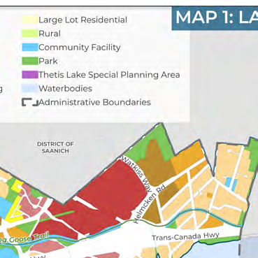
The following land use designations shall apply to lands within View Royal, as shown in Map 1:
| Designation | Description | Maximum Height/Density |
|---|---|---|
| Western Gateway Employment District Corridor | Uses include a mix of flexible and adaptable building forms that support a range of employment functions suitable for commercial, light industrial, arts and culture, and tourist accommodations. Supports: Commercial space (retail, restaurants, etc.); Light industrial space (distribution, repair, processing, etc.); Research, innovation and technology uses. | • Up to 6 storeys • Up to 2.5 FSR |
| Hospital Transit-Oriented Area | Uses include a mix of residential (e.g. apartments), commercial (e.g. visitor accommodations, restaurants, retail, office), institutional (e.g. hospital), and civic uses (e.g. daycares, libraries, public gathering spaces). | • Up to 10 storeys • Up to 3.5 FSR |
| Designation | Description | Maximum Height/Density |
|---|---|---|
| Neighbourhood Village | Uses include mixed-use buildings, such as multi-unit housing, community care facility, and community serving commercial and civic uses (e.g., daycares, libraries, public gathering and amenity spaces). Also supports schools, offices, restaurants, retail, grocery stores. | • Up to 6 storeys • Up to 2.5 FSR |
| Neighbourhood Centre | Uses include small-scale mixed-use development, including apartments with community-serving commercial and civic uses, such as daycares, schools, libraries, offices, restaurants, retail, and small grocery stores. | • Up to 6 storeys • Up to 3.0 FSR |
| Commercial | Uses include a variety of commercial uses, including retail, offices, technology, services, and restaurants. | • Up to 4 storeys • Up to 2.5 FSR |
| Intensive Mixed Use | Uses include low-rise mixed-use development in the form of townhouses and low-rise apartments, designed to include ground floor commercial space and upper floors for residential dwellings. Commercial may include retail, restaurants, medical offices, etc. | • Up to 4 storeys • Up to 2.5 FSR |
| Neighbourhood Mixed Use | Uses include low-rise mixed-use development in the form of townhouses and low-rise apartments, designed to include ground floor commercial space and upper floors for residential dwellings. Commercial may include retail, restaurants, medical offices, civic uses, etc. | • Up to 3 storeys • Up to 1.5 FSR |
| Designation | Description | Maximum Height/Density |
|---|---|---|
| Mixed Residential | Uses include detached and attached dwellings, such as single detached, duplexes, secondary suites, garden suites, rowhouses, townhouses, houseplexes, and apartments. | • Up to 3 storeys / 1.25 FSR • Up to 4 storeys / 1.6 FSR for apartments |
| Small-Scale Multi-Unit Housing | Uses include detached and attached dwellings, such as single detached, duplexes, secondary suites, garden suites, rowhouses, townhouses, houseplexes, and apartments. | • Up to 3 storeys • Up to a maximum of 6 dwelling units |
| Residential | Uses include single-detached and attached dwellings, duplexes, rowhouses, townhouses, houseplexes accessed via separate entrances at ground level, secondary suites, and garden suites. | • Up to 2.5 storeys • Up to 0.6 FSR for appropriate infill |
| Large Lot Residential | Uses include detached homes on large lots and yards. | • Up to 2.5 storeys |
| Rural | Uses include single-detached dwellings on large rural lots, as well as recreation, and agriculture. | • Up to 2 storeys • Up to 1 unit per 10 hectares permitted |
| Community Facility | Uses include government buildings and publicly owned facilities providing a range of services: health care, emergency service buildings, community halls, libraries, schools, treatment plants. | Varies |
| Designation | Description | Maximum Height/Density |
|---|---|---|
| Parks, Trails and Open Space | Uses include a mix of active and passive parks, trails, natural and green spaces, and outdoor recreation facilities. | N/A |
| Thetis Cove Special Planning Area | This land use designation has been created with the expectation that this land will be transferred to Xʷsepsəm Nation within the lifespan of this Official Community Plan. Administration of this process will be led by the Province of British Columbia. | N/A |
5.2 WESTERN GATEWAY EMPLOYMENT DISTRICT CORRIDOR DESIGNATION
5.2.1 CONTEXT
The Western Gateway Corridor is made up of four distinct land use designations, including the Western Gateway Employment District Corridor, as shown on Map 1. This land use designation is strategically located along the corridor to create a future employment hub that attracts investment and enhances services and amenities in the community and region.
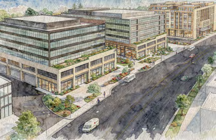
The Western Gateway Employment District Corridor land use designation supports medium-density commercial and light industrial land uses located along the Island Highway from the Colwood border to the south of Parsons Bridge, as shown on Map 1. It is View Royal’s vision that this corridor will transform into a medium-density employment hub for the Town, the West Shore, and the broader region.
In addition, this corridor will support the Atkins Neighbourhood Village located to the north, as shown on Map 4. The corridor will also support future transportation investment and surrounding residential areas by providing an abundance of employment opportunities, services, and amenities.
Employment opportunities facilitated through a mix of light industrial, commercial, arts and culture, and hospitality uses are encouraged. As discussed in Section 10.0, the Town aims to support new and existing businesses in the research, technology and innovation sectors, as well as those that support tourism and the healthcare industry, such as hotels, research labs, and biomedical services, amongst others. Given the Town’s central location within the region and existing healthcare assets such as the Victoria General Hospital, such investment opportunities would be highly supported in the Western Gateway Employment District Corridor.
Development in the corridor is intended to support pedestrian-oriented activity, encourage non-auto-oriented travel, and increase connections to the Millstream Creek greenway, as well as access to the nearby public waterfront along Millstream Creek and Esquimalt Harbour. Urban design that supports a strong public realm will be highly encouraged for new development, with connections to transit, trails, pedestrian-friendly streetscapes, and bike lanes provided wherever possible, particularly those that support the objectives of the transportation and mobility objectives outlined in Section 8.0.
5.2.2 PERMITTED HEIGHTS AND DENSITIES
A. Heights and densities permitted in this land use designation are as follows: i) Building heights up to 6 storeys ii) Maximum density of 2.5 Floor Space Ratio
[Image 52a: 3D massing diagram for a 6-storey mixed employment building with a Floor Space Ratio of 2.5] Caption: The image provides an example of building massing for a 6-storey mixed employment use building with a Floor Space Ratio of 2.5 on a standard-sized lot in the Western Gateway Employment District Corridor. The first two storeys have higher ceiling heights to allow for industrial uses, while the upper storeys have typical floor heights for commercial office or similar uses. Trail and sidewalk connections for walking, cycling, and rolling are encouraged throughout the corridor.
[Image 52b: Rendering of a modern 5-storey mixed-use building with industrial uses on lower floors and offices above] Caption: A mix of employment uses with strong public realm connections to alternate modes of transport, such as transit, cycling, and walking, are encouraged for the Western Gateway Employment District Corridor. The concept shown here demonstrates how a mixed 5-storey building comprising of industrial uses on the first two storeys and commercial office space on the upper storeys can have strong urban design that supports a pedestrian-friendly environment.
[Image 53a: Artistic illustration depicting a high-quality mixed commercial and light industrial development along Island Highway] Caption: The Western Gateway Corridor has two components: an employment district and a neighbourhood village. The employment district applies to lands located along Island Highway between Parsons Bridge and the Colwood border. The illustration above depicts what this area could look like with mixed commercial - industrial development.
[Image 53b: Artistic illustration of a future mobility hub within the Atkins Neighbourhood Village showing transit connections and buildings near the Galloping Goose trail] Caption: In the illustration below, a future mobility hub is shown within the Atkins Neighbourhood Village. The illustration shows a mixed-use building connected to transit stops and the Galloping Goose trail just off Island Highway, and apartment buildings on the north side of the trail.
5.2.3 POLICIES
A. Collaborate with the City of Colwood to establish the Western Gateway Corridor as a regional employment hub, that prioritizes economic development and attracts business investment.
B. Encourage redevelopment of lands designated as Western Gateway Employment District Corridor to promote medium-density mixed-use development, with an emphasis on commercial, light industrial, arts and culture, and hospitality uses, and a high-quality urban design. Development in the Western Gateway Employment District Corridor land use designation should aim to achieve: i) A mix of employment uses including office, retail, hotel, research labs, community/civic use, arts and culture, and light industrial (e.g. light manufacturing and processing of goods, distribution). ii) Integration of entertainment, arts and culture uses in the Atkins Mobility Hub. iii) Strong public realm design and a pedestrian-friendly streetscape that is designed to attract visitors to the area through orienting buildings towards the street, locating parking underground, below-grade, and behind the building and using landscaping features such as plantings, street trees, and seating to welcome users to the space, providing sidewalk and trail connections to transportation options, Millstream Creek, the waterfront, and other key businesses in the corridor, and supporting the nearby Atkins Mobility Hub. iv) Compatibility with nearby residential development through thoughtful design and landscape buffers, where appropriate. v) Long-term protection of Millstream Creek and the shoreline by dedicating park land for green space and / or recreational trails wherever possible. vi) Enhanced economic development opportunities for the Town, particularly local businesses and investments in emerging industries.
C. Enable the provision and viability of light industrial development by establishing greater flexibility in the design and configuration of buildings with industrial uses, such as exploring opportunities to support stacked development and buildings with high ceiling heights on the first two floors, amongst others.
5.3 HOSPITAL TRANSIT-ORIENTED AREA DESIGNATION
5.3.1 CONTEXT
Provincial regulations have designated the area west of Victoria General Hospital around the existing bus exchange as a Transit-Oriented Area, as shown on Map 4. To comply with Bill 47: Housing Statues (Transit-Oriented Areas) Amendment Act, the Hospital Transit-Oriented Area designation has been applied to lands within 200 metres of the Hospital Transit-Oriented Area’s prescribed bus exchange.
The hospital is expected to expand its services and construct new buildings in the coming decade, ideally co-locating with primary care facilities and ancillary medical service providers. Higher density residential uses in the form of apartments have started developing in recent years and are planned to continue to be built along Watkiss Way, Hospital Way, and Erskine Lane to provide more housing, support the expanding demand for amenities and services, and take advantage of current and future investments in bus rapid transit.
The Victoria General Hospital Transit Exchange is presently served by a single frequent transit service route. The service connects Victoria, View Royal, Colwood, and Langford on a single route, providing rapid bus service within the region. There is potential to expand frequent transit service and provide additional rapid transit service if the parcels within the Transit-Oriented Area surrounding the hospital are developed to densities that can support such service. The Victoria General Hospital Transit Exchange is ideally located to become a major mobility hub for the community because it is located near the Helmcken Park and Ride, Galloping Goose Regional Trail, and Highway 1. Helmcken Road is another key corridor, which connects neighbourhoods in View Royal and the neighbouring District of Saanich.
The Hospital Transit-Oriented Area is envisioned as a vibrant, high-density mixed-use community that integrates residential, tourist accommodation, medical, and commercial spaces to support the Victoria General Hospital and regional rapid transit system. Transit, cycling, and walking are envisioned to be the primary modes of transportation in this area to encourage active transportation connections, enhance the public realm, and create a safe, walkable, pedestrian-friendly environment for residents and visitors alike.
5.3.2 PERMITTED HEIGHTS AND DENSITIES
A. Heights and densities permitted in this land use designation are as follows: i) Building heights up to 10 storeys ii) Maximum density of up to 3.5 Floor Space Ratio
[Image 56a: 3D massing diagram for a 10-storey mixed employment and residential building with a Floor Space Ratio of 3.5] Caption: The image provides an example of building massing for a 10-storey mixed employment and residential use building with a Floor Space Ratio of 3.5 in the Hospital Transit-Oriented Area. The first two storeys have higher ceiling heights to allow for retail commercial or medical office uses, the third and fourth storeys have typical floor heights for commercial office or similar uses. The remaining upper residential floors include a step back that provide a human-scale streetscape, increase sunlight exposure to the street, and can provide an outdoor terrace for residential or commercial use. Trail and sidewalk connections for walking, cycling, and rolling are encouraged throughout the mobility hub.
[Image 56b: Rendering of a 10-storey mixed-use building near Victoria General Hospital with commercial space and transit infrastructure] Caption: A diverse range of employment and residential uses is encouraged within the Hospital Transit-Oriented Area, with a strong emphasis on integrating high quality public spaces and supporting alternative transportation modes such as transit, cycling, and walking. The concept shown here demonstrates how a mixed 10-storey building comprising of commercial and ancillary medical offices on the first four storeys to augment the nearby Victoria General Hospital and how residential space on the upper storeys could support greater transit service and animate the street.
5.3.3 POLICIES
A. Encourage redevelopment of lands designated as Hospital Transit-Oriented Area.
B. Prioritize high-density, mixed-use development in the Hospital Transit-Oriented Area that aims to provide, or create conditions for the following: i) New residential dwellings, medical-related office spaces, tourist accommodations, and retail uses that benefit from and support Victoria General Hospital. ii) A regional health hub with facilities that provide comprehensive care across all stages of life. iii) Provide a mix of housing types and tenures to diversify the housing stock, including opportunities for family-friendly, senior, below-market and affordable housing options. iv) Diverse employment and commercial services that strengthen the local economy and support or complement existing local businesses and services. v) Rapid and frequent transit service routes. vi) Ground floor commercial space that activates the streetscape and public realm. vii) Underground or sub-surface parking facilities that promote a safe and enjoyable pedestrian environment. viii) A high-quality streetscape and public realm to accommodate people gathering, socializing, and recreating including plazas, playgrounds, greenspace, or other off-street public spaces. ix) Improved access and traffic circulation within the area. x) Construction of, or partnership with the Town to provide, active transportation infrastructure to connect new development to the Victoria General Hospital Transit Exchange, Victoria General Hospital, Galloping Goose Regional Trail, Eagle Creek Village, and the established residential area southeast of Helmcken Road.
Rapid Transit and Frequent Transit are two types of transit service.
Service Type Frequency Rapid Transit Routes are designed to move large volumes of passengers between major destinations and stop less often than Frequent Transit service. Customers can expect buses to arrive at least every 15 minutes between 7:00 a.m. and 10:00 p.m. every day of the week. Frequent Transit Routes operate at a 15 minute frequency between a specific period of time. Routes generally operate on arterial roads, serve corridors with mixed land use and provide connections between urban centres. Customers can expect buses to arrive every 15 minutes or better service, 7:00 a.m. to 7:00 p.m., Monday through Friday.
5.4 NEIGHBOURHOOD VILLAGE DESIGNATION
5.4.1 CONTEXT
Neighbourhood Villages are situated near the lands comprising and surrounding the Atkins Neighbourhood Village and Hospital Mobility Hubs to create density conditions that support rapid and frequent transit service, as shown on Map 4. The Neighbourhood Village designation includes mixed-use buildings, such as multi-unit housing and community serving commercial and civic uses such as schools, offices, restaurants, retail, grocery stores, community care facilities, and community spaces.
To comply with the Bill 47: Housing Statues (Transit-Oriented Areas) Amendment Act, the Neighbourhood Village designation has been applied to lands within 201 - 400 metres of the Hospital Transit-Oriented Area’s prescribed bus exchange. It is acknowledged that many lands in this designation are already built out or are under development, reducing the likelihood of redevelopment within the lifespan of this Official Community Plan.
5.4.2 PERMITTED HEIGHTS AND DENSITIES
A. Heights and densities permitted in this land use designation are as follows: i) Building heights up to 6 storeys ii) Maximum density of up to 2.5 Floor Space Ratio
[Image 59a: 3D massing diagram for a 6-storey mixed-use building in a Neighbourhood Village with a Floor Space Ratio of 2.5] Caption: The image provides an example of building massing for a 6-storey mixed-use building with a Floor Space Ratio of 2.5 on a standard-sized lot in a Neighbourhood Village. Ground floor commercial and civic uses are provided, while the upper storeys are residential. An active street frontage is emphasized to ensure a comfortable space for pedestrians and active transportation users.
[Image 59b: Rendering of a vibrant 6-storey mixed-use building with ground-floor shops and daycare] Caption: A diverse range of uses, increased densities, and good public realm design are encouraged within the Neighbourhood Village to support connections of mobility hubs and enable better transit service. The concept shown here combines ground floor commercial and civic uses, such as a daycare and retail shops with residential space on the upper storeys of a mixed 6-storey building to support a vibrant community hub.
5.4.3 POLICIES
A. Enable better transit service and connections of mobility hubs through increased densities and public realm design.
B. Create walkable and safe linkages to the surrounding neighbourhoods, parks, and trails at the following locations: i) The Neighbourhood Village designated area within the Western Gateway Corridor, between the Atkins Neighbourhood Village, Parsons Bridge, and Price Bay Road. ii) The Neighbourhood Village designation within the Hospital Transit-Oriented Area providing access to Craigflower Creek, the Galloping Goose Regional Trail, View Royal Park, and other existing parks.
C. Prioritize medium-density, mixed-use development in the Neighbourhood Village and promote the village designation as vibrant hubs that aims to provide, or create conditions for the following:
i) Provide a mix of housing types and tenures to diversify the housing stock, including opportunities for family-friendly, senior, below-market and affordable housing options. ii) Diverse local-serving commercial uses that strengthen the local economy and support or complement existing local businesses and services. iii) Ground floor commercial space that activates the streetscape and public realm. iv) Incorporate community spaces that support arts, culture and recreation opportunities for residents and visitors. v) Underground or sub-surface parking facilities that promote a safe and enjoyable pedestrian environment. vi) A high-quality streetscape and public realm to accommodate people gathering including outdoor seating, plazas, or other off-street public spaces.
5.5 NEIGHBOURHOOD CENTRE DESIGNATION
5.5.1 CONTEXT
The Neighbourhood Centre designation currently applies to a single parcel at the intersection of Island Highway and Helmcken Road, as shown on Map 1. This designation allows medium-density, mixed-use development to serve local neighbourhood needs. It also encourages walkability by providing multi-unit housing forms and community-serving commercial and civic uses with active street frontages.
5.5.2 PERMITTED HEIGHTS AND DENSITIES
A. Heights and densities permitted in this land use designation are as follows: i) Building heights up to 6 storeys ii) Maximum density of up to 3.0 Floor Space Ratio
[Image 61a: 3D massing diagram for a 6-storey mixed-use building on a Neighbourhood Centre lot with a Floor Space Ratio of 3.0] Caption: The image provides an example of building massing for a 6-storey mixed-use building with a Floor Space Ratio of 3.0 on a Neighbourhood Centre lot. Ground floor commercial and civic uses are provided, while the upper storeys are residential. An active street frontage is emphasized to ensure a comfortable space for pedestrians and active transportation users.
[Image 61b: Rendering of a modern 6-storey mixed-use residential building at a busy intersection with commercial storefronts] Caption: The Neighbourhood Centre designation is intended to support an active neighbourhood corridor with a diverse range of uses, increased densities, and good public realm design. The concept shown here combines ground floor commercial and civic uses with residential space on the upper storeys of a mixed 6-storey building to make the intersection of Island Highway and Helmcken Road a walkable neighbourhood destination.
5.5.3 POLICIES
A. Encourage mixed-use residential and commercial development at the intersection of the Island Highway and Helmcken Road to support greater transit service and mobility, and to provide greater access to services that meet the daily needs of residents in surrounding established neighbourhoods.
B. Ground floor commercial and civic uses may include schools, offices, restaurants, retail, small grocery stores, and community spaces.
C. Mixed-use development should be reviewed to consider the following: i) Opportunities to establish connections across Island Highway and Helmcken Road to enhance pedestrian safety. ii) Pedestrian-friendly street frontages that accommodate people arriving by all modes. iii) Strong and safe connections to surrounding residential areas, the waterfront, Helmcken Road, and View Royal Elementary School.
iv) High-quality architecture, landscaping and public realm that enhances the neighbourhood context. v) Underground or sub-surface parking facilities that promote a safe and enjoyable pedestrian environment.
5.6 COMMERCIAL DESIGNATION
5.6.1 CONTEXT
The lands designated Commercial are primarily located along the Admirals Road and Island Highway Corridors, as shown on Map 1. The designation permits a variety of commercial uses, including retail, office, technology, services, and restaurants. Lands in the Commercial designation should help create more local jobs as View Royal grows, while providing services and amenities to residents.
PERMITTED HEIGHTS AND DENSITIES
A. a) Heights and densities permitted in this land use designation are as follows: i) Building heights up to 4 storeys ii) Maximum density of up to 2.5 Floor Space Ratio
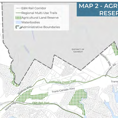
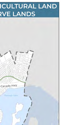
5.6.2 POLICIES
A. Promote development of commercial lands along the Admirals Road Corridor as a commercial centre that supports a mix of employment uses, including retail, office, technology, services, and restaurants.
B. Encourage new development along Admirals Road and adjacent areas to facilitate a strong pedestrian-oriented streetscape. Development applications should be reviewed to consider opportunities for: i) Incorporating high quality urban design features in buildings and public spaces; ii) Strong and safe pedestrian and cycling connections; and iii) Active street frontages.
C. Support public space enhancements along Admirals Road, Hallowell Road, and Island Highway, in collaboration with Xʷsepsəm and Songhees Nations, to create a safe, walkable, and enjoyable pedestrian environment, and to reinforce the development of this area as the Admirals Road Corridor. Enhancements may include: i) Sidewalk widening and improvements; ii) Coordinated street furnishing and lighting standards; iii) Public art, banners and gateway features; iv) Wayfinding signage; and v) Improved bike facilities and crossings.
5.7 INTENSIVE MIXED USE DESIGNATION
5.7.1 CONTEXT
The lands designated Intensive Mixed Use are located throughout View Royal, including the Fort Victoria RV Park, the Western Gateway Corridor, and near the Atkins Mobility Hub, as shown on Map 1. This designation is intended to provide low-rise mixed-use development in the form of townhouses and low-rise apartments, designed to provide ground floor commercial space and upper floors designated for residential dwellings.
5.7.2 PERMITTED HEIGHTS AND DENSITIES
A. Heights and densities permitted in this land use designation are as follows: i) Building heights up to 4 storeys ii) Maximum density of up to 2.5 Floor Space Ratio
[Image 64a: 3D massing diagram for a 4-storey intensive mixed-use development with a Floor Space Ratio of 2.5] Caption: The image provides an example of building massing of a 4-storey development with a Floor Space Ratio of 2.5 permitted within the Intensive Mixed Use designation. This building incorporates neighbourhood-serving commercial space on one side, with residential units distributed throughout the remainder of the building.
[Image 64b: Rendering of a 4-storey mixed-use building featuring a ground-floor café and upper-level balconies] Caption: The concept shown here combines local-serving ground floor commercial uses with apartment units on the upper storeys. The Intensive Mixed Use designation emphasizes active street frontages, safe connections to surrounding neighbourhoods, and strong connections to nearby mobility hubs and active transportation networks.
5.7.3 POLICIES
A. Support low-rise mixed-use development in the form of townhouses and low-rise apartments, with ground floor commercial space.
B. Ground floor commercial uses may include retail, restaurants, medical offices, offices, and civic uses (e.g. daycares, libraries, public gathering and amenity spaces).
C. Mixed-use development should be reviewed to consider the following: i) Pedestrian-friendly street frontages that accommodate people arriving by all modes of transportation. ii) Strong and safe connections to surrounding residential areas, the Western Gateway Corridor, the Atkins Mobility Hub, the local and regional multi-use trails, and Island Highway. iii) High-quality architecture, landscaping and public realm that enhances the neighbourhood context.
5.8 NEIGHBOURHOOD MIXED USE DESIGNATION
5.8.1 CONTEXT
The lands designated Neighbourhood Mixed Use include the Helmcken Corridor (Eagle Creek Village), Island Highway at the intersection of Helmcken Road, and Lakeside Village south of Thetis Lake along Six Mile Road, as shown on Map 1. This designation supports the development of corridors and mobility hubs with low-rise multi-unit residential and commercial uses serviced by active and public transportation infrastructure. As View Royal grows, mixed-use development will be crucial for creating a walkable community where residents can easily access daily needs such as work, education, childcare, recreation, and health services without passenger vehicles.
The proximity of the Neighbourhood Mixed Use area at Eagle Creek Village to the Hospital Transit-Oriented Area will support the View Royal’s vision of a vibrant mixed-use transit-supported mobility hub. It is acknowledged that most of Eagle Creek Village and Lakeside Village are built out at this time (the two commercial centres were constructed in the late 2010s), reducing the likelihood of redevelopment within the lifespan of this Official Community Plan.
5.8.2 PERMITTED HEIGHTS AND DENSITIES
A. Heights and densities permitted in this land use designation are as follows: i) Building heights up to 3 storeys ii) Maximum density of up to 1.5 Floor Space Ratio
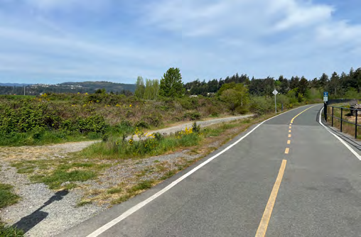
5.8.3 POLICIES
A. Support low-rise mixed-use development, such as townhouses and low-rise apartments with ground floor commercial space and upper floors designated for residential dwellings.
B. Ground floor neighbourhood-serving commercial uses may include one or more of the following: retail, restaurant, medical office, office, and civic use (e.g., daycare, library, amenity space).
C. Encourage mixed-use development near the intersection of Island Highway and Helmcken Road to support greater transit service and mobility.
D. Mixed-use development should be reviewed to consider the following: i) Opportunity to establish connections across Island Highway and Helmcken Road to enhance pedestrian safety. ii) Pedestrian-friendly street frontages that accommodate people arriving by all modes. iii) Strong and safe connections to surrounding residential areas, the waterfront, Helmcken Road, and View Royal Elementary School. iv) High-quality architecture, landscaping and public realm that enhances the neighbourhood context.
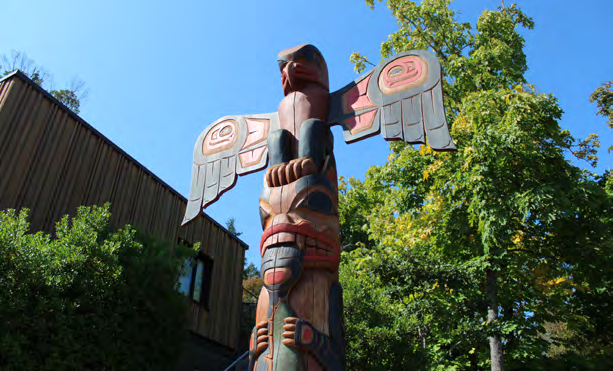
5.9 MIXED RESIDENTIAL DESIGNATION
5.9.1 CONTEXT
The lands designated Mixed Residential are primarily located along Island Highway, Christie Point, to the west of Admirals Corridor, and in several other areas. This designation permits detached and attached dwellings, such as small-lots, duplexes, secondary suites, garden suites, rowhouses, townhouses, houseplexes, and apartments. Its purpose is to increase housing choices along key corridors and in areas where services and amenities are concentrated. Medium density development in these areas will help improve mobility, including access to non-automobile transportation options, especially near the Atkins Mobility Hub.
5.9.2 PERMITTED HEIGHTS AND DENSITIES
A. Heights and densities permitted in this land use designation are as follows: i) Building heights up to 3 storeys/Maximum density of up to 1.25 Floor Space Ratio ii) Building heights up to 4 storeys/Maximum density of up to 1.6 Floor Space Ratio for apartments
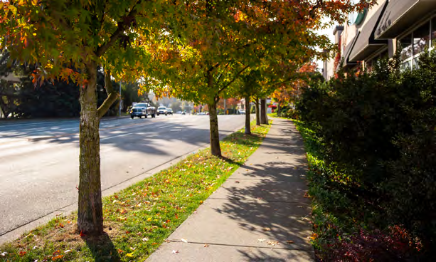
Caption: A diverse range of housing forms are encouraged within the Mixed Residential designation to provide residents with housing choices that are attainable. The concept shown here is a small 3-storey townhome development.
5.9.3 POLICIES
A. Support a variety of housing options, including opportunities for infill and gentle density in the form of duplexes, secondary suites, garden suites, rowhouses, townhouses, houseplexes, and apartments in established neighbourhoods.
B. Mixed Residential development along corridors should be carefully reviewed to consider the following: i) Right-of-way conditions and pedestrian safety, including connections across Island Highway and Helmcken Road. ii) Pedestrian-friendly street frontages that accommodate people arriving by all modes of transportation. iii) Strong and safe connections to surrounding residential areas, the waterfront, Helmcken Road, and View Royal Elementary School. iv) High-quality architecture, landscaping and public realm that enhances the neighbourhood context.
5.10 SMALL-SCALE MULTI-UNIT HOUSING DESIGNATION
5.10.1 CONTEXT
The Small-Scale, Multi-Unit Housing designation supports a variety of housing types in established residential neighbourhoods including detached and attached dwellings, duplexes, secondary suites, garden suites, rowhouses, townhouses, houseplexes, and apartments up to three storeys in height. This designation has been established to align with the province’s Bill 44: Housing Statutes (Residential Development) Amendment Act and applies in many of the established low-density residential neighbourhoods in the community. Small-Scale, Multi-Unit Housing offer greater housing choice and improve attainability. It is anticipated that Small-Scale, Multi-Unit Housing will be a key factor in addressing the demand for ground-oriented housing in View Royal.
5.10.2 PERMITTED HEIGHTS AND DENSITIES
A. Heights and densities permitted in this land use designation are as follows: i) Building heights up to 3 storeys ii) Maximum density of up to 4 dwelling units or 6 dwelling units for parcels within 400m of a Prescribed Transit Stop
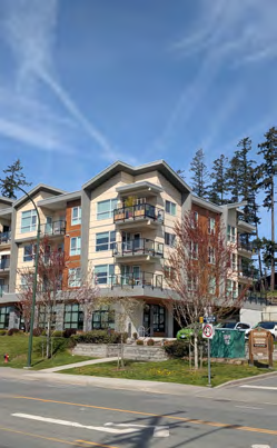
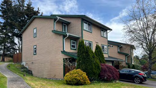
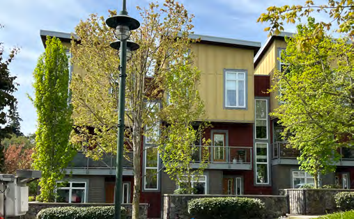
5.10.3 POLICIES
A. New development should contribute to and enhance the residential form and character of the surrounding neighbourhood.
B. Protect and enhance the tree canopy and preserve natural features.
C. Strengthen connections between existing residential neighbourhoods and mixed-use developments, such as those included in View Royal’s mobility hubs and corridors (as shown on Maps 3 and 4), through urban design, public space improvements, and pedestrian, bike, and transit supportive facilities.
D. When reviewing applications for infill developments, adhere to the redevelopment policies outlined in Section 5.1.6.
5.11 RESIDENTIAL DESIGNATION
5.11.1 CONTEXT
The Residential designation has been applied to parcels that do not meet provincial legislative criteria for Small-Scale Multi-Unit Housing, as shown on Map 1. This designation supports development of single detached dwellings, secondary suites, garden suites, duplexes, rowhouses, and townhouses that are accessed via separate entrances at the ground level.
5.11.2 PERMITTED HEIGHTS AND DENSITIES
A. Heights and densities permitted in this land use designation are as follows: i) Building heights up to 2.5 storeys ii) Maximum density of up to 0.6 Floor Space Ratio for appropriate infill
[Image 74a: Two 3D massing diagrams on standard residential lots showing a detached home with secondary suite entrance and a duplex] Caption: ↑ The image provides two examples of building massing on a standard-sized residential lot for the Residential designation, permitting up to 2.5 storeys and a Floor Area Ratio of 0.6. The first example depicts a single detached dwelling with a separate ground floor entrance for a secondary suite; the second example is a duplex with ground floor entrances.
[Image 74b: Photo of a 2.5-storey detached home with a side entrance for a secondary suite] Caption: → The concept shown here is a 2.5-storey single detached dwelling with a separate secondary suite entrance provided on the side of the house, that would suit a typical established neighbourhood in View Royal.
5.11.3 POLICIES
A. Support low density housing forms in existing residential neighbourhoods, including detached and attached dwellings, such as the following: single detached dwellings, duplexes, secondary suites, and garden suites.
B. New development should contribute to and enhance the residential form and character of the surrounding neighbourhood.
C. Strengthen connections between existing residential neighbourhoods and mixed-use developments, such as those included in View Royal’s mobility hubs and corridors (as shown on Maps 3 and 4), through urban design, public space improvements, pedestrian, bike, and transit supportive facilities.
D. Protect and enhance the tree canopy and preserve natural features.
E. When reviewing applications for infill developments, adhere to the redevelopment policies outlined in Section 5.1.6.
5.12 LARGE LOT RESIDENTIAL DESIGNATION
5.12.1 CONTEXT
The lands designated Large Lot Residential are large lots located within established neighbourhoods, as shown on Map 1. These lots consist of detached dwellings. Limited redevelopment is anticipated for these parcels.
5.12.2 PERMITTED HEIGHTS AND DENSITIES
A. Heights and densities permitted in this land use designation are as follows: i) Building heights up to 2.5 storeys
Caption: The image provides an example of building massing on a large residential lot, permitting up to 2.5 storeys.
5.12.3 POLICIES
A. Support detached dwellings and secondary suites in existing residential neighbourhoods.
B. Protect and enhance the tree canopy and preserve natural features.
C. New development should be designed in a way that complements the existing surrounding neighbourhood.
5.13 RURAL DESIGNATION
5.13.1 CONTEXT
The lands designated Rural are primarily located north of Thetis Lake Regional Park outside the Urban Containment Boundary, with the exception of two parcels on Atkins Road, as shown on Map 1. These lands are used for agriculture, recreation, or for large lot residential uses. There is limited servicing available to parcels designated as Rural and therefore, development potential is limited.
5.13.2 PERMITTED HEIGHTS AND DENSITIES
A. Heights and densities permitted in this land use designation are as follows: i) Building heights up to 2 storeys ii) Maximum density of up to 1 unit per 10 hectares
Caption: The image provides an example of building massing on a standard-sized rural lot, permitting up to two storeys and one unit per ten hectares.
5.13.3 POLICIES
A. Support the retention of rural lands north of Thetis Lake Regional Park by maintaining the Urban Containment Boundary.
B. Maintain farming, agriculture, and low-density residential as the primary land use on rural lands, to preserve the rural character of the area.
5.14 COMMUNITY FACILITY DESIGNATION
5.14.1 CONTEXT
The Community Facility designation has been applied to lands with existing government buildings and publicly-owned facilities providing a range of civic and institutional services and uses, amenities, and utilities for the community including health care facilities, emergency service buildings, community halls, libraries, supportive housing, places of worship, schools, public childcare, transit facilities such as park and rides and bus exchanges, and utility services such as water, sanitary sewer, and hydro.
The Town’s prominent community facilities include the following:
- Town Hall and Public Safety Building on Island Highway;
- Three schools, including Shoreline Community Middle School, View Royal Elementary, and Eagle View Elementary;
- Three community centres, including the Strawberry Vale Community Club, View Royal Community Association, and Victoria Scottish Community Centre;
- Victoria General Hospital;
- Capital Regional District’s Infrastructure and Water Services building on Island Highway; and
- Two existing park and ride facilities located in the Atkins Neighbourhood Village and on Helmcken Road.
5.14.2 PERMITTED HEIGHTS AND DENSITIES
A. Heights and densities permitted in this land use designation vary from site to site.
5.14.3 POLICIES
A. Promote a variety of public, non-profit, or utility uses, including community halls/centres, schools, public health facilities, community care facilities, supportive housing, emergency facilities, libraries, government buildings, childcare, and schools.
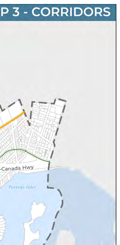
B. Retain existing Community Facility parcels and seek opportunities to expand and consolidate parcels to accommodate future growth.
C. Ensure all community facilities provide accessibility infrastructure at all existing and new community facilities to ensure these spaces may be reasonably accessed by people of all mobility levels.
D. Support the development of the Atkins Mobility Hub as a Community Facility that will provide rapid transit service and support the growth of surrounding land uses.
E. Encourage institutional landowners to preserve on-site open space and make it publicly accessible where possible.
F. Where redevelopment is being considered on Community Facility designated land: i) Prioritize the retention of community or non-profit ownership of the property. ii) Support the use of the site for non-profit rental housing or non-market housing where the development can also provide a community facility, commercial uses, or other compatible uses.
5.15 PARKS, TRAILS AND OPEN SPACE DESIGNATION
5.15.1 CONTEXT
The lands designated Parks, Trails, and Open Space have been applied to active and passive parks, trails, natural conservation areas, green spaces, waterfront areas, and outdoor recreation facilities, as shown on Map 1. Parks, trails, and open spaces provide opportunities to facilitate walkable connections to key areas within the community, including mobility hubs.
The Parks, Trails, and Open Space designation has also been applied to the Provincial Agricultural Land Reserve parcels, which are intended for long-term farm use to support the local economy and food security. As shown on Map 2, the Agricultural Land Reserve applies to the following areas:
- Chilco Park;
- Little Road unnamed park;
- Trans Canada Highway and Atkins Neighbourhood Village road right-of-way at Burnside Road West;
- View Royal Park; and
- Marler Park and 4 neighbouring parcels.
The Town may consider excluding these parcels from the Agricultural Land Reserve in the future as they no longer serve the intended purpose of the Agricultural Land Reserve designation; however, no immediate action is planned.
5.15.2 PERMITTED HEIGHTS AND DENSITIES
A. Heights and density permissions are not applicable for this land use designation.
5.15.3 POLICIES
A. Enhance on-site green space by considering the needs of green space requirements over parking space requirements, when considering a development variance permit, development permit, temporary use permit, an official community plan amendment or zoning bylaw amendment.
B. Protect the natural environment along Millstream Creek and support opportunities for fish habitat, wildlife corridors, historic interpretation signage, public access to the shoreline, and connection to the Western Gateway Corridor and nearby Neighbourhood Village.
C. Continue to support the preservation of Thetis Lake and Mill Hill Regional Parks as important recreational amenities and significant natural resources.
D. Collaborate with Capital Regional District and the View Royal FireSmart Program to develop and implement strategies to mitigate the risk of wildfires within Thetis Lake and Mill Hill Regional Parks.
E. Improve local and regional access and connections to Thetis Lake and Mill Hill Regional Parks from surrounding neighbourhoods.
F. Collaborate with the Capital Regional District to expand regional park boundaries where appropriate.
G. Ensure that current and future use of land designated as Agricultural Land Reserve is compliant with Agricultural Land Commission legislation and regulations.
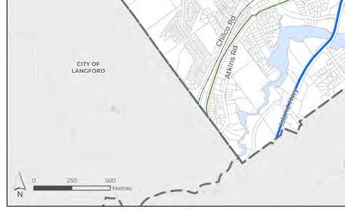
5.16 THETIS COVE SPECIAL PLANNING AREA DESIGNATION
5.16.1 CONTEXT
The land designated as Thetis Cove Special Planning Area, as shown on Map 1, is located in the area known as Thetis Cove. This land is adjacent to the Xʷsepsəm Nation Reserve. The Province purchased the land to transfer to the Xʷsepsəm Nation as part of the negotiations at the Recognition of Indigenous Rights and Self-Determination table. The transfer of land is likely to occur within the lifespan of this Official Community Plan.
5.16.2 PERMITTED HEIGHTS AND DENSITIES
A. Heights and density permissions are not applicable for this land use designation.
5.16.3 POLICIES
A. Collaborate with Xʷsepsəm and Songhees Nations to return the land to Xʷsepsəm Nation to advance reconciliation efforts.
B. Review the Town’s boundary following the transfer of the lands to Xʷsepsəm Nation.
Part Three: Reconciliation
6.0 Reconciliation (77)
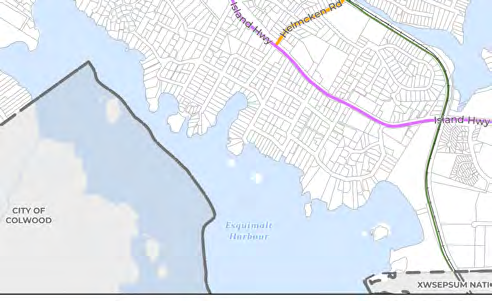
6.0 Reconciliation
6.1 CONTEXT
View Royal approaches reconciliation as a long-term priority grounded in relationship-building, learning, collaboration, accountability, and action. The Town recognizes the impacts of colonization on the community as it is today and acknowledging the injustices experienced by the First Nations peoples whose lands the Town is located upon. It will take time and commitment for View Royal to advance decolonizing practices and build respectful, meaningful relationships with the Xʷsepsəm and Songhees Nations.
Given the influence of Official Community Plans on long-term community initiatives and decision-making processes, this section focuses on practical and achievable policy direction to support ongoing reconciliation, collaboration, partnership, and relationship-building initiatives with the Xʷsepsəm and Songhees Nations so that community planning and priorities reflect the enduring presence and stewardship of the lək̓ʷəŋən Peoples. Through a reconciliation, collaboration and relationship-building lens, the Town worked with the advisors representing Xʷsepsəm and Songhees Nations on the review and update of the Official Community Plan. Both Nations provided comments on many aspects of the Official Community Plan to strengthen the objectives and policies and guide the Town on important matters related to self-determination, culture, land stewardship, and economic development.
The following Official Community Plan Goals may be achieved through the objectives and policy direction provided in this section:
- Community Well-Being
- Economic Development
- Reconciliation
- Regional Partnerships
6.2 OBJECTIVES
6.2.1 GOVERNMENT-TO-GOVERNMENT RELATIONSHIPS AND RECONCILIATION IN DECISION-MAKING
Build respectful, government-to-government relationships with the Xʷsepsəm and Songhees Nations, and integrate reconciliation frameworks into View Royal’s community planning initiatives, particularly for decisions impacting the Nations’ interests and self-determination goals.
6.2.2 INDIGENOUS PRESENCE, IDENTITY, AND CULTURAL EXPRESSION
Recognize, respect, and enhance the presence of Indigenous Peoples by promoting an inclusive atmosphere for those identifying as Indigenous in View Royal, and ensure that representation of Indigenous communities reflects their historical, continuing, and enduring significance within the community.
6.3 POLICIES
6.3.1 GENERAL
A. Identify a joint vision for reconciliation in View Royal in partnership with the Xʷsepsəm and Songhees Nations. B. Continue to develop and implement existing Memorandums of Understanding and/or protocol agreements with the Xʷsepsəm and Songhees Nations around shared commitments.
6.3.2 COMMITMENT TO CULTURAL AWARENESS AND LEARNING
A. Work with Xʷsepsəm and Songhees Nations to identify and deliver appropriate public education and reconciliation programming for View Royal residents and staff. B. Respect Indigenous data governance and sovereignty including through application of principles for ownership, control, access, and possession of data principles, and collaborate with Xʷsepsəm and Songhees Nations on municipally based data gathering.
Deleted original Policy 6.3.2 (A): Align municipal policies with the United Nations Declaration on the Rights of Indigenous Peoples & the provincial Declaration on the Rights of Indigenous Peoples Act to ensure Indigenous rights are explicitly recognized. While Section 3.0 acknowledges both the declarations, it was advised that tthe mandatory language of this policy may result in inconsistencies between future policies and bylaws adopted by the Town.
6.3.3 ADVANCING RECONCILIATION IN LAND USE DECISIONS
A. Proactively engage, and collaborate meaningfully and respectfully, with Xʷsepsəm and Songhees Nations on land use initiatives and decisions by which they may be affected to respect rights recognition and shared decision-making. B. Best efforts to follow procedures and protocols for respectful engagement and consultation as outlined by Xʷsepsəm and Songhees Nations referrals processes. C. Support economic reconciliation with lək̓ʷəŋən Peoples by collaborating on land use and development projects led by Xʷsepsəm and Songhees Nations. D. Consider the impact of land use decisions to the long-term needs of the Xʷsepsəm and Songhees Nations to help ensure land use directions support and advance reconciliation efforts.
E. Promote awareness of the responsibility of the Town and property owners to protect archeological sites and artifacts, including those of Indigenous significance, and encourage compliance under the Heritage Conservation Act.
6.3.4 UNDERSTANDING INDIGENOUS LAND AND WATER MANAGEMENT
A. Work with Xʷsepsəm and Songhees Nations to learn about Indigenous land and water stewardship practices, values, and rights. B. Work actively with Xʷsepsəm and Songhees Nations to integrate Indigenous knowledge systems with Western science for land and water stewardship initiatives, such as habitat restoration, culturally informed ecological management, resilient food systems, and conservation of natural assets.
6.3.5 SUPPORTING ECONOMIC RECONCILIATION AND RIGHT TO SELF-DETERMINATION
A. Collaborate with Xʷsepsəm and Songhees Nations to identify and pursue opportunities for Indigenous led land and economic development initiatives, such as Nation-led housing, mixed use, and economic projects. B. Support Indigenous-led economic initiatives through locally-forged business partnerships with Xʷsepsəm and Songhees Nations and support Indigenous business development and Indigenous development corporations.
6.3.6 CELEBRATING INDIGENOUS IDENTITY WITHIN VIEW ROYAL
A. Expand Indigenous cultural representation in public space, by supporting public art from Xʷsepsəm and Songhees artists, seeking opportunities for First Nations naming of parks, facilities, and streets, and exploring opportunities to develop interpretive materials co-authored with Xʷsepsəm and Songhees Nations to reflect the current presence of lək̓ʷəŋən People.
Deleted the original Policy 6.3.3 (A): Remain committed to recognizing the Xʷsepsəm and Songhees Nations' rights to make decisions over their lands, resources, and economic future that reflect their laws, values, and community priorities. It was advised that the mandatory language of this policy may result in inconsistencies between the OCP and future decision-making and adoption of Nation and Town bylaws. There are several policies that speak to collaborating with the Nations on lands, resources and economic futures.
Part Four: Policies
- 7.0 Housing (81)
- 8.0 Transportation and Mobility (88)
- 9.0 Community Infrastructure and Services (105)
- 10.0 Economic Development (114)
- 11.0 Natural Environment and Hazards (119)
- 12.0 Climate Action and Sustainability (132)
- 13.0 Parks, Trails, and Recreation (138)
- 14.0 Community Well-Being and Culture (145)
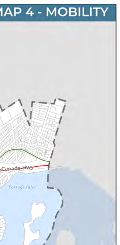
7.0 Housing
7.1 CONTEXT
Housing in View Royal and the Capital Regional District as a whole is increasingly challenged by rising land and construction costs, demographic shifts, and limited land availability for new development. Many residents are living in housing that is no longer suitable for their needs, including older adults seeking to downsize and families seeking attainable, appropriately sized homes. Inadequate housing options and growing risks of homelessness further highlight the need for greater diversity in housing types and tenures.
The 2024 View Royal Interim Housing Needs Report outlined the most current housing conditions in the community and found that 0.9% of owner households and 7.81% of renter households are in extreme core housing need in 2021.
A total of 842 dwelling units are necessary to address extreme core housing need, persons experiencing homelessness, suppressed household formation, anticipated growth, rental vacancy rate adjustment, and local demand in View Royal by 2026, and a total of 2,889 dwelling units are need by 2041. The Interim Housing Needs Report estimates that the total number of Extreme Core Housing Need dwelling units needed by 2041 is 174, this is approximately 12 new units per year between 2026 and 2041. Considering the lifetime of this Official Community Plan extends beyond the year 2041 to 2050, a total of 4,189 units may be necessary to meet long-term housing needs in the community, based on findings identified in the Interim Housing Needs Report. Section 16.3 of the Community Profile in Appendix A summarizes View Royal's residential development trends, population projections and housing needs.
A household is said to be in extreme core housing need if its housing falls below at least one of the adequacy, affordability or suitability standards and it would have to spend 50% or more of its total before-tax income to pay the median rent of alternative local housing that is acceptable (meets all three housing standards).
Suppressed household formation is said to be new households that would have been formed but are not due to a lack of attainable options. The persons who would have formed these households include, but are not limited to, many adults living with family members or roommates and individuals wishing to leave unsafe or unstable environments but cannot due to a lack of places to go.
Rental vacancy rate adjustment adds surplus rental units to restore local vacancy rates to levels representing a healthy and well-functioning rental housing market. Typically, rates between 3% and 5% are considered healthy vacancy rates.
With little vacant land remaining within the Urban Containment Boundary, most new residential development will occur through the redevelopment of older housing stock and infill within existing neighbourhoods. Addressing community housing needs and desires will require an expanded supply of ground oriented, family-friendly housing, such as secondary and garden suites, duplexes, houseplexes, rowhouses, and townhouses. The development of new detached dwellings that occupy a smaller building footprint may also be viable to fill housing gaps and address community needs.
The purpose of this section is to provide policy direction that supports suitable, attainable, and affordable housing forms for all residents.
The Town’s 2024 Housing Needs Assessment Report identifies the breakdown of existing housing need in View Royal and the type of housing that is required to address this need.
The following Official Community Plan Goals may be achieved through the objectives and policy direction provided in this section:
- Diverse and Affordable Housing
- Regional Partnerships
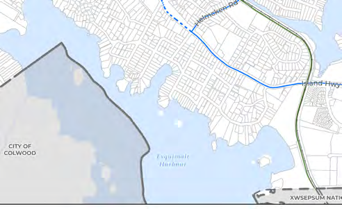
7.2 OBJECTIVES
7.2.1 HOUSING DIVERSITY AND SUPPLY
Support the diversification and overall supply of housing throughout the Town, including affordable, supportive, and non-market rental housing.
7.2.2 AGE-FRIENDLY HOUSING
Encourage accessible housing design that allows residents to age-in-place and enables residents to live and remain in their community, despite differences and changes in individual lifestyle, income, and health.
7.2.3 PRESERVE STABLE LONG-TERM RENTALS
Seek opportunities to preserve long-term rental housing stock that is suitable, adequate, and affordable, to ensure long-term housing stability and affordability in the community.
7.2.4 HOUSING FOR PEOPLE
Continue to support the provision of a diverse range of housing types and tenures to meet the diverse needs of current and future residents, including families, seniors, people with diverse abilities, physical disabilities, and low-income households.
7.2.5 HOUSING PARTNERSHIPS
Explore opportunities to develop new partnerships and strengthen existing partnerships with non-profit housing providers, BC Housing, and the Capital Region Housing Corporation to ensure View Royal can continue to support affordable housing initiatives in the community.
7.3 POLICIES
7.3.1 GENERAL
A. Continue to update the Housing Needs Report every five years using the provincial standardized Housing Needs Report Method, following the timeline and requirements specified in the Local Government Act to inform housing priorities. B. Research what forms of amenity space are needed and desired to create strong, socially connected communities and explore how the Zoning Bylaw may implement amenity space requirements in multi-unit residential developments.
7.3.2 HOUSING SUPPLY
A. Continue to consider opportunities to facilitate an increase in housing supply by streamlining development approval and permitting processes. B. Research what forms of non-traditional housing ownership and building construction types (e.g. market rental, cooperatives, mixed market and non-market projects, mass timber, prefabrication) are needed, desired, and may be viable. C. Review annual housing starts data to identify and track progress towards housing goals, and to find opportunities to increase housing supply. D. Continue to review, monitor and enforce zoning regulations that regulate Short-Term Rental accommodations to increase the availability of long-term rental housing supply, and prevent the commercialization of residential dwellings.
7.3.3 AFFORDABLE AND RENTAL HOUSING
A. Support the attainment of affordable housing in View Royal by achieving a minimum of 1 unit of below-market housing for every 15 units of market housing, and 1 unit of supportive housing for every 44 units of market housing being built in the Town. B. Undertake financial feasibility analyses to identify if density bonusing and inclusionary zoning are viable tools to utilize in the Zoning Bylaw to increase affordable market and non-market rental housing supply.
C. Collect in-kind and cash-in-lieu contributions towards affordable housing, where possible, through the establishment of relevant tools, including reserve funds and amenity contribution policies. D. Protect below-market and affordable rentals where redevelopment of existing ground-oriented rental and cooperative housing units are proposed by considering how to retain rental units of the same quantity, size, and where possible, maintain the equivalent monthly rental rate for tenants. Achieve a minimum replacement of 1:1 for all below-market and affordable rentals that are lost through redevelopment. E. Where the redevelopment of an existing cooperative housing site is considered, an increase in residential density will be supported only if additional cooperative housing units are provided. F. Continue to review the Town’s Tenant Assistance Policy to ensure it is designed to mitigate the loss of existing affordable units and protect tenants who are displaced during the redevelopment or renovation of older rental buildings. G. Investigate additional measures to protect tenants displaced by the redevelopment or renovation of purpose-built rental housing, such as regulations that ensure existing tenants have adequate time to find new housing, are provided compensation where applicable, and receive priority for new housing.
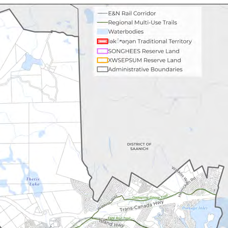
7.3.4 FAMILY HOUSING
A. Support family-oriented housing by requiring new multi-unit residential developments of four or greater storeys, with the exception of seniors housing, supportive housing, and affordable rental housing projects, to allocate a proportion of units as follows: i) a minimum of 30% of units with two bedrooms or more; and ii) a minimum of 10% of units with three bedrooms or more B. Investigate how family housing needs can be better addressed in View Royal, including access to supports and amenities such as childcare facilities, schools, and parks. C. Promote ground-oriented, family-friendly housing within neighbourhoods close to schools and amenities.
7.3.5 ACCESSIBILITY IN HOUSING
A. Incorporate Universal Design principles in the design of common and amenity spaces, such as entryways, hallways, stairwells, patios, and multi-purpose rooms, amongst others. B. Achieve 10% of units in all new multi-unit housing developments of four or more storeys to be accessible or adaptable units, particularly in below-market developments, and at least be designed and constructed in accordance with the BC Building Code, or an equivalent standard. These units should be provided on the ground floor wherever possible.
7.3.6 COORDINATION AND PARTNERSHIPS
A. Strengthen partnerships to deliver more affordable housing and supportive housing. B. Build community capacity to support the development of affordable housing, for example by connecting non-profits with funding streams, land opportunities, and market developers for potential partnerships. C. Work together with housing agencies, stakeholders, and senior levels of government to identify sites and collaborate, where possible, on the provision of supportive housing projects with social and mental health support. D. Continue annual financial contributions to the Regional Housing Trust Fund, administered by the Capital Region Housing Corporation, to support the acquisition, development, and retention of housing that is affordable to households with low or moderate incomes. E. Continue to collaborate with the Capital Regional District and other regional stakeholders to implement the Regional Housing Affordability Strategy and continue to support and contribute to regional housing initiatives and programs.
[Image 93a: Photo of a modern five-storey residential building with white and grey siding] [Image 93b: Photo of a row of modern two-storey townhomes with grey and white exteriors] [Image 93c: Photo of a four-storey residential building featuring large balconies and wood-style siding] [Image 93d: Photo of a modern high-density mixed-use building with ground-floor commercial and residential units above]
8.0 Transportation and Mobility
8.1 CONTEXT
The transportation and mobility choices existing within a community define how community members can get around. View Royal’s central location with the Capital Regional District and as the gateway to the West Shore makes it well-connected to the broader region. The Trans-Canada Highway (owned and maintained by the Ministry of Transportation and Transit), Island Highway, Galloping Goose Regional Trail, E&N Rail Trail, and BC Transit’s bus routes including the 95 Blink Rapid Bus, number 14 (Vic General / UVic), and number 40 (UVic/Dockyard via McKenzie-Admirals) traverse View Royal and provide connections to key destinations within adjacent communities and beyond.
Within View Royal, there are five key corridors along which amenities and services are concentrated, as shown on Map 3: Island Highway, Admirals Road, Helmcken Road, Watkiss Way, and the Western Gateway Corridor. These corridors serve key transportation functions in their ability to move goods and people within the Town and provide connections to neighbouring communities. It is anticipated that higher levels of density will be concentrated along these corridors to enable alternate modes of transportation beyond the private car and to ensure that residents can easily access the services and amenities they need daily near their home. The foundation for this is embedded within the Official Community Plan’s land use policy, included in Part Two.
Each of the corridors noted are also supported by one of View Royal’s two mobility hubs. As shown on Map 4, these are located at the site of the provincially designated Hospital Transit-Oriented Area, which comprises the existing Victoria General Hospital Transit Exchange and the Atkins Neighbourhood Village. Both mobility hubs are located within proximity to the Galloping Goose Regional Trail and the Trans-Canada Highway which provide opportunities for travel within the region by cycling, rolling, walking, or car. In addition, they are each serviced by transit routes that provide connections within View Royal and beyond. BC Transit is updating the Victoria Regional Transit Plan to address network design priorities and infrastructure and service improvements. A bus rapid transit route already serves the Atkins Mobility Hub, and additional connections may be identified for the Hospital Transit-Oriented Area and Atkins Mobility Hub, as shown on Map 4, once BC Transit has adopted the Victoria Regional Transit Plan.
Corridors are primary transportation routes where increased development density is generally encouraged to maximize accessibility for vehicles, public transit, and pedestrians. In View Royal, key corridors include Admirals Road, Helmcken Road, Island Highway, and the Western Gateway Employment District Corridor.
Increased densities are permitted in and around these mobility hubs to promote alternate modes of transportation through enhanced public realm design that creates a pedestrian-friendly environment and provides connections to key active transportation infrastructure such as trails.
Decisions regarding the location, intensity, and timing of growth directly influence travel demand, congestions, infrastructure costs, accessibility, and community livability. The Town recognizes that regional transportation planning has identified increasing pressure on key transportation corridors and growing communities throughout the Capital Region. Growth patterns, transportation networks, transit performance, and infrastructure capacity are closely interconnected and should be planned together. The Town supports growth that is aligned with available and planned transportation infrastructure and services. Furthermore, the Town considers transportation capacity, transit service levels, active transportation connectivity, emergency access, and regional mobility performance to be important factors in determining the pace, scale, and location of future growth. Expectations regarding future growth should be informed by the delivery of provincial, regional, and local transportation infrastructure.
The objectives and policies included in this section aim to enhance mobility options for getting around View Royal and travel through the community by employing strategies that encourage alternate transportation behaviours and choices. Such strategies will address primary concerns of residents related to traffic congestion along major routes such as the Trans-Canada Highway and Island Highway by creating alternative modes for a smoother travel experience. In addition, reduced reliance on the automobile yields reduced greenhouse gas emissions, cleaner air, and a healthier community.
Mobility Hub means a strategic location offering access or connections to multiple modes of transport, including transit, cycling, walking, rolling, and private vehicles. These hubs are usually central to concentrations of medium- to high-density development. View Royal has two mobility hubs - the provincially designated Hospital Transit-Oriented Area which comprises the existing transit exchange located at Victoria General Hospital and the Atkins Neighbourhood Village located adjacent to Island Hwy and the Galloping Goose trail.
The following Official Community Plan Goals may be achieved through the objectives and policy direction provided in this section:
- Mobility & Connectivity
- Community Well-Being
- Climate Action and Resilience
- Regional Partnerships
- Sustainable Service Delivery through Asset Management
Note: Second paragraph was attended to this page in response to Council resolution C-134-26 that was passed at the June 16, 2026 Council meeting.
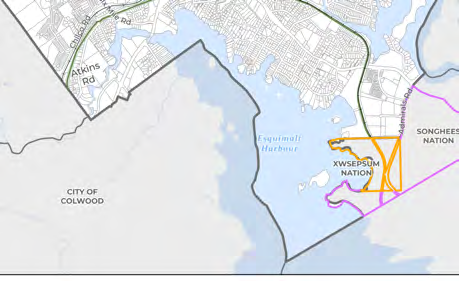
==End of extracted content==
Document Images
(52)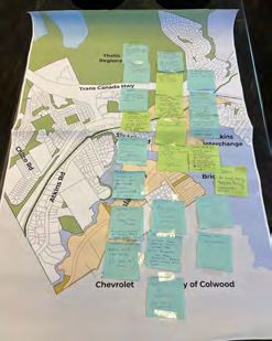
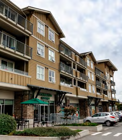
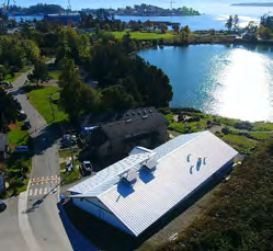
Regional Planning Framework Diagram showing relationships between Provincial Legislation, Regional Growth Strategy, Strategic Plan, Financial Plan, Master Plans, OCP, Zoning Bylaw, and other Bylaws/Policies
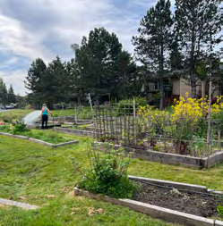
OCP Update Process Summary Diagram
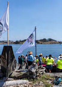
Engagement statistics infographic
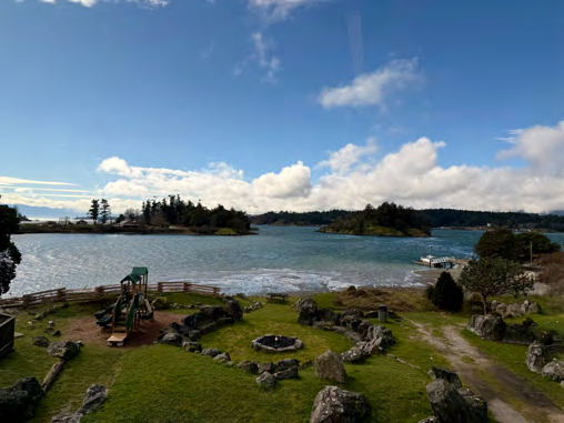
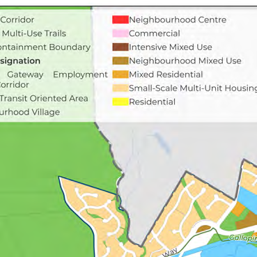

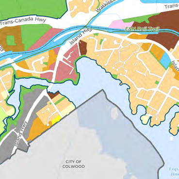
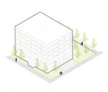
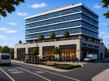
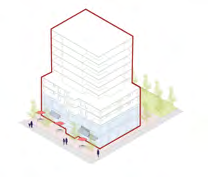
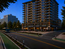
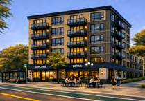
Photo of a modern mixed-use residential building with an integrated bus stop shelter in front
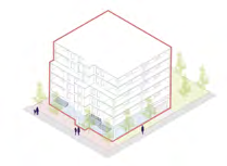
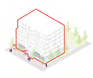
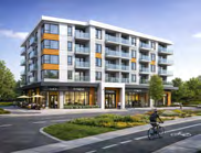
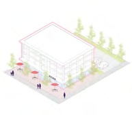
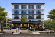
Photo of a roadway in View Royal with clearly marked green bike lanes and pedestrian crosswalks
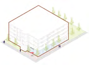
Map 1: Land Use Map of View Royal showing various land use designations and administrative boundaries
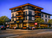
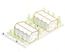
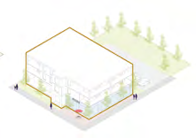
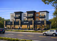
Photo of the rocky View Royal shoreline with yellow wildflowers in the foreground
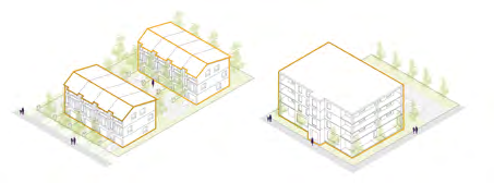
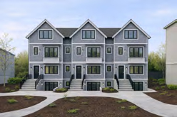
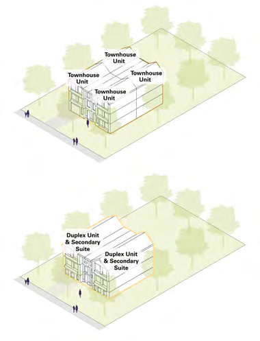
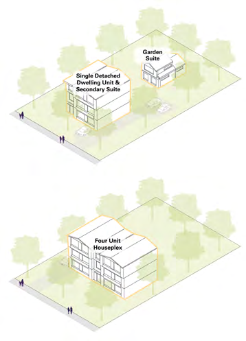
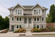
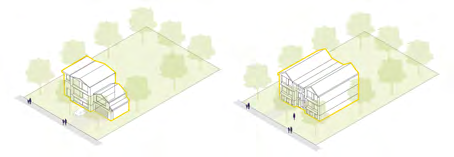
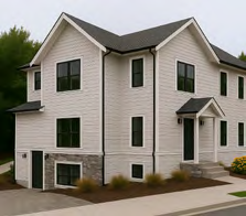
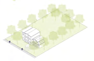
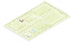
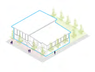
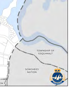
Two 3D massing diagrams for 3-storey buildings with a Floor Space Ratio of 1.5, showing townhouse and mixed-use configurations
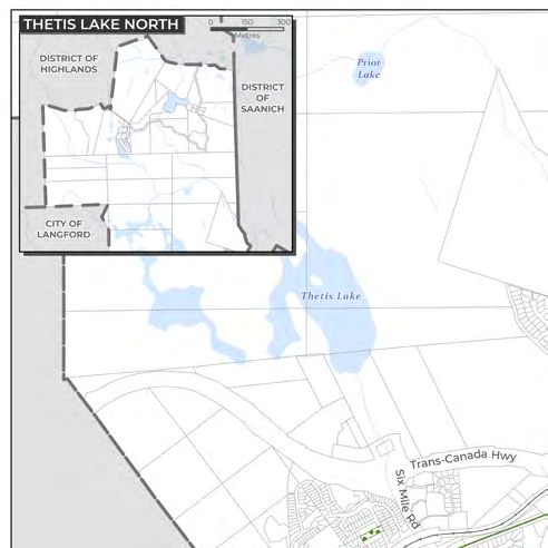
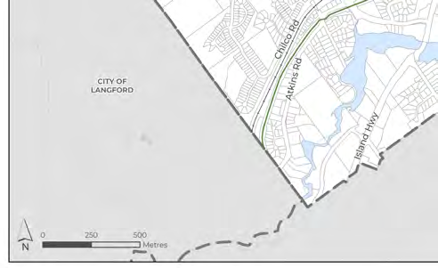
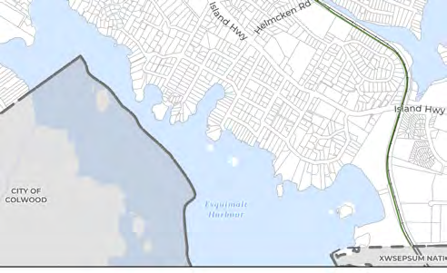
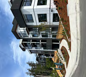
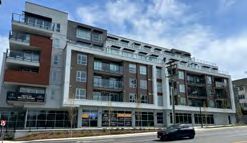
3D massing diagram of a 2.5-storey house on a large residential lot
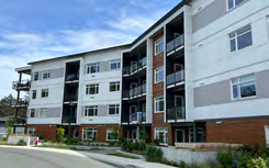
3D massing diagram for a rural lot showing a 2-storey home and outbuilding on 10 hectares
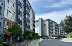
3D massing diagram for a 2-storey community facility building with active street frontage