Official Community Plan - 11.0 Natural Environment and Hazards Context
Overview of terrestrial, aquatic, and marine ecosystems and associated natural hazards.
11.0 Natural Environment and Hazards
11.1 CONTEXT
The natural environment is interconnected with how View Royal approaches growth, its character and identity, and its long-term stewardship and sustainability objectives. Maintaining, restoring, and expanding healthy ecosystems provides important ecosystem services, including clean air, shade for cooling, natural drainage systems, and erosion mitigation, alongside opportunities for people to connect with nature.
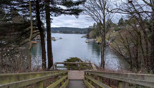
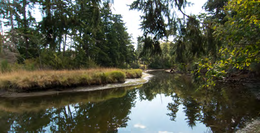
View Royal comprises a diverse array of marine, freshwater, and terrestrial ecosystems and habitats, as shown on Map 12 Environmentally Sensitive Areas. Marine ecosystems comprise Esquimalt Harbour and Portage Inlet, including their coastal shorelines. Freshwater ecosystems merge with the salt waters of these two water bodies in the estuaries of Craigflower, Hospital, and Millstream Creeks. Thetis, Prior, Pike, and McKenzie Lakes all comprise freshwater ecosystems that include foreshore and riparian areas. Terrestrial ecosystems exist throughout the town, though are particularly prevalent in Thetis Lake and Mill Hill Regional Parks, in the form of mature Coastal Douglas Fir forests along with rocky outcrops and Garry Oak meadows. These natural spaces provide important habitat for wildlife and species at risk, as shown on Map 13.
In addition to providing habitat for many species, the natural environment also poses some natural hazards such as flooding, tsunamis, steep slopes exceeding 30%, as shown on Map 14, and wildfires. These hazards all pose risks to public safety and potential impacts to the built environment. Construction activities occurring within any zones where the risk to public safety is deemed high because of a natural hazard are subject to the Development Permit Area Guidelines included in Part 6 of this Official Community Plan. This includes restrictions to development in areas where slopes are equal to or greater than 30%²⁰, as shown on Map 14, and where flooding or slope instability may occur. This section discusses considerations and strategies for emergency response to events occurring as a result of such natural hazards, plus wildfires and earthquakes.
Access to the natural environment is a key priority for the View Royal community. Overall health and well-being may be correlated with the level of access that community members have to the natural environment, whether that be through public green space or on privately-owned lands. This section aims to work in tandem with Sections 13 and 14 of the Official Community Plan to recognize that protection of the natural environment as places for people to recreate, both passively and actively, will positively impact the physical and mental health of residents. Many natural features and habitats shown on Maps 12 and 13 are designated as parkland as shown on Map 15. The reduction of greenhouse gas emissions, expanded upon in Section 12, and other air pollutants are also essential to maintaining a healthy environment in View Royal and advancing community-wide sustainability for years to come.
²⁰ Restrictions to development in areas where slopes are equal to or greater than 30% is best engineering practice to avoid unsafe development and public safety risks.
It is important to note the key role that trees play in protecting the natural environment, mitigating the impacts of climate change, and improving overall community health and well-being. Many studies discuss the benefits that trees can provide for both physical and mental health, in terms of their ability to provide shade, clean air, and a connection to the natural environment. Areas of high tree canopy coverage may also act as corridors connecting wildlife habitat areas. The Town’s Urban Forest Strategy, endorsed by Council in 2026, aims to recognize the importance of trees in View Royal through establishing a tree canopy coverage goal of 30%. This section aims to further support the vision of the strategy and recognize the role of the urban forest in protecting the natural environment.
The following objectives and policies outline how View Royal can strengthen the long-term resilience of the Town’s natural environment and reduce community risk from natural hazards. Together, they support protection from flooding, tsunamis, landslides, wildfires, and earthquakes, while safeguarding environmentally sensitive areas, urban forests, and aquatic environments from potential impacts of development.
The following Official Community Plan Goals may be achieved through the objectives and policy direction provided in this section:
- Natural Amenities
- Community Well-Being
- Community Safety & Security
- Climate Action and Resilience
- Reconciliation
- Regional Partnerships
- Sustainable Service Delivery and Asset Management
Environmentally sensitive areas are ecosystems and/or habitats that provide high value to the natural environment through their ability to support biodiversity, animal and plant species, and natural systems such as purifying the air and water. View Royal has a number of sensitive and significant terrestrial, aquatic, and riparian ecosystems that provide habitat for many species. Examples include:
- Terrestrial ecosystems: old growth and mature forests such as those found in Thetis Lake and Mill Hill Regional Parks
- Aquatic ecosystems: saltwater habitats provided in large waterbodies and their shorelines such as the Portage Inlet
- Riparian ecosystems: freshwater streams and lakes that have the potential to support fish habitat, such as Craigflower Creek and Thetis Lake