Appendix
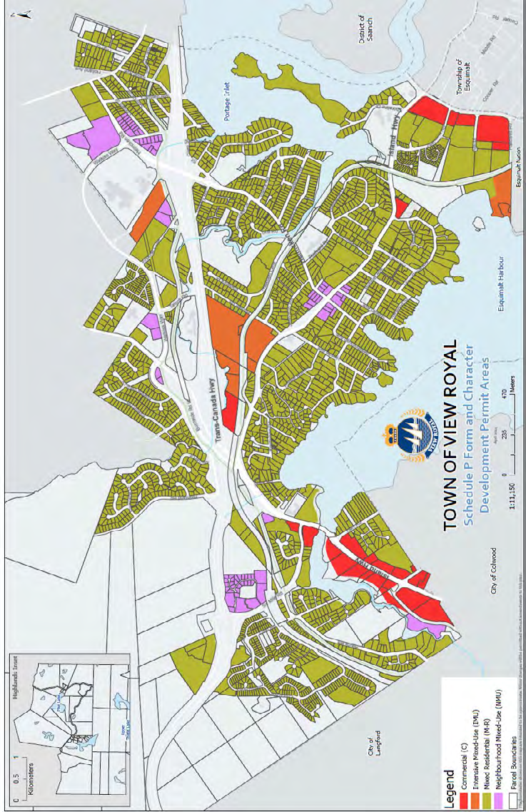
Schedule P Form and Character Development Permit Areas (Map)
Map showing designations for Mixed Residential, Neighbourhood Mixed-Use, Intensive Mixed-Use, and Commercial DPAs.
TOWN OF VIEW ROYAL Schedule P Form and Character Development Permit Areas

Legend
| Map Category |
|---|
| Commercial (C) |
| Intensive Mixed-Use (IMU) |
| Mixed Residential (M-R) |
| Neighbourhood Mixed-Use (NMU) |
| Parcel Boundaries |
Map Information
- Scale: 1:11,150
- Scale Bar: 0 to 470 Meters
- Date: April 2011
Geographic Features and Locations
- Surrounding Jurisdictions: City of Langford, City of Colwood, District of Saanich, Township of Esquimalt, Esquimalt Nation.
- Water Bodies: Esquimalt Harbour, Portage Inlet, Pike Lake (Inset), Upper Thetis Lake (Inset).
- Major Roadways: Trans-Canada Hwy, Island Hwy, Burnside Rd, Watkiss Way, Helmcken Rd, Old Island Hwy, Atkins Rd, Six Mile Rd.
Page 256
Document Images
(1)
Extracted from: 2026 07 07 Council Meeting - Agenda - Pdf(507 pages total)