Council Meeting/Documents/Schedule Q Environmental Protection and Natural Hazard Development Permit Areas (Map)
Appendix
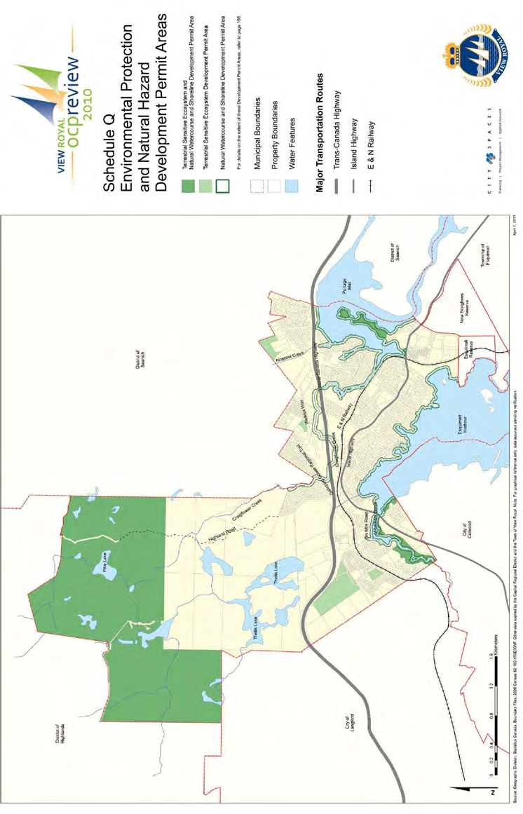
Schedule Q Environmental Protection and Natural Hazard Development Permit Areas (Map)
Map designating sensitive ecosystem and natural watercourse DPA boundaries.
VIEW ROYAL ocp review 2010
Schedule Q: Environmental Protection and Natural Hazard Development Permit Areas

Legend
- Terrestrial Sensitive Ecosystem and Natural Watercourse and Shoreline Development Permit Area
- Terrestrial Sensitive Ecosystem Development Permit Area
- Natural Watercourse and Shoreline Development Permit Area
- Municipal Boundaries
- Property Boundaries
- Water Features
Note: For details on the extent of these Development Permit Areas, refer to page 156.
Major Transportation Routes
- Trans-Canada Highway
- Island Highway
- E & N Railway
Geographic Features and Landmarks Identified on Map
- District of Highlands
- Pike Lake
- District of Saanich
- Highland Road
- Craigflower Creek
- Thetis Lake
- City of Langford
- Galloping Goose Regional Trail
- Watkiss Way
- Hospital Creek
- Six Mile Road
- Portage Inlet
- City of Colwood
- Esquimalt Harbour
- Esquimalt Reserve
- New Songhees Reserve
- Township of Esquimalt
Source: Geography Division, Statistics Canada, Boundary Files, 2006 Census 92-160-XWE/XMF. Other data supplied by the Capital Regional District and the Town of View Royal. Note: For graphical reference only; data accuracy pending verification.
April 7, 2011
Page 270
Document Images
(1)
Extracted from: 2026 07 07 Council Meeting - Agenda - Pdf(507 pages total)