Appendix
Plans and Elevations – Alan Lowe Architect Inc.
June 19, 2018Pages 15–317 sections
Detailed architectural drawing set including floor plans, elevations, site context, and landscape design.
May 15, 2018Project No. 17-5044 storeysUnderground parking plan
Page 1: Cover Sheet
ISSUED FOR REZONING PERMIT
- Project Title: Proposed Residential Development
- Civic Address: 242-244 Island Highway, Victoria, B.C.
- Project Number: 17-504
- Date: 15 May 2018
- Architect: Alan Lowe Architect Inc.
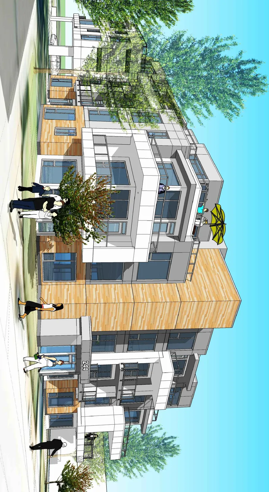
Index of Drawings
Architectural
- A0.0: Cover Sheet
- A1.0: Context Plan
- A1.1: Existing Site Plan
- A1.2: Proposed Site Plan (1:200) / Project Data (With Revision Clouds)
- A1.3: Proposed Site Plan - Larger Scale (1:100)
- A2.0: Underground Floor Plan (Parking)
- A2.1: Ground Floor Plan
- A2.2: Second Floor Plan
- A2.3: Third Floor Plan
- A2.4: Fourth Floor Plan
- A2.5: Roof Plan
- A3.0: Elevations
- A3.1: Elevations
- A3.2: Streetscapes
- A3.3: 3D Model / Perspectives
- A4.0: Sections
- P1: Site Landscape Plan
Page 15–31
Page 2: Context Plan (A1.0)

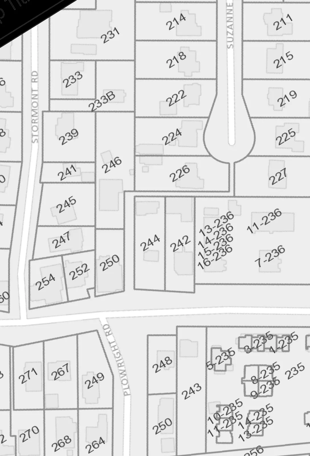
Page 15–31
Page 3: Existing Site Plan (A1.1)
Project Information
- Description: Multiple Unit Residence
- Legal Address: Remainder Lot 34 & 35, Section 3, Esquimalt District, Plan 3738 except parts in plans EPP8968 and EPP9053
- Civic Address: 242-244 Island Highway, Victoria, B.C.
Page 15–31
Page 4: Proposed Site Plan (A1.2)
Project Information
- Description: Multiple Unit Residence
- Legal Address: Remainder Lot 34 & 35, Section 3, Esquimalt District, Plan 3738 except parts in plans EPP8968 and EPP9053
- Civic Address: 242-244 Island Highway, Victoria, B.C.
Zoning Data
- Zoning: RM-3 Mixed Residential
- Site Area: 1,860.5 m² [20,027 sq.ft.]
- Area of Proposed Sidewalk Projecting into Site Area: 59.5 m² [640.75 sq.ft.] (Hatched in Site Plan)
- Greatest Horizontal Area: 869.4 m² [9,358.3 sq.ft.]
- Site Coverage Proposed: 46.7%
- Open Site Space: 27.4%
- Building Average Grade: 36.70 m
- Impermeable Surface Coverage Proposed: 72.6%
- Maximum Floor Area Ratio Allowed: 1.6 (1.5 + 0.1 with provision of 80% underground parking)
- Maximum Floor Area Allowed: 2,976.8 m² [32,042 sq.ft.] (Calculation: 1,860.5 m² x 1.6 = 2,976.8 m²)
- Forth Floor Area: 686.5 m² [7,389 sq.ft.]
- Third Floor Area: 836.1 m² [9,000 sq.ft.]
- Second Floor Area: 836.1 m² [9,000 sq.ft.]
- Ground Floor Area: 588.1 m² [6,331 sq.ft.]
- Gross Floor Area: 2,946.8 m² [31,720 sq.ft.] (Excluding all decks & balconies)
- Floor Area Ratio Proposed: 1.58 (Calculation: 2,946.8 m² / 1,860.5 m² = 1.58)
- Total Units: 37 (16 units of 2BD + 21 units of 1BD)
- Number of Storeys: 4
| Floor Space Ratio | Required | Proposed |
|---|---|---|
| Ratio | 1.6 : 1.0 | 1.58 : 1.0 |
| Building Height (Top of Parapet) | 13.5 m [44'-3 1/2"] | 13.00 m [42'-8"] |
| Site Coverage | 60% (max.) | 46.7% |
| Impermeable Surface Coverage | 80% (max.) | 72.6% |
Setbacks
| Location | Required | Proposed |
|---|---|---|
| Front (Along Island Hwy) | 7.5 m [24'-7 1/4"] (min.) | 4.30m [14'- 1"] ** |
| Rear | 7.0 m [22'-11 1/2"] (min.) | 7.0 m [22'-11 1/2"] |
| Side | 4.0 m [13'-1 1/2"] (min.) | 4.06 m [13'-4 1/4"] |
| Flanking (Lane) | 4.0 m [13'-1 1/2"] (min.) | 4.05 m [13'-3 1/2"] |
** Variance required for front stairwell and entrance lobby projecting into front setback by 3.22m [10'-6 1/2"]. Note: Variance required for balconies projecting into required setbacks. Projections range from 0.73m to 1.89m.
- Open Site Space Proposed: 27.4% (Not including parking & ramp)
- Open Space to Site Area Ratio: 0.27
- Parking Required: 45 (80% Underground (36 spaces)) (Calculation: [16 (2BD units) x 1.5] + [21 (1BD units) x 1] = 45)
- Parking Proposed: 45 (9 surface stalls + 36 underground) (Including 1 handicapped)
- Bicycle Parking: 48 plus 6 @ entry
Average Grade Calculation
- Points A & B (36.63+36.58)/2 = 36.60 x 17m = 622.2
- Points B & C (36.58+36.40)/2 = 36.49 x 3.77 m = 137.56
- Points C & D (36.40 + 36.20)/2 = 36.3 x 9.68 m = 351.38
- Points D & E (36.20 + 37.30)/2 = 36.75 x 25.75 m = 946.31
- Points E & F (37.30 + 37.0)/2 = 37.15 x 9.68 m = 359.6
- Points F & G (37.0 + 36.90)/2 = 36.95 x 3.5 m = 129.3
- Points G & H (36.90 + 36.66)/2 = 36.78 x 17 m = 625.2
- Points H & A (36.66 + 36.63)/2 = 36.64 x 20.2 m = 740
- Total: 3,911.61
- Building Perimeter: 106.58 m
- Average Grade: 3,911.61 / 106.58 = 36.70
Page 15–31
Page 12: Elevations (A3.0)
Exterior Finishes & Notes
- F1: Hardie Panel - Dark Colour
- F1a: Hardie Panel - Light Colour
- F2: Horizontal T&G Cedar Siding
- F3: Pre-finished Metal Flashing
- F4: Al-13 Composite Metal Panels
- F5: Prefinished Aluminum Guardrails w/ Glazing
- F6: Aluminum Picket Fence - 4' High
Page 15–31
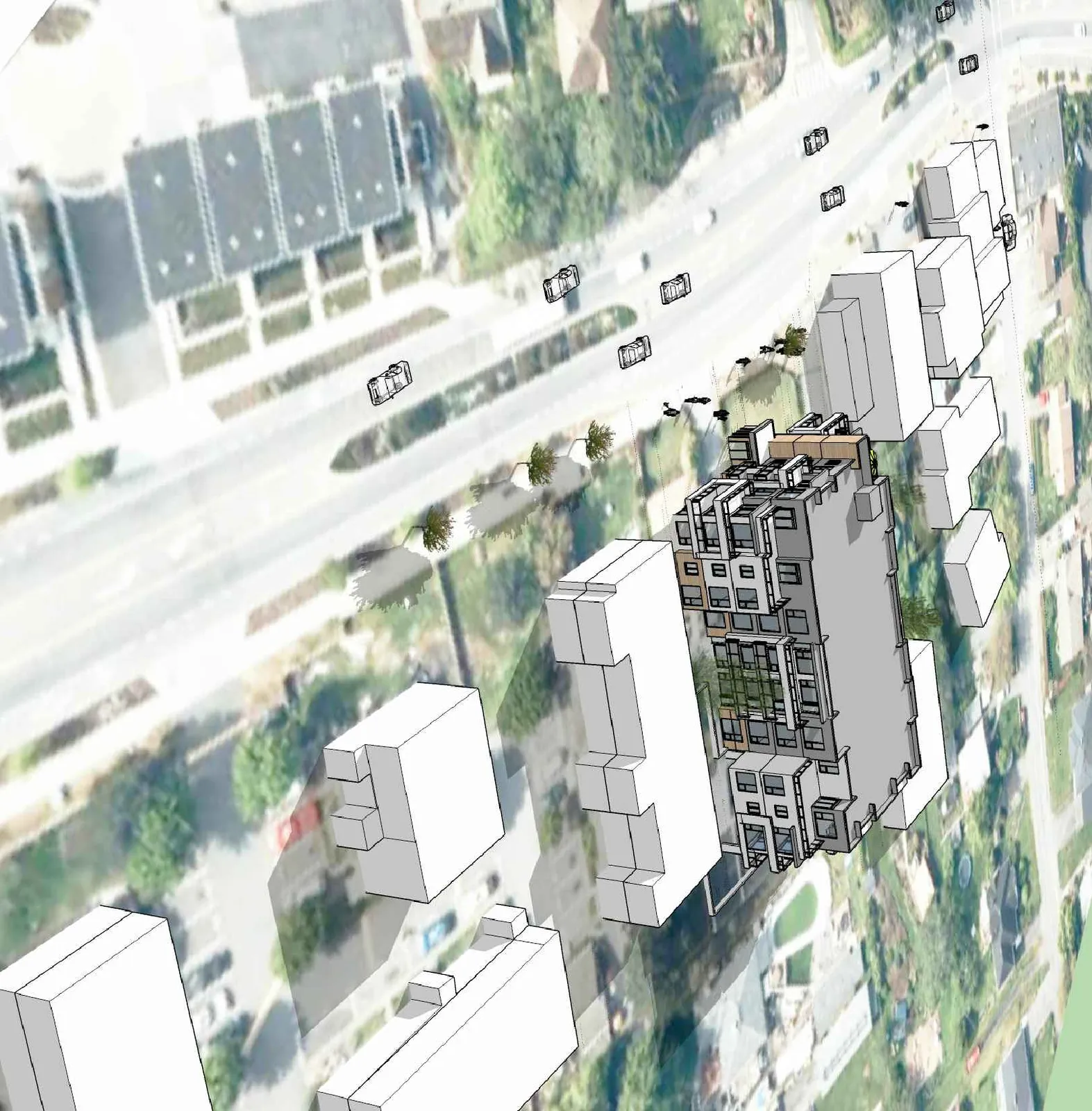
Page 15: 3D Massing Model Perspectives (A3.3)

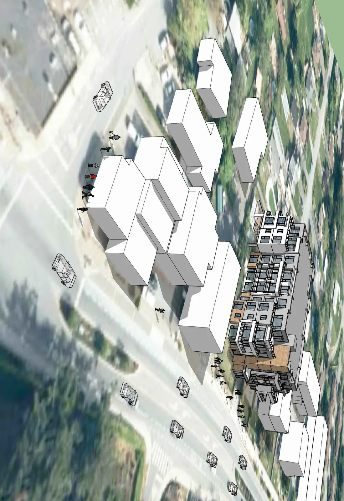
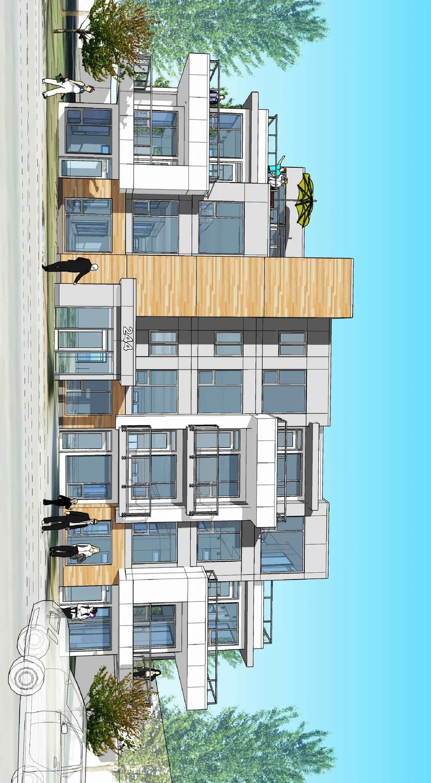
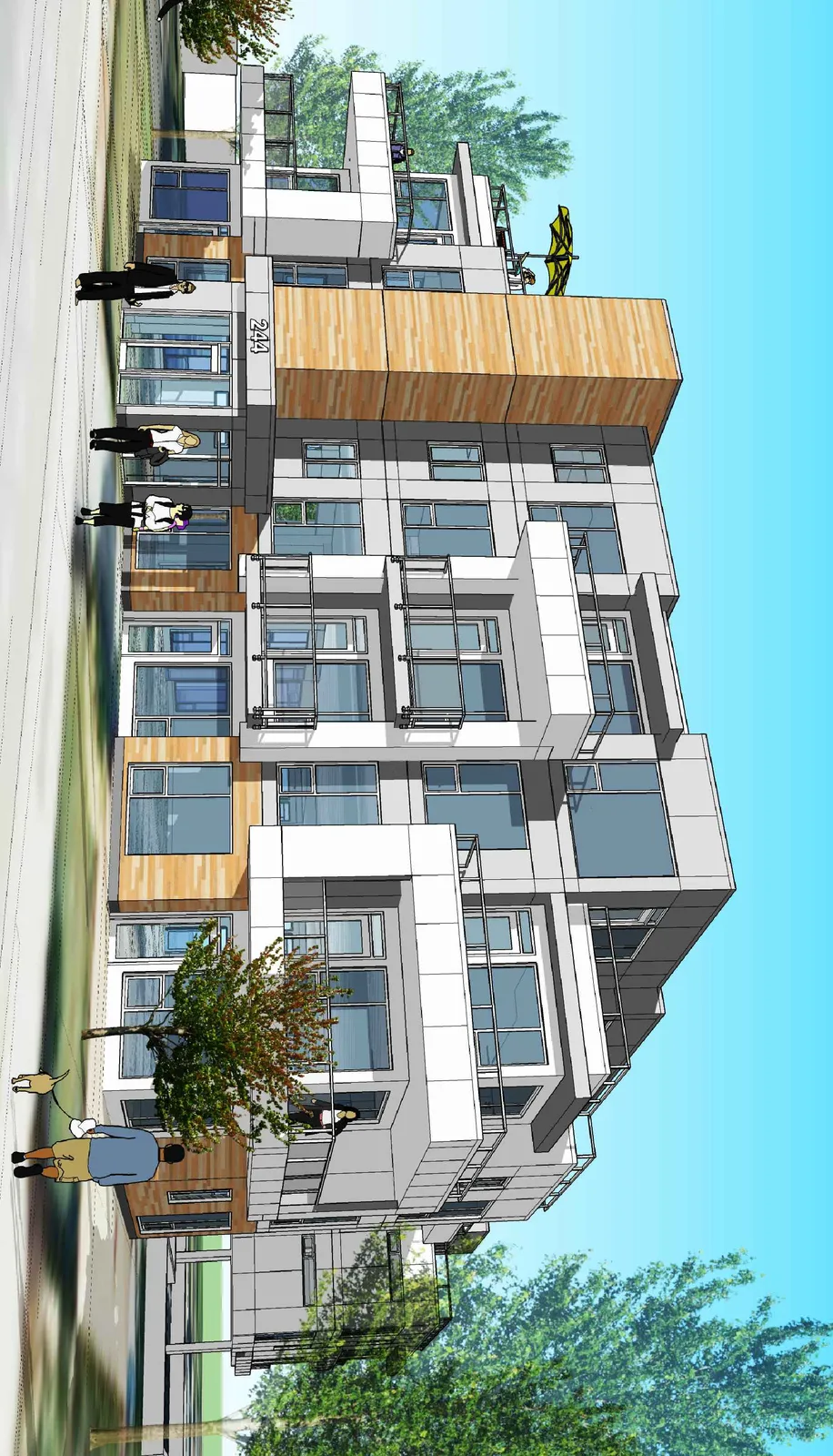
Page 15–31
Page 17: Site Landscape Plan (P1)
- Project Title: 244 Island Highway, Victoria, B.C.
- Date: May 19, 2018
- Scale: 1 : 200
Legend
- Deciduous Trees:
- Pyrus calleryana 'Chanticleer' (Chanticleer Pear)
- Cercis canadensis 'Forest Pansy' (Forest Pansy Redbud)
- Acer palmatum 'Bloodgood' (Bloodgood Japanese Maple)
- Acer circinatum (Vine Maple)
- Shrubs and Groundcovers: (Various species detailed on original plan)
Page 15–31
Extracted from: 2018 06 19 Public Hearing Agenda - Bylaw No. 1002 - Agenda - Pdf(39 pages total)