This site is in beta — data may be incomplete and features are still being added.
Council Meeting/Documents/Bylaw No. 848 - SCHEDULE 1
Appendix

Bylaw No. 848 - SCHEDULE 1

April 30, 2013Page 81 section

Map showing land use designation amendments for the subject properties at Portage and Helmcken Road.

2. APPROVAL OF AGENDA
Plan 31445Plan 1073Designations: P and NMU

SCHEDULE 1

AMENDMENTS TO SCHEDULE "L" LAND USE DESIGNATIONS AND SCHEDULE "P" FORM AND CHARACTER DEVELOPMENT PERMIT AREAS
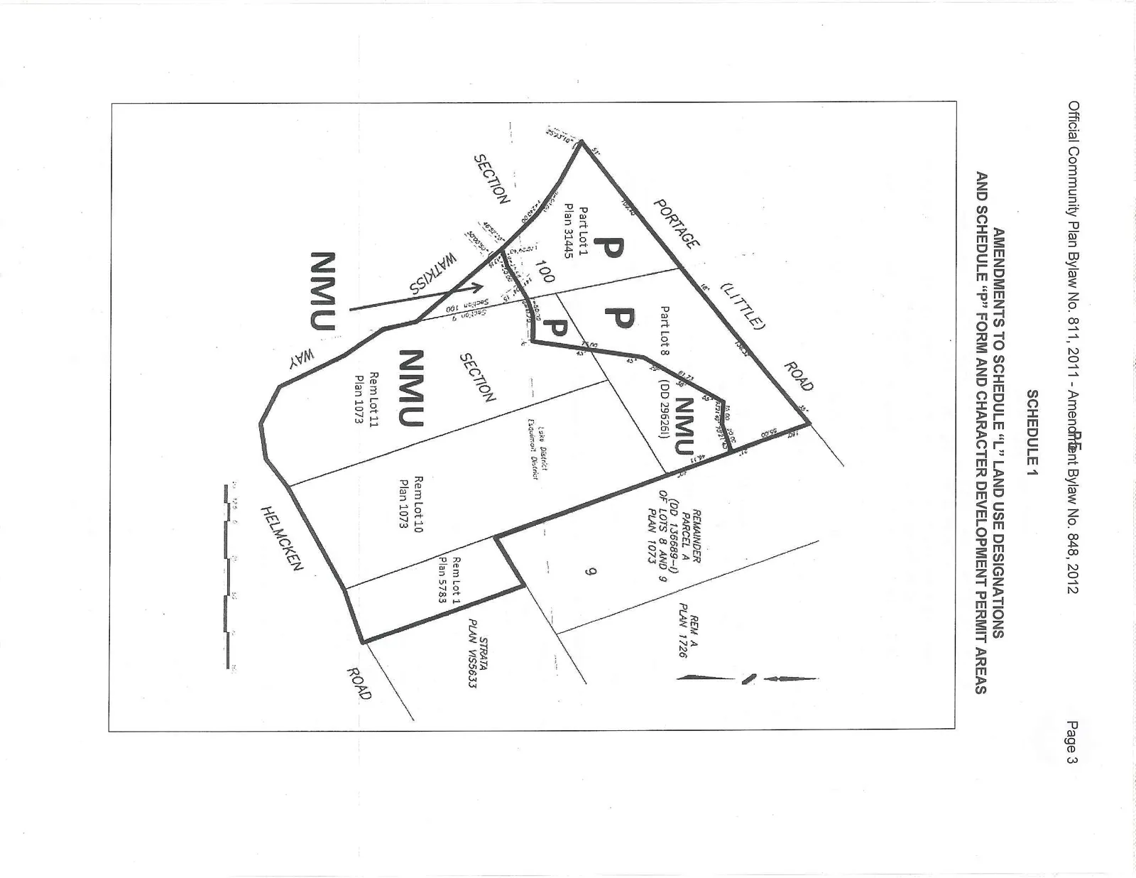
Map illustrating land use designation amendments for several parcels. The map shows areas designated as 'NMU' and 'P' located between Portage (Little) Road, Watkiss Way, and Helmcken Road. Specific parcels identified include Part Lot 1 Plan 31445, Part Lot 8 (DD 29626L), Remainder Parcel A (DD 136689-I) of Lots 8 and 9 Plan 1073, Rem Lot 11 Plan 1073, Rem Lot 10 Plan 1073, Rem Lot 1 Plan 5783, and Strata Plan VIS5633. The map also references Section 100, Section 2, and the Lake District, Esquimalt District.
Page 8
Extracted from: 2013 04 30 Council Agenda