This site is in beta — data may be incomplete and features are still being added.
Council Meeting/Documents/Development Permit Areas Illustration
Appendix

Development Permit Areas Illustration

April 30, 2013Page 311 section

Mapping of the Natural Watercourse and Sensitive Terrestrial Ecosystem Development Permit Areas at the site.

1. CALL TO ORDER
Natural Watercourse Environmental DP AreaSensitive Terrestrial Ecosystem DP Area

Environmental Development Permit (DP) Areas Map
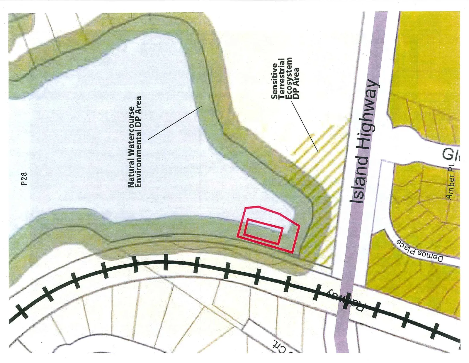
A site map showing a property boundary outlined in red, located adjacent to a Natural Watercourse Environmental DP Area and a Sensitive Terrestrial Ecosystem DP Area. The map also identifies geographic features including the Island Highway, a Railway line, Demos Place, and Amber Pl.

Map Labels:

  • P28
  • Natural Watercourse Environmental DP Area
  • Sensitive Terrestrial Ecosystem DP Area
  • Island Highway
  • Railway
  • Demos Place
  • Amber Pl.
  • Crt.
Page 31
Extracted from: 2013 04 30 Council Agenda