ENVIRONMENTAL ASSESSMENT Eagle Creek Village
A comprehensive environmental assessment report by Osiris Wildlife Consulting covering the ecological survey, impact assessment, and recommendations for the site.
ENVIRONMENTAL ASSESSMENT
Eagle Creek Village
23 Helmcken Rd
View Royal, BC
Report to Jessica Ng Development Coordinator OMICRON
April 2012
by Bill Harper, RPBio Osiris Wildlife Consulting Victoria, BC
Table of Contents
- INTRODUCTION...3
- ECOLOGICAL SURVEY...3
- ENVIRONMENTAL IMPACT ASSESSMENT...4
- ENDANGERED SPECIES ASSESSMENT...4
- RECOMMENDATIONS...5
- REFERENCES...6
List of Figures
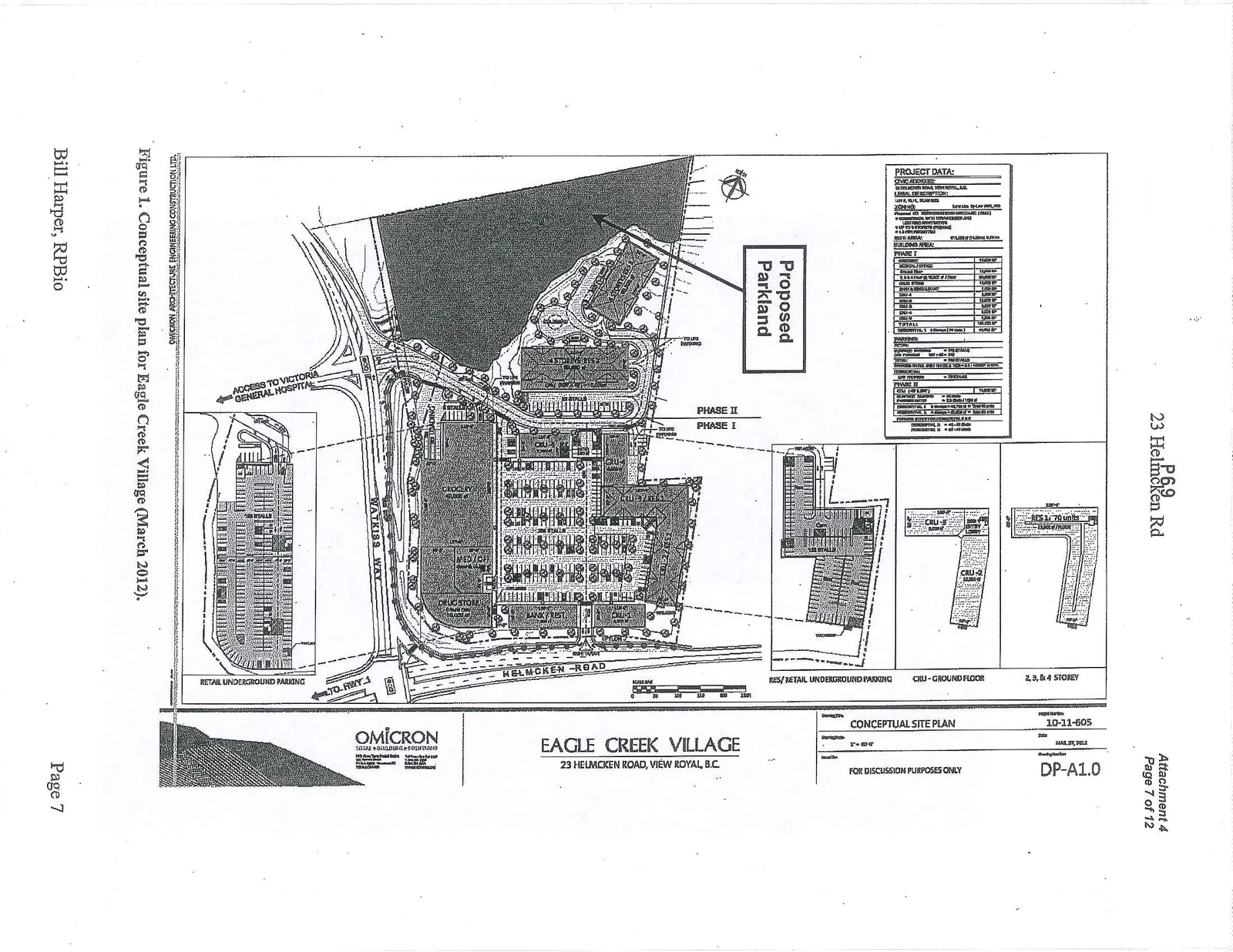
- Figure 1. Conceptual site plan for Eagle Creek Village (March 2012)...7
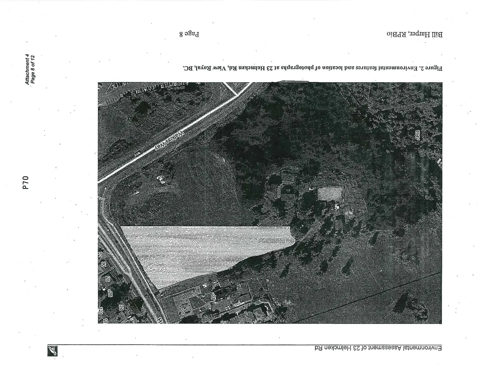
- Figure 2. Environmental features and location of photographs at 23 Helmcken Rd, View Royal, BC...8
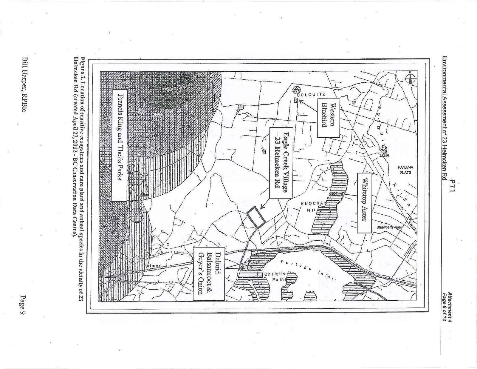
- Figure 3. Location of sensitive ecosystems and rare plant and animal species in the vicinity of 23 Helmcken Rd (created April 27, 2012 - BC Conservation Data Centre)...9
Introduction
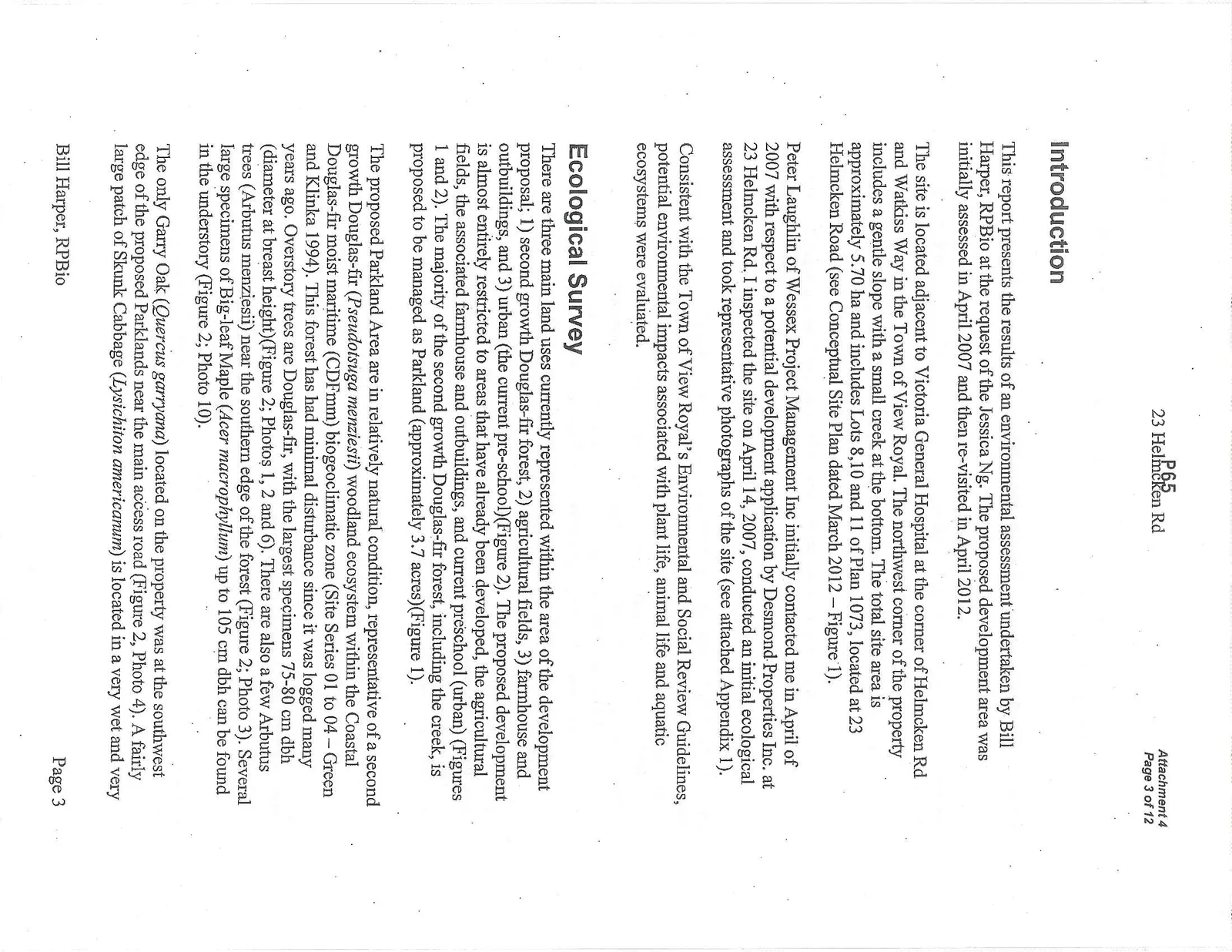
This report presents the results of an environmental assessment undertaken by Bill Harper, RPBio at the request of the Jessica Ng. The proposed development area was initially assessed in April 2007 and then re-visited in April 2012.
The site is located adjacent to Victoria General Hospital at the corner of Helmcken Rd and Watkiss Way in the Town of View Royal. The northwest corner of the property includes a gentle slope with a small creek at the bottom. The total site area is approximately 5.70 ha and includes Lots 8,10 and 11 of Plan 1073, located at 23 Helmcken Road (see Conceptual Site Plan dated March 2012 – Figure 1).
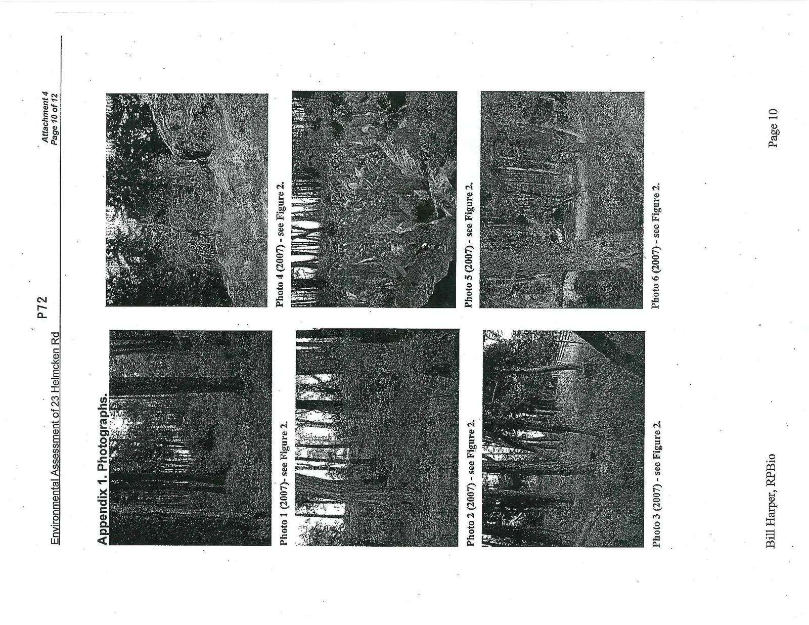
Peter Laughlin of Wessex Project Management Inc initially contacted me in April of 2007 with respect to a potential development application by Desmond Properties Inc. at 23 Helmcken Rd. I inspected the site on April 14, 2007, conducted an initial ecological assessment and took representative photographs of the site (see attached Appendix 1).
Consistent with the Town of View Royal’s Environmental and Social Review Guidelines, potential environmental impacts associated with plant life, animal life and aquatic ecosystems were evaluated.
Ecological Survey
There are three main land uses currently represented within the area of the development proposal; 1) second growth Douglas-fir forest, 2) agricultural fields, 3) farmhouse and outbuildings, and 3) urban (the current pre-school)(Figure 2). The proposed development is almost entirely restricted to areas that have already been developed, the agricultural fields, the associated farmhouse and outbuildings, and current preschool (urban) (Figures 1 and 2). The majority of the second growth Douglas-fir forest, including the creek, is proposed to be managed as Parkland (approximately 3.7 acres)(Figure 1).
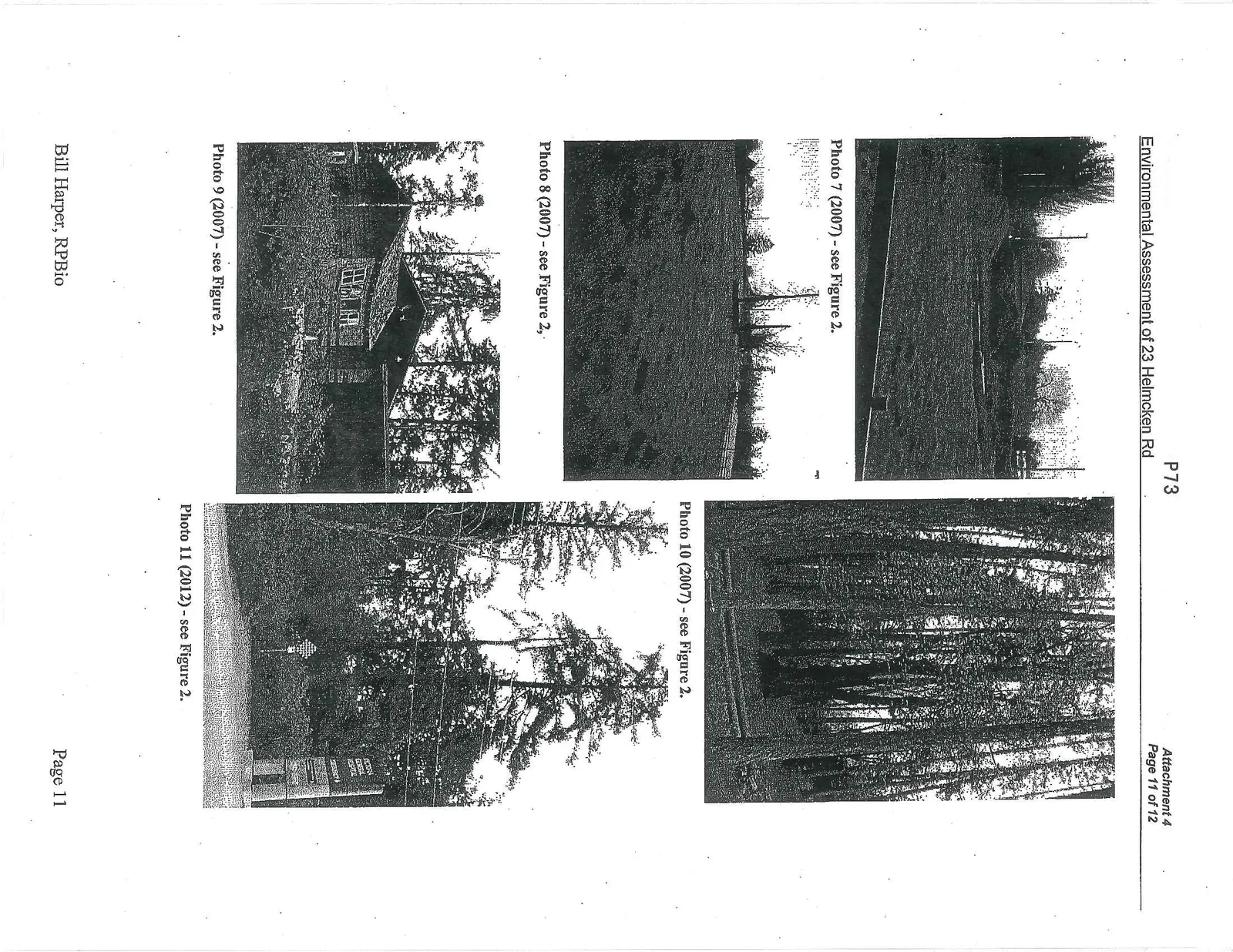
The proposed Parkland Area are in relatively natural condition, representative of a second growth Douglas-fir (Pseudotsuga menziesii) woodland ecosystem within the Coastal Douglas-fir moist maritime (CDFmm) biogeoclimatic zone (Site Series 01 to 04 – Green and Klinka 1994). This forest has had minimal disturbance since it was logged many years ago. Overstory trees are Douglas-fir, with the largest specimens 75-80 cm dbh (diameter at breast height)(Figure 2; Photos 1, 2 and 6). There are also a few Arbutus trees (Arbutus menziesii) near the southern edge of the forest (Figure 2; Photo 3). Several large specimens of Big-leaf Maple (Acer macrophyllum) up to 105 cm dbh can be found in the understory (Figure 2; Photo 10).
The only Garry Oak (Quercus garryana) located on the property was at the southwest edge of the proposed Parklands near the main access road (Figure 2, Photo 4). A fairly large patch of Skunk Cabbage (Lysichiton americanum) is located in a very wet and very rich site (CDFmm – site series 11 – Green and Klinka 1994) adjacent to the creek within the proposed Parkland Area (Figure 2; Photo 5).
Environmental Impact Assessment
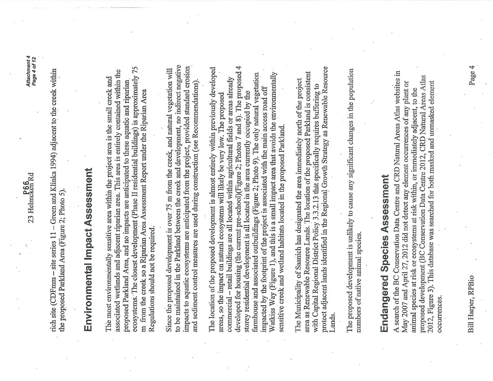
The most environmentally sensitive area within the project area is the small creek and associated wetlands and adjacent riparian area. This area is entirely contained within the proposed Parkland Area, and no impacts are anticipated to these aquatic and riparian ecosystems. The closest development (Phase II residential buildings) is approximately 75 m from the creek so a Riparian Area Assessment Report under the Riparian Area Regulations should not be required.
Since the proposed development is over 75 m from the creek, and natural vegetation will to be maintained in the Parkland between the creek and development, no indirect negative impacts to aquatic ecosystems are anticipated from the project, provided standard erosion and sediment control measures are used during construction (see Recommendations).
The location of the proposed development is almost entirely within previously developed areas, so the impact on natural ecosystems will likely be very low. The proposed commercial – retail buildings are all located within agricultural fields or areas already developed for housing (the current pre-school)(Figure 2; Photos 7 and 8). The proposed 4 storey residential development is all located in the area currently occupied by the farmhouse and associated outbuildings (Figure 2; Photo 9). The only natural vegetation impacted by the footprint of the project is associated with the main access road off Watkiss Way (Figure 1), and this is a small impact area that avoids the environmentally sensitive creek and wetland habitats located in the proposed Parkland.
The Municipality of Saanich has designated the area immediately north of the project area as Renewable Resource Lands. The location of the proposed Parkland is consistent with Capital Regional District Policy 3.3.2.13 that specifically requires buffering to protect adjacent lands identified in the Regional Growth Strategy as Renewable Resource Lands.
The proposed development is unlikely to cause any significant changes in the population numbers of native animal species.
Endangered Species Assessment
A search of the BC Conservation Data Centre and CRD Natural Areas Atlas websites in May 2007 and April 27, 2012 did not detect any element occurrences of any plant or animal species at risk or ecosystems at risk within, or immediately adjacent, to the proposed development (BC Conservation Data Centre 2012, CRD Natural Areas Atlas 2012, Figure 3). This database was searched for both masked and unmasked element occurrences.
The nearest location of Element Occurrences of species or ecosystems at risk was located through the BC Conservation Data Centre 0.6 km south of the project area near the shores of Portage Inlet. These were Element Occurrence #7000 (a Red-listed vascular plant Deltoid Balsamroot - Balsamorhiza deltoidea last observed in 1976) and Element Occurrence #8184 (a Blue-listed vascular plant Geyer’s Onion - Allium geyeri var. tenerum last observed in 1959)(Figure 3).
The next nearest location of a species at risk was 1.2 km east of the project area east of Knockan Hill Park. This was Element Occurrence #6904, a Red-listed vascular plant White-top Aster - Sericocarpus rigidus in a Garry Oak community destroyed by housing development in 1996. North of the project area there are are records from 1983 and 1984 of Red-listed Western Bluebirds (Sialia mexicana) nesting near Laritz Park (Figure 3).
Recommendations
- Unless the Parkland Area is transferred to administrative control of the Town of View Royal, a Restrictive Natural Area Covenant should be registered against the titles of all the properties in which it occurs. Under this arrangement, all title holders could pay an annual fee or tax to cover the ongoing costs of monitoring and maintaining the Parkland Area by a qualified body hired by the title holders or the by the Town of View Royal.
- Prior to construction activities, snow fencing should be placed about 1 m outside all edges of the Parkland Area. This fencing will provide an obvious visual cue to construction personnel to identify and avoid damaging protected areas. The fencing should be placed under the direction of a qualified biologist working in cooperation with on-site construction representatives. The Parkland Area should be considered “off-limits” to any and all vehicles, machinery and construction materials.
- Excavation for building foundations and utility services should be avoided within the drip-line (area of canopy coverage) of any larger specimen trees (e.g. Douglas-fir) that occur inside the Parkland Area.
- During construction, all surface runoff must be controlled to limit erosion and contained to remove sediments until landscaping within the development is completed. A qualified biologist working in cooperation with on-site construction representatives must direct the placement of suitable erosion control and sediment containment measures.
- Bare soil exposed during construction activities should be seeded promptly within the growing season from April to September using a mix of equal amounts of Fall Rye, Italian Ryegrass and Perennial Ryegrass in order to minimize erosion and the introduction of invasive week species. Bare rock should not be seeded.
References
BC Conservation Data Centre. 2012. Mapped Known Locations of Species and Ecological Communities at Risk [web application]. Available: http://www.env.gov.bc.ca/atrisk/ims.htm (Accessed May 2007 and April 2012).
CRD Natural Areas Atlas. 2012. Capital Region Natural Areas Atlas [web application]. Available: http://www.crd.bc.ca/es/natatlas/atlas.htm# (Accessed May 2007 and April 2012).
Green, R.N. and K. Klinka. 1994. A field guide to site identification and interpretation for the Vancouver Forest Region. Research Branch, Ministry of Forests, Victoria, BC. 283 pp.
View Royal Official Community Plan Bylaw No. 361 (2006). Regional Context Statement. Available: http://www.crd.bc.ca/regionalplanning/growth/documents/ViewRoyalRCS.pdf (Accessed April 2012).
Appendix 1. Photographs.
Document Images
(7)