Appendix
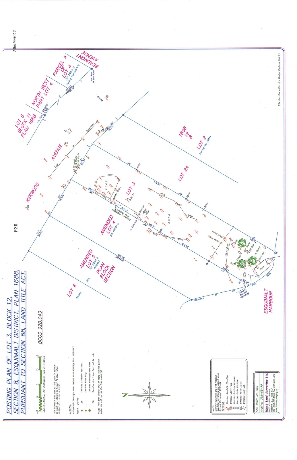
Attachment 3. Posting Plan of Lot 3, Block 12, Section 8
April 2, 2013Page 241 section
Official land survey plan for the property at 283 Kerwood Street.
Address: 283 Kerwood StreetPlan 1688
POSTING PLAN OF LOT 3, BLOCK 12, SECTION 8, ESQUIMALT DISTRICT, PLAN 1688, PURSUANT TO SECTION 68, LAND TITLE ACT.
BCGS 92B.043
SCALE 1:250. All distances are in metres.
The intended plot size of this plan is 560mm in width by 432mm in height (C Size) when plotted at a scale of 1:250.
LEGEND
- Astronomic bearings were derived from Posting Plan VIP72843.
- Denotes Standard Iron Post.
- Denotes Lead Plug.
- Denotes Non-Standard Post.
- Rk. Denotes short Iron Post set in rock.
NOTE: This plan shows one or more witness posts which are not set on the true corner(s).
NOTE:
Existing buildings are not located. Geodetic elevations are based upon Control Monument 1R06-11.
LEGEND
- Denotes Geodetic Elevation
- Denotes Utility Pole
- Denotes Sanitary Manhole
- Denotes Drain Manhole
- (W) Denotes Water Meter
- X Denotes Mark Set
File: 0560-JK-36A
Archive: 36A-GB-PP
Island Land Surveying Ltd.
1-15 Cadillac Avenue
Victoria, B.C. V8Z 1T3
TEL 250.475.1515 fax 250.475.1516
www.islandsurveying.ca
This plan lies within the Capital Regional District.
Page 24
Extracted from: 2013 04 02 Council Agenda