Appendix
Attachment 9. West Side Elevation Drawing
April 2, 2013Page 361 section
Technical drawing showing the side elevation of the structure and retaining wall.
Date: 16/02/13
Attachment 9
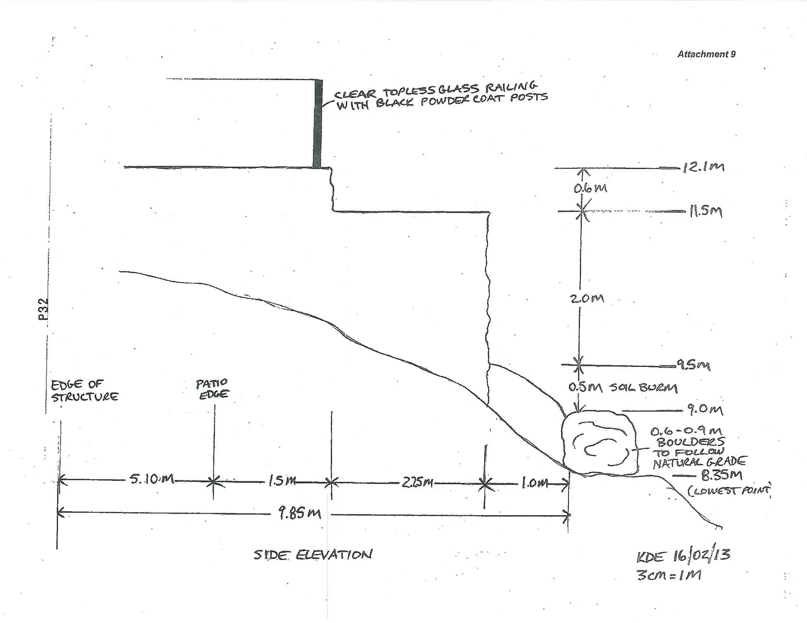
SIDE ELEVATION
Labels and Annotations:
- CLEAR TOPLESS GLASS RAILING WITH BLACK POWDER COAT POSTS
- EDGE OF STRUCTURE
- PATIO EDGE
- 0.5M SOIL BURM
- 0.6-0.9M BOULDERS TO FOLLOW NATURAL GRADE
- 8.35M (LOWEST POINT)
- KDE 16/02/13
- 3cm = 1M
Vertical Elevation and Height Measurements:
- 12.1m (Top of railing)
- 0.6m (Railing height)
- 11.5m (Upper patio level)
- 2.0m (Vertical drop to mid-level)
- 9.5m (Mid-level elevation)
- 0.5m (Vertical drop to soil berm)
- 9.0m (Berm elevation)
- 8.35m (Lowest point at natural grade)
Horizontal Measurements:
- 5.10m (From edge of structure to patio edge)
- 1.5m
- 2.25m
- 1.0m
- 9.85m (Total horizontal span)
Page 36
Extracted from: 2013 04 02 Council Agenda