This site is in beta — data may be incomplete and features are still being added.
Council Meeting/Documents/Attachment 1. Subject Property Map - 1950 Watkiss Way
Appendix

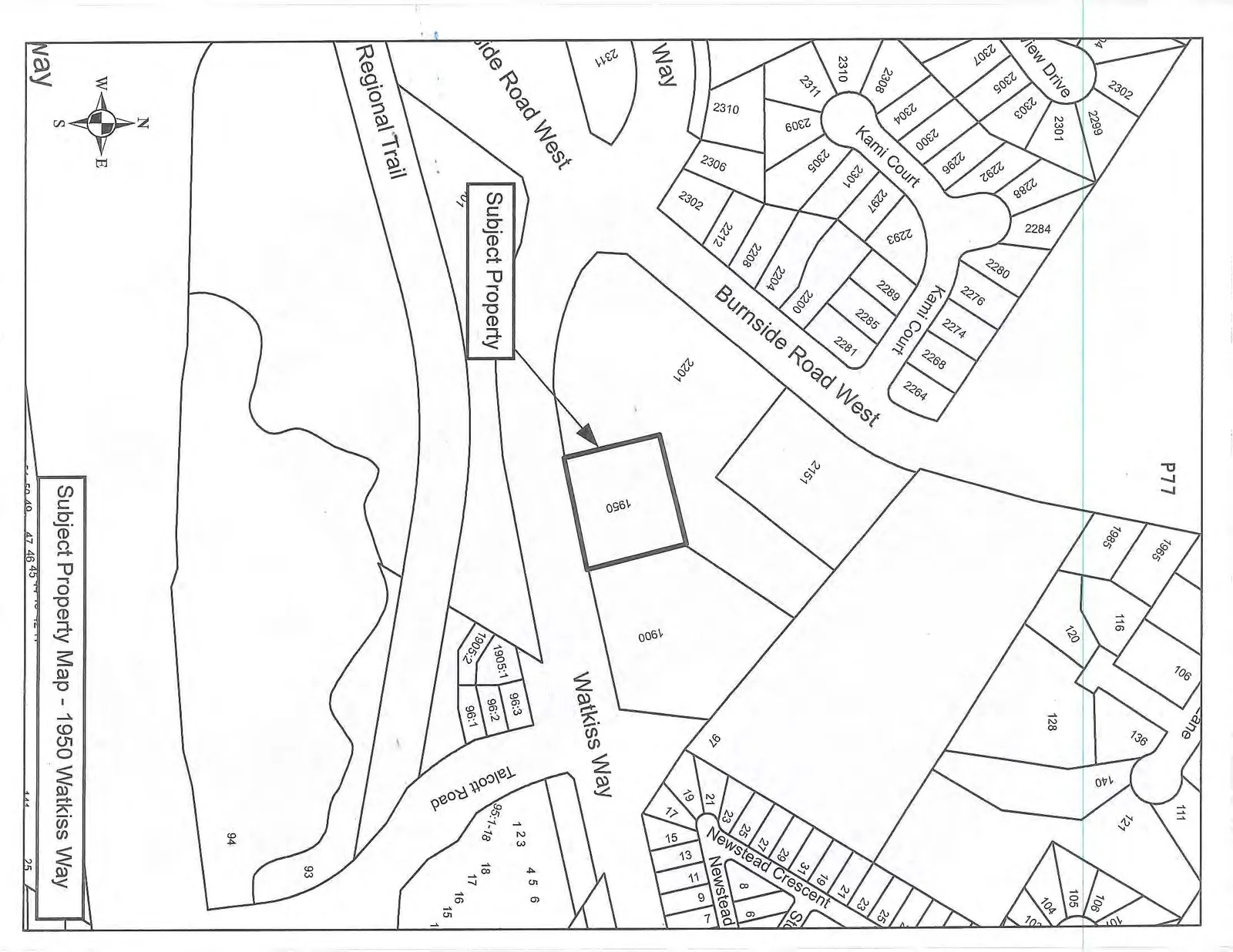
Attachment 1. Subject Property Map - 1950 Watkiss Way

May 7, 2013Page 811 section

Location map for the property at 1950 Watkiss Way.

8.1.c Temporary Sign Permit No. 2013/02 – 1950 Watkiss Way

Subject Property Map - 1950 Watkiss Way

A property map highlighting 1950 Watkiss Way as the "Subject Property." The lot is located south of Burnside Road West and north of Watkiss Way. The Regional Trail is shown running parallel to Watkiss Way to the south. Surrounding streets include Kami Court, View Drive, Newstead Crescent, and Talcott Road. Numerous surrounding residential lot numbers are labeled.

Map Details:

  • Subject Property: 1950 Watkiss Way
  • Surrounding Streets:
    • Burnside Road West
    • Watkiss Way
    • Kami Court
    • View Drive
    • Newstead Crescent
    • Talcott Road
  • Key Landmarks:
    • Regional Trail
    • P77 (Large lot area)
    • Lots 93 and 94 (Large lot areas)
Page 81
Extracted from: 2013 05 07 Council Agenda