Planning & Development Report - Development Permit Application No. 2011/12
Staff report recommending approval of a development permit for a 24-unit multi-family residential development on Island Highway with multiple requested variances.
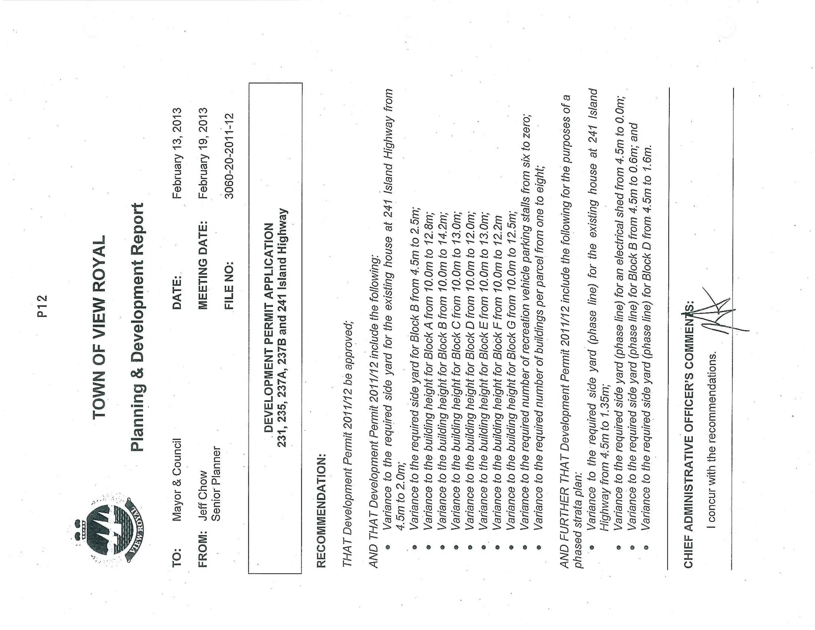
TOWN OF VIEW ROYAL Planning & Development Report
TO: Mayor & Council DATE: February 13, 2013 FROM: Jeff Chow, Senior Planner MEETING DATE: February 19, 2013 FILE NO: 3060-20-2011-12
DEVELOPMENT PERMIT APPLICATION
231, 235, 237A, 237B and 241 Island Highway
RECOMMENDATION:
THAT Development Permit 2011/12 be approved;
AND THAT Development Permit 2011/12 include the following:
- Variance to the required side yard for the existing house at 241 Island Highway from 4.5m to 2.0m;
- Variance to the required side yard for Block B from 4.5m to 2.5m;
- Variance to the building height for Block A from 10.0m to 12.8m;
- Variance to the building height for Block B from 10.0m to 14.2m;
- Variance to the building height for Block C from 10.0m to 13.0m;
- Variance to the building height for Block D from 10.0m to 12.0m;
- Variance to the building height for Block E from 10.0m to 13.0m;
- Variance to the building height for Block F from 10.0m to 12.2m;
- Variance to the building height for Block G from 10.0m to 12.5m;
- Variance to the required number of recreation vehicle parking stalls from six to zero;
- Variance to the required number of buildings per parcel from one to eight;
AND FURTHER THAT Development Permit 2011/12 include the following for the purposes of a phased strata plan:
- Variance to the required side yard (phase line) for the existing house at 241 Island Highway from 4.5m to 1.35m;
- Variance to the required side yard (phase line) for an electrical shed from 4.5m to 0.0m;
- Variance to the required side yard (phase line) for Block B from 4.5m to 0.6m; and
- Variance to the required side yard (phase line) for Block D from 4.5m to 1.6m.
CHIEF ADMINISTRATIVE OFFICER'S COMMENTS:
I concur with the recommendations.
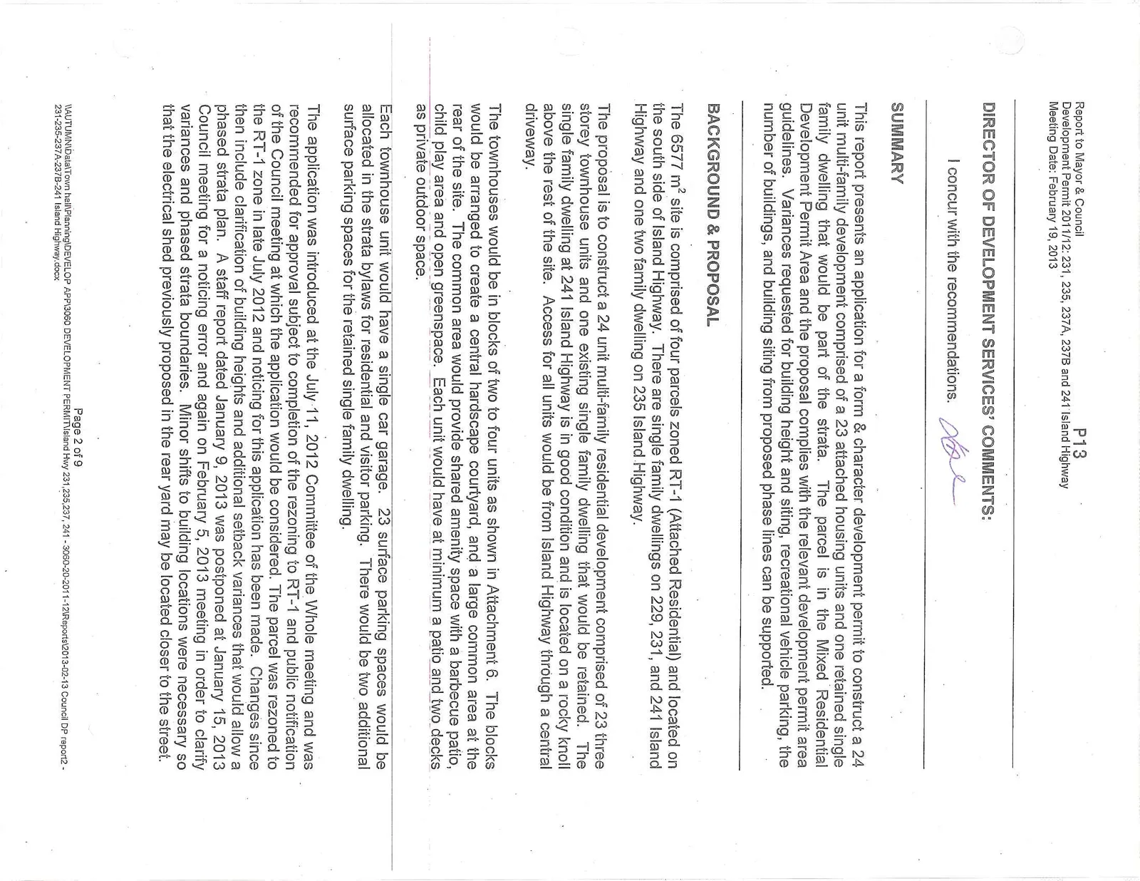
DIRECTOR OF DEVELOPMENT SERVICES' COMMENTS:
I concur with the recommendations.
SUMMARY
This report presents an application for a form & character development permit to construct a 24 unit multi-family development comprised of a 23 attached housing units and one retained single family dwelling that would be part of the strata. The parcel is in the Mixed Residential Development Permit Area and the proposal complies with the relevant development permit area guidelines. Variances requested for building height and siting, recreational vehicle parking, the number of buildings, and building siting from proposed phase lines can be supported.
BACKGROUND & PROPOSAL
The 6577 m² site is comprised of four parcels zoned RT-1 (Attached Residential) and located on the south side of Island Highway. There are single family dwellings on 229, 231, and 241 Island Highway and one two family dwelling on 235 Island Highway.
The proposal is to construct a 24 unit multi-family residential development comprised of 23 three storey townhouse units and one existing single family dwelling that would be retained. The single family dwelling at 241 Island Highway is in good condition and is located on a rocky knoll above the rest of the site. Access for all units would be from Island Highway through a central driveway.
The townhouses would be in blocks of two to four units as shown in Attachment 6. The blocks would be arranged to create a central hardscape courtyard, and a large common area at the rear of the site. The common area would provide shared amenity space with a barbecue patio, child play area and open greenspace. Each unit would have at minimum a patio and two decks as private outdoor space.
Each townhouse unit would have a single car garage. 23 surface parking spaces would be allocated in the strata bylaws for residential and visitor parking. There would be two additional surface parking spaces for the retained single family dwelling.
The application was introduced at the July 11, 2012 Committee of the Whole meeting and was recommended for approval subject to completion of the rezoning to RT-1 and public notification of the Council meeting at which the application would be considered. The parcel was rezoned to the RT-1 zone in late July 2012 and noticing for this application has been made. Changes since then include clarification of building heights and additional setback variances that would allow a phased strata plan. A staff report dated January 9, 2013 was postponed at January 15, 2013 Council meeting for a noticing error and again on February 5, 2013 meeting in order to clarify variances and phased strata boundaries. Minor shifts to building locations were necessary so that the electrical shed previously proposed in the rear yard may be located closer to the street.
DISCUSSION
There are three principle issues associated with this development permit application:
- Does the proposed design adequately respond to the development permit area guidelines?
- Are the requested variances appropriate?
- Are the requested variances for a Phased Strata Plan acceptable?
1. Development Permit Area Guidelines
The proposal is in keeping with the guidelines of the Mixed Residential development permit area. A summary of how the proposal addresses the guidelines can be found in Attachment 2.
2. Zoning and Requested Variances
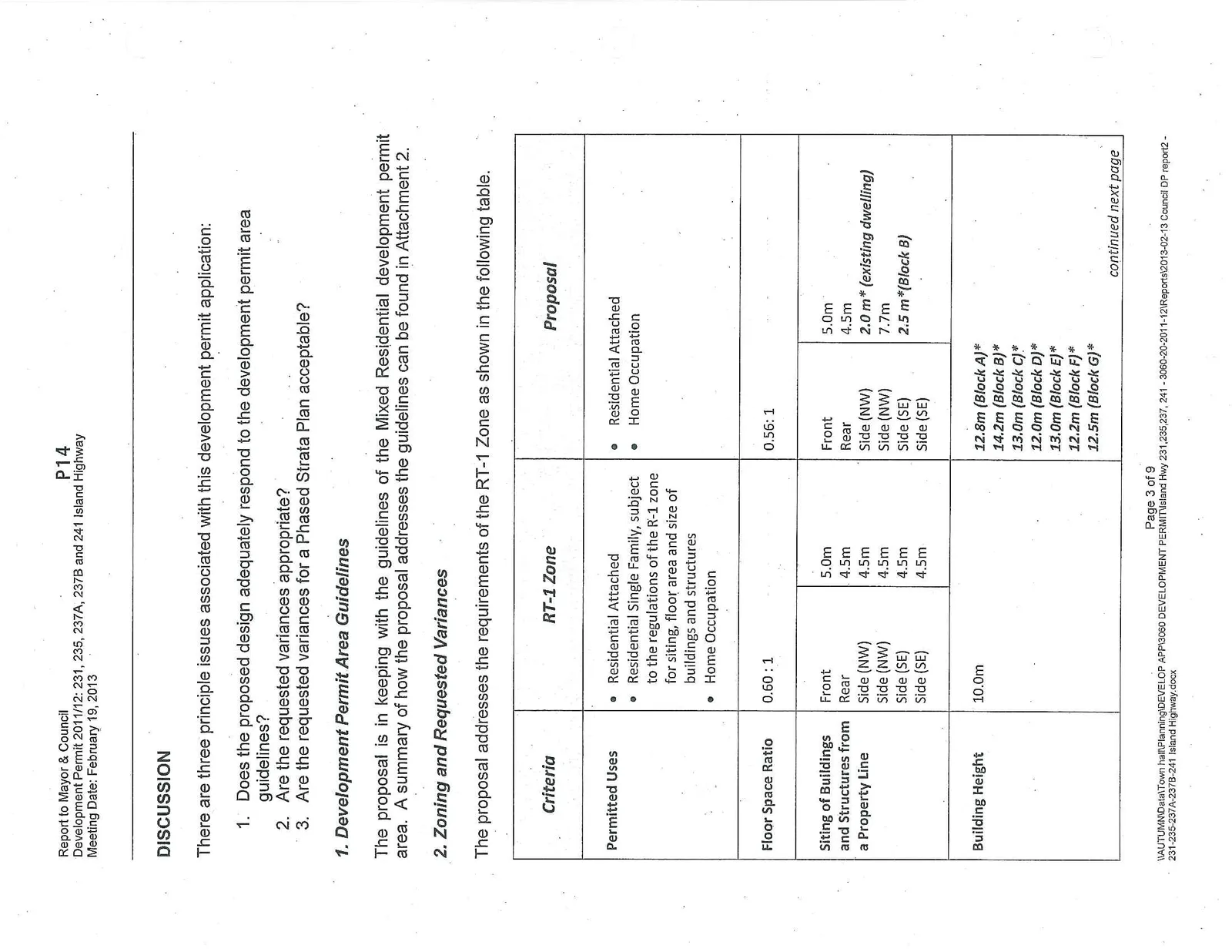
The proposal addresses the requirements of the RT-1 Zone as shown in the following table.
| Criteria | RT-1 Zone | Proposal |
|---|---|---|
| Permitted Uses | • Residential Attached • Residential Single Family, subject to the regulations of the R-1 zone for siting, floor area and size of buildings and structures • Home Occupation |
• Residential Attached • Home Occupation |
| Floor Space Ratio | 0.60 : 1 | 0.56 : 1 |
| Siting of Buildings and Structures from a Property Line | Front: 5.0m Rear: 4.5m Side (NW): 4.5m Side (NW): 4.5m Side (SE): 4.5m Side (SE): 4.5m |
Front: 5.0m Rear: 4.5m Side (NW): 2.0 m* (existing dwelling) Side (NW): 7.7m Side (SE): 2.5 m* (Block B) Side (SE): |
| Building Height | 10.0m | 12.8m (Block A) 14.2m (Block B) 13.0m (Block C) 12.0m (Block D) 13.0m (Block E) 12.2m (Block F) 12.5m (Block G)* |
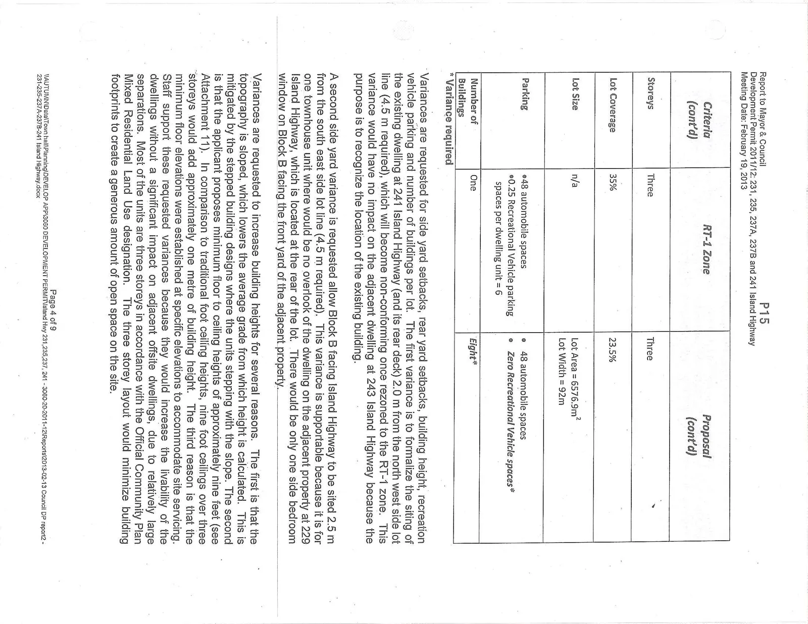
| Storeys | Three | Three |
| Lot Coverage | 35% | 23.5% |
| Lot Size | n/a | Lot Area = 6576.9m² Lot Width = 92m |
| Parking | • 48 automobile spaces • 0.25 Recreational Vehicle parking spaces per dwelling unit = 6 |
• 48 automobile spaces • Zero Recreational Vehicle spaces* |
| Number of Buildings | One | Eight* |
* Variance required
Variances are requested for side yard setbacks, rear yard setbacks, building height, recreation vehicle parking and number of buildings per lot. The first variance is to formalize the siting of the existing dwelling at 241 Island Highway (and its rear deck) 2.0 m from the north west side lot line (4.5 m required), which will become non-conforming once rezoned to the RT-1 zone. This variance would have no impact on the adjacent dwelling at 243 Island Highway because the purpose is to recognize the location of the existing building.
A second side yard variance is requested allow Block B facing Island Highway to be sited 2.5 m from the south east side lot line (4.5 m required). This variance is supportable because it is for one townhouse unit where would be no overlook of the dwelling on the adjacent property at 229 Island Highway, which is located at the rear of the lot. There would be only one side bedroom window on Block B facing the front yard of the adjacent property.
Variances are requested to increase building heights for several reasons. The first is that the topography is sloped, which lowers the average grade from which height is calculated. This is mitigated by the stepped building designs where the units stepping with the slope. The second is that the applicant proposes minimum floor to ceiling heights of approximately nine feet (see Attachment 11). In comparison to traditional foot ceiling heights, nine foot ceilings over three storeys would add approximately one metre of building height. The third reason is that the minimum floor elevations were established at specific elevations to accommodate site servicing. Staff support these requested variances because they would increase the livability of the dwellings without a significant impact on adjacent offsite dwellings, due to relatively large separations. Most of the units are three storeys in accordance with the Official Community Plan Mixed Residential Land Use designation. The three storey layout would minimize building footprints to create a generous amount of open space on the site.
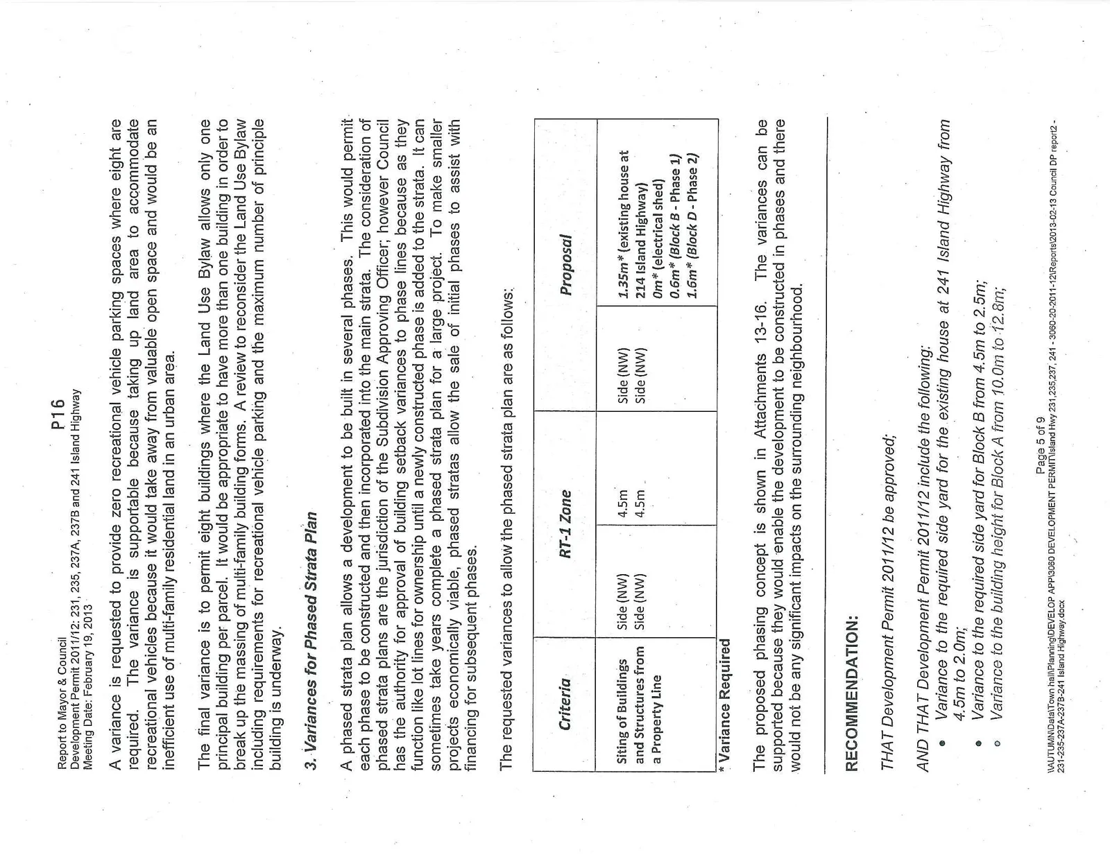
A variance is requested to provide zero recreational vehicle parking spaces where eight are required. The variance is supportable because taking up land area to accommodate recreational vehicles because it would take away from valuable open space and would be an inefficient use of multi-family residential land in an urban area.
The final variance is to permit eight buildings where the Land Use Bylaw allows only one principal building per parcel. It would be appropriate to have more than one building in order to break up the massing of multi-family building forms. A review to reconsider the Land Use Bylaw including requirements for recreational vehicle parking and the maximum number of principle building is underway.
3. Variances for Phased Strata Plan
A phased strata plan allows a development to be built in several phases. This would permit each phase to be constructed and then incorporated into the main strata. The consideration of phased strata plans are the jurisdiction of the Subdivision Approving Officer; however Council has the authority for approval of building setback variances to phase lines because as they function like lot lines for ownership until a newly constructed phase is added to the strata. It can sometimes take years complete a phased strata plan for a large project. To make smaller projects economically viable, phased stratas allow the sale of initial phases to assist with financing for subsequent phases.
The requested variances to allow the phased strata plan are as follows:
| Criteria | RT-1 Zone | Proposal |
|---|---|---|
| Siting of Buildings and Structures from a Property Line | Side (NW) 4.5m Side (NW) 4.5m |
Side (NW) 1.35m* (existing house at 241 Island Highway) Side (NW) 0m* (electrical shed) 0.6m* (Block B - Phase 1) 1.6m* (Block D - Phase 2) |
* Variance Required
The proposed phasing concept is shown in Attachments 13-16. The variances can be supported because they would enable the development to be constructed in phases and there would not be any significant impacts on the surrounding neighbourhood.
RECOMMENDATION:
THAT Development Permit 2011/12 be approved;
AND THAT Development Permit 2011/12 include the following:
- Variance to the required side yard for the existing house at 241 Island Highway from 4.5m to 2.0m;
- Variance to the required side yard for Block B from 4.5m to 2.5m;
- Variance to the building height for Block A from 10.0m to 12.8m;
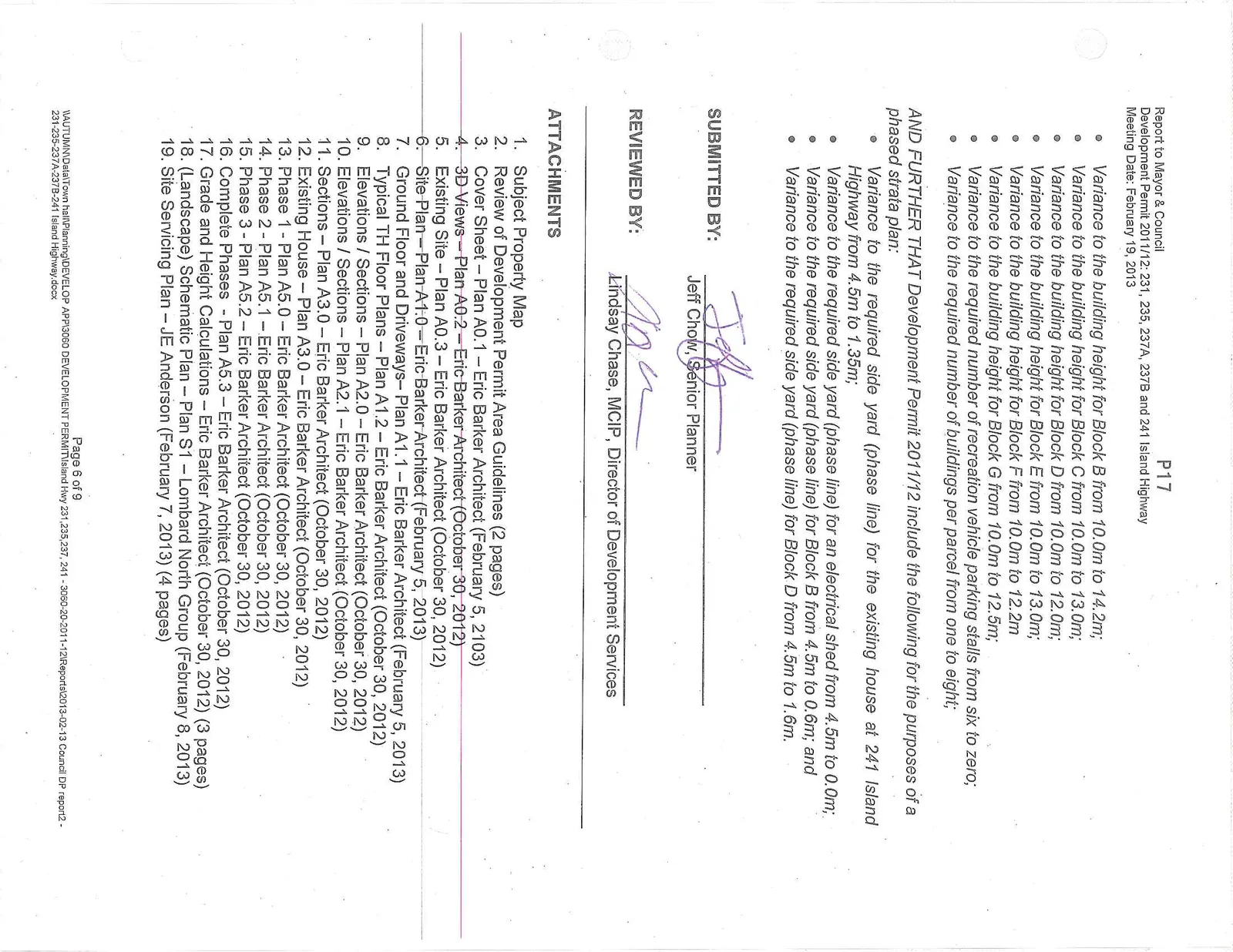
- Variance to the building height for Block B from 10.0m to 14.2m;
- Variance to the building height for Block C from 10.0m to 13.0m;
- Variance to the building height for Block D from 10.0m to 12.0m;
- Variance to the building height for Block E from 10.0m to 13.0m;
- Variance to the building height for Block F from 10.0m to 12.2m;
- Variance to the building height for Block G from 10.0m to 12.5m;
- Variance to the required number of recreation vehicle parking stalls from six to zero;
- Variance to the required number of buildings per parcel from one to eight;
AND FURTHER THAT Development Permit 2011/12 include the following for the purposes of a phased strata plan:
- Variance to the required side yard (phase line) for the existing house at 241 Island Highway from 4.5m to 1.35m;
- Variance to the required side yard (phase line) for an electrical shed from 4.5m to 0.0m;
- Variance to the required side yard (phase line) for Block B from 4.5m to 0.6m; and
- Variance to the required side yard (phase line) for Block D from 4.5m to 1.6m.
SUBMITTED BY: Jeff Chow, Senior Planner
REVIEWED BY: Lindsay Chase, MCIP, Director of Development Services
ATTACHMENTS
- Subject Property Map
- Review of Development Permit Area Guidelines (2 pages)
- Cover Sheet – Plan A0.1 – Eric Barker Architect (February 5, 2103)
- 3D Views – Plan A0.2 – Eric Barker Architect (October 30, 2012)
- Existing Site – Plan A0.3 – Eric Barker Architect (October 30, 2012)
- Site Plan – Plan A1.0 – Eric Barker Architect (February 5, 2013)
- Ground Floor and Driveways – Plan A1.1 – Eric Barker Architect (February 5, 2013)
- Typical TH Floor Plans – Plan A1.2 – Eric Barker Architect (October 30, 2012)
- Elevations / Sections – Plan A2.0 – Eric Barker Architect (October 30, 2012)
- Elevations / Sections – Plan A2.1 – Eric Barker Architect (October 30, 2012)
- Sections – Plan A3.0 – Eric Barker Architect (October 30, 2012)
- Existing House – Plan A3.0 – Eric Barker Architect (October 30, 2012)
- Phase 1 - Plan A5.0 – Eric Barker Architect (October 30, 2012)
- Phase 2 - Plan A5.1 – Eric Barker Architect (October 30, 2012)
- Phase 3 - Plan A5.2 – Eric Barker Architect (October 30, 2012)
- Complete Phases – Plan A5.3 – Eric Barker Architect (October 30, 2012)
- Grade and Height Calculations – Eric Barker Architect (October 30, 2012) (3 pages)
- (Landscape) Schematic Plan – Plan S1 – Lombard North Group (February 8, 2013)
- Site Servicing Plan – JE Anderson (February 7, 2013) (4 pages)
Document Images
(6)