This site is in beta — data may be incomplete and features are still being added.
Council Meeting/Documents/Sign Permit Attachments (430 Six Mile Road)
Appendix

Sign Permit Attachments (430 Six Mile Road)

July 30, 2013Pages 76–831 section

Site maps, photos, and sketches showing the proposed location and design of the real estate signs at 430 Six Mile Road.

1 CALL TO ORDER
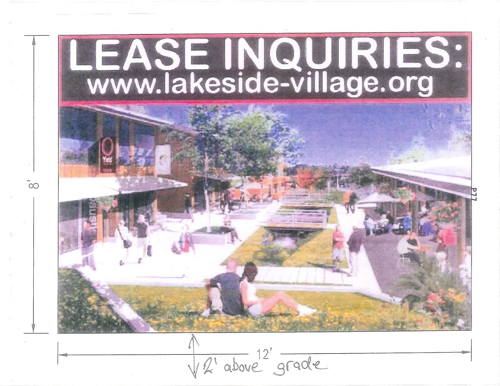
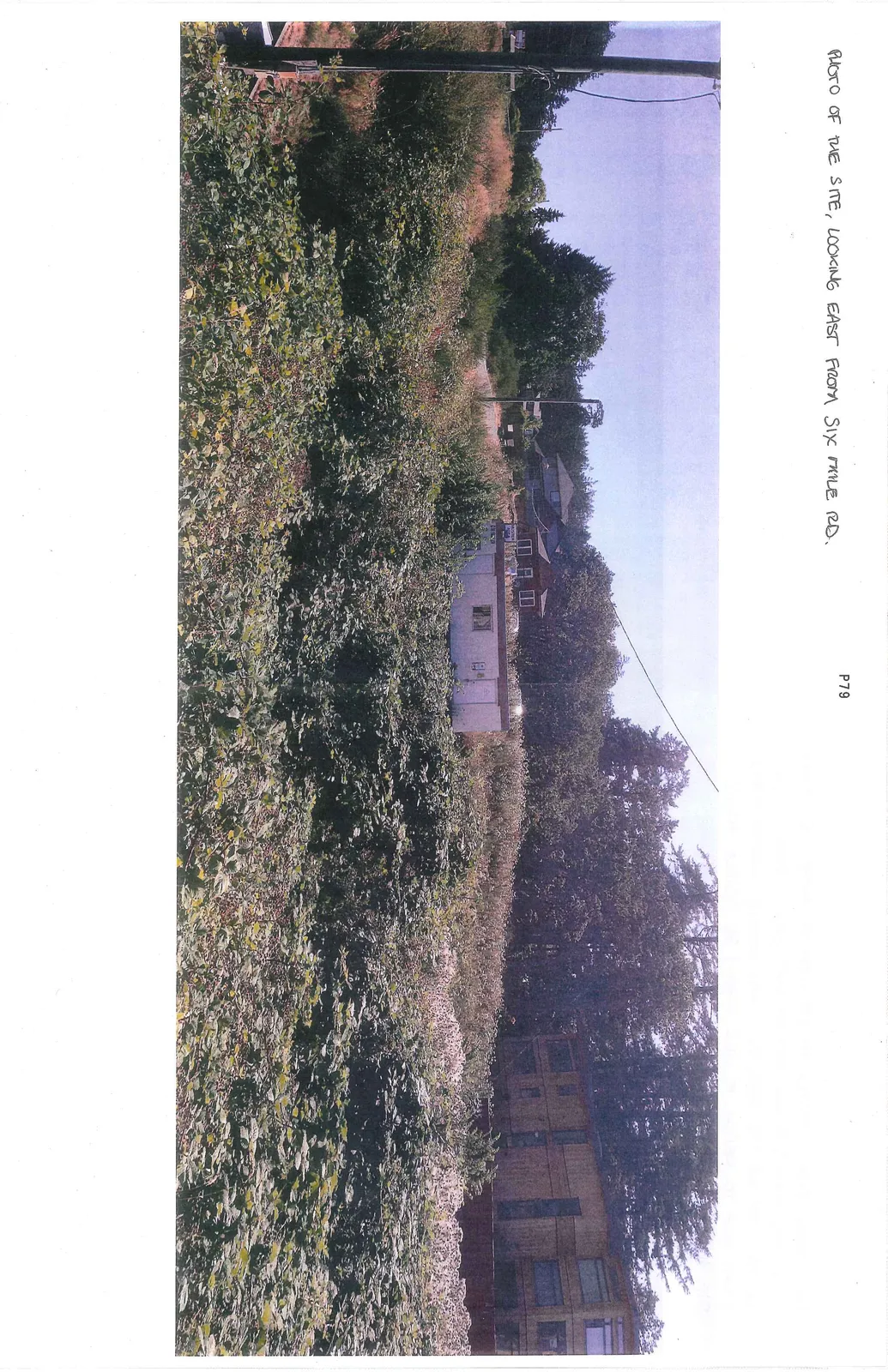
12' wide by 8' high sign sketchPhotos looking east from Six Mile Road

Report to Council Re: 2311 Watkiss Way Temporary Sign Application

Attachments

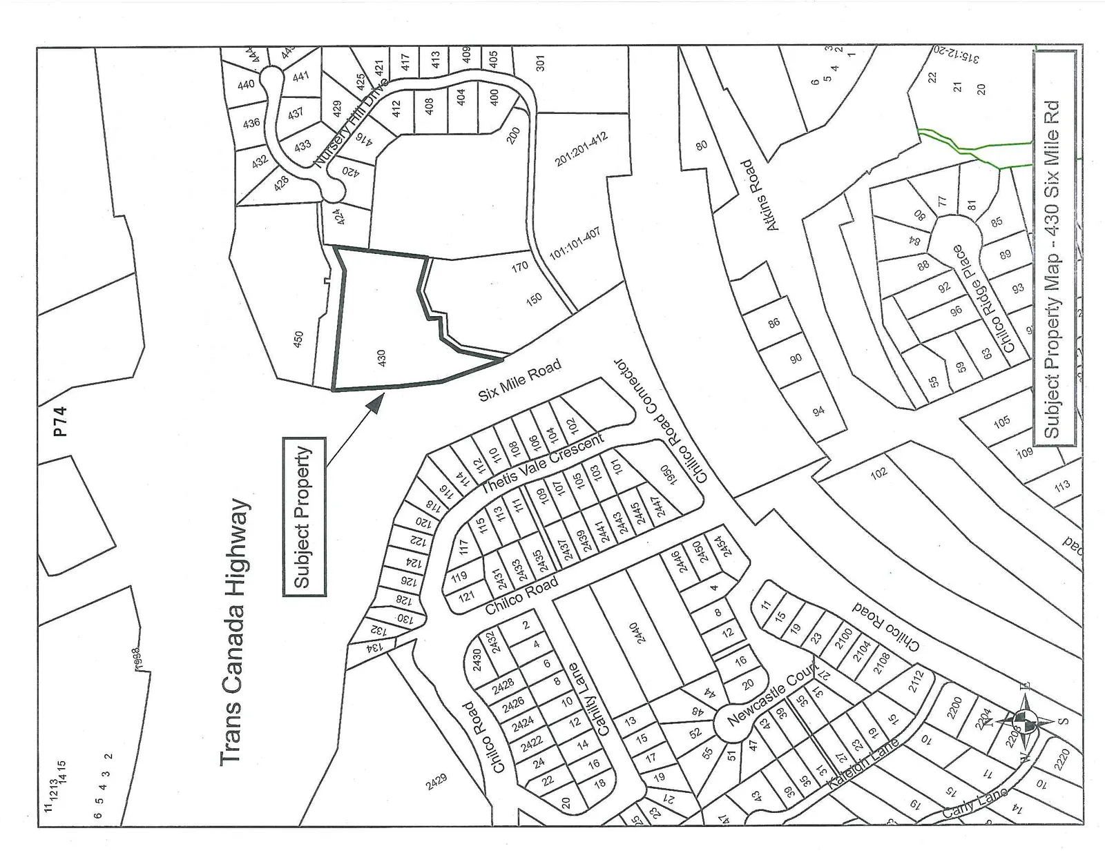
  1. Subject Property Map
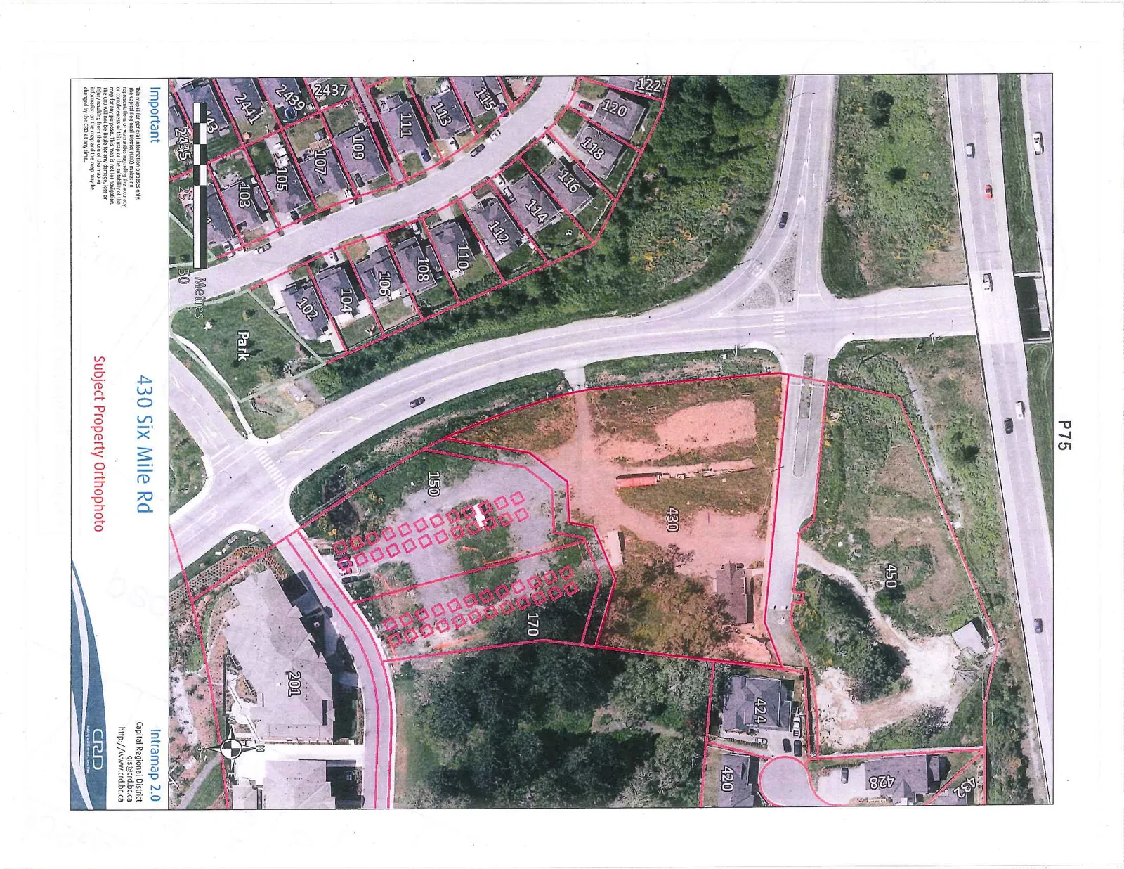
  2. Subject Property Orthophoto
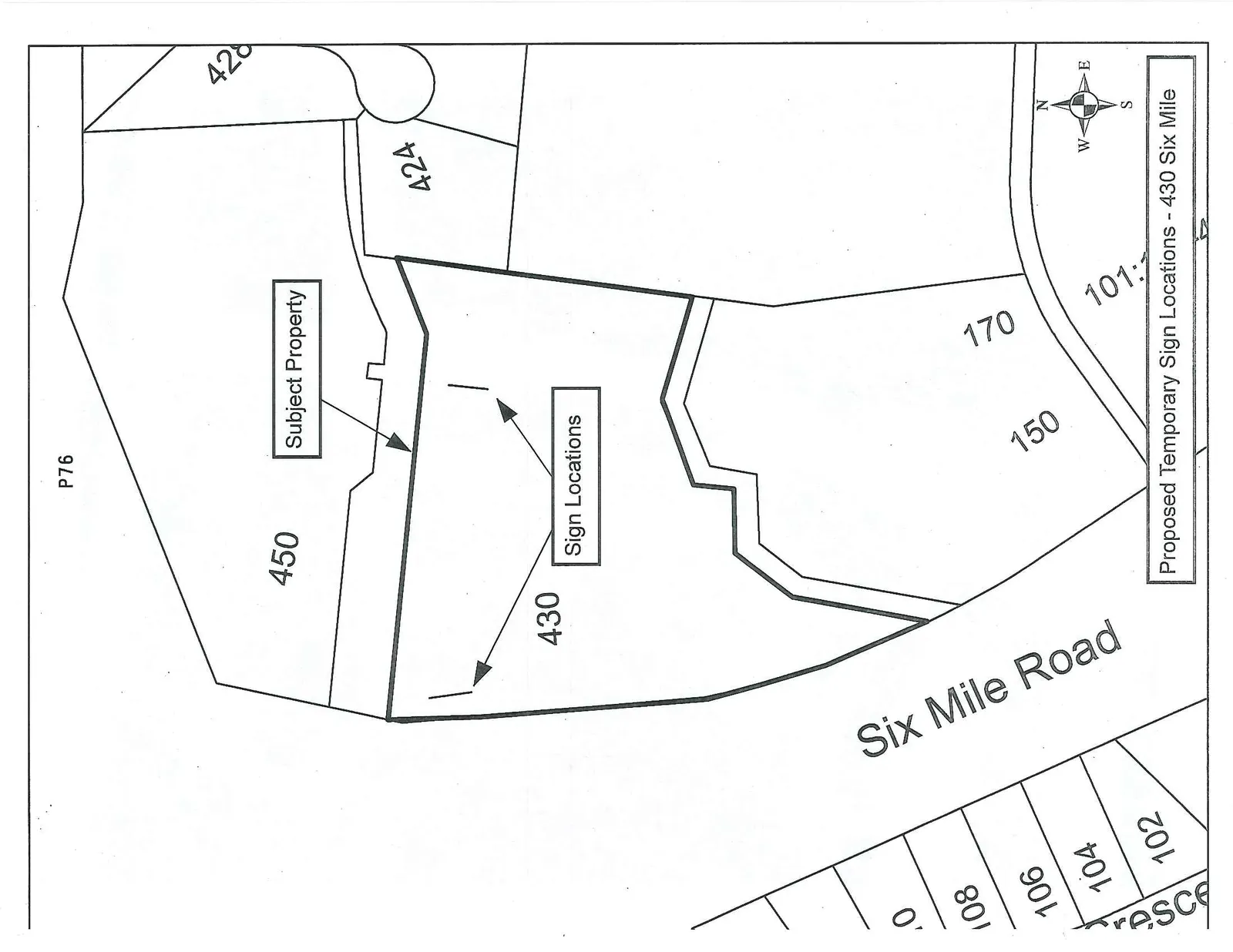
  3. Site Plan showing proposed location of the sign – staff – July 2013
  4. Sketch of the sign dimensions – applicant – July 2013
  5. Staff photos of the site and views
Subject Property Map of 430 Six Mile Rd showing the property's proximity to Trans Canada Highway, Six Mile Road, and Chilco Road
Subject Property Orthophoto showing an aerial view of 430 Six Mile Rd with property boundaries outlined
Diagram showing two proposed temporary sign locations on the subject property at 430 Six Mile Road

THIS PAGE LEFT BLANK INTENTIONALLY

PHOTO OF THE SITE, LOOKING EAST FROM SIX MILE RD.
Photograph of the site looking east from Six Mile Road showing overgrown vegetation and a small white building

PHOTO TAKEN FROM APPROXIMATE LOCATION OF HIGHER EASTERN SIGN. THE HOUSES ALONG AND AROUND CHILCO PARK WILL BE ABLE TO SEE THE SIGN, AS IT WILL EXTEND HIGHER THAN I WAS ABLE TO REACH. IT WILL LIKELY BE VISIBLE FROM THE HIGHWAY.
Panoramic photograph taken from the approximate location of the proposed higher eastern sign looking toward nearby residential areas and the highway
Page 76–83

Document Images

(2)
Document image
Document image
Extracted from: 2013 07 30 Council Agenda