This site is in beta — data may be incomplete and features are still being added.
Public Hearing/Documents/Schedule 1: Schedule P Form and Character Development Permit Areas
Appendix

Schedule 1: Schedule P Form and Character Development Permit Areas

June 18, 2024Page 91 section

Map showing the updated Form and Character Development Permit Areas for the Town of View Royal.

Scale: 1:11,150

TOWN OF VIEW ROYAL

Schedule P Form and Character Development Permit Areas
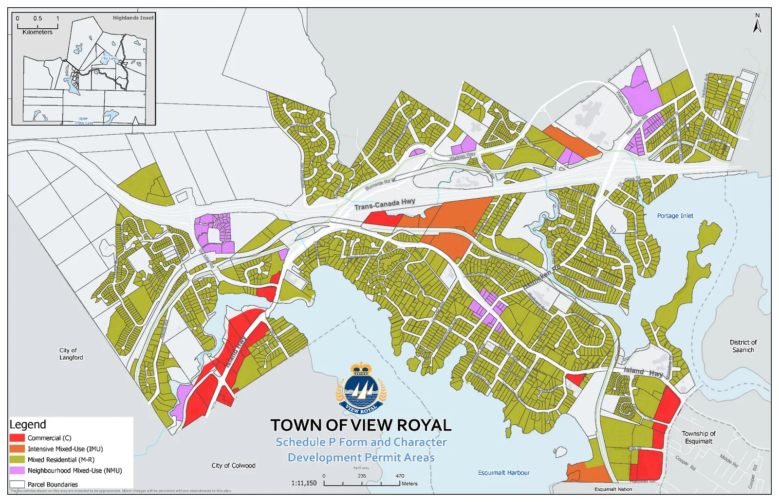
Map of the Town of View Royal showing Schedule P Form and Character Development Permit Areas. The map includes a legend for Commercial, Intensive Mixed-Use, Mixed Residential, and Neighbourhood Mixed-Use zones, along with parcel boundaries. Major landmarks and neighboring jurisdictions include the City of Langford, City of Colwood, Esquimalt Harbour, Portage Inlet, Township of Esquimalt, and District of Saanich. Major roads labeled include Trans-Canada Hwy, Island Hwy, Burnside Rd W, Watkiss Way, and Helmcken Rd. An inset map for Highlands is also provided.

Legend

  • Commercial (C)
  • Intensive Mixed-Use (IMU)
  • Mixed Residential (M-R)
  • Neighbourhood Mixed-Use (NMU)
  • Parcel Boundaries

Scale 1:11,150 0 to 470 Meters

The parcels shown on this map are intended to be approximate. Minor changes will be permitted without amendments to this plan.

Page 9
Extracted from: 2024 06 18 Public Hearing Agenda - Agenda - Pdf