This site is in beta — data may be incomplete and features are still being added.
Public Hearing/Documents/Appendix 1 Map 1: TOWN OF VIEW ROYAL Prescribed Frequent Transit Stops (Option 2)
Appendix

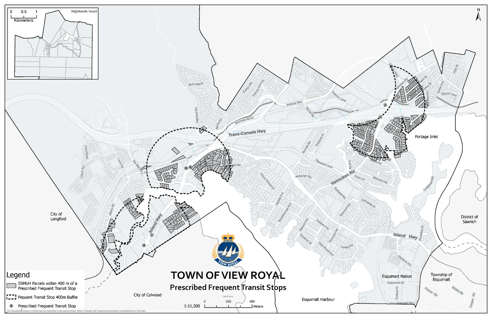
Appendix 1 Map 1: TOWN OF VIEW ROYAL Prescribed Frequent Transit Stops (Option 2)

June 18, 2024Page 391 section

Duplicate map identifying frequent transit stop buffers for reference within the Option 2 package.

1 CALL TO ORDER
Scale: 1:11,500

Appendix 1

Map 1

Map of the Town of View Royal titled "Prescribed Frequent Transit Stops." The map displays frequent transit stop locations, a 400m buffer zone around each stop, and SSMUH parcels located within those buffers. Geographic features include the Trans-Canada Highway, Island Highway, Helmcken Road, Portage Inlet, and Esquimalt Harbour. An inset map showing the Highlands area is included in the upper left corner.

TOWN OF VIEW ROYAL Prescribed Frequent Transit Stops

Legend

  • SSMUH Parcels within 400 m of a Prescribed Frequent Transit Stop (indicated by shaded areas)
  • Frequent Transit Stop 400m Buffer (indicated by dashed circular lines)
  • Prescribed Frequent Transit Stop (indicated by a circled 'R' symbol)

Scale: 1:11,500

Page 39
Extracted from: 2024 06 18 Public Hearing Agenda - Agenda - Pdf